
Why Drive the Southern Alps Route?
Do you want to see some of the best views, glacial blue lakes, rugged mountains, and exciting hikes in New Zealand? If you only had one week in NZ, this is the trip you should do.

This post describes the drive from Lake Tekapo to Aoraki/Mount Cook National Park (NP) and Lake Wanaka.
Author & Photographer: George Mitchell

Our recommendations are not influenced by affiliate links – we have none. Our itineraries, photos, and advice are based on travelling six months in New Zealand (over three trips), as well as three years around the world. We are avid hikers, nature lovers and photographers. NZ is one of our favourite destinations.
All of our recommendations are top-rated by Google Maps Ratings, which is based on the opinions of everyone, not just tourists. Each place recommended in our custom NZ SI Southern Alps Route is appended with a Google Maps Rating (G0 to G5). Acronyms can be found in the Abbreviations section.
How Much Time Do You Need for the Southern Alps?
You can drive through this area in three days, but that would be rushing it. You need much more time to enjoy the scenery and go hiking.
Lake Tekapo

Our first reaction was “What a peaceful setting”! All you see behind Lake Tekapo (G4.8) are mountains. There is no commercialization.
Church of the Good Shepherd

The only building along the lake is the Church of the Good Shepherd (G4.6). This beautiful stone church seems to fit right into the landscape, partly because the existing grassland vegetation was deliberately not disturbed.
The Church was built in 1935 to commemorate the early settlers of Mackenzie Country. There was a touristy view of the lake through the window behind the altar but photography is no longer allowed. There are just too many tourists.
Sheepdog Statue

As a nice touch, there is a bronze statue of the most important early settler, the New Zealand sheepdog (G4.5). They were essential for the establishment of sheep farming.
Lupine Flowers

Enjoy photographing the many colourful lupine flowers. Connie Scott scattered lupine seeds all around Lake Tekapo in the late 1940s. No one is eradicating this invasive species because they spread all over the South Island and are a big hit with the tourists.
The Appeal of Lake Tekapo
Two other little-known facts are:
- Tekapo is one of the sunniest places in NZ.
- Tekapo is a dark sky reserve, which means outdoor artificial light is minimized and stargazing is maximized.
Speaking of dark skies and astronomy, drive up a hill that resisted the glaciers to the Mt. John Observatory.

What is unique about Tekapo is that there is no development anywhere in the vista. The small town is to the east of the lake. We stayed at the very nice Alpine Vista B&B just south of Lake Tekapo.
We asked our hosts what is to stop investors from building condos or other commercial properties. They said there is a management board that prevents the construction of buildings. We would argue that any change to any area in NZ would spoil the natural beauty. Do you want proof? Just look at how Queenstown, NZ was spoiled.
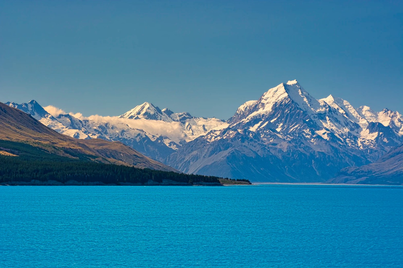
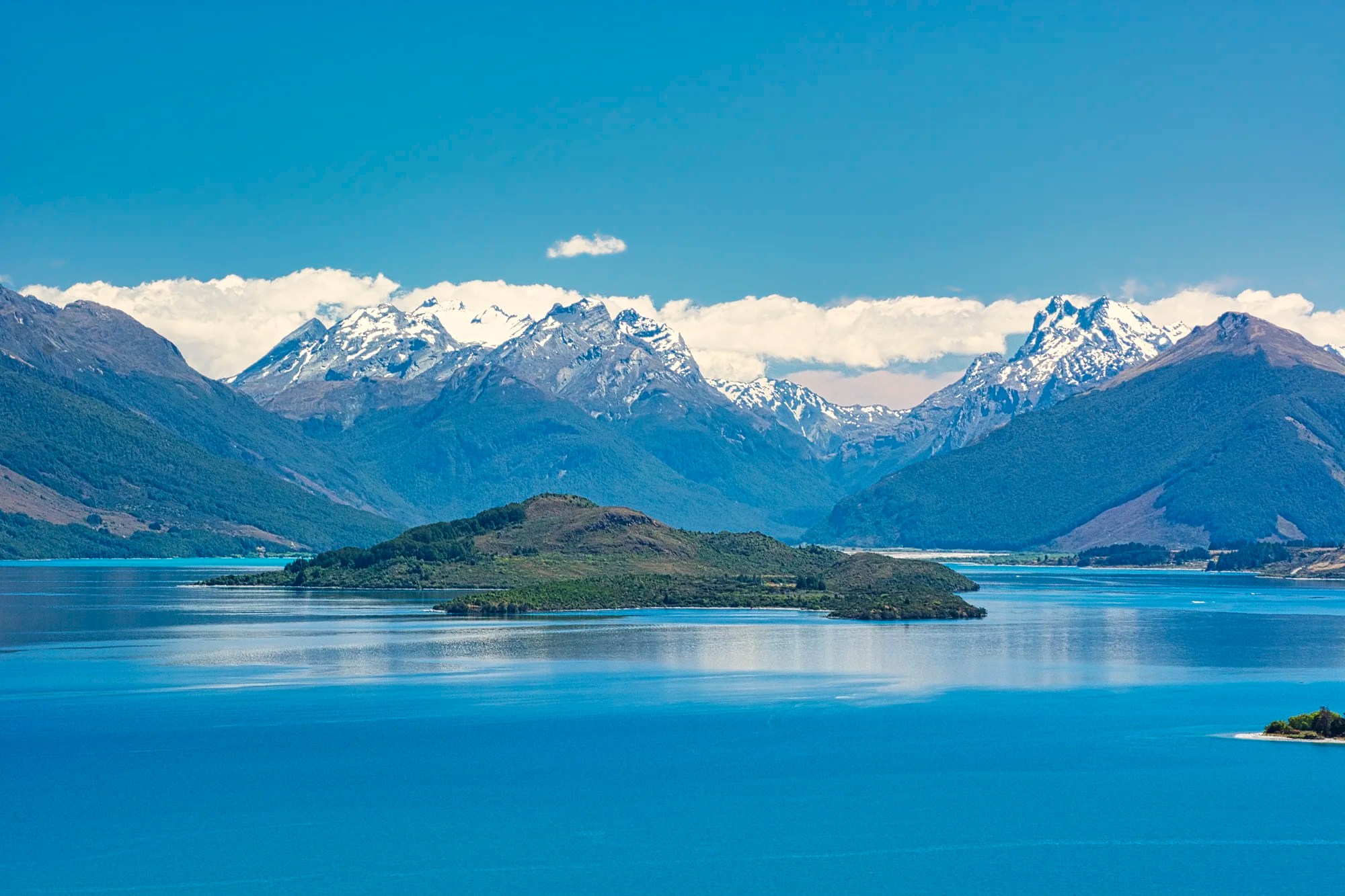
Stunning Lake Pukaki

While the main view is Aoraki National Park, Lake Pukaki is not part of the NP. Peter’s Lookout (G4.7) is just one formal pullover; it is still far away from Mt. Cook.
Why is Lake Pukaki so Baby Blue?
Lake Pukaki has a gorgeous blue colour. The colour is due to glacial flour (fine rock grains) ground by the glaciers. But, in NZ, the colour is more baby blue rather than the turquoise colour of the lakes along the Icefield Parkway of the Canadian Rockies.
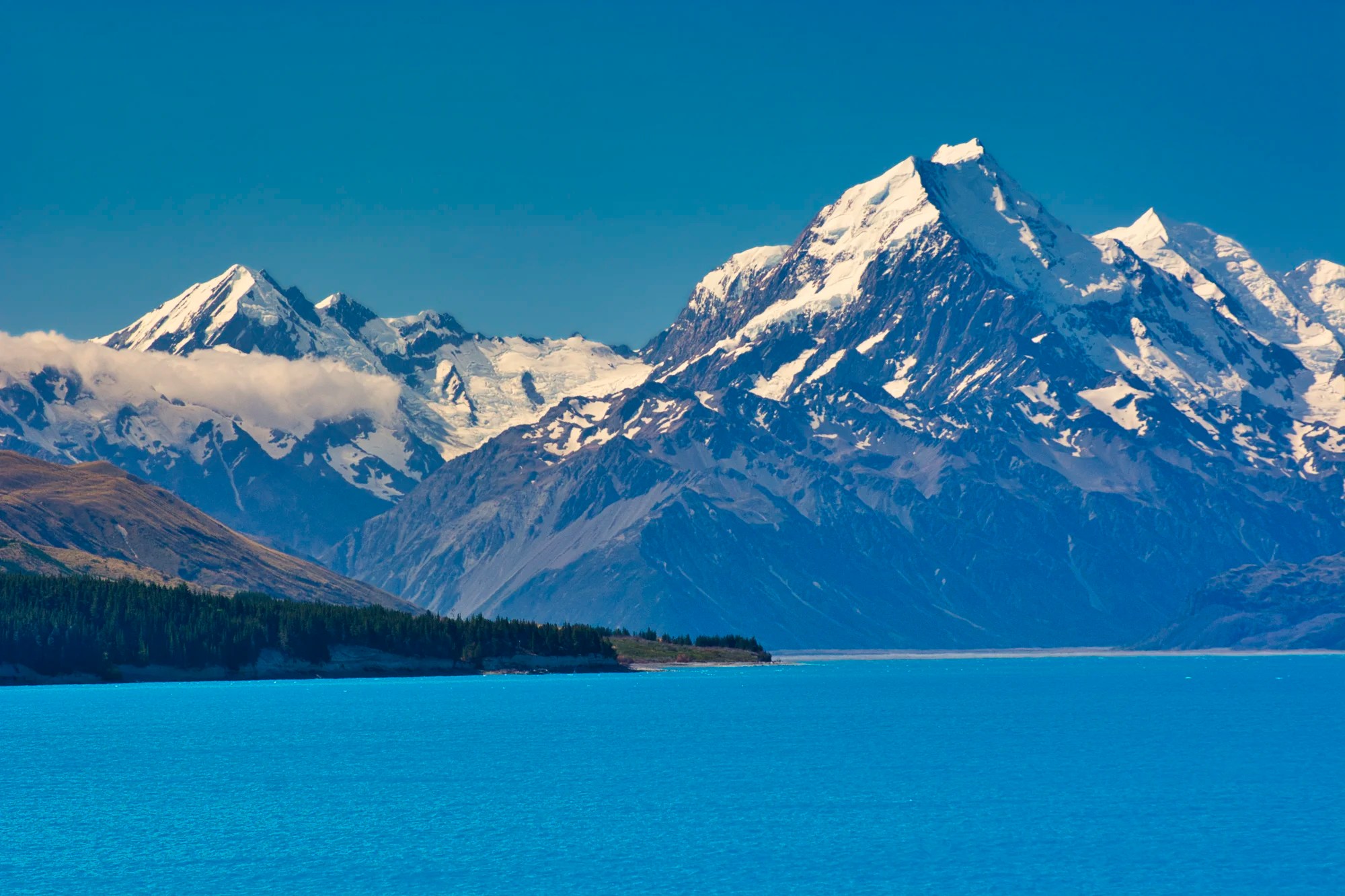
Lake Pukaki is huge, covering an area of 178.7 km². The views improve as one drives the 65 km (40 mi) along Highway 80. The whole drive along surreal Lake Pukaki is scenic, especially in near sunset lighting.
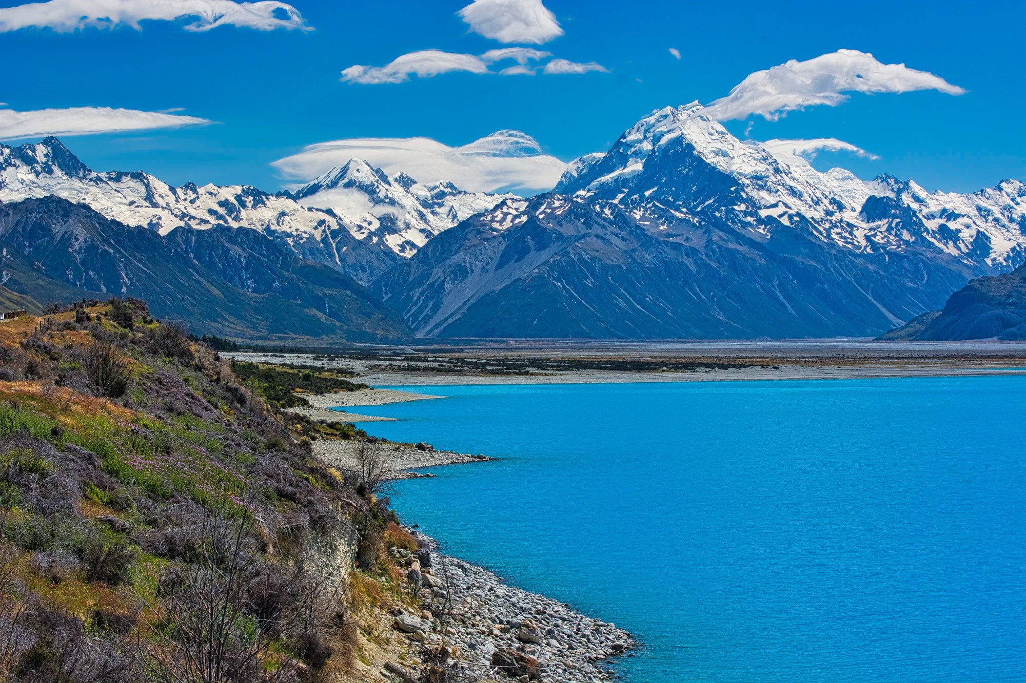
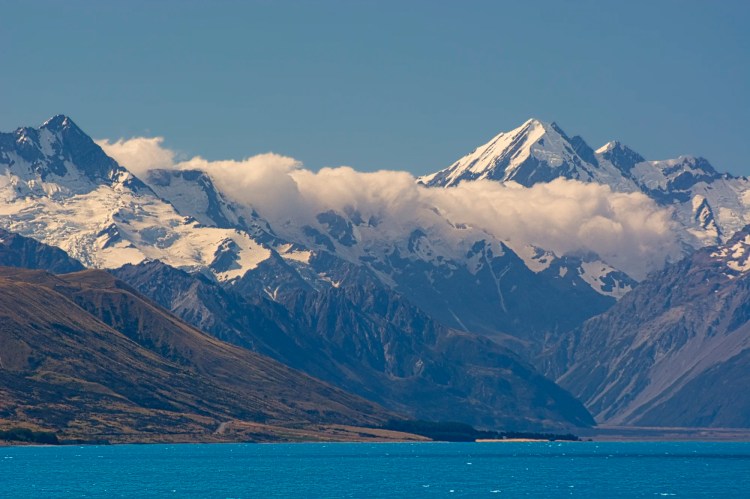
Aoraki/Mt Cook National Park
Formerly called Mt. Cook NP, New Zealand has started renaming places based on the original Māori name. This makes sense since normally the first explorers get the right to name sites. Moreover, the Aoraki name means “cloud piercer”, which is much more descriptive than Captain Cook. Apparently, Mt. Cook is rarely viewed without its cloud cover! We know from experience!
The NP covers 722 km2 (279 sq mi), which is half the size of Yoho NP, Canada. Points of interest are easily reachable from the one road, but the rest of the park requires hiking.
Enjoy the views of Aoraki NP before you enter
The mountains of the Southern Alps are less than ten million years old and are still rising! The mountains were created by the tectonic pressure of the Australian plate hitting the Pacific plate.
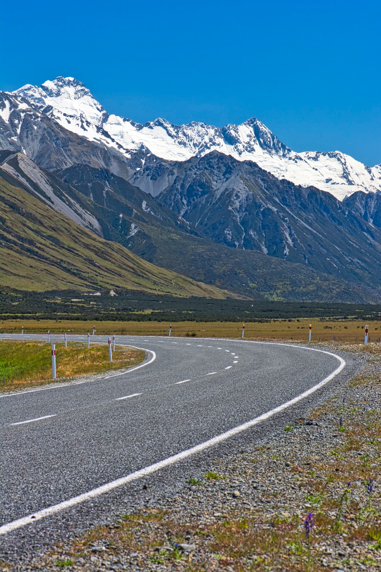
Be sure to stop as the highway enters the NP. Enjoy some of the best views of the mountains and the fields of colourful lupine flowers. Considering this was high season, there was not too much traffic.
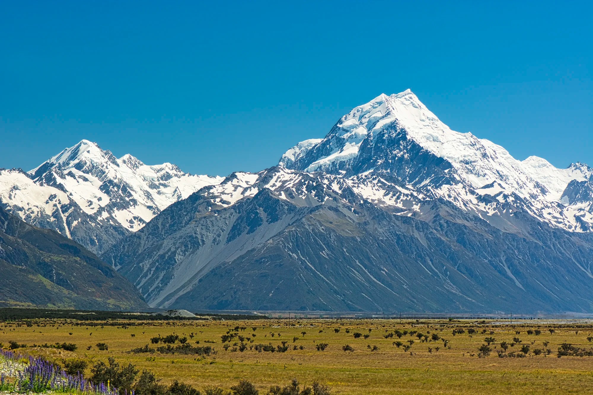
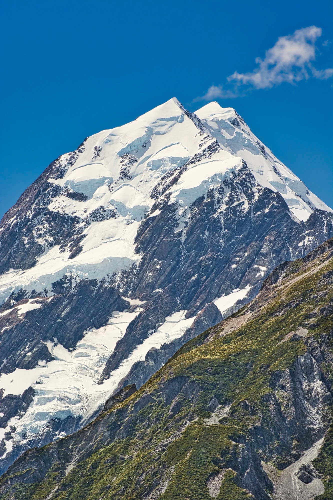
Mt. Cook (G4.7) is NZ’s highest mountain at 3,724 m (12,218 ft) and is a highlight of this park. Kiwis tell us how lucky we were to get these views in glorious sunlight — South Island is a very rainy area.
Aoraki NP Accommodation
We stayed at the Youth Hostel on our first trip and at the campground on the second trip. There are also hotels in the small Mt. Cook Village. Accommodation is very limited if you come during the summer when the Kiwis also vacation here, i.e. Christmas.
On our last trip, everything inside the NP was reserved. We had to book a gorgeous holiday home, Moore Fishinn, in Twizel. The plus side is that we commuted 65 km each day along the beautiful Lake Pukaki. That made it worthwhile. Also, Twizel has many more reasonable options for eating out as well as supermarkets.
Aoraki Tracks (Hikes)
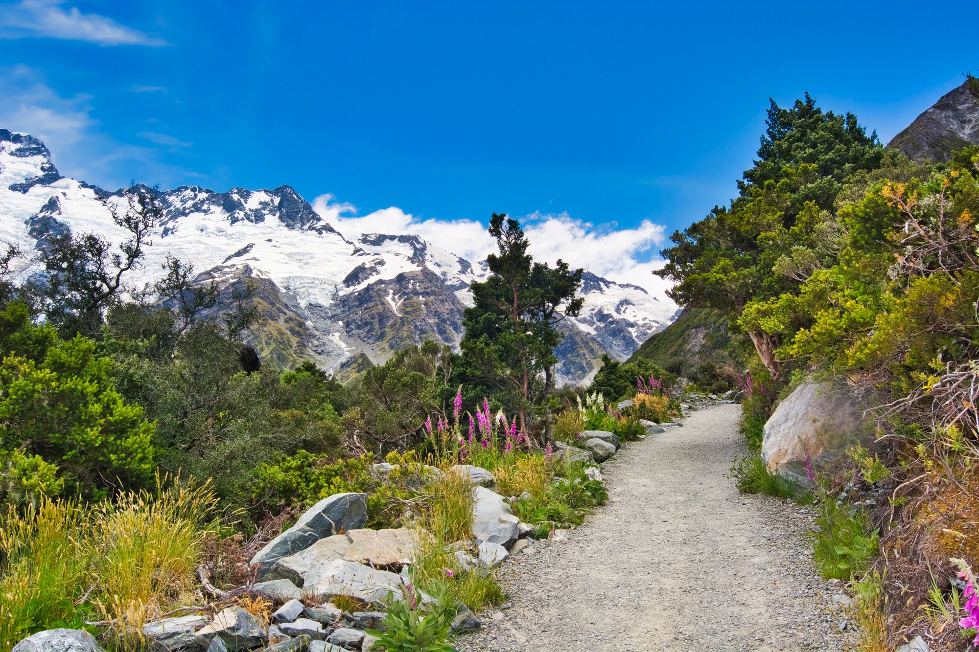
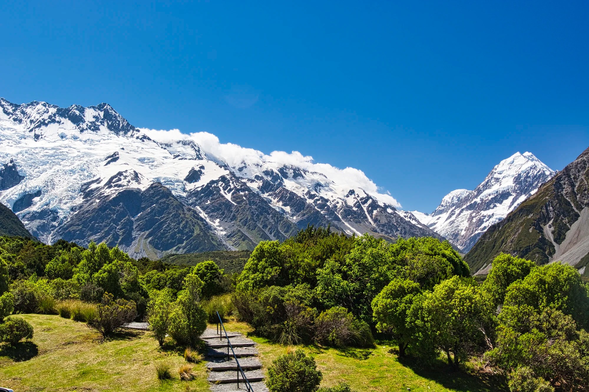
Hooker Valley Track
Hooker Valley Track (G4.8) is hands down our favourite day hike. Even if you are not a hiker, you can walk the first level part. The first 700 m of the Hooker Valley Track is suitable for wheelchairs and strollers. You can still enjoy this part while the track is closed until the bridge has been rebuilt.
Mount Sefton Meadows
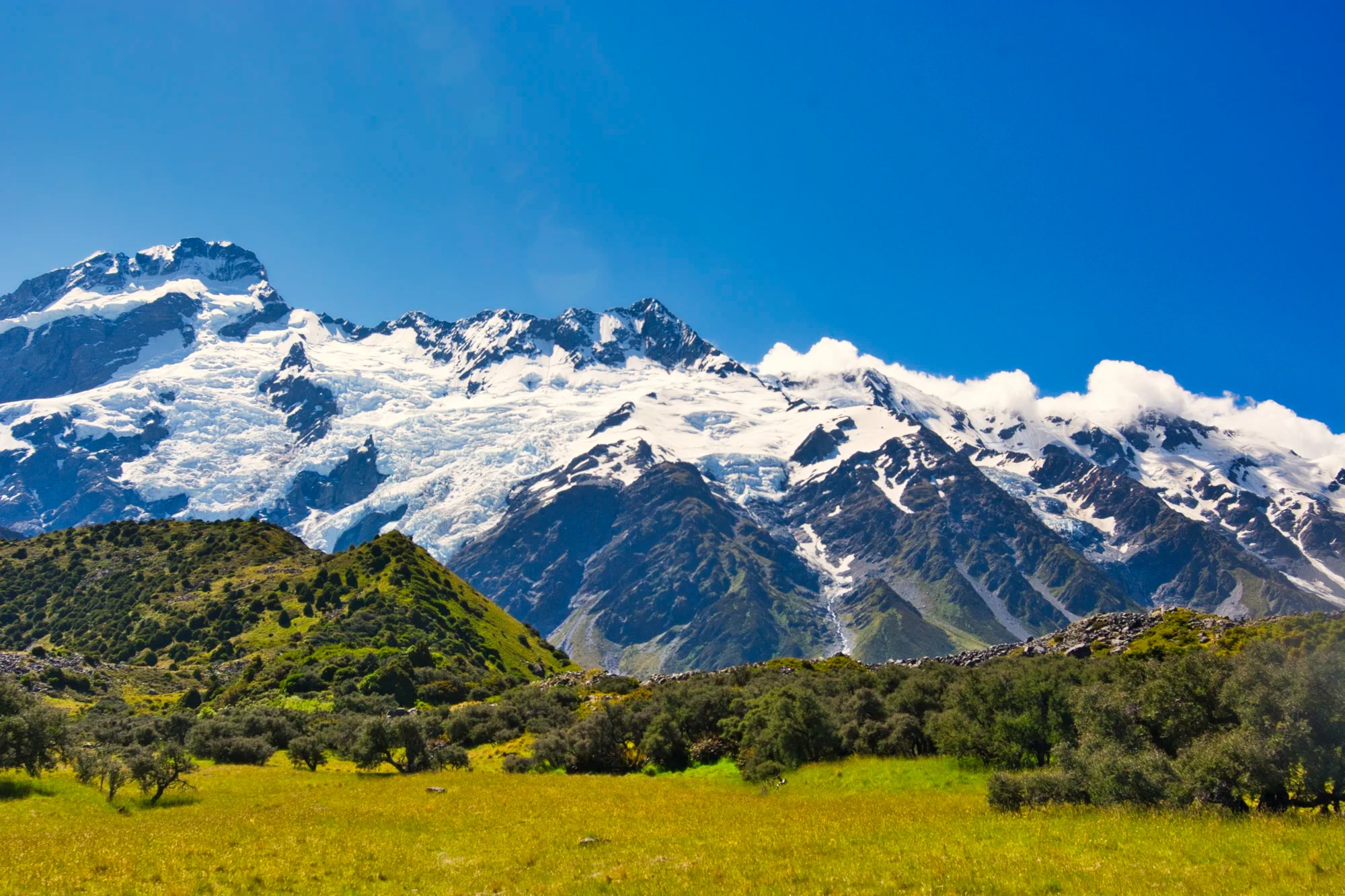
As you stroll through grassy meadows, you are stunned by the views of Mount Sefton (G5.0) and its dramatic glaciers and ice falls. Even though Mt. Cook has greater name recognition, we love Mt. Sefton just as much.
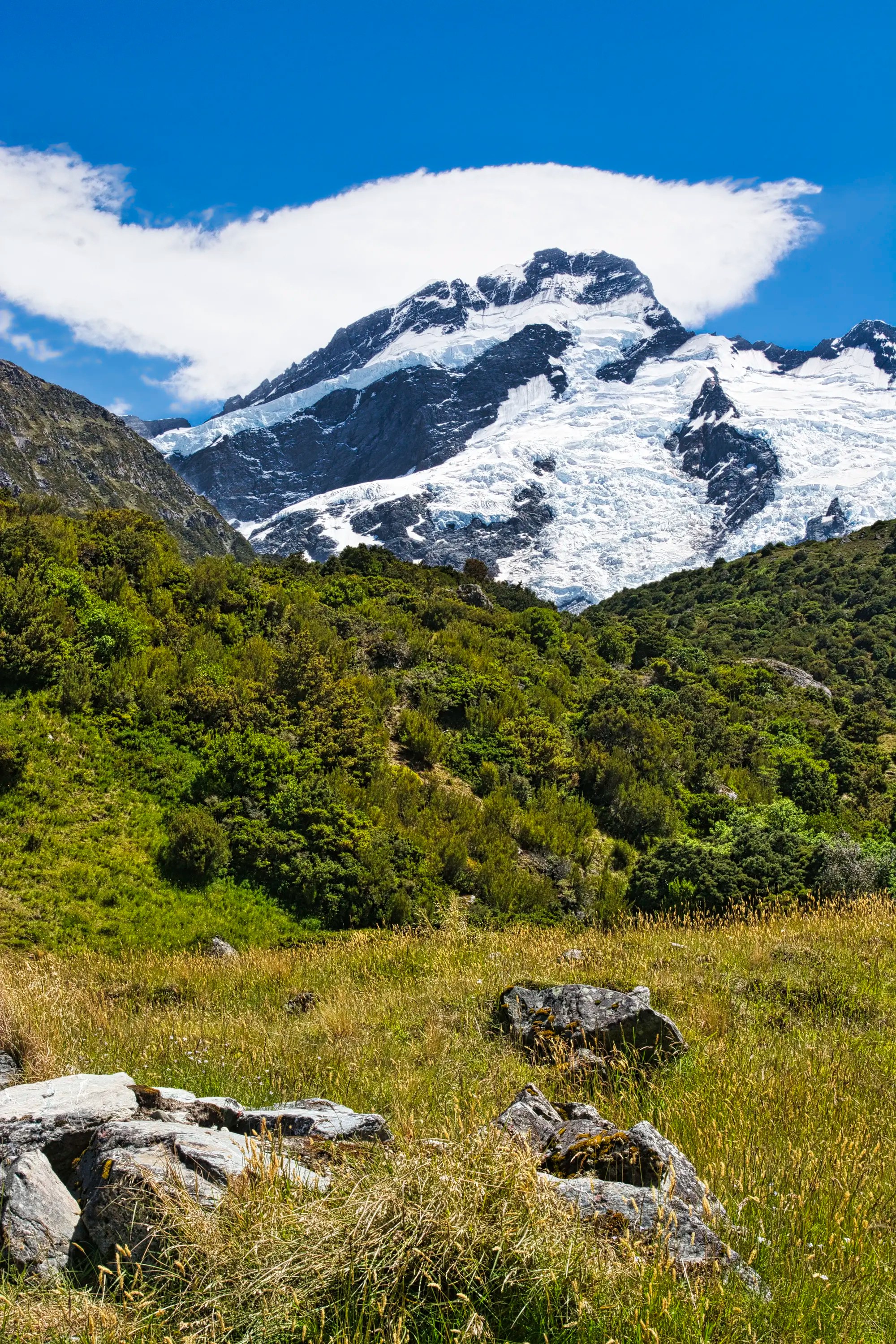
I liked photographing the contrast of the meadows meeting the mountains. The treeless meadows allow wide-open views of the 3,151 m (10,338 ft) Mt. Sefton.
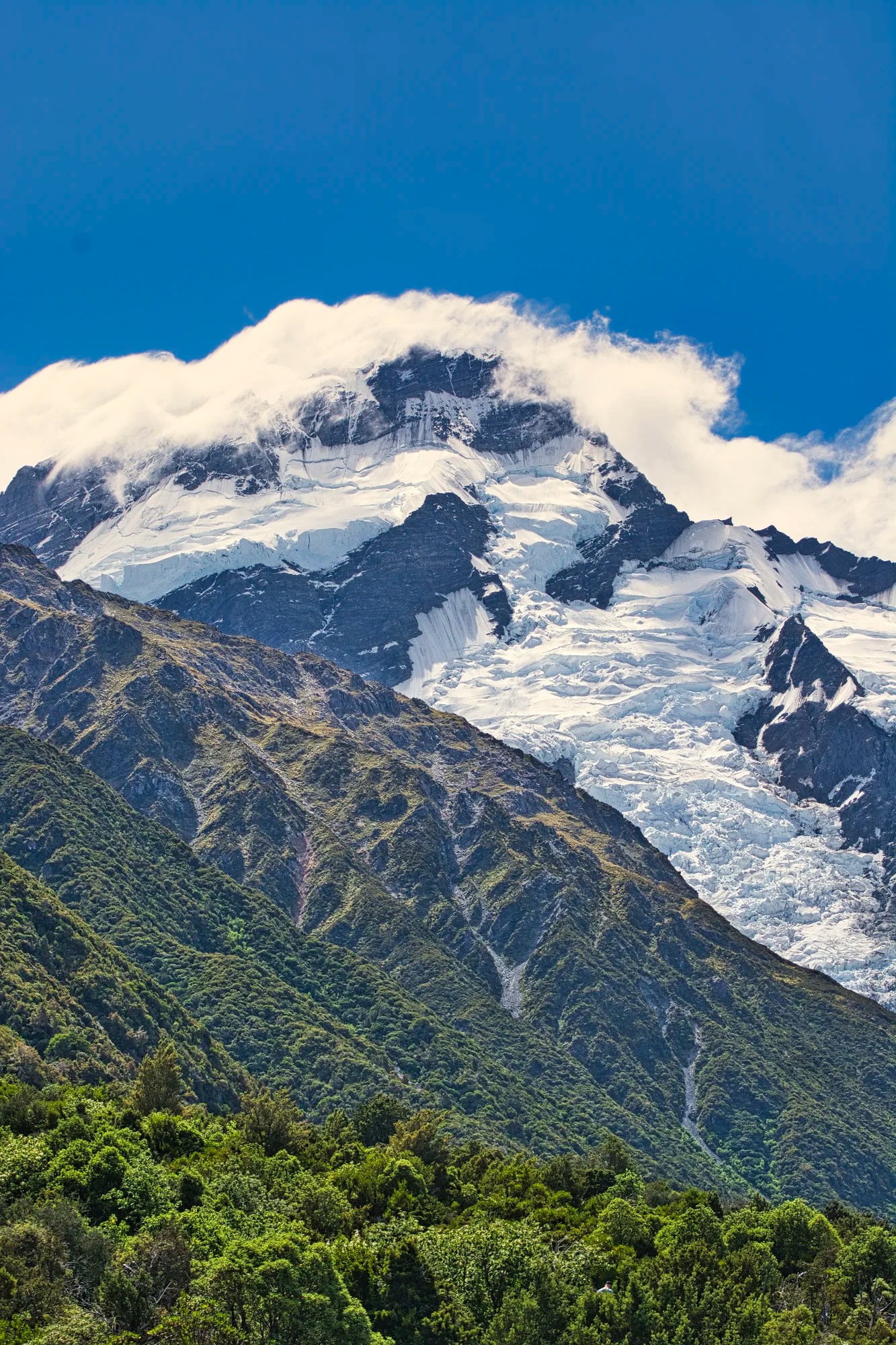
Mt. Sefton has a much more poetic Māori name, Maukatua, or “mountain of the gods”.
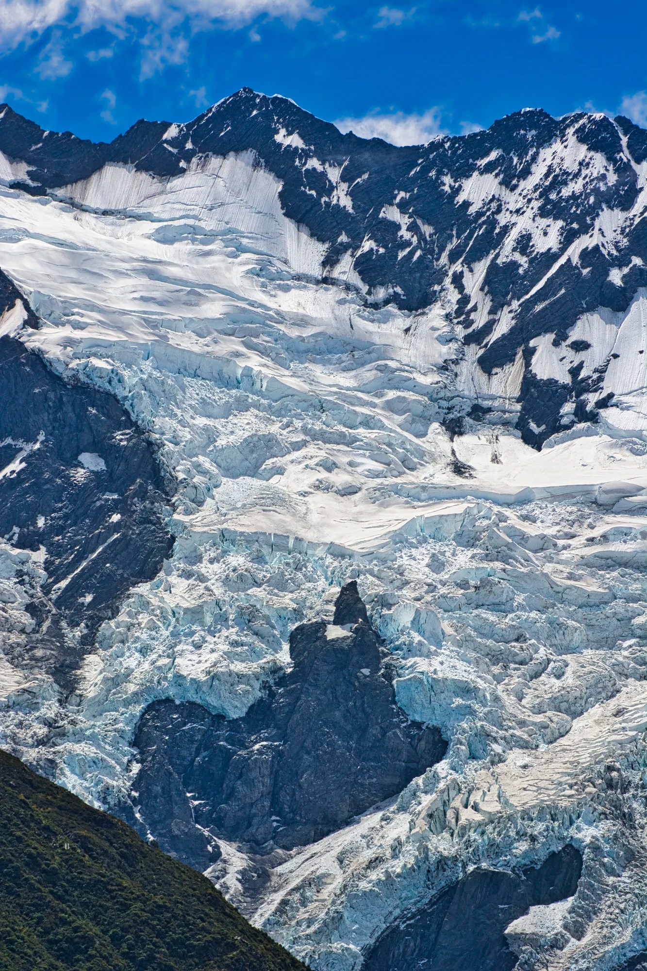
How do glaciers go down mountains? They flow downhill like a frozen waterfall. I used a zoom lens to capture the icefalls on Mt. Sefton. Eight of NZ’s 12 large glaciers are in this NP. In my opinion, the glacial scenery is far nicer than the more famous West Coast.
Lake Mueller Lookout
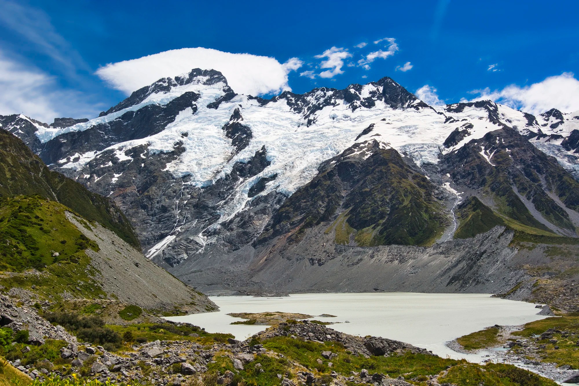
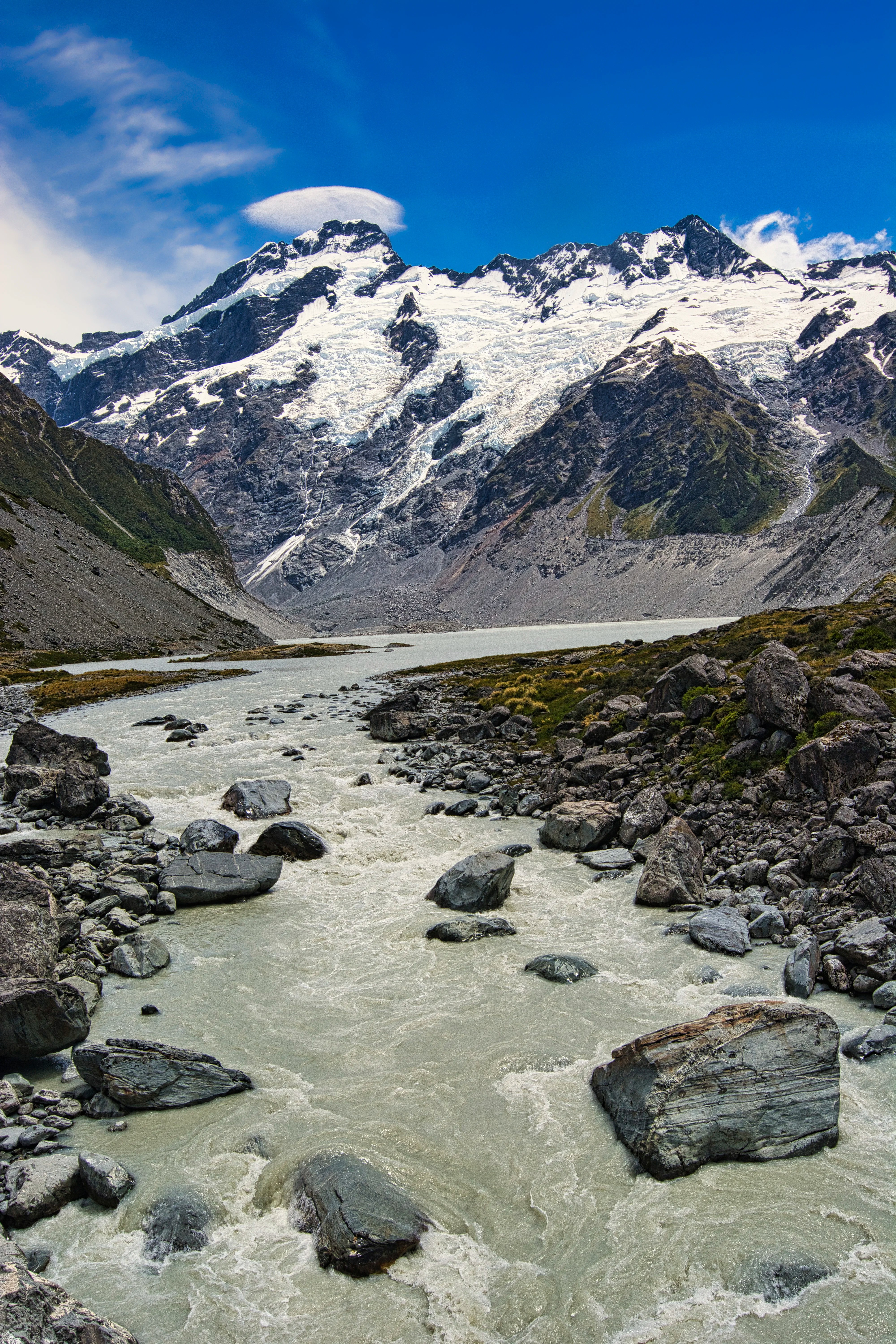
If you are out of shape, you may stop at the Lake Mueller Lookout (G4.9). Massive Mt. Sefton towers above. The lake is glacial but not your beautiful turquoise colour.
The view from the Lake Mueller Lookout also features the first swing bridge over the Hooker River. Keep going on the track, it’s worth it.
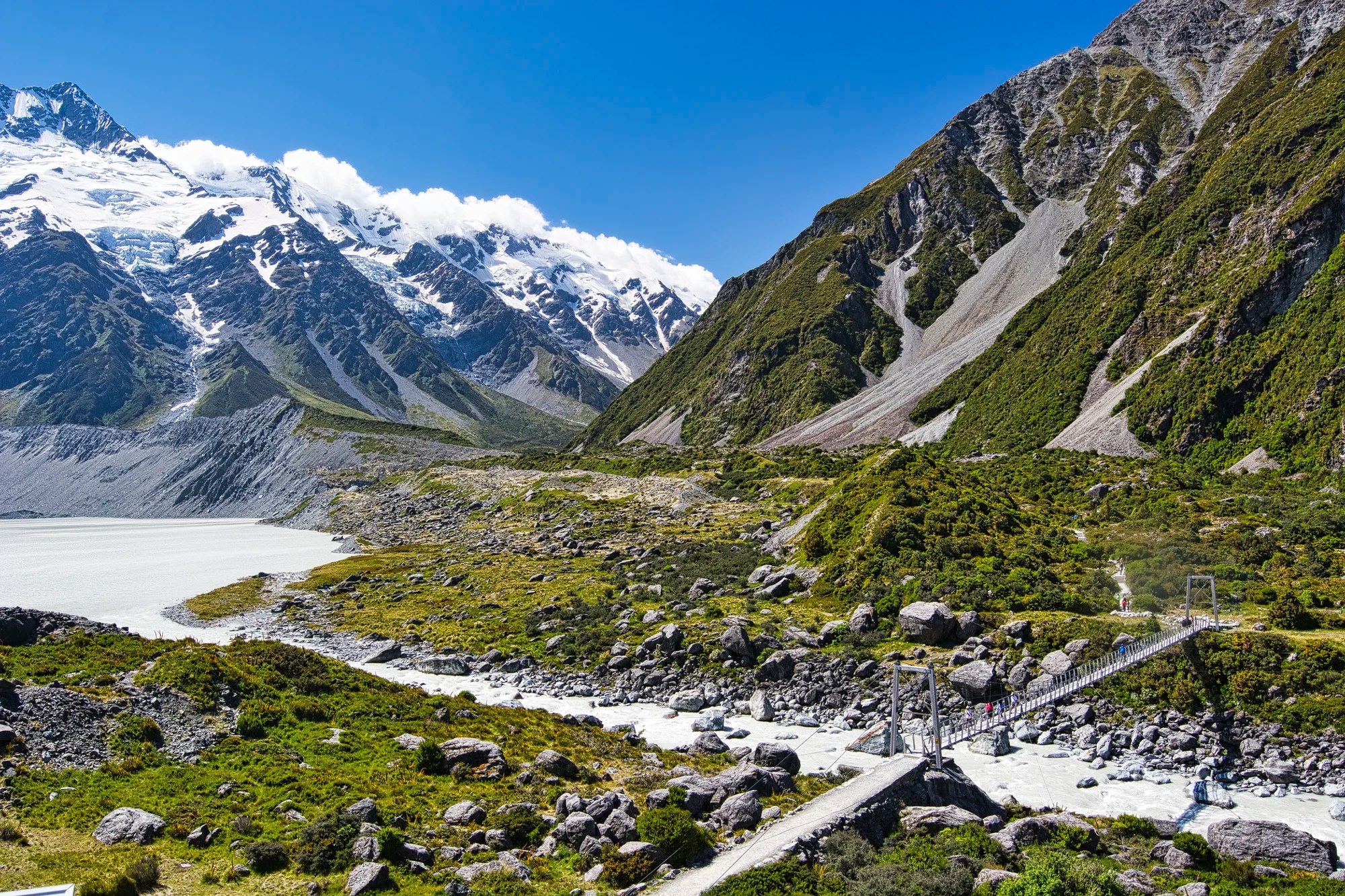
Hooker River Suspension Bridge
After a steep descent, the first suspension bridge is massive and offers great views. Follow the trail to the top of a glacial moraine. This is a wall of boulders pushed by nature’s bulldozer, a glacier. Later, you cross two more suspension bridges.
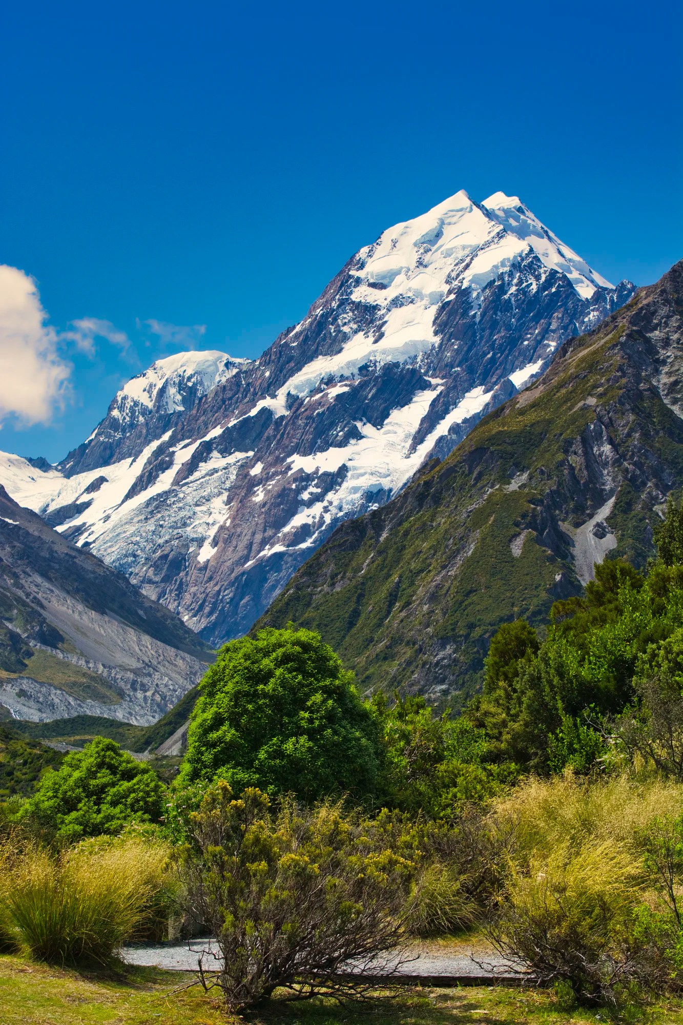
Mount Cook
At this point, the track is quite wide but views to the right are blocked by a mountain ridge.
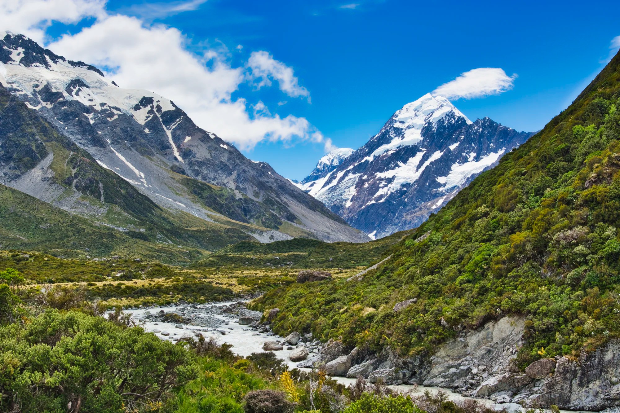
As you turn the corner, you are suddenly stunned by a spectacular view of Mount Cook (G4.8), the tallest mountain in NZ. It seems close enough to touch.
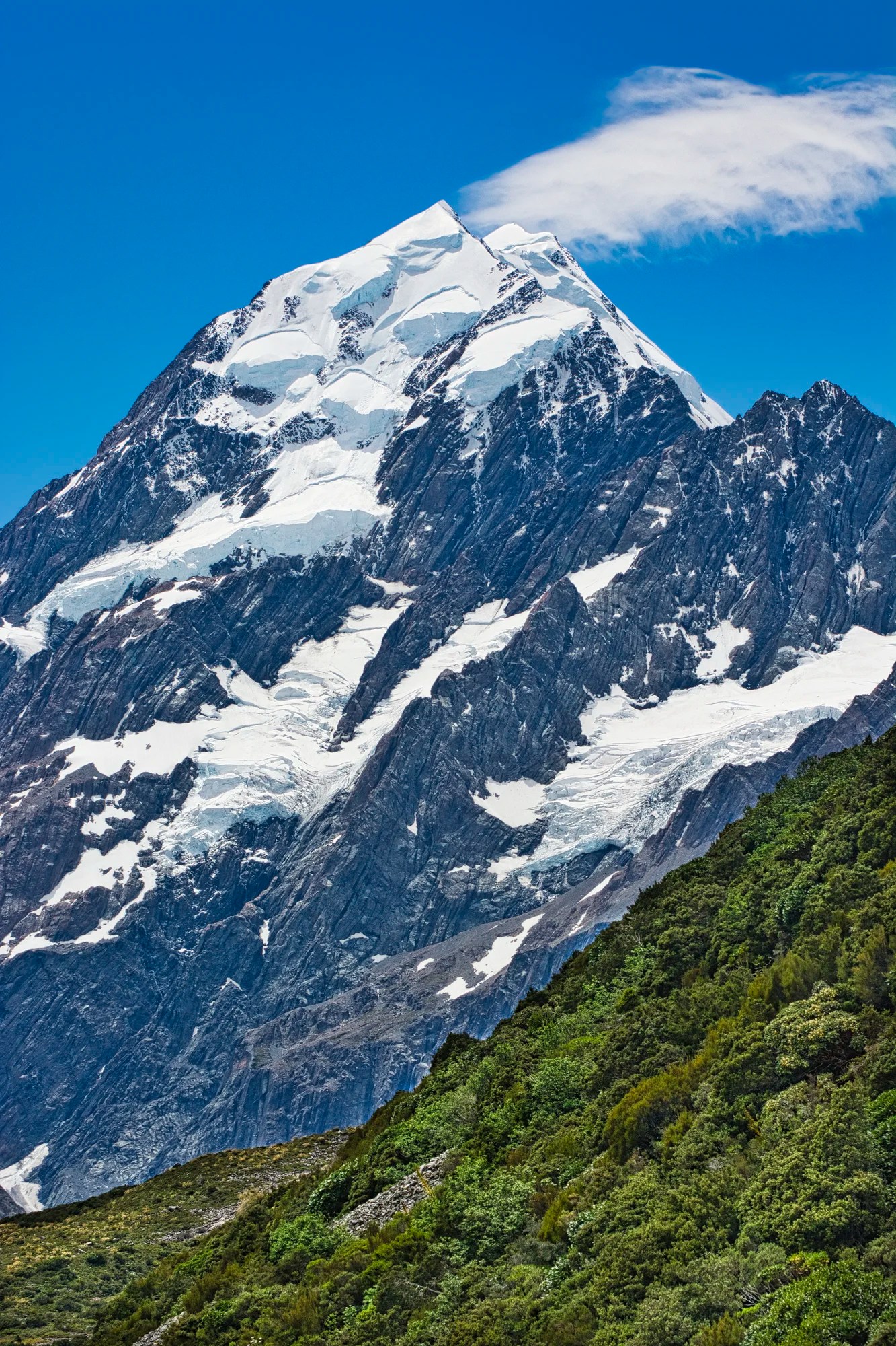
Once again, because there are no trees in the way, you can see the full rise of this 3754 m (12,316 ft) mountain. Mt. Cook was climbed by Kiwi Edmund Hillary in 1948 before he made the first climb of Mt. Everest in 1953.
Hooker Valley Track Details
Distance: 10.8 km (5.4 km OW)
Time: 3-4 hours return
Elevation Gain: 195 m

Aoraki NP has many easy day hikes that lead to spectacular views.
Kea Point Track
On an early April morning on a previous trip, we hiked through an open valley, down stone stairs and across dry stream beds to Kea Point – a short walk that’s only one hour return from the White Horse Hill car park. The trail winds to a viewpoint over the Mueller Glacier moraine wall.
We reached the trail junction to Sealy Lakes. The trail ascended a very steep slope with a bit of a rock scramble at the end (56 mins.). We had views of Mt. Cook and Mt. Sefton, already being veiled by clouds. We descended and then completed the Kea Point Track.
Kea Point Track Details
Distance: 2.9 km OW
Time: 50 mins;
Elevation Gain: 88 m
Sealy Lakes Track Details
Distance: 5.3 km
Time: 2:50 hrs;
Elevation Gain: 546 m
Tasman Glacier Track
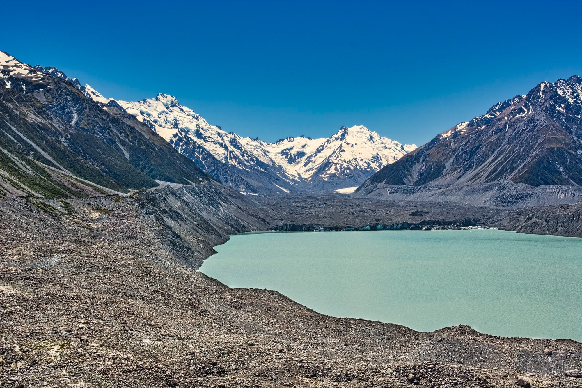
Drive south on Highway 80, then turn left on the Tasman Valley Road until the parking lot. It’s a very short hike to the Tasman Glacier Viewpoint (G4.7). You are surrounded by gravel ground up by the Tasman Glacier, the largest in NZ. Tasman Lake is a milky green, more like a grey-green. This probably means the glacial silt has a larger particle size than the glacial flour suspended in the Icefield Parkway Lakes.
Ball Hut Track
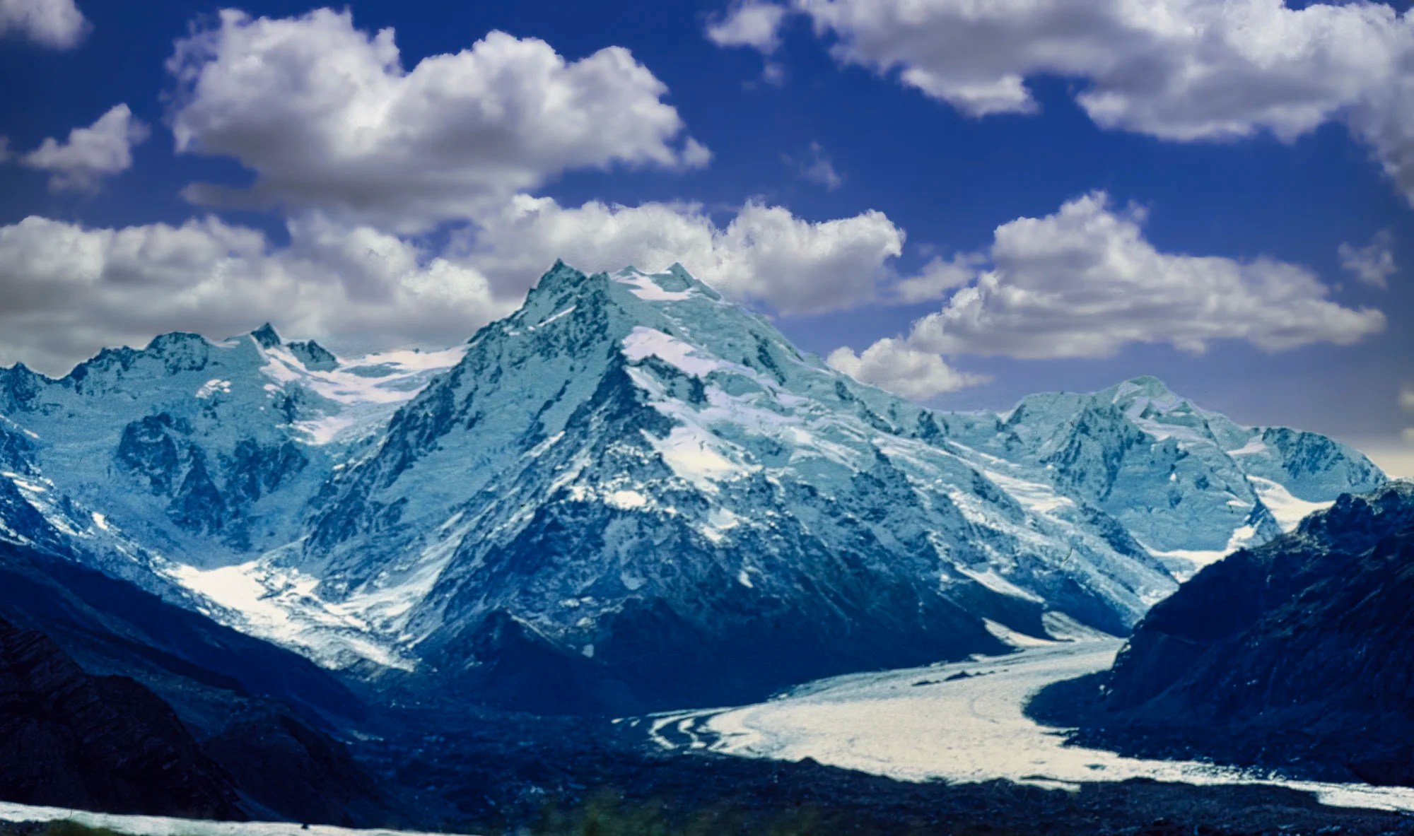
Ball Hut Track starts at the parking lot. But we drove partway up the rough gravel Ball Hut Road with park rangers. After fording a river in their jeep, we walked the rest of the gently sloped road to the edge of the moraine. We called the Tasman Glacier black in our diary because the first part of the glacier was literally covered with rock. We climbed up the hill above Bell Hut with some rock scrambling. It feels like we are in an airplane. Mt. Cook loomed to our left outside of the photo. Below us was the chasm carved by Bell Glacier, the black area at the bottom. The view was stunning, with the huge Tasman Glacier below the blue ice-covered mountains.
The shaded areas of snow and glaciers are blue. That is normal because the red (long) wavelengths of white light are absorbed by ice, but the blue (short) wavelengths are transmitted. The longer the path that the light travels, the more blue appears. This effect is increased when the ice or snow is in the shade.
I am not sure if the strange lighting in the photo was due to it being a scan of an old slide. The photo was overexposed and washed out, and became purple-blue as I adjusted the exposure. I used Luminar Neo to make it a usable photo.
Ball Hut Track Details
Distance: 19.6 km
Elevation Gain: 677 m
Hermitage Hotel
On our first trip, the April rain was so bad that we sheltered in the lounge of the Hermitage Hotel (G4.3) and wrote our diary. It was much warmer than outside! Mt. Cook Village is at a low altitude of 750 m (2,460 ft). The temperatures range from 7.6°C (45.7°F) in wintry July to 20.5°C (68.9°F) in summer January. On our first two visits to NZ, we were rained out most days at Mt Cook. The third time was the charm: it was gloriously sunny and warm, close to 30°C!
On our last trip, we stopped for a cappuccino at the Hermitage, which we took outside on the second-floor balcony. Here, non-hikers can see the views of Mt. Cook without the effort. Yes, it is a bit far away,y but Mt. Sefton is just as spectacular.
Using a zoom lens or binoculars from the same viewpoint, it feels like Mt. Cook is right next door.
Lake Pukaki
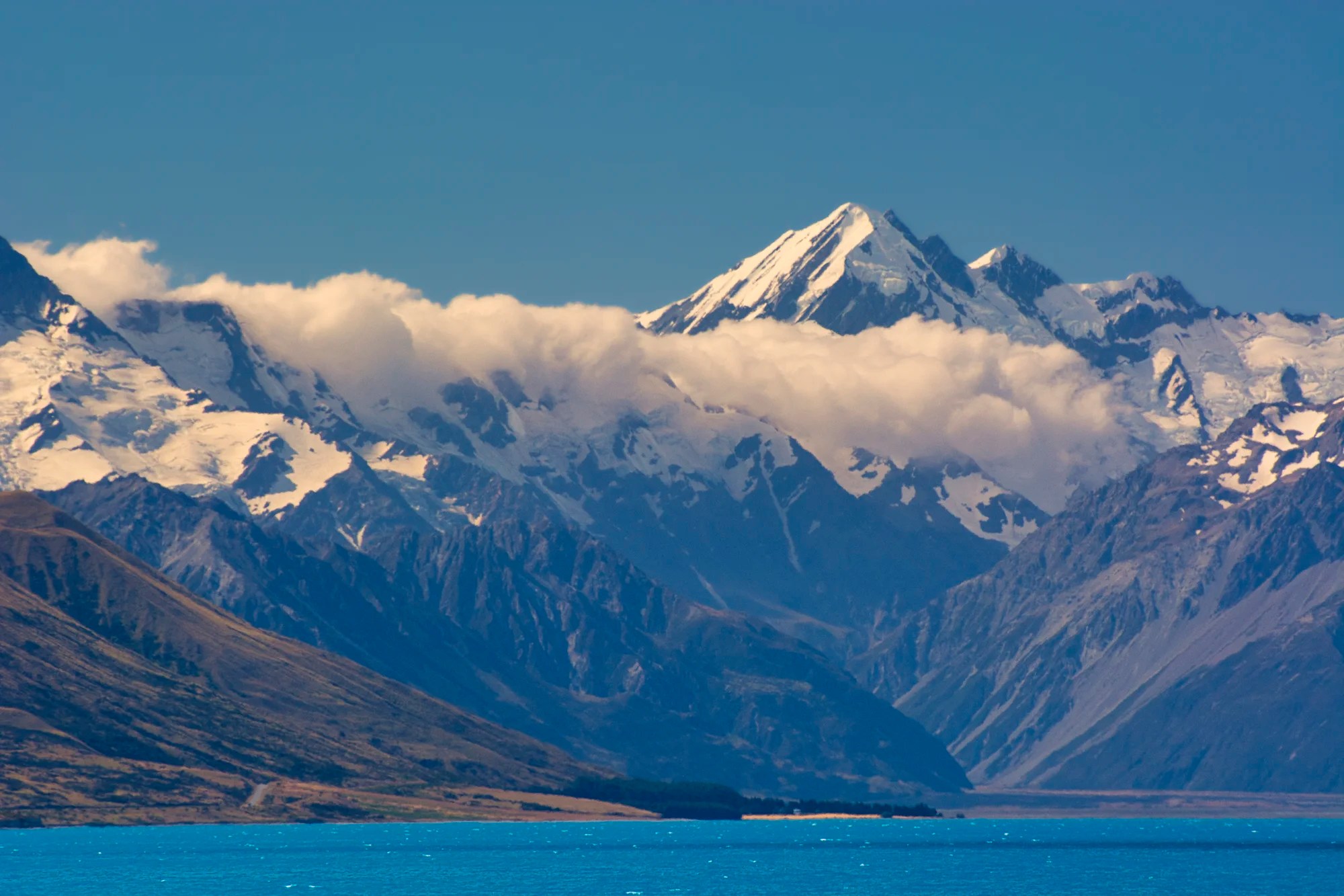
The drive “home” (Twizel) each day was spectacular. It was not sunset yet but the east sides of the mountains were in shade. However, the sunlit peaks peering through the clouds confirm the Māori name Aoraki, “cloud piercer”.
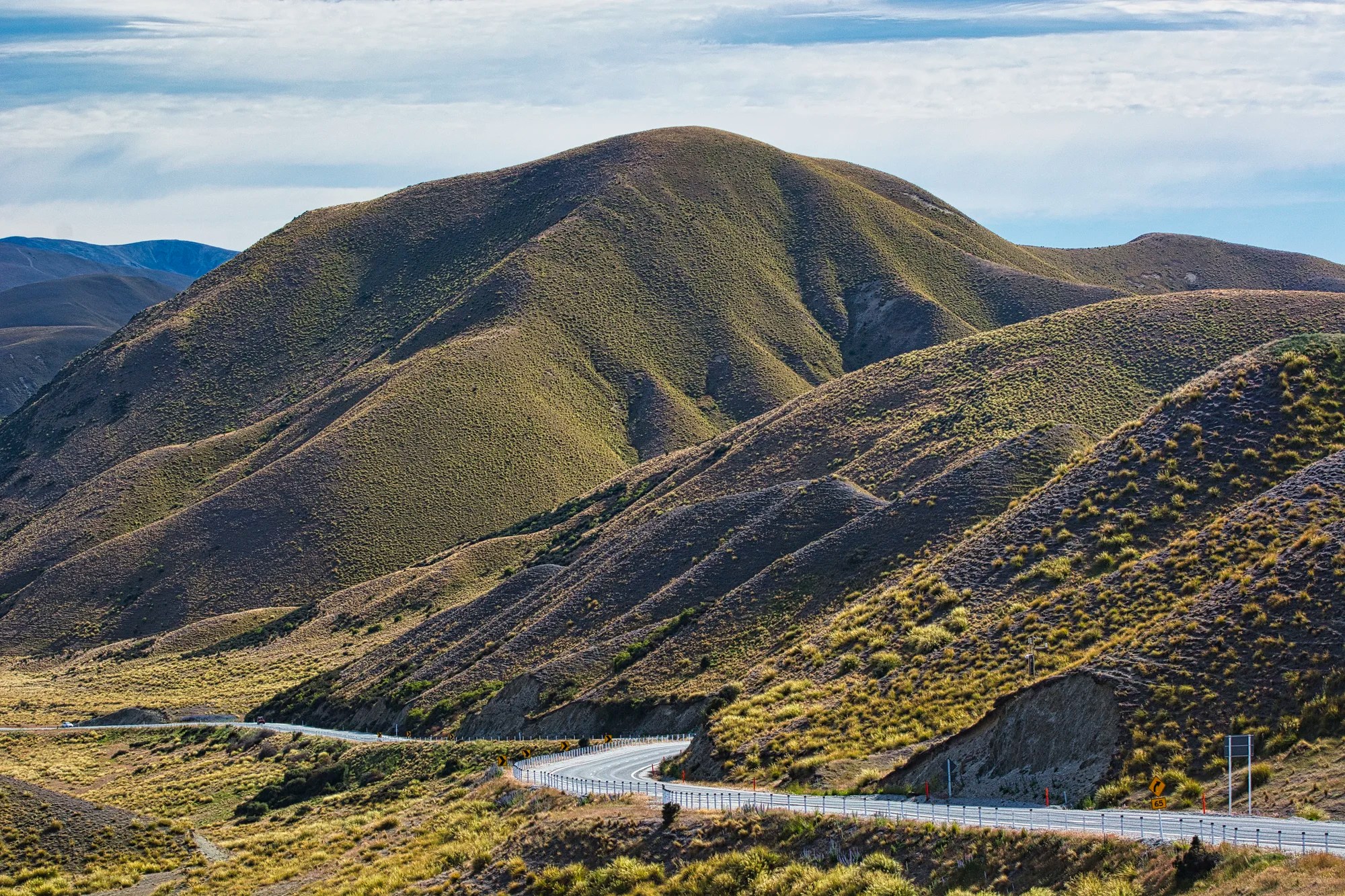
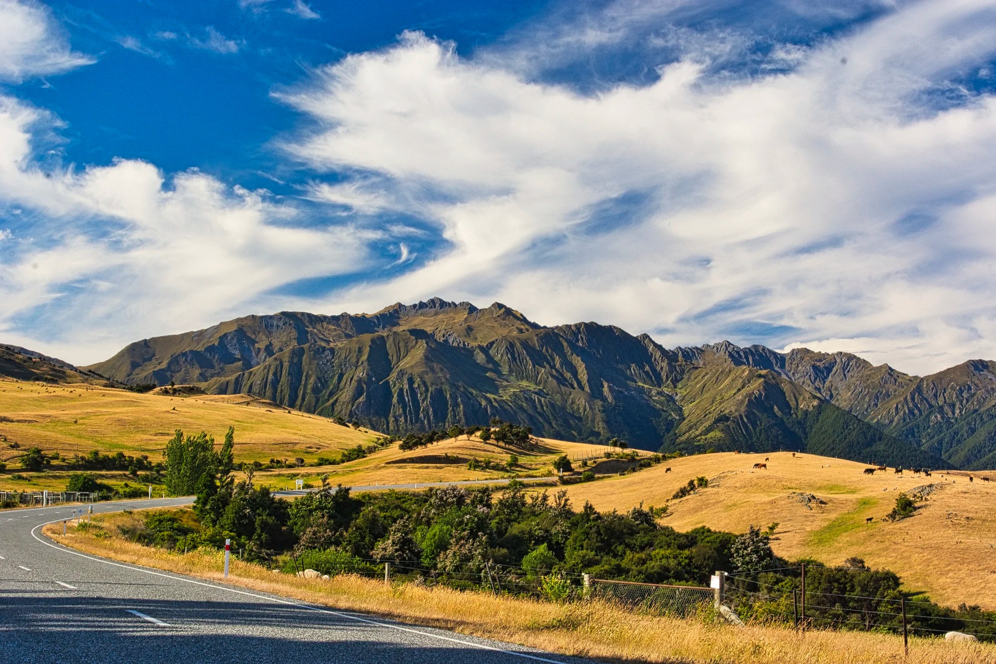
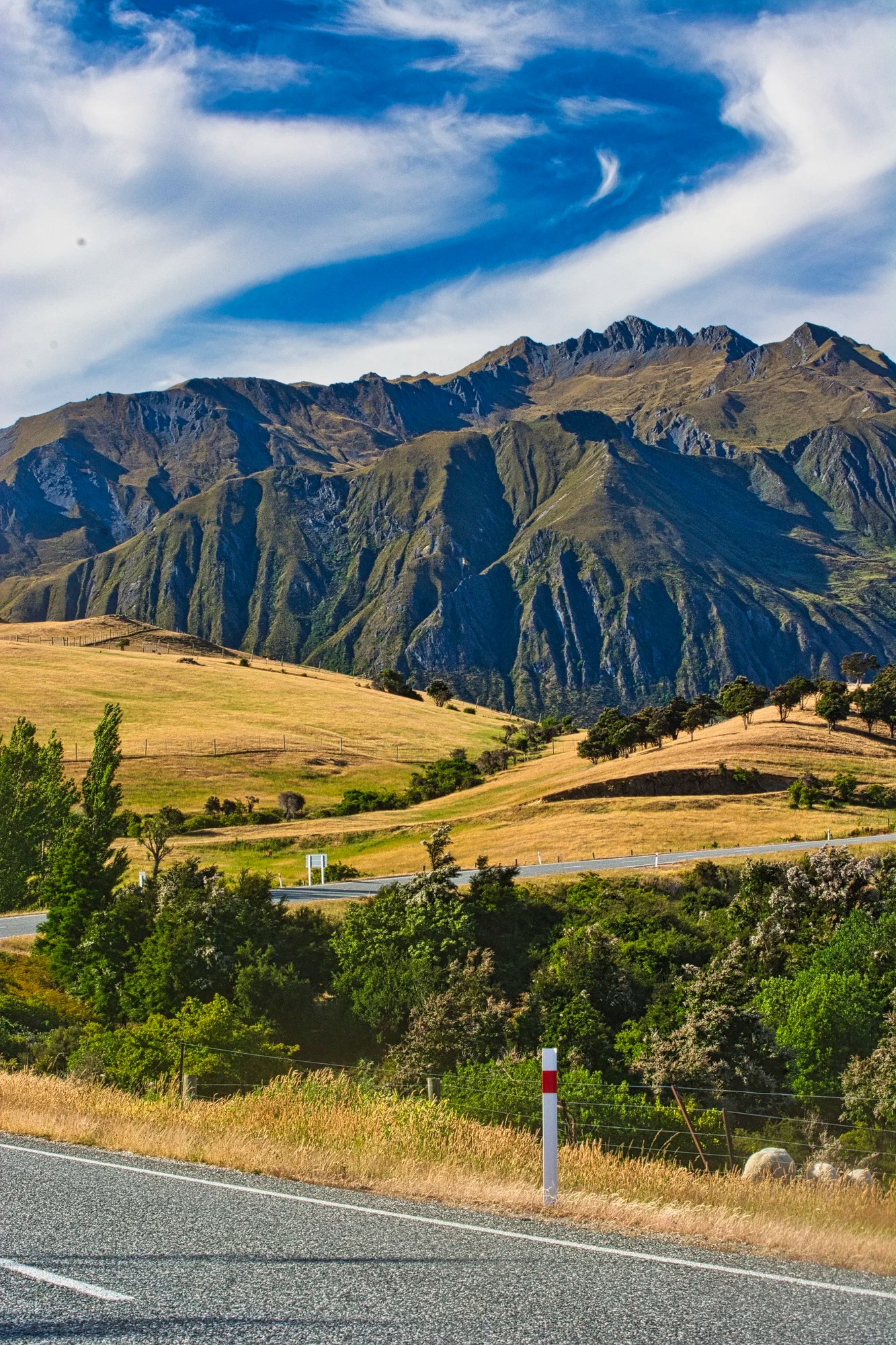
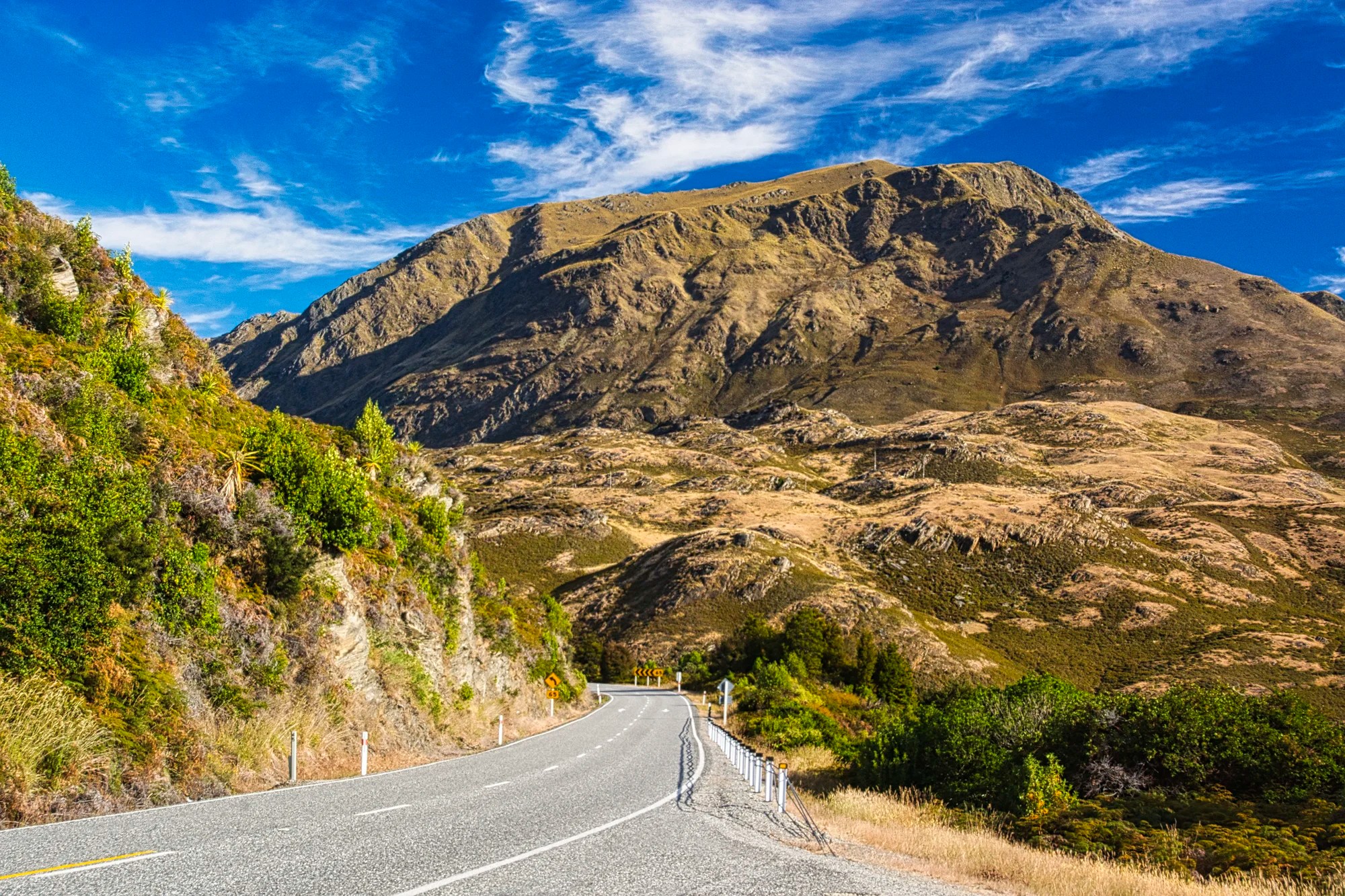
Lindis Pass
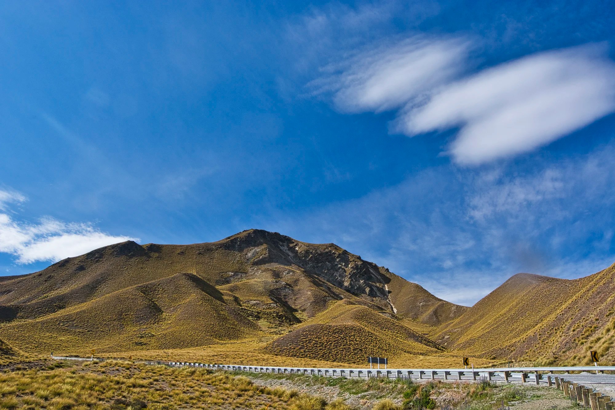
From Twizel, Highway 8 goes south to Wanaka. Lindis Pass (G4.6) may not be a must-see for most tourists. The treeless pass may seem boring. On the other hand, with the right lighting, it is otherworldly scenery. We would highly recommend driving here either early morning or late afternoon for the softer lighting.
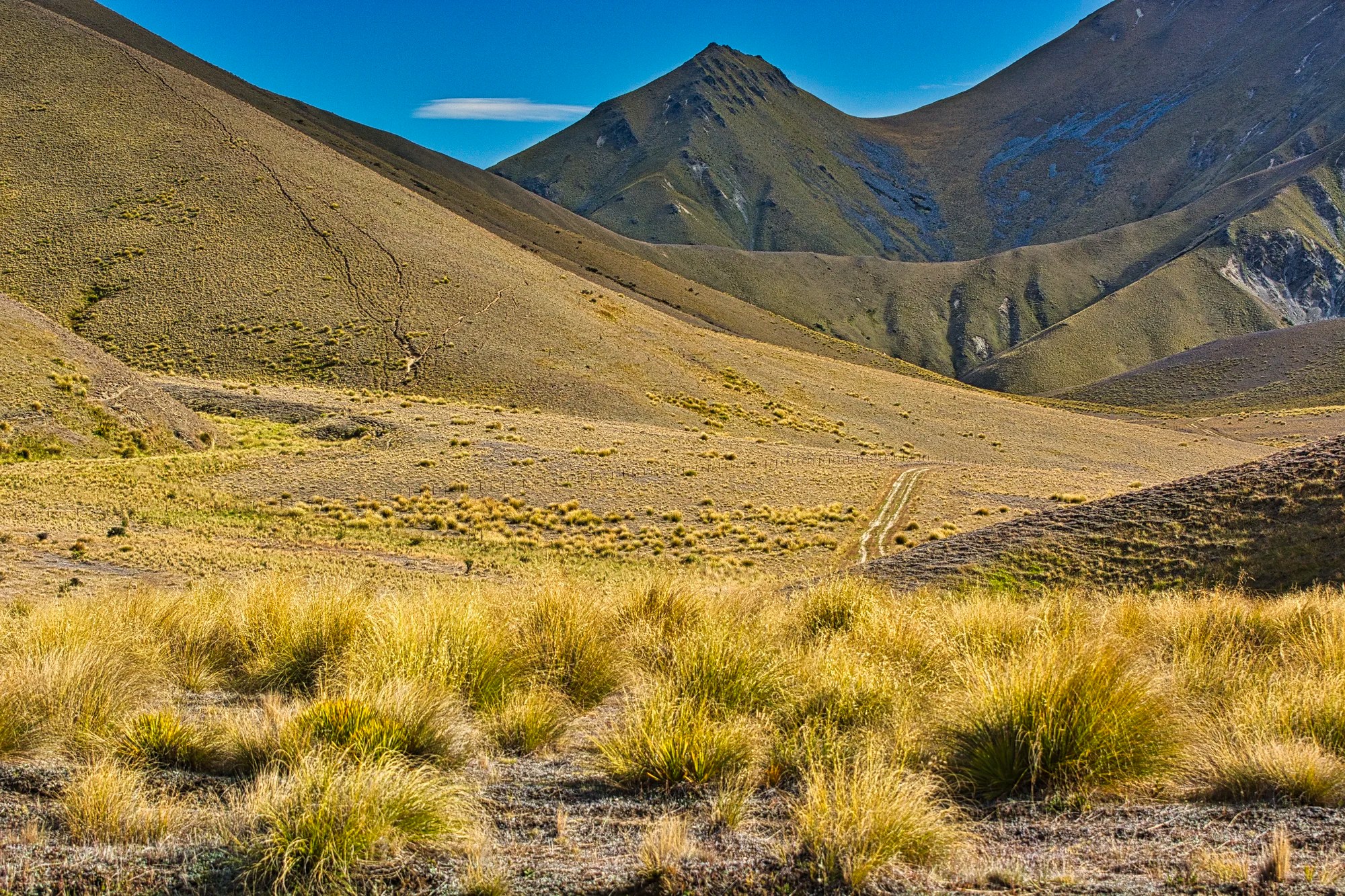
The pass area is dry and hot in the summer as it is in the rain shadow of the Southern Alps. You are surrounded on all sides by grassland called snow tussocks. In this photo, I used the tussocks as the foreground as a reminder of what we were seeing in the distance.
I really like photographing the play of light and shade on the shapes and curves of the golden-coloured mountains.
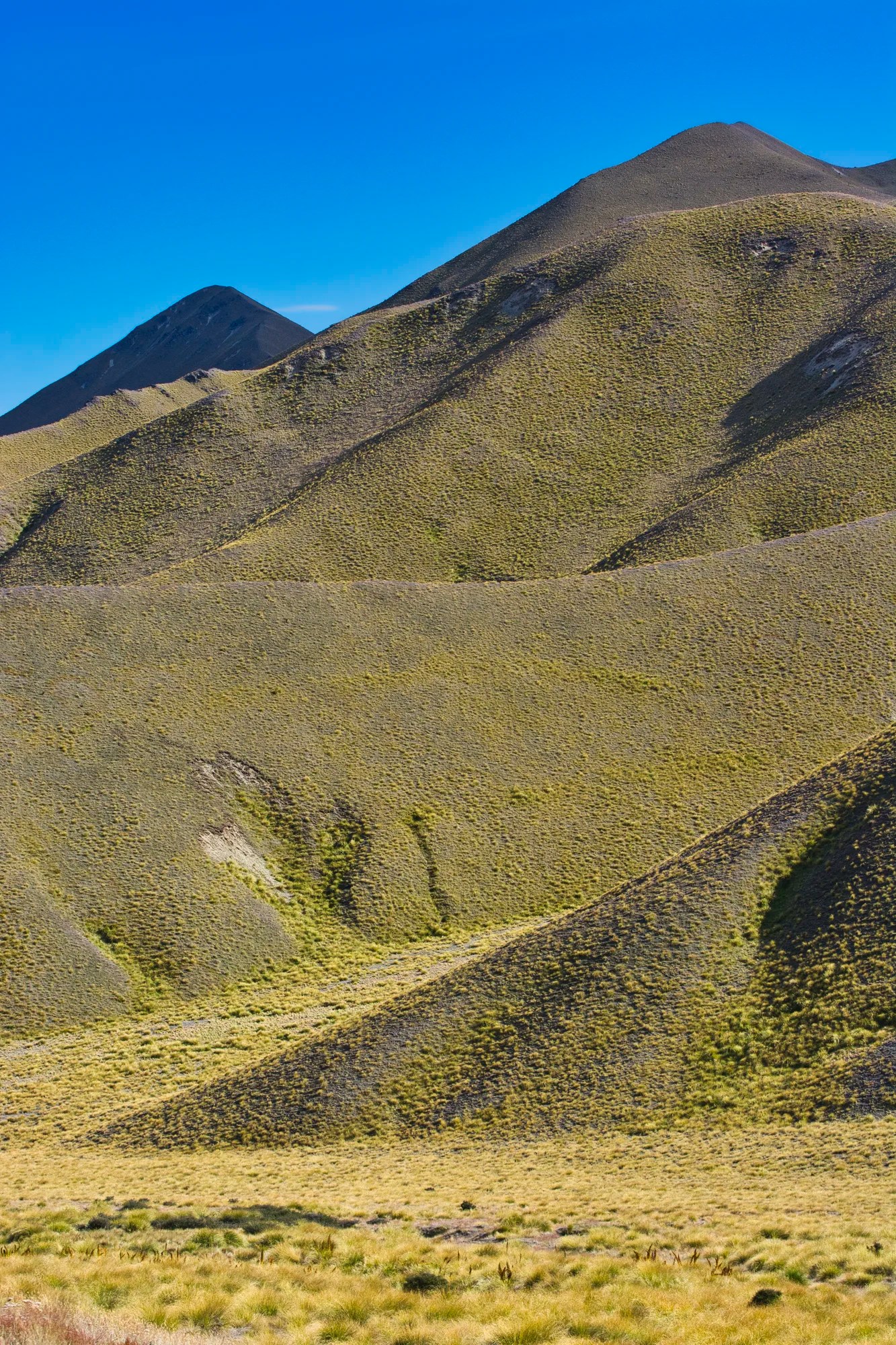
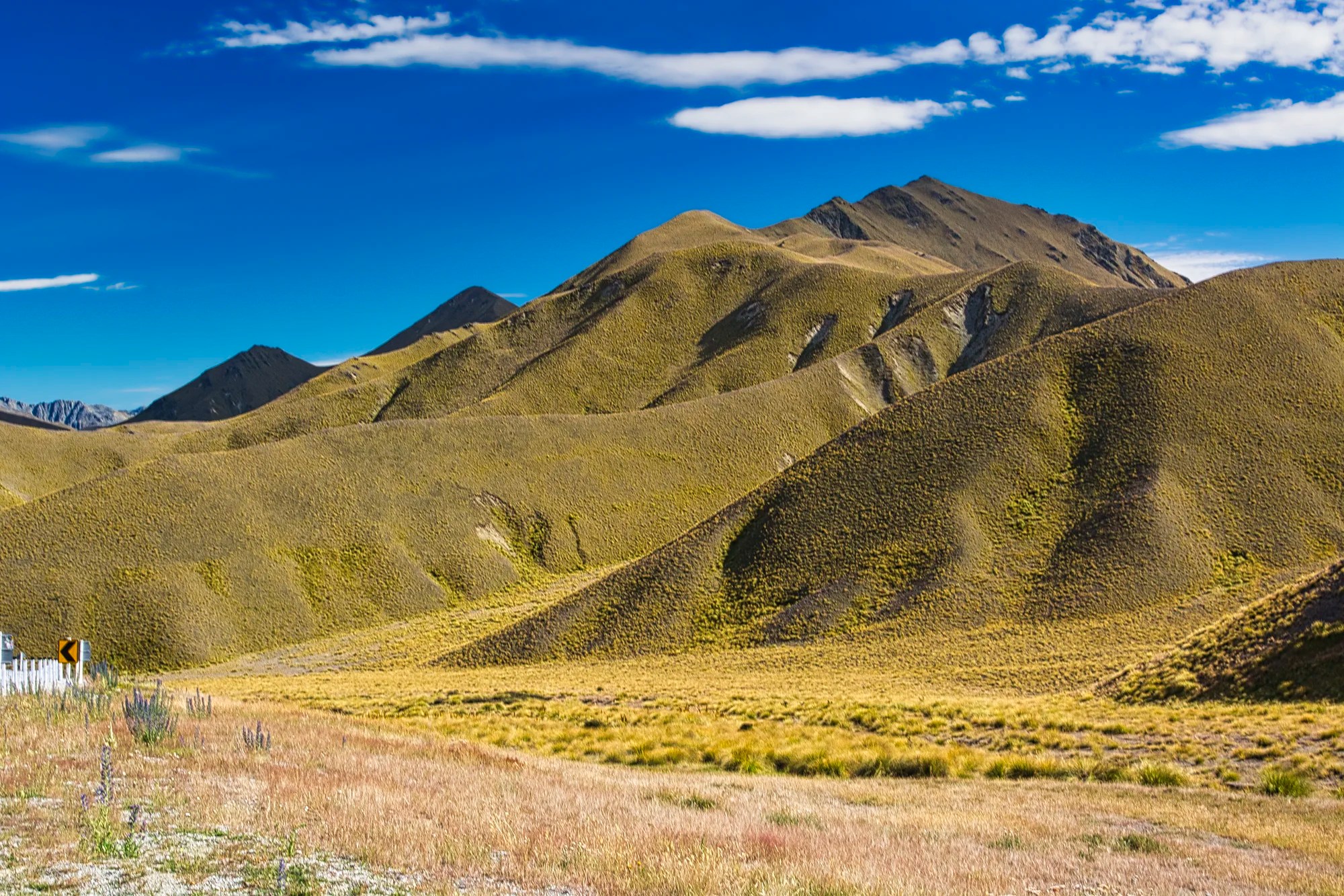
This is exactly the same place, but zoomed in to create a close-up using portrait mode to emphasize the height of the mountains. This area used to be grazed by sheep, but now it is a conservation area.
There are pull-offs up to the 971 m (3,186 ft) pass, where there is a parking lot with a viewpoint. There are a couple of tracks to tramp, in Kiwi-speak.
Double Peak Mountain Track
Elevation: 1323 m, 4340 ft
Time: 45 to 60 minutes
Elevation gain: 352 m, 1154 ft
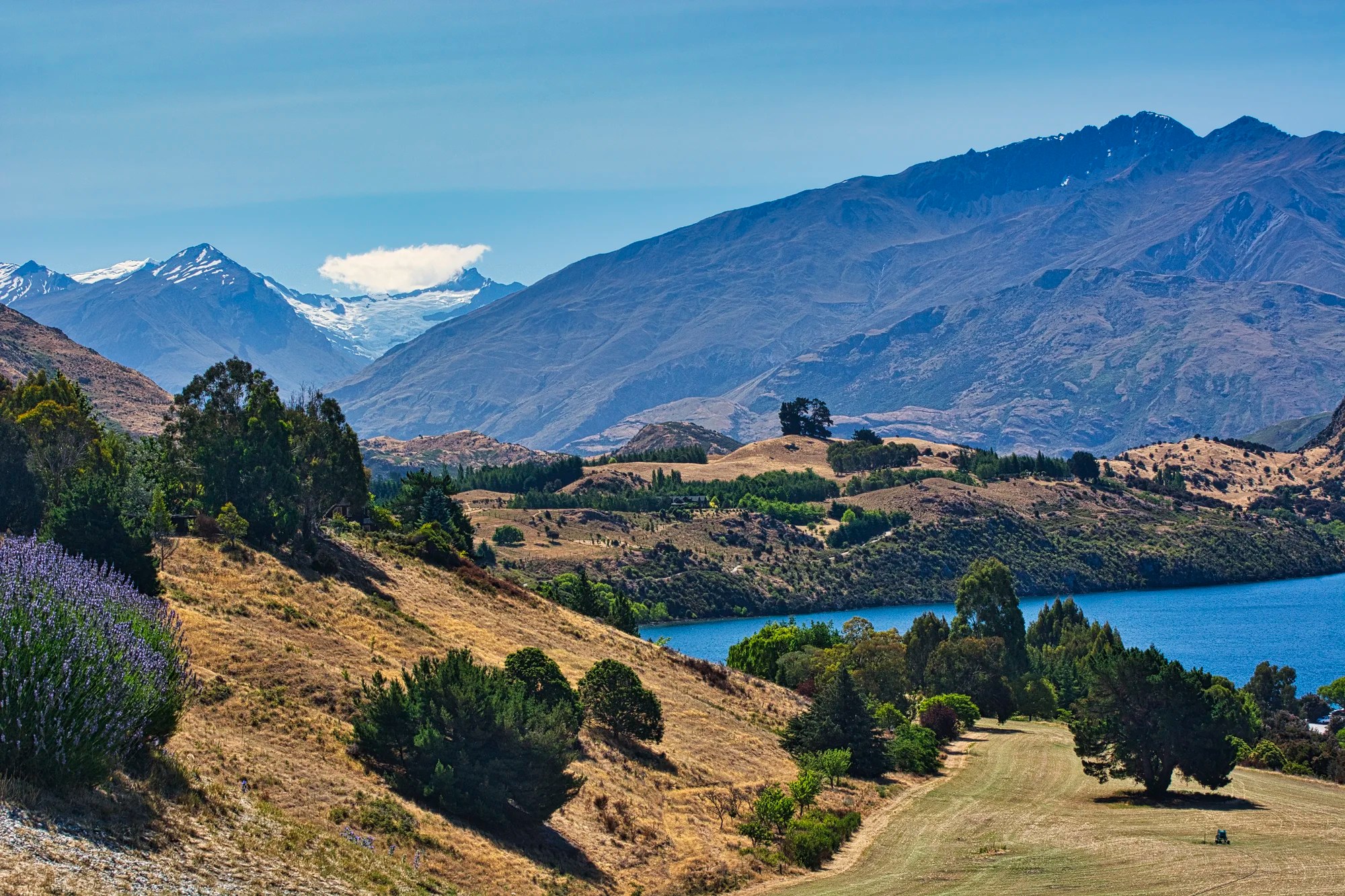
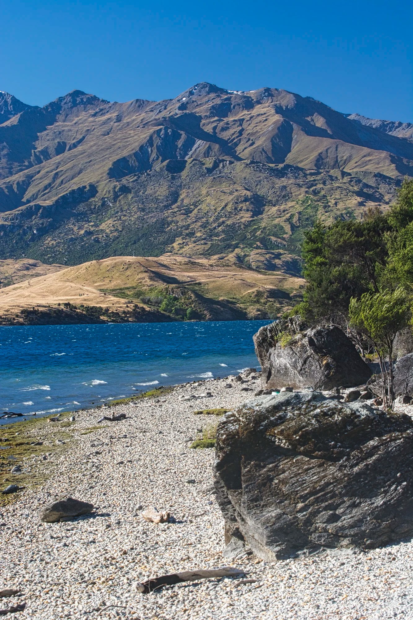
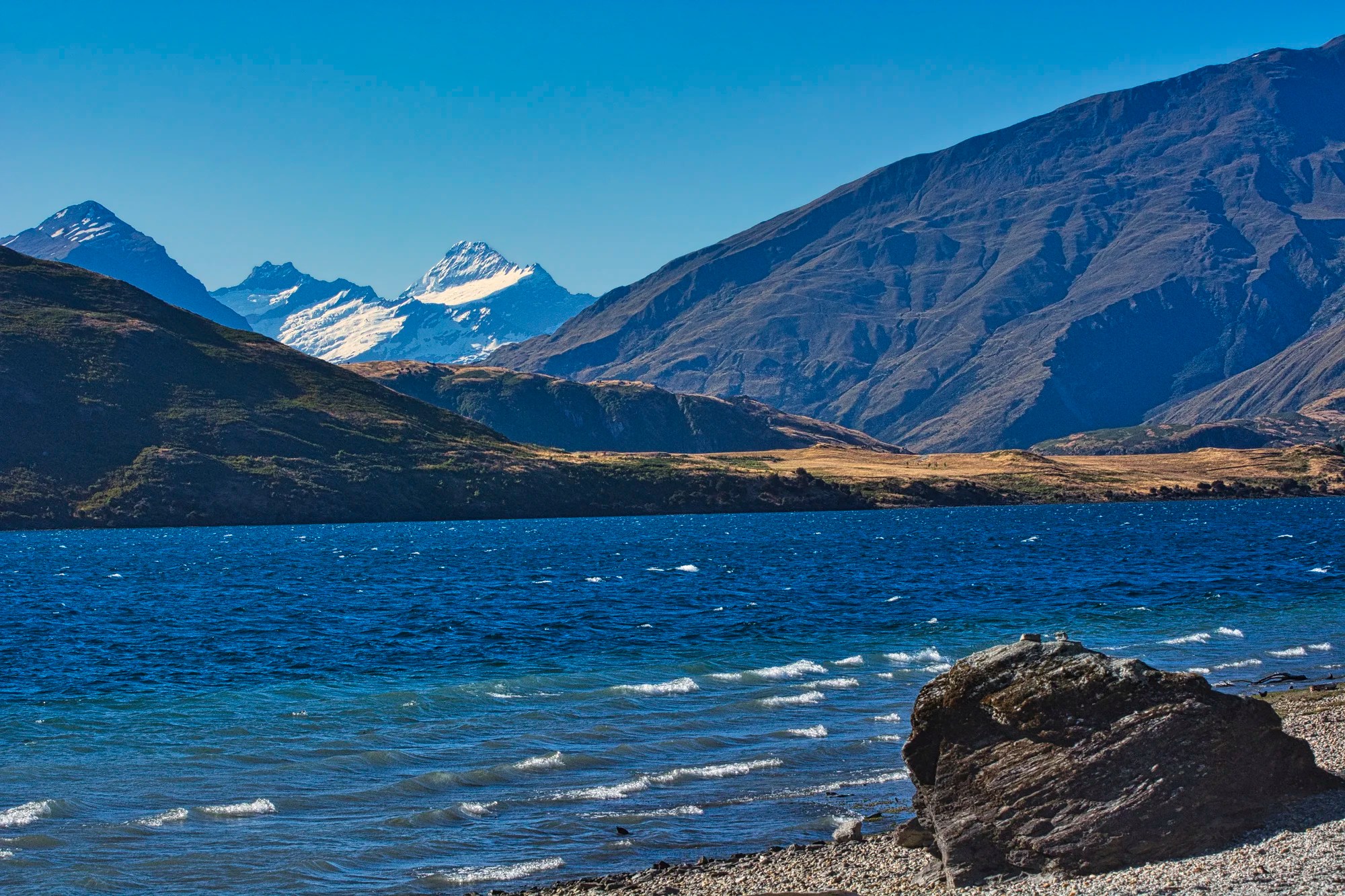
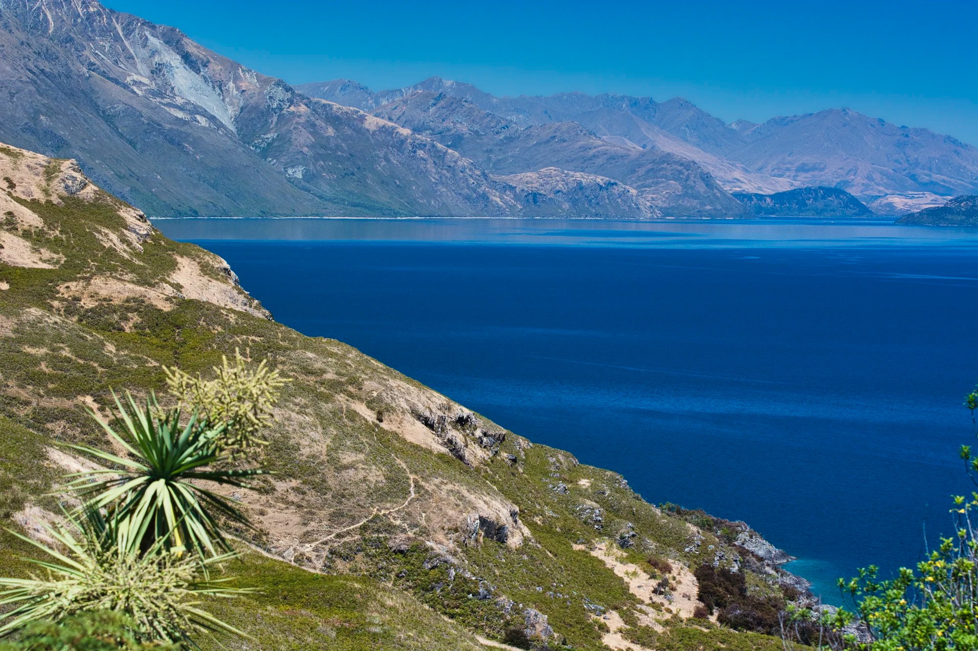
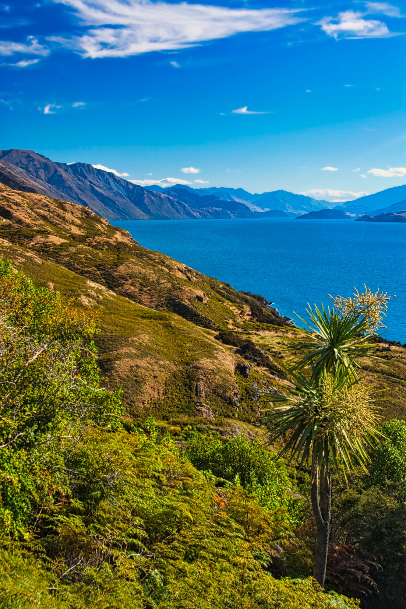
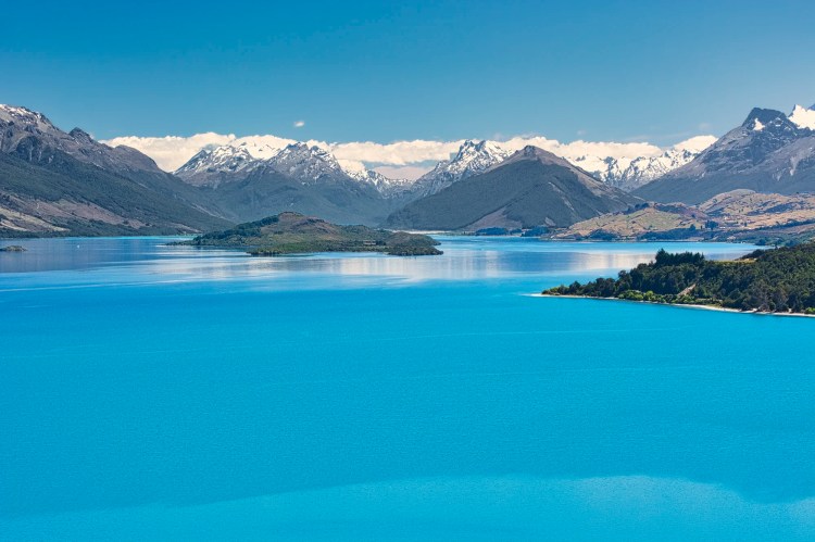
Lake Wanaka
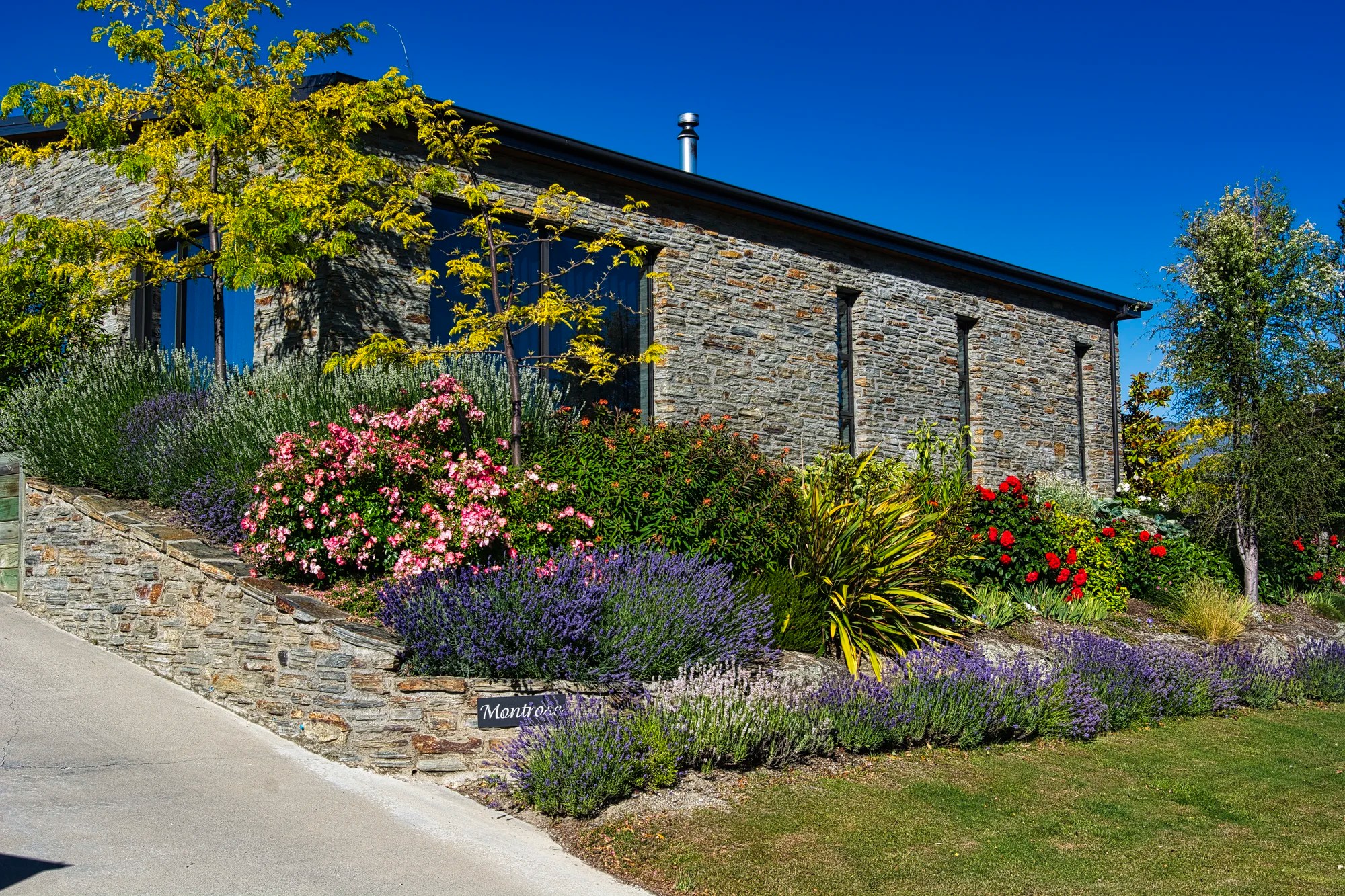
Located near the town of the same name, Lake Wanaka provides a wide panorama backdrop of mountains. We stayed at the beautiful Montrose B&B. The big plus is that Wanaka is a quiet, relaxing place with only 11,550 people. There are lots of low-key activities like tramping, boating, and fishing. But this is the antithesis of Queenstown with its’ tourist cruises, flightseeing and auto traffic.
That Wanaka Tree
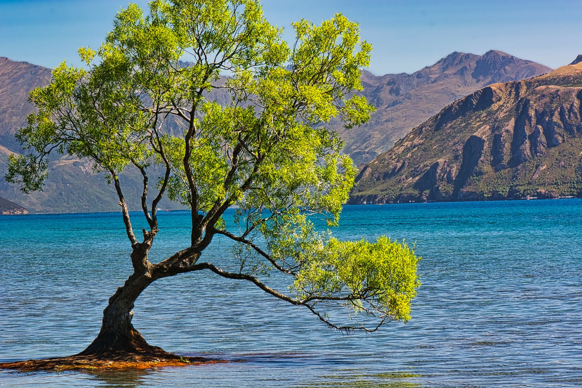
But most tourists come here to see the only tree that has its own hashtag. It is a short walk along the beach to #ThatWanakaTree (G4.5). Located at the southwestern end of Lake Wānaka, this willow tree stands alone, surrounded by water. The lakeshore is a good place for photos, but it is always better to have a foreground or frame to add depth and interest to landscapes. I don’t know why people are so fascinated, but #ThatWanakaTree does make a good photographic subject.
Wanaka War Memorial
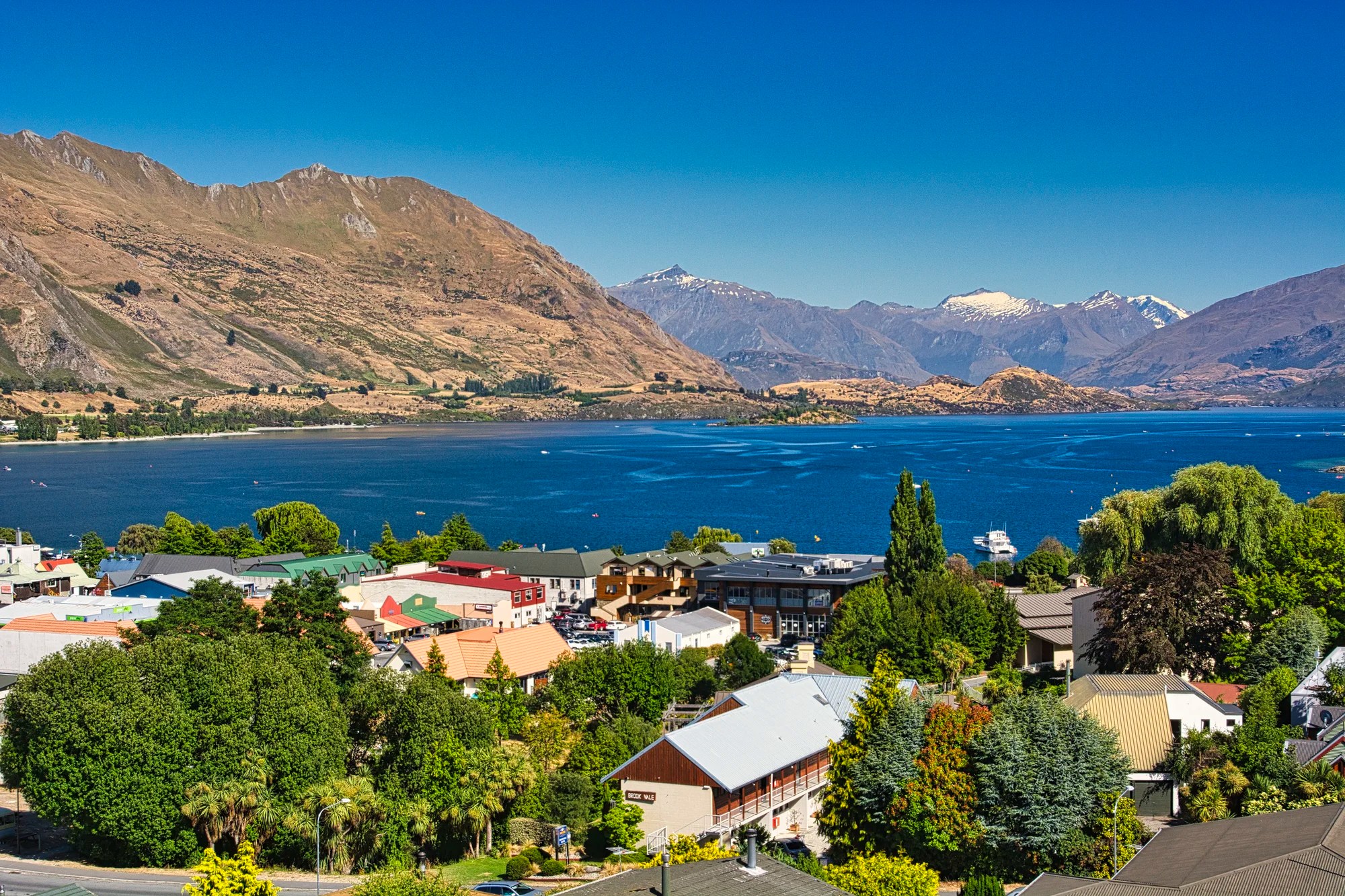
We found a viewpoint above the town that I’m not sure tourists know. Drive up Chalmers St. to the Wanaka War Memorial (G4.6). Lake Wanaka is 45 km long and 10 km wide, surrounded by mountains up to 2000 m on the north.
The War Memorial provides faster access than the 90-minute hike up Mt Iron. A more strenuous alternative is to hike the Mt. Roy Track for 5 hrs RT, starting from 7 km along the Glendhu Bay road.
Travel Photography and Editing


Pull handle (< >) left or right to see before (original) and after images.
Photographer Leanne Cole once wrote that she does not really like travel photography. It’s true that you usually do not get atmospheric or amazing photos because you cannot control the weather or even the time of the day that you visit. As our last trip was primarily for our son and expert birder, the best times for soft lighting — sunrise and sunset — are also the best times for birding. He saw 144 species.
Due to exceptionally sunny weather, I had to deal with harsh lighting and haze. For some reason, I did not use a polarizer filter on my 105 mm macro lens for these two Wānaka Willow photos. As the photos were washed out, I used the Luminar Neo AI editor to improve them. You can see the before and after photos above.
The main Neo features used were the Enhance slider (Sky +35) to make the sky resemble a polarizer filter (like your sunglasses), the Dehaze slider (25); and the Relight slider to slightly darken (-15) the background mountains. The photos in NZ were taken with my previous camera, a Nikon D7100 with a 105 mm macro lens recording NEF (RAW) images.
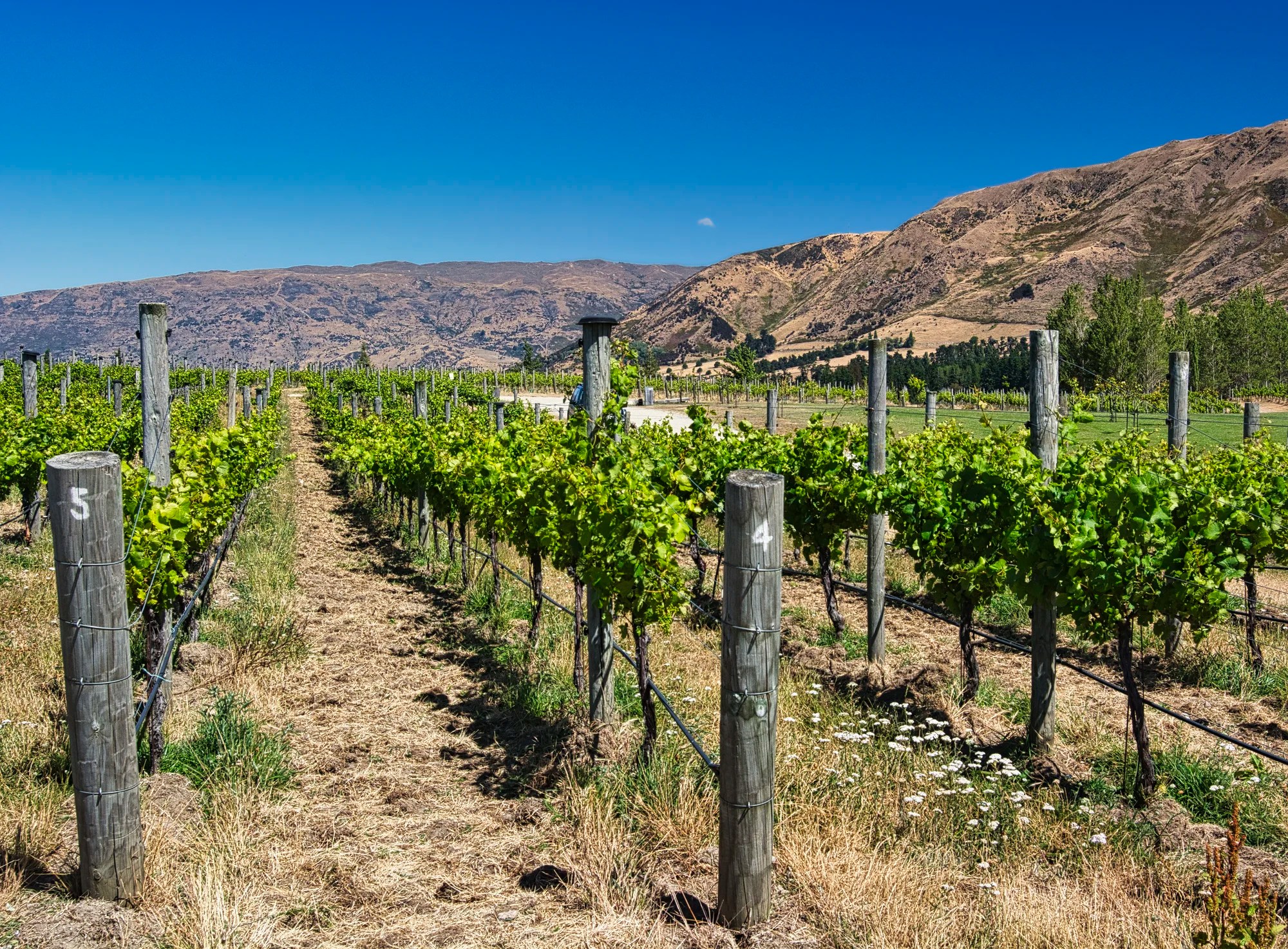
Rippon Winery
The Rippon Winery (G4.5) is located on a hill above Lake Wānaka with views of Mt. Aspiring NP in the distance. We came for the wines, but we stayed for the views. Since we had bought one of their wines earlier, we attended the wine-tasting session, which was definitely worthwhile.
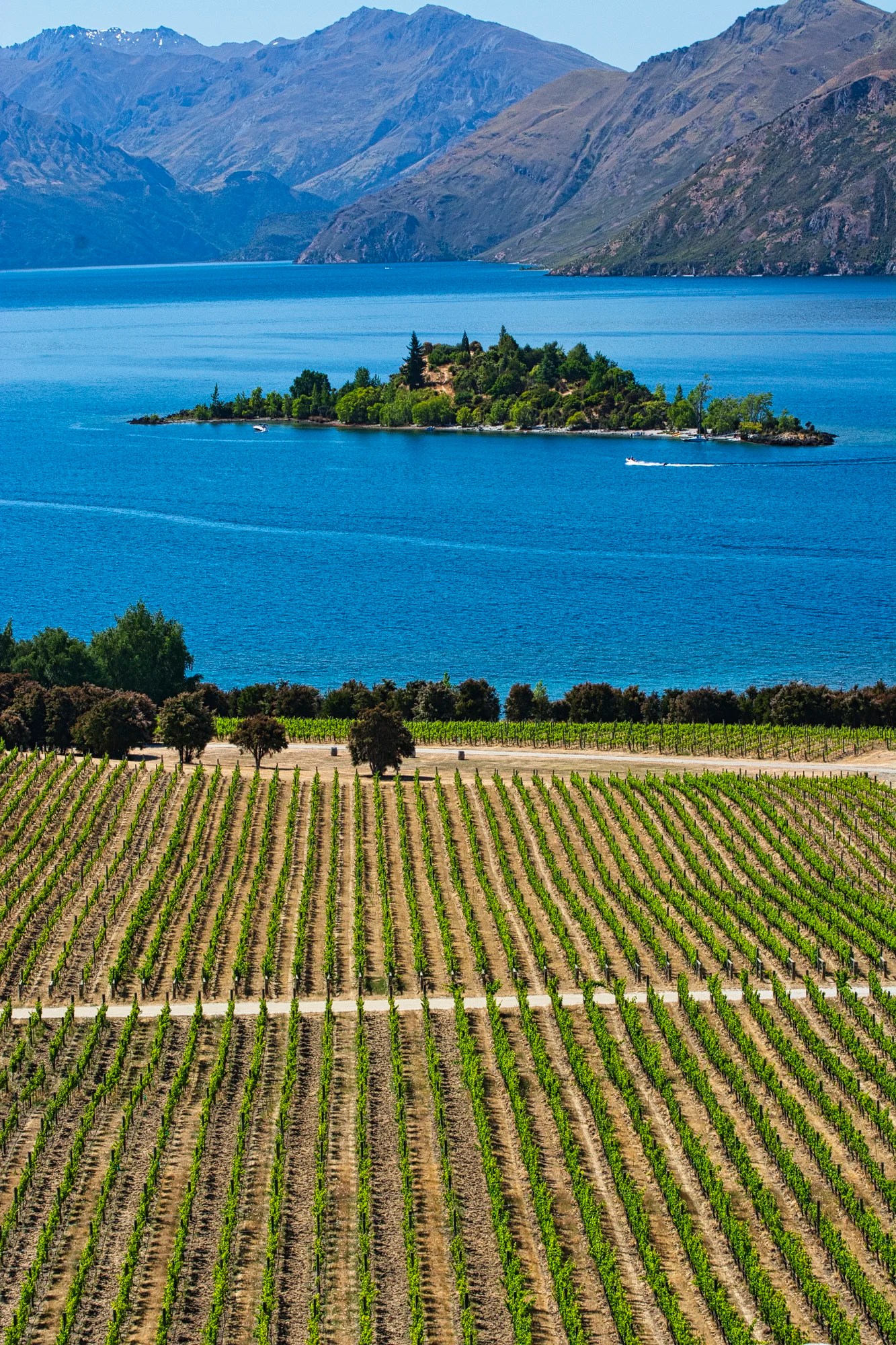
Ruby Island (G4.6) in Lake Wānaka was a hot spot during the Prohibition Era. Locals flocked here for clandestine parties.
Rippon Winery Grape Varieties
Several grape varieties are grown here, but the most notable are the Pinot Noir and Riesling.
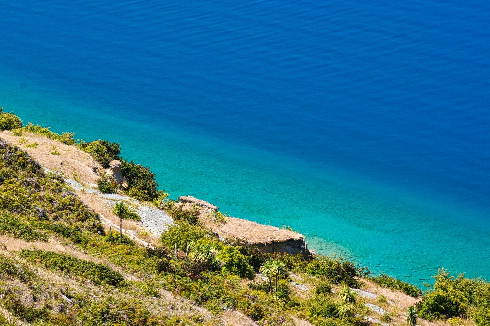
Glendhu Bay
Glendhu Bay is part of Lake Wānaka. Drive 7.5 km west of the Wānaka Willow on the Wānaka-Mt. Aspiring Road. It is famous for its golden poplars along the highway in the right season. This photo shows the overall view of the arid mountain scenery.
From the Glendhu Bay Lookout (G4.6) parking lot, we did a short hike along the shore. In this photo, I used the textured black rocks as a frame for the white gravel beach and mountain backdrop.
This is the view to the left of the previous photo, showing the peaks of Mt. Aspiring NP.
Parkins Bay Lookout
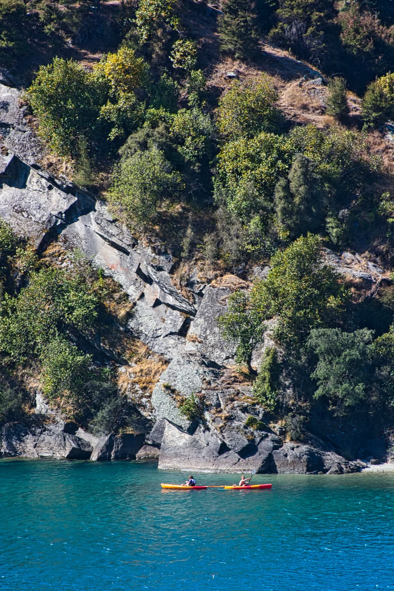
At the end of the lake, we stopped at the Parkins Bay Lookout. Kayakers are admiring the Princess Rock.
Before getting to Glendhu Bay, we stopped at the gate to Whare Kea Lodge. The contrast of the arid, golden grassland stood out against the shaded mountains.
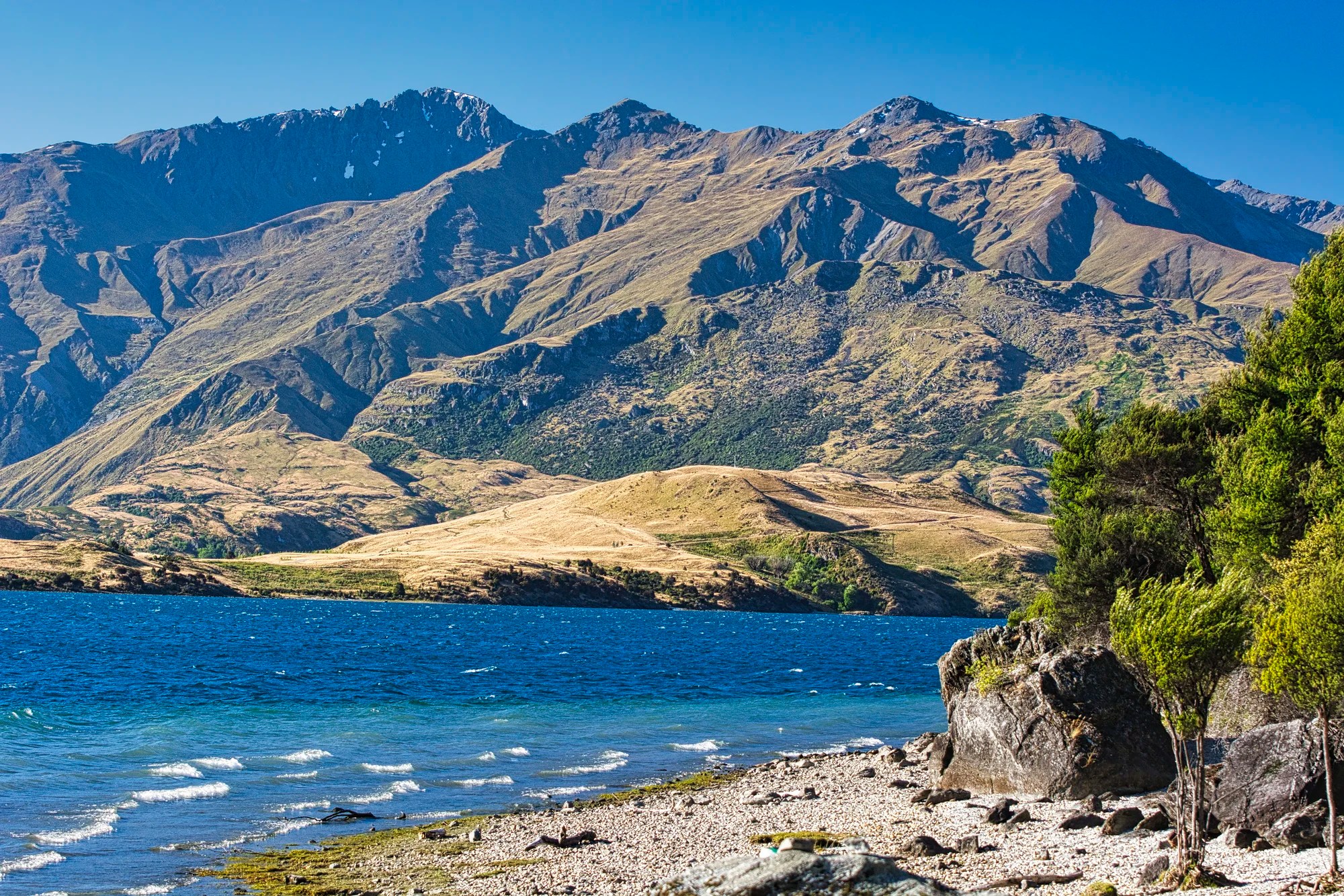
Lake Hawea
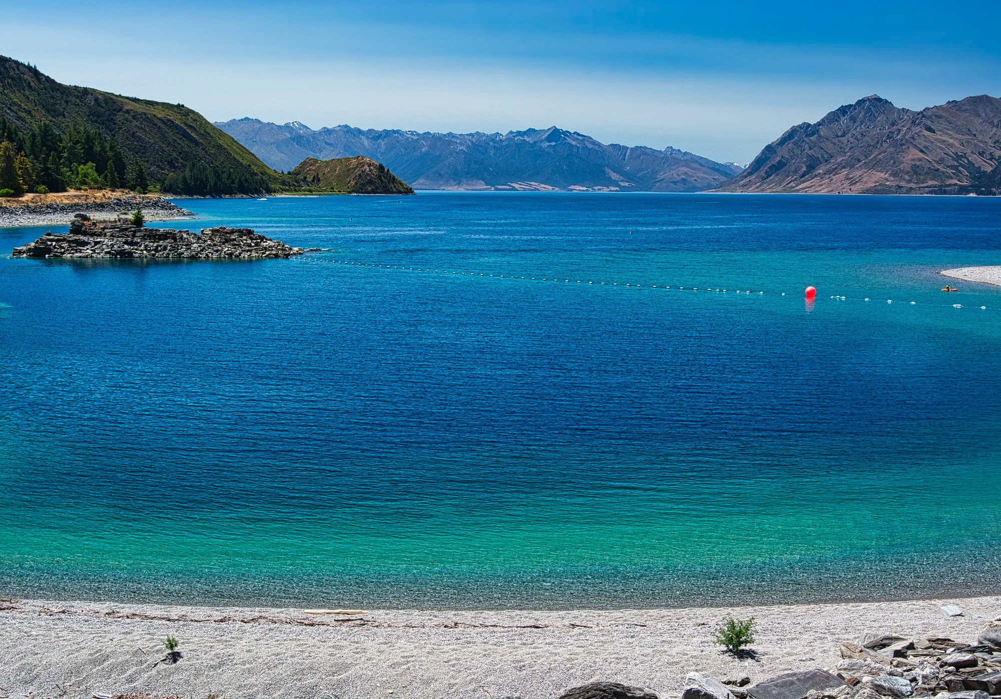
If you are pressed for time, this day trip is not a must-see, but it was definitely worth driving on Highway 6. Our first stop was Scotts Beach (G4.6) in the town of Lake Hawea.
You won’t see glaciers or waterfalls. But there are definitely many photogenic views on this low-traffic road. The lake is extremely deep (410 m), which probably accounts for the dramatic colour change from turquoise to surreal blue. The bottom of the lake is below sea level and is populated by landlocked salmon!
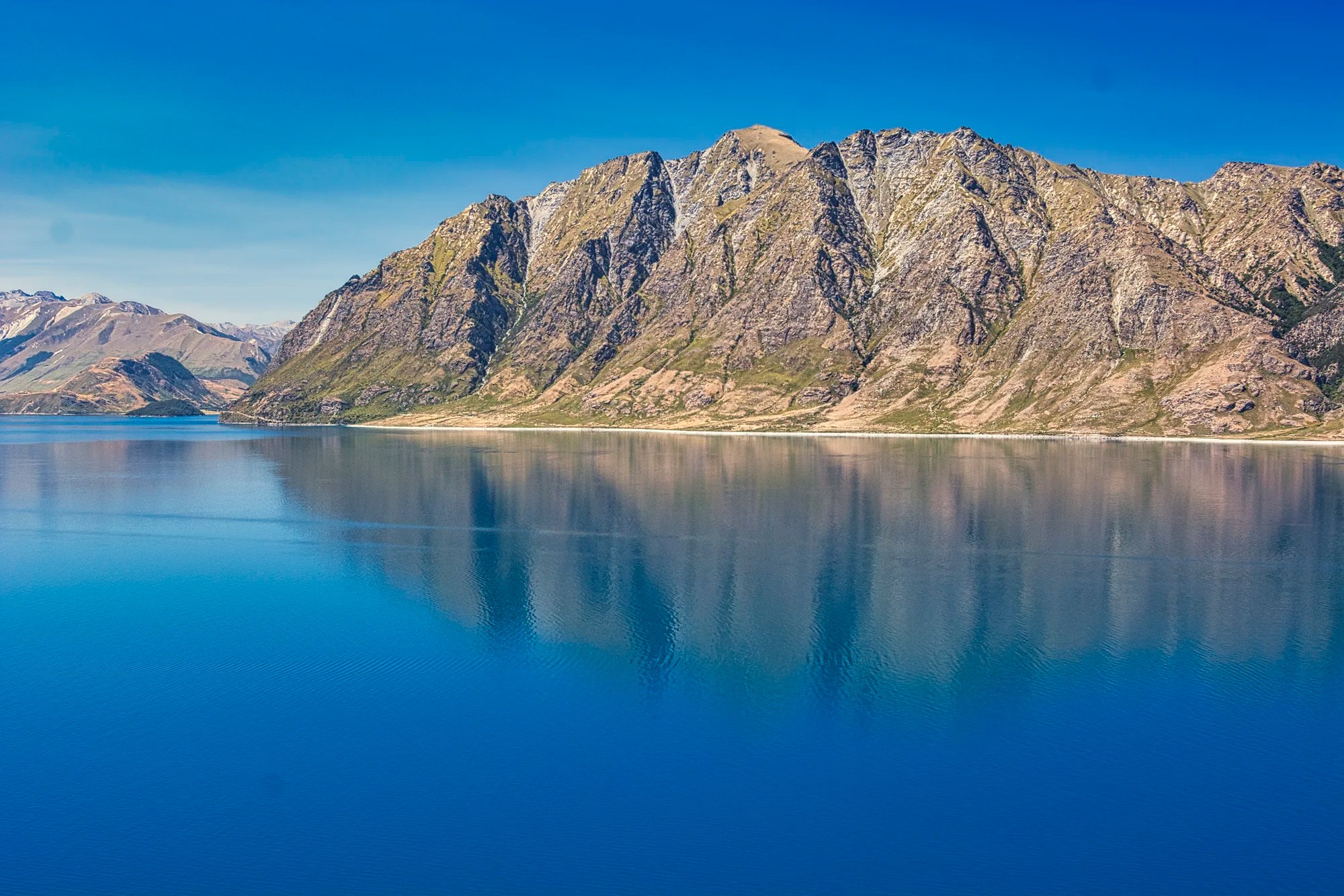
Lake Hawea Lookout (G4.7) is a short climb up a ridge. Parking spaces are very limited. The treeless, serrated Corner Peak mountain is reflected in the lake.
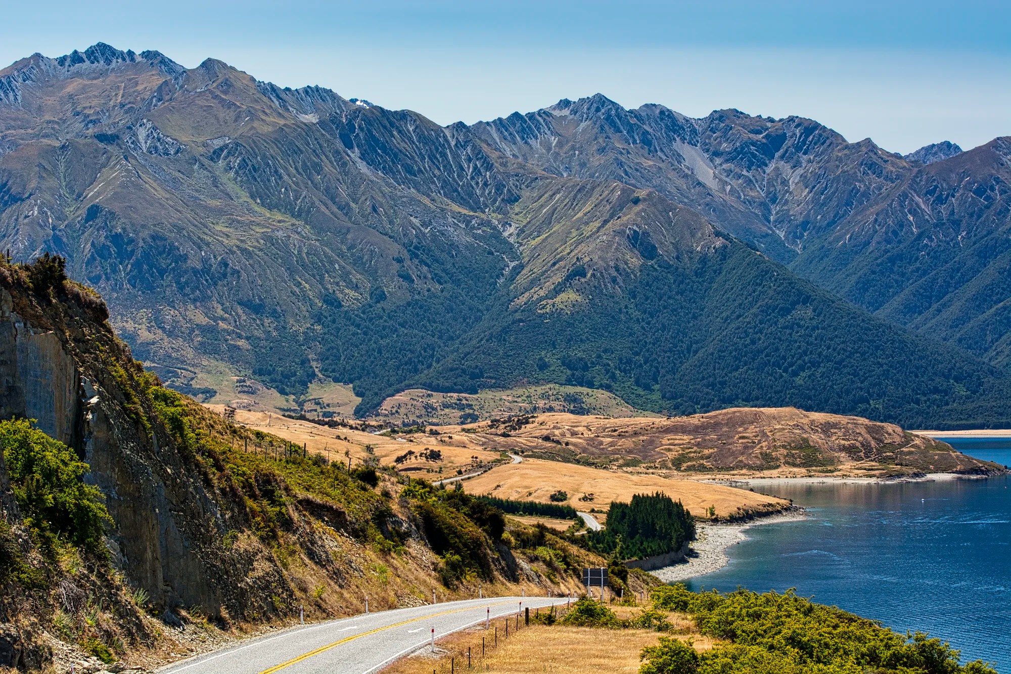
From a later hill viewpoint, I liked how the road led down to the coast and the sunlit golden grassland that contrasted with the shaded mountains in the background.
Here, I used the serpentinata (S shape) road to lead your eyes through the golden grassland to the dark, jagged mountain behind.
This is taken from the same viewpoint but zooming closer to capture the mountain.
The road then curves west. I liked the knobbly texture of The Neck, a narrow stretch of land between Lake Hawea and Lake Wanaka.
Lake Hawea Tree Ferns
When we rejoined Lake Wānaka, we stopped at a viewpoint. Here we saw ancient tree ferns that are a quintessential feature of NZ. Tree ferns date back 360 million years and were decimated along with the dinosaurs by the Cretaceous Mass Extinction Event 65 million years ago.
The tree ferns survived in damp, shady habitats and poor, infertile soils in NZ, Tasmania and South Africa. The Silver Fern is the national symbol used by the All Blacks rugby team and Air New Zealand. It almost became part of a proposed new flag for New Zealand.
Blue Pools Track
We continued north towards Haast Pass but stopped at our destination. The Blue Pools Track (G4.7) is an easy hike to ultra-clear blue pools.
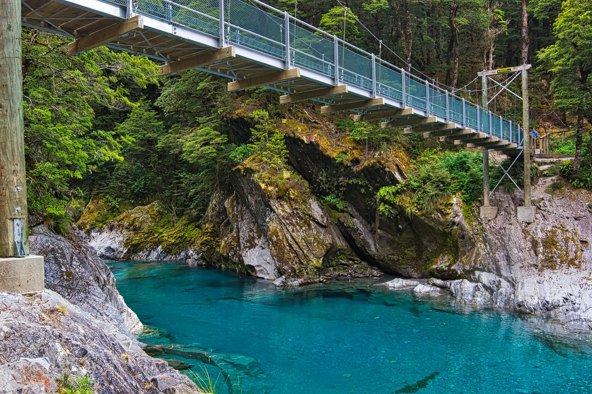
Check if the bridge over the river to the pools has reopened. In any event, you can still view the pools from the initial side. People were swimming in the water.
Distance: 3.2 km
Time: 50 mins.
Elevation Gain: 77 m
Cromwell
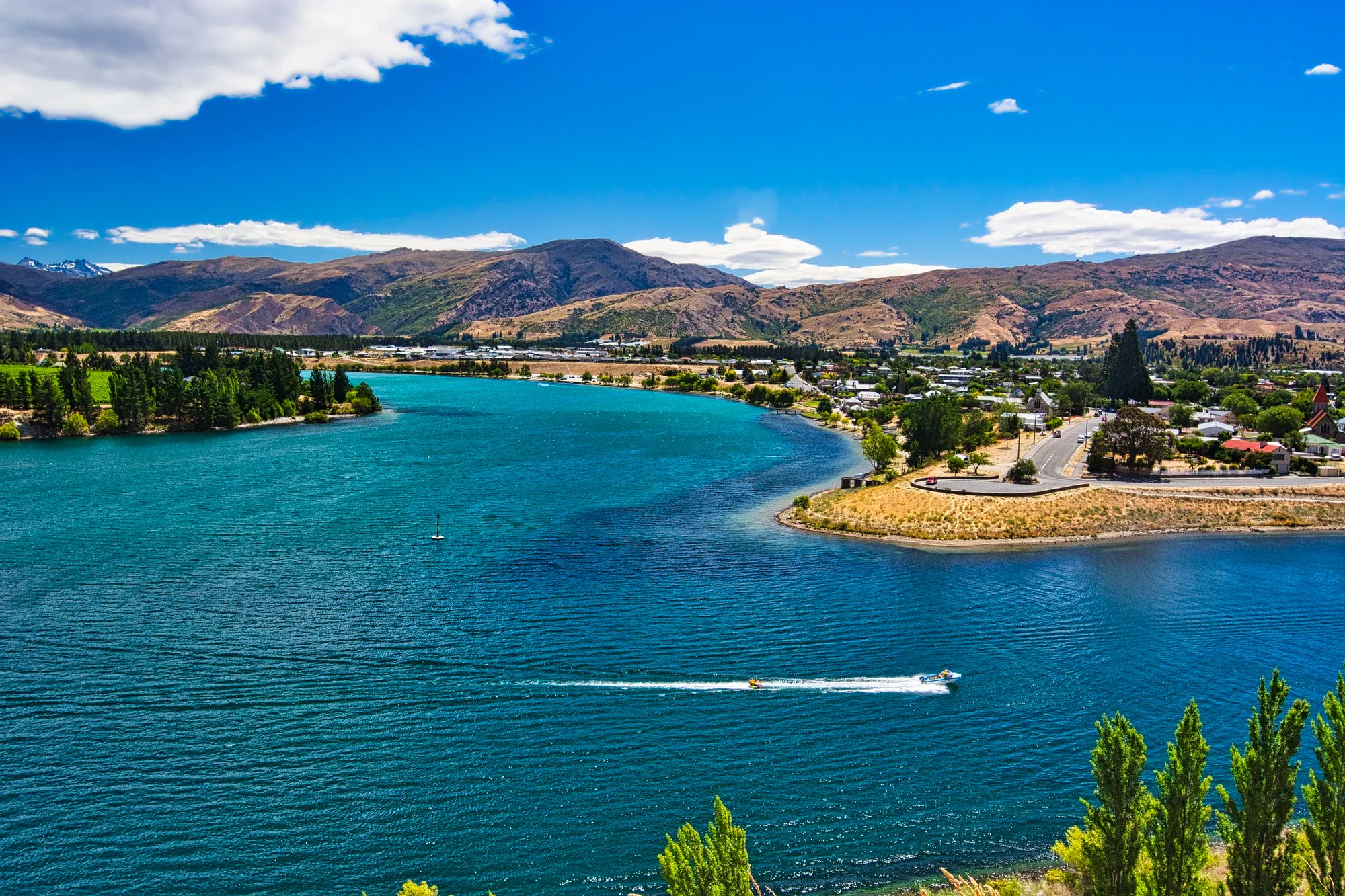
Cromwell is where we stopped at the very nice Carrick Lodge (G4.6). Located at the junction of the Kawarau River and Lake Dunstan, it is a hidden gem off the beaten path. You have to travel over the bridge south of town to the Bruce Jackson Lookout (G4.8) on Highway 8 to see this view.
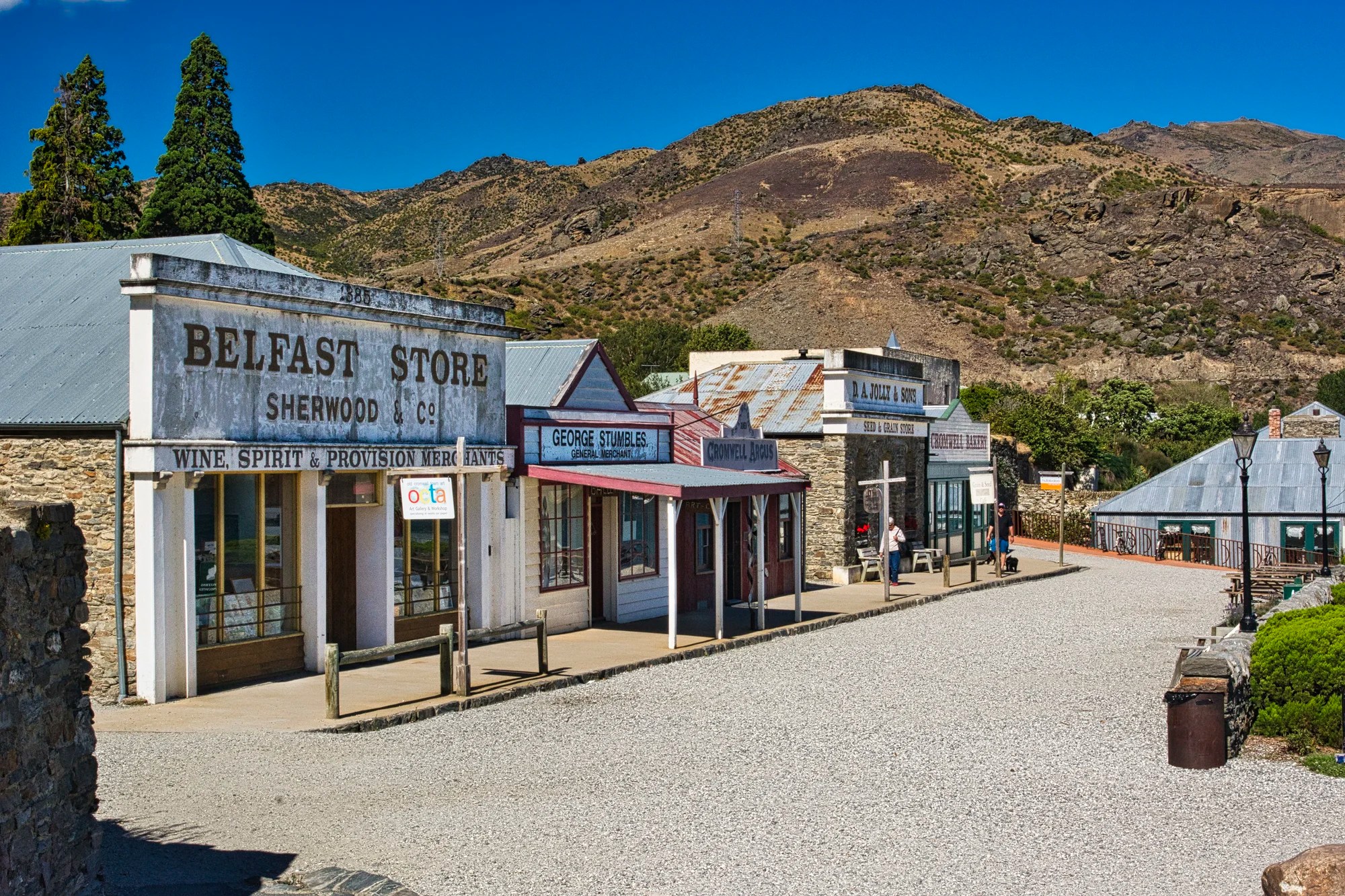
The Cromwell Heritage Precinct (G4.5) is lined with historic shops. Actually, this is not the original Main Street, which was flooded by the building of the Clyde Dam in 1990. The buildings were moved to this “park”. The Belfast Store is now a gallery and printmaking shop. The George Stumbles store is now an art gallery. Yes, it is geared to tourism. We missed the Sunday morning farmers market at the end of the street.
But why is this town here in this desolate location? The California Gold Rush ended in 1855. The next really big one was the Cariboo Gold Rush in Canada from 1861 to 1867 (see Barkerville, the Town that Changed the History of Canada). Where did the gold prospectors go after California? New Zealand! The Coromandel Gold Rush started in 1852. Cromwell was a gold rush town during the 1862 Dunstan Gold Rush.
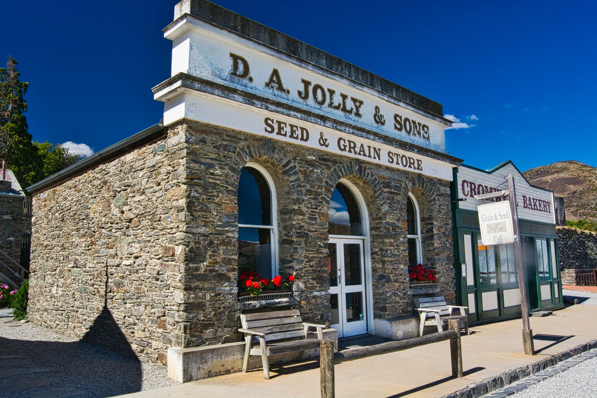
The Jolly & Sons Store is now the Seed and Grain Café. The Cromwell Bakery is now an art gallery.
The town is named after the terrible 17th-century English leader, Oliver Cromwell. He led the overthrow of the monarchy and the execution of King Charles I during a civil war (1642–51). He proclaimed himself Lord Protector of the Commonwealth of Britain and then embarked on the conquest of Ireland. Oliver Cromwell viciously attacked Catholic Churches and confiscated Irish-owned estates.
In 1647, Commonwealth forces burned the cathedral and massacred ca. 1000 civilians as discussed in the Shock of Cashel. The Irish people view Cromwell as a war criminal. He was a member of the Puritans, the same Puritans who fled to New England and founded the Massachusetts colony. Our word puritanical is derived from the Puritans.
We used Cromwell as a base to explore three other off-the-beaten-path, gold-rush towns: Clyde, Ophir and Naseby. They are located southeast of Cromwell and will be a possible subject of another post.
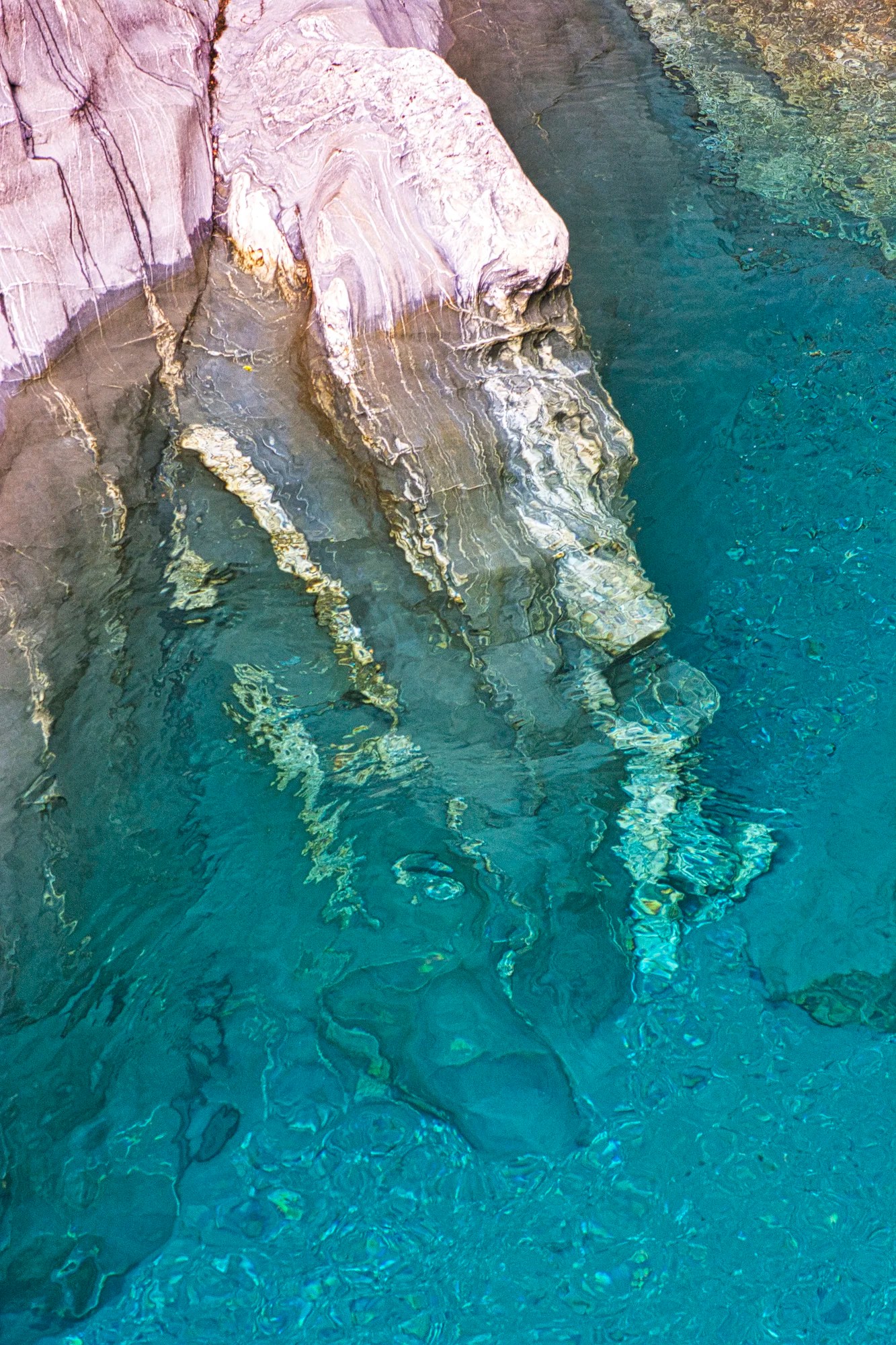
Kawarau River
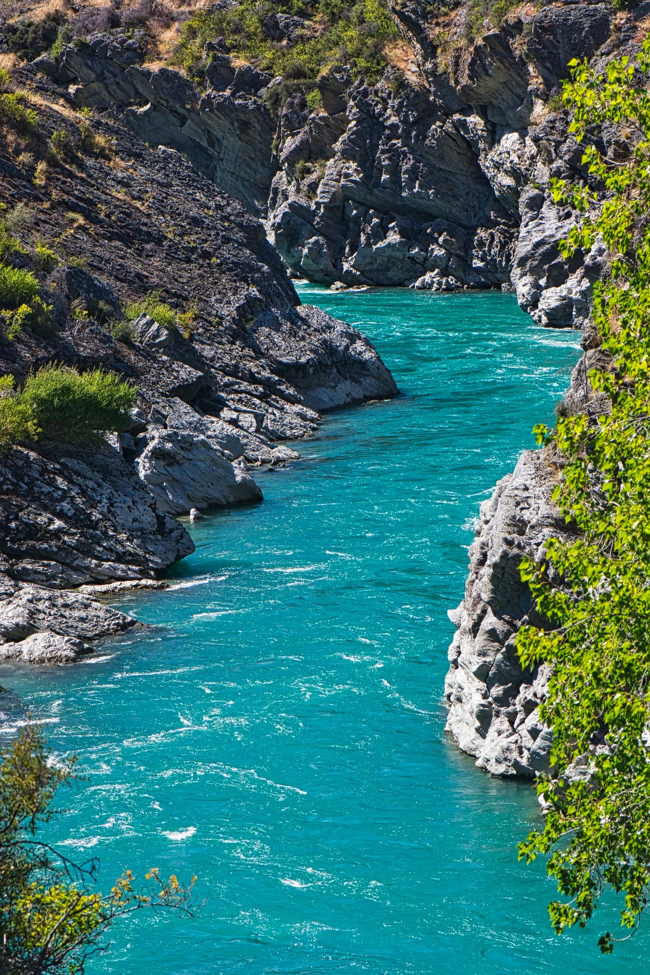
Next, we drove Highway 6 northwest to the Queenstown area. This road parallels the Kawarau River, which travels 60 km from Lake Wakatipu (Queenstown) to Lake Dunstan (Cromwell). Consider yourself lucky. People used to be waylaid and robbed on this road in the old days.
The river is a gorgeous subject for photography, thanks to its turquoise colour. The colour is due to the glacial rock flour suspended in the water. There are a few pull-offs, but you will have to look for places to stop to get photos.
Kawarau River Vineyards
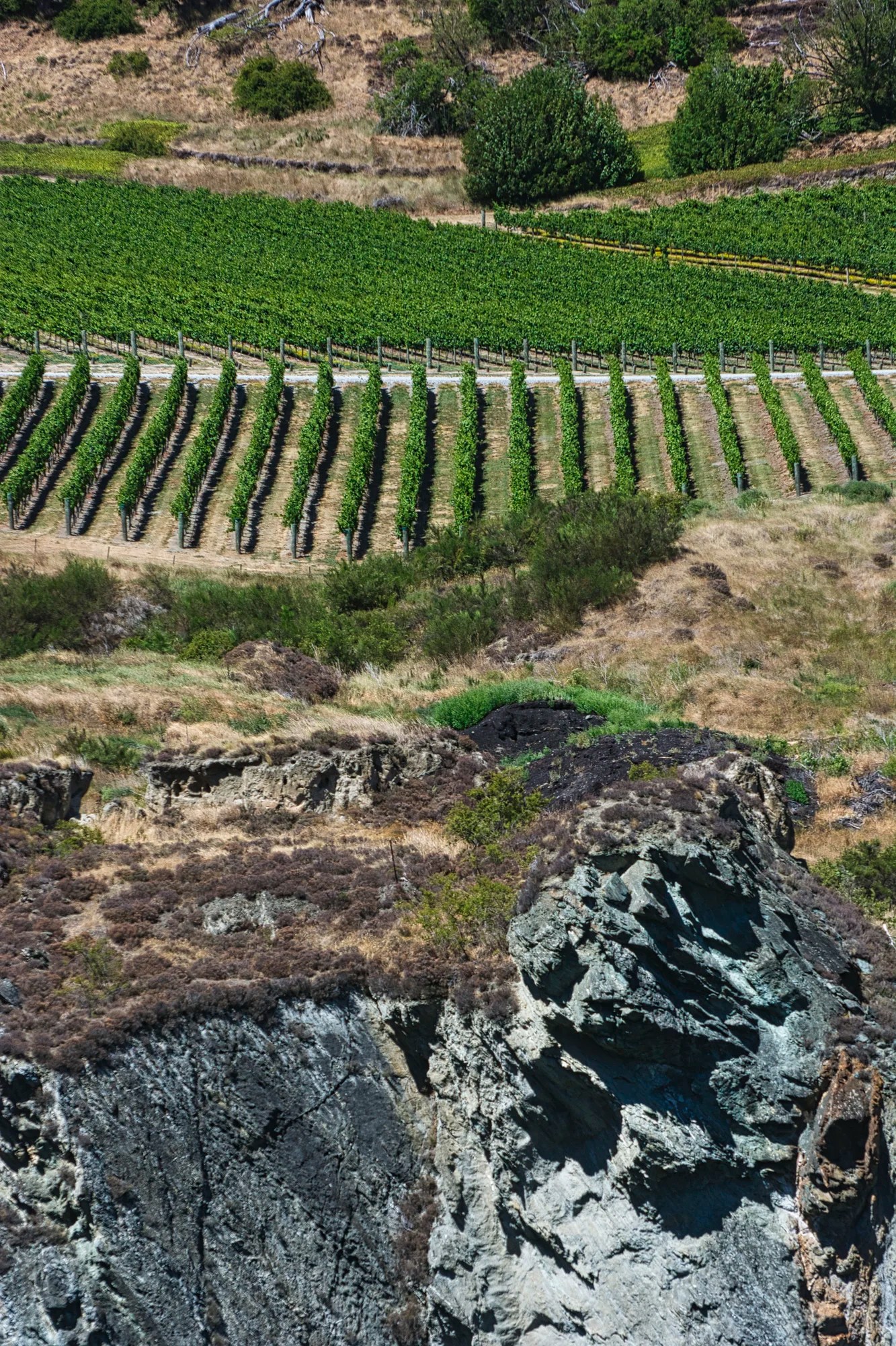
Cromwell Basin is Central Otago’s most important wine region. There are many vineyards along the river. Cromwell is known for its Pinot Noir, which does well in this arid landscape.
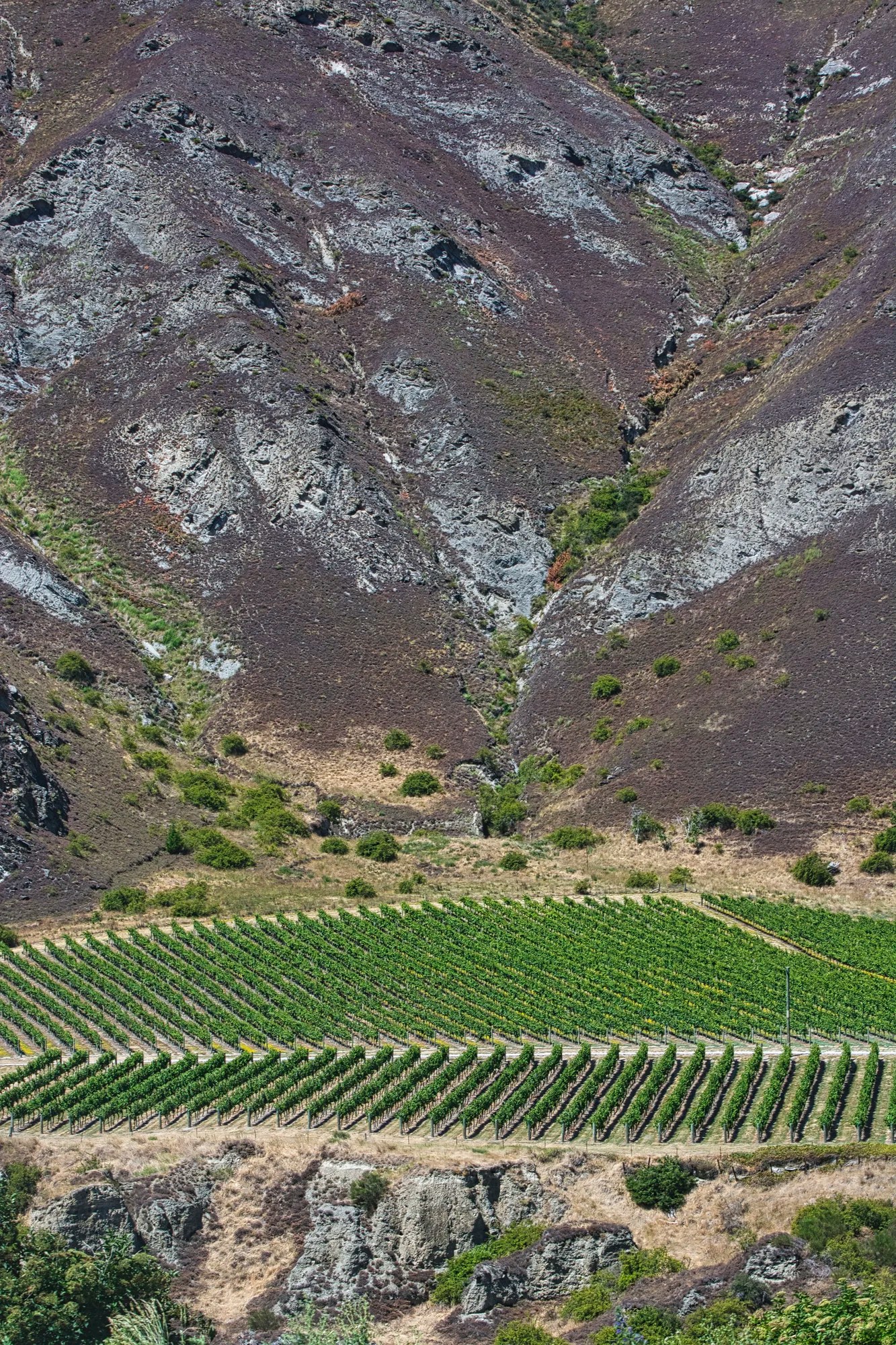
So this is a good place to go wine tasting. In fact, all of NZ is known for very good wines: there are over 400 wineries so take time to try some of them. NZ is noted for Pinot Noir, Chardonnay and Sauvignon Blanc. I use the ratings by a local sommelier/author to choose wines for ourselves.
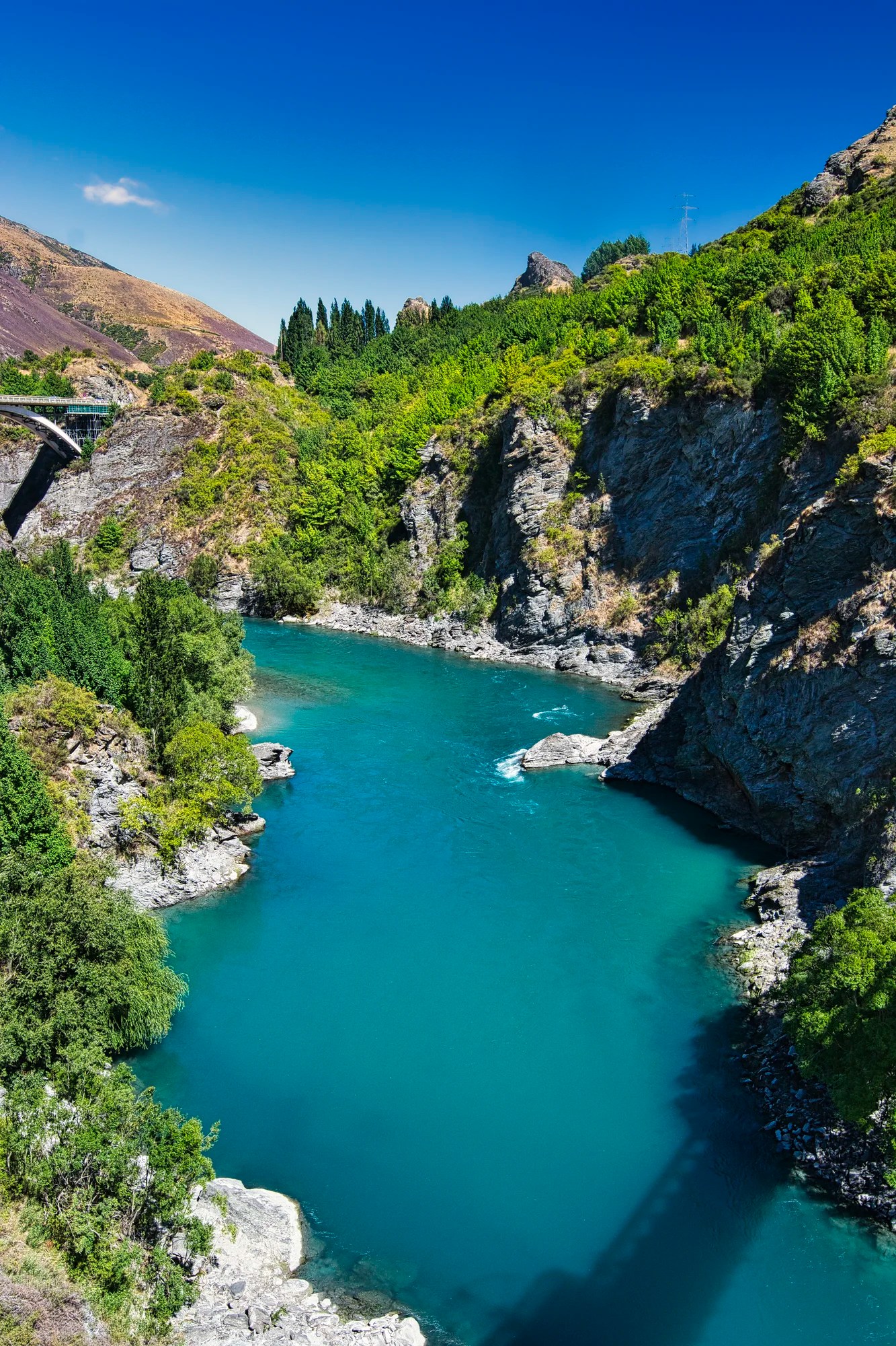
Kawarau River Gorge
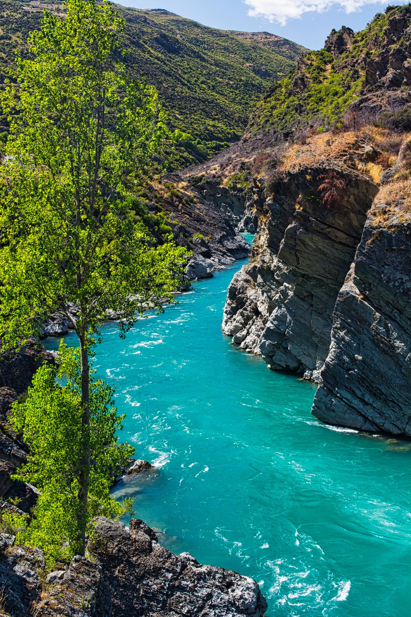
The rugged Kawarau Gorge (G4.8) lines the turquoise river. I like the contrast of the cool green river against the grey rock outcroppings.
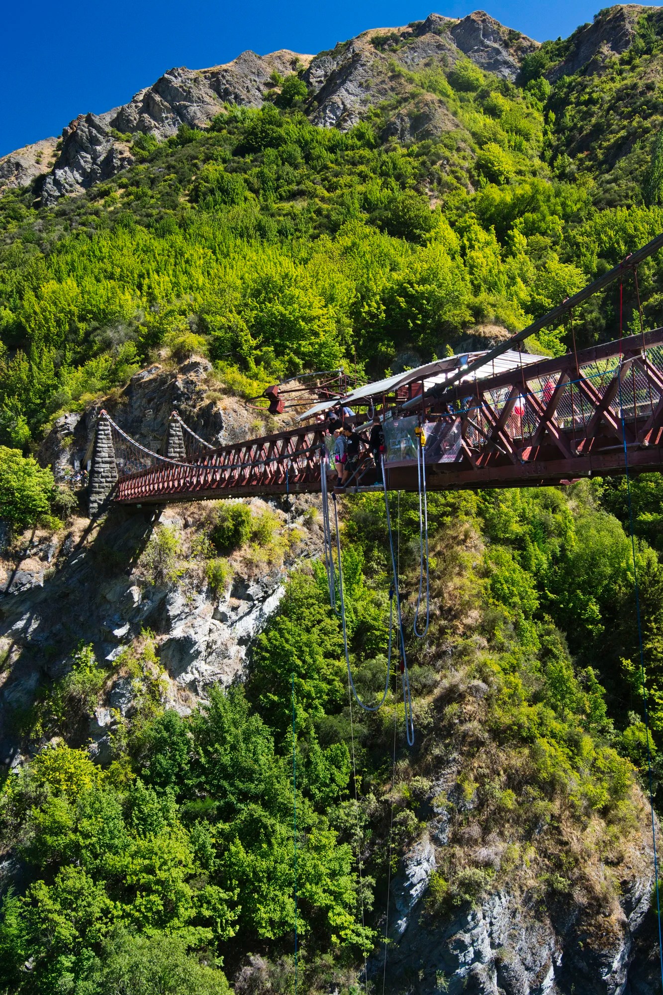
Midway along the road is the Kawarau Suspension Bridge above. The AJ Hackett Kawarau Bungy Centre is where bungy jumping was invented.
Even if you are not game for bungy jumping or white-water kayaking, the parking lot gives you access to great scenery for photography, including this view of the gorge towards the Highway 6 bridge.
Final Comments on this Itinerary
This itinerary has some of the best alpine scenery in NZ. Thanks in part to the stunning glacial blue lakes, we prefer it to the overhyped West Coast Drive. The Aoraki area should be on your New Zealand bucket list. We recommend that you use this route as the foundation for any itinerary for the South Island.
This action-packed itinerary is very busy during the summer high season. Book accommodation well ahead of time for December 20 to January 20. This is when Kiwis go on their summer vacation. Remember, the most important “destination” is meeting the people.
Subscribe
Get travel tips and advice delivered directly to your inbox. The best part is that it is free.
What things fascinate you? How long is your trip? What questions do you have? If you have been here, share your experiences with us.
Itinerary Map & Resources
Lonely Planet New Zealand — their website
New Zealand, Lonely Planet — the book, but nowadays most people use the internet
Walking Tracks in Aoraki/Mount Cook National Park
Email: mtcookvc@doc.govt.nz
Google Maps Ratings
Google Maps provides a rating from 0 to 5 for all sights, hotels, and restaurants (but not cities). All of our recommendations are appended with the rating (prefixed with a G) from Google Maps. Google Ratings are based on feedback from locals as well as tourists. They are much more reliable than travel booking websites or tourist anecdotes. We consider a score of 4 to 4.39 to be Very Good and 4.4 to 5 to be Excellent.
Other Places to Add to Your Itinerary
Do you want to see more of the South Island? Here are some posts to help you plan your itinerary:
New Zealand FAQ
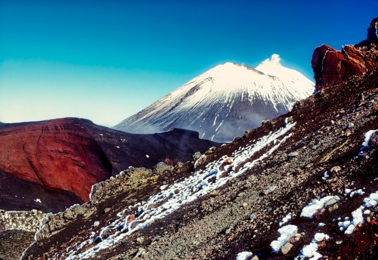
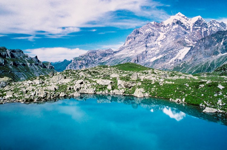
Is Switzerland More Beautiful than NZ?
The wide-open views of NZ and sheep grazing meadows (called “alps” by the Swiss) are similar to the feeling you get travelling in Switzerland. But can you really say that Switzerland is the most beautiful country?
What are the Best Hikes in NZ?
Kiwis use several different words, such as tramping for hiking and track for hiking trail. Our favourite tramps in NZ are the long-distance, multi-day hikes — Tongariro Alpine Crossing, Routeburn, and the Abel Tasman Coast Tracks.
But this itinerary has some of the best day hikes, especially the Hooker Valley Track in Aoraki/Mount Cook National Park and Blue Pools Track in Mt. Aspiring NP. If you have been very good this year, you will see some of the best scenery bathed in sunshine.
What are the Most Scenic Areas in NZ?
Which part of New Zealand (NZ) is most beautiful? This is a difficult, if not impossible, question to answer, as all of NZ is beautiful. This is not a flippant comment. One quintessential feature of NZ is that the journey from point A to point B is just as spectacular as the destination. Enjoy the trip and look for photo opportunities wherever you drive.
The New Zealand FAQ post answers Frequently Asked Questions (FAQ) such
- What time of year is best to visit New Zealand?
- Should I visit North Island or South Island?
- Do you need a car to explore New Zealand?
- Where are the best hiking trails?
- How do I plan an itinerary for New Zealand?
- How many days are enough for New Zealand?
- Which parts of New Zealand should I visit?
Abbreviations
asl = above sea level
DOC = Department of Conservation = Parks NZ
Max Elev = Maximum Elevation above sea level
Kiwi = New Zealander, or a nocturnal flightless bird
NP = National Park
NZ= New Zealand
NZD = New Zealand Dollar
NI = North Island
OW = One Way
RT = Round Trip
SI = South Island
USD = United States Dollar

Leave a comment