

Why You Should Drive from Kylemore to Connemara
The Kylemore to Connemara road covers everything from a Victorian Castle to natural wonders. It started with disappointment and ended with a bang!
Author & Photographer: George Mitchell

Our content and advice are derived from our personal experience and knowledge, gained from living in Europe for seven years and studying its art and architecture. Our recommendations are not influenced by affiliate links – we do not have any. Ireland is one of our favourite destinations.
All of our recommendations are top-rated by Google Maps, which is based on the opinions of everyone, not just tourists. Each place recommended in our posts and custom maps is appended with a Google Maps Rating (G0 to G5).
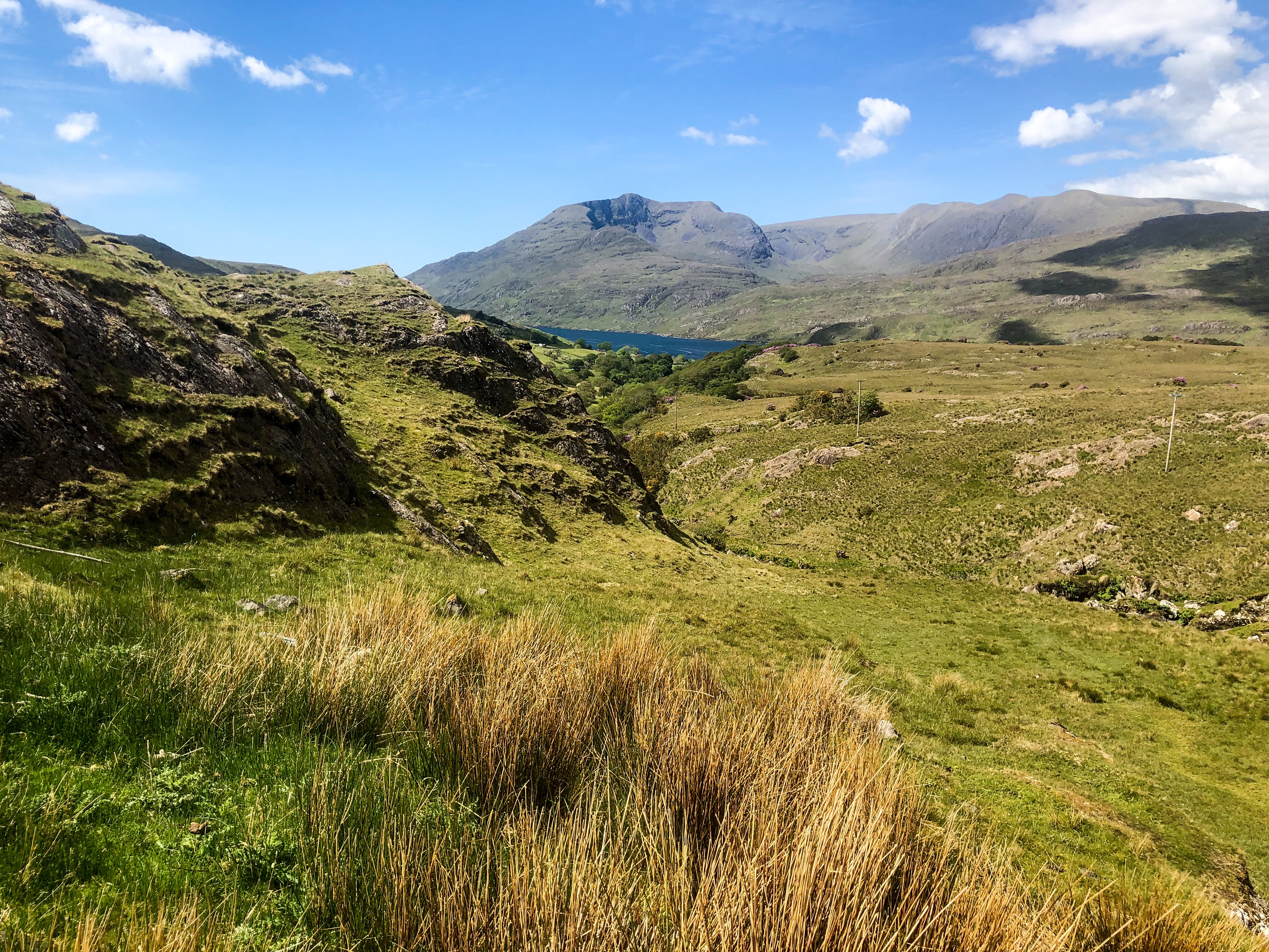
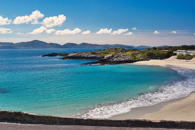
Connemara
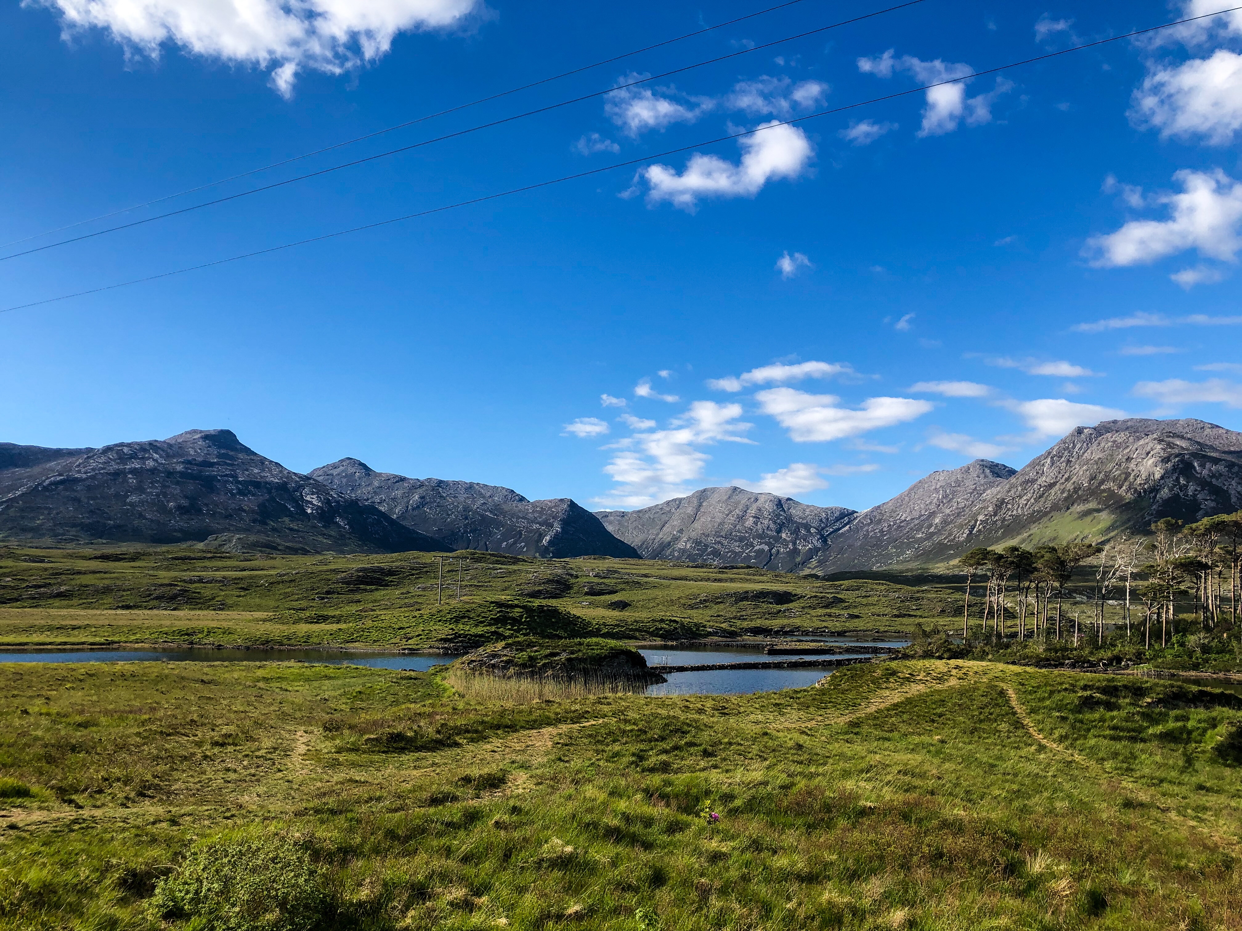
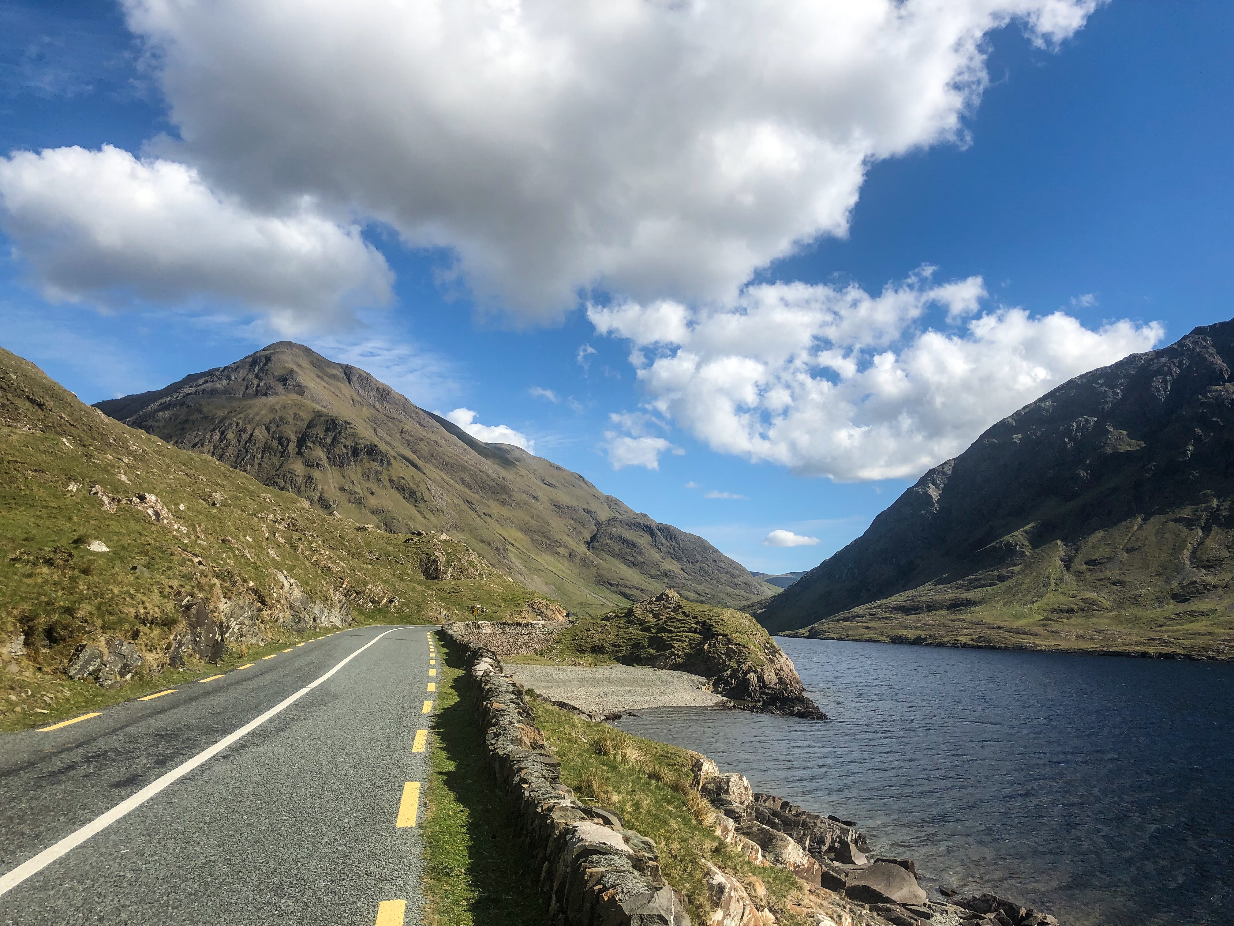
Once again, we travelled the unremarkable main road until the turnoff to Kylemore Abbey. Route R344 had wide open views of a valley surrounded by rugged mountains. We found only tiny, narrow spaces to take photos. At 55.4 km from our excellent Bohola B&B in Salthill (Galway), we stopped for this view. We believe this is a backside view of Pine Island Lake we mentioned in our post From Galway to Gurteen Bay.
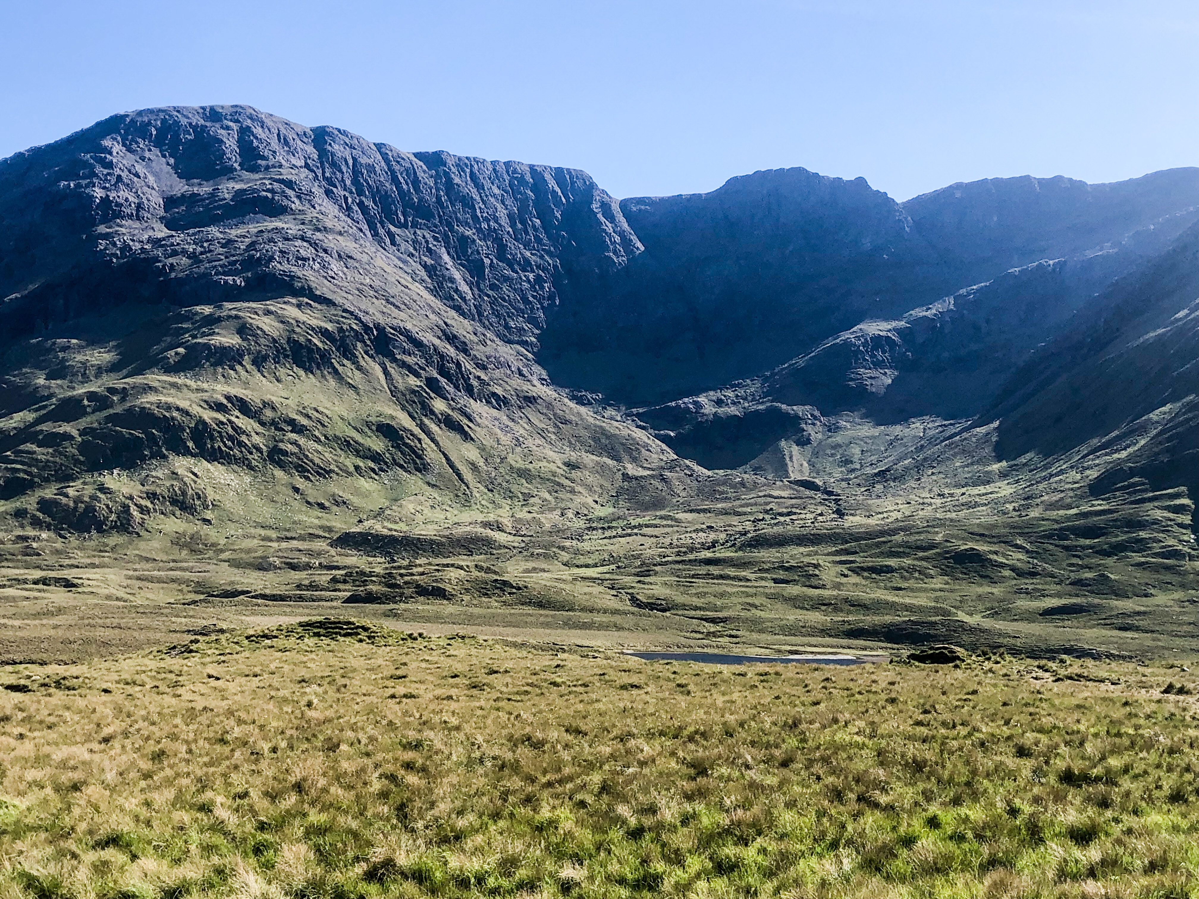
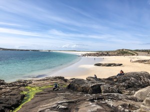
By contrast, Connemara National Park (NP) was very disappointing as it had no roads and no views. It was just a parking lot for three hiking trails. The Visitor Centre host said the drive into the mountains was more spectacular than the NP.
We could not understand why travellers raved about Connemara NP when such a small area is accessible. Are they referring to the whole area rather than the NP?
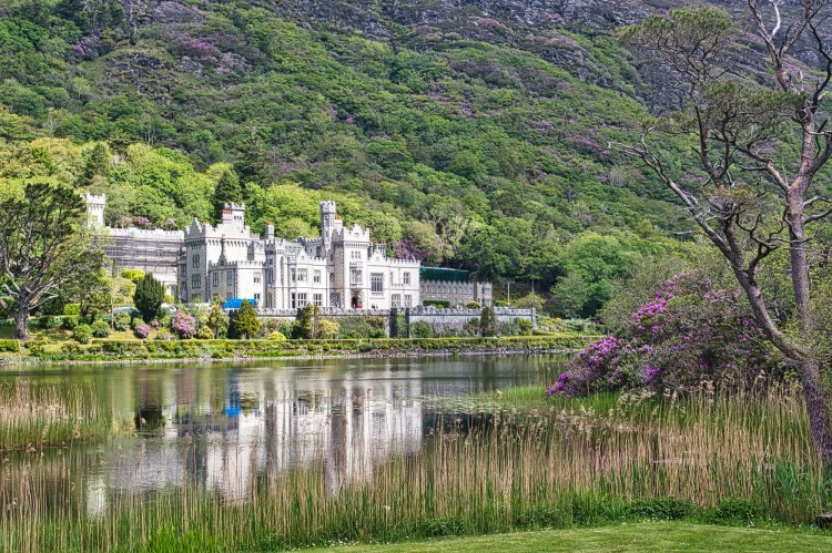
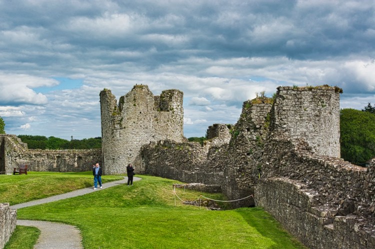
Kylemore Abbey
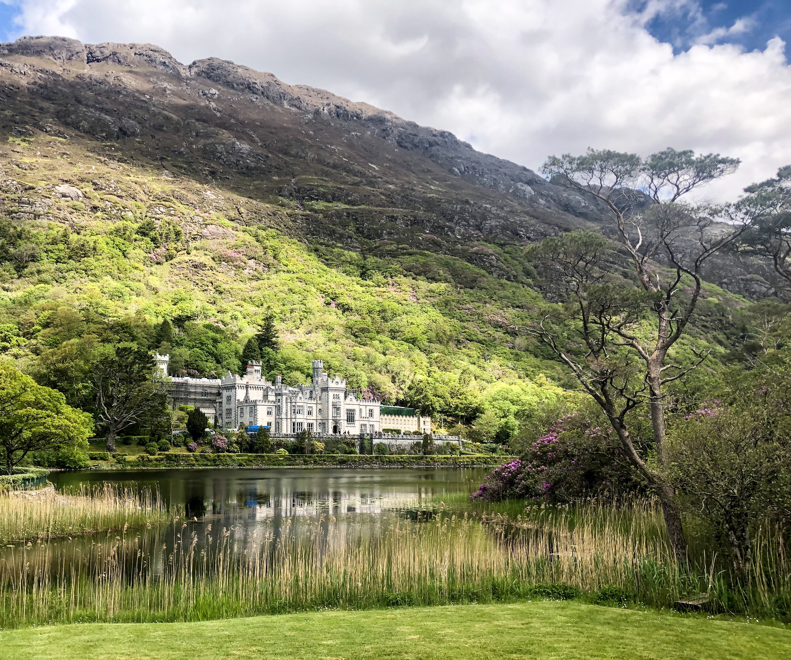
We travelled to nearby Kylemore Abbey. This site was easily the most overrun with tourists and tour buses of our trip so far. It is owned and run by the Benedictine Nuns (fee €14, senior €10.50). You can park for free and grab coffee or lunch for €11.50. The best view and photos can be taken from the bridge to the restaurant, reflection ps included.
This Victorian mansion was built in 1868 by Dr. Mitchell Henry, whose family made their money in the textile industry in Manchester, UK. At this point, Ireland was a colony of Great Britain. Dr. Henry moved to Ireland and became MP for County Galway from 1871 to 1785.
The castle has 70 rooms covering 3700 sq. m (40,000 sq. ft.). It is way too big! So, how did the Benedictine Nuns get this property? Their abbey in Ypres, Belgium, was destroyed during World War I. They moved to Ireland and bought the estate from the debt-ridden owner.
Leenaun — Doo Lough
It was only 14:47, so there was still plenty of time until sunset. We learned during this trip that we had to take advantage of the sunny weather in Ireland. So we did the Doo Lough drive that we planned to do two days later, which was forecast to be a rainy day.
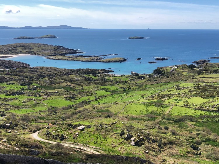
This was one of the most scenic and must-drive itineraries we have done so far. Pulling over wherever there was a small road or even local highway intersections, we captured our first views of Killary Fjord near an adventure centre.
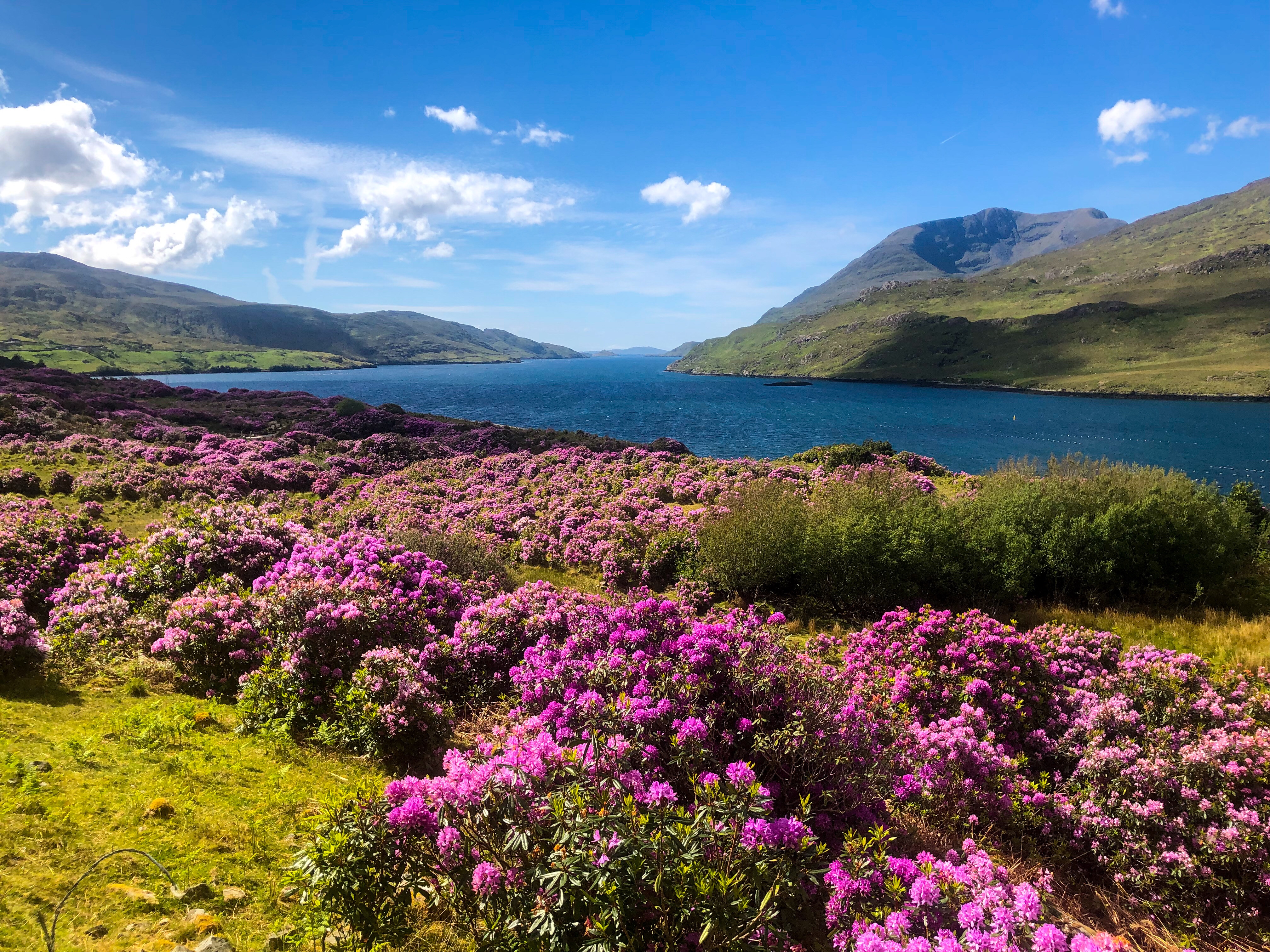
This is one of only three fjords carved by glaciers in Ireland. It’s hard to believe that Ireland was covered by an ice sheet that spread out from Norway about 20,000 years ago.
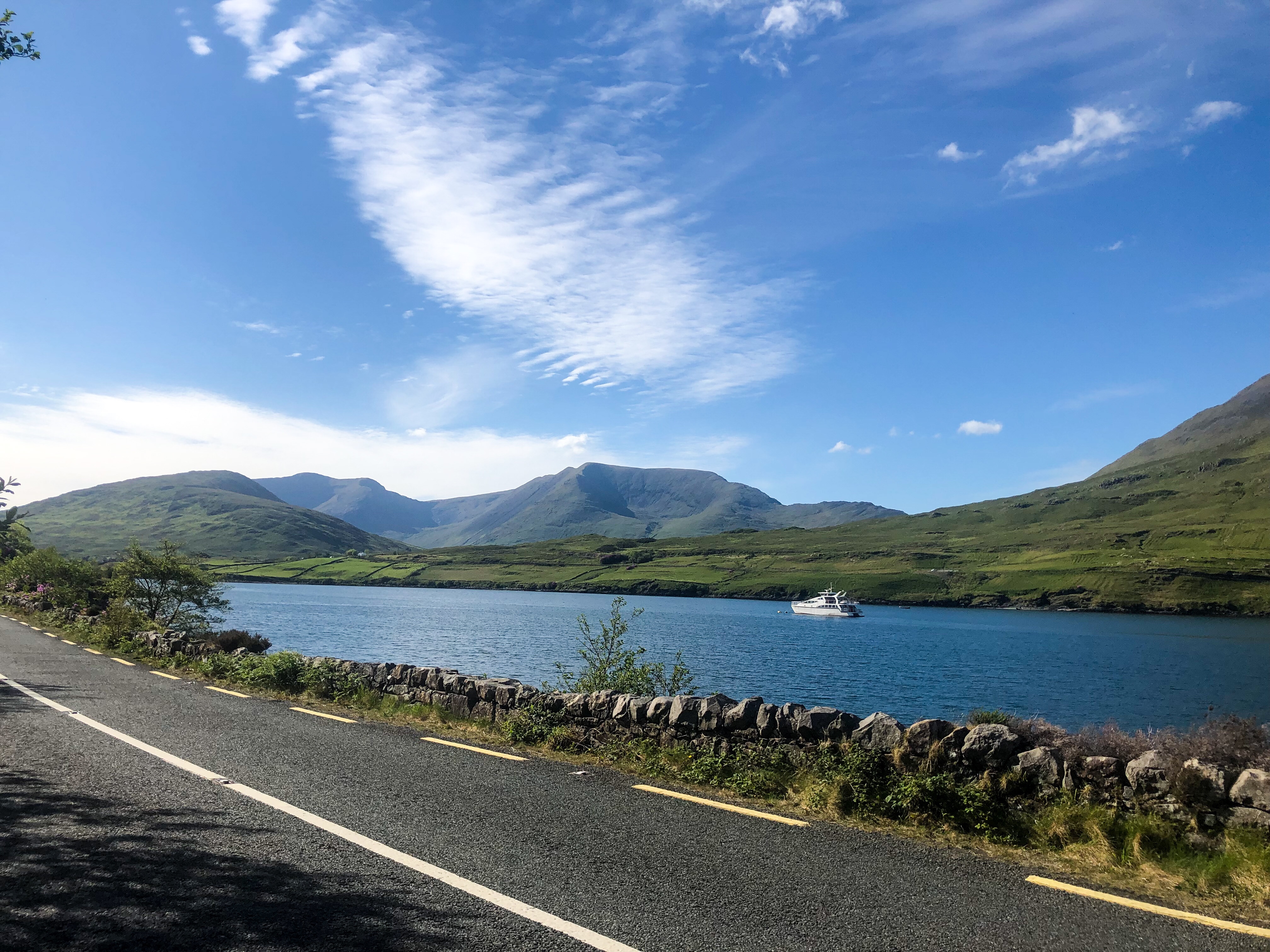
The road parallels the fjord all the way down to the tiny village of Leenaun and crosses a bridge.
Here you can stop to see a simple falls. But this is the lone pullover as you drive the curvy road along the steep mountainside above the dark blue fjord until the village of Delphi.
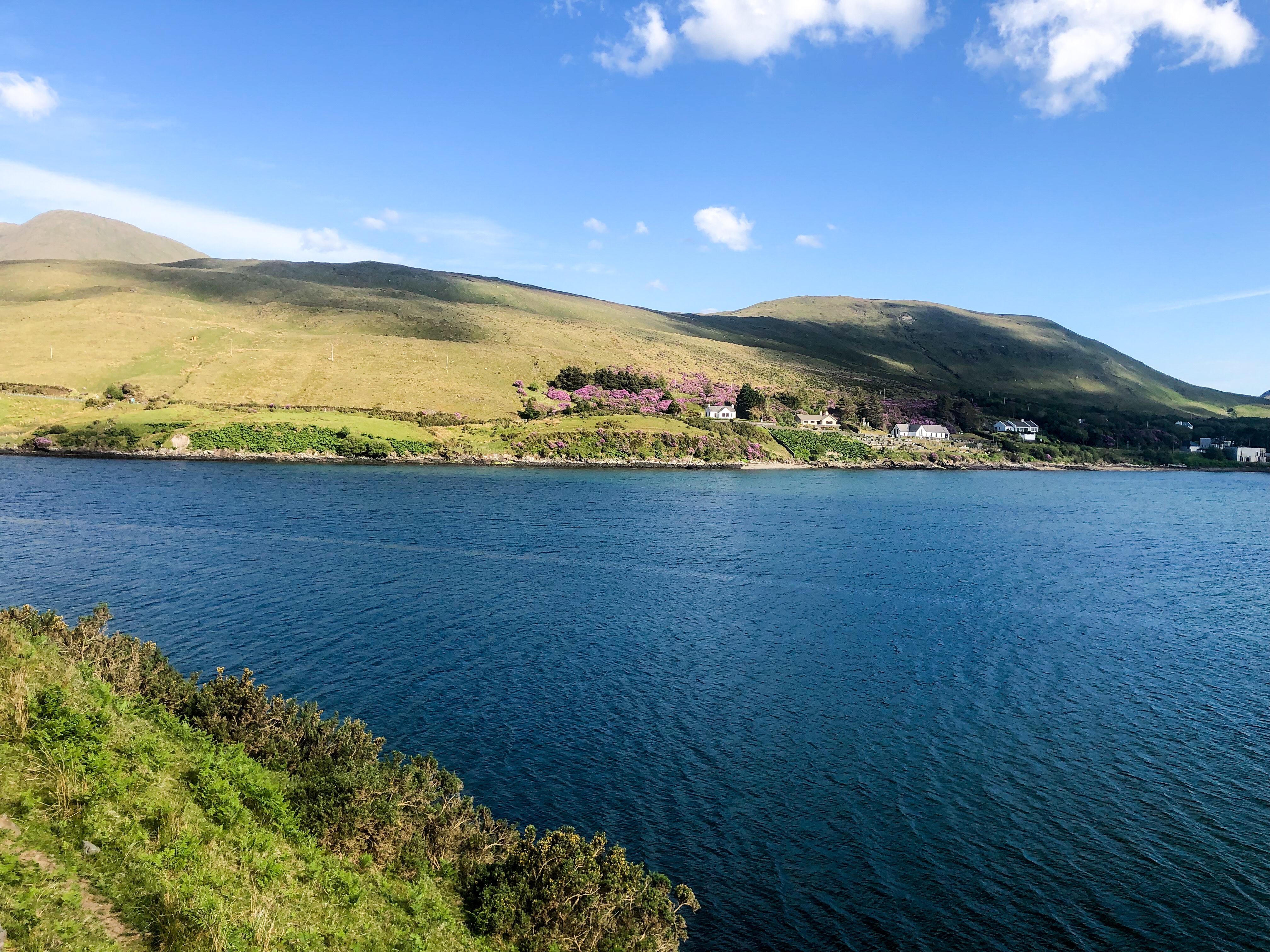
The narrow road hugs the steep mountainside as it zigzags along Doo Lough. The road gently climbs to a famine monument. It is sickening that 600 starving people in Louisburgh were told to go to Leenane to get work. They were turned away by well-fed officials enjoying their meal. They perished on a cold, wintry night as they re-crossed this pass.
What is more tragic is that while there was a potato blight, there was not a lack of food. The British insisted on taking the crops as rent, so the Irish starved or emigrated abroad. As a result, 15% of Canada, 11% of the United States and 10% of Australia are of Irish Heritage! In fact, 25% of the population of Newfoundland is of Irish ethnicity!
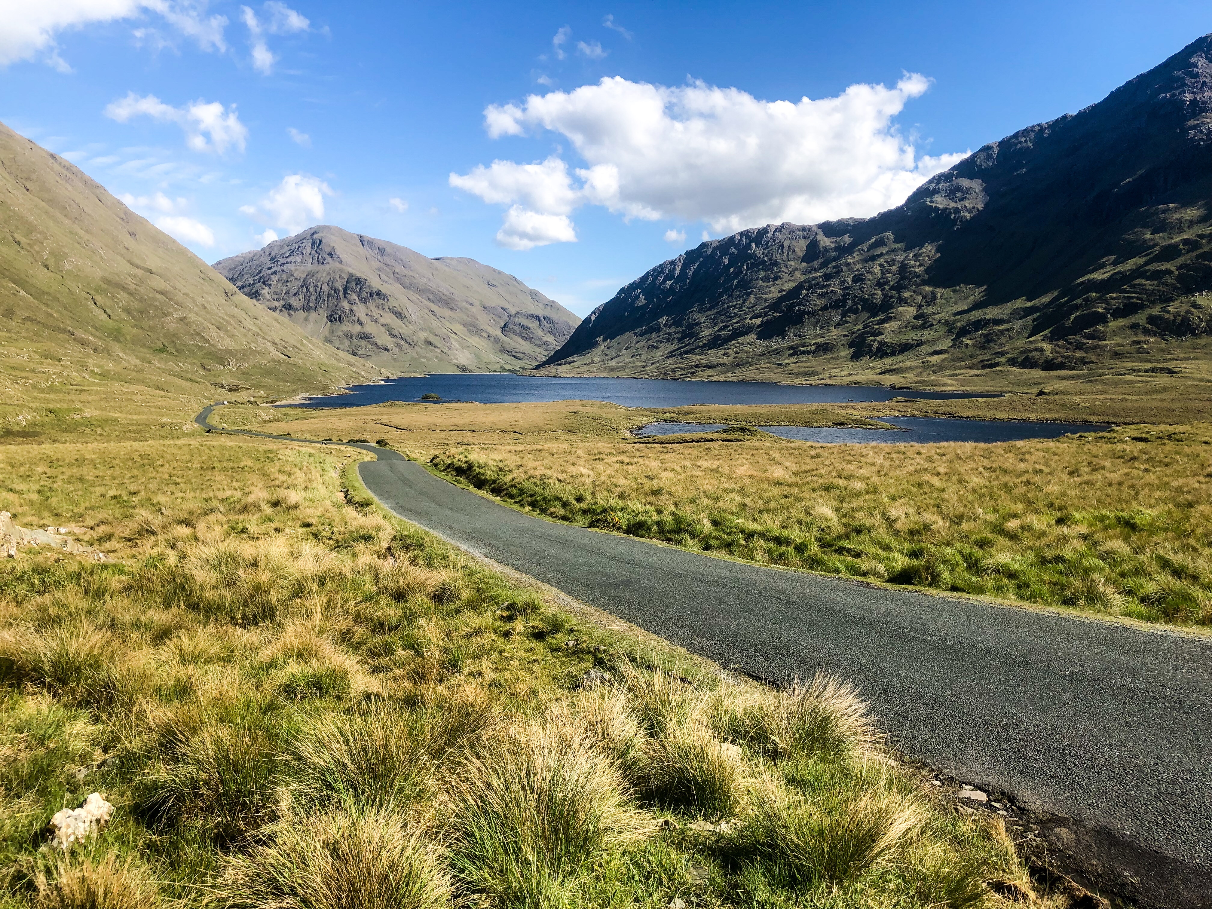
Today, we enjoy one of the best views of the day. You feel encircled by mountains. The slight gain in elevation improves the vista. Late in the evening, we made our way back to Bohola after driving a 232.3 km round trip.
Final Comments on this Itinerary
This is an exciting trip to one of the most beautiful but long road trips in Ireland.
Subscribe
Get travel tips and advice delivered directly to your inbox. The best part is that it is free.
What things fascinate you? How long is your trip? What questions do you have?
Itinerary Maps & Guides
The Kylemore to Connemara route is part of our Ireland West and our Best Places for 2 Weeks in Southwest Ireland itineraries.
If you have more than a week, then combine this tour with places in the Ireland East, Ireland South and the Best Places for 2 Weeks in Southwest (SW) Ireland itineraries below. Or just visit some of the nearby places listed below.
Google Maps Ratings
Google Maps provides a rating from 0 to 5 for all sights, hotels and restaurants (but not cities). All of our recommendations are appended with the rating (prefixed with a G) from Google Maps. As it is based on feedback from tourists and locals, it is much more reliable than travel booking websites. We consider a score of 4 to 4.39 to be Very Good; 4.4 to 5 to be Excellent.
Ireland FAQ
The Ireland FAQ post answers Frequently Asked Questions (FAQ) like:
- Where should I go in Ireland?
- What is the best season for travel?
- What is the best clothing?
- Where should I go? What are the must-sees?
- How much time do I need for Ireland?
- Can I see everything in a week?
- How safe is Ireland?
- How much cash should you take to Ireland?
- Should I pay in Euros or my own currency?
- What apps are useful for travel?
- Should I rent a car? Take a Taxi?

Leave a comment