

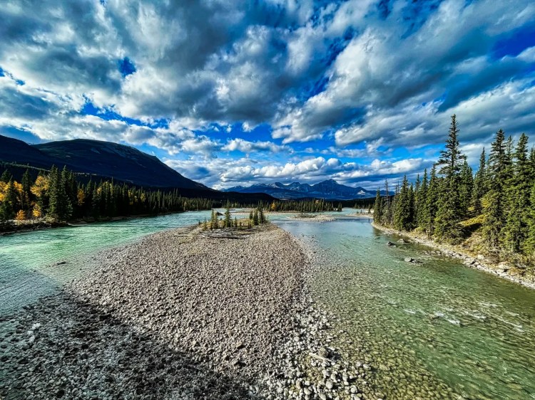
Do you want to get away from the hectic world of mass over-tourism? Do you want to feel like an ancient explorer in a new land? This itinerary traverses the northern part of the province of British Columbia (BC), Canada. Here are five hidden gems you can enjoy: one roadside glacier, several roadside bears, flowing waterfalls and fjords, solidified lava beds, and the last Hudson’s Bay fur trade post!
But the best part is that there are very few residents and even fewer tourists. Northern BC is home to 256,977 people in an area 3% bigger than France and 34% bigger than California!! Moreover, this region is 60% of the total area of BC.
Here is your chance to enjoy little-known places sprinkled in the middle of utter wilderness. On the other hand, there are fewer gas stations — always keep your gas tank fed in the far north!
Author & Photographer: George Mitchell

Our advice below is not based on a couple of tourist trips. Our recommendations are based on our extensive experience living in Western Canada. We are avid hikers, nature lovers and photographers (all photos are my own).
All of our recommendations are top-rated by Google Maps Ratings, which is based on everyone, not just tourists. Each place recommended in our custom BC North Map is appended with a Google Maps Rating (G0 to G5).
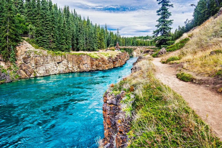
Stewart-Cassiar Highway
Heading south from Yukon’s Klondike Highway Must Not Be Missed, we took the Stewart Cassiar Highway 37 heading for Terrace, BC.
We stayed the first night at the Northway Motor Inn (Google #4.3) in Dease Lake. It provides a microwave and a coffee maker in the shared kitchen/living room. NB: You need WiFi in your hotel as there is no cell service along the Stewart-Cassiar Highway.
1 Bear Glacier
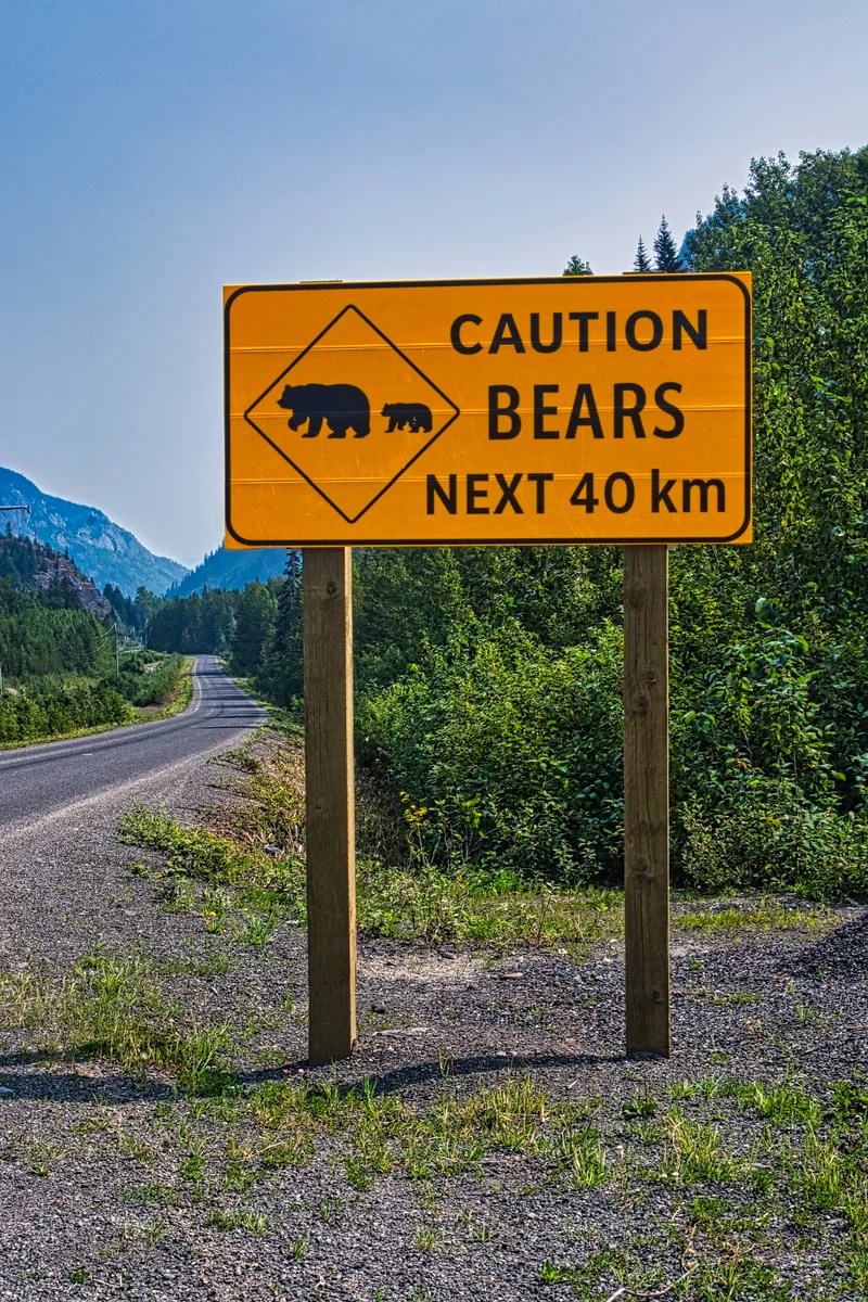
Along the Stewart-Cassiar Highway, we saw a “Caution Bear Next 40 km” sign. There are 135,000 brown bears and 15,000 grizzly bears in BC.
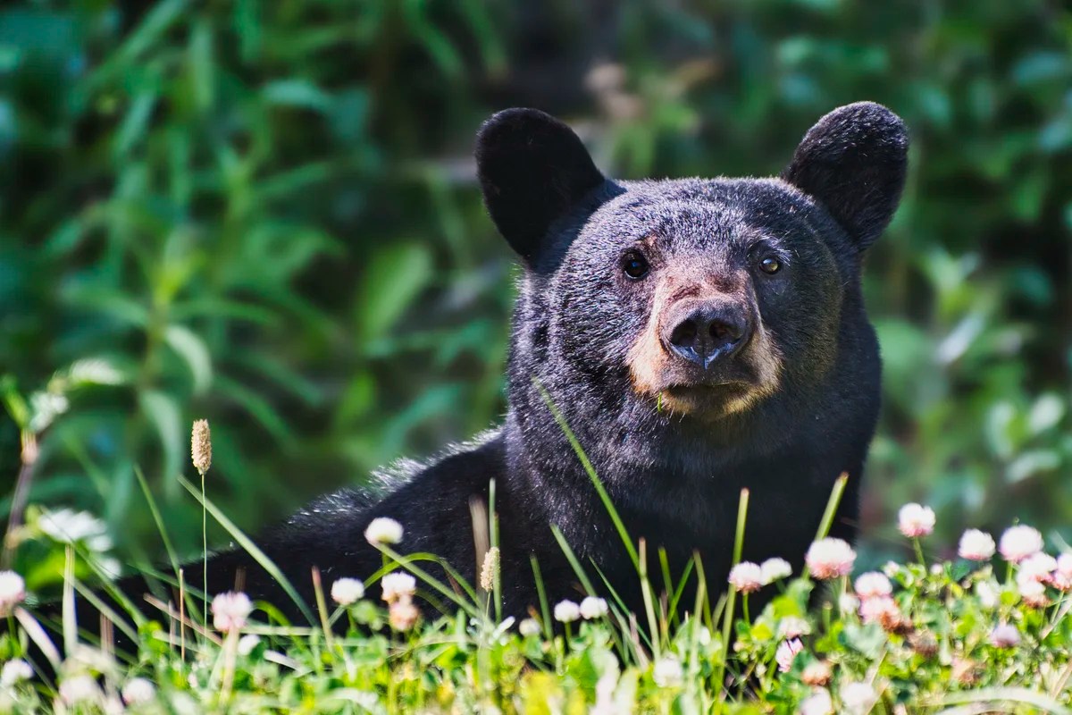
But the Stewart Cassiar Highway should be called Bear Boulevard. We saw five bears browsing right along the highway!!! One time, I opened the window to get this picture, and the bear immediately stopped and stared at us. I wonder if it could smell the food in the car? No, I definitely did not get out of the car!
The first two hidden gems are along Highway 37A, from Meziadin Junction to Stewart. The scenery was sensational as soon as we drove through the coastal mountains. This road is definitely the most scenic of the whole trip to Terrace.

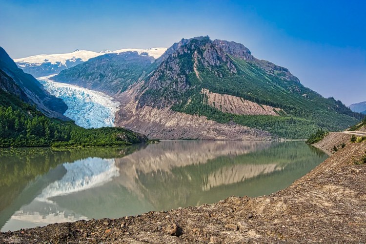
The highlight was Bear Glacier, which descends to the level of the road. We are at same latitude as southern Alaska, so the climate is cold enough to have glaciers down at sea level.

Ice once reached across the lake to the pull-off where these pictures were taken! As Bear Glacier receded in the 1940s, it created Strohn Lake. All in all, Bear Glacier is one of the best places to see in BC, if not Canada.
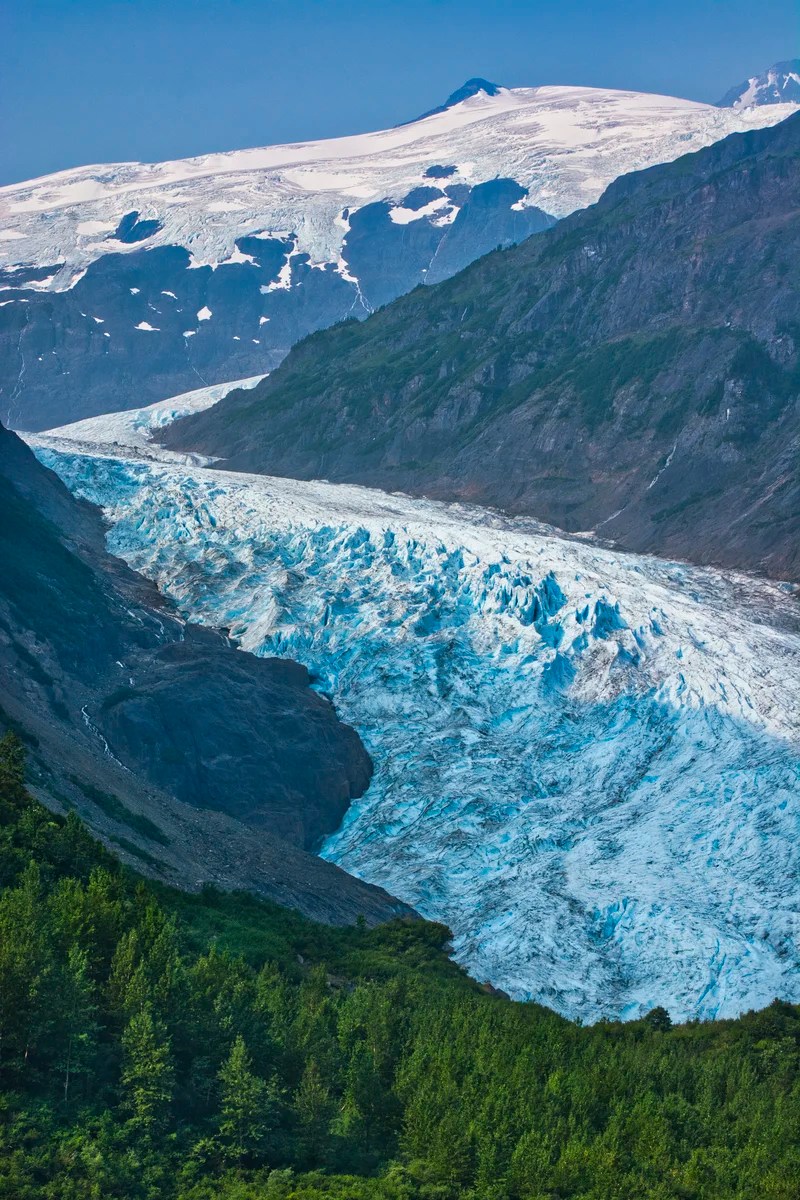
Bear Glacier Provincial Park was only established in 2000 as part of the Nisga’a First Nation Treaty, described below.
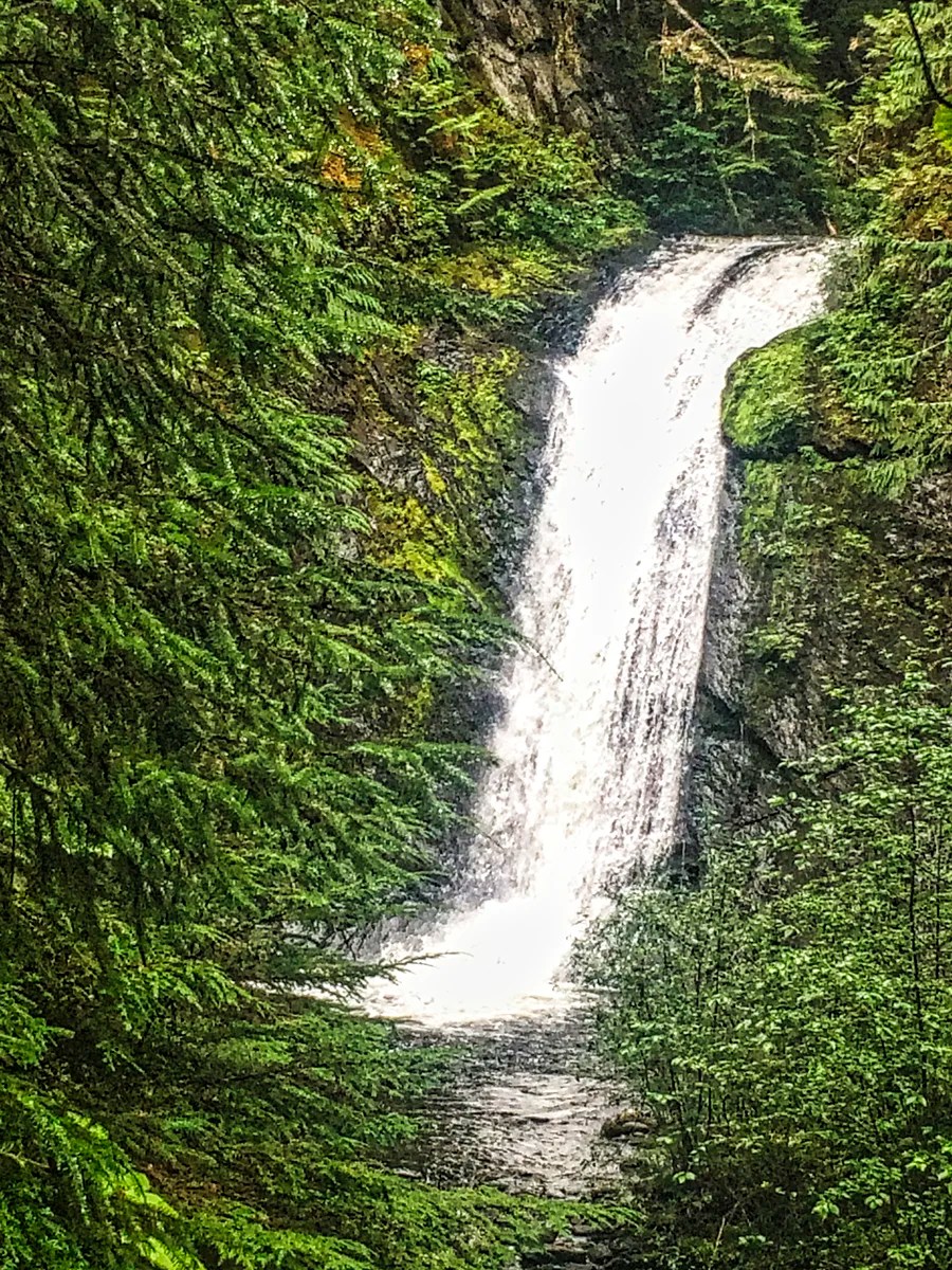
2 Stewart Waterfalls
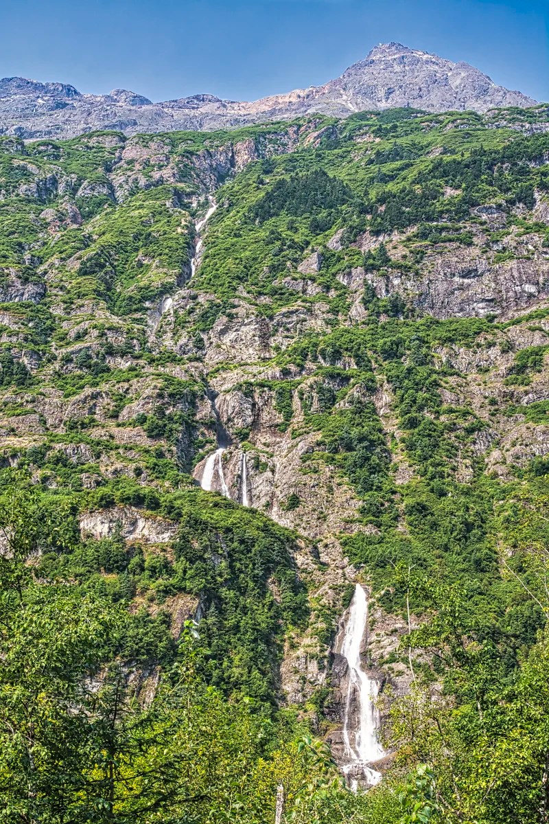
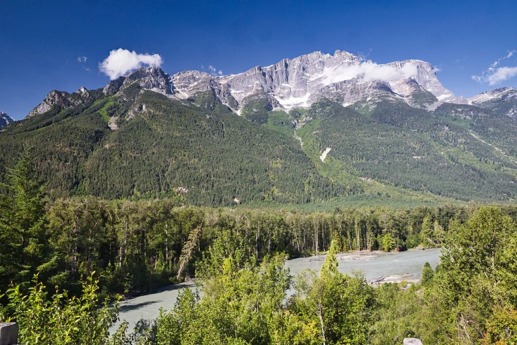
The next hidden gem was the highway to Stewart. The scenery was sensational with waterfalls and tall mountains capped with snow and 20 glaciers.
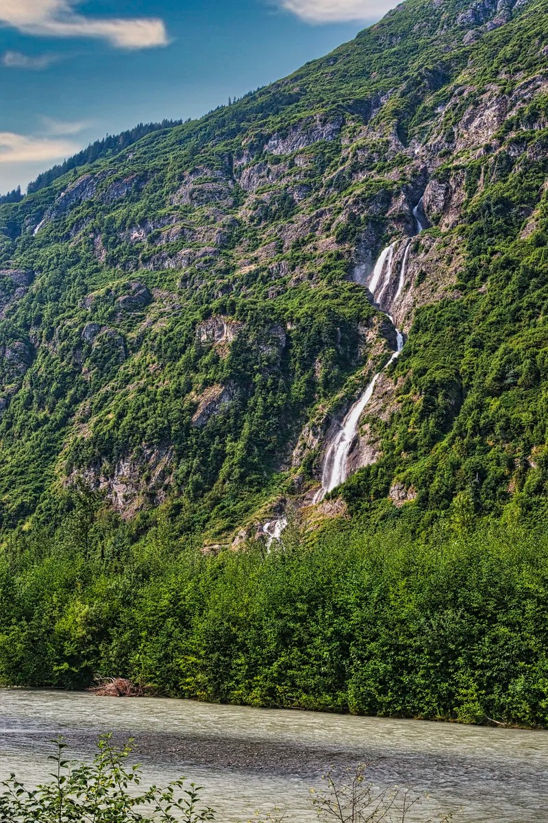
But, I wish that Destination BC would install pull-offs near the best views. You will have to park and walk to take photos. Be careful, as this is a very busy road with no shoulders. The markers for these waterfalls and glaciers on the BC North Map are just an approximation, but you cannot miss them.

We met 28-year-old Katherine Ryan in the post Is Dawson City Yukon Worth Visiting? She was the first female Klondiker, the first female Northwest Mounted Police constable, and the first female gold commissioner. In honour of her legendary exploits, she was given the nickname Klondike Kate. She retired in Stewart, renting out this store-front to businesses. Stewart would also make an interesting base for this old gold and silver mining town, Estuary Boardwalk, and cross-border exploration of Salmon Glacier and Hyder, Alaska.
Nisga’a Nation
The Nisga’a First Nation (FN) is a hidden gem for both Indigenous culture and natural landscapes. The Nisga’a are the original occupants of the Lisims (Nass River Valley). Their territory was declared Crown Land (i.e. government property) when British Columbia joined Canada in 1871. There was never any treaty or basis for the theft of their lands. In 2000, after much negotiation, they were granted the largest First Nation (FN) territory — 2,000 km2 in the Nass River Valley. This historic agreement was the first to grant self-government to an Indigenous people, free from the restrictions of the paternalistic Indian Act.
There is a road connecting Stewart to the Nisga’a FN. But, we made our base in the town of Terrace. From here, you can also day trip to visit the fish canneries in Prince Rupert or the area around Kitimat.
Like most visitors, we entered the Nisga’a FN via Highway 113. We drove into a wide valley surrounded by soaring mountains. There was a feeling of peace and quiet. I felt like I could live here. Before reaching any Indigenous towns, we travelled through a special provincial park.
3 Nisga’a Memorial Lava Bed Provincial Park
When you think about Canada, do you think of volcanoes? Neither do we, and we’re Canadians. However, Canada is on the Pacific Ring of Fire. BC has 18 sleeping volcanoes. Major volcanic eruptions occurred during the formation of the mountains of BC as BC slammed into the cost of pre North America. In fact, microscopic glass shards and ash from Canadian volcanoes are found as far away as Ireland and northern Europe.
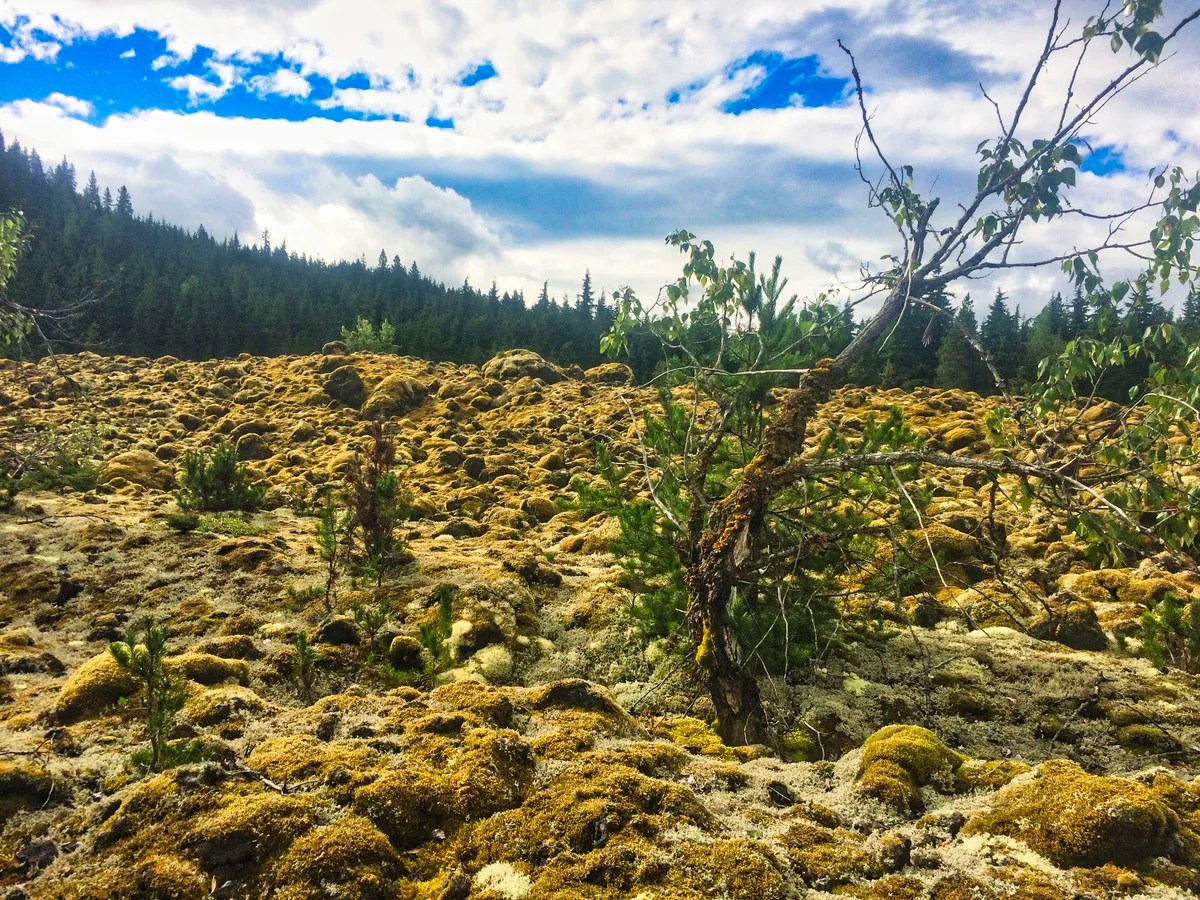
The third hidden gem is the site of Canada’s last eruption right here in the Nisga’a FN in 1700! Large lava flows dammed and diverted the course of the Nass River and destroyed two villages. More than 2,000 people perished. That is why it is named a memorial park.
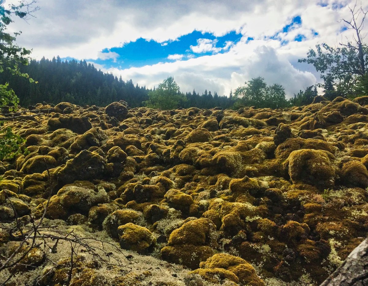
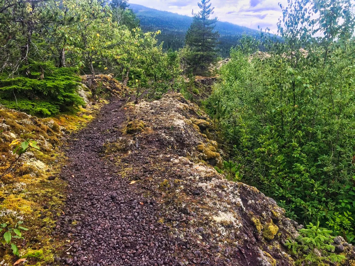
You are figuratively walking on the ancestors who perished. The source of the eruption was the Tseax Cone, which can only be visited on a guided hike. Lava beds rise as much as 12 metres above the modern road. This view is surreal.
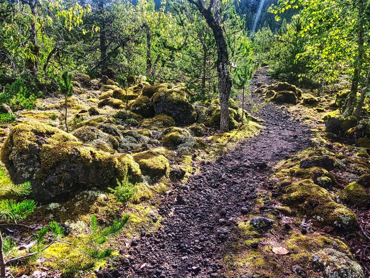
The trails are made of scoria, black volcanic glass pebbles. The black lava flows are topped by golden vegetation and moss that resembles a fairy tale or a Tolkien forest.
There are five short trails that you can hike on your own. I believe we did the Crater Creek, Beaupre Falls, and Vetter Creek trails.
We walked the short 100 m trail to Beaupre Falls, which resembles a giant waterslide.
This Provincial Park (PP) was created in 1992. It was included in the Nisga’a Treaty in 2000, becoming the first park in the province to be jointly managed by the government and a First Nation.
4 Nisga’a Museum
The Nisga’a were coerced into converting to Christianity. The missionaries treated their decorations as pagan and made the people give up their rattles, headdresses, baskets, masks, and totem poles. But these artifacts were not so pagan that the Church could profit by selling artifacts to traders who sold them to museums around the world. The Anglican Church also kept many of the stolen artifacts!
The Nisga’a Treaty required the return of these artifacts from the Anglican Church, the Royal British Columbia Museum in Victoria, and the Museum of Civilization in Ottawa. “The treaty became more than money, land or self-government; it became about the Nisga’a ancestors and their spirits”.
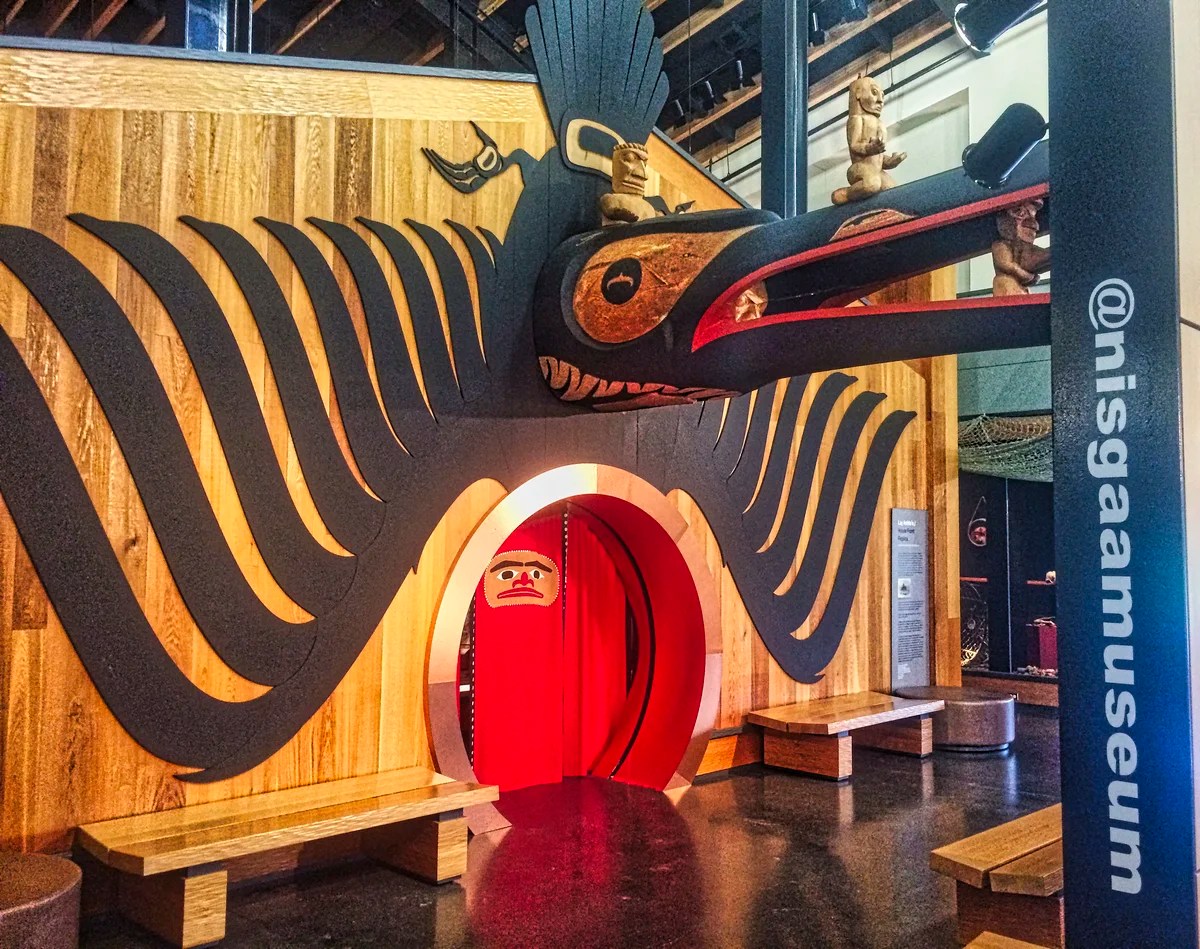
The Nisga’a Museum is our fourth hidden gem where you can meet Indigenous people and learn not only about the superb artifacts but also their culture. Located in Lax̱g̱altsʼap village, the museum is a $14 million state of the art facility that opened in 2011. The building design was inspired by the traditional Nisga’a longhouse.
We were very lucky to get an enthusiastic teenage guide, who told us many interesting stories that made the museum come alive.
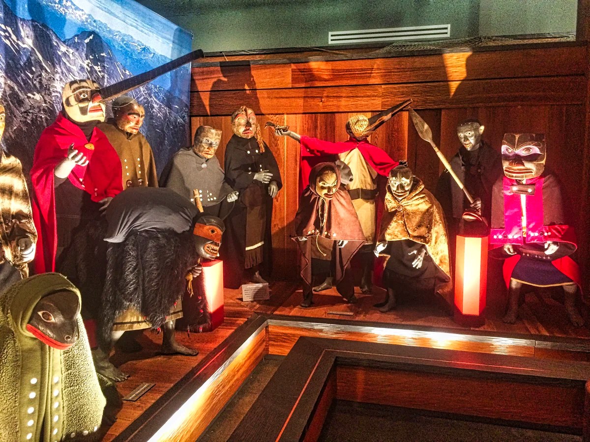
The Nisga’a believe in spirits (naxnok) that can bring both good luck and bad. The Transformation Gallery displays an array of naxnok masks. It also commemorates the Nisga’a performers who brought these spirits to life. A living part of Nisga’a oral culture is passed down via stories.
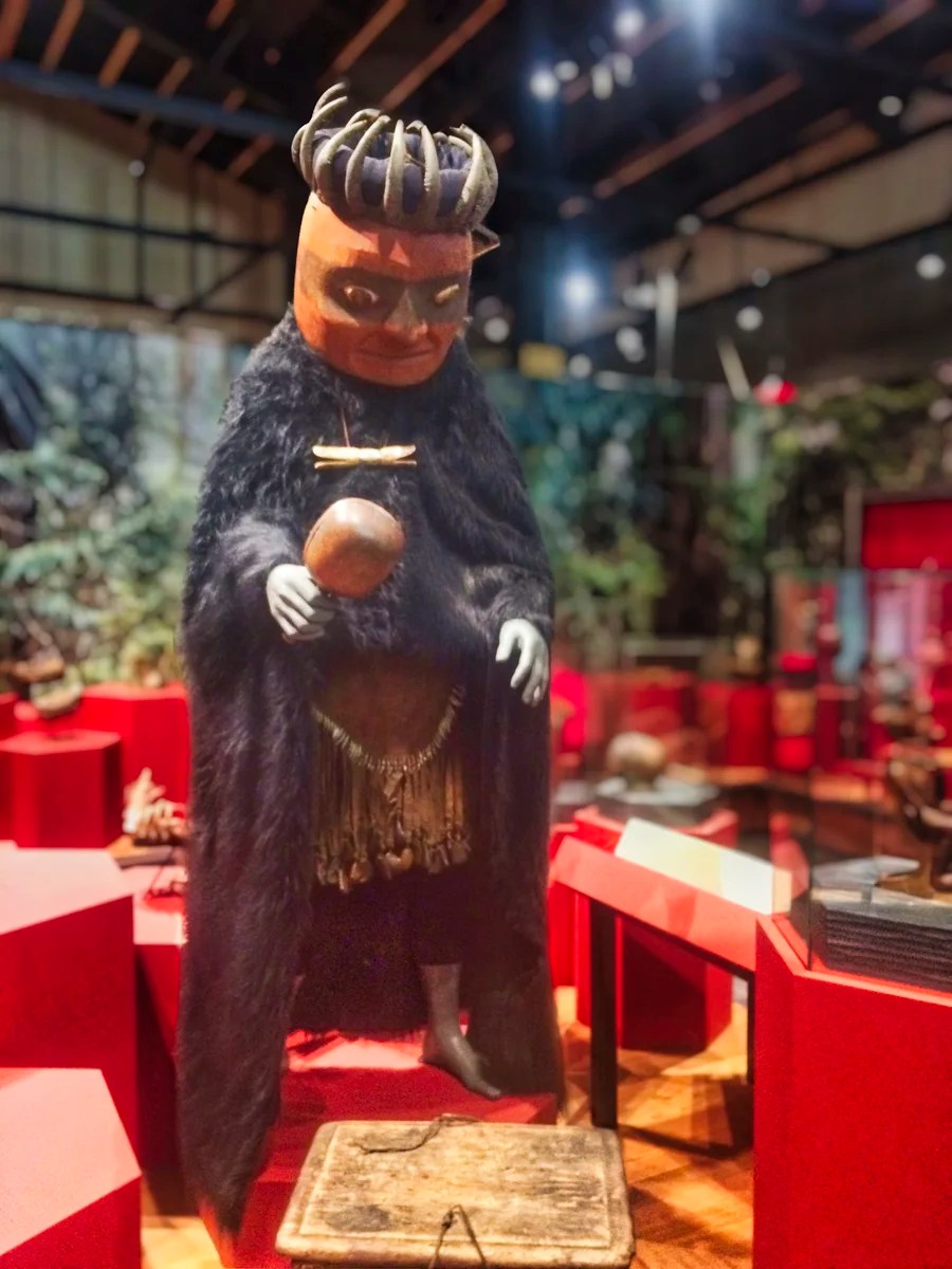
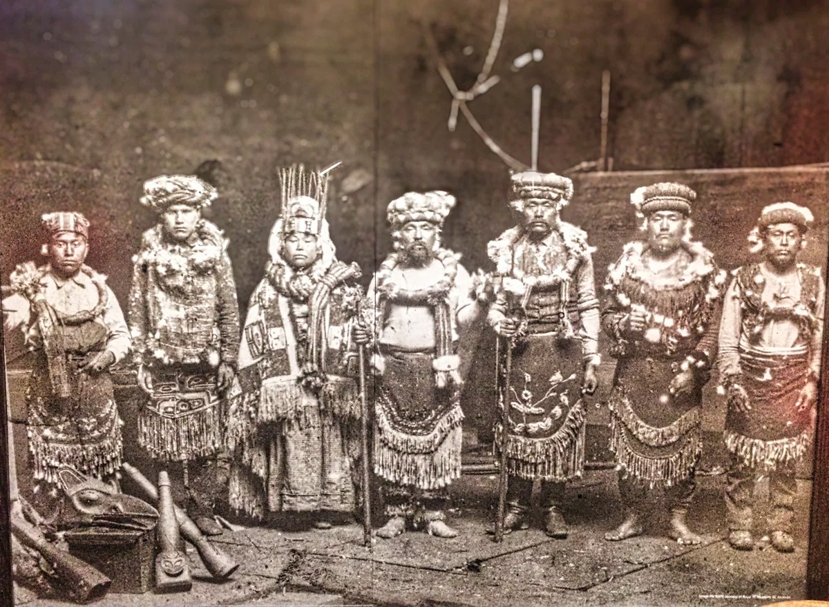
The Halayt Gallery displays of items used by Nisga’a shamans to summon and direct supernatural forces. Halayt (healers or medicine men) were responsible for taking care of people’s spiritual and physical well-being. They used sacred songs and objects to cure people. As shown in the exhibit, they often wore a bearskin robe, a headdress made of bear claws, an ambilaan (apron), and a haseex (rattle). I never realized how large bear claws are. We saw a movie in the Canadian Rockies showing bears prying open the doors of campers and cars.
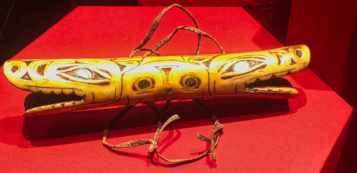
This is a close-up of a necklace similar to the one worn by the Halayt in the previous photo.
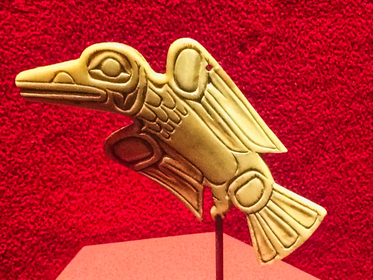
The museum displays exceptional pieces of art and decoration. I believe this is a thunderbird pendant. Prominent in Indigenous legends, Thunderbird represents power and protection. By flapping his wings, he creates thunder. He controls rain and ensures vegetation growth. Only the most powerful and successful chiefs and families use the thunderbird in their crests.
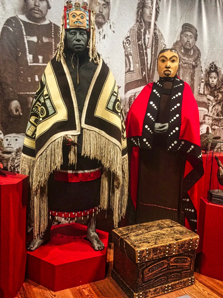
In the Ayuuk Gallery, you can see the regalia worn by a chief and his wife. At their feet is a hoohlgan (a chiefʼs box or trunk), which is often carved and decorated with crests. A hoohlgan is used to keep his regalia and possessions that symbolize the social roles prescribed by the Nisg̱aʼa customs.
The Nisga’a refer to their oral culture, traditional laws, belief system and art as Ayuuk. The Nisga’a strive to protect the Ayuuk and to pass it on to younger generations.
The Nisga’a Museum is one of the best places to visit in all of British Columbia. Don’t miss it!
Portland Fjord

You can drive past the museum through several Nisga’a villages to the village of Kincolith and a major fjord. Portland Inlet/Canal is a 114 km (71 miles) channel that is one of the world’s longest fjords. It is not as dramatic as the fjords in Norway, which are hemmed in by mountains.
This is because the fjords in BC were carved by much larger and wider glaciers. The Wisconsinan Glaciation is the name of the last Ice Age 25,000 year ago. Rather than individual glaciers, the Pacific Coast mountain range was covered by the Cordilleran Ice Sheet, which was up to 2,000 metres (6562 ft) high!!! Imagine that the valley in the photo was filled with ice up to the tops of the mountains!
The fjords in BC are best viewed by one of the ferries in the Sunshine Coast region, Desolation Sound, or the Inside Passage from Vancouver Island to Prince Rupert. Spectacular Howe Sound, which is really a fjord, can be visited by hiking or driving north on the Vancouver Sea to Sky Highway.
These fjords are so wide and deep they can never be bridged. Because the BC coast is riddled with so many fjords, the only way south is to take the ferry or drive east half way across the province to Prince George then head south on Highway 97.
5 Fort St. James
Fort St. James (FSJ) is another hidden gem you must see. It is one of the best places to visit in all of Western Canada. Here you can experience the last Hudson’s Bay (HBC) fur trade post, which was still in use until 1951! FSJ is a National Historic Park that comes with actual original buildings and interpreters in period costumes that make the fort come alive.
In 1670 HBC was more than a major fur trade company. It actually controlled and administered the 3.9 million sq km of Rupert’s Land, 40% of the land area of Canada! That is the size of Western Europe! Fort St James was the headquarters for New Caledonia, the Latin name for New Scotland and the original name for British Columbia.
In 1869, HBC was negotiating to sell Rupert’s Land to the United States for $10 to $40 million. Britain barred that deal and made HBC sell Rupert’s Land to Canada for $1.5 million. The Canadian dollar was equal to or stronger than the US Dollar in those days.
Fur Warehouse (1888-89)

We were surprised to learn that the majority of HBC employees were First Nations. They were treated well since they were most often the trappers as well as the trading post employees. Only the management positions were held by Europeans, and they were married to FN women.
How do you construct buildings in the wilderness without trained tradesmen and modern materials? Well, there are lots of trees. For more details on these buildings and the fur trade, see the blog The Last Fur Trade Post – Preserving History at Fort St James.
Trade Store (1884)

The Hudson’s Bay Company (HBC) trade with the First Nations was carried out through bartering. The HBC standardized the unit of account as the Made Beaver (MB), or one high quality male beaver skin, to ensure consistent pricing for pelts throughout Rupert’s Land.
Americans trace the term buck meaning deer skins back to 1748, about 44 years before the first U.S. dollar was minted. However, that was not the original buck. The HBC struck a coin in the 17th century that was equal to the value of one buck-toothed male beaver pelt – it was known as a “buck”. The beaver became the national symbol of HBC and later Canada. It is still found on the tail side of the Canadian nickel (five cent coin).
The fascinating story about FSJ – its role in the history of BC joining Canada and the contributions of the First Nations to Canadian and world culture – can be found in the blog The Last Fur Trade Post – Preserving History at Fort St James. This itinerary can be driven in reverse to take you south to the cloud piercing Mt. Robson in the Canadian Rockies.
Final Comments on this Itinerary
This is a relaxing itinerary where you can get away from the crowds of tourists. It is much more relaxing compared to the overcrowded Banff.
Subscribe
Get travel tips and advice delivered directly to your inbox. The best part is that it is free.
What things fascinate you? How long is your trip? What questions do you have?
Itinerary Map & Resources
BC North Map — our custom map with all points of interest
Google Maps Ratings
Google Maps provides a rating from 0 to 5 for all sights, hotels and restaurants (but not cities). All of our recommendations are appended with the rating (prefixed with a G) from Google Maps. As it is based on feedback from tourists and locals, it is much more reliable than travel booking websites. We consider a score of 4 to 4.39 to be Very Good; 4.4 to 5 to be Excellent.
Other Places to Add to Your Itinerary
Here are nearby places you might want to explore:
Canada FAQ

The Exploring Canada post answers Frequently Asked Questions (FAQ) such as:
- How do you plan a trip to Canada?
- How safe is Canada?
- What is the best season for travel?
- Can I see everything in 3 or 3 weeks?
- What are the best places to see in Canada?

Leave a comment