
Why visit Fiordland?
Is it worth visiting Milford Sound and Fiordland National Park (NP)? Yes, it is, but you need to take a boat cruise to see the awesome mountains and waterfalls, seals and dolphins. Moreover, many tourists miss out on enjoying the many points of interest as they travel in Fiordland NP. Don’t be surprised if a large green kea (parrot) visits you at one of the alpine viewpoints!

Author & Photographer: George Mitchell

Our recommendations are not influenced by affiliate links – we have none. Our itineraries, photos, and advice are based on having stayed in New Zealand for a total of six months over three trips. We are avid hikers, nature lovers and photographers. NZ is one of our favourite destinations.
All of our recommendations are top-rated by Google Maps Ratings, which is based on everyone, not just tourists. Each place recommended in our custom New Zealand Wakatipu-Fiordland Map is appended with a Google Maps Rating (G0 to G5).
Getting There
From Queenstown, you need to drive south on Highway 6, then west on Highways 97 and 94 to Te Anau (166 km, 2 hrs), then north on Highway 94 to Milford (119 km, 1:45 hrs).
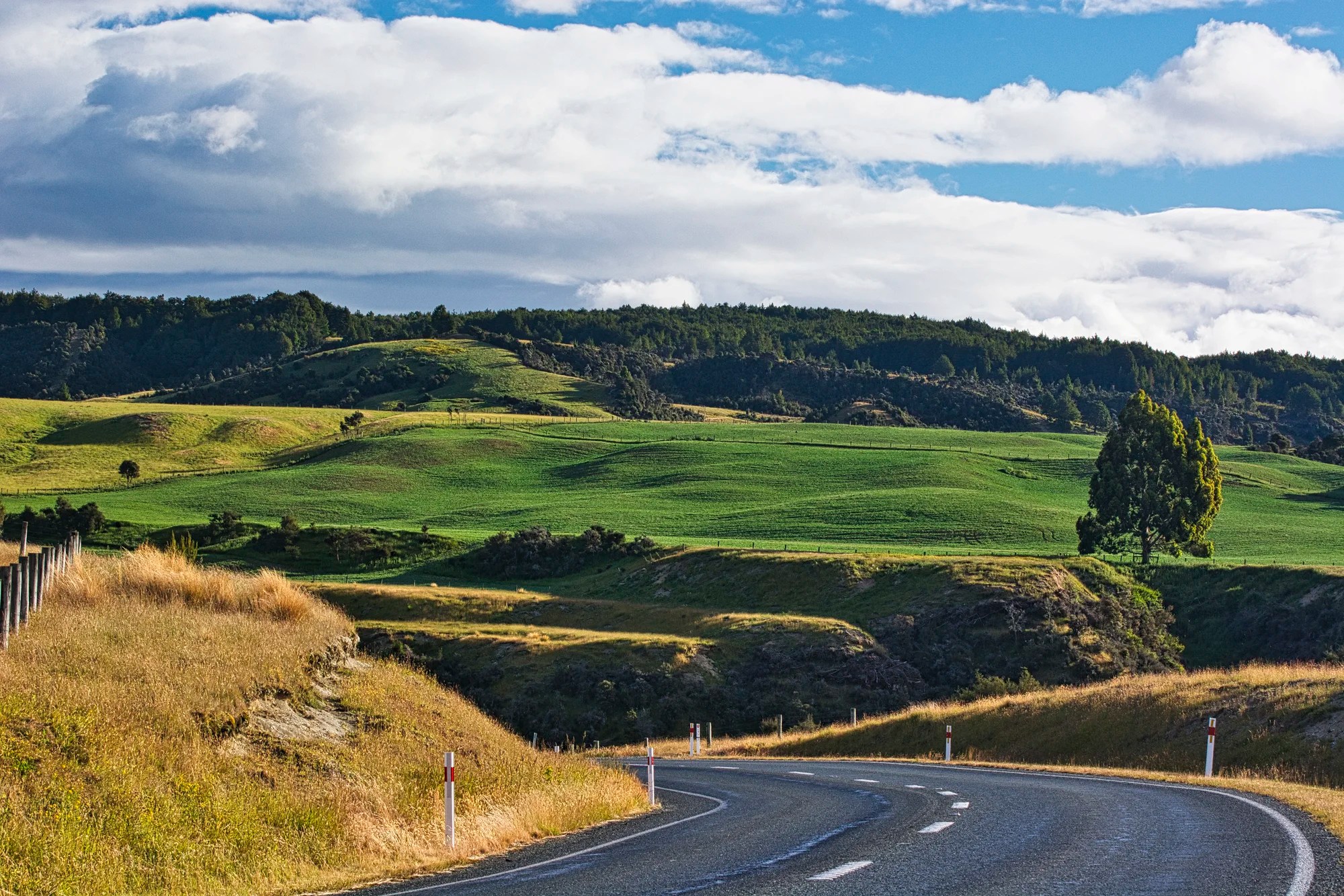
In our case, we stayed in Manapouri. We saw a scene that is Quintessential NZ — a golden road curving towards green pastures. OK, it is missing the most stereotypical feature— white sheep!
The roads will be busy during mid-morning when the Queenstown bus groups travel to take the noon hour cruises. As a self-driven person, you should go on an early morning or late afternoon cruise.
There are no shops or petrol (gas) stations between Te Anau and Milford Sound. Bring your own tucker (food) and fuel unless you plan to shop at the more expensive Milford Sound.
The majority of coaches leave from Te Anau between 9:00 and 10:00 hrs and arrive at Mirror Lakes around 10:30 h, Knob’s Flat at 11:00 hrs, The Chasm at 12:30 hrs and Milford Sound for the 12:00 to 13:00 sailings.
The worst speeders were the bus drivers. The tour buses are travelling over 100 kph, which is way too fast for any National Park or tourist road. Be very careful walking across Highway 94 or pulling out of roadside stops.
Note: The itinerary is in geographical order but if you want to take the earliest sailings then simply reverse the itinerary. However, the views are better driving north.
Manapouri to Milford Sound
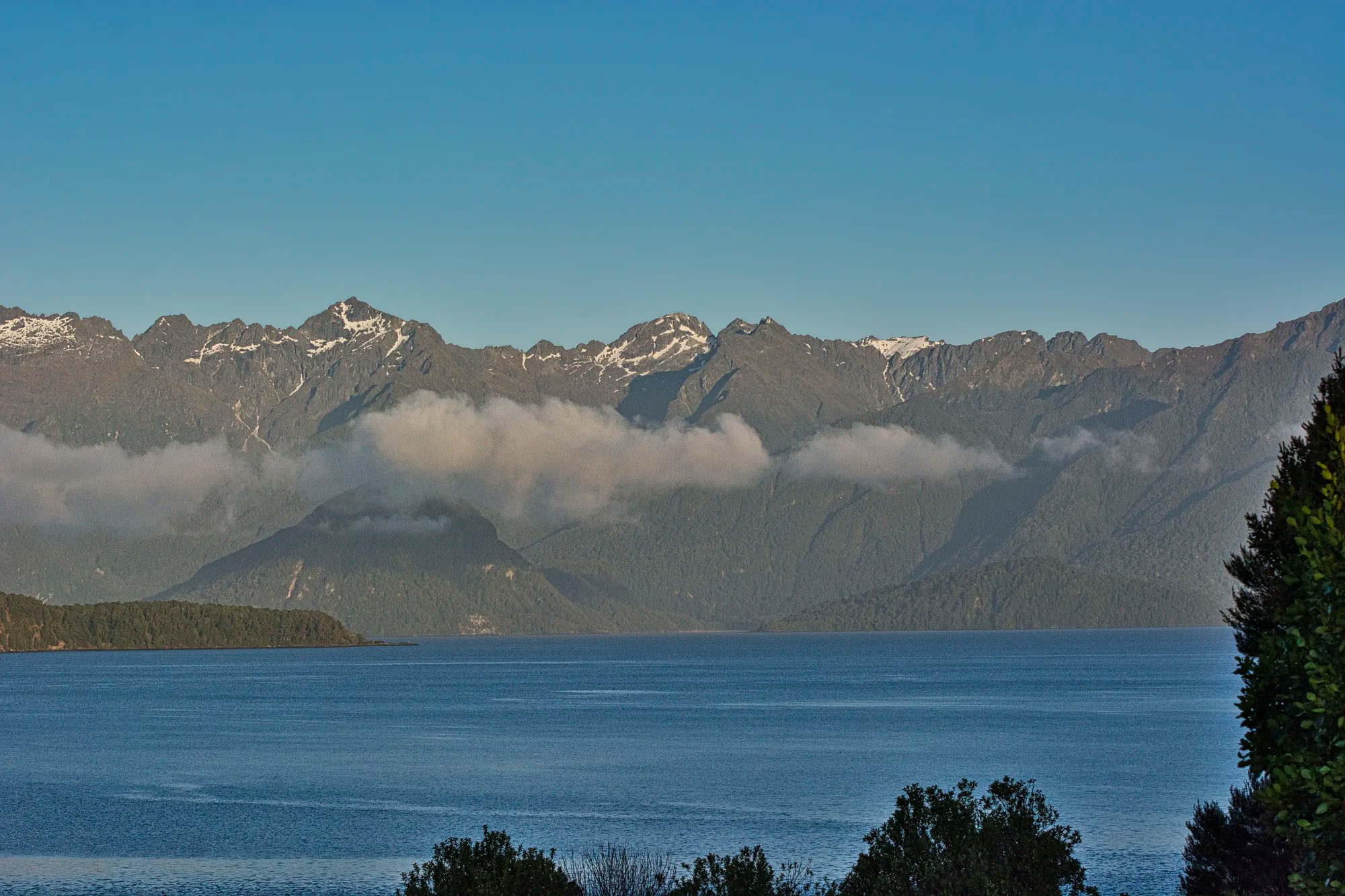
Manapouri
Distance: 22 km from Te Anau
Te Anau was the last place we booked about 4 months ahead. There was a mix-up, and our original booking fell through. Everything was filled up for New Year’s. Agoda was extremely helpful and got a client of theirs to open up just for us. The family-run Cathedral Peaks B&B was not renting for the holidays. It was a superb place.
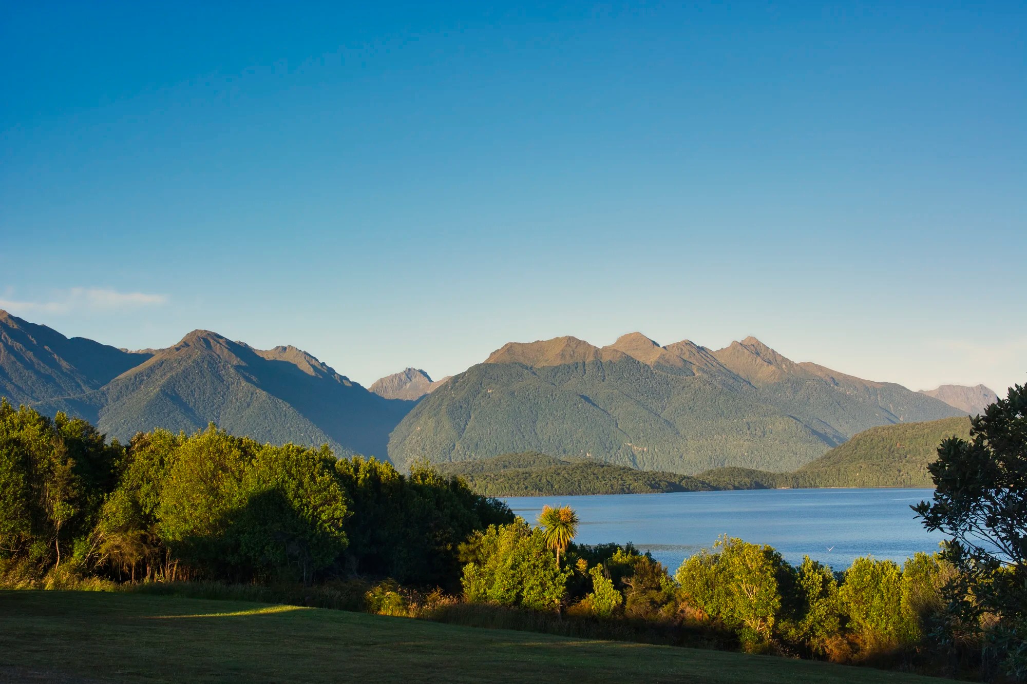
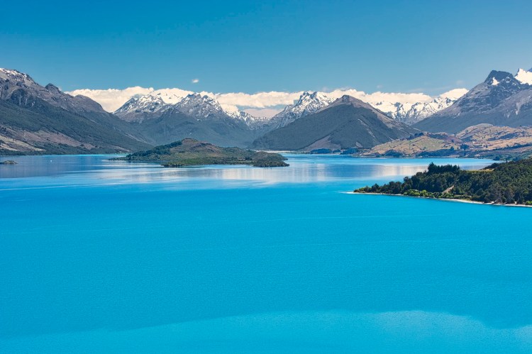
The views of the water and the mountains early in the morning were very beautiful. Manapouri is the departure point for cruises to Doubtful Sound (G4.8), which we have yet to visit.
Mirror Lakes
Distance: 58 km from Te Anau
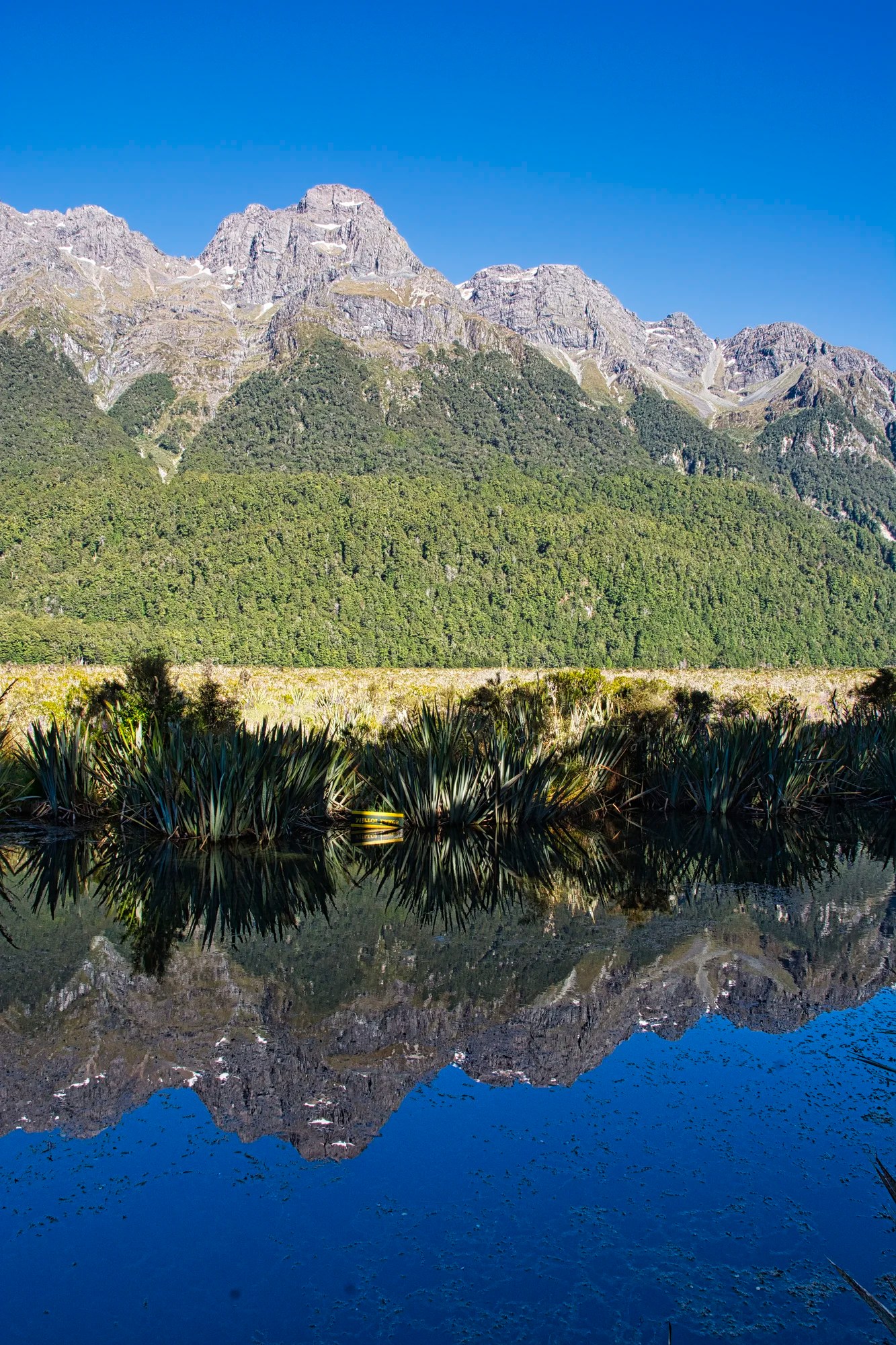
We had a spectacular, sunny, calm day. Famous for their reflections, the Mirror Lakes (G4.4) lived up to their name with glorious mountain reflections.
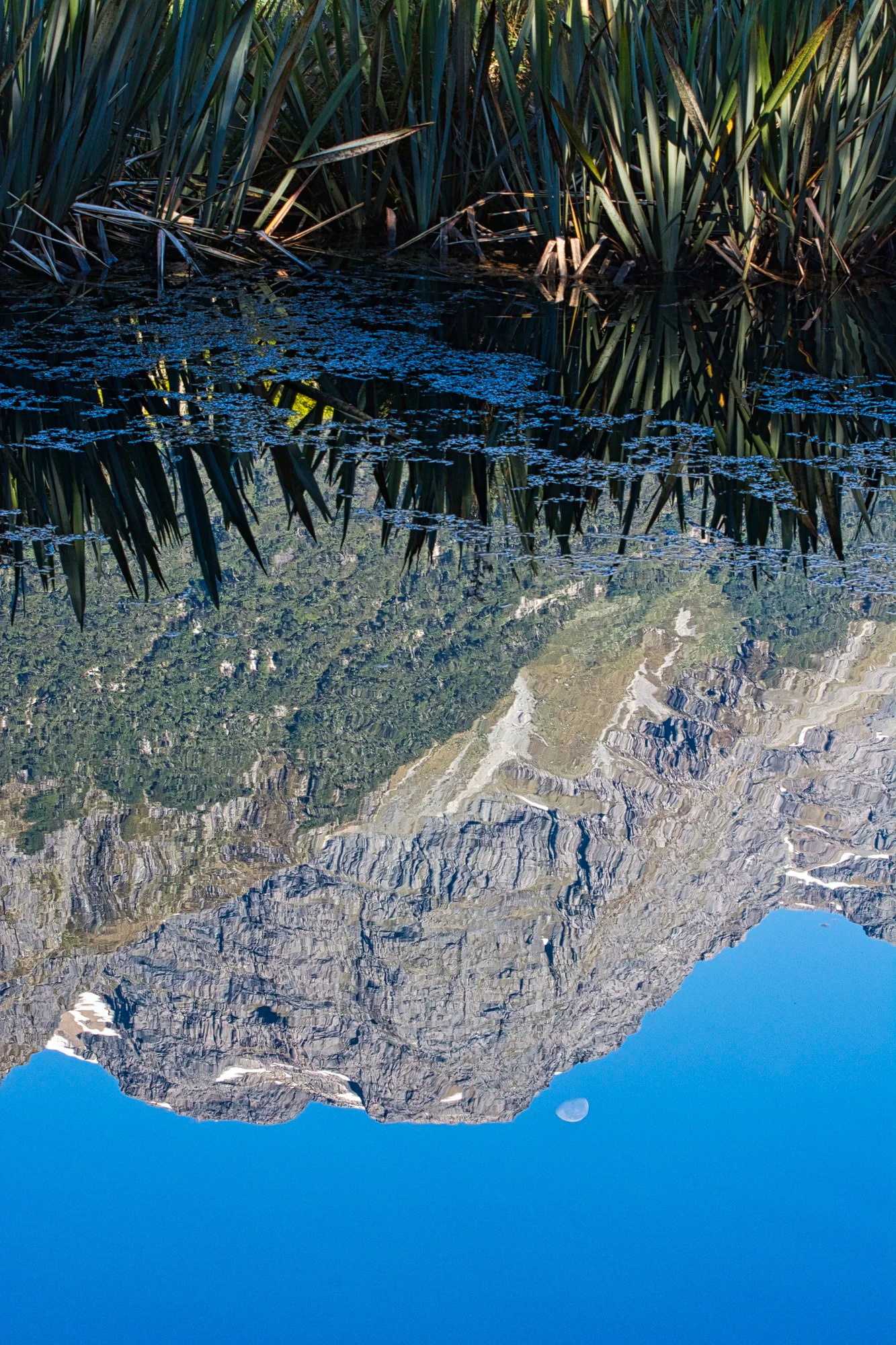
Here are the mountains and the moon in the mirror! There is a short trail between the three lakes, and it can be quite crowded as it is a very popular stop for tour groups.
Knobs Flat
Distance: 63 km from Te Anau
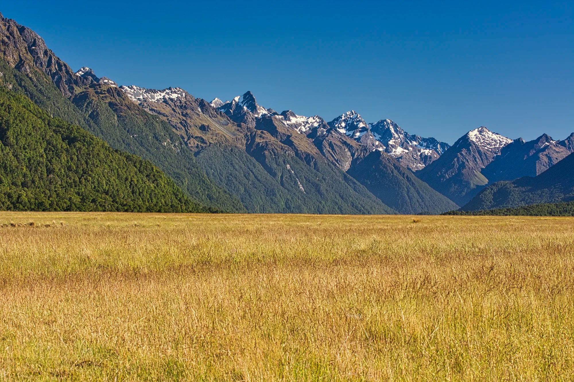
Knobs Flat (G4.6) are tussock grasslands in the Eglinton Valley. This flat valley was bulldozed by glaciers during the last ice age. The result is a classic “mountains meet the meadows” scene, providing wide open views unimpeded by trees. I used a slight 105 mm zoom to bring the mountains a bit closer.
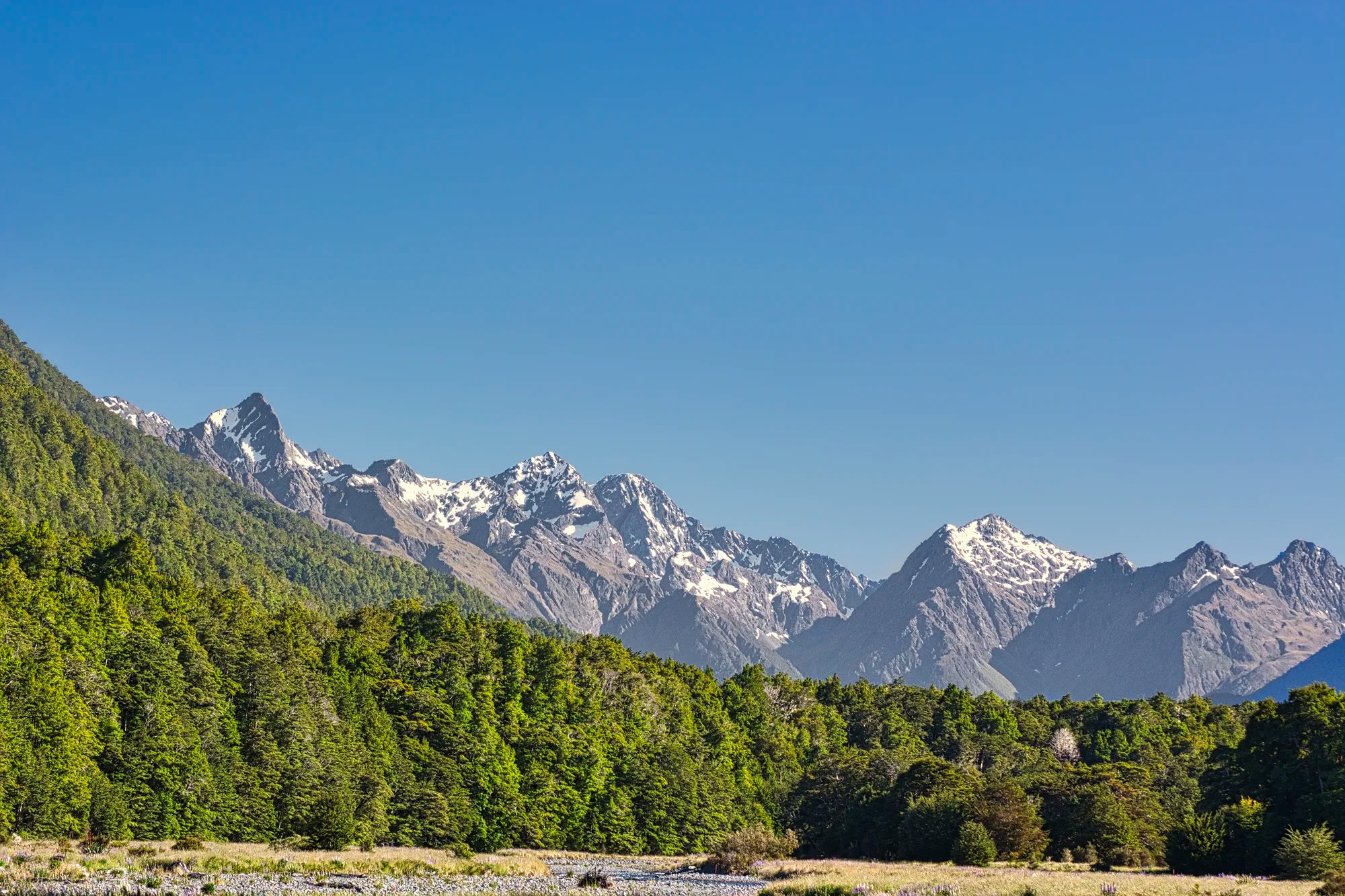
Here you will find amenities such as toilets and a campsite. But the real reason to stop is that it is a great place for photos of the steep-sided mountains. This photo was taken at the same point as the first, but with a 168 mm zoom.
Cascade Creek
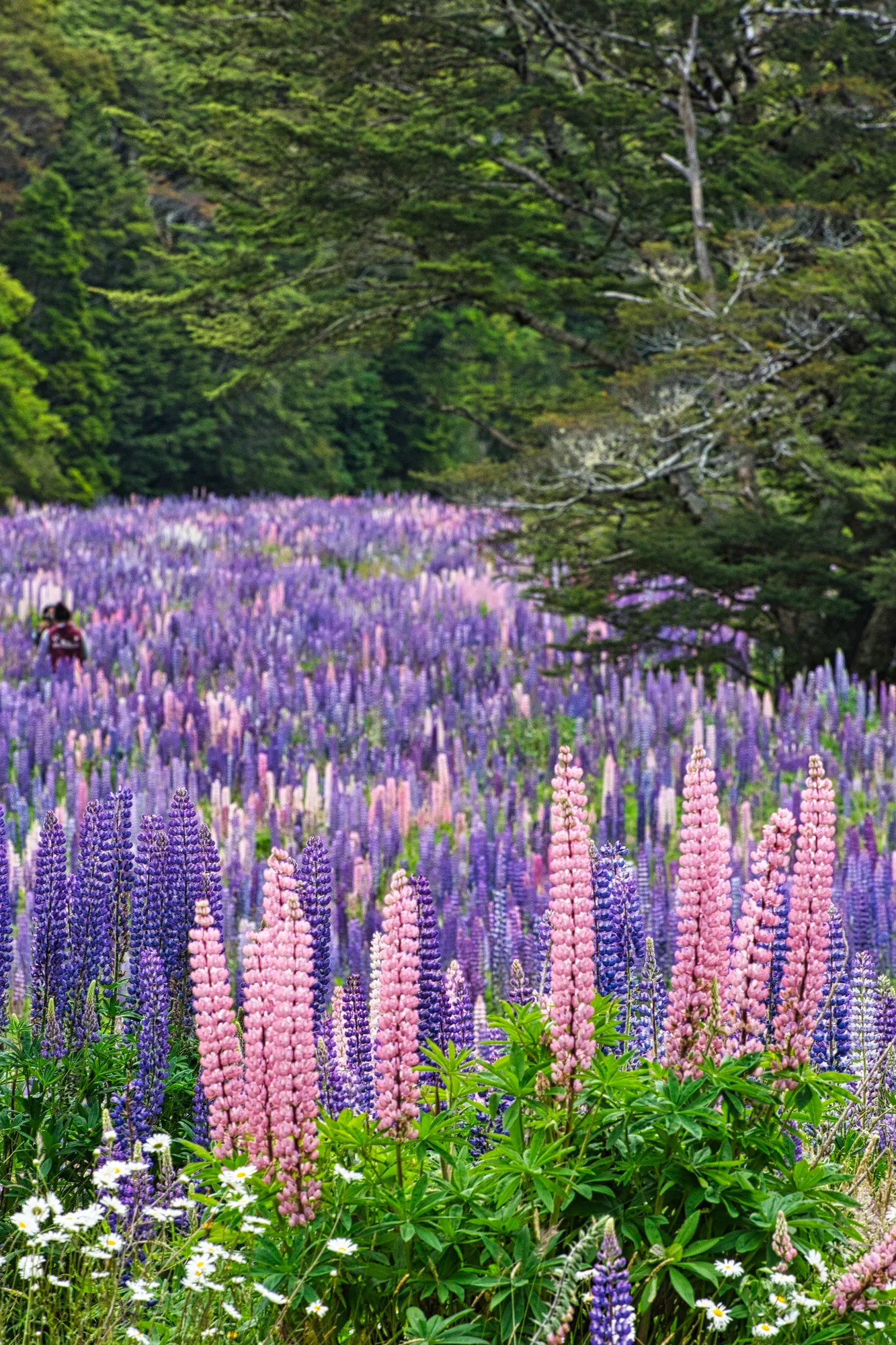
We stopped at Cascade Creek Campsite (G4.4) for the birding and found colourful violet and coral meadows. Lupines were planted in the 1950s by Connie Scott at Lake Tekapo. They have since spread throughout South Island. While these flowers are considered invasive, NZ has declined to eradicate them because the tourists love them!
The Divide
Distance: 84 km from Te Anau
The Divide is the trailhead (or end) for the Routeburn, Greenstone, and Caples Tracks.
Key Summit Track
If you have time, you can get a taste of the Routeburn Track, one of our three favourite multi-day hikes in NZ. Do the day hike to the Key Summit viewpoint (918 m asl, 3 hrs return) to see spectacular views of the Eglinton, Hollyford and Greenstone Valleys.
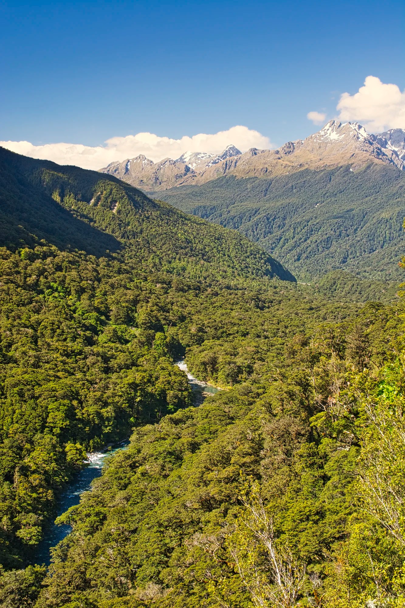
Hollyford Valley Lookout
Distance: 88 km from Te Anau
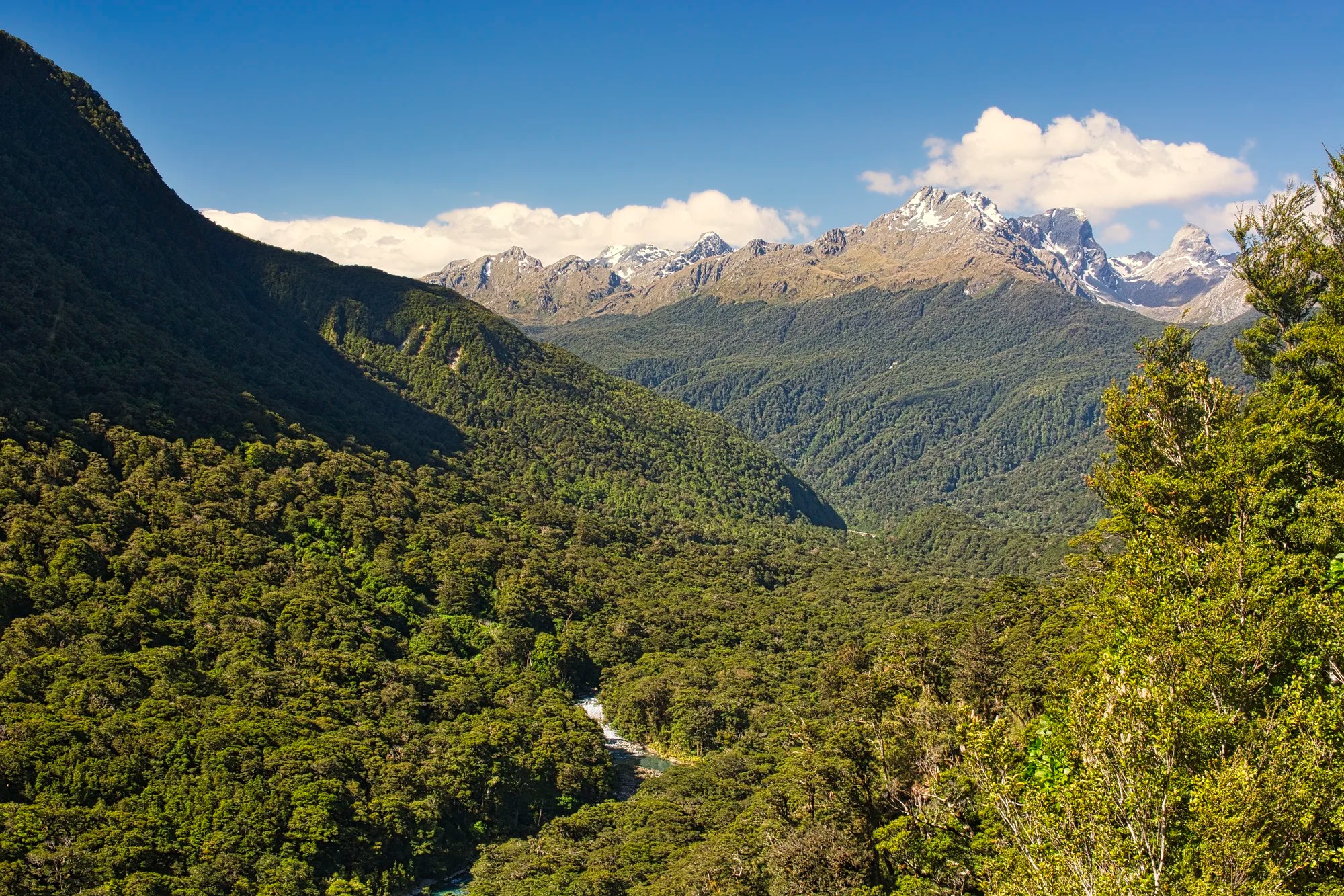
Pop’s Lookout provides an excellent view over the Hollyford Valley and the Darren Mountains where we hiked the Routeburn Track. It was great seeing the scenery in gloriously sunny weather!
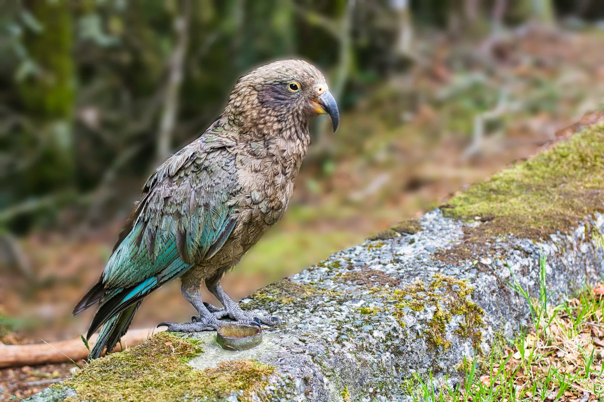
This area is home to the intelligent and inquisitive Kea, an olive-green parrot. They can be cheeky, trying to remove the rubber molding around windows! I shooed them away from our rental car. But they came back to the roadside curb. I was fairly close to the kea, shooting with a 129 mm focal length. They often help themselves to your belongings; so close your car doors.
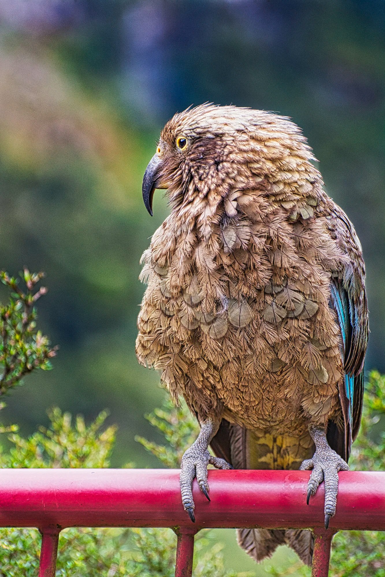
The name is Maori and originates from the Kea’s distinct loud “keee-aaa” call. The kea is the world’s only true alpine parrot, endemic (found only) on the South Island of New Zealand. Kea are friendly and curious so it did not fly away. I took my photo using a 202 mm zoom lens.
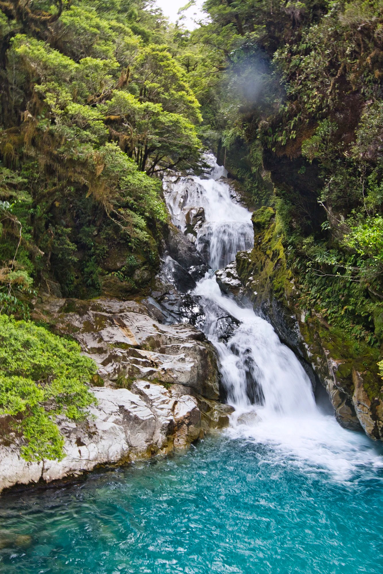
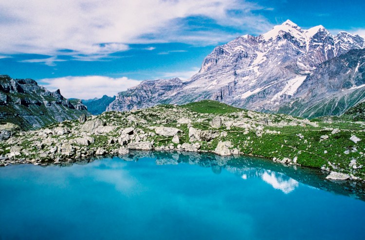
Christie Falls
Christie Falls (G4.8) is a hidden gem that most people miss, even though they drive right past it on Highway 94. The falls tumble into a gorgeous turquoise pool. This was a 27 mm wide-angle shot. Be careful of speeding tour buses if you are crossing the highway to the west side.
Monkey Creek
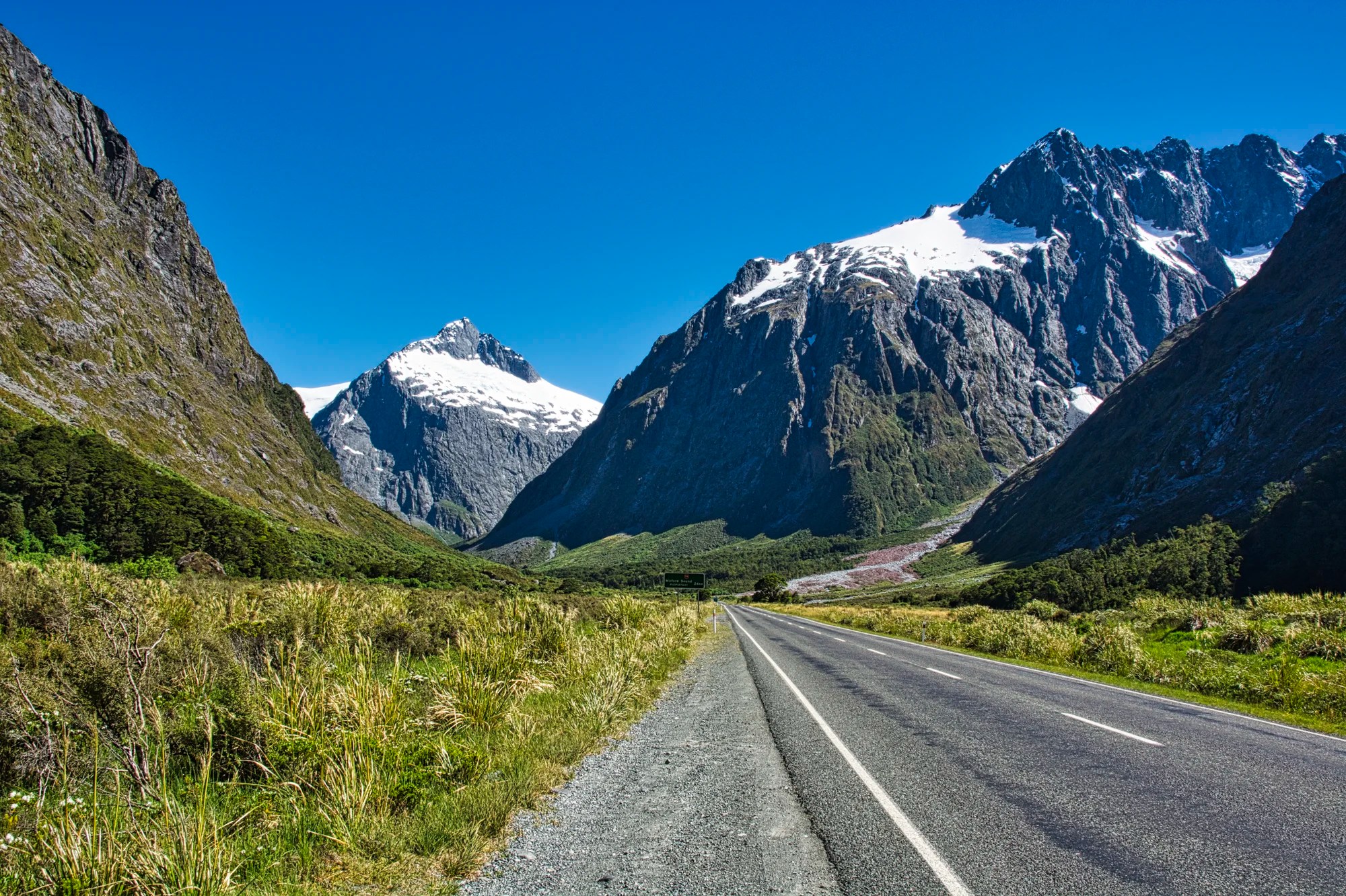
This pull-off was supposedly named after the dog “Monkey” belonging to surveyor William Homer. This car park is a common spot to see a kea. We were here for birding and photography. Actually, this photo was taken along the road a bit further north and thus closer to the mountains. Even though this was a 28 mm wide-angle shot, the mountains still feel close.
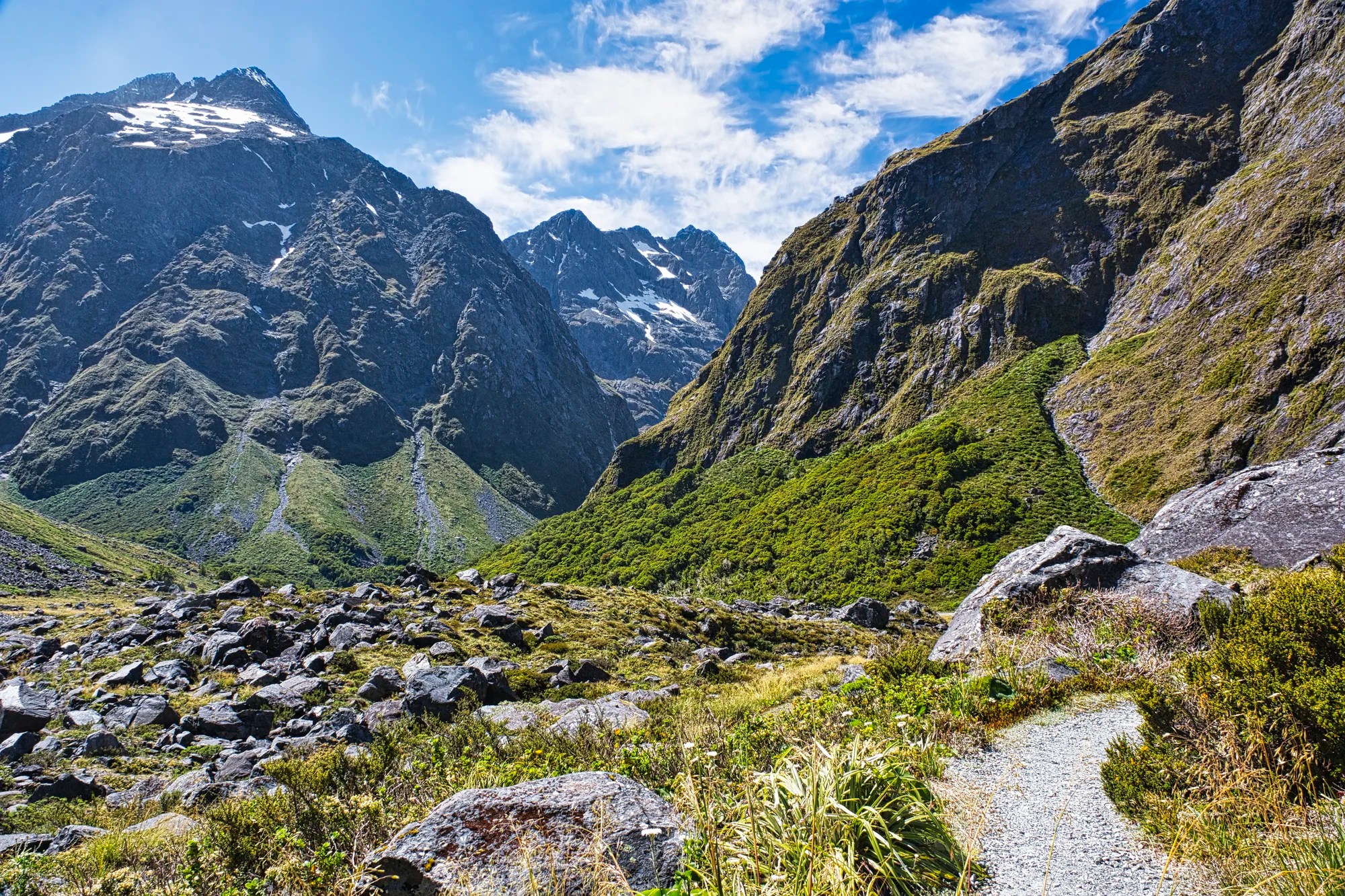
Homer Saddle
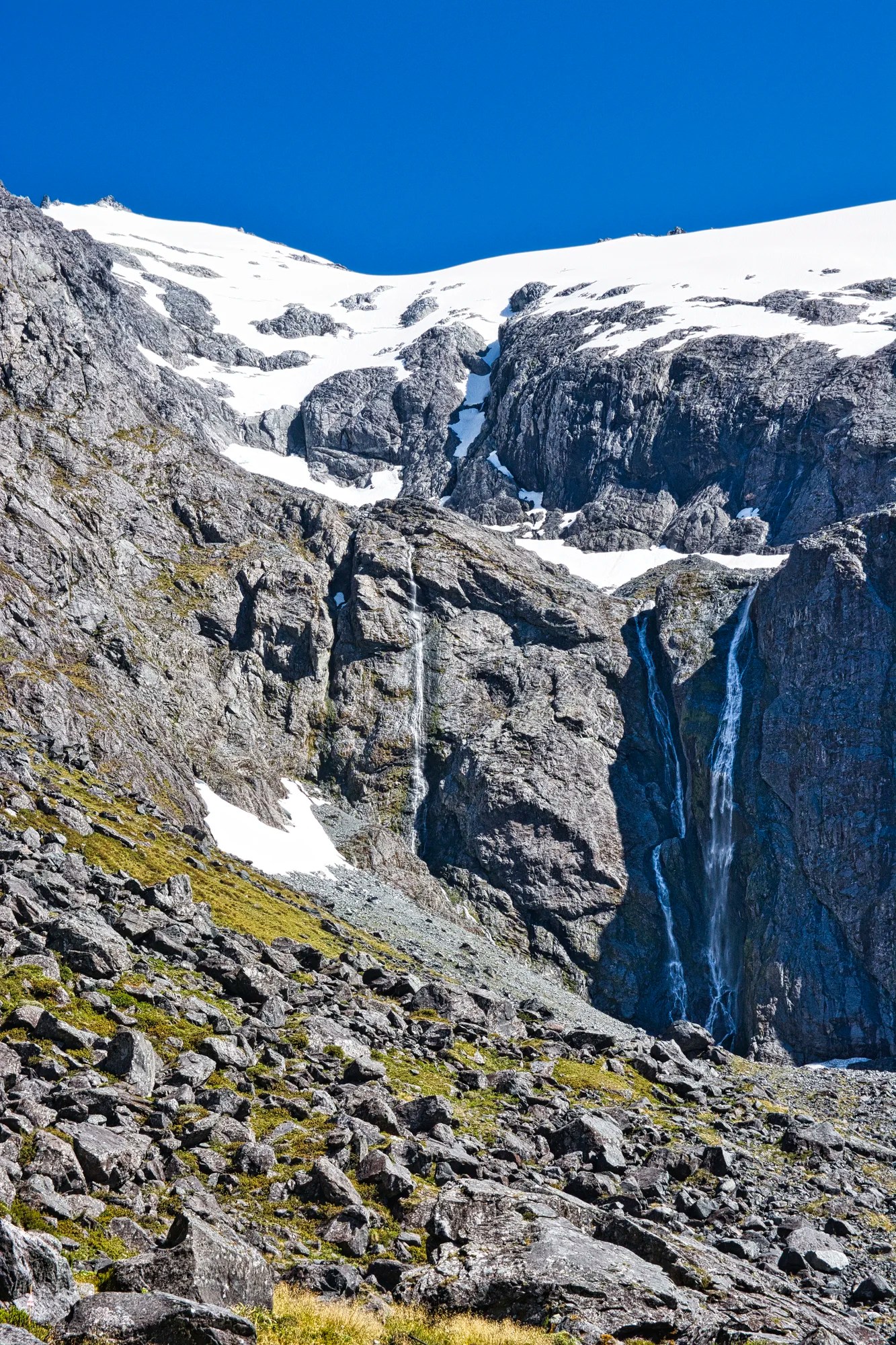
At 1270 m this is the highest point on Milford Road. Before continuing through the tunnel, stop at the parking area outside the Homer Tunnel. The Homer Saddle (1375 m) is a walk up the hill. This was a 75 mm shot.
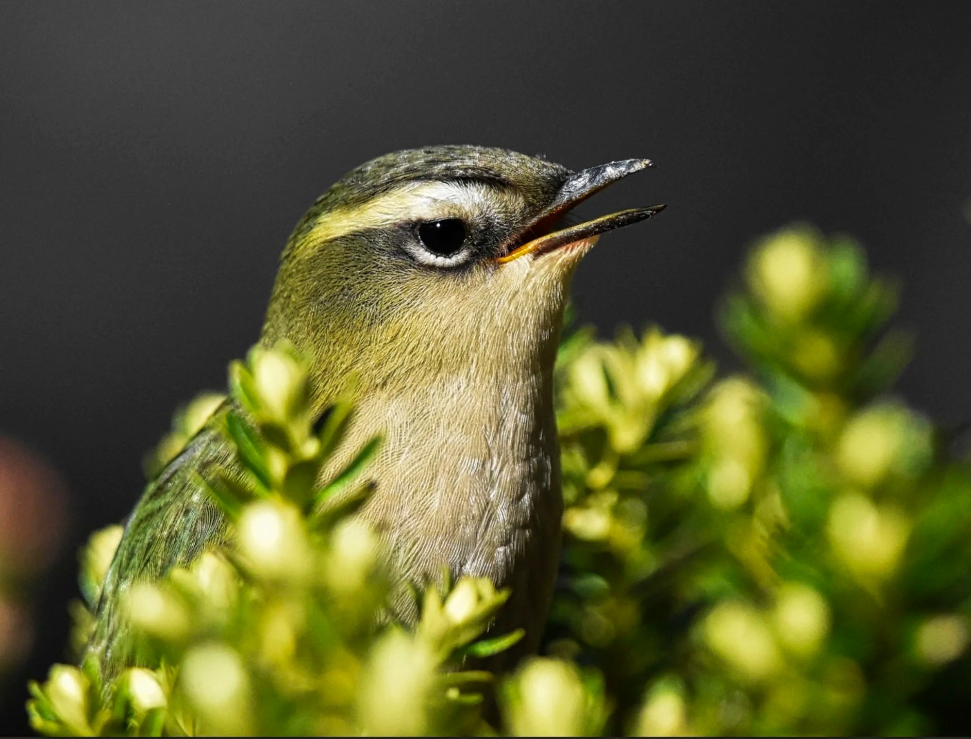
Our real reason for coming here (several times) was to see the rare South Island Wren. We saw it (eventually) in the rocky boulder fields, hence its common NZ name, Rock Wren. It is an endangered species that is endemic to or found only in the alpine areas of the South Island. The male is a mossy green above and pale gray below. But the creamy eyebrow is most noticeable. It constantly bobs up and down, but my son managed to capture this very clear photo.
Daniele saw 145 bird species in NZ and 55 species in Southland. We would never have gone on this short track if it weren’t for birding. This was a 25 mm wide angle shot of this delightful area.
This is a good example of finding beautiful spots even when they are not famous. We walked on the south side of Highway 94 above Homer Tunnel. You feel you are encircled by mountains. This was a 25 mm wide angle shot but the mountains still feel close.
Homer Tunnel
Distance: 96 km from Te Anau
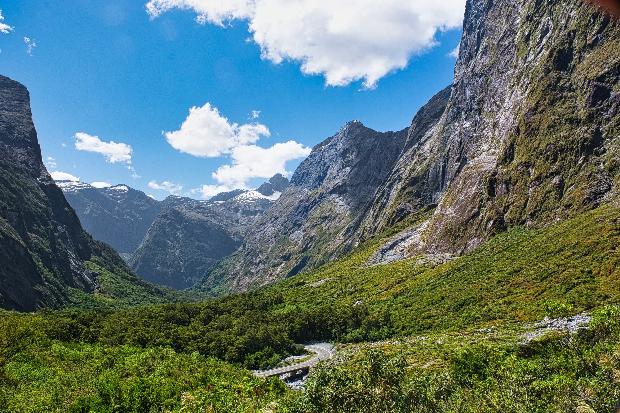
William Homer discovered Homer Saddle in 1889. He suggested building a tunnel to enable tourists to access Milford Sound. But there was a 500 m vertical granite wall blocking the way. The tunnel was started during the Great Depression in 1935 using picks and shovels! It was only completed in 1954. This 105 mm shot cannot capture the size of this rocky amphitheatre.
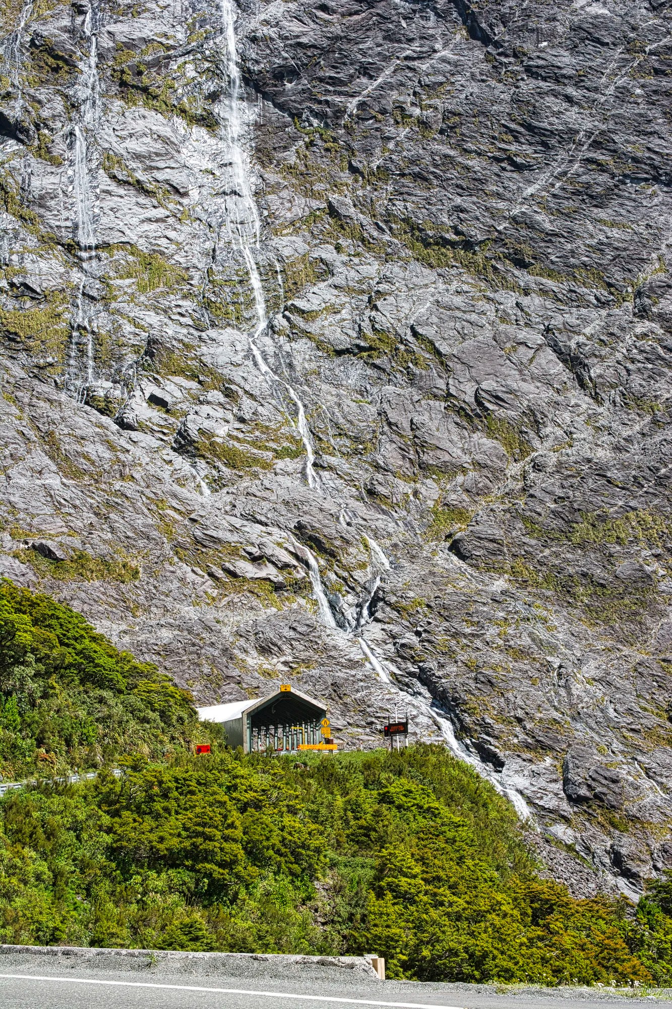
The single-lane (OK, 1½ lane) Homer Tunnel pierces a massive mountain wall with lots of snow in the winter. Oh, there are traffic lights to ensure one-way traffic. You can be stopped here for as long as 15 minutes. An information board states how long the wait will be. The very dark Homer Tunnel descends 129 m over its 1.2 km length. This was a 57 mm shot.
The Chasm
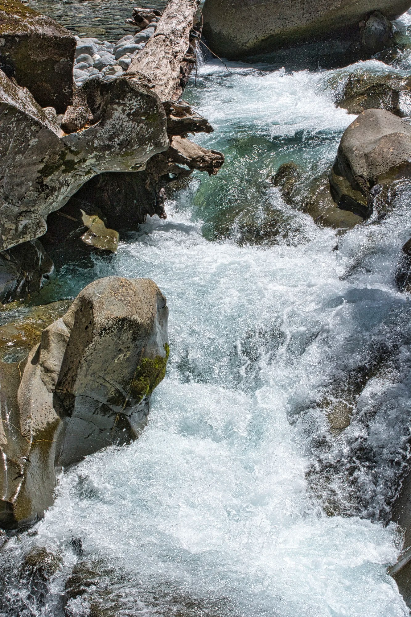
Walk an easy 20-minute 400 m track through the tranquil native forest. We came for the birding and stayed for the deep ravine. As we neared the Chasm, we could hear the powerful thunder of the falls.
The Chasm was formed by the Cleddau River being forced through a narrow valley as it descended from the Darran Mountains. Small rocks and gravel carried by the river scoured the soluble limestone. Powerful swirling currents carved round potholes and sculpted the smooth sides.
Because of the overhanging vegetation and low light, it was very difficult to photograph. None of my other photos captured the 22 m depth as one could only look down from the bridge — no side views. A storm in 2020 washed away the viewing bridge, which is being reconstructed.
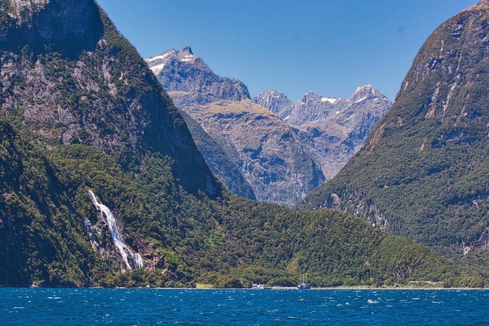
Milford Sound
Distance: 122 km from Te Anau
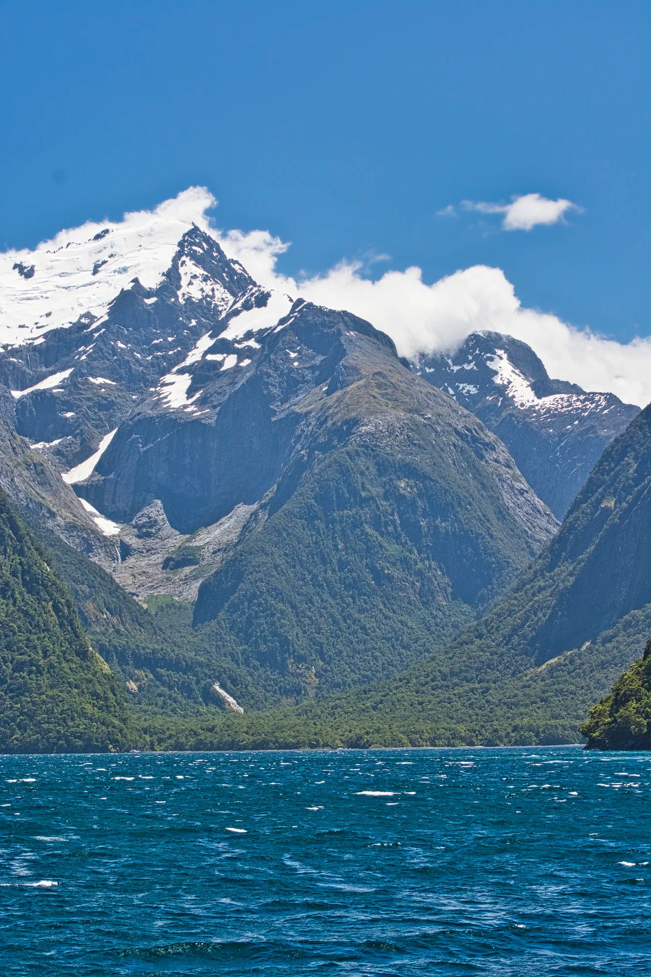
Milford Sound is incorrectly named! The British had a bad habit of naming narrow sea arms as “sounds” but they are really fjords carved by glaciers. In any event, the Maori were the first to discover Milford, and so the name should be Piopiotahi. When the legendary Polynesian hero Maui died trying to win immortality for his beloved people, a single (tahi) piopio (extinct native bird) flew here in mourning.
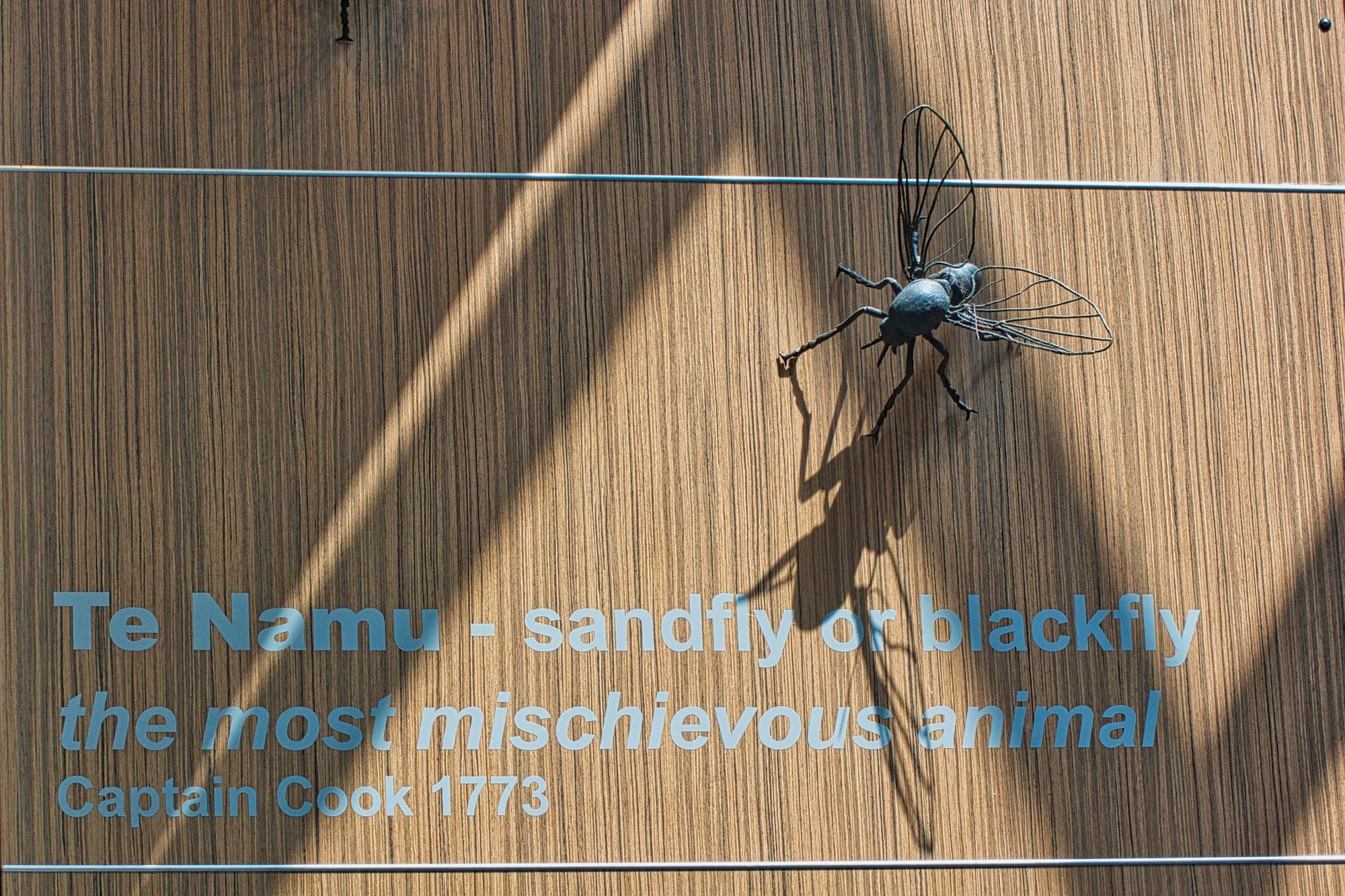
Milford Sound is one of the most-visited places in all of New Zealand. There are about 400,000 visitors per year out of the 1.4 million visitors to NZ. But Fiordland NP does not feel as overcrowded as national parks in North America. Banff NP and Yosemite NP each have more than 4.5 million visitors per year. Annoying sandflies are another frequent flyer to Milford Sound! They bite!
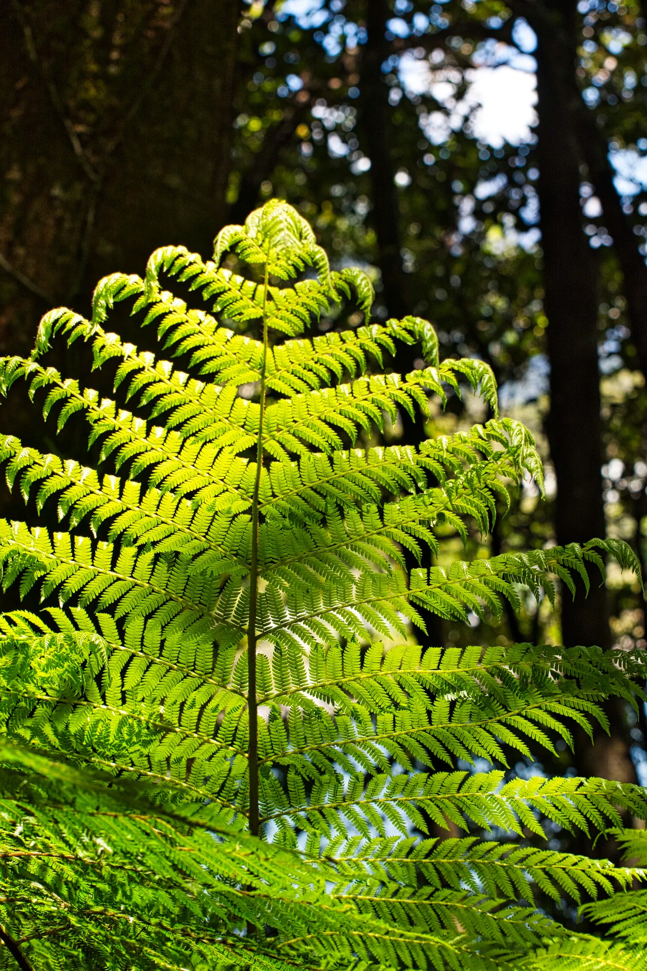
Near the Visitor Centre (VC), we admired the silver ferns, the national plant of NZ. In a 2016 referendum, New Zealanders rejected replacing the Union Jack with a Silver Fern flag.
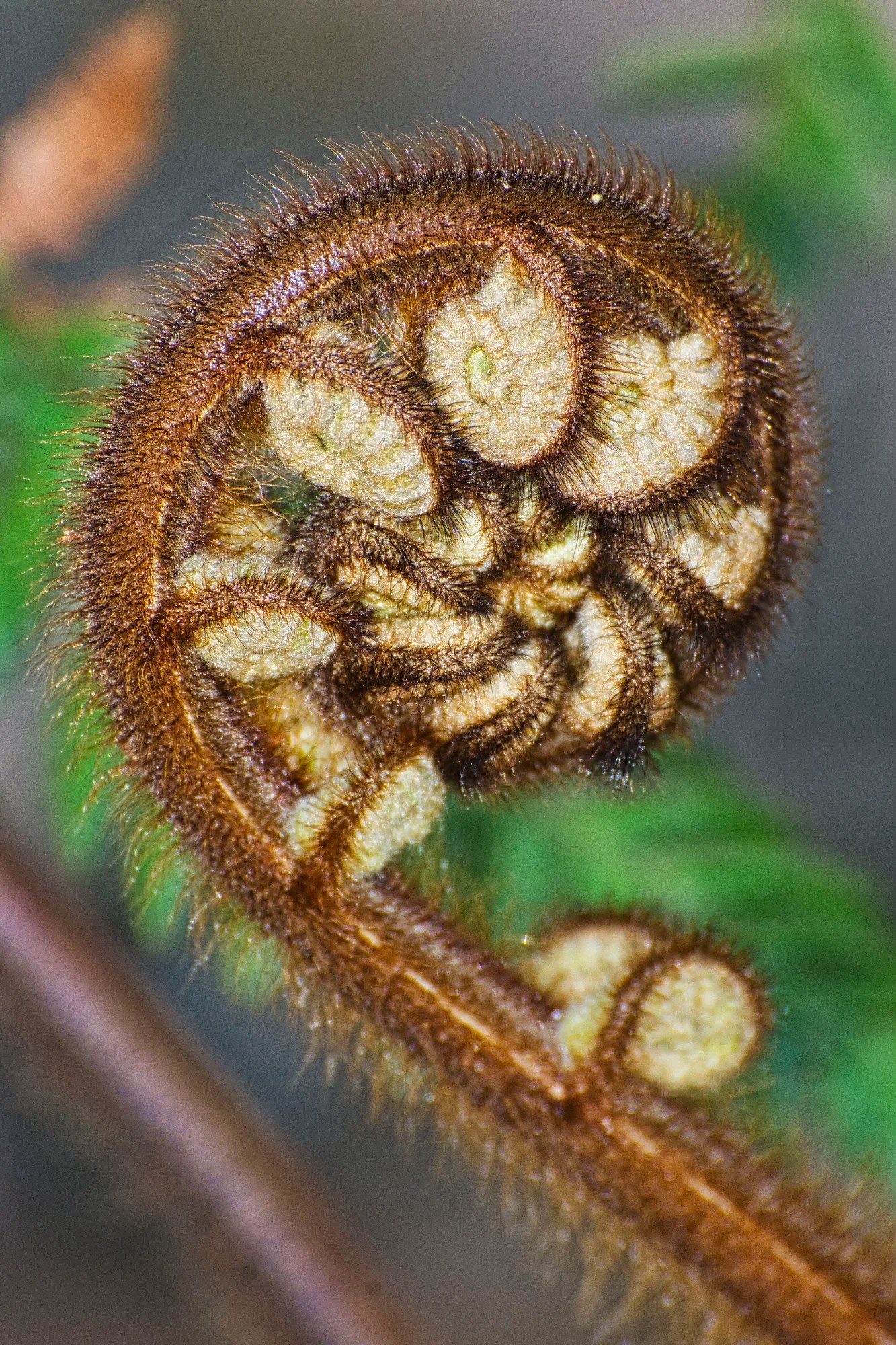
The unfurled fern leaf is a common motif used in Maori art. The koru (spiral) motif depicts new beginnings, growth and harmony. The koru motif is used in Maori sculpture and tattoos. This was a 450 mm shot.
Milford Sound Cruises
It is well worth taking a cruise. Every cruise will do the same loop of the fjord, some go marginally further out to the Tasman Sea but the best views are within the fjord. Complimentary coffee, tea and biscuits are provided on-board. Bring your own tucker.
Bloggers cannot really recommend one cruise over another when they have probably only taken one cruise. I think we used the ratings in Trip Advisor to choose the boat and focused on cost and a smaller boat size. The smaller boat means less crowding and lets you to get up closer to the waterfalls and wildlife.
On our third trip, we booked only at the last minute because the purpose of our son was birding, which came first. It was Christmas time, and we did not have a problem. The following are just representative cruises and sailing times that you can take.
Cruise Milford NZ Small Boutique NZD 149 1:45 hrs
Summer: 5 sailings — 08:45, 09:45, 10:45, 12:45, 14:45
Winter (Jun-Jul): only 3 sailings — 10:45, 12:45, 14:45
May and Aug: 5 sailings — 10:45, 11:45, 12:45, 13:45, 14:45
Milford Sound Cruise and Underwater Observatory
NZD 145 – 179 winter-summer
Summer: 7 sailings — 09:30, 10:30, 11:15, 12:15, 13:15, 14:35, 15:15
Larger boat, but get access to the Milford Underwater Observatory.
Milford Mariner NZD 139
Trips and Tramps includes a bus from Te Anau, NZD 184, leaves at 8:00 and back by 16:00 hrs
Kayaking costs more than the cruises, NZD 169 to 245. But these tours are longer, and some include returning by walking back on the Milford Track.
The cruise boats all seem to go clockwise, which means that the best views are on the left side and the rear, as you can see the mountain backdrop behind the fjord. The cruises depart at different times, so you never feel like there are too many boats together.
Milford Sound Sights From Trails
If you are really strapped for money, there are a couple of trails that you can do — also useful while waiting for your sailing. The one we did was along the tidal flats. Here you can see the massive monoliths that line the fjord. But you can never get the feeling of the fjord.
Another alternative is a 30 minute trail from the Milford Sound wharf to Bowen Falls offering scenic views of Mitre Peak across the fjord.
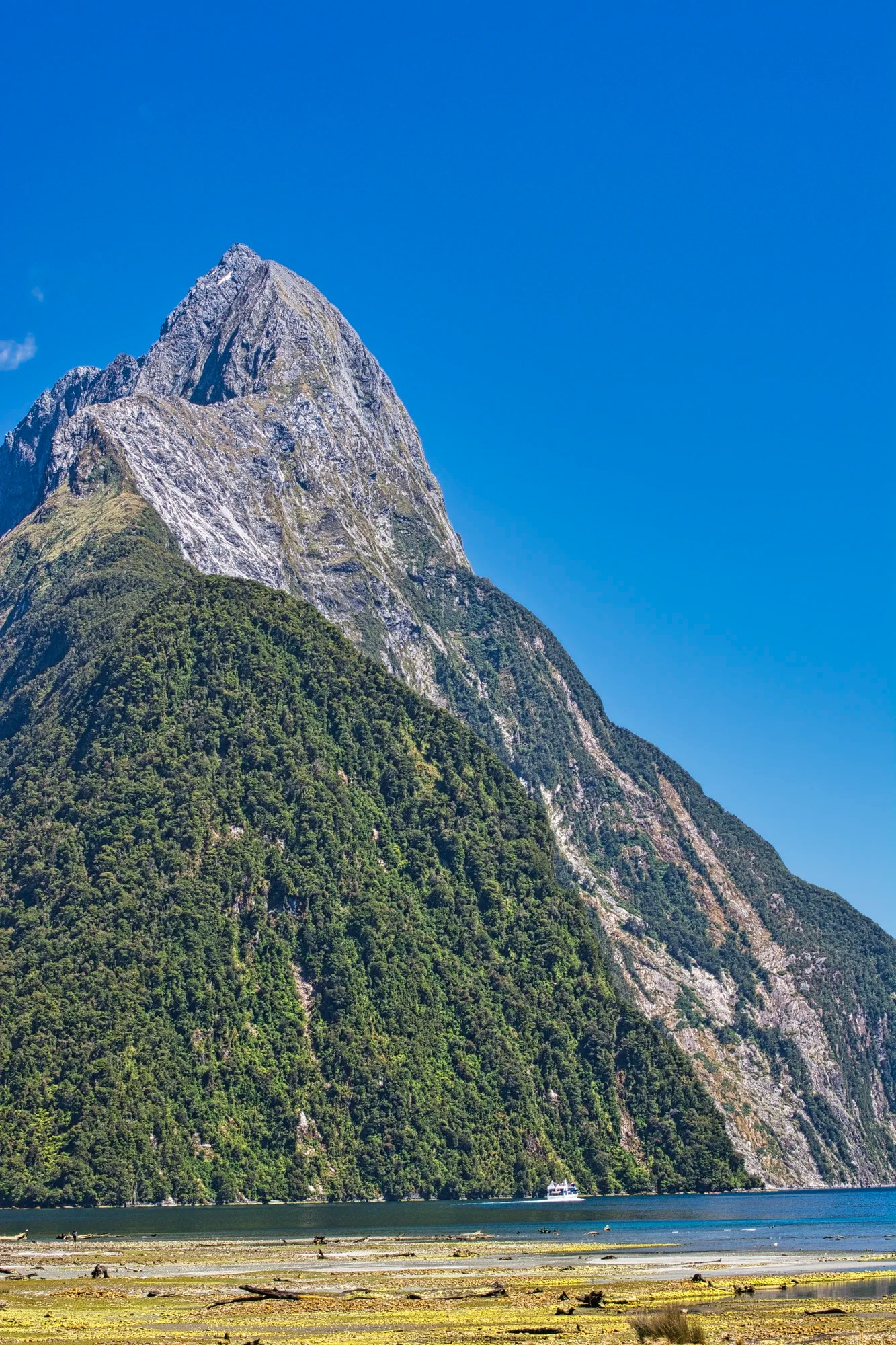
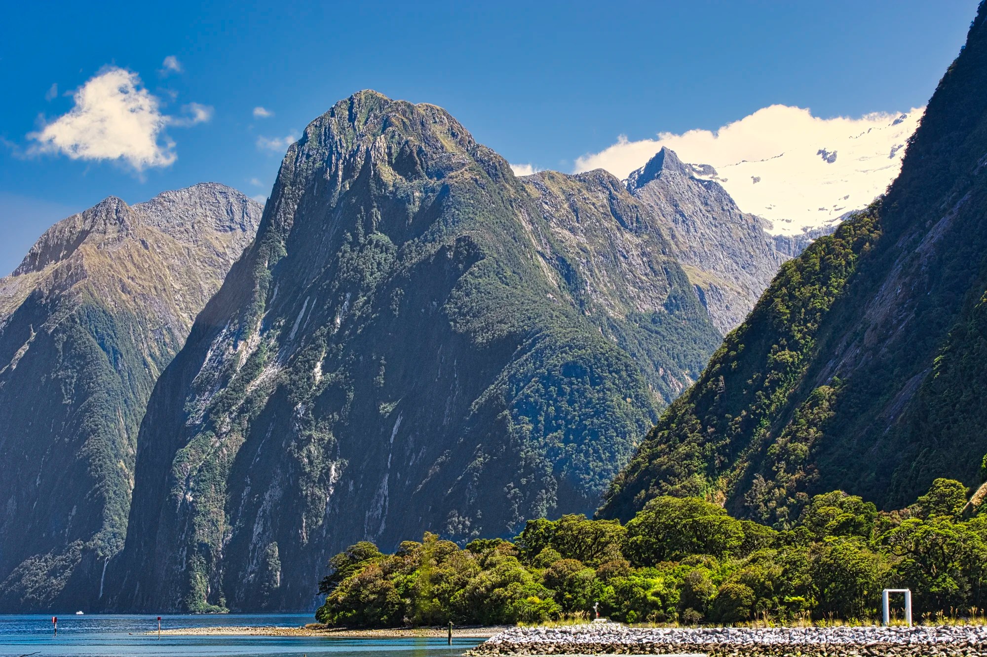
Mitre Peak (G4.9) is the most iconic sight of Milford Sound. It rises 1,692 metres (5,555 feet) above sea level (asl). Its’ name comes from the distinctive shape, which looks like a bishop’s mitre or hat. FYI, the mitre originates from the headdress of the Jewish high priest and the crown of Byzantine emperors.
Milford Sound Sights on Cruise
Here are the top sights in the clockwise order of the cruise.
Mitre Peak
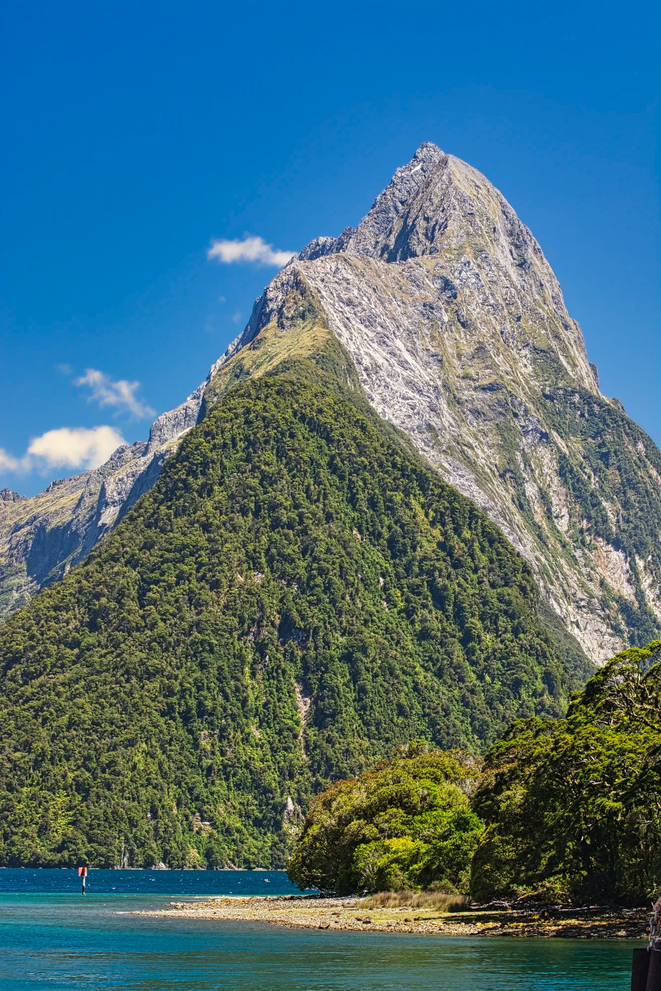
Mitre Peak (G4.9) is the most iconic sight of Milford Sound.
Bowen Falls is named for Lady Bowen, the wife of one of New Zealand’s first governors. This was not a zoom picture: it was taken with a 105 mm lens. We will see these falls again at the end of the trip.

One reason to stand at the stern is to get the panorama shots as you leave.
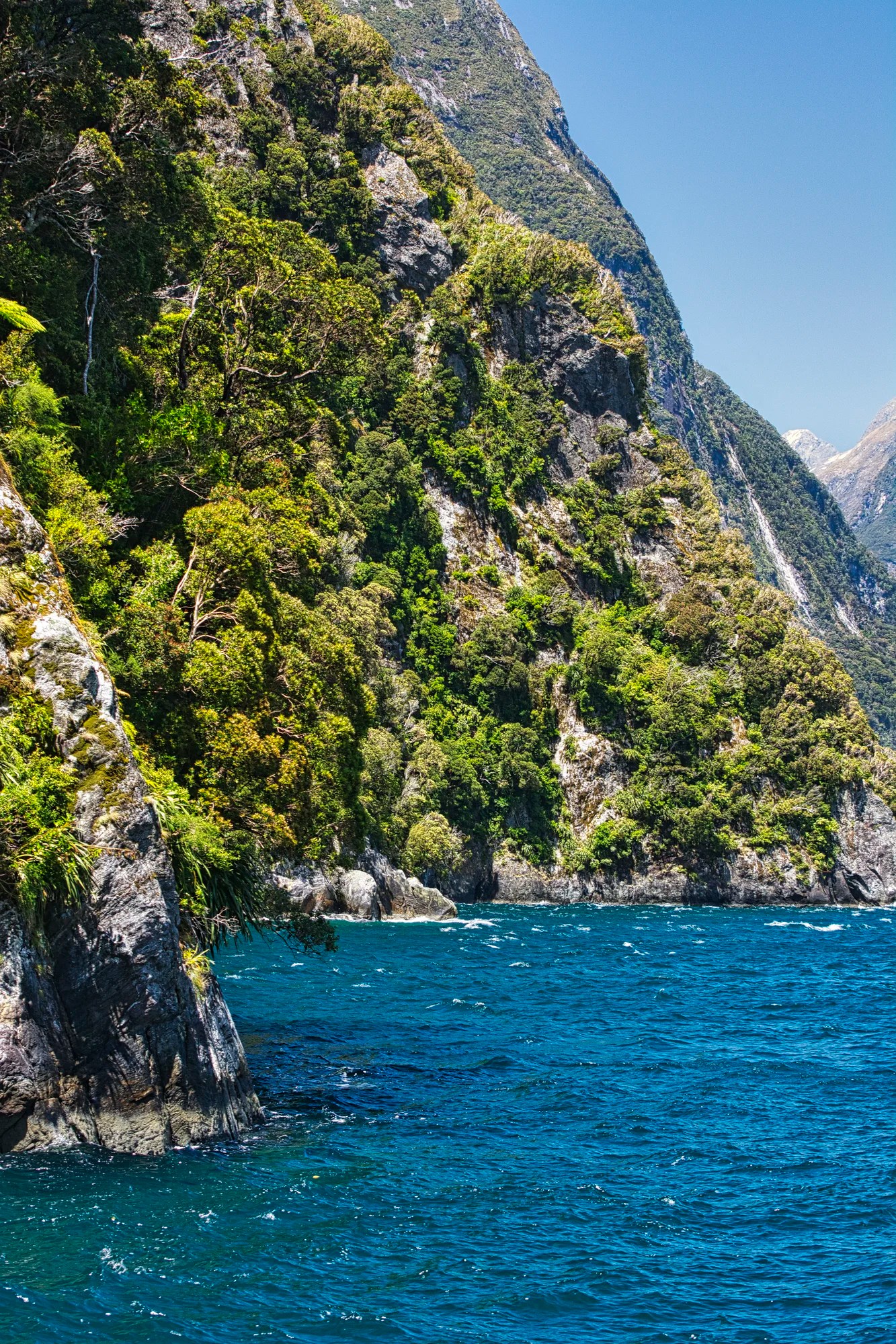
Rock Gardens
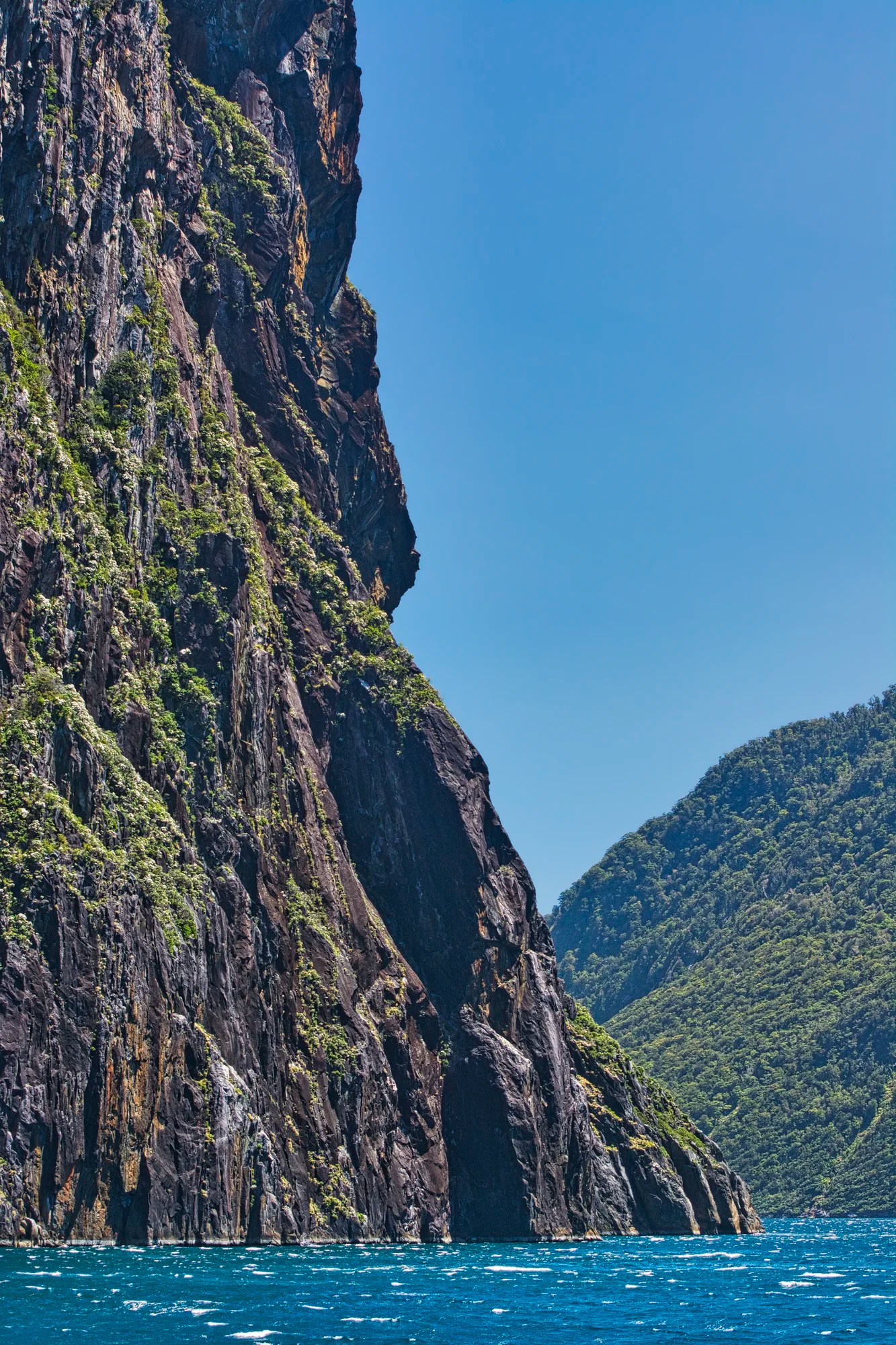
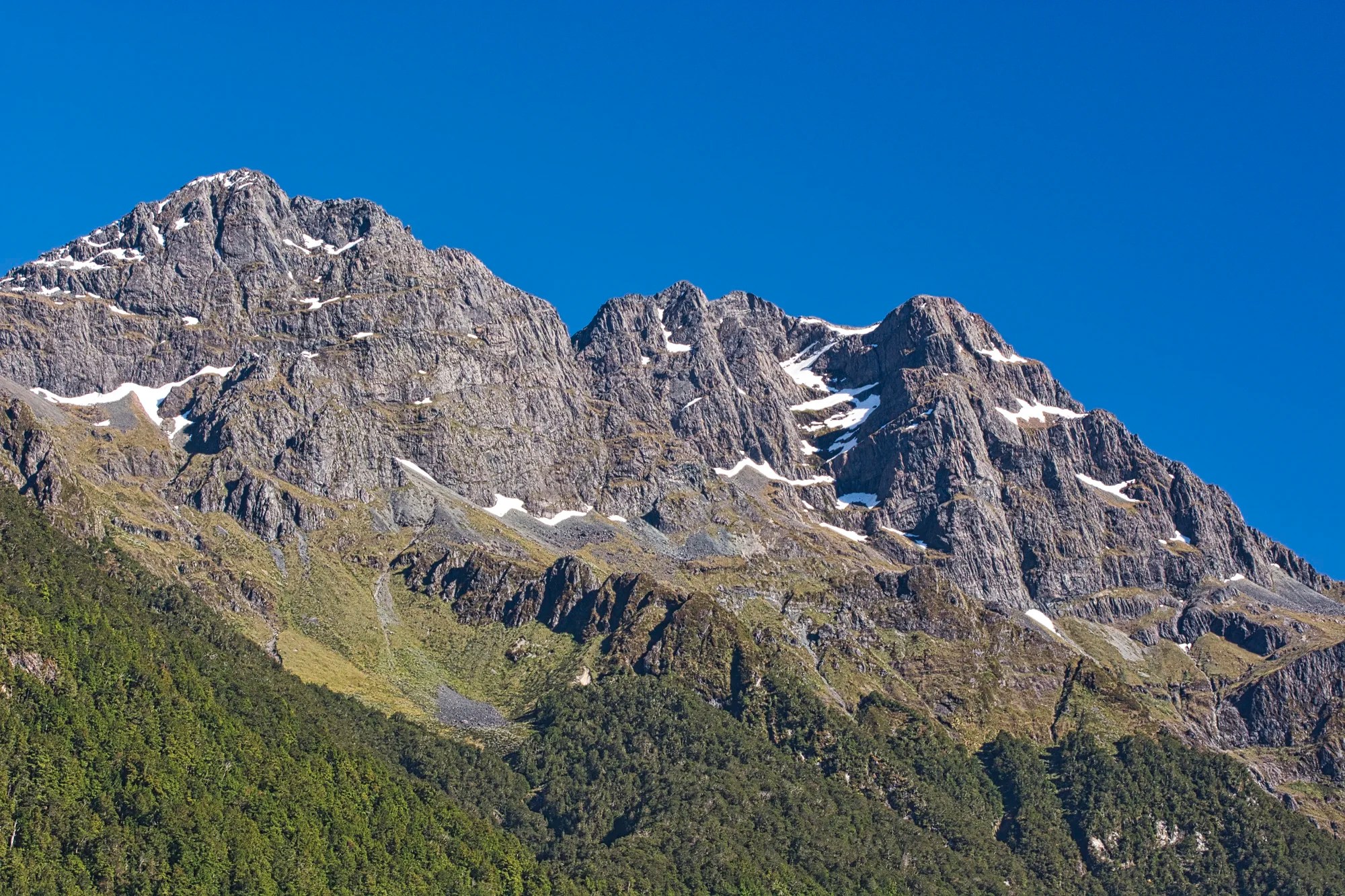
The fjord is 16 km (10 mi) long. Five times glaciers carved through the solid rock mountains, which rise from 1695 m (5560 ft) to 2045 m (6710 ft) asl. These are not high mountains. The impression of great height is due to the sheer rock cliffs that rise straight up 1200 m (3900 ft) and plunge down to 512 m (1680 ft) below sea level! Because the mountains were carved by glaciers, the walls of the fjord plunge vertically.
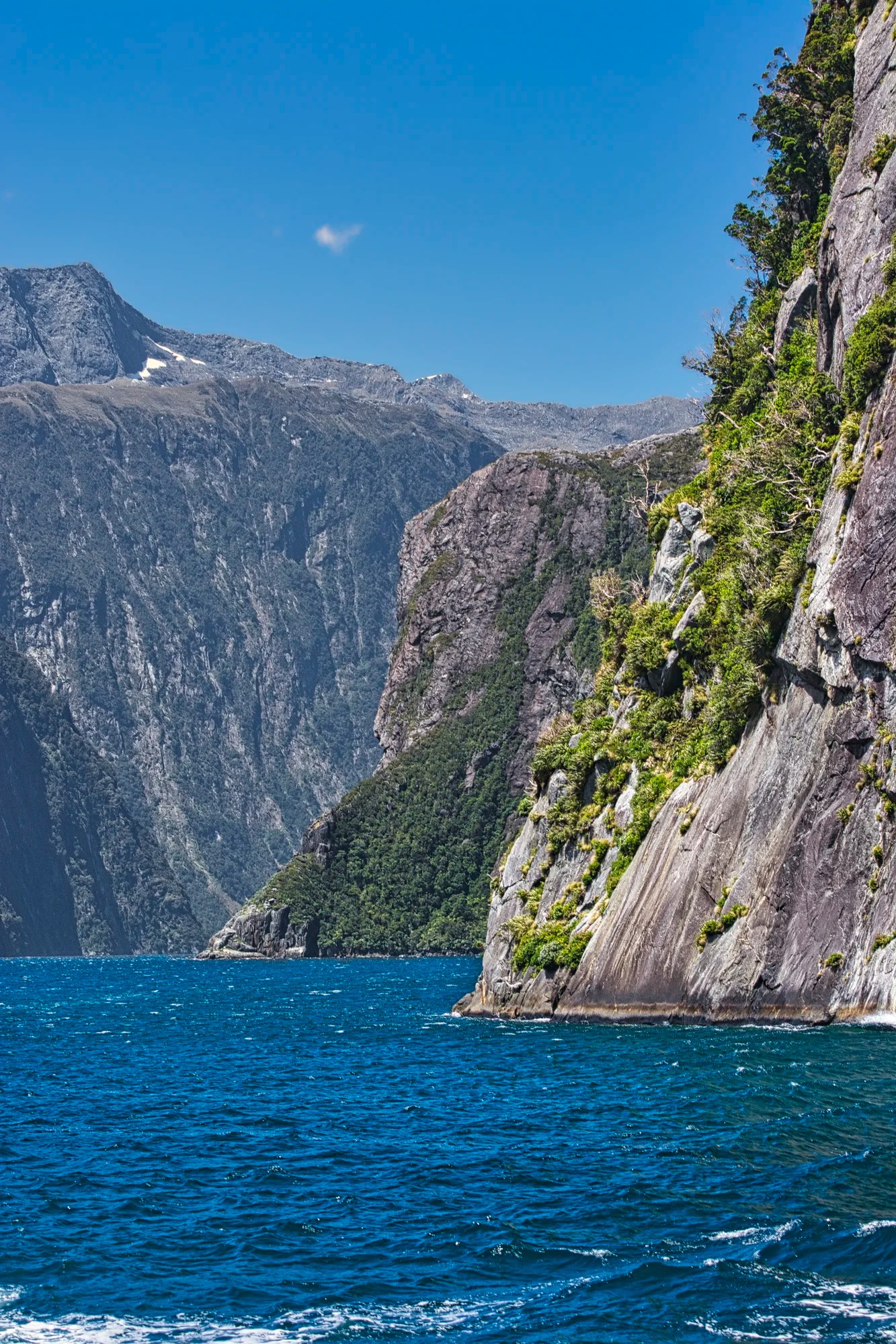
Welcome to the Milford rock gardens! Many trees and plants hang precariously along the cliffs. Think a minute about amazing nature. There is no soil to put down roots on a cliff. The roots intertwine along the surface of the rock wall. Some trees are knocked down by strong windstorms and they still keep growing!
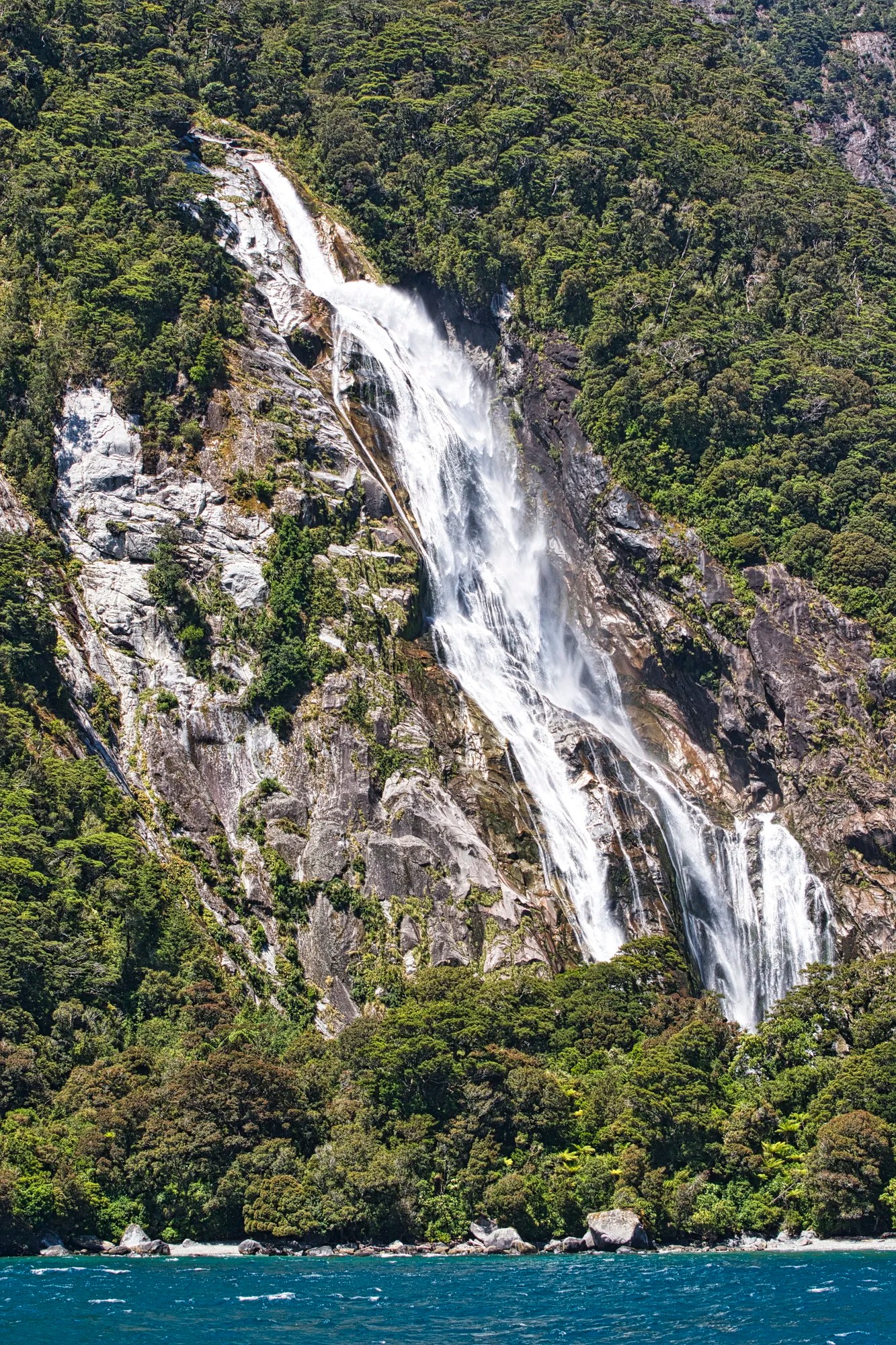
Palisades Falls
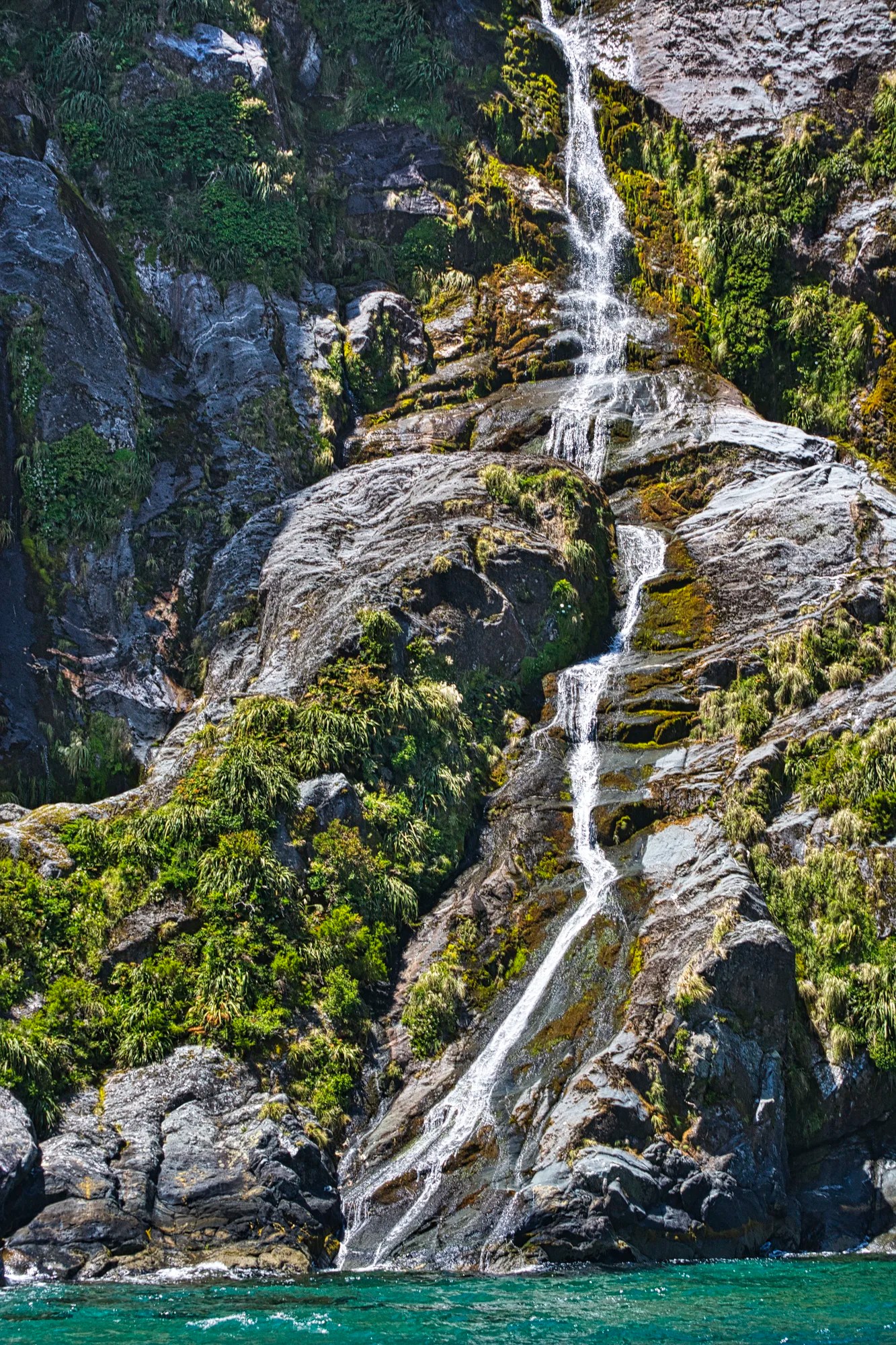
It is assumed that these ribbon falls are coming down from Palisades Mountain. They may not be famous, but to me, they are just as beautiful.
Seal Rock
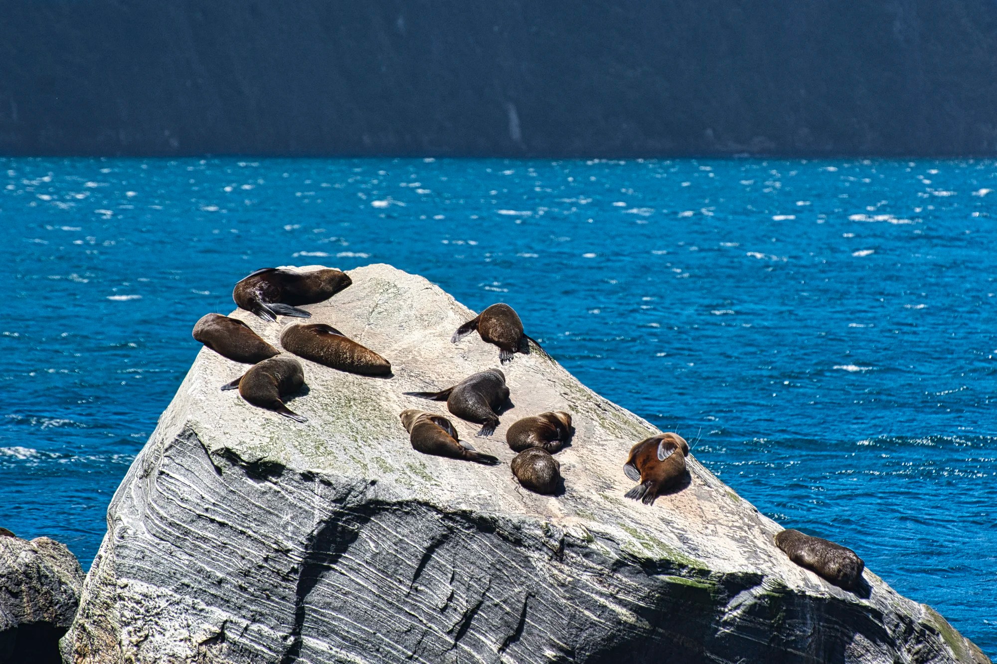
While Milford Sound is regularly visited by wildlife, most of its coastline is made up of sheer vertical cliffs. Seal Rock (G4.8) is one exception, a large rock that fur seals can clamber on to get a suntan – it’s a seal spa!
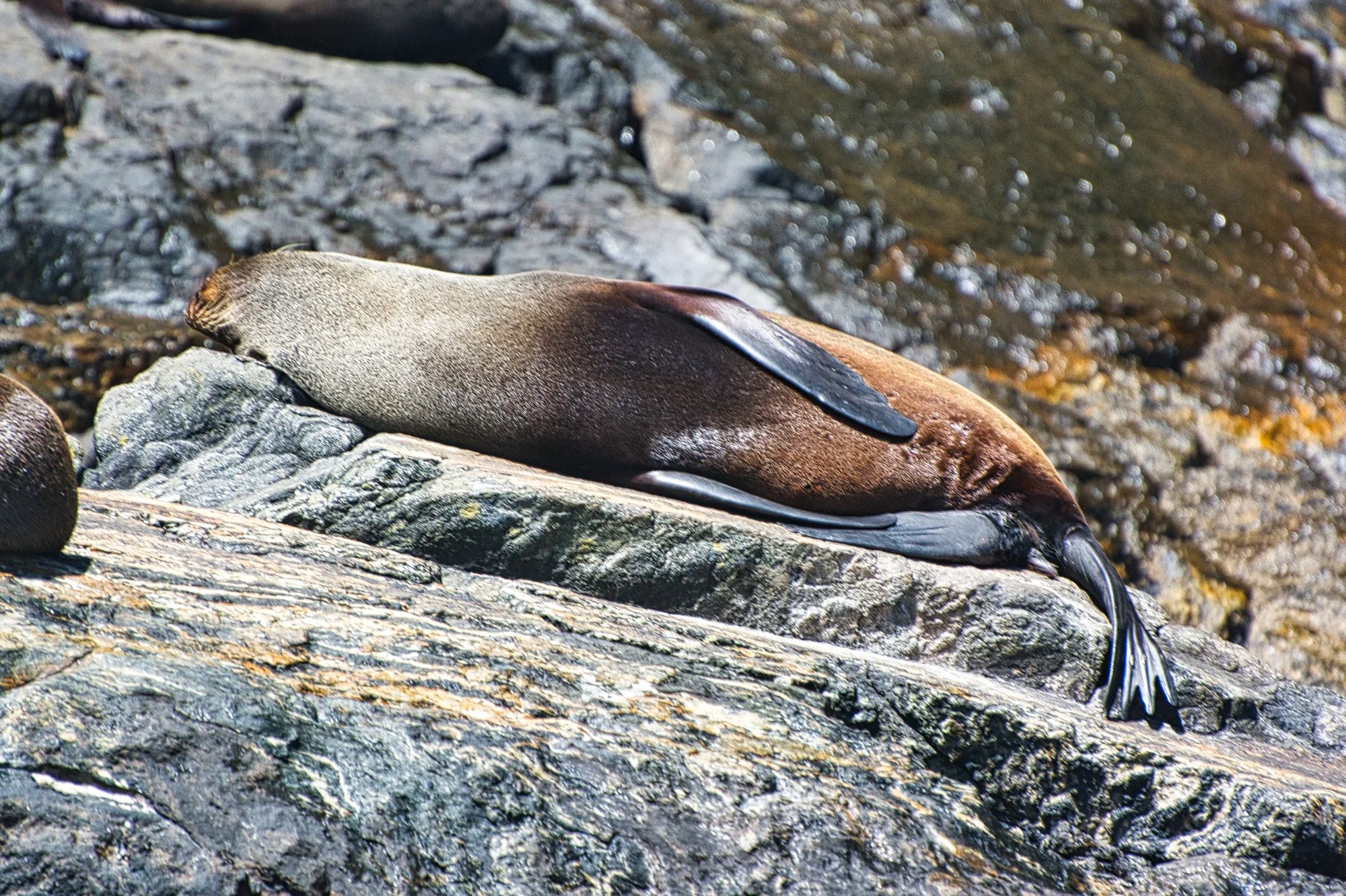
Fur Seals were hunted almost to extinction in the early 1800s when their fur was sought after by the fashion industry. The seals have made a great comeback! You can also see penguins and dolphins in the Sound. This was a 450 mm zoom shot.
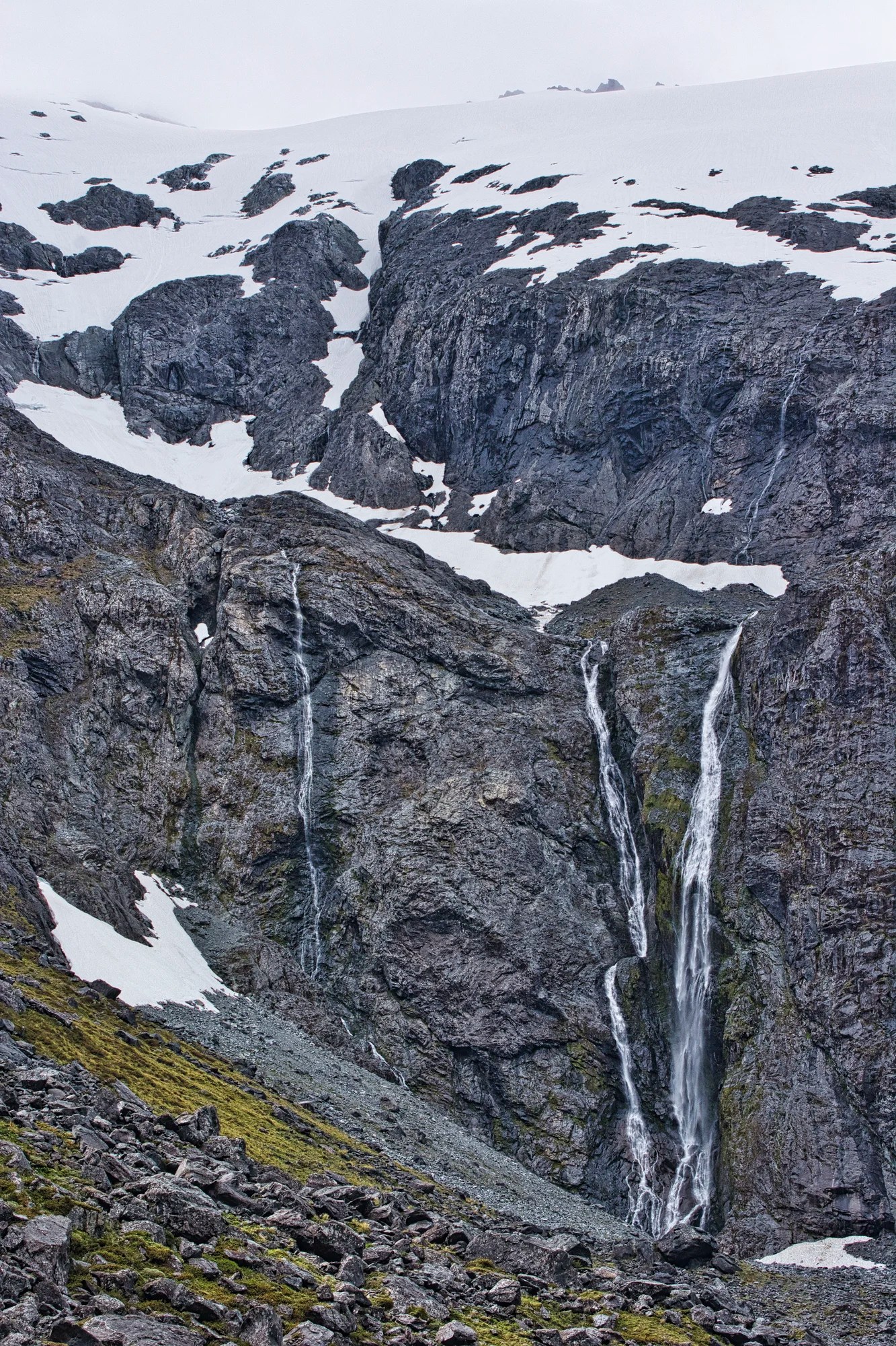
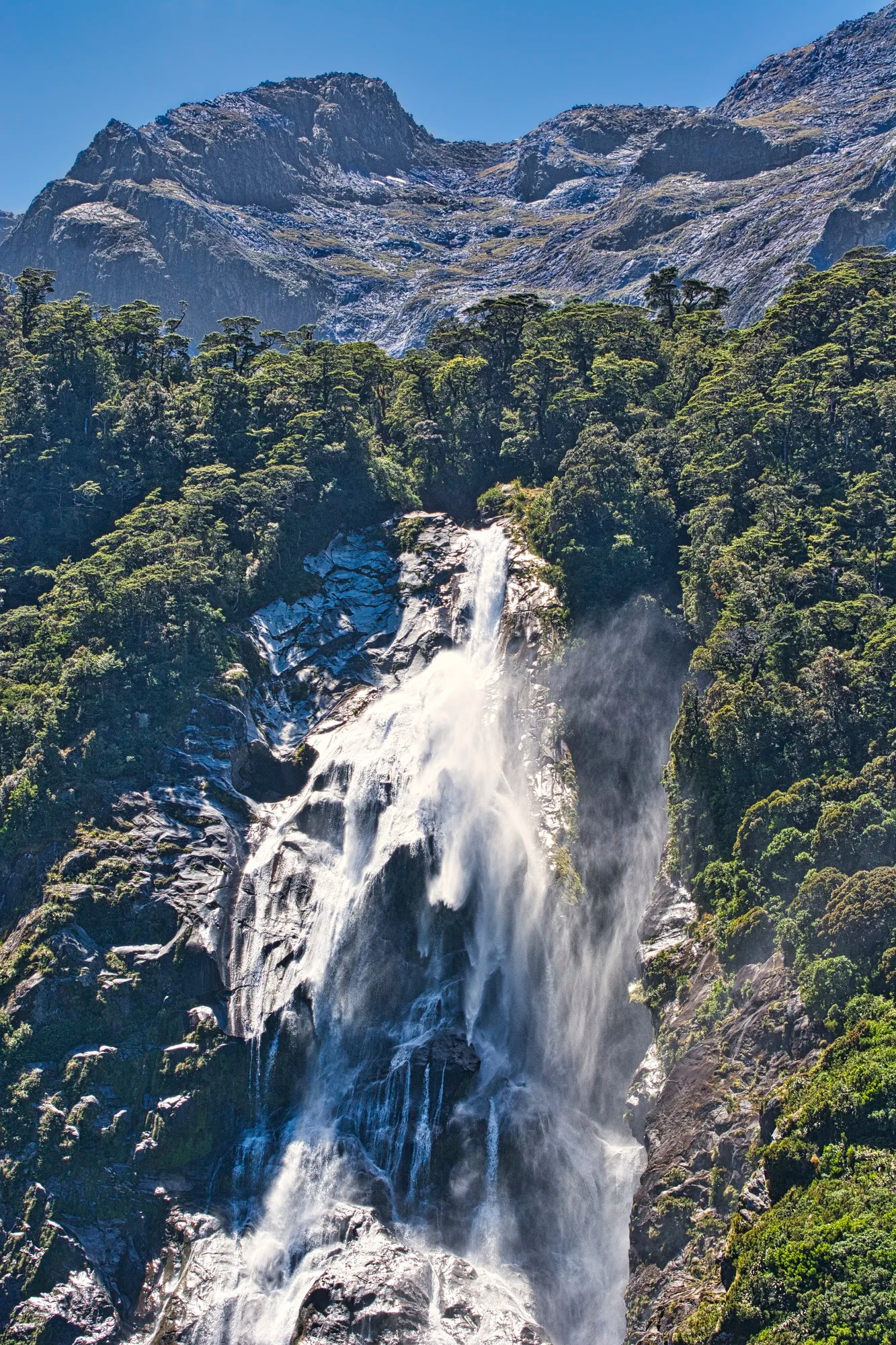
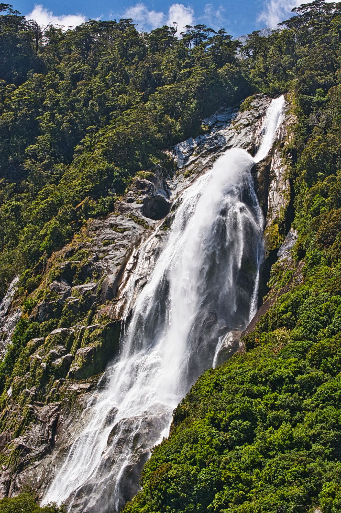
Stirling Falls
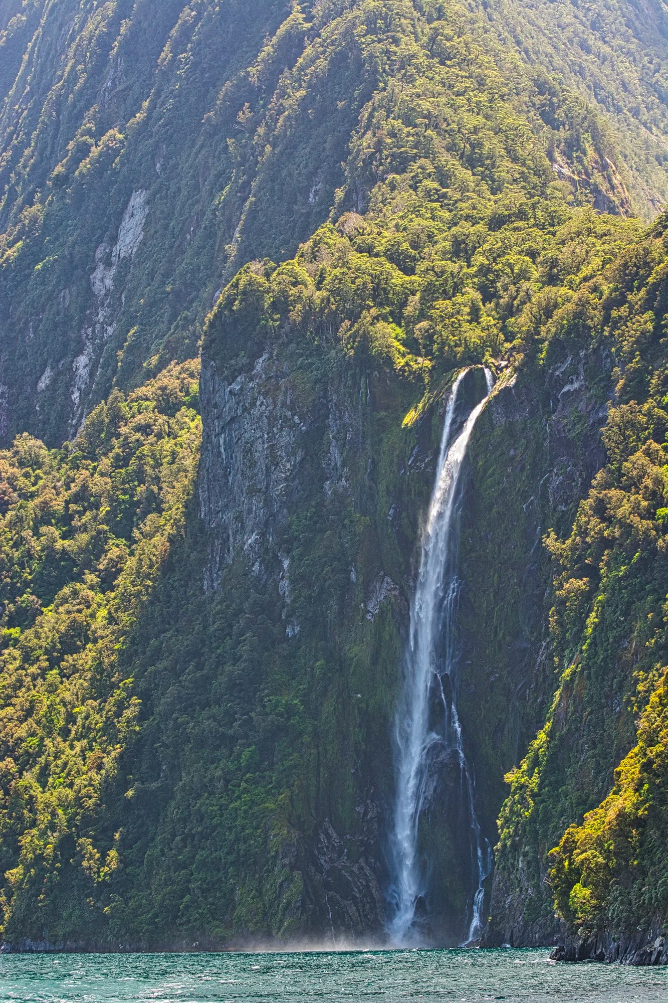
Stirling Falls (G5.0) drops 146 m (479 ft) from a hanging valley between two imposing mountains. It’s fed by glaciers situated in the mountains behind. Stirling Falls is nearly three times the 51 m height of Niagara Falls! We saw rainbows as we sailed back to port.
The waterfall is named after Captain Stirling, who sailed into Milford Sound during the 1870s. He founded and became the first governor of Western Australia.
There are more trees on the rocks. On our last trip to NZ, three young women were already bored with the cruise and stopped watching the scenery. They spent half the trip taking selfies of themselves and just joking around.
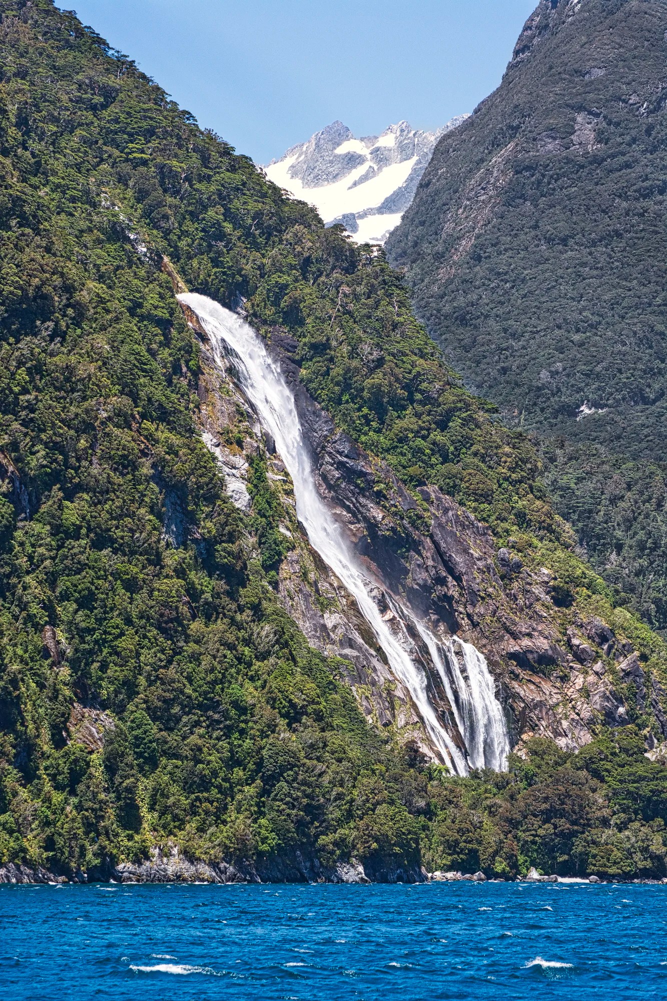
Bowen Falls
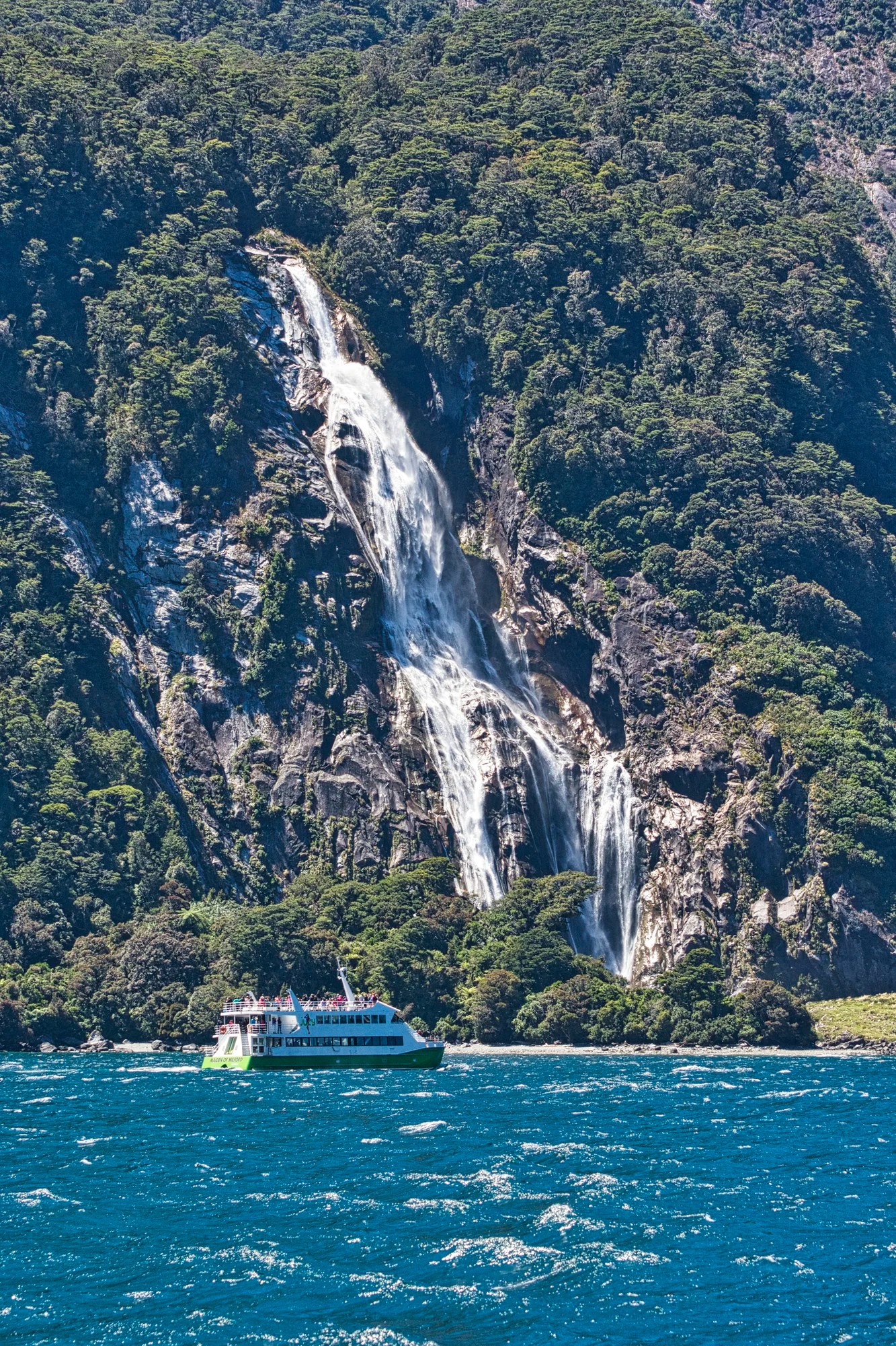
Bowen Falls (G4.7) is the highest falls at 161 m (531 ft).
Bowen Falls pours into a pool about a third of the way down.
The falls then bounce up over the ledge into the fjord.
Final Comments on this Itinerary
This is an action-packed itinerary that draws many visitors to NZ. While it is busy, it is not over-touristed like North American NPs. It is definitely worth visiting and doing one of the cruises. Be sure to go beyond Milford Sound. Many tourists miss out on enjoying the many other points of interest as they travel in Fiordland NP. Don’t be surprised if a large green kea visits you at one of the alpine viewpoints! The places included in the itinerary are all highly rated by the people, as shown by their Google Maps Ratings.
Subscribe
Get travel tips and advice delivered directly to your inbox. The best part is that it is free.
What things fascinate you? How long is your trip? What questions do you have? If you have been here, share your experiences with us.
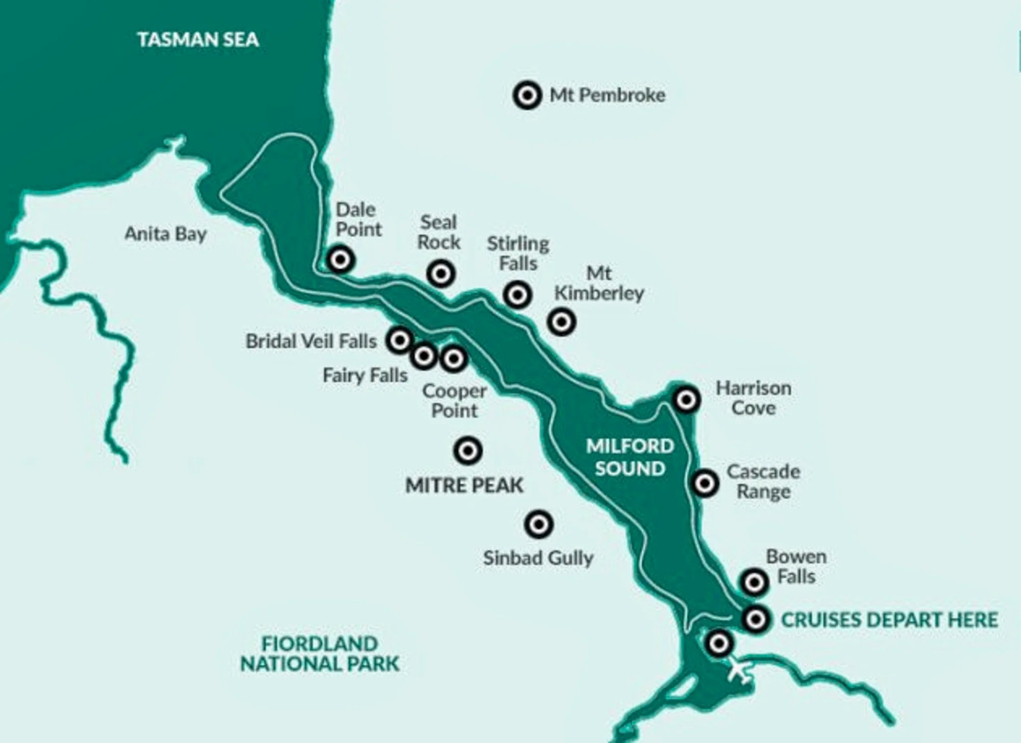
Itinerary Map & Resources
New Zealand Wakatipu-Fiordland Map — our custom map with points of interest
Lonely Planet New Zealand — their website
New Zealand, Lonely Planet — the book, but nowadays most people use the internet
Fiordland National Park, DOC NZ website
Milford Sound Drive Guide, Cruise Milford Sound
Pure New Zealand — NZ Government website
Routeburn Track, DOC NZ pamphlet
Google Maps Ratings
Google Maps provides a rating from 0 to 5 for all sights, hotels, and restaurants (but not cities). All of our recommendations are appended with the rating (prefixed with a G) from Google Maps. Google Ratings are based on feedback from locals as well as tourists. They are much more reliable than travel booking websites or tourist anecdotes. We consider a score of 4 to 4.39 to be Very Good and 4.4 to 5 to be Excellent.
Other Places to Add to Your Itinerary
Here are some beautiful places and posts to help plan your South Island itinerary:
Where to Stay
The key thing to remember is how few people live in South Island. and even less people live in cold Fiordland. You can stay in any place on the Milford Sound Road but Te Anau and Manipuri are the best bets as they are larger towns with more facilities.
If you have a car do not stay in Queenstown, which is 287 km, 3:45 hours one way to Milford Sound! That is way too far away; plus that does not give you time to explore the sights along the Milford Sound road. We avoid Queenstown like a plague. It is overhyped and overcrowded — comes with traffic jams. The bus-cruise tours start at Queenstown and Te Anau.
When is the Best Time to Visit Milford Sound?
Milford Sound is one of the wettest places in the world. From our photos above, you can see how gloriously sunny it was in late December. This was our third trip to NZ!
Here are the average high temperatures and monthly rainfall at Milford Sound by season. There is not much to choose from, as basically it is either cool or cooler. The plus in the winter is that there is less rainfall, but then there may be fewer waterfalls.
| Season | Mean High Temp | Avg Rain per Month |
|---|---|---|
| Dec-Mar | 18.2°C 64.8°F | 582.1 mm 22.9″ |
| Apr-May | 14.0°C 57.2°F | 557.3 mm 21.9″ |
| Jun-Aug | 10.0°C 50.0°F | 415.6 mm 16.4″ |
| Sep-Nov | 14.3°C 57.7°F | 579.3 mm 22.8″ |
New Zealand FAQ
The New Zealand FAQ post answers Frequently Asked Questions (FAQ) such as:
- Where should I go in NZ?
- What is the best season for travel?
- How much time do I need for NZ?
- How safe is NZ?
Abbreviations
Kiwi = New Zealander, or a nocturnal flightless bird
DOC = Department of Conservation = Parks NZ
NP = National Park
NZ= New Zealand; NZD = New Zealand Dollar;
NI = North Island
SI = South Island

Leave a comment