

Why You Must Go on the Yukon Green Road Trip
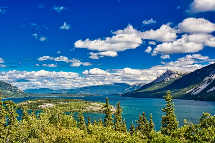
Yukon is the excitement of the Klondike and the new frontier. But today we are heading not for Yukon Gold but Yukon Green. The Whitehorse area features the turquoise green of the Yukon River and Emerald Lake, with verdant forests and even a “desert”. All this wilderness space comes with only 36,000 people.
Imagine a virgin territory larger than California! Don’t believe those maps you are looking at. They distort the size of arctic territories. It takes 4 days non-stop to drive from Ottawa to Banff. That seems to be a long distance across the continent on a map. But it takes 4 days to drive from Banff to Whitehorse in the southern part of the Yukon.
Author & Photographer: George Mitchell

Our recommendations are not influenced by affiliate links – we have none. Our advice is based on extensive experience driving across Canada as well as travelling for three years around the world.
All of our recommendations are top-rated by Google Maps Ratings, which is based on everyone, not just tourists. Each place in our custom Google Maps is appended with a Google Maps Rating (G0 to G5).
Stewart-Cassiar Highway

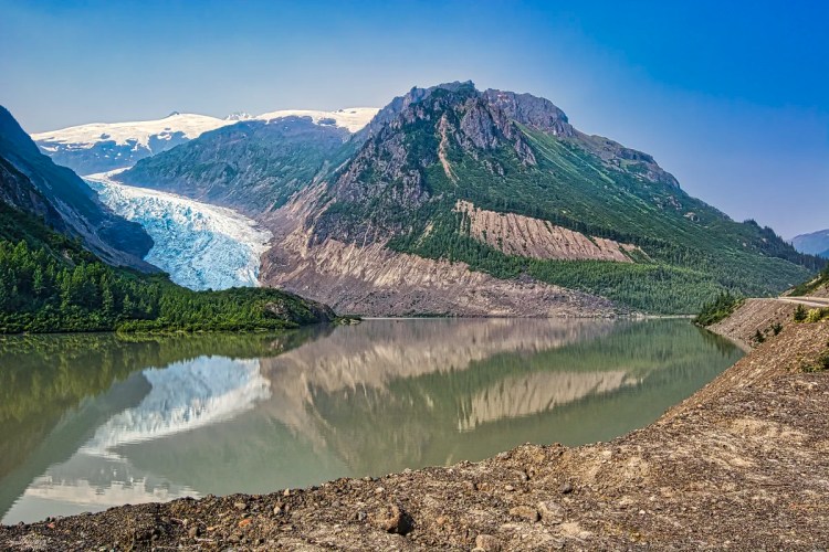
Rather than use the busy Alaska Highway, we drove the very remote, two-lane Stewart-Cassiar Highway 37 described in our post on Explore Wild British Columbia – the Solitary Stewart-Cassiar Highway. The highlight was Bear Glacier right at road level above. Highway 37 ends 725 km later at the Alaska Highway in the Yukon.

Right near the Yukon border, there was one of the few pull-offs on Highway 37 with a gorgeous green lake. But in the background was the result of two huge forest fires of 2010 and 2011. It was 124 square kilometres in size! We asked a local about it and she said that as there was no nearby settlement, they contained it from spreading north and let the fire burn out. They just do not have enough firefighters to combat this massive burn.
There are so few people that there is limited Wi-Fi. We sent an email to request a room in Whitehorse. Then we started driving and could not receive a reply until we reached the Yukon. We were asked to confirm and sent a reply that we were on the way. But as we left the gas station, no signal.
Our first impression of Whitehorse was that there wasn’t much endearing other than it was a quiet city with little traffic. Then we started exploring our surroundings. Our first destination was Yukon Green.
Miles Canyon
Miles Canyon Rd Viewpoint

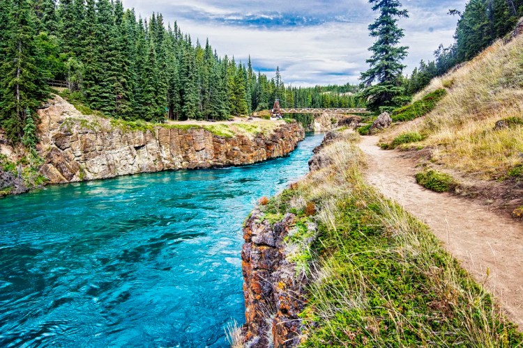
Stop at the viewpoint at the top before the road descends. You are looking at the longest river in both Yukon and Alaska. The Yukon River is 3,190 km (1,980 mi) long and empties into the Bering Sea. It was one of the principal means of transportation during the 1896–1903 Klondike Gold Rush. So why is the river green? It is a glacial river that originates from the Llewellyn Glacier at the southern end of Atlin Lake. Glaciers create rock flour — and it really is as fine as flour. You can feel it at the Athabasca Glacier Interpretive Centre. See itinerary Icefield Parkway – Do not Miss the Best Road Trip in Canada.
Miles Canyon Suspension Bridge

Drive to the parking lot at the bottom of the road. Steep stairs take you to the trailhead on the Grand Canyon. Really? The original name was changed to Miles Canyon in 1883 after General Nelson Miles.
Robert Lowe came to the Yukon in 1899 and had mining interests in the Whitehorse Copper belt and a successful cartage business. Robert Lowe became a long-serving local and territorial politician. The Robert Lowe suspension bridge across Miles Canyon was built in 1922 and dedicated by Governor General Lord Byng. The Lady Byng trophy of NHL hockey is named after his wife, who donated it. These British nobles were avid hockey fans who watched the Ottawa Senators play.
Miles Canyon Trails

Cross the suspension bridge, go right for the short trail shown in the photo above. Then double back past the bridge for a long trail. There is an extensive network of trails in the Miles Canyon area that are used year-round. “Enjoying Whitehorse Trails” is a 28-page guide to the main trail.
Miles Canyon Basalt

Why are there basalt columns here? Did you think this was a volcanic region? This is lava that came from a low volcanic vent 8.5 million years ago. It cooled rapidly due to the Yukon River creating five or six-sided basalt crystals. The vertical faces of the columns are weak, allowing the river to erode the basalt and form a canyon. Basalt is the most common volcanic rock found in Hawaii and Iceland as well as the ocean crust. It is a glassy rock, which makes sense since it primarily consists of silica or sand, the key ingredient of glass. If it has a rusty red colour, that indicates the presence of iron. The orange is lichen.
This area was covered by glaciers 20,000 years ago, which rounded all the mountains around Whitehorse. Magma from deep in the Earth’s crust 112 million years ago brought up rich copper deposits. This copper was mined from 1898 to 1982!
Miles Canyon Gold Rush
During the Gold Rush, the Klondikers worked hard all winter and spring to build flimsy, makeshift boats to carry them down the Yukon. Hundreds of boats loaded with precious supplies were lost, as well as several lives. Sam Steele of Ontario joined the Northwest Mounted Police in 1873. To regulate traffic, Supt. Sam Steele ruled that only qualified pilots could take boats through the canyon. The NWMP became the Royal Canadian Mounted Police (RCMP) in 1919. Later, a horse-drawn tram along log rails eliminated the need to battle the canyon hazard.

The layer of lava reaches up to 110 meters thick. Only the top 10 meters of this layer are currently visible at the bridge. The hydroelectric dam constructed in 1958 to provide power to Whitehorse has tamed Miles Canyon, but a century ago, dangerous rapids surged between the 50-foot-high basaltic walls. Before the dam, the water level was about 10 meters lower, exposing much more of the lava and creating a huge and dangerous eddy.
These rapids and the Miles Canyon provided a significant challenge to gold-seekers heading to the Klondike Gold Rush, and also established the upstream terminus for paddle-wheel river boats.
S.S. Klondike NHS
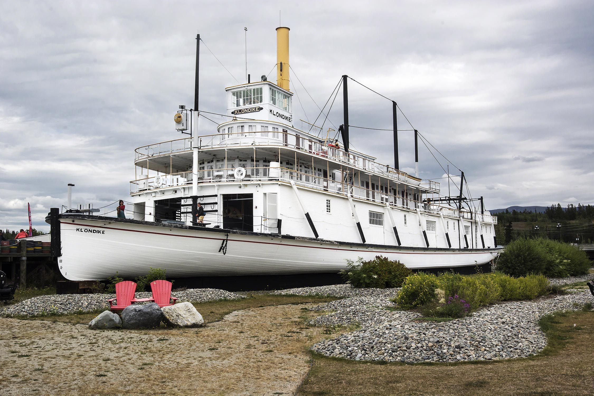
A sternwheeler with a shallow draft plied the Yukon River from 1929 to 1950. Klondike I ran aground in 1936. The Klondike II stopped service when the Alaska Highway became the main transportation route.

Thanks to cans and crates, the Klondike boat transported clothing, shredded wheat, tea, powdered and condensed milk, onions, potatoes, vegetables and fruits to Dawson City.

There was a huge difference between the ornate dining room and table settings of first-class passengers and the simple dining table of second-class passengers. Unfortunately, the first-class area is closed for repairs and can only be seen from afar. It is reminiscent of the Titanic.

In 1966, five tractors dragged the boat through the streets of Whitehorse to its current location. It was restored to its 1940 appearance and designated a National Historic Site (NHS). It took 8 tons of soap to lubricate a steel cradle on wooden skids.
Where to Stay
There were only a few hotels available that were either overpriced or had poor ratings on either Google or TripAdvisor. We thought about staying at the Robert Service Campground or at the Takhini Hot Springs Campground ($20), 30 minutes out of town. Another strategy is to try places outside of downtown, as there is less demand. The B&Bs we wanted to stay at were all booked according to TripAdvisor and Agoda.
We decided to contact these B&Bs directly on a lark. Red Door was highly rated, as was Vangorda and Hidden Valley B&B. The lesson learned from our trip was that you can not trust the hotel websites. They only get a proportion of the room inventory and make it look like the hotel is booked. The hotels said to always call to see if there is something available. In the case of the B&Bs, there can be last-minute cancellations. So we lucked into Vangorda
Vangorda B&B

Vangorda B&B provides a home away from home in a quiet suburb. The breakfast is self-serve in the very attractive dining room. Coffee is made, and fruit and pastries are placed on the table. If the guests are open, breakfast is a good chance to meet people.

Pamela was friendly and we had lots of talks about living and working in Yukon. What an amazing house full of crafts and framed sayings. Each room has its own themed décor.

Instead of grass that needs mowing, there is a very decorative garden full of flowers, furniture and figurines.
Where to Eat
Baked Café + Bakery
Klondike Rib & Salmon G4.5

Antoinette’s G4.3
Real Canadian Superstore
2270 2nd Ave, Whitehorse
Save-On-Foods
43 Chilkoot Way #100, Whitehorse
What to Know
The population of Yukon is 35,874, of which 20.1% are First Nations (FN). Whitehorse has 25,085 people, of whom 13.2% are FN.
Other Posts You May Like
Here are the posts describing our road trip from Northern BC to the Yukon.
Yukon Itineraries
The Yukon (YT), a territory of Canada, is 14% bigger than California and 9% smaller than Spain! All this wilderness space comes with only 36,000 people. Twenty-three percent of the population of the Yukon is Indigenous. They have welcome centres and offer hosts to meet and connect with you.
Northern BC Itineraries
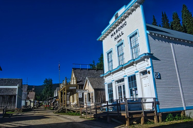
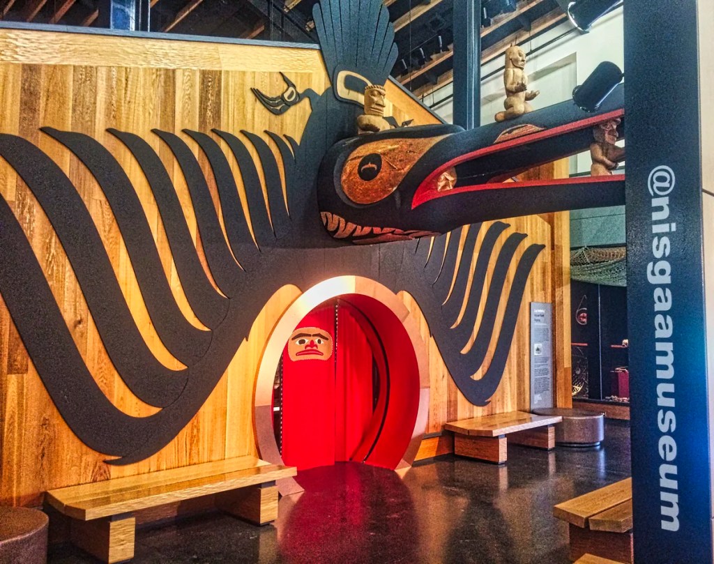
Northern BC is home to 256,977 people in an area 3% bigger than France and 34% bigger than California!! While there are very few residents, the best part is that there are even fewer tourists. Don’t miss Barkerville Historic Park (G4.7), Fort St. James National Historic Site (G4.7), Bear Glacier (G4.8) and the Nisga’a Museum (G4.7).

13 thoughts on “Yukon Green”