
Why You Should Do the Jasper & Mt Robson Drive
For snowy sierras, gorgeous glaciers, exciting hiking trails, and spectacular turquoise lakes, it is hard to beat the Jasper to Mt Robson itinerary. Jasper National Park (NP) and Mt Robson Provincial Park (PP) are a lot quieter than Banff NP. Even the town of Jasper is much more laid back than Banff.
Author & Photographer: George Mitchell

Our advice below is not based on a couple of tourist trips. Our recommendations are based on our extensive experience living in Alberta (AB). We are avid hikers, nature lovers and photographers (all photos are my own). The Rocky Mountains were our weekend playground. We often hosted out-of-province friends and family using the itineraries we are recommending.
All of our recommendations are top-rated by Google Maps Ratings, which is based on everyone, not just tourists. Each place in our custom Rocky Mountain Itinerary Map is appended with a Google Maps Rating (G0 to G5).
Should I See Banff or Jasper NP?
One recurrent question is “Should I visit Banff or Jasper NP?” Too many tourists think Banff town and Lake Louise are the ultimate destinations of the Rockies. They are not! Banff NP has more than 4.5 million visitors per year, about the same as overcrowded Yosemite NP.
By contrast, Jasper NP has approximately 2.5 million visitors per year, a bit less than Yellowstone NP. Jasper NP gives you a chance to enjoy equally spectacular mountains and views as Banff without the hordes of tourists.
Best Places to See in Jasper-Robson
The special aspects of the Canadian Rockies are the glittering glaciers, vibrant turquoise lakes, wicked waterfalls, and superb hiking trails. These are the key features of the Quintessential Canadian Rockies.
Our advice is not based on a single tourist trip. Our recommendations are based on our extensive experience living in Alberta for ten years. We are avid hikers, nature lovers and photographers (all photos are my own). The Rocky Mountains were our weekend playground as well as vacation destination.
Since most tourists are on a short visit, we are highlighting only our favourite hikes and viewpoints. We have pinned additional places on our custom Rocky Mountain Itinerary Map, should you have more time. More advice on itinerary planning can be found at the end of this post.
Highways 93 and 93A
This section is a direct continuation of the Icefield Parkway Itinerary. The first stop is located at the junction of the Icefield Parkway (Highway 93) and Highway 93A, 32 km before of the town of Jasper.
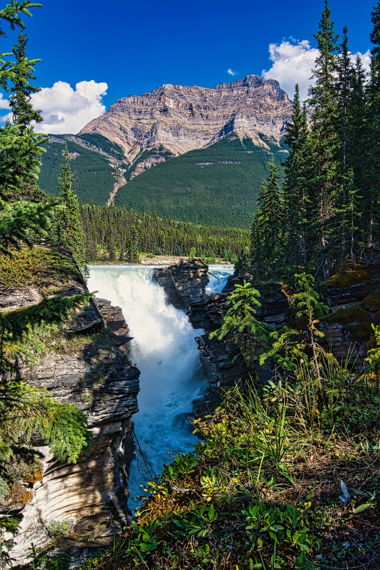
Athabasca Falls

The Athabasca Falls are a spectacular and popular place. Due to tourist deaths in the past, all the pathways are railed or fenced. The downside is that there are narrow congestion points.
As with any popular tourist destination, you should avoid visiting between from about 10:30 to 15:30 hours during peak season. The parking lot can also be very busy. Spring and early summer days are very long in Alberta. Sunset is as late as 22:00 hrs! One year, when my in-laws came to visit us in the Rockies, we did a morning and afternoon hike. Then we said do want you to do an evening hike? They said yes.
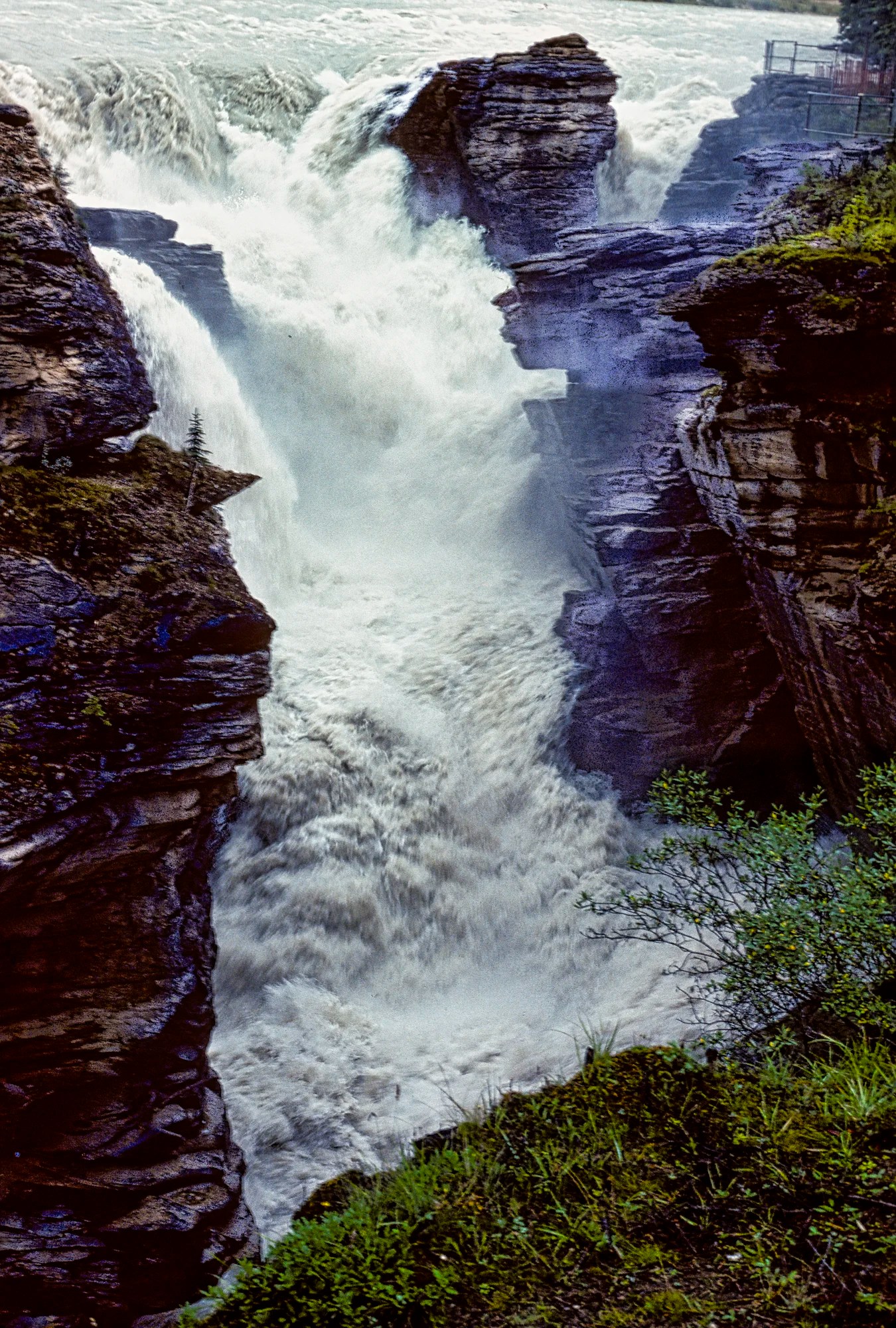
Athabasca Falls is one of the more dramatic waterfalls in the Rockies. You can feel the power of the water being forced through a narrow gap.
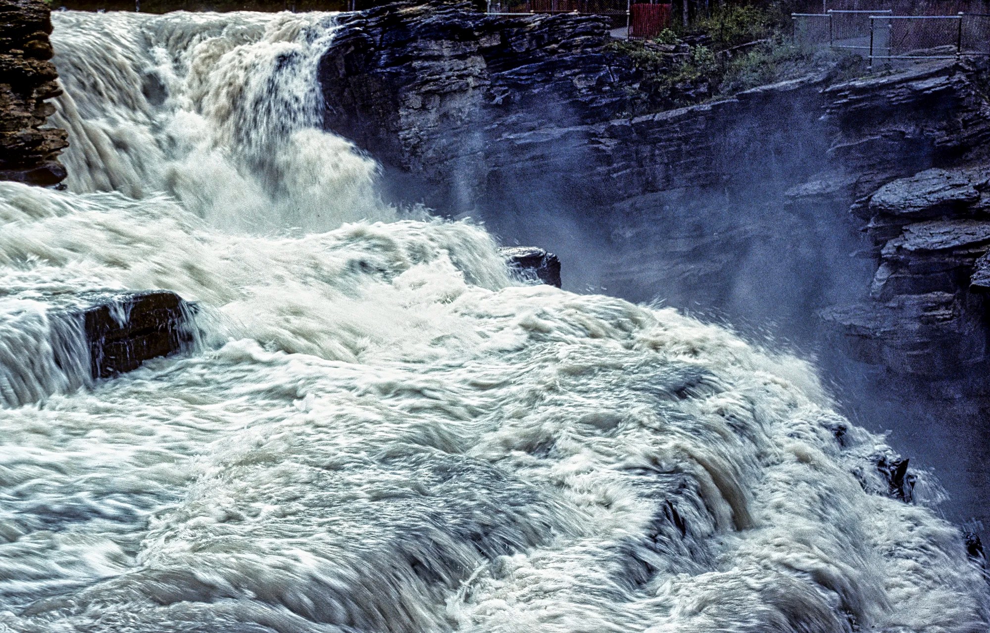
Millennia ago, the then much longer Athabasca Glacier carved through layers of softer limestone. Now, a very wide river has to squeeze through a narrow gap.
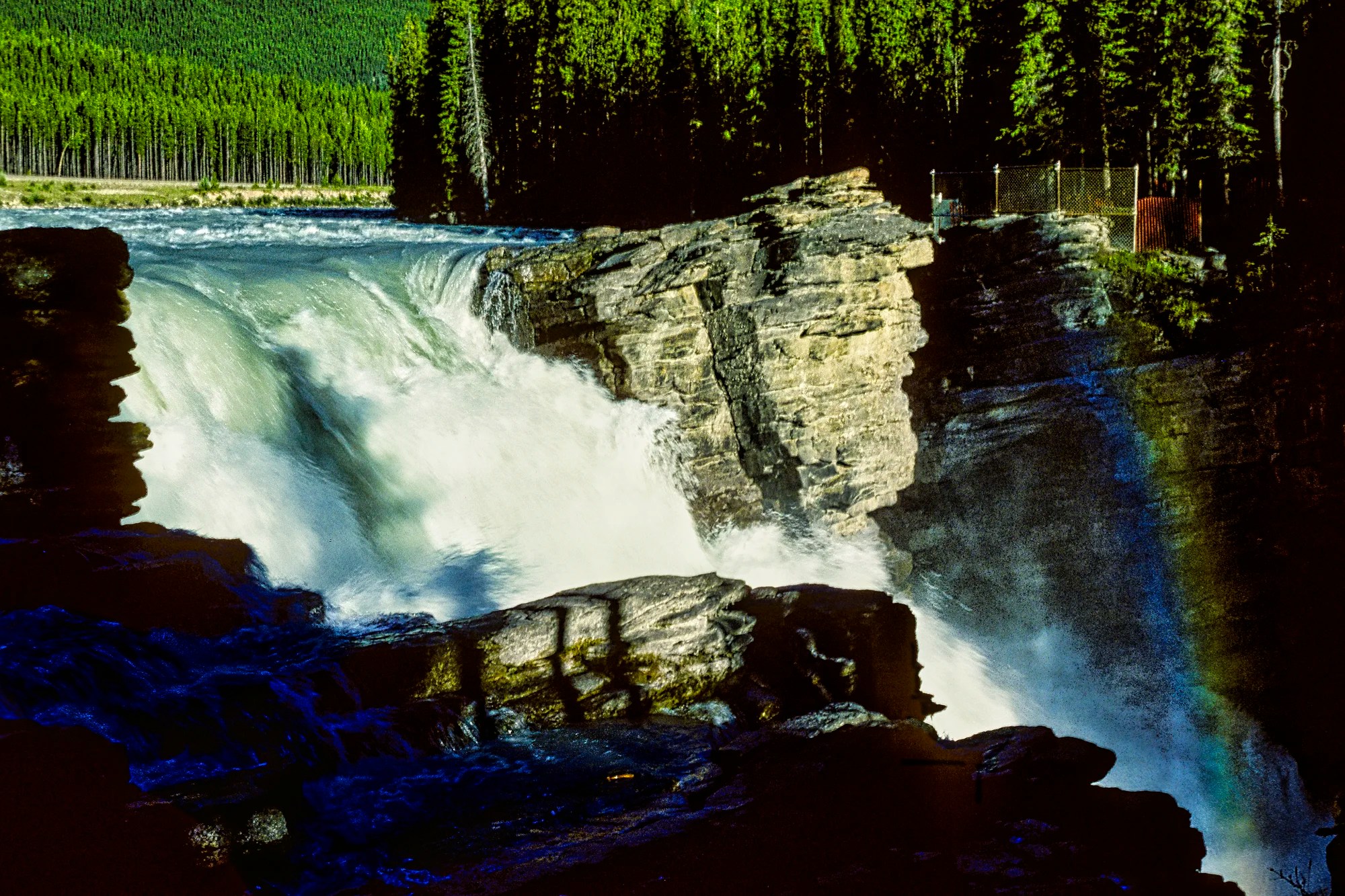
The roaring water comes from the meltwater of the Columbia Icefields. The 1231 km Athabasca River heads north through the Fort McMurray tar sands (heavy oil). It joins the Peace and Mackenzie Rivers to eventually reach the Arctic Ocean.
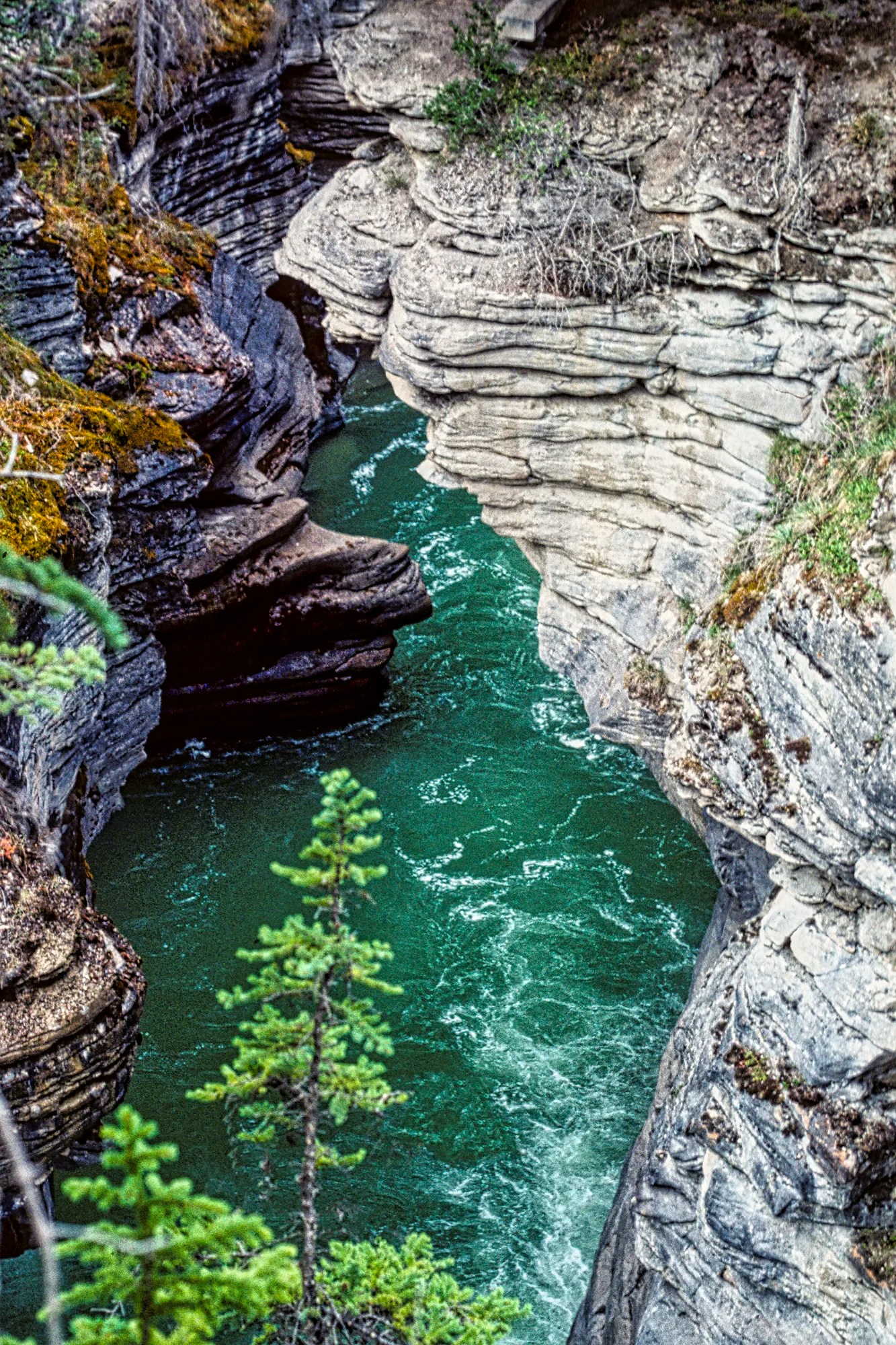
There is a path to the right that leads along the exit canyon carved through the limestone strata. The silt in the glacial green river carved potholes, creating the curved walls of the canyon.
One year, we brought my father-in-law on this walk. He was so concerned by the erosion around the decaying Highway 93A bridge over the canyon. He wrote a letter right away to draw attention to the problem. He was a chief engineer. I don’t know if the letter had any effect, but within two years the bridge was completely rebuilt.
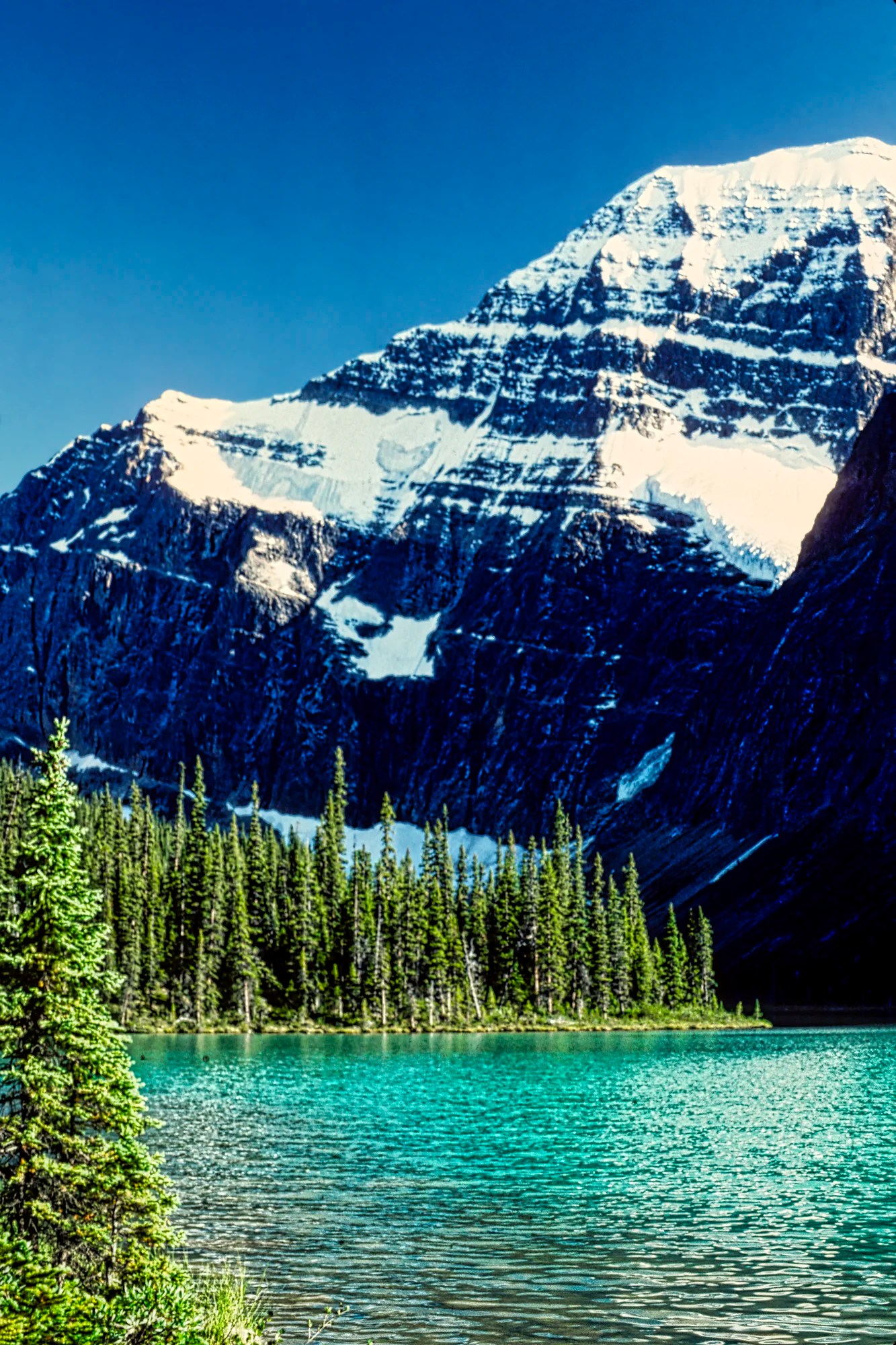
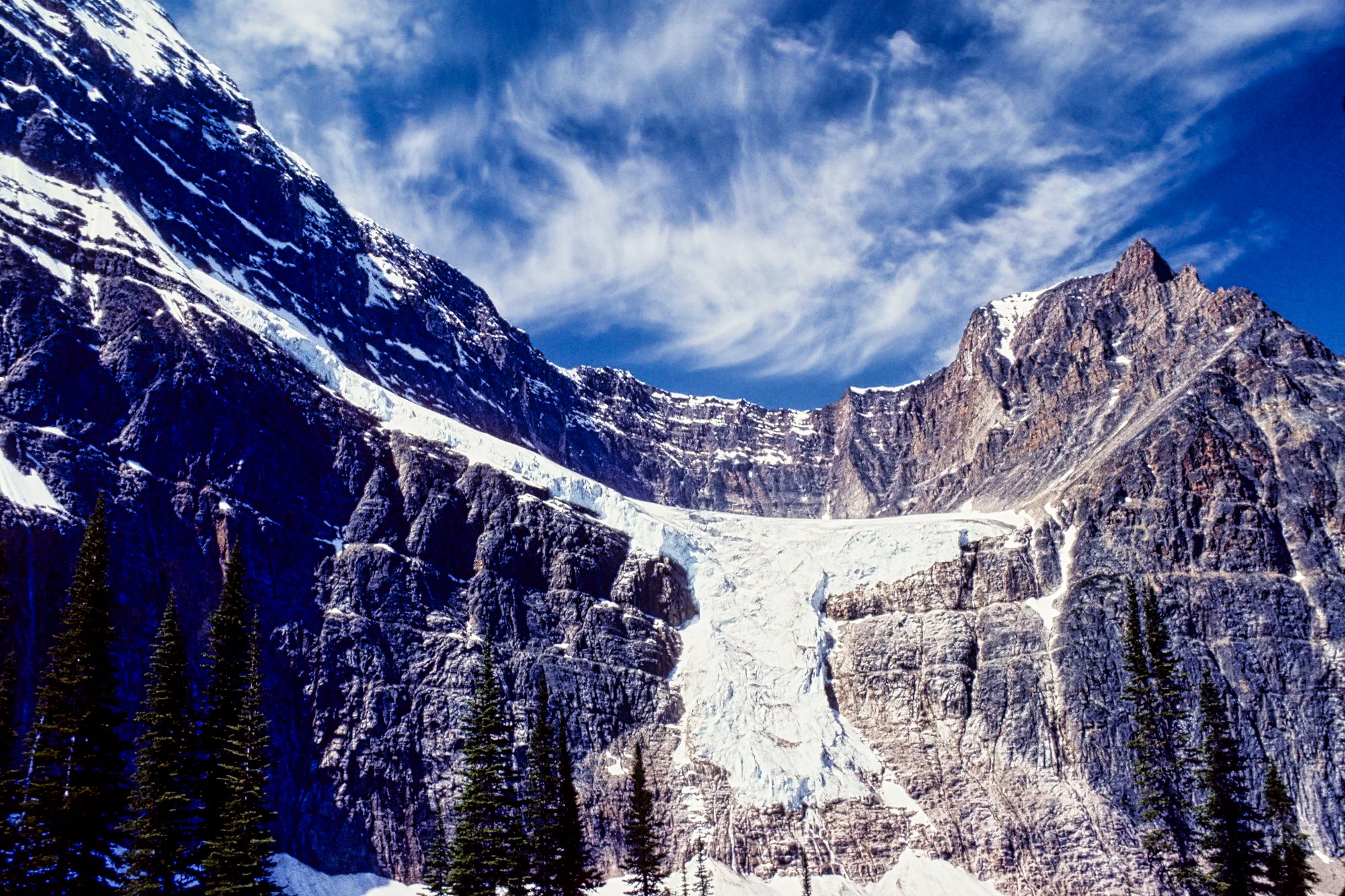
Mt. Edith Cavell
This panorama of Mt Edith Cavell is one of my favourite views in all of the national parks. It also comes with a gorgeous glacial green Cavell Lake. Most people do not see this lake as you have to hike part of the Tonquin Valley Trail.
N.B.: Cavell Road is a 14 km (8.7 mile) narrow road that does not allow trailers or motor homes. It is only open seasonally, typically mid-June to the end of October. This depends on snow so in 2023 the road opened on June 23. Check with Parks Canada web site given in the Reading Section below.
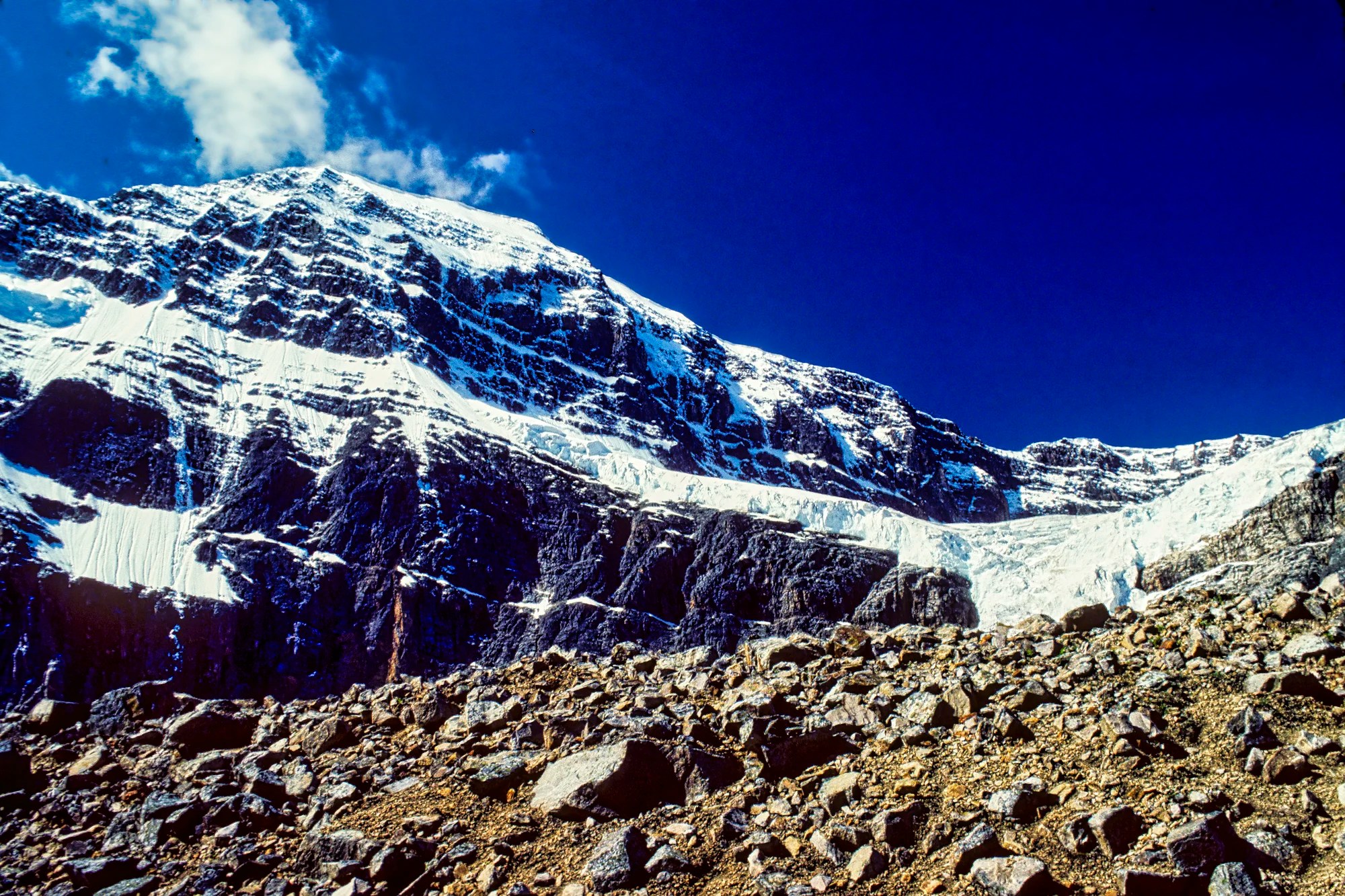
This is the view most tourists get of the mountain. What’s more intriguing is its name. The Indigenous people called it “White Ghost”. The fur trade voyageurs called it Montagne de la Grande Traverse, a landmark to the Athabasca Pass. Now the mountain is named Edith Cavell. She was a 49-year-old English nurse who worked in German-occupied Belgium. She gave assistance to soldiers of all nations during World War I. She was executed by the Germans during World War I (1916) for “treason” (even though she was not German). She admitted that she helped Allied soldiers escape from occupied Belgium to the Netherlands. Edith Cavell became the best-known casualty of World War I due to a British propaganda campaign. There was such a furor that many monuments and remembrances were made around the world. Canada named a mountain after her.
Angel Glacier Hikes
Mt Edith Cavell also comes with her own guardian angel, Angel Glacier.
Path of the Glacier Trail (map)
1.6 km 1 hr RT; gain 70 m: paved
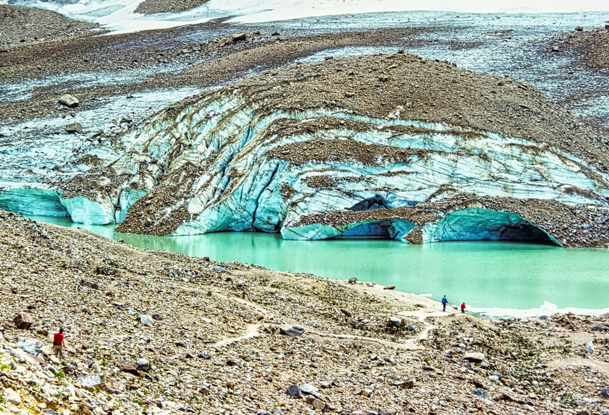
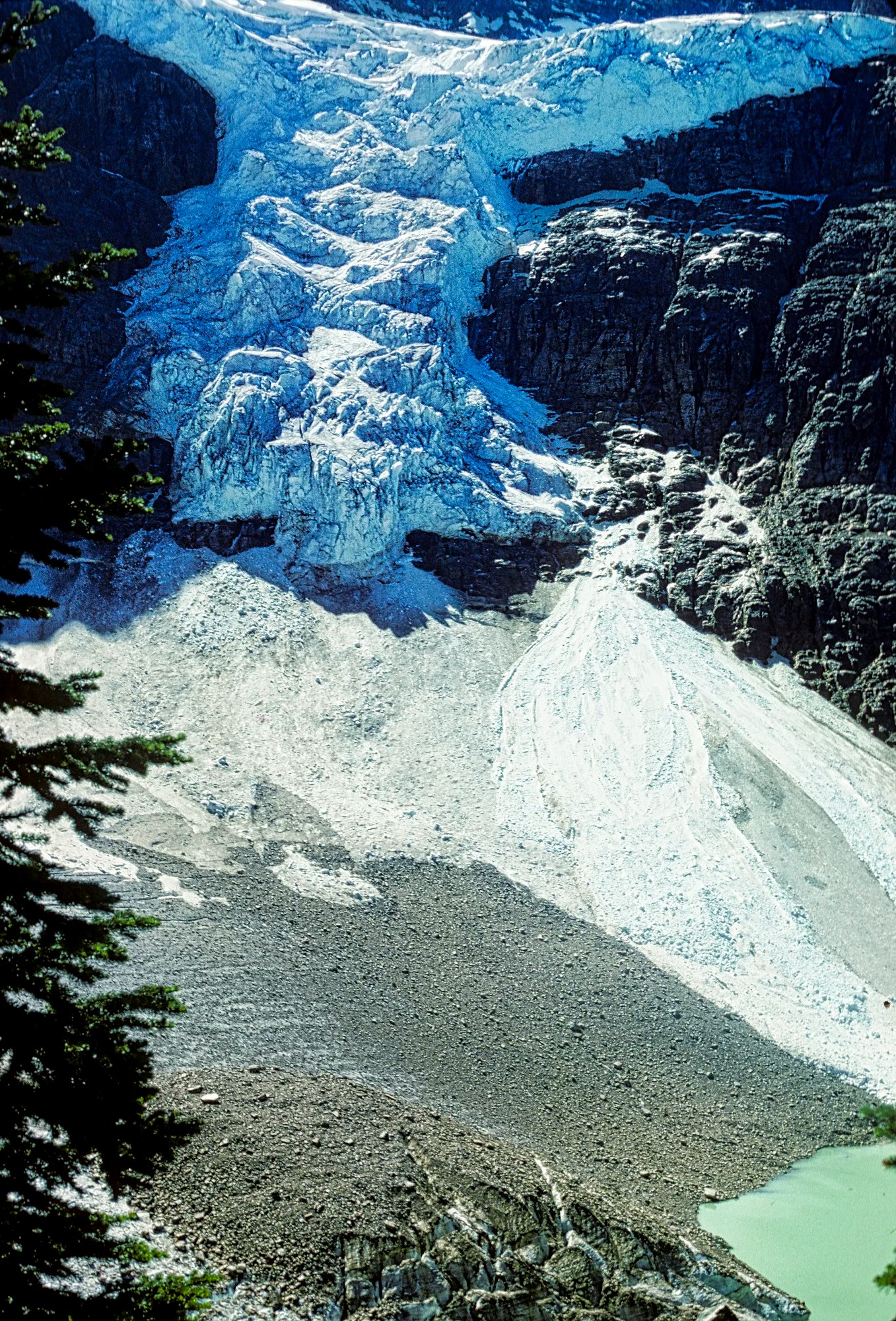
The Path of the Glacier Trail goes to a mint green glacial pond at the foot of Cavell Glacier. High above, Angel Glacier looks down upon us.
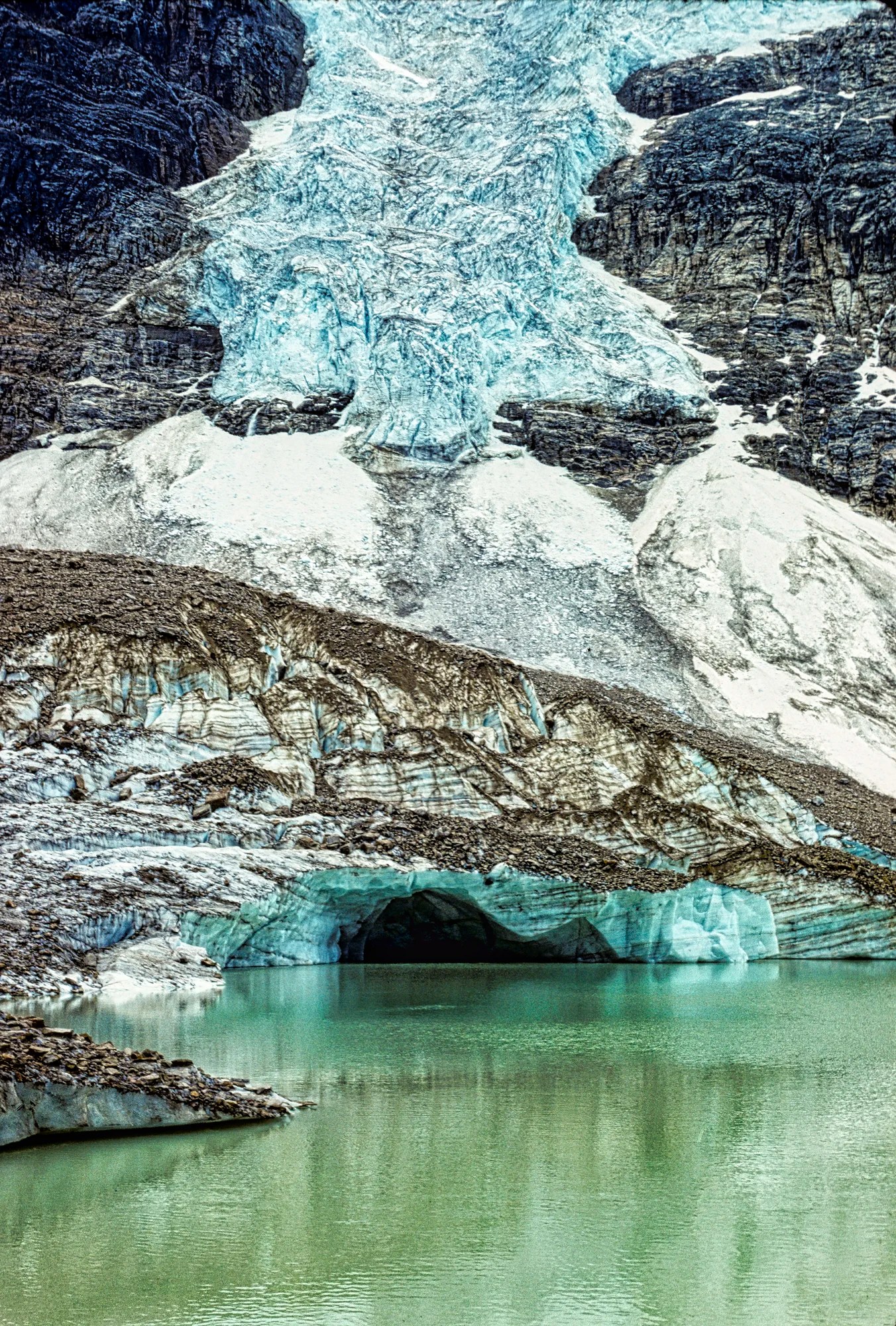
Cavell Glacier is a remnant of an ancient glacier at the bottom of the mountain. The rock-strewn ice is melting into the glacial tarn. I spent an inordinate amount of time taking photos of the icebergs floating in the tarn. Note that glacial ice reflects various shades of blue, especially in the shade areas. The ice fall above Cavell Glacier is the separate Angel Glacier. But it will no longer look like this, as it has since melted back.
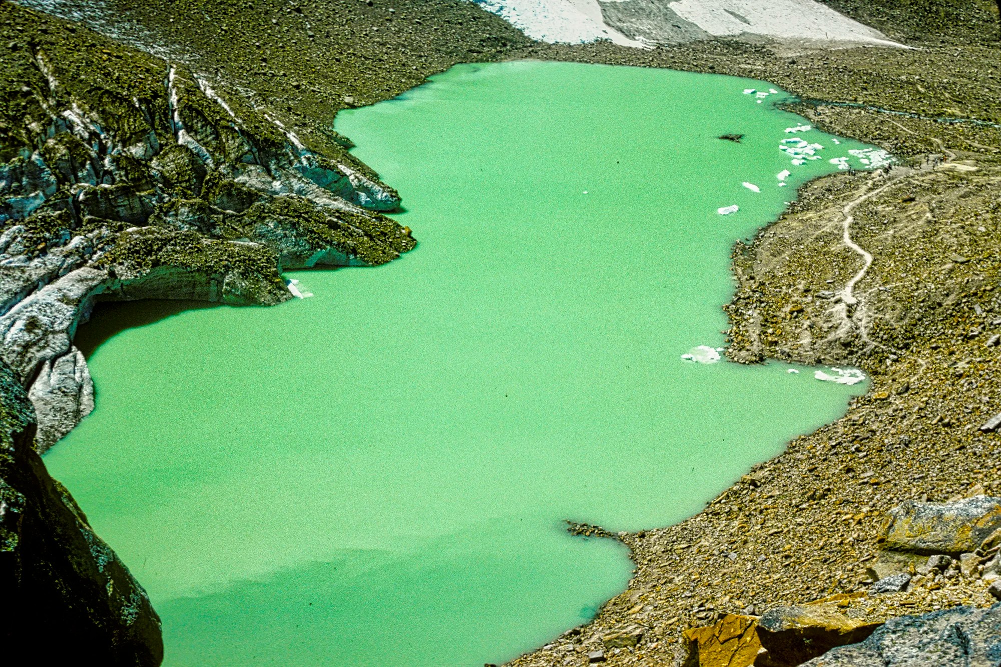
Cavell Pond has a mint-green colour but don’t expect it to look this big! A rock and ice fall roared down the valley flooding and damaging the valley including the lower return trail. Due to the danger of falling rock and ice, Parks Canada advises you to stay away from the cliffs and glaciers.
Cavell Meadows Trail (map)
6-7 km 3-5 hrs RT; gain 500 m
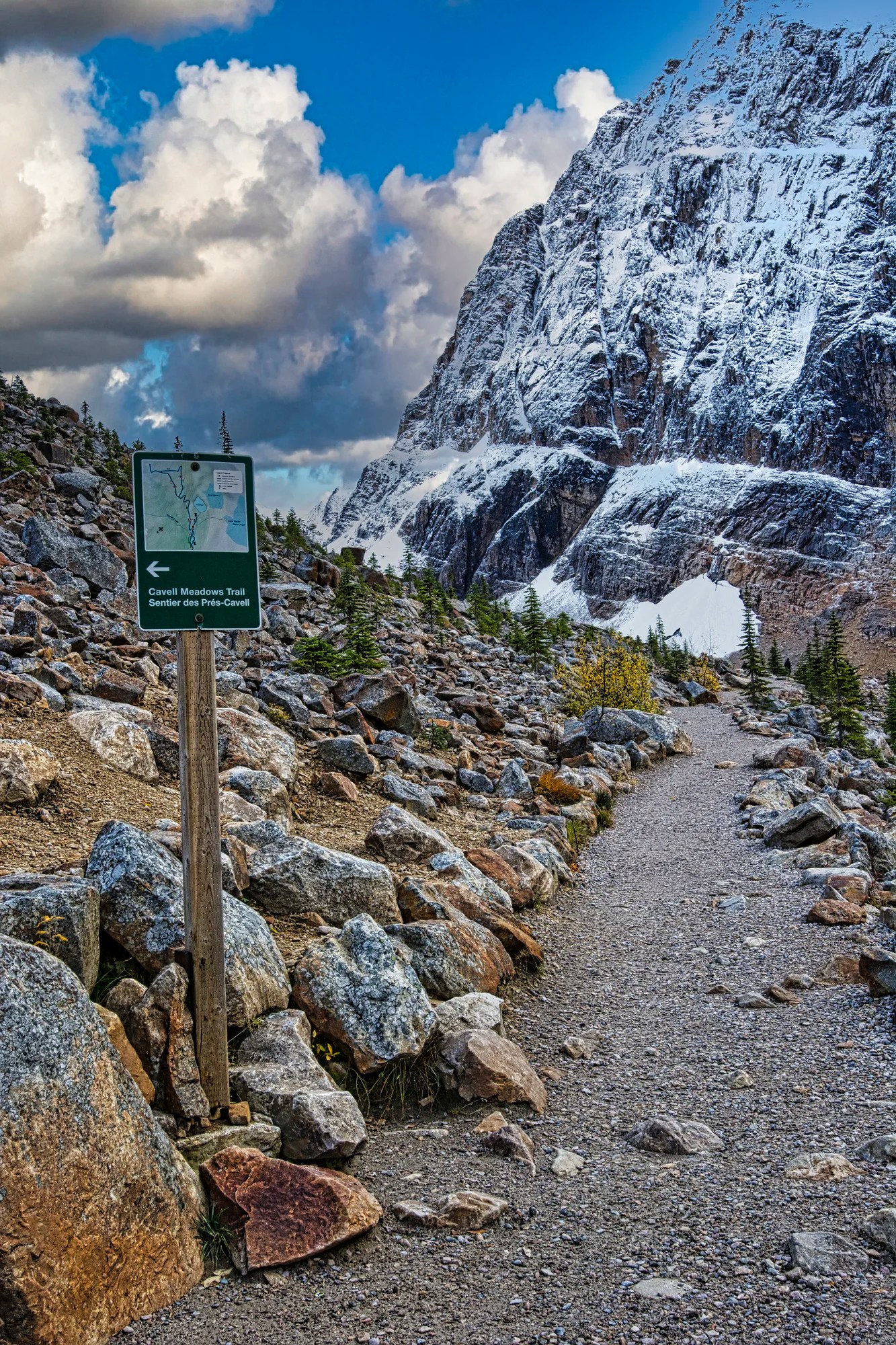
Cavell Meadows Trail and The Path of the Glacier are the same trail until this point. A left hand turn climbs steeply to Cavell Meadows where there are alpine flowers from mid-July to mid-August.
As this is an alpine area, there are unimpeded views of the glaciers and mountains.
You do not have to hike the whole trail to get the best view of Angel Glacier right at eye level. In fact, we often took friends and family just to get to this point.

This is a great place for a picnic. It comes with stone seats and great views.
One can see the whole valley from here, but note that Cavell Lake is hidden. Look for pikas and marmots in this area.
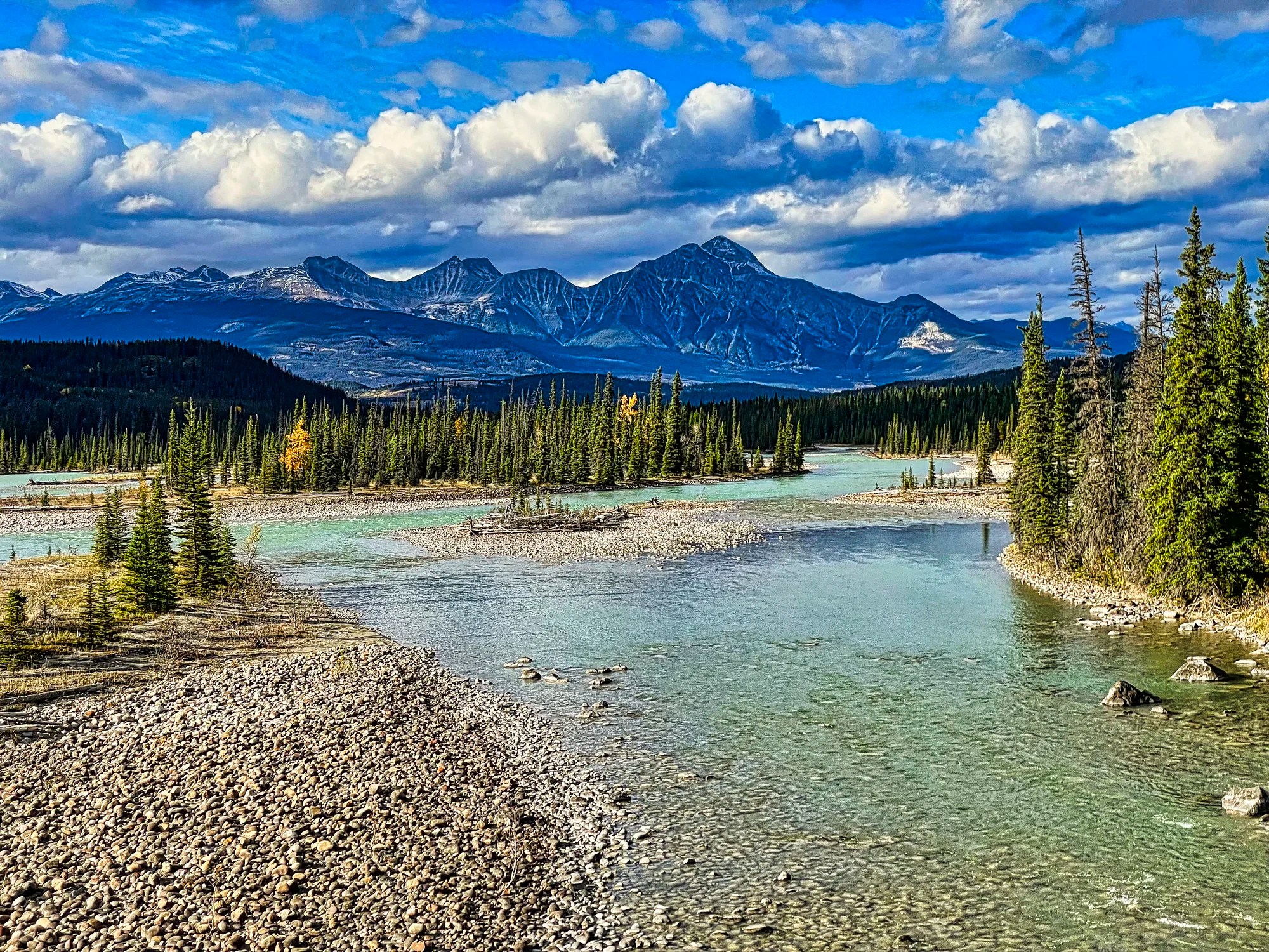
Icefield Parkway (Hwy 93)
The last part of the Icefield Parkway from Athabasca Falls to the town of Jasper is a good area to see wildlife, especially wapiti and mule deer. Bears used to be common before the bear-proof garbage bins, and bans on humans feeding the wildlife or leaving coolers on picnic tables. Highway 93A, including the campgrounds, are also good places for wildlife.
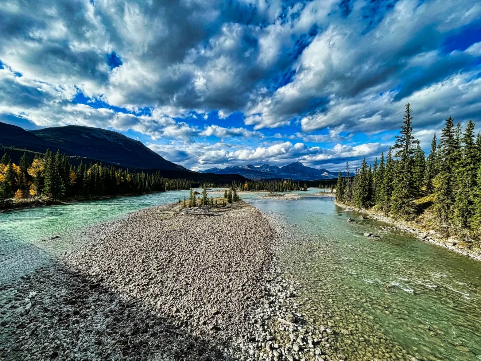
Athabasca River Bridge
One sight we never gave much notice before is the bridge over the Athabasca River. When you visit a place at mid-day the lighting is harsh. Evening lighting made the views look special. Park on the shoulder before (not on) the bridge. Walk partway across for spectacular views at sunset or late evening lighting.
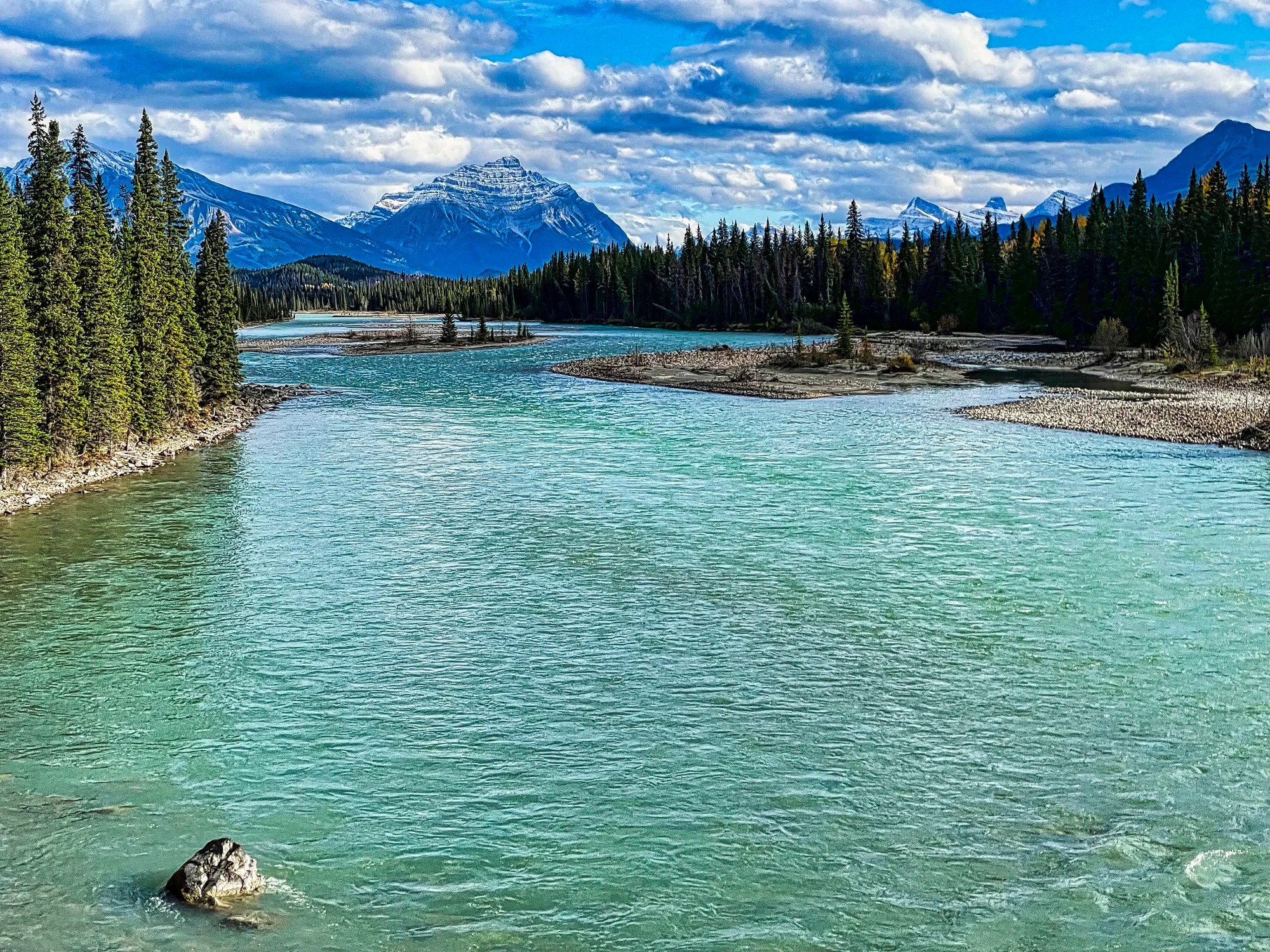
The view south shows Mt. Kerkeslin, with the same syncline (upturned strata) literally as the Big Bend on the Icefield Parkway.
The view northeast is dominated by the appropriately named Pyramid Mountain. In reality, it won’t appear this close as a moderate zoom lens was used for this photo.
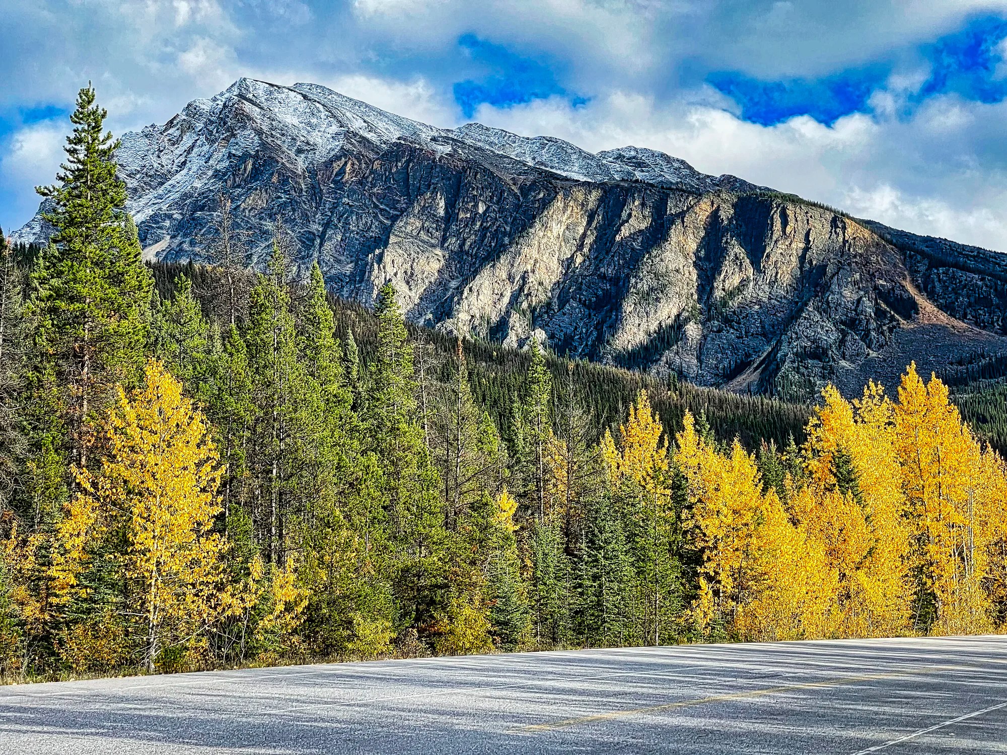
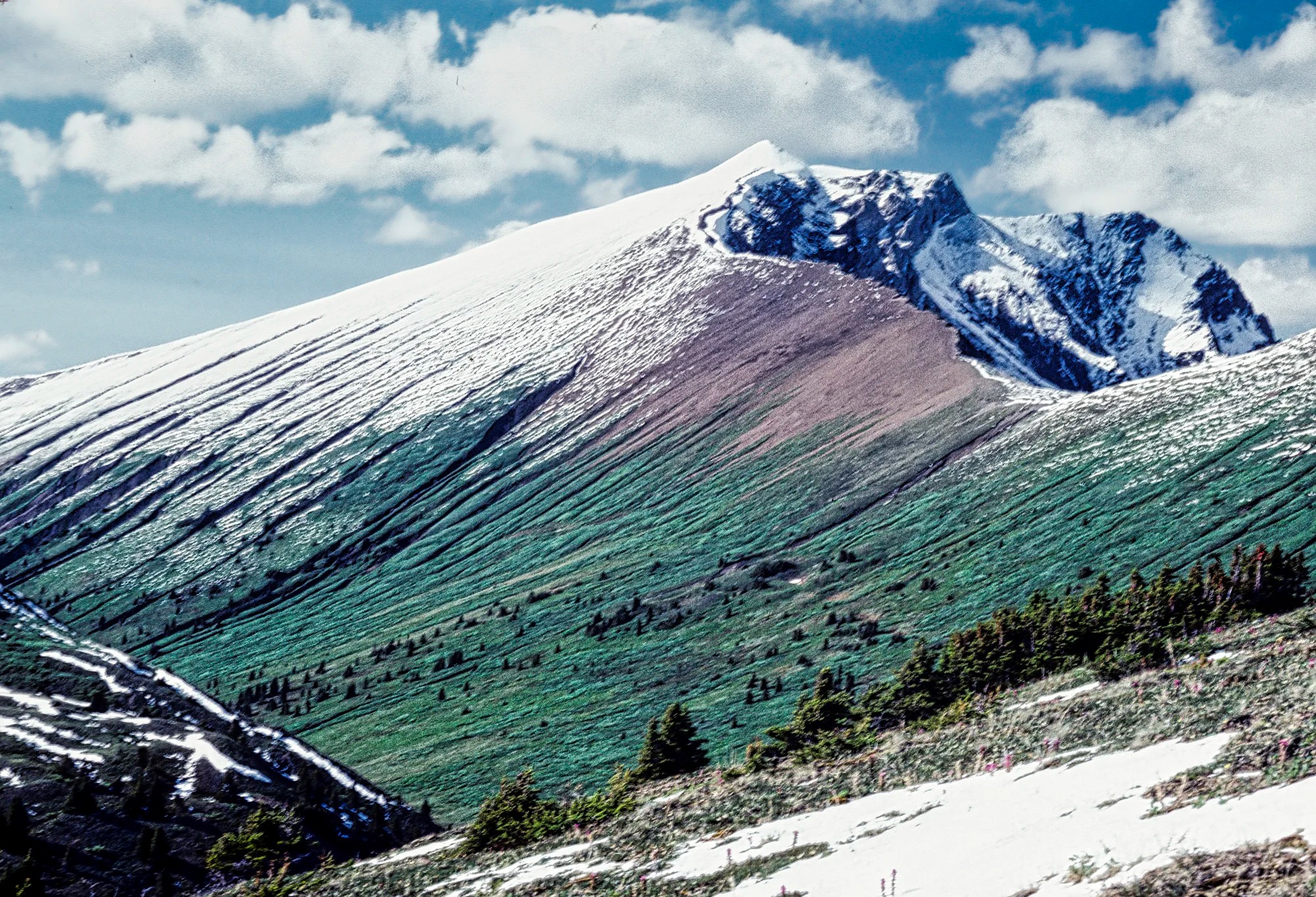
Icefield Parkway Autumn Views
We ended our October trip with these views along the Parkway. The roads were lined with golden-leaved trees.
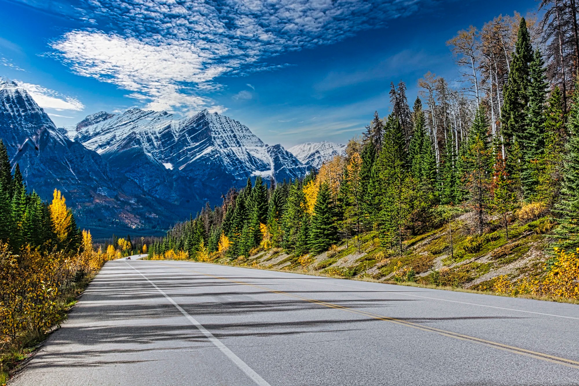
The mountain looked like a cake with sugar icing, highlighting every stratum.
What flora can you see in the Rockies?
There is one unusual thing to see along Highway 93A, which veers right 7.4 km (4.6 mi) south of the town of Jasper. Drive on Highway 93A for 14 km (8.8 mi) to the Valley of the Crooked Trees. It can also be reached via the Athabasca Falls junction with the Icefield Parkway and continuing on for 10.3 km (6.4 mi). NB: This may have been burned down by the 2024 forest fire.
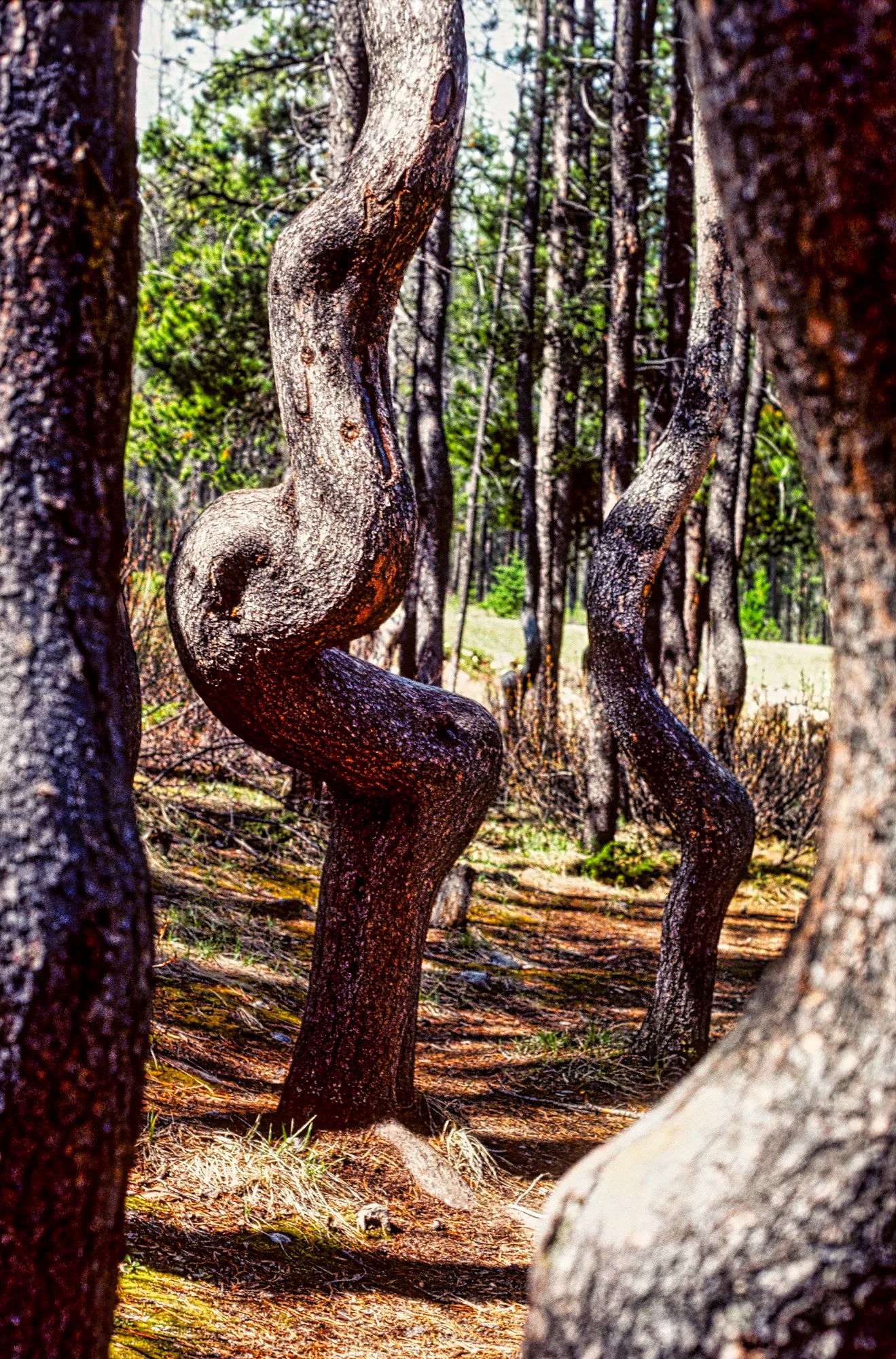
Lodgepole pines are slender, tall, vertical pines. This forest was felled by a forest fire. But lodgepole pine cones are fire resistant. So new trees grew up and had to twist and turn to work their way up past the fallen spars. It’s a great place for family photos framed by the twisted trees.
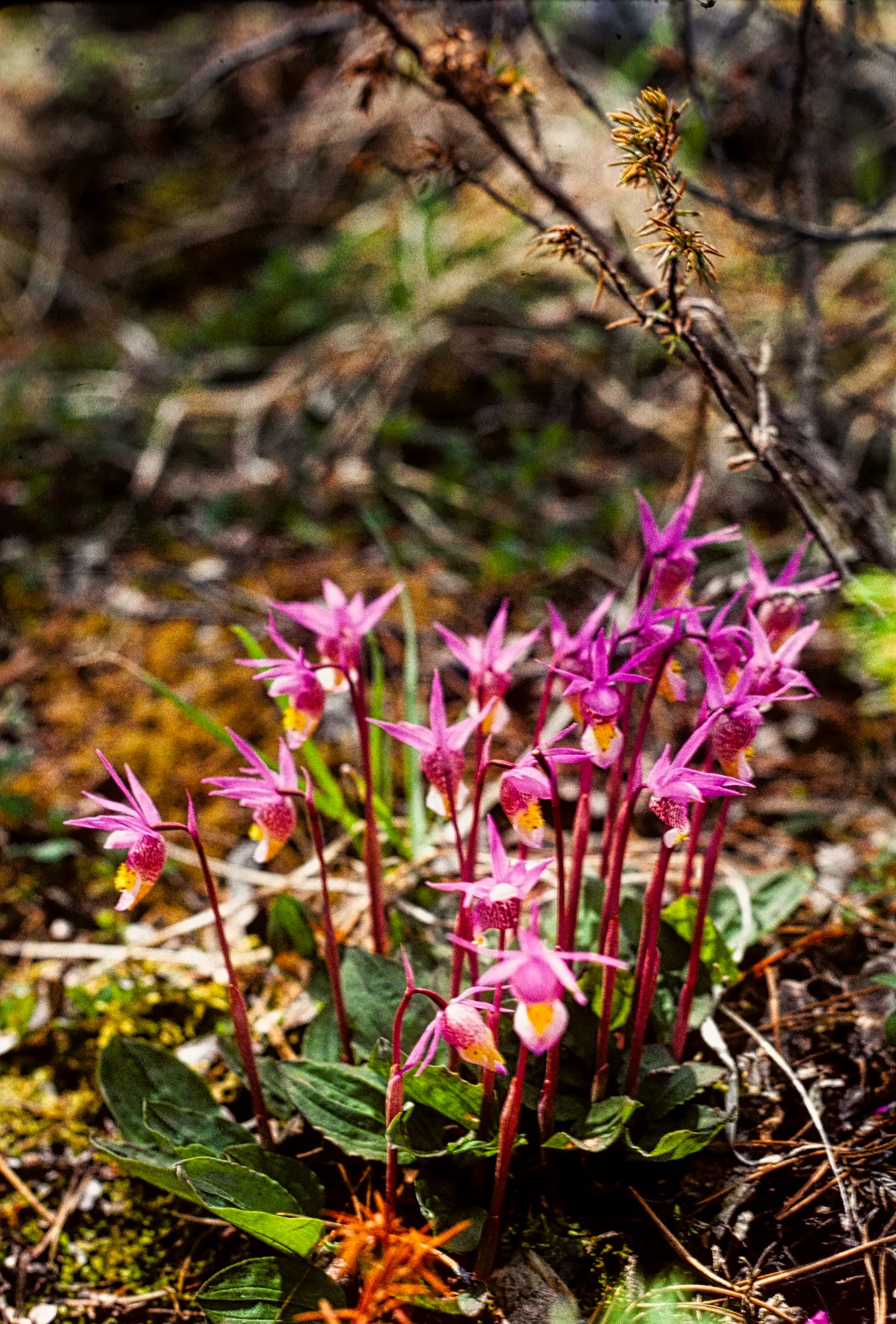
We once saw calypso orchids, also called Fairy Slipper or Venus Slipper. That was exciting, as we never associated the Rockies with orchids! They grow among the Lodgepole pine needles at high elevations from May to July. Because the mountains are so high, you may not realize that the elevation of the town of Jasper is 1825m (5988 ft).
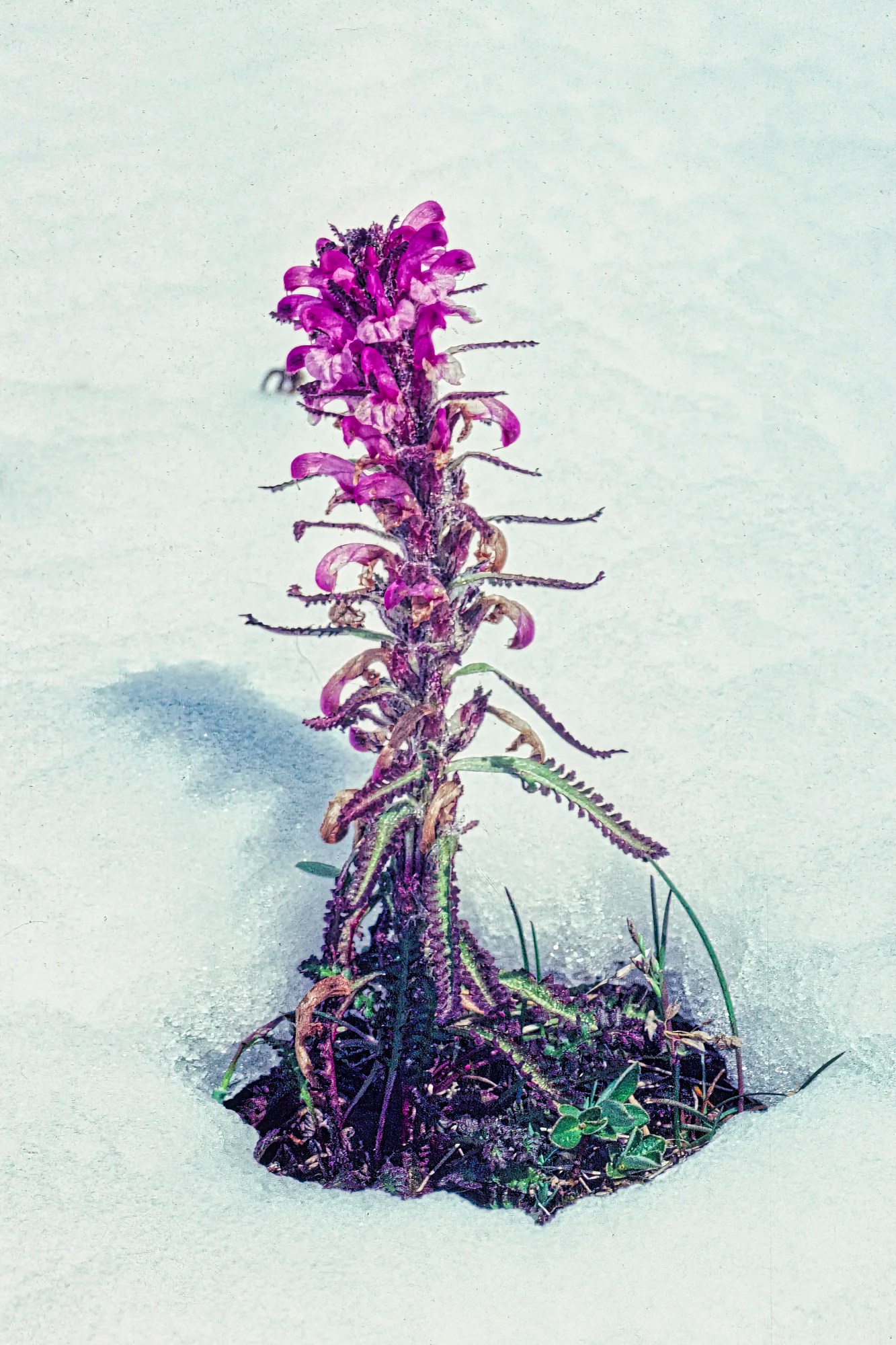
In the spring it is amazing to see wildflowers bloom as soon as the snow starts melting. Hiking trails like Cavell Meadows and Opal Hills are the best places to see wildflowers during the summer – generally mid-July to August. Additional flowers you can see are described in 15 Things you Must Do in Banff and Lake Louise.
What wildlife can I see in the Rockies?
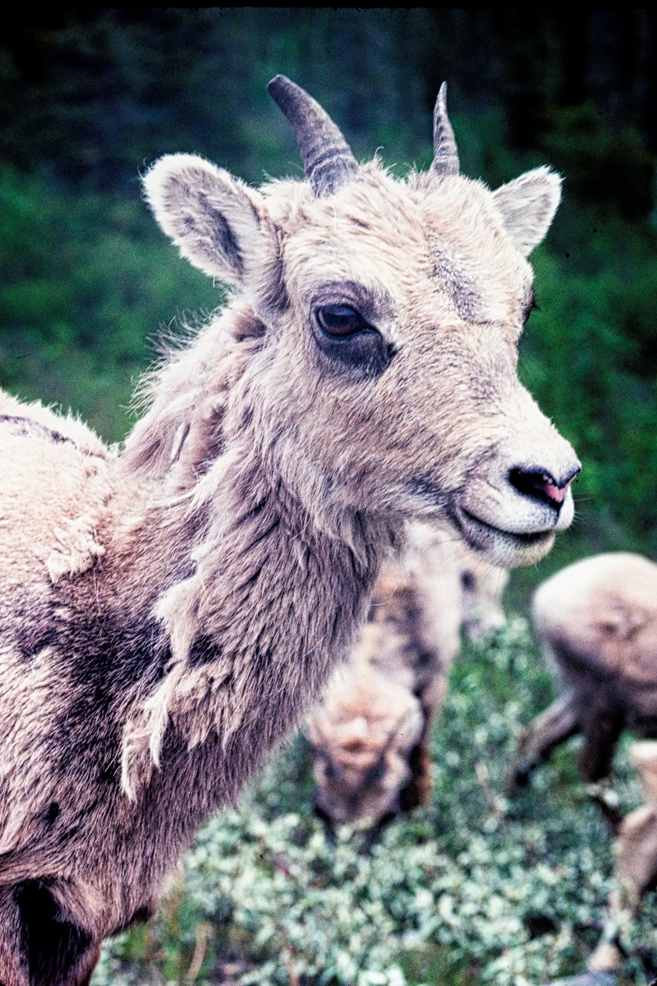
This last stretch of the Icefield Parkway provides a good chance of seeing wildlife. Hiking, side roads, camping, dusk and dawn increase the probability of seeing wildlife. You can see Rocky Mountain sheep, goats, marmots, wapiti, deer, pika, and bears if you are (un)lucky!
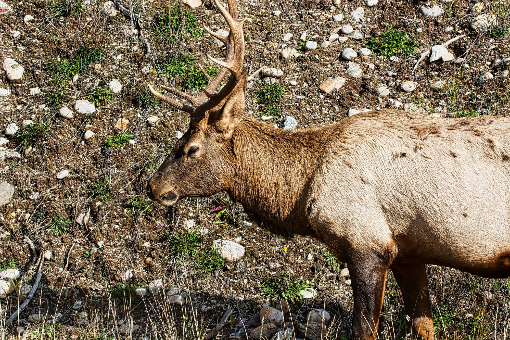
Elk in Alberta are called Wapiti by the locals and Parks Canada. Wapiti is the Shawnee name meaning “white rump”.
Many tourists used to get mauled by bears and even wapiti. The cardinal rule is never get too close to foraging wildlife. My technique is to move slowly and keep some distance. If they keep eating you are safe; if not you have gone too close. When we visited Yellowstone NP, we saw tourists rushing towards bears and buffalo to get a selfie. I never saw such aggressive actions in the Rockies, but it does happen and people get hurt.
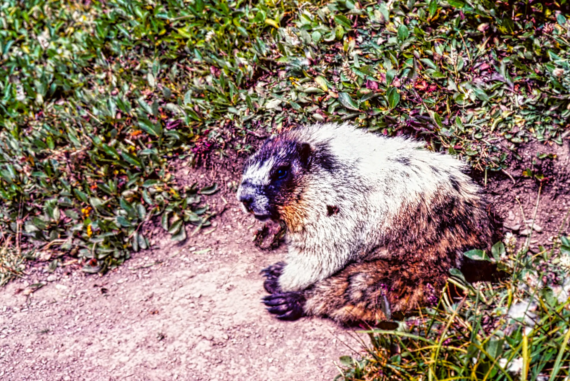
The animals we saw more in Jasper NP than Banff were bears — we even saw one suntanning on its back on a picnic table one time! Marmots and pika are common in rock pile areas like Mt. Edith Cavell. This fat specimen must be a middle class marmot.
Jasper and the Valley of the Five Lakes
One plus in Jasper NP is that the town of Jasper is centrally located. One can easily drop in for a coffee or other treats as you transverse from one area to another. Jasper is a less commercialized small town that happens to be surrounded by a national park rather than a town built for tourism. BTW, the landlord of all three towns in the Rockies is Parks Canada. The towns cannot be expanded and require approval for all changes desired.
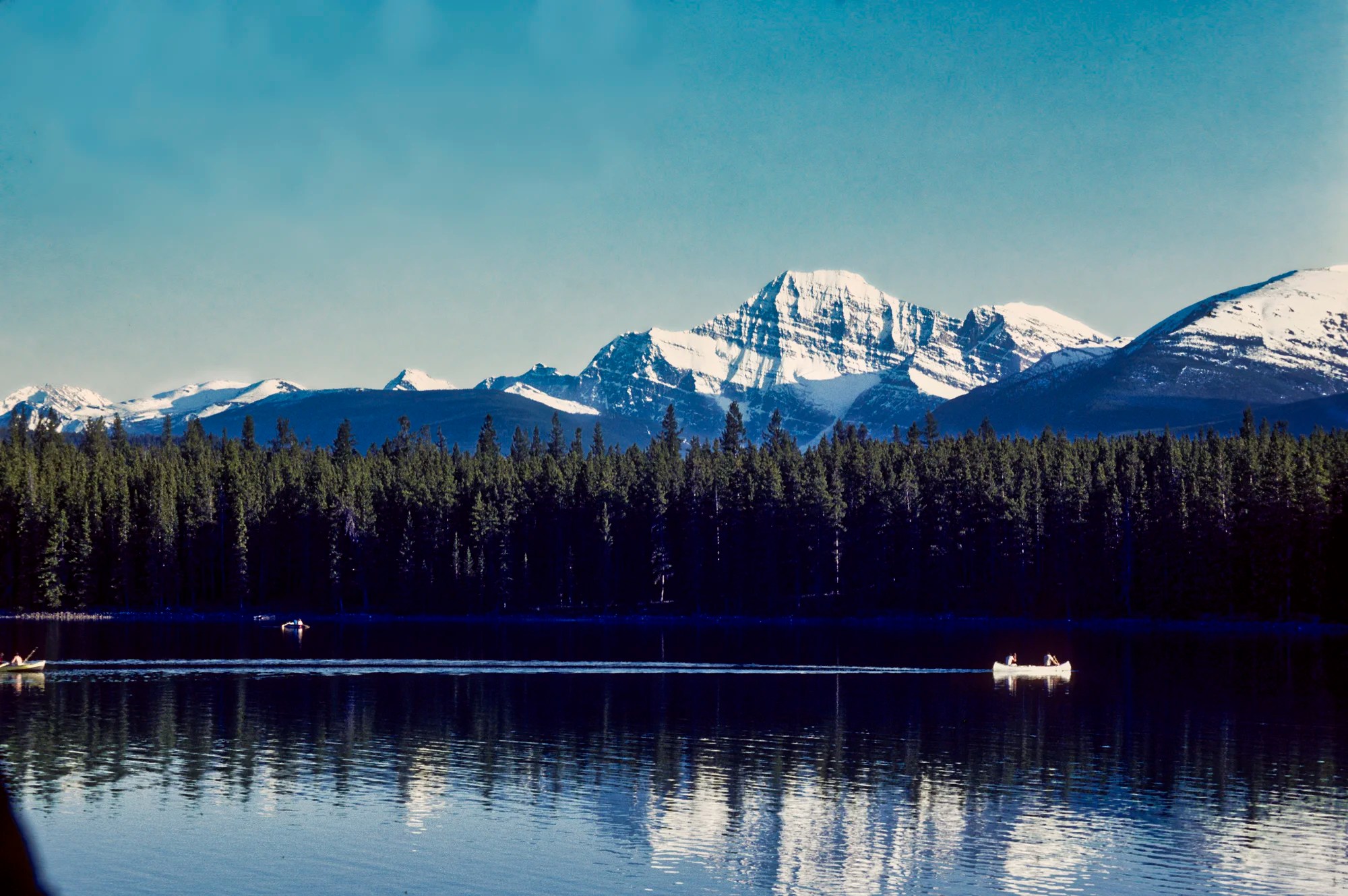
There are five cute, small lakes very close to the town of Jasper. Some of them have a backdrop of Rocky Mountains. Lake Beaufort is home to the famous Jasper Park Lodge. This is not a must-see but it is a pleasant drive or hike if you have extra time.
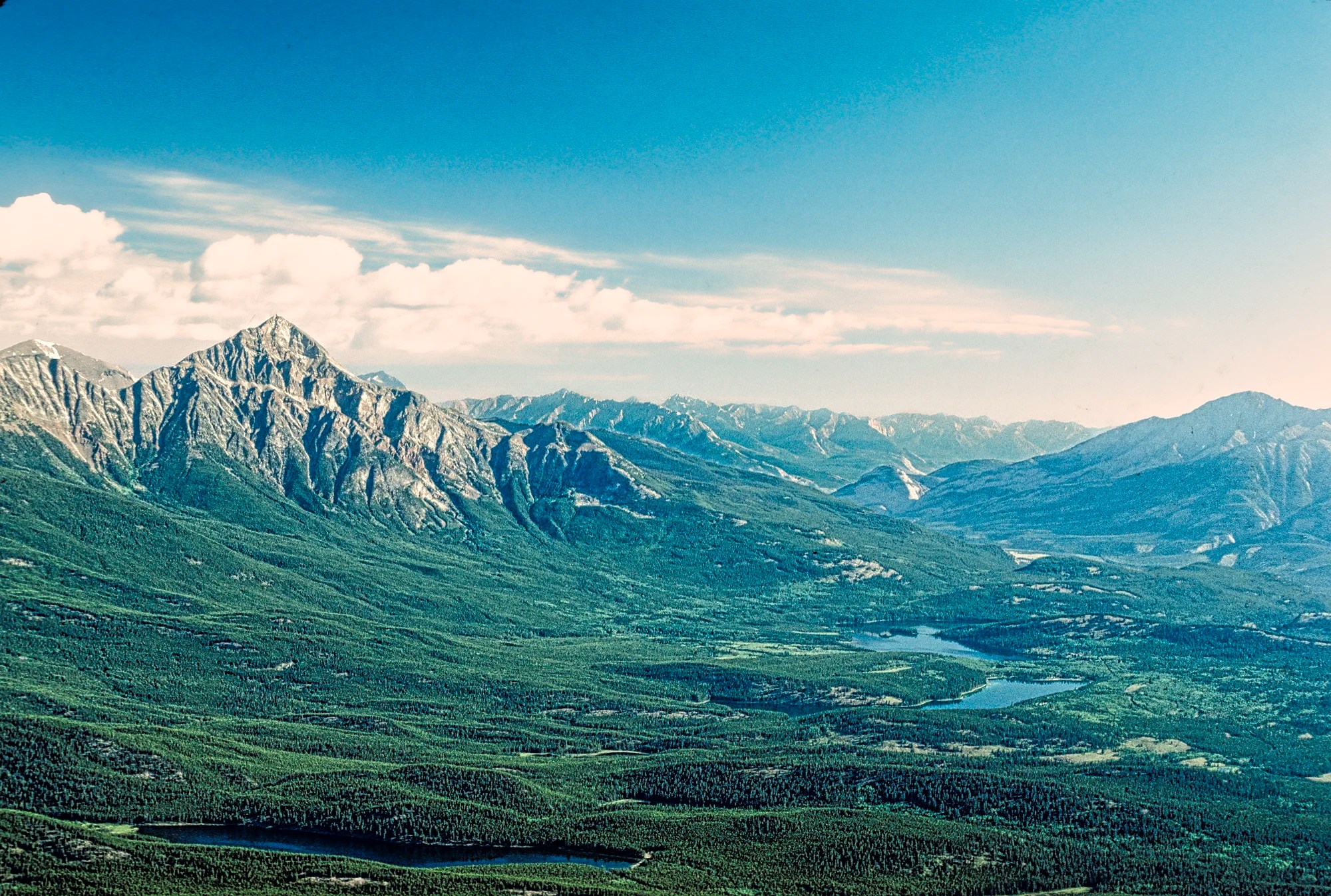
This photo was taken from Whistler Mountain. We were rewarded with 360’ views of the Athabasca Valley. Pyramid Mountain stands out in this sweeping panorama of green forest.
Maligne Lake Road
From Jasper, drive 7 km, 9 minutes east on the Yellowhead Highway (16) to the junction with the Maligne Lake Road. There are three interesting sights along the drive on Maligne Lake Road 44.6 km (22.7 mi) south to the lake.
Maligne Canyon
This is a very easy and busy walk, only 12 km (7.5 mi) east of Jasper town. It is definitely worth doing to see how water can carve a canyon, albeit a very narrow one. Cascades cast swirling (glacial) green water into potholes carved into the canyon walls. The railings were erected because many tourists went too close to the edge and fell to their death up to 50 m (165 ft) below. Before the guard rails, we remember seeing tourists walking at the canyon edge, vying for the Darwin Award.
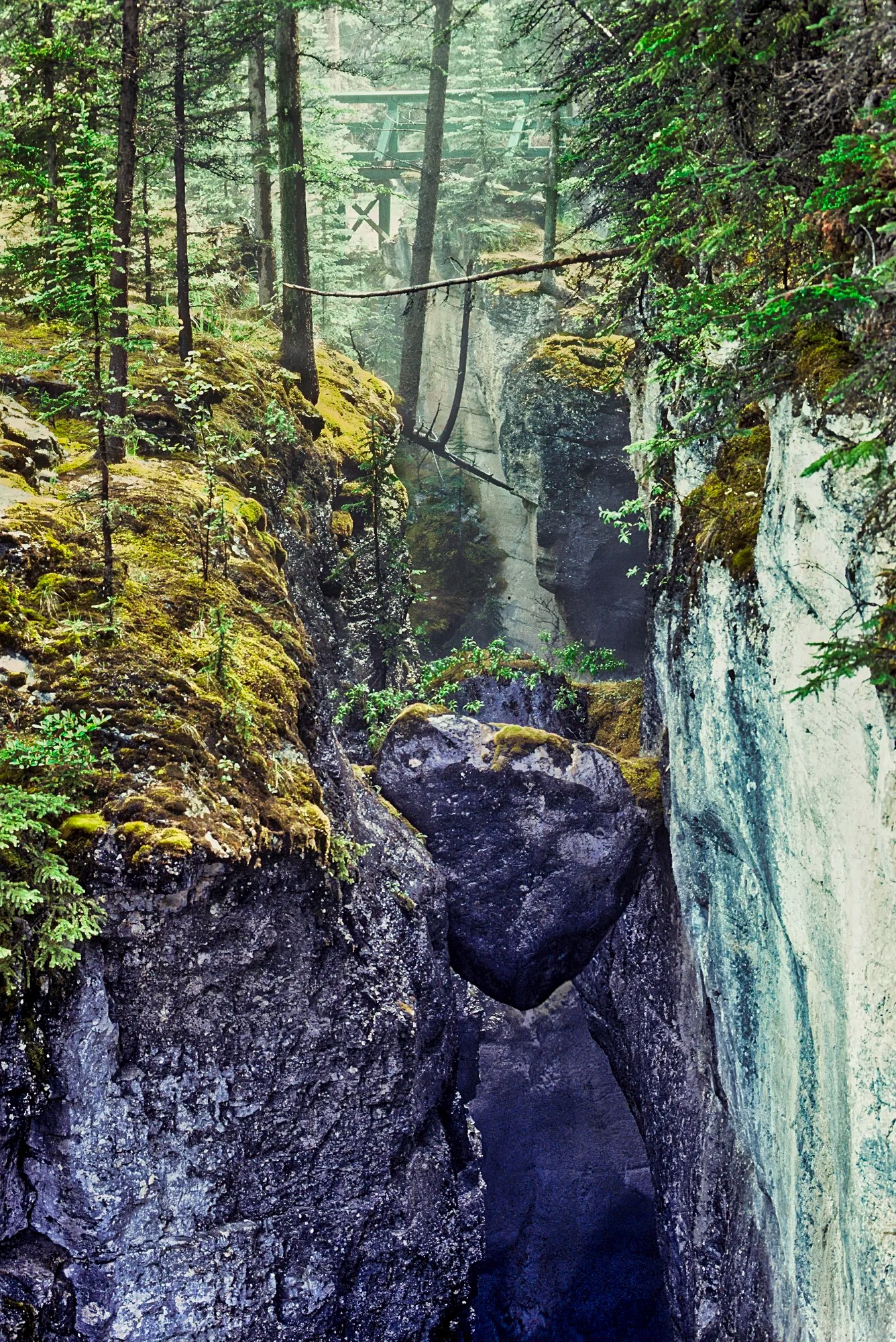
Why is this rock eroded by water? The canyon is very soluble limestone formed from the skeletal remains of marine organisms. Cephalopod, brachiopod and crinoid fossils as well as ripple marks are embedded in the rocks on the way to the first bridge. This 365 million-year-old layer used to be the bed of a tropical sea before the Rockies were uplifted. It’s hard to believe that Canada was once tropical. OK, there was no Canada then, just one supercontinent, Pangaea.
This self-guided interpretative trail comes with signs describing the natural and geological history of the area. Look for oily-feathered American dippers and rare black swifts along the canyon.
The main parking is near the First Bridge. Before the First Bridge, the river travels 32 km underground from Medicine Lake! The hike to the Sixth Bridge is 3.7 km OW. Allow 1 to 2 hrs OW. But most tourists do the shorter walk to the Fourth Bridge, as this is the most dramatic and scenic part. The walk is not difficult, except perhaps in the winter when there are guided ice walks.
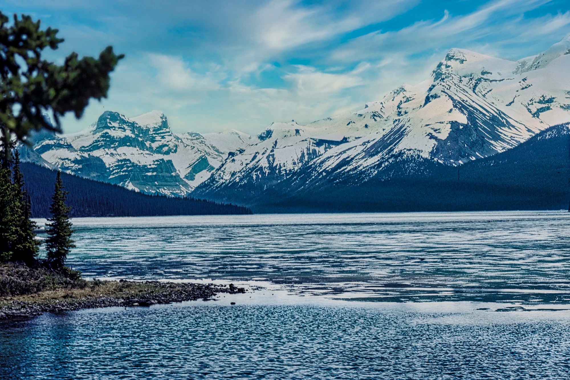
Medicine Lake
This is a less touristy area and we were lucky to see moose in the shallow part of the lake a couple of times. There is a viewpoint at the very beginning. On the northeast shore, look for a “sawtooth” mountain range. Giant slabs of once level limestone were tilted near vertically during the uplift of the Rocky Mountains, ca. 70 million years ago.
By winter, this becomes the mud flats of the “disappeared lake”. The water is from glacial meltwater during the spring and summer. The water stops flowing in the winter, and the lake keeps draining, but there is no visible river outlet. The lake drains underground through a limestone cave system, one of the largest in the world. It reappears at Maligne Canyon!
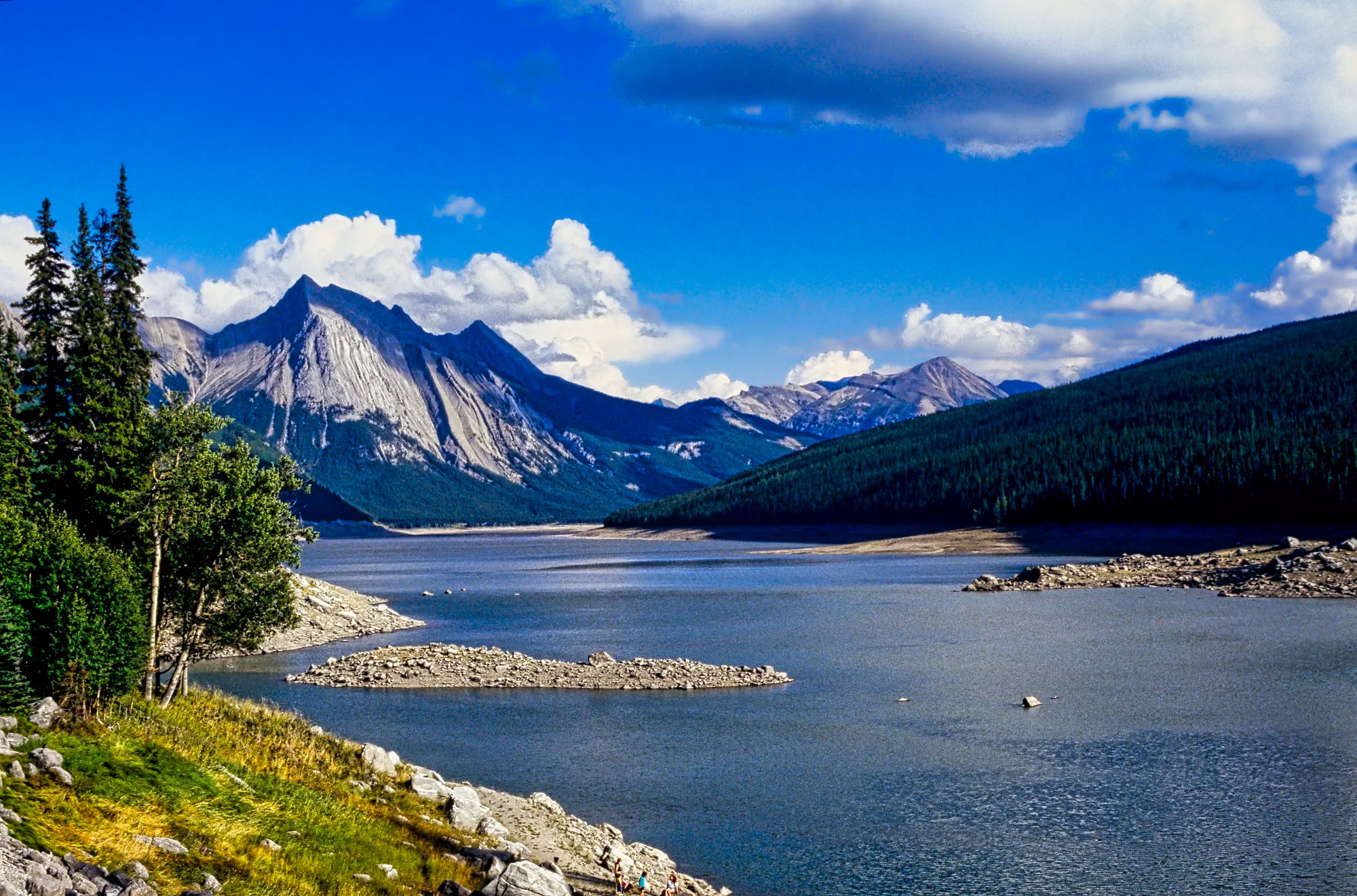
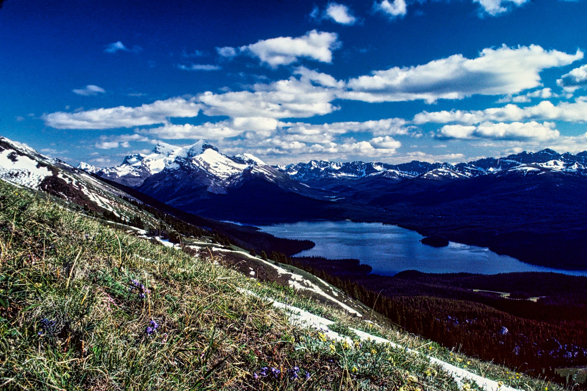
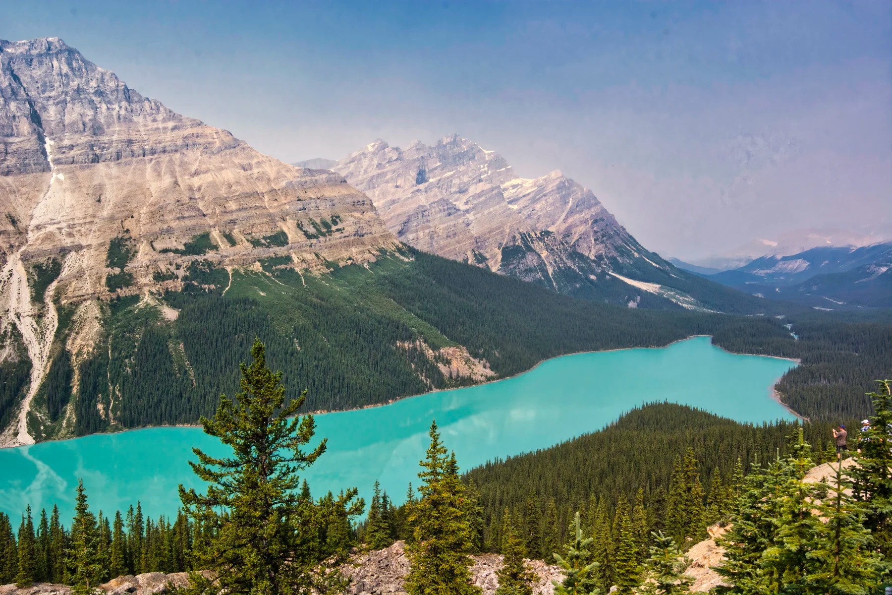
Maligne Lake
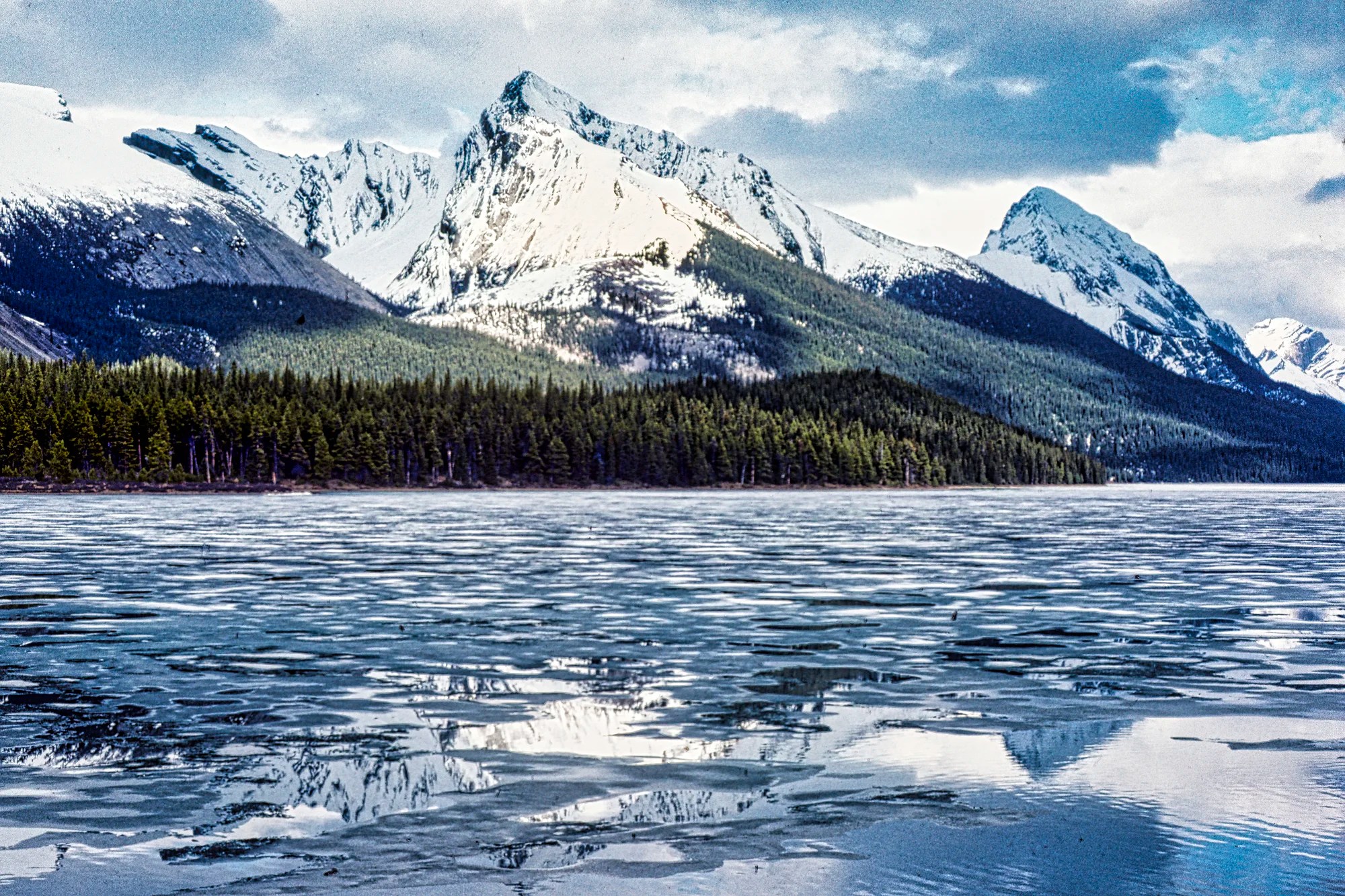
Maligne Lake is one of the famous places to visit in the Jasper area. Perhaps it is because of the iconic Maligne Lake cruise ($84) to Spirit Island and the Narrows. That view is the one most used for postcards.
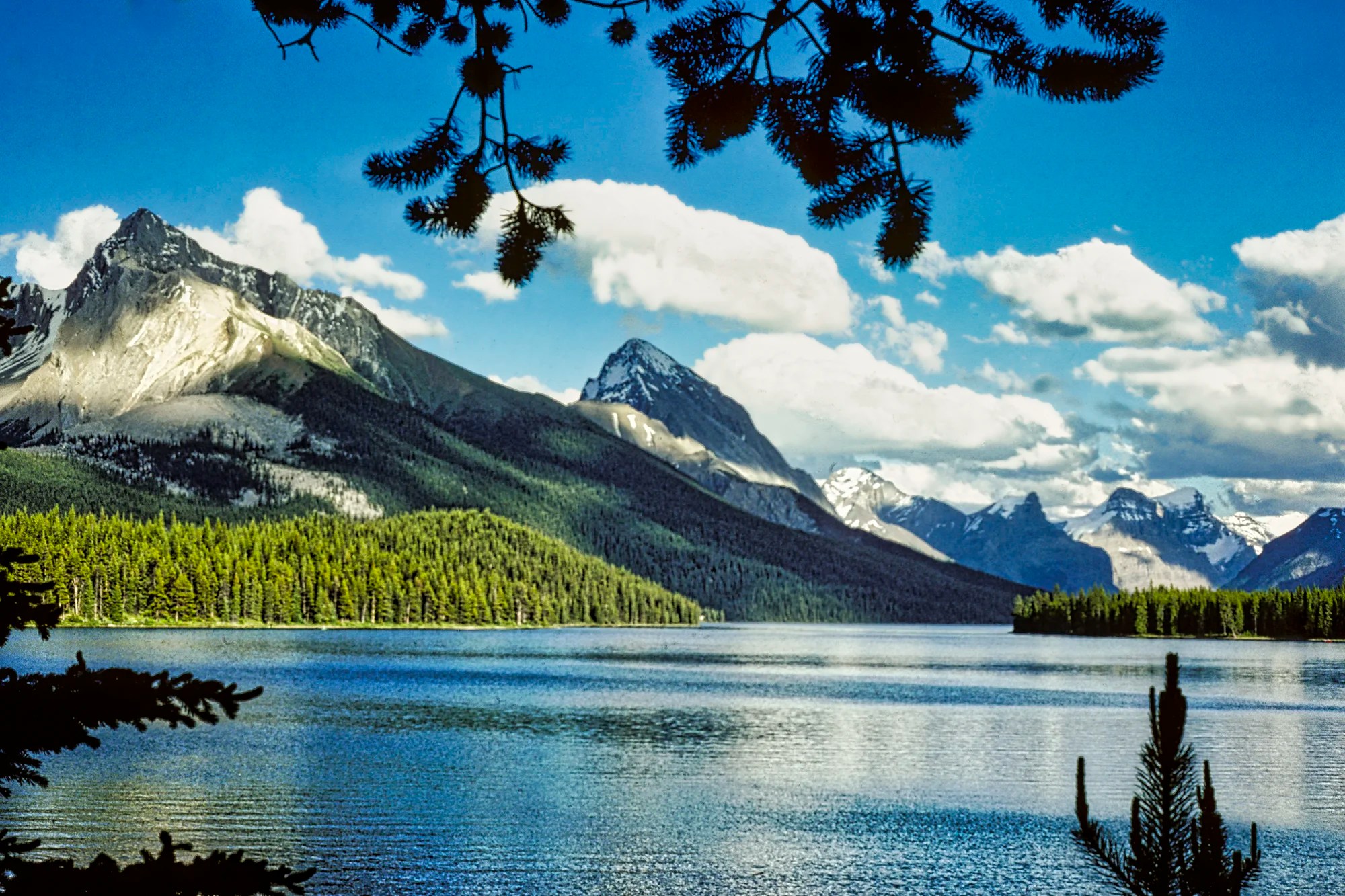
Actually, it is a very peaceful, scenic area — especially compared to Lake Louise. We always had a tradition of walking to the end of the path from the parking lot to get a view. You can not see the full scope of this 22.5 km (14 mi) lake due to the Narrows, an alluvial fan. The gravel you are walking on is the terminal moraine of a once massive 22.5 km glacier.
Maligne Lake Hikes
Two beautiful hikes start at the parking lot.
Bald Hills Trail
Bald Hills Trail starts at the parking lot near the warden’s station. It is a steep climb up a fire road. At 3.4 km, you reach wide open alpine meadows and a spectacular view of Maligne Lake.
Bald Hills Lookout Trail
Distance: 5.2 km (3.2 mi), 2 hrs OW;
Elevation: 2165 m (7100 ft); gain 490 m (1600 ft)
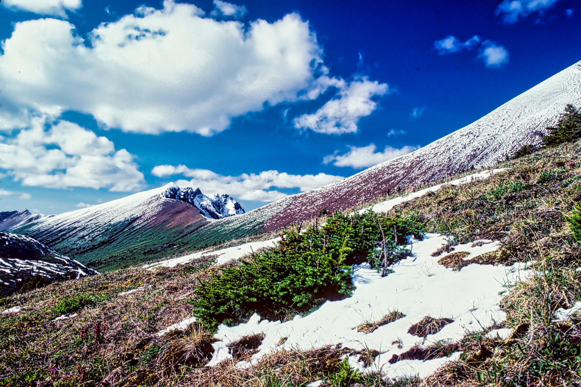
Opal Hills Trail
The Opal Hills Trail starts at the upper parking lot above the boat dock. We really enjoyed this trail despite the immediate, steep climb with no switchbacks. After 1.6 km, you reach the trail junction of the loop part of the trail. Turn right to see the views earlier.
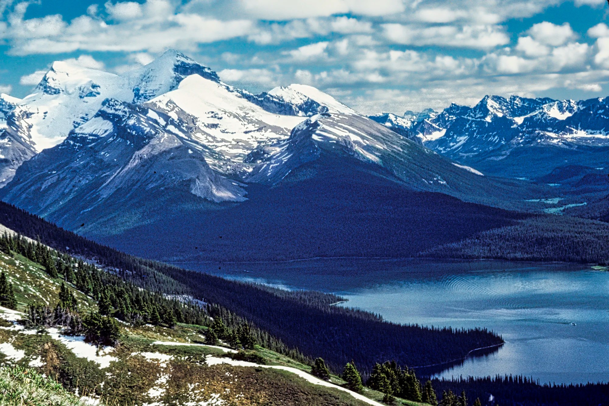
At 2.6 km you reach the alpine meadows with lots of wildflowers. There were extensive views of Maligne Lake resting 307 m (1010 ft) below you. The group of mountains behind the lake was named in 1953 to celebrate the coronation of Queen Elizabeth II. The tall peaks like snowy Mount Charlton have an elevation of 3,217m (10,554 ft).
We did not have perfect weather but the views were still spectacular. The trail continues along a tilted mountain meadow dusted with snow.
Opal Hills Trail:
Distance: 8.2 km (5.1 mi), 4 hrs RT; start at lake 1673 m (5490 ft) asl
Elevation: 2200 m (7218 ft); gain 517 m (1696 ft)
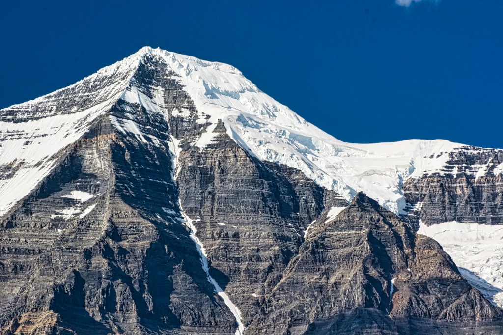
Mt. Robson
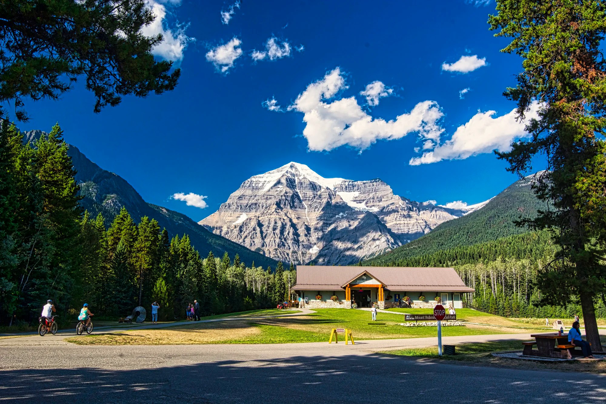
Take the Yellowhead Highway west from Jasper. It is a pleasant and very short trip to Mt Robson Provincial Park (PP). There is a very nice campground, and there was space in high season. We got the last campsite at ca. 17:30 hrs.
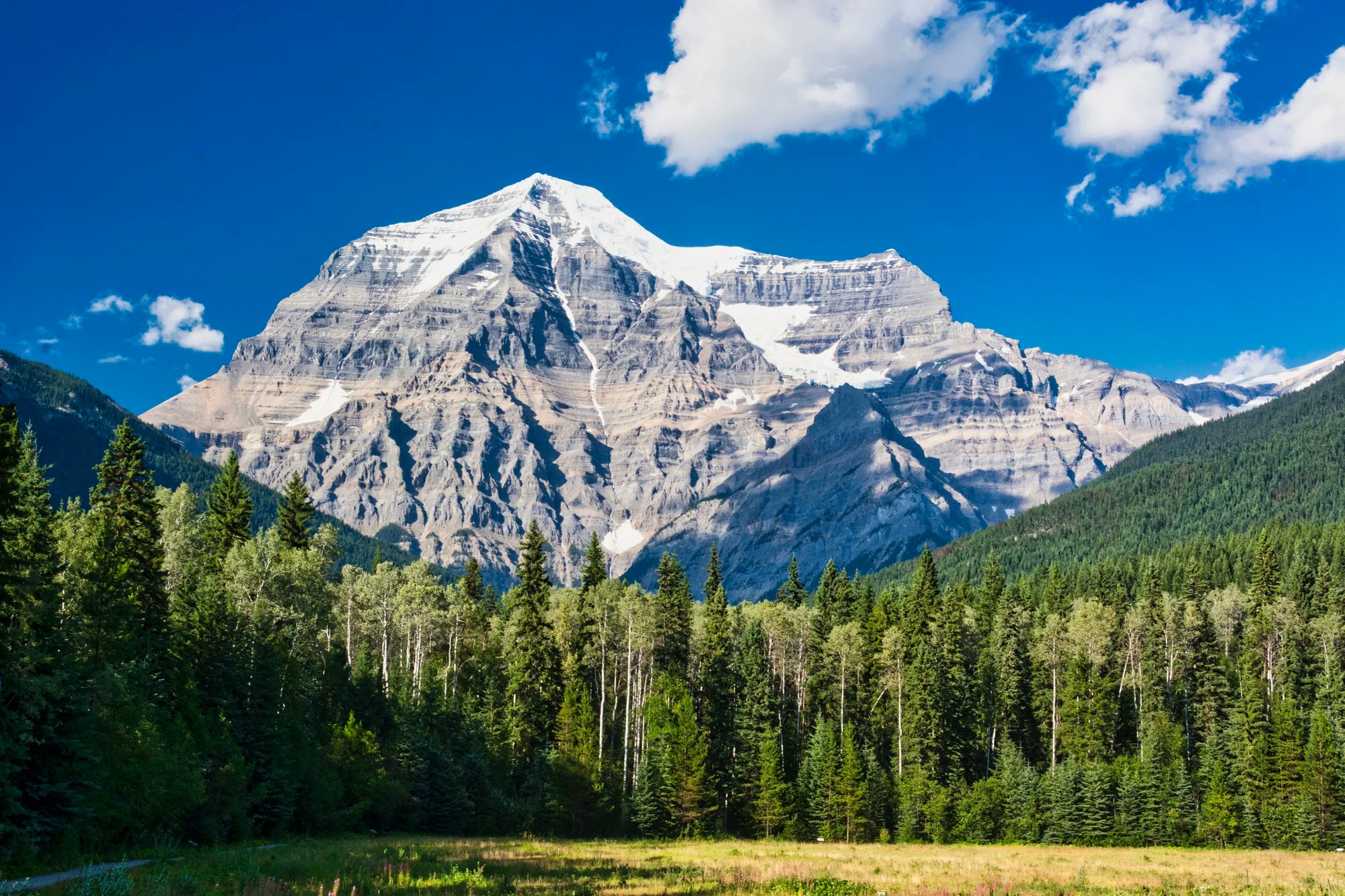
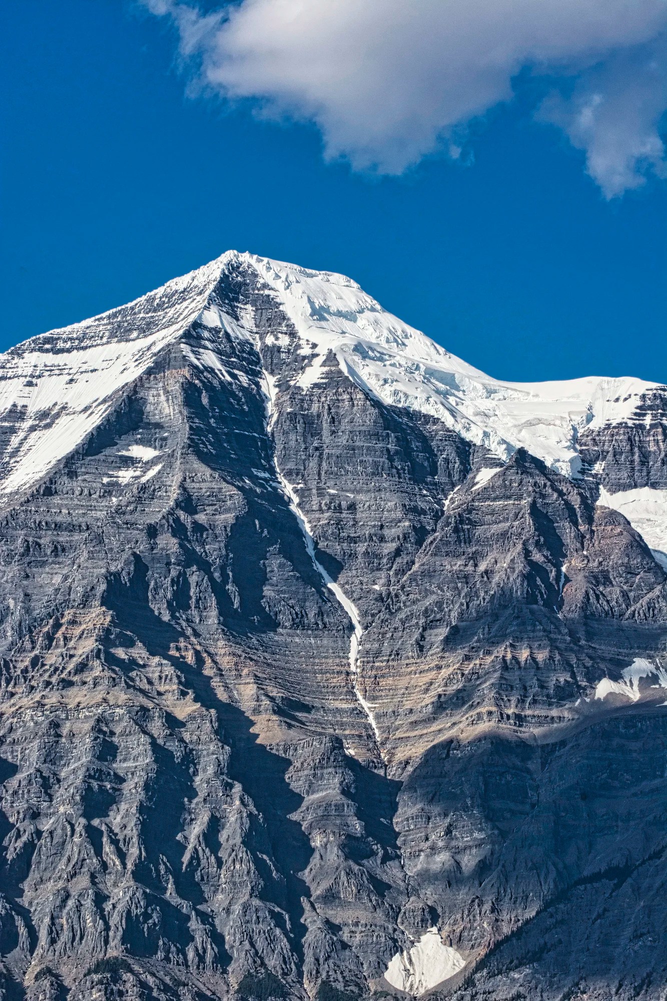
Wow, Mt Robson is a must-see. The Canadian Rockies’ tallest mountain has an elevation of 3,954 m (12,972 ft). One Indigenous name, Cloud Cap Mountain, would be more appropriate. Apparently, mist or cloud always shrouds the mountain.
Imagine our OMG reaction to seeing this magnificent view two days in a row, despite the massive forest fires just to the west of us in central British Columbia. It was the best view we had in all of the Rockies, which were affected by smoke from forest fires.
Berg Lake Trail
17.4 km 8-10 hrs OW; gain 790 m (2600 ft);
Final Comments
Jasper NP and Mt. Robson PP are wonderful places to visit. There are also fewer tourists and a more relaxed atmosphere.
Subscribe
Get travel tips and advice delivered directly to your inbox. The best part is that it is free.
Itinerary Maps & Resources
Rocky Mountain Itinerary Map — our custom itinerary map
The two books below should be available in a bookstore in Alberta and are on Amazon.
- Parkways of the Canadian Rockies (Brian Patton 2008, CAD 24.47) is like bringing a naturalist along to interpret what you should be seeing.
- Canadian Rockies Trail Guide (Brian Patton & Bart Robinson 2022, CAD 29.95) is the best hiking book we have seen or used in all our travels around the world.
- Jasper NP Visitor Guide (Parks Canada)
- Jasper NP Points of Interest (Parks Canada)
- Jasper NP Day Hiking Guide (Parks Canada)
- Travel Tips page provides advice that applies to any trip (you can access via the Terra Encounters menu as well).
Google Maps Ratings
Google Maps provides a rating from 0 to 5 for all sights, hotels and restaurants (but not cities). All of our recommendations are appended with the rating (prefixed with a G) from Google Maps. As it is based on feedback from tourists and locals, it is much more reliable than travel booking websites. We consider a score of 4 to 4.39 to be Very Good; 4.4 to 5 to be Excellent.
Where to Stay
Jasper has supermarkets, cafés, and restaurants and is an excellent base for the places described in this post. Hotels are expensive and hard to come by in the peak season.
Other Places to Add to Your Itinerary
Here are “nearby” places you might want to explore:
Other Planning Information
We have compiled additional tips and advice. Topics include Rocky Mountains Itineraries, Parks Passes, Travel by Car, Best Time to Visit the Rockies, Other Places to Add to Your Itinerary, and Canada FAQ. You can read these topics in the Ravishing Rockies Portal post.

Leave a comment