
Is Christchurch Worth Visiting?
The Christchurch region offers a unique mix of historic charm and stunning scenery. It is the best city to visit in New Zealand. With a population of around 545,000, the small city is easy to drive around. Plus it has everything you need. Do you want atmosphere? Christchurch is full of Victorian architecture and gardens. Do you want dramatic scenery and mountains? Explore the Banks Peninsula. Do you want wine? Visit the vineyards to the west and north. This is Quintessential NZ. Plus, it’s a gateway to stunning natural landscapes like the Southern Alps and various national parks.
Author & Photographer: George Mitchell
Our recommendations are not influenced by affiliate links – we have none. Our itineraries, photos, and advice are based on travelling six months in New Zealand. We are avid hikers, nature lovers and photographers. NZ is one of our favourite destinations.
All points of interest are shown on our NZ SI Kaikoura to Christchurch Map. Their names on this map and in this post are appended with their Google Maps Ratings from G0 to G5. Acronyms can be found in the Abbreviation section.
Christchurch
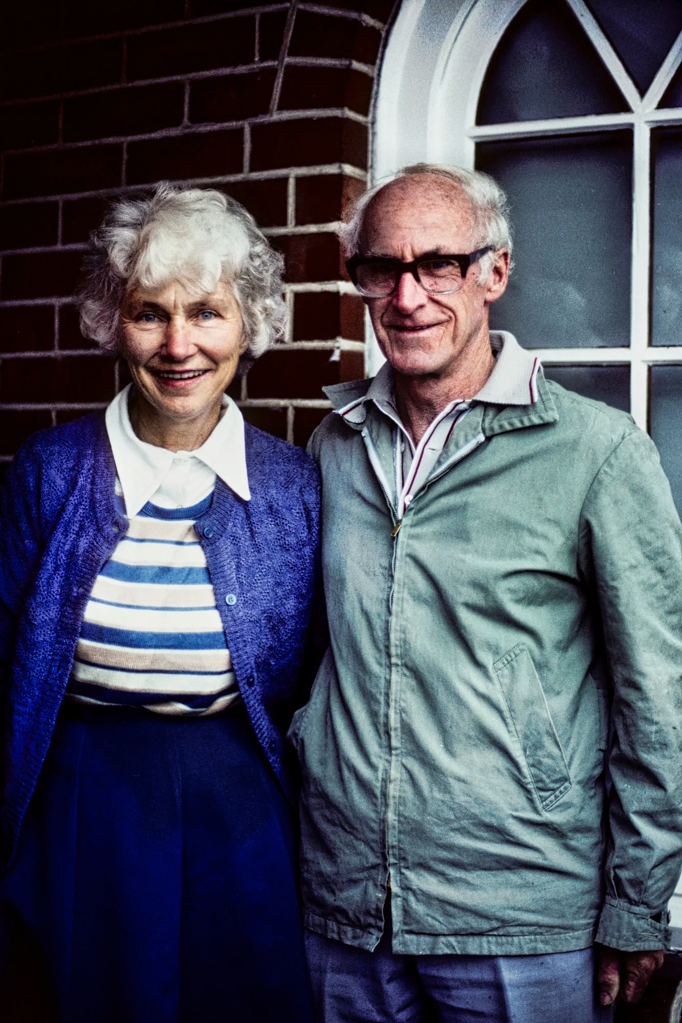
We visited Christchurch three times. The first time we called the parents of a Wellington friend. They were very welcoming and invited us to stay with them. They had just finished wallpapering the bedroom — typical for Kiwi houses at that time. They even came and picked us up!
Joan Robertson did volunteer work in a Lifeline Centre, a crisis helpline service. Jack was a retired industrial arts teacher. Jack had trained as a navigator in Winnipeg, Canada. He fought in the Solomon Islands during World War II. After a four-day visit, they told us they felt like we were part of their extended family.
Christchurch Botanic Gardens
Hours: Nov-Feb 7:00 to 21:00 hrs; Apr-Sep 7:00 to 18:30 hrs
Christchurch Botanic Gardens were founded in 1863. It is quite large at 21 hectares (52 acres). I believe we spent half a day here on each visit but you could easily spend all day. The Botanic Gardens Walking Guide lists the seasonal highlights by month. This itinerary starts at the parking lot.
The Magnetic Observatory (G4.6) was set up in 1901. Explorers like Robert Scott and Ernest Shackleton calibrated their instruments here before heading south to Antarctica.
Conservatories
If it’s raining go into the conservatories.
- Fern House to see NZ’s iconic silver fern (Cyathea dealbata) and tree ferns (punga).
- Gilpin House to see orchids.
- Cunningham House to see tropical plants. Bromeliads are native to the tropical Americas. One bromeliad you know very well is the pineapple!
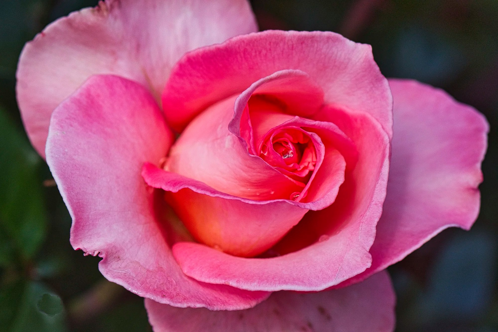
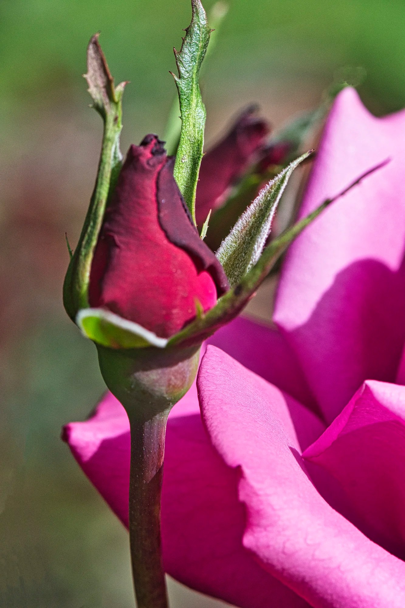
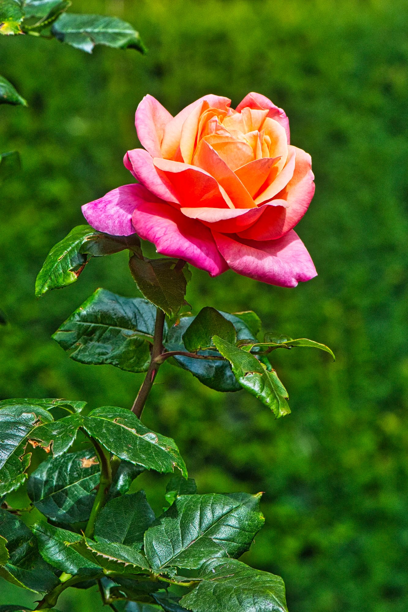
Central Rose Garden
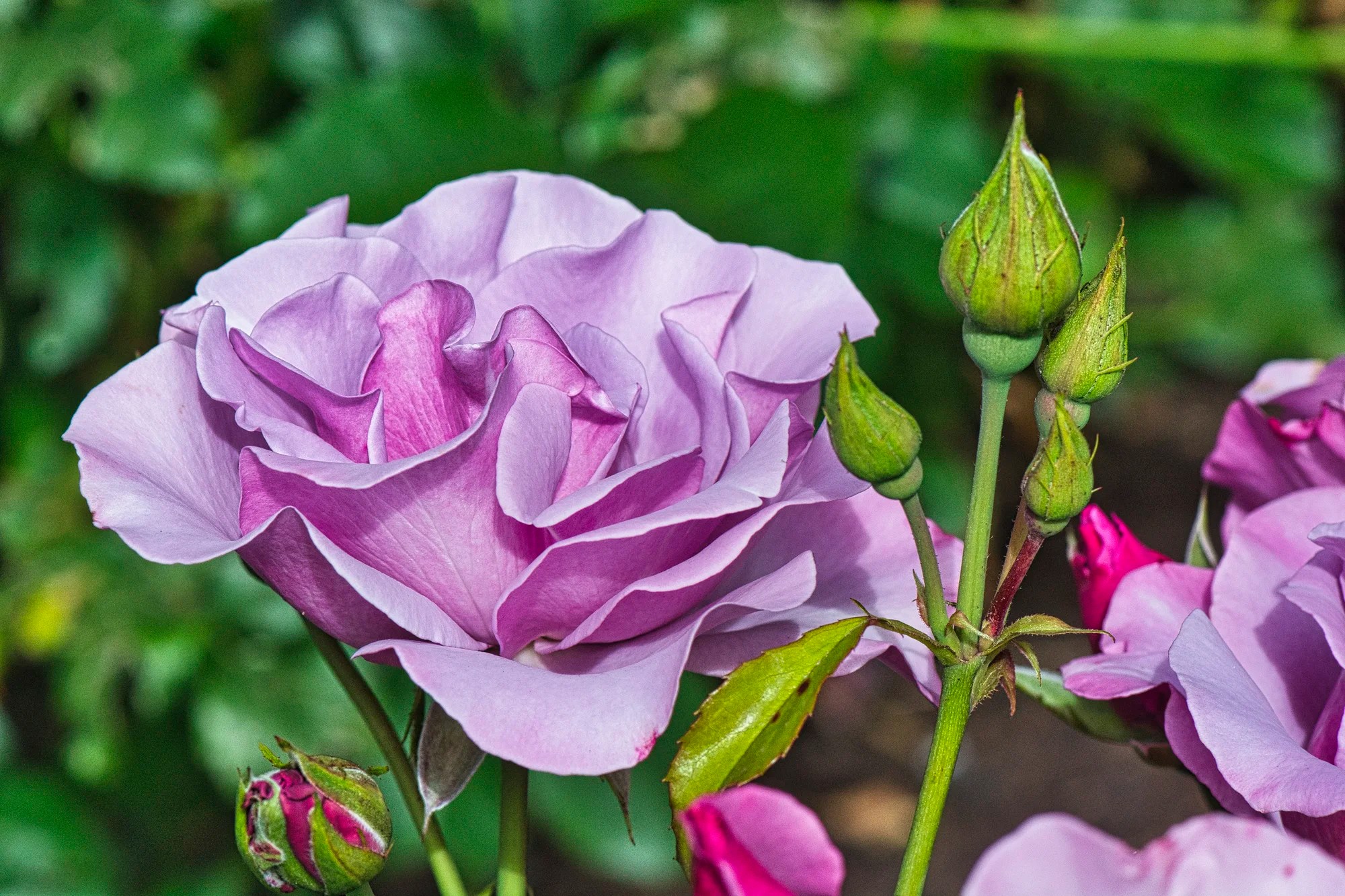
The Central Rose Garden was built in 1909. I have many beautiful photos of the tea roses.
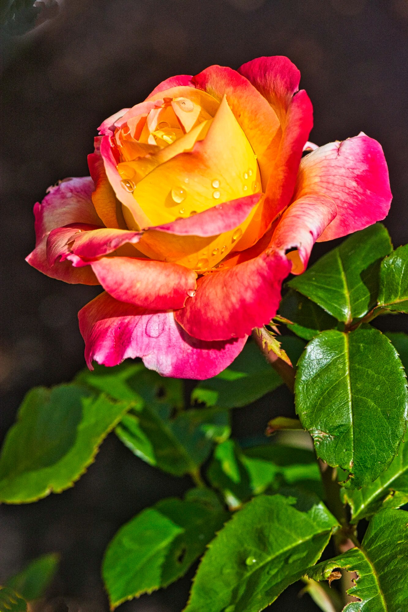
It was the French, not the British, who popularized rose gardens. Château de Malmaison created the first garden that specialized solely in roses. After living in England, this came as quite a shock.
Its owner was Empress Joséphine, the wife of Napoleon Bonaparte. She created an extensive collection of roses (1803–1814), growing 250 varieties of roses.
The first hybrid Tea Roses were created in France in the mid-1800s.
Cockayne Memorial Garden
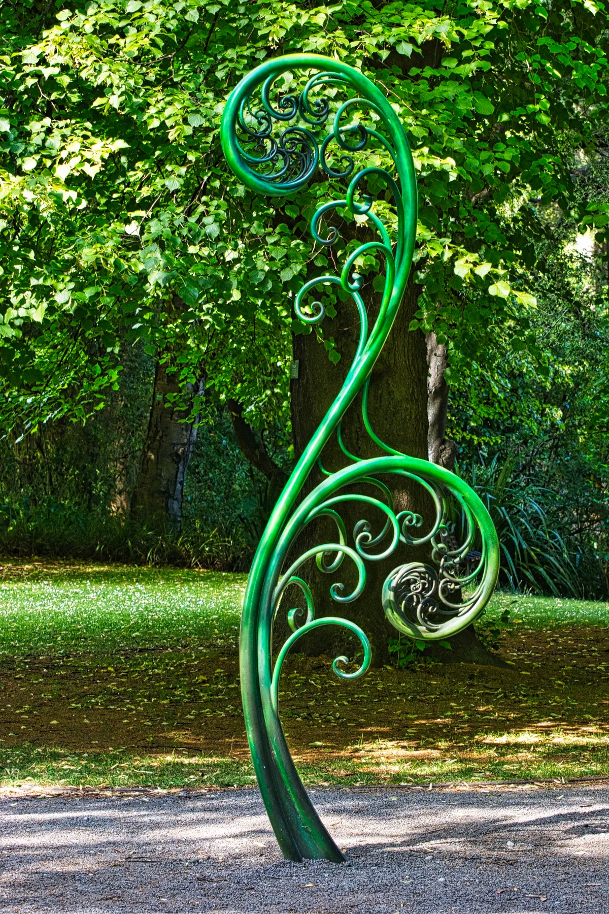
The Koru (silver fern) sculpture marks one of the entrances to a native plant section of the gardens. This beautiful sculpture is inspired by the shape of an unfurling silver fern frond.
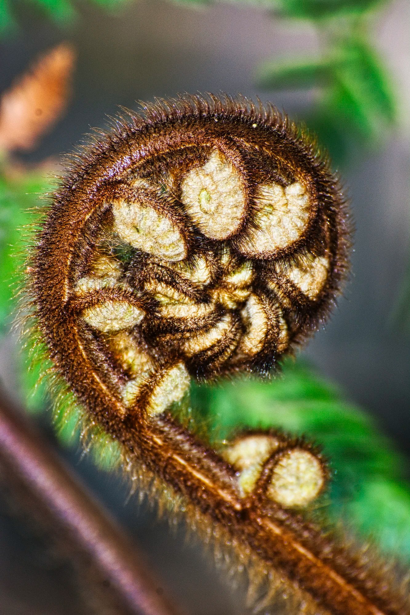
The koru is a significant symbol in Māori culture, representing life, growth, strength, and peace. Look for real ponga or tree ferns. The silver fern on a black background is a symbol of sports teams and Air New Zealand. The koru dates back to 180 million years ago (Jurassic Era). They survived the Cretaceous Mass Extinction Event that killed off the dinosaurs. Why?
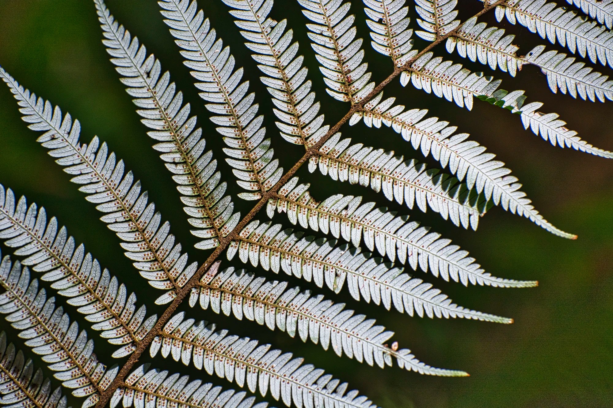
Ferns reproduce via spores, those little orange dots on the underleaves above. They reproduce in large quantities and spread quickly over wide areas. This allows them to recolonize devastated areas faster than many other plants. Ferns are resilient to environmental change. They can grow in poor soil quality and limited light, which is what happened in the Cretaceous Mass Extinction Event.
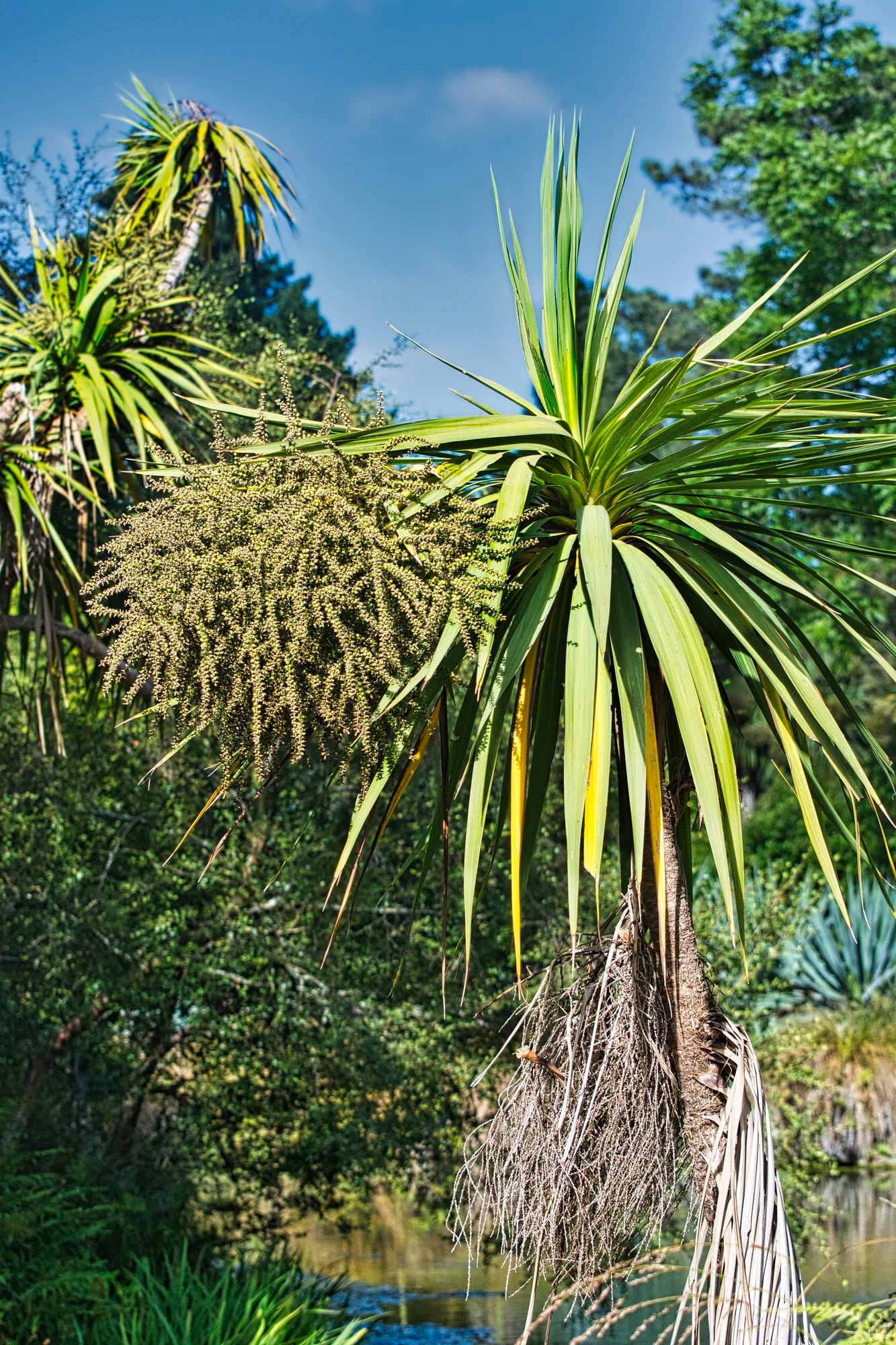
Another common sight in NZ is the Cabbage tree (tī kōuka). Its’ leaves were used by the Maori to make sandals and short cloaks. The cabbage tree is the largest member of the lily family in the world.
Look for the Rimu or red pine tree. Rimu has long been favoured for fine furniture. What is more incredible is that the rimu dates back to when Earth had only one continent, Gondwana – 600 million years ago. Today’s continents began forming 180 million years ago (Jurassic Era). New Zealand spun off from Australia around 85 million years ago.
Birds

The park is also home to 56 species of native and introduced birds. The NZ pigeon (kererū) is a very large, endemic pigeon with an iridescent, green upper body. It is hard to miss this bird.
River and Pond
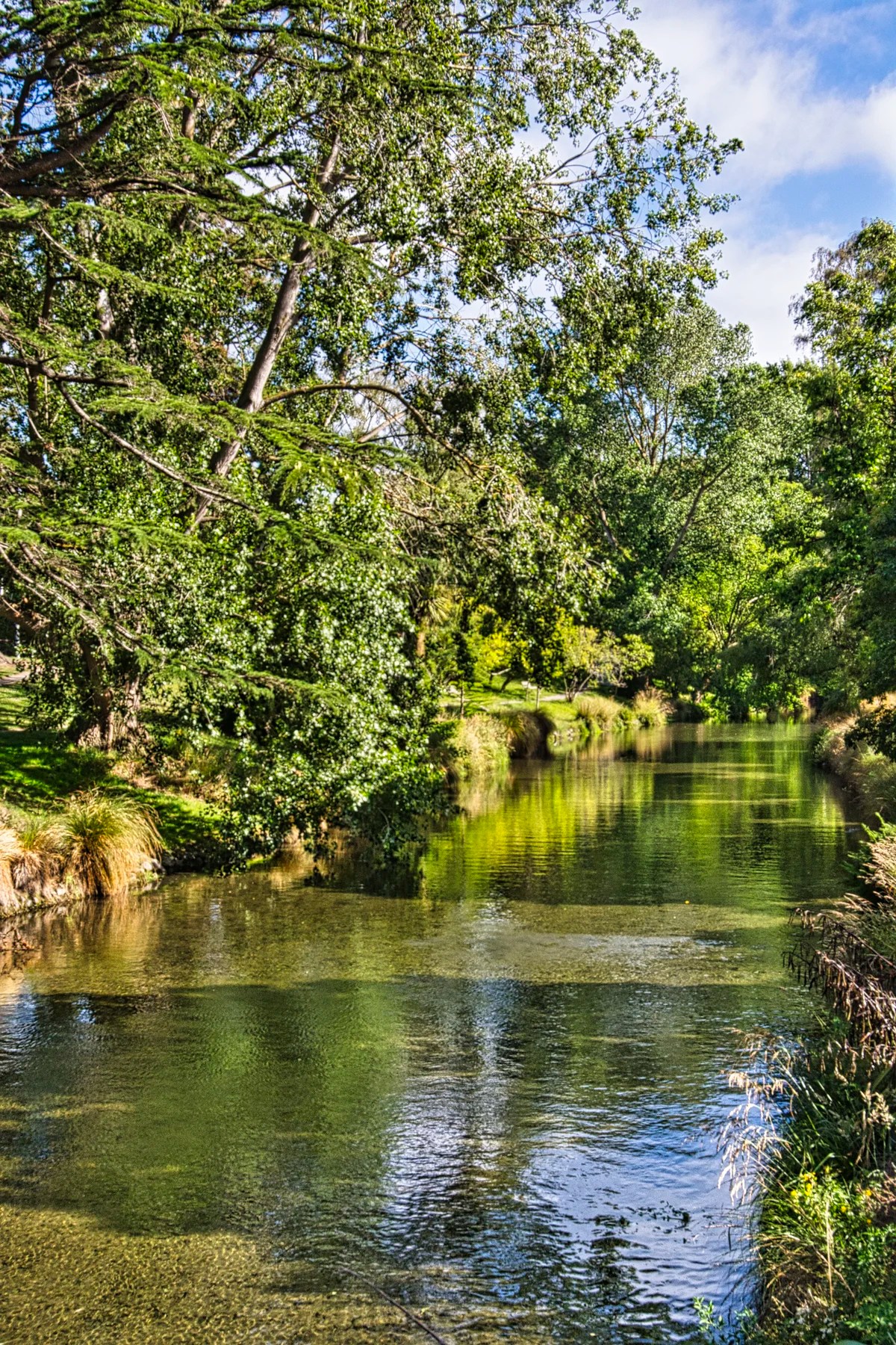
The gardens provide a tranquil setting with many walking trails including one along the Avon River.
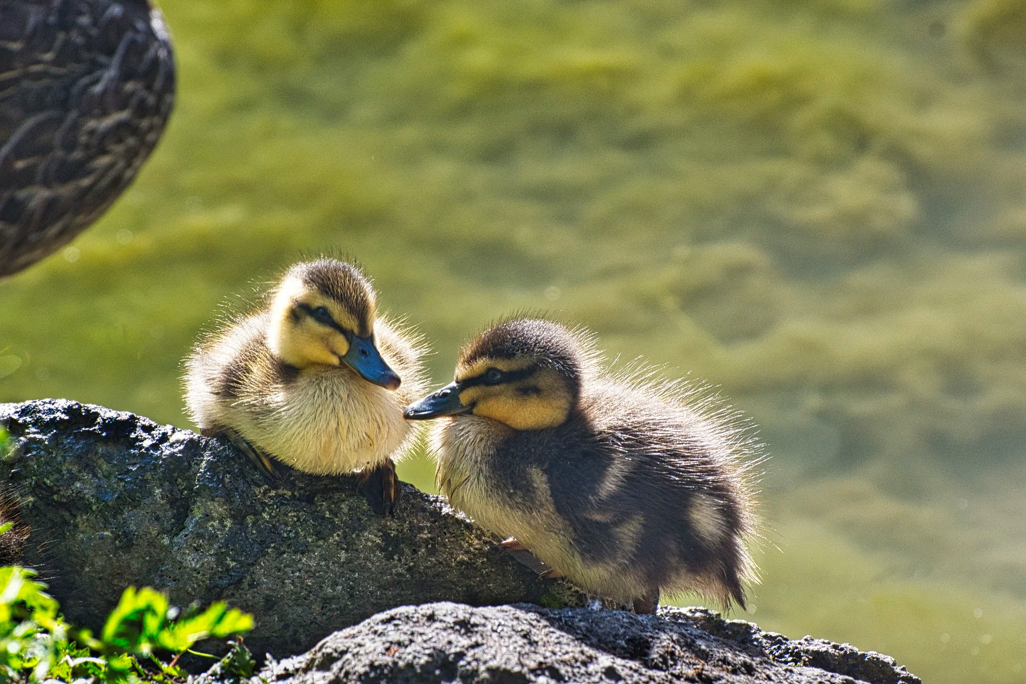
Six blue-winged teal ducklings were swimming in the pond. A couple were tired out and decided to rest on the rocks.
Trees
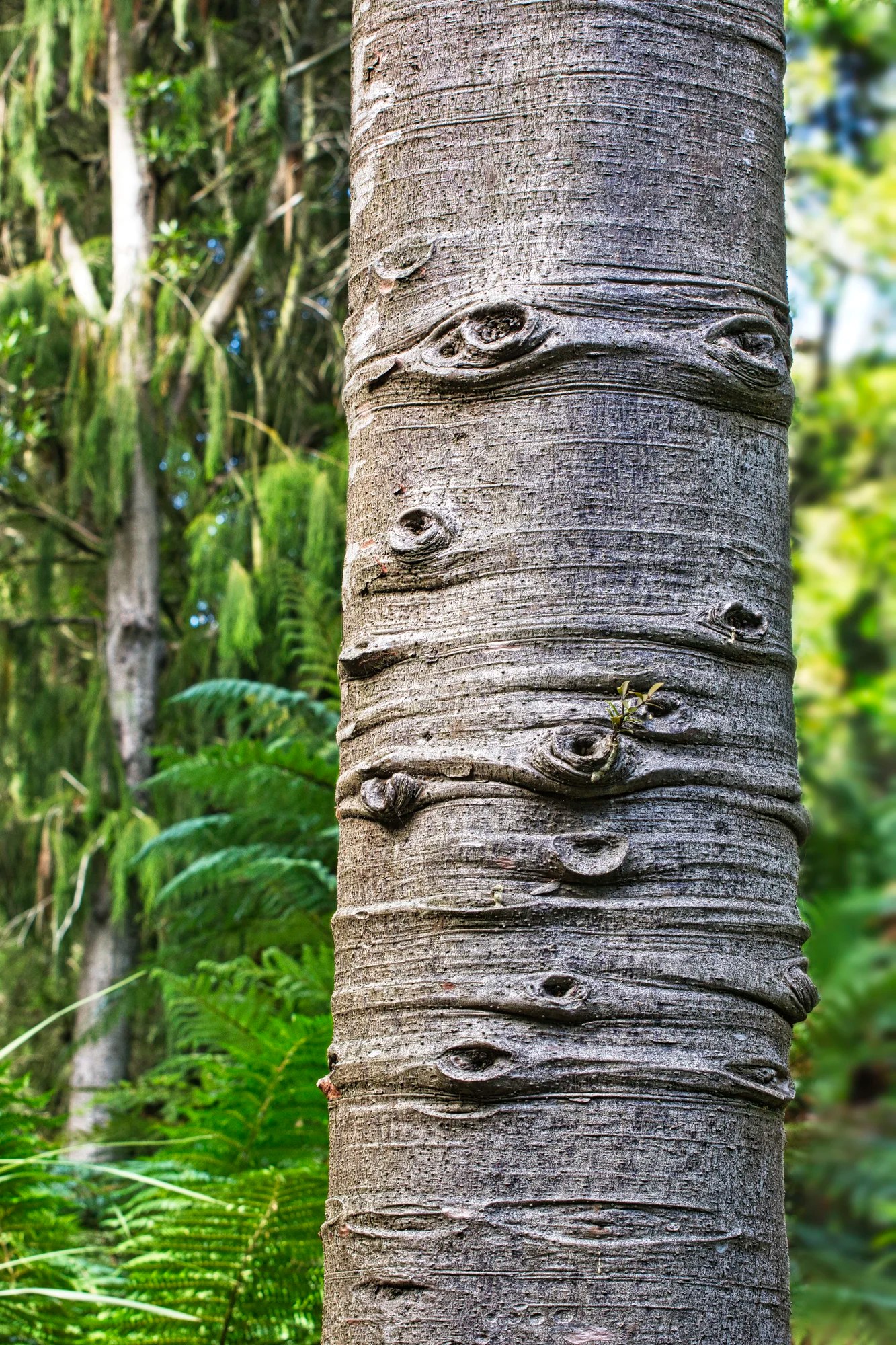
Look at the details and you will be amazed by nature. I don’t know the name of this tree. But the bark looks like the Spots of Jupiter.
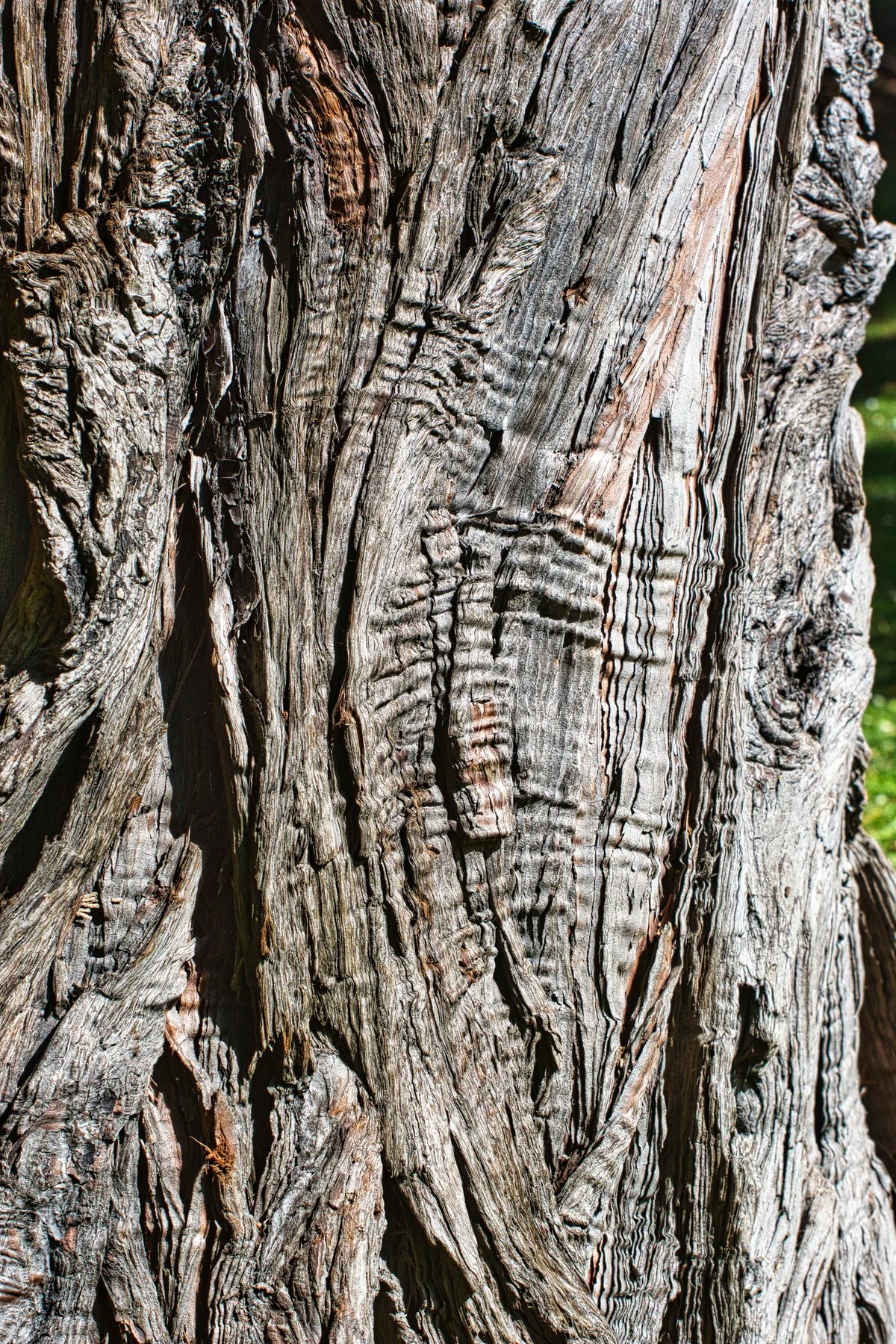
The grain on this Incense Cedar Bark interested me.
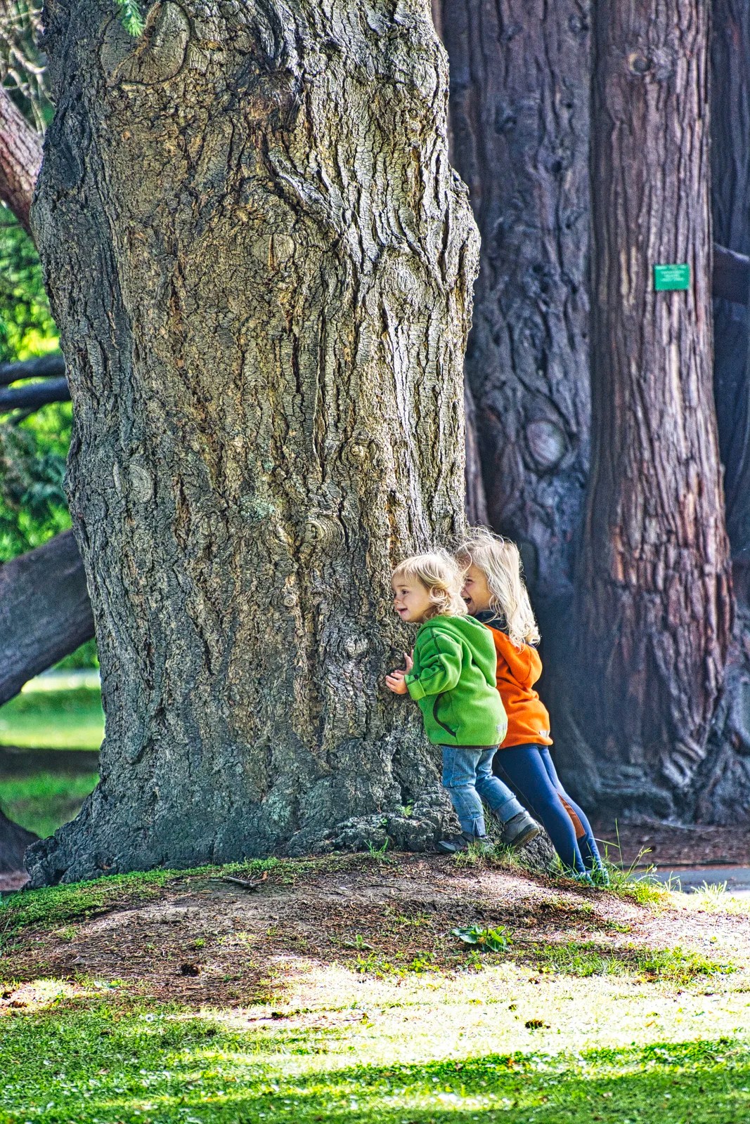
The gardens offer many family-friendly facilities including playgrounds, picnic areas, and restaurants. Here “cheating” kids are playing hide ‘n seek with their parents. There is no way their parents will be able to spot their kids hidden behind these massive trees.
The River Walk Border
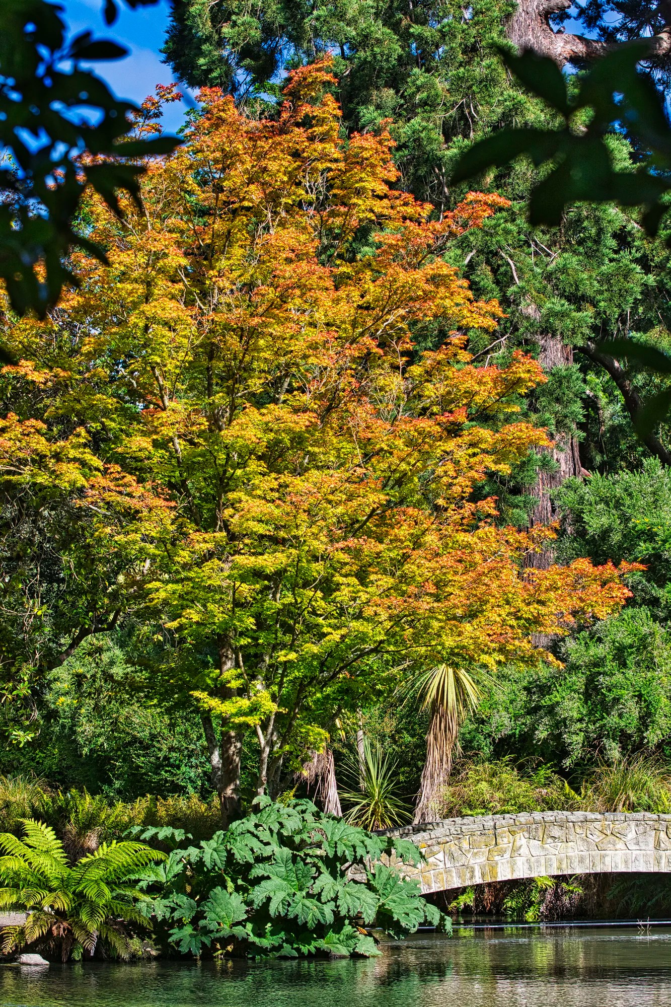
The River Walk Border, south of the Archery Lawn, contains a temperate Asian collection of trees and shrubs, most of them from China, Japan and the Himalayas. This stone-arched bridge and golden Japanese Maple are located in the Temperate Asian Garden. It’s a peaceful spot to enjoy the serene surroundings.
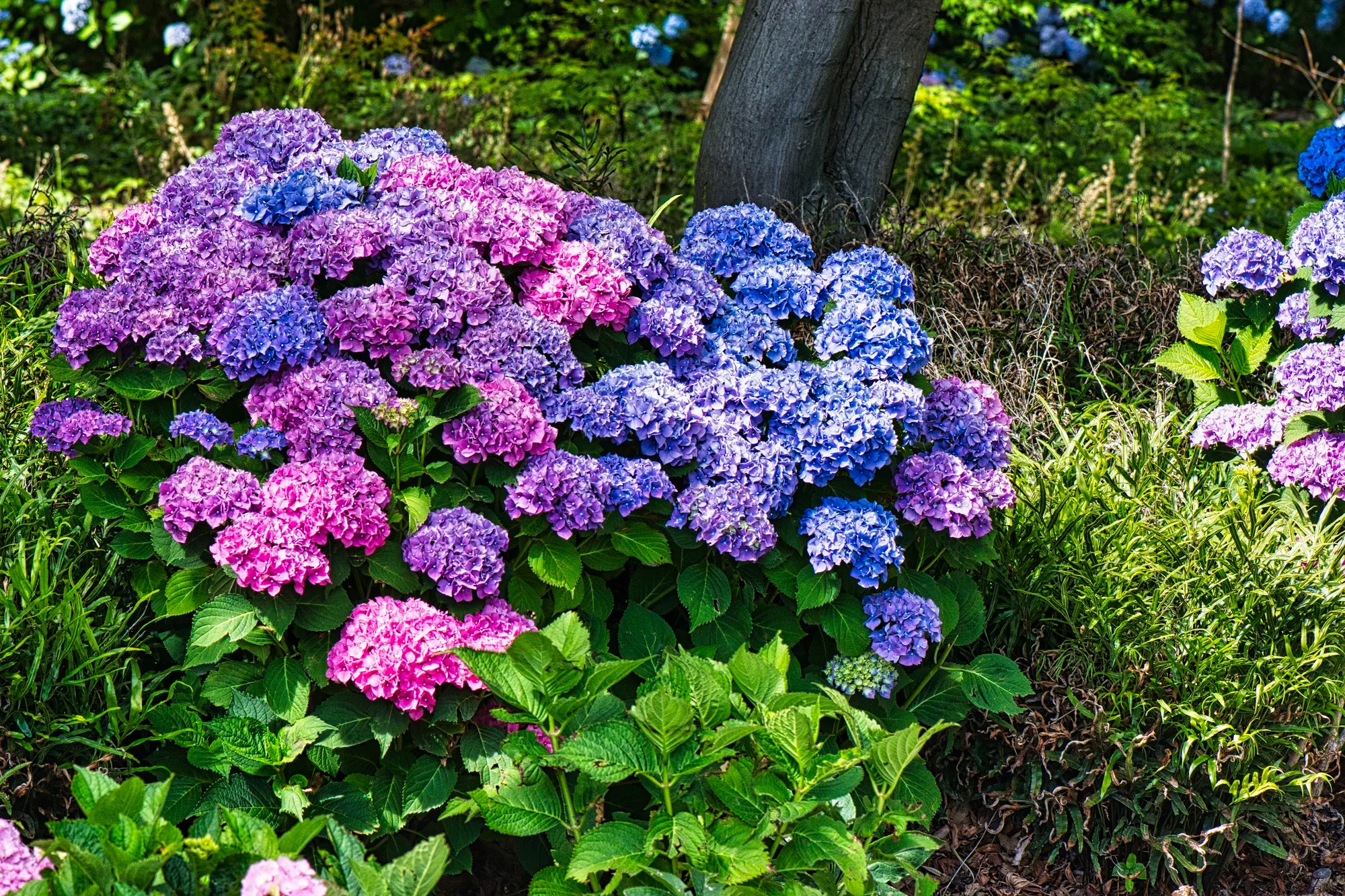
Why are the Hydrangea macrophylla located in the River Walk Border? Hydrangea are native to both Asia and the Americas. The name Hydrangea is derived from Greek and means ‘water vessel’.
What is amazing is that Hydrangea are natural pH indicators. When the soil is acidic (pH of 5.5 or lower), they will produce blue flowers. When the soil is alkaline (pH of 6.5 or higher), they will produce pink flowers. When the soil is between pH 5.5 and 6.5 they will have purple flowers. That is just amazing!
Peacock Fountain
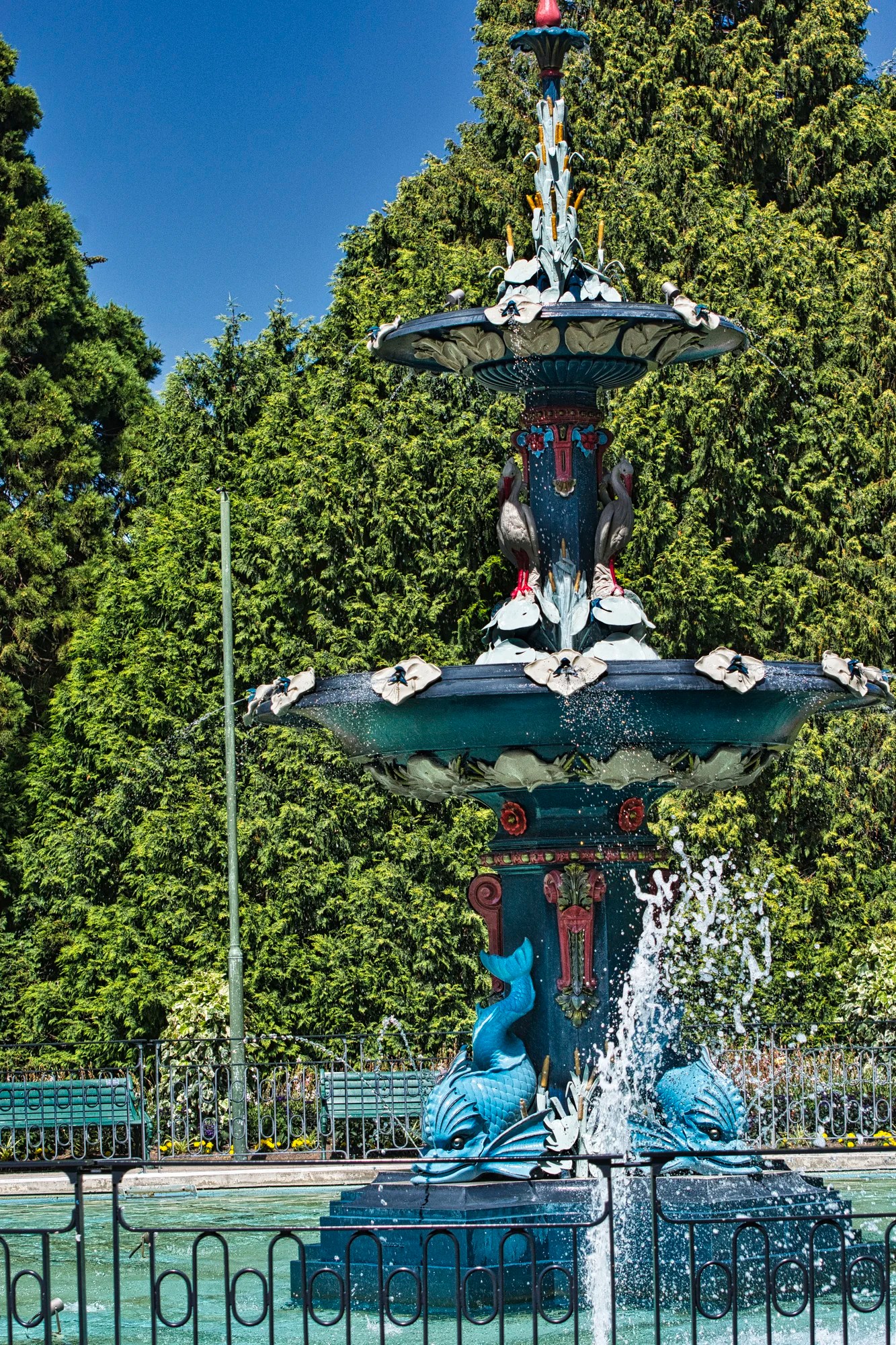
The iconic Peacock Fountain is near the Rolleston Ave. entrance of Christchurch Botanic Gardens. It is an ornate, three-tier cast-iron fountain. The fountain is decorated with dolphins, herons, lily leaves, and foliage. Why is it called the Peacock Fountain when there are no peacocks on it? It was imported from London and installed in 1911 thanks to a bequest from John Peacock.
Christ’s College
Address: 33 Rolleston Avenue
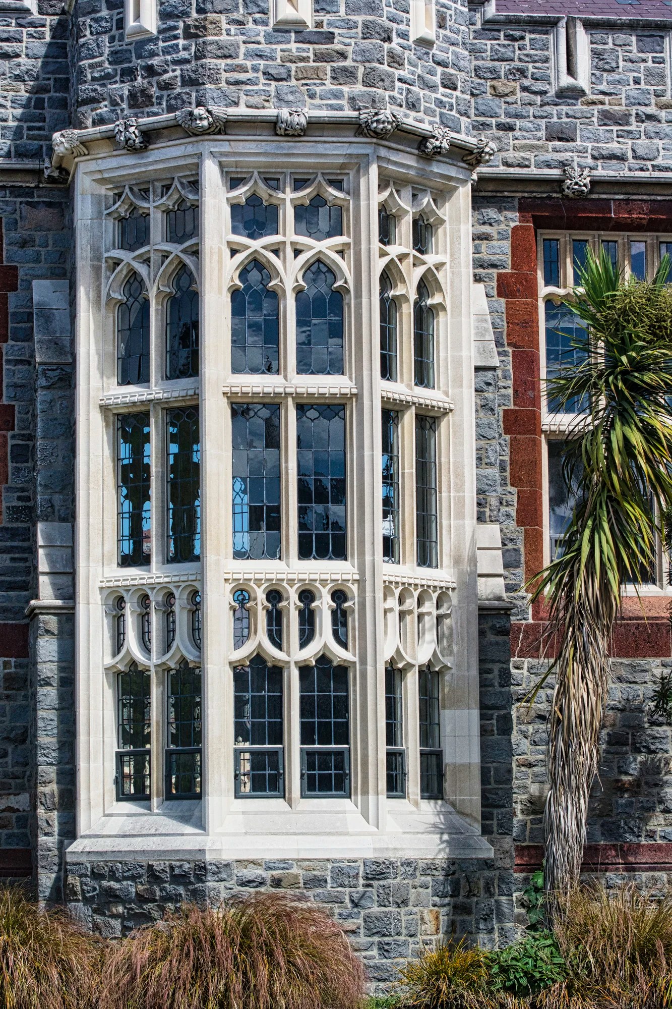
Completed in 1930, Christ’s College (G3.4) is the oldest school in Christchurch. To meet the need for more educational space, this private school came up with the idea of open-air classrooms. Its’ ornate architecture was modelled on the public schools of England. Christ’s College has been extensively strengthened with exposed steel diagonal bracing after the earthquakes of 2011.
Kiwi English
New Zealand has a unique brand of the English Language. Kiwi is the alias for New Zealander and Chinese gooseberry (kiwifruit). BTW, there is a Kiwi English section in the New Zealand FAQ. There are many amusing words and expressions in NZ. But what is a kiwi?
Kiwi
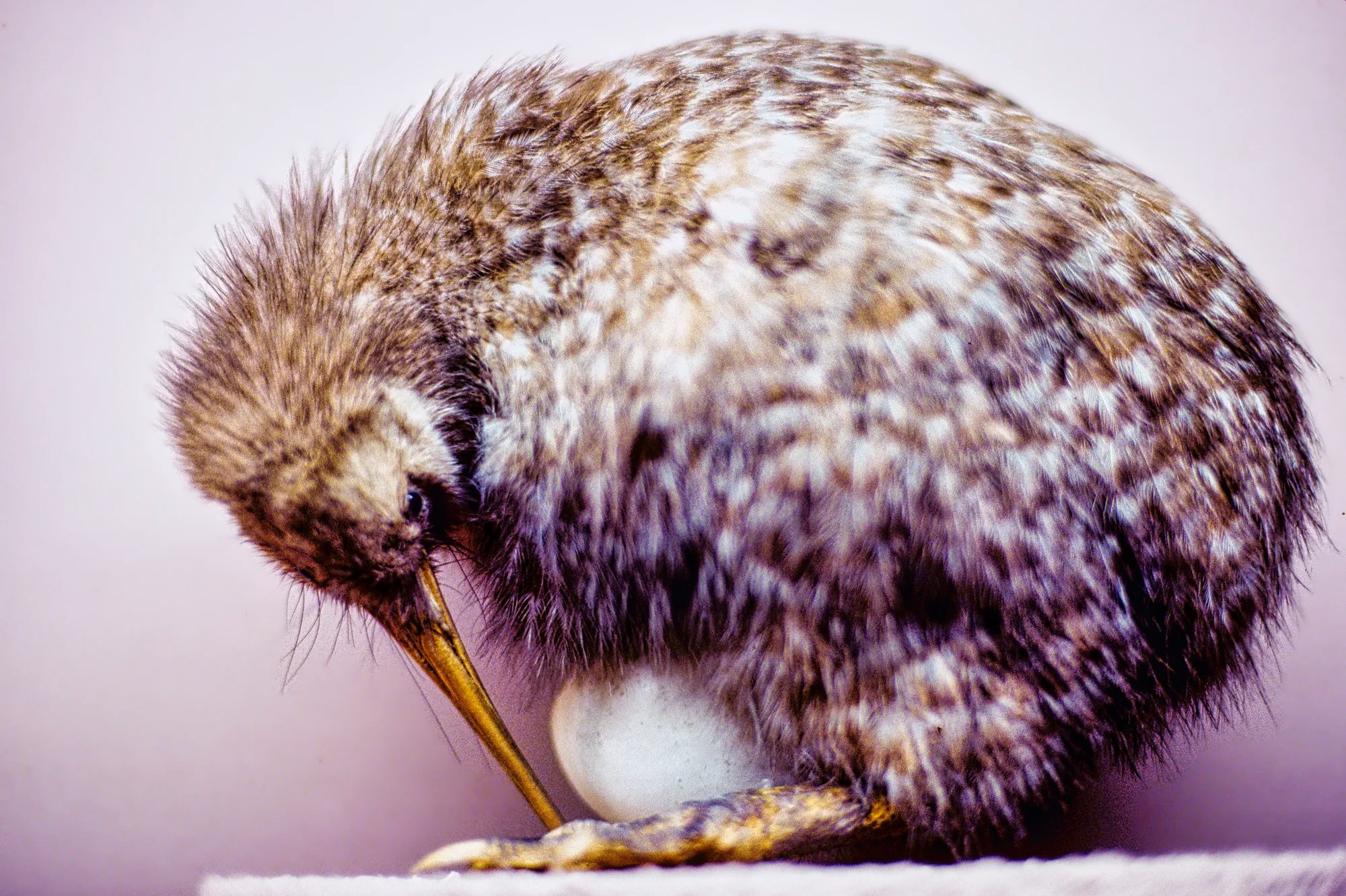
Kiwi is a small flightless bird that is the national symbol of NZ. Their feathers have evolved into more like warm hair. There are 16 species of flightless birds in NZ. The kiwi is endemic to (only found in) NZ. There are 115 endemic bird species in NZ. It is a birder’s paradise.
Kiwis have a low metabolism so they don’t need to eat much. The kiwi puts a lot of effort into incubating their eggs for 80 days. But the most amazing fact is that they lay the largest eggs in proportion to their body size. Their 10 kg eggs are 15% of their 70 kg body weight. This is a photo of a diorama at the Canterbury Museum. I don’t think that is a real Kiwi egg.
Kiwis live up to 50 years. They are nocturnal and half-blind. They have catlike whiskers to help them forage. We have never seen them in the wild but we have seen them at Kiwi nocturnal houses. The illumination was equivalent to moonlight. I don’t remember the names of the places we visited. One place highly recommended on social media is:
Willowbank Wildlife Reserve
Address: 60 Hussey Rd
Hours: 09:30 to 17:00 daily
Canterbury Museum
Address: 11 Rolleston Avenue
Hours: currently closed
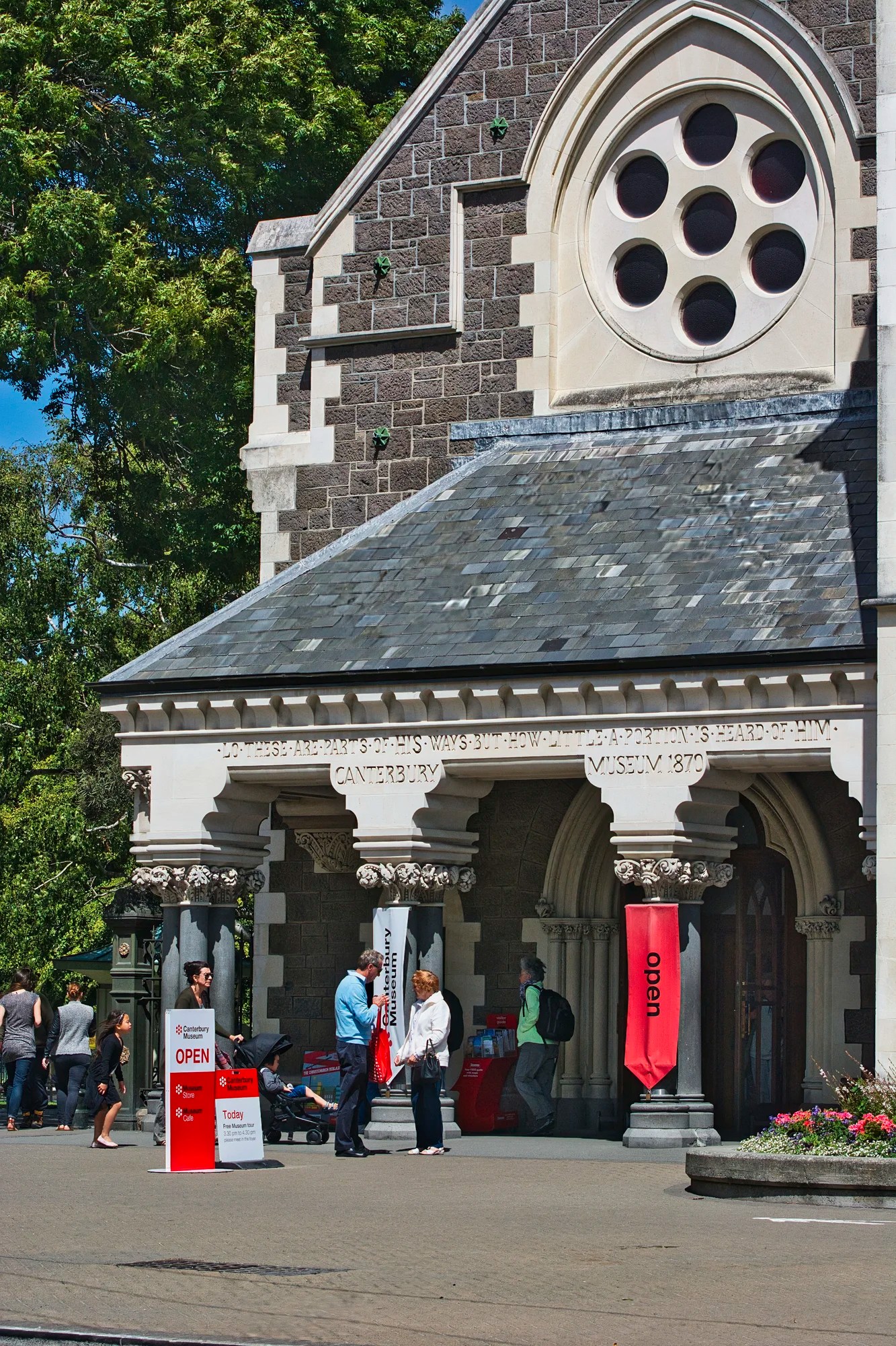
The Canterbury Museum (G4.6) was established in an 1867 Gothic Revival building. The museum sustained minor damage to its façade during the 2011 Christchurch earthquake. The museum is currently closed but some exhibits are housed in the nearby Centre of Contemporary Art (CoCA) below.
We saw this excellent museum on our first trip. There were two collections we especially loved. Many expeditions to the South Pole started from NZ. The Antarctic Collection displays the history and artifacts of these treks. Most moving is the courage of the explorers in the face of adversity. Imagine the disappointment of Scott who reached the South Pole only to find Amundsen had beat him by one month! Also surprising is the meagre amount of food they ate each day. No doubt this was due to the heaviness of all the canned food and the early, primitive equipment.
The Colonial Hall was well designed as a town street with storefronts displaying typical items for sale. There was even a buggy and a horse coach. Upstairs, the Lace Corner had fine examples of lace and who had worn it!
CoCA Toi Moroiki Museum
Address: 66 Gloucester Street
Hours: 09:00 am to 17:30 (Oct to Mar); else until 17:00
Fee: free /donation
We read that the Antarctic and Colonial Street exhibits are on display here. A whole new museum is being constructed to replace the Canterbury Museum.
Old Chief Post Office
Address: 31 Cathedral Square
The old Chief Post Office (CPO) was designed in the Italianate style popular in the Victorian era. It has Venetian Gothic elements such as the fake pointed Saracenic arches (from India and the Middle East) in the upper storey windows.
The CPO is a historic building that opened in 1879 and has served various purposes over the years, including housing the first telephone exchange in New Zealand. While it has survived several earthquakes, it has been closed since the 2011 earthquake. The renamed building, The Grand, is set to open soon and will include restaurants, shops, and a visitor information center.
Christchurch Cathedral
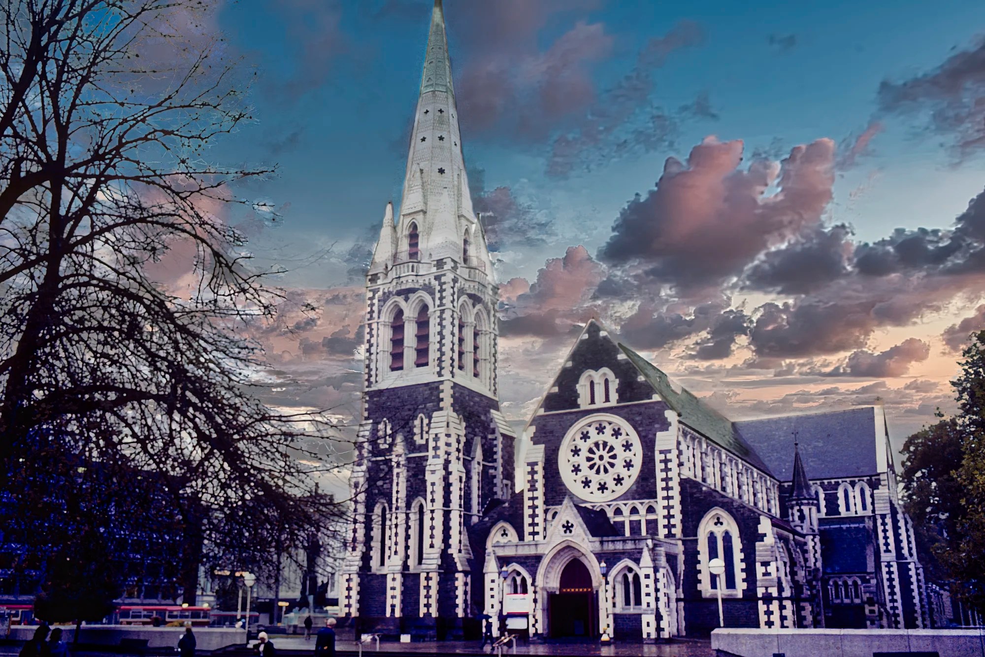
Christchurch Cathedral (G4.1) is located in the centre of the city, surrounded by Cathedral Square. It is the icon of the city. This was a very old slide photo on a rainy day. I tried to add more light but had to settle for converting it into a low-light sunset photo.
Its design was modelled after Christ Church Cathedral, Oxford in the UK. Like many of the world’s great cathedrals, it took many years to complete — from 1864 to 1904. The interior had a lot of woodwork and tilework.
Christchurch Cathedral was severely damaged in the 6.3-magnitude 2011 Canterbury earthquakes. The quake destroyed the spire and the upper portion of the tower, and severely damaged the building. In 2012, the Anglican Church decided to demolish the building and replace it with a new structure. Various groups opposed this idea and took the church to court. The Church won the case but demolition was halted. In 2017, a new survey estimated the cost of reconstruction at NZD 104 million. In 2024 the reconstruction cost was revalued to $248 million. The NZ government decided not to fund the rebuild. There has been no further progress.
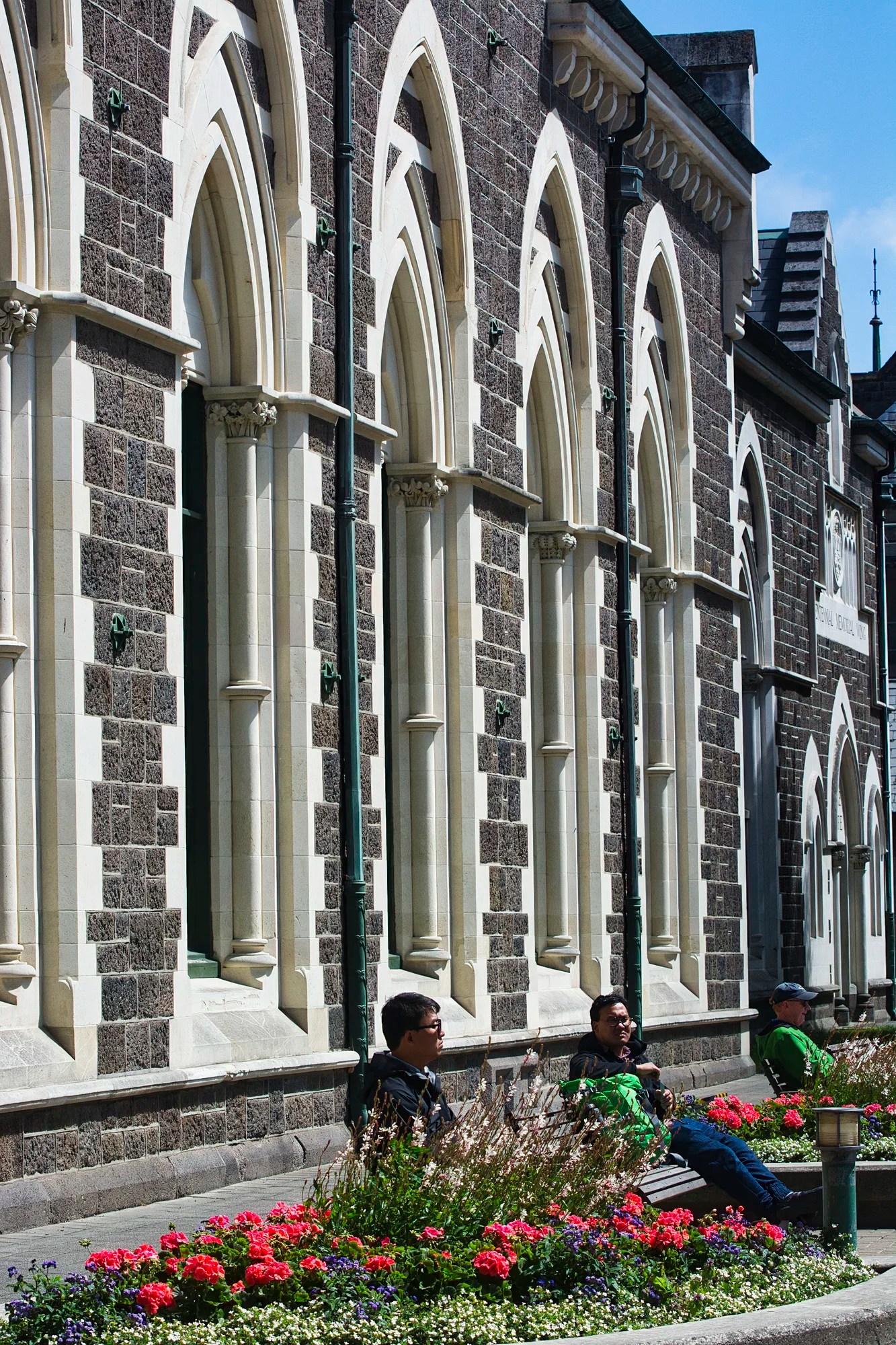
Victorian Architecture
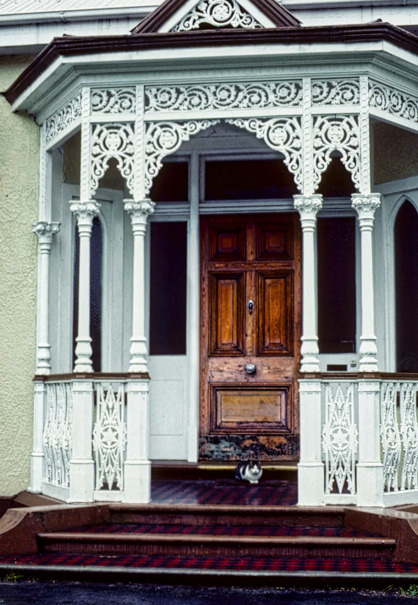
Many parts of Christchurch have Victorian architecture. Victorian architecture is NOT a particular style. It refers to the era of Queen Victoria (1837 to 1901). The Victorian Era reflects the wealth of the British Empire at its height. It encompasses overlapping styles such as Romanesque Revival, Gothic Revival, and Italianate. The most memorable Victorian-style elements are wrought iron balconies and fences, spires, turrets, gables, and rooftop finials. They use intricate motifs in the ironwork, tiles, and friezes.
Christchurch Cathedral was designed in the Gothic Revival style and is characterized by features such as pointed arches, ribbed vaults, and large windows with intricate tracery. It became the preeminent style in the 19th century — not only in Europe but in the British Commonwealth. Another notable example is the Parliament Hill buildings in Ottawa, Canada.
Riccarton House
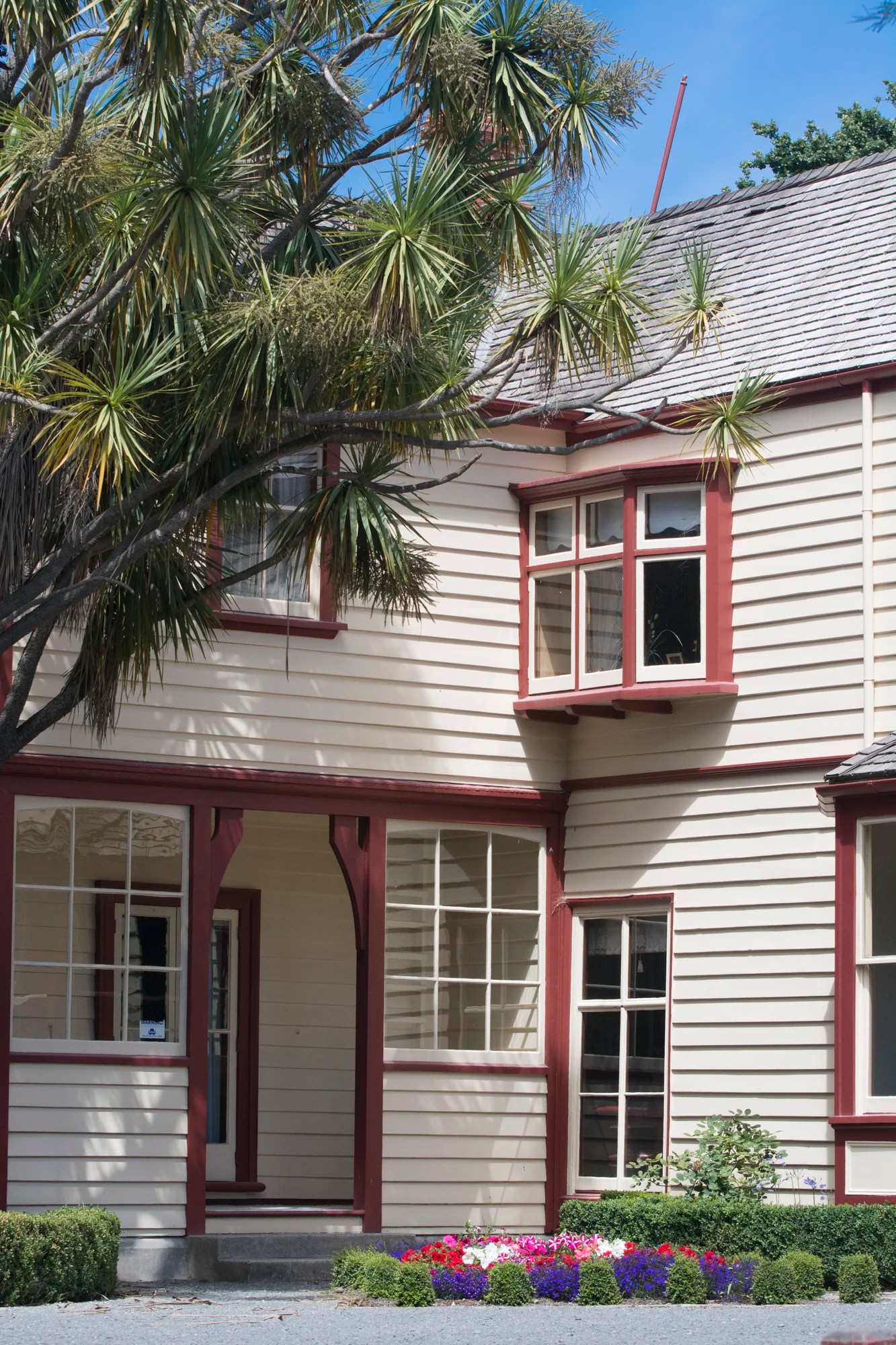
Riccarton House was completed in 1856. It is one of the oldest surviving homesteads. It combines elements of both Victorian and Edwardian architecture styles. After suffering damage from the 2010 and 2011 earthquakes, Riccarton House was restored and reopened in 2014. We walked a bit of the forest trails. The Riccarton estate is now owned by the Christchurch City Council.
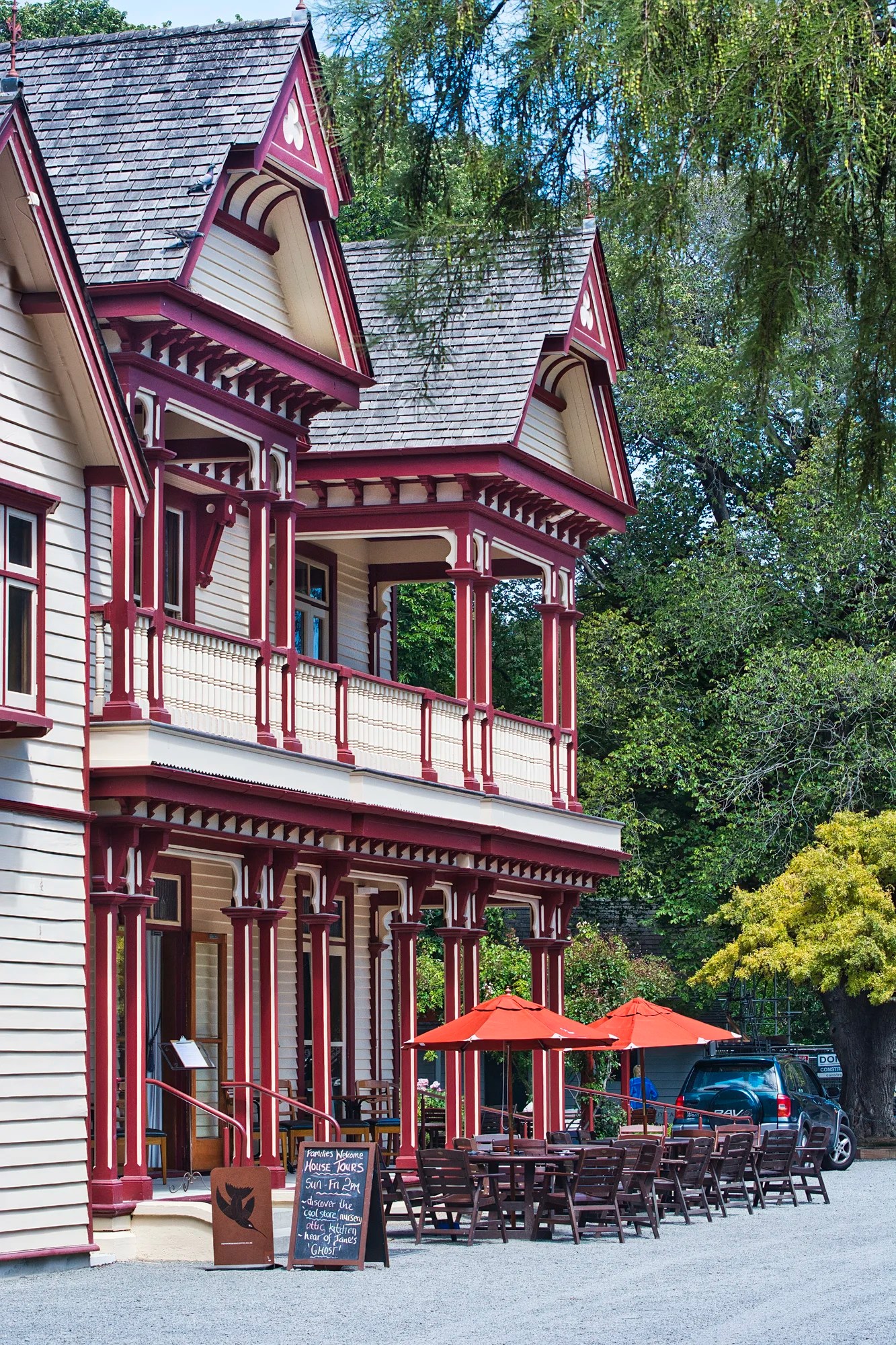
On Saturday (09:00 to 12:00), it hosts the Christchurch Farmers’ Market (G4.7). This popular market features fresh produce, crafts, meat, coffee, and baked goods. On other days you can get coffee and meals at Quarters (G4.1) in the House.
Food and Cafés
We tried many good cafés and restaurants in Christchurch. For supper with the Robertsons, we had hogget (1 to 2-year-old sheep) for the first time. It had a much richer and stronger flavour than lamb. Generally at home, we eat lamb (< 1-year-old sheep).
Wine Regions
New Zealand has some superb wines. On our first trip, we were blown away as we did not even know about Kiwi wines. We read about them in the Air New Zealand in-flight magazine as we flew into NZ. Today NZ wines are very common in our liquor boards. Christchurch is a good jumping-off place for wine tasting. In particular, you can visit these nearby regions:
Marlborough, the largest wine region in NZ, is famous for Sauvignon Blanc. The sunny climate, silty soil, and long growing season create perfect conditions for producing vibrant and aromatic wines. The most famous wineries are Cloudy Bay and Villa Maria Estate. But why go to wineries whose products are available at home? Instead, try Fromm Winery (G4.5), Wither Hills (G4.5), Framingham Wines (G4.8), Nautilus Estate (G4.6), and Saint Clair Family Estate (G4.6) for wine tasting.
Waipara Valley / Canterbury is known for Riesling, Pinot Noir, Sauvignon Blanc and Chardonnay. Try Torlesse Wines (G4.8), Black Estate (G4.6), and Pegasus Bay Winery (G4.7). The Waipara Hills Winehouse (G4.5) is temporarily closed. Also, try Cellar Door (G4.6) right in Christchurch. These wineries have been pinned to the Christchurch map.
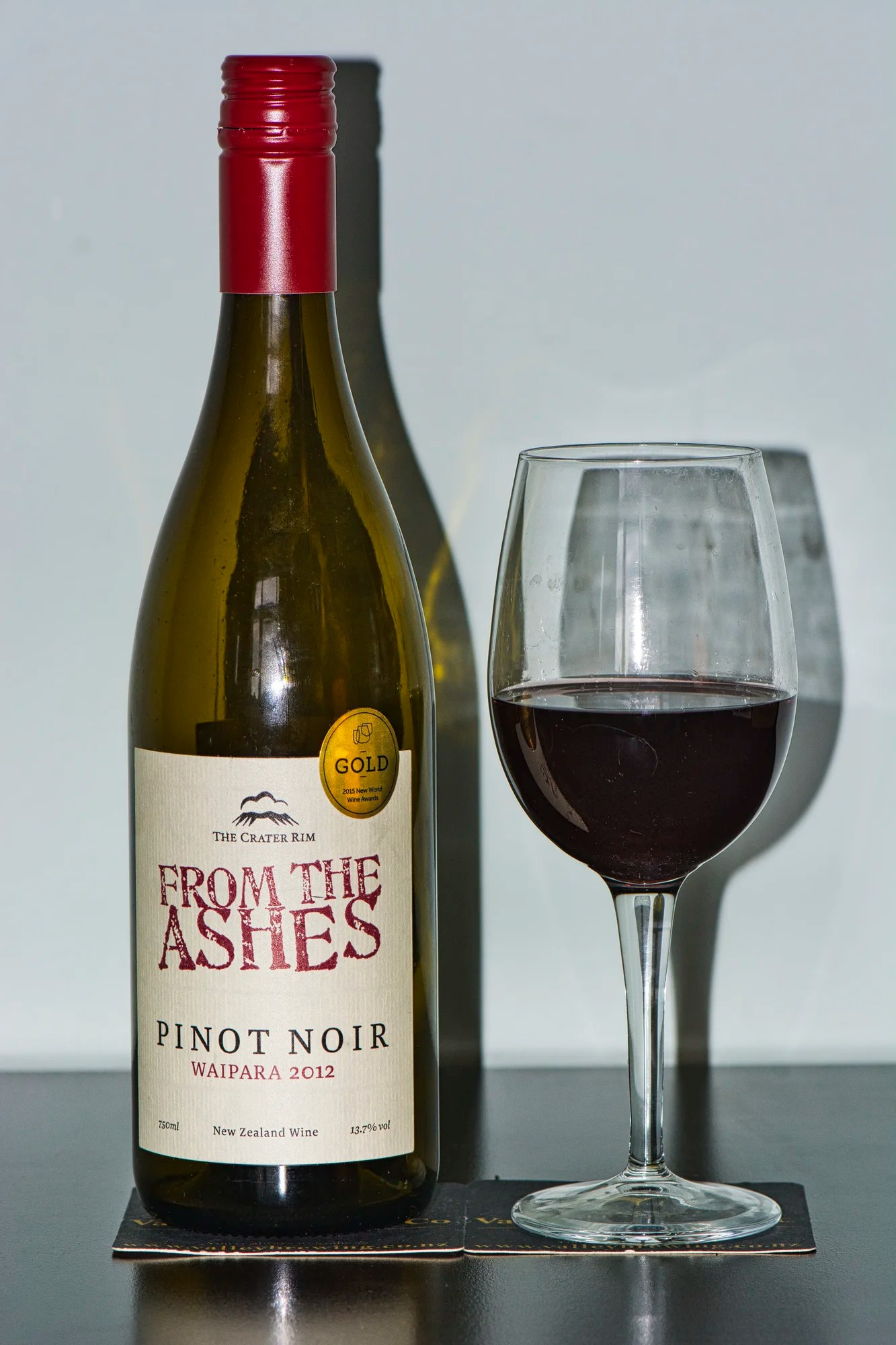
On our last trip, we tried From the Ashes Pinot Noir from The Crater Rim Winery and a Riesling from Giesen Wines. Giesen Wines have won awards for their Pinot Gris, Riesling, and Sauvignon Blanc.
Christchurch Information and Map References
Botanic Gardens Walking Guide brochure PDF, Christchurch City Council 2011
Christchurch Walking Map web page, Christchurch City Council 2011
Christchurch Coast and Plains Walks brochure PDF, Christchurch City Council
Ōtautahi Christchurch and Canterbury, Pure New Zealand
Ōtautahi Christchurch & Canterbury Itineraries
Port Hills Walks brochure, Christchurch City Council
Rome2Rio app – Christchurch transportation options
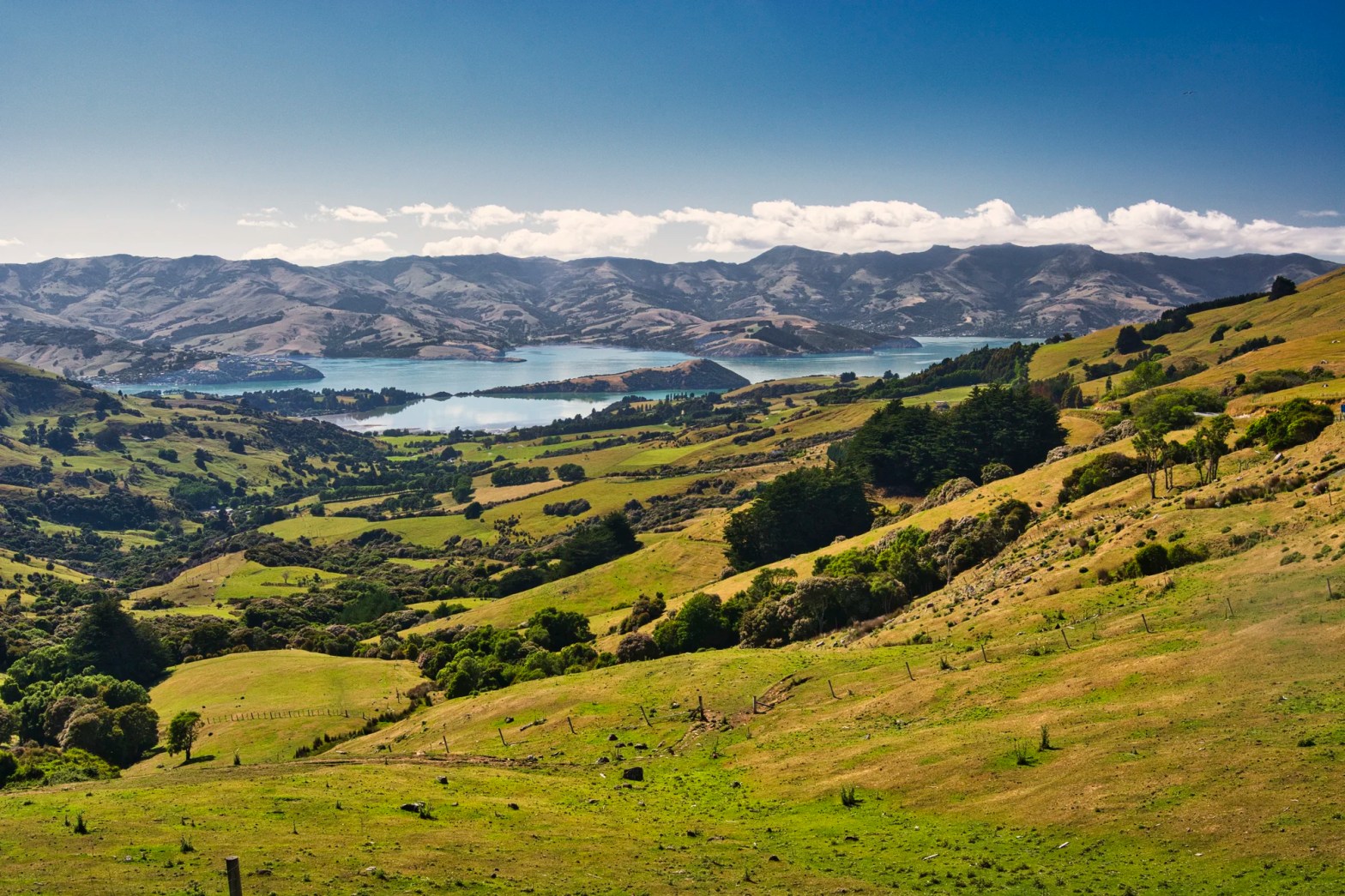
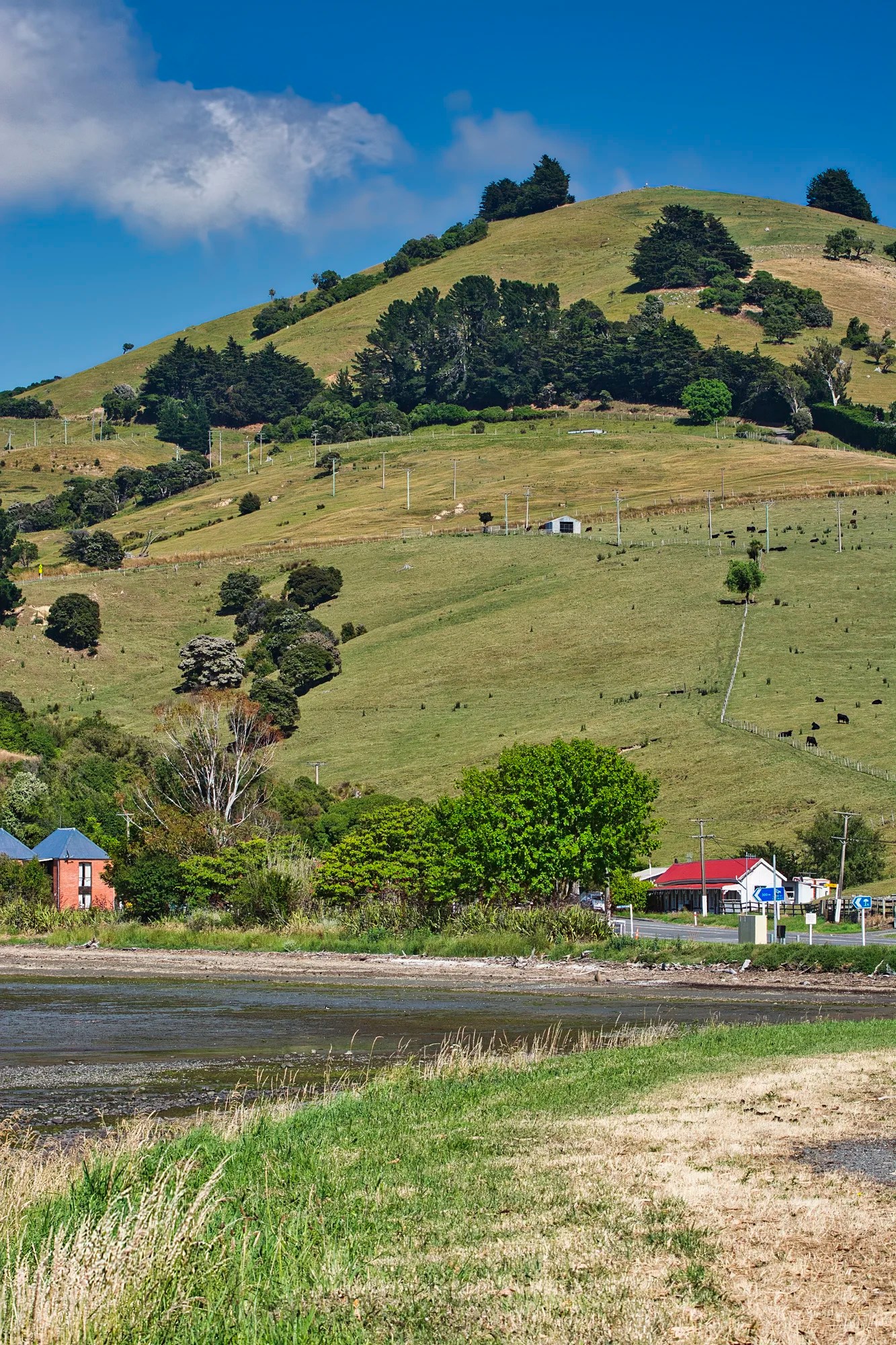
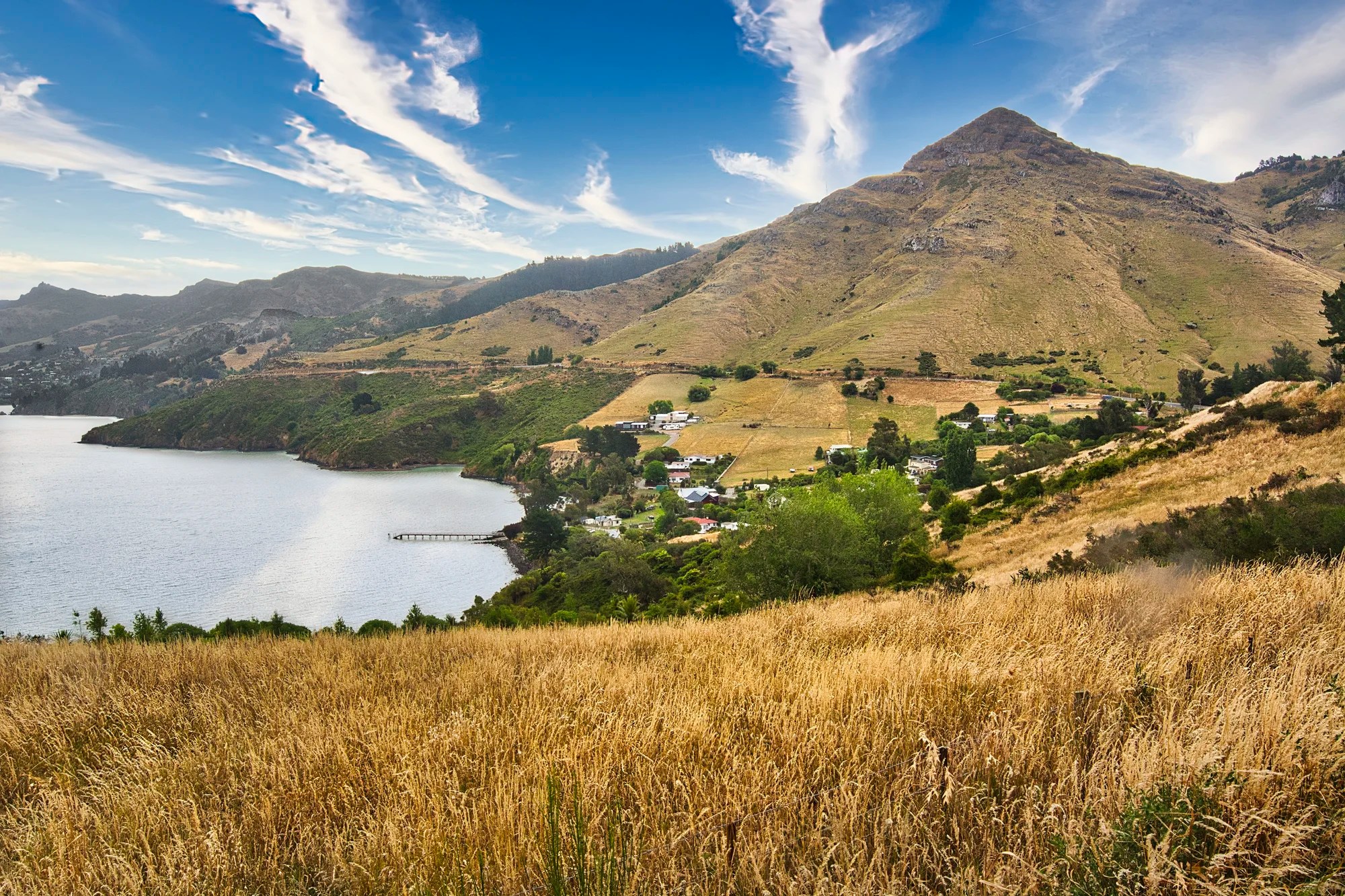
Banks Peninsula
Many people on social media rave about Akaroa. This is an example of name recognition of the most touristy town, where the cruise boats go. The main focus should be on driving the Summit Road around the Banks Peninsula.
Who is Banks?
Captain James Cook was the first European to see the peninsula in 1770. Cook mistook it for an island and named it “Banks Island” in honour of Endeavour‘s botanist, Joseph Banks. Ironically, it was an island — millions of years ago.
How did Banks Peninsula Form?
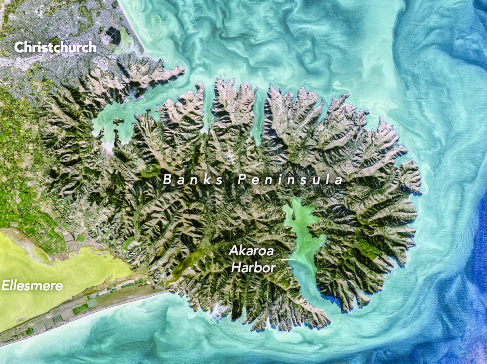
The Banks Peninsula is huge. It has an area of approximately 1,200 square km (450 sq mi) — the size of Rome. Look at a map and you see its classic circular shape. It was once a massive volcano — actually two volcanoes. It has been inactive for 5 million years.
Volcanoes formed due to the tectonic collision of the Australian and Pacific plates between ca. eleven to eight million years ago (Miocene Era). The peninsula originally was an island with 1,500 m high volcanoes. Both craters must have blown up as they are now the deep water harbours of Akaroa and Lyttleton. The flat Canterbury Plains to the northwest formed from the erosion of the Southern Alps, which joined the South Island with Banks Island.
Transportation

Our itineraries really cater to car transportation. Note that the minor roads have no shoulders. Only stop in a real pull-off to admire the views.
For those of you on a budget or not wanting to rent a car, parts of the Banks Peninsula can be reached by bus. The cheapest and best options are using the city bus NZD 1.20 to 2.40.
Bus #1: dep. Smiths City Bus Stop every hour
Sign of the Takahe: 23 mins + walk
Sign of the Kiwi: 29 mins + 2 km walk 29 mins
Bus #8: dep. Sydenham Shops Bus Stop every 30 mins
Gondola Summit Station: 19 mins + 30 mins walk
Lyttleton: 34 mins
Akaroa: 2:10 hrs, dep. 08:50 once daily Intercity Bus NZD 50
Sign of the Takahe
Car: 8 km 13 mins
Bus #1: 23 mins
Without a car, you are a 12-minute walk to Victoria Park views, 1:15 hrs walk to Sugar Loaf Viewpoint on Summit Road.
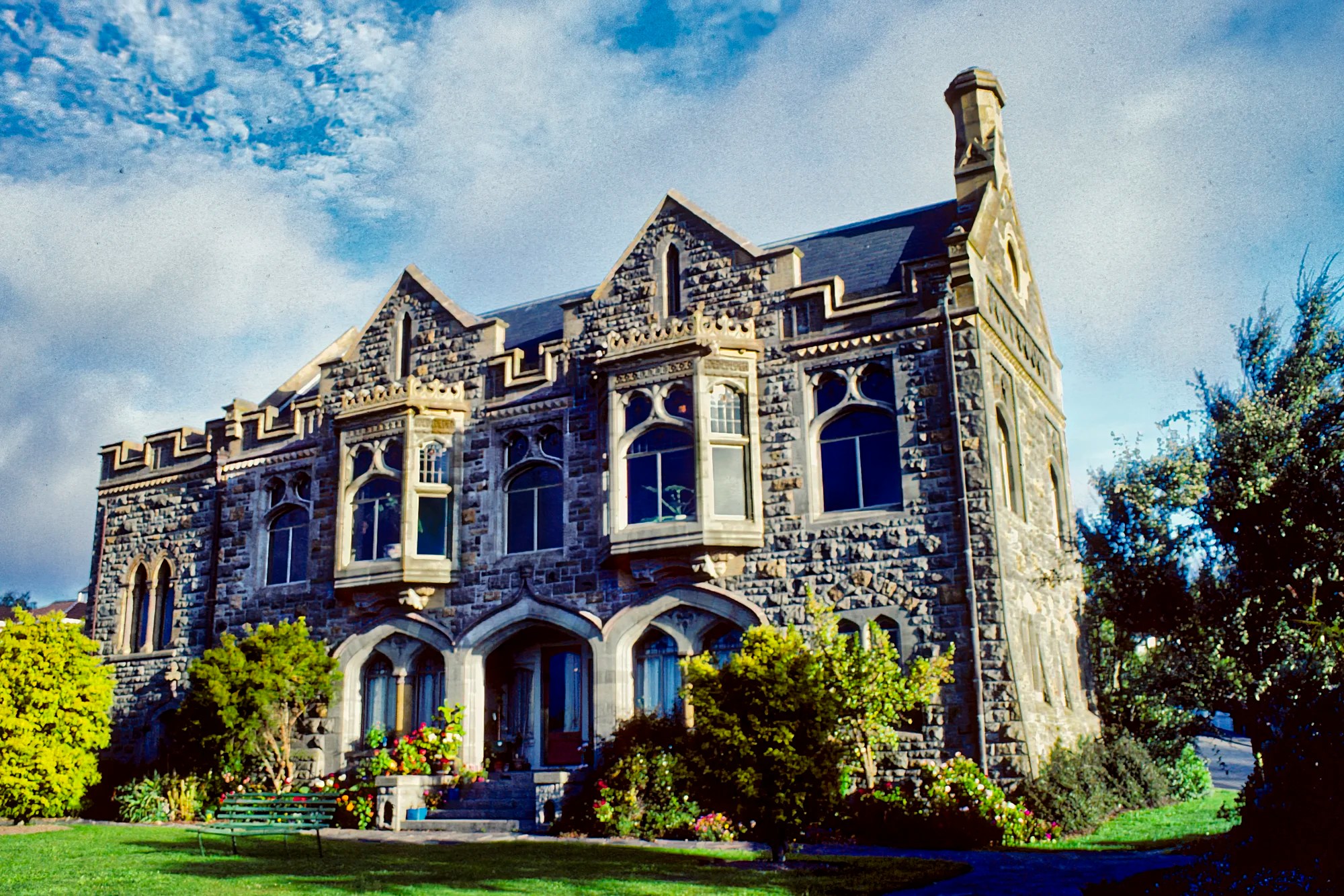
The neo-Gothic style Sign of the Takahe building looks like a castle sitting on the top of a hill. It was named after the NZ endemic flightless bird, the takahē. This historic building was supposed to be an inn for those horseback riding or walking the Port Hills that overlook Christchurch and Lyttelton Harbour.
The inn was never used due to the emergence of cars. The Gothic interior was dark, solid wood. The restaurant used to serve Devonshire tea as well as meals. Today the Garden Cafe and Beer Garden is open from 9:00 to 15:00 hrs. Wednesday to Sunday.
Construction began in 1918 but it was only completed in 1949! The building was damaged in the 2011 Canterbury earthquake. The 2011 earthquakes had their epicentres in the Port Hills. A NZD 2.8 million restoration was completed for the building’s centennial in 2017.
We drove the narrow Dyers Pass Road but also did a side trip to Victoria Park (G4.7) with views toward the ocean.
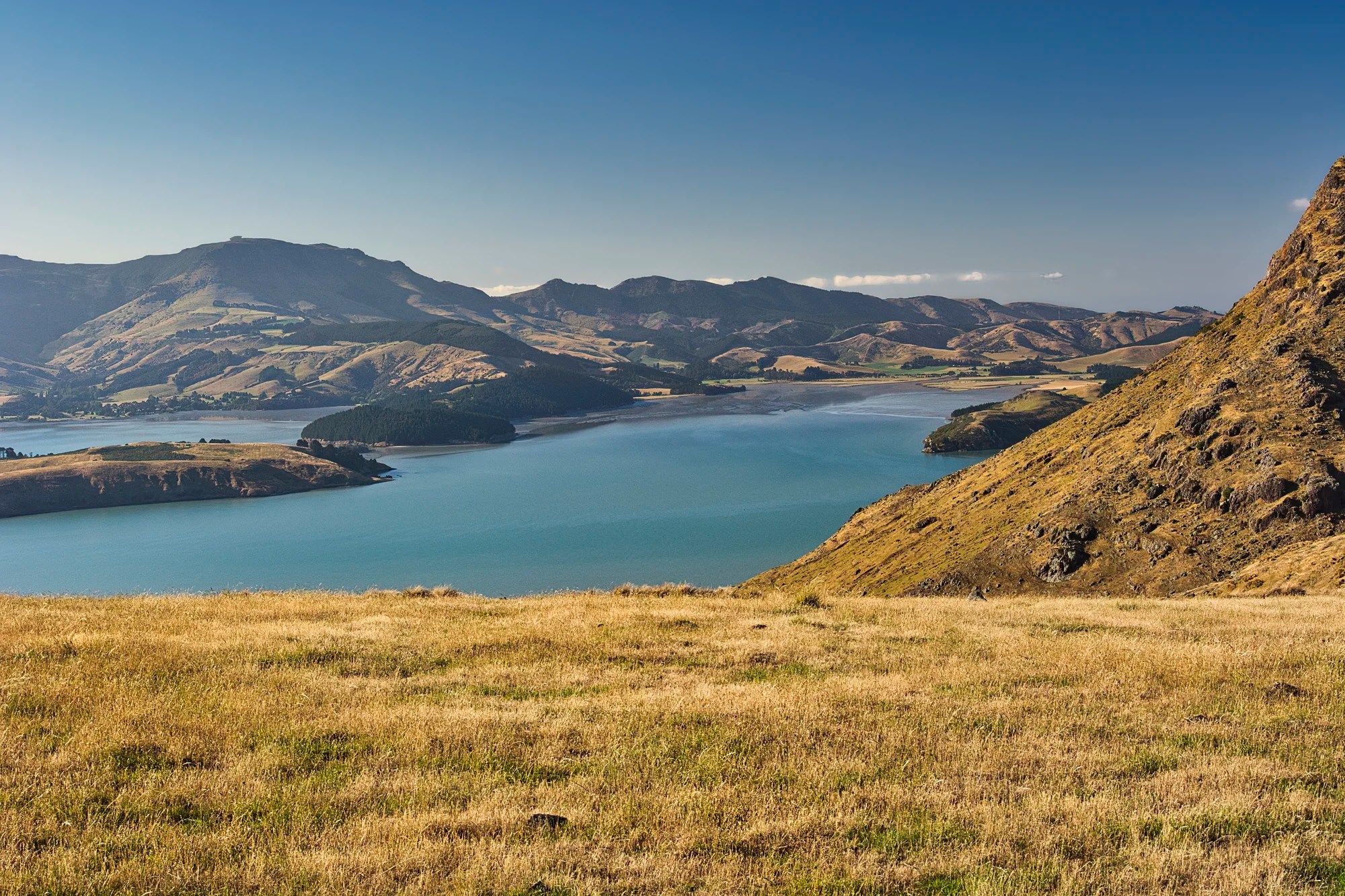
Sugar Loaf Scenic Reserve
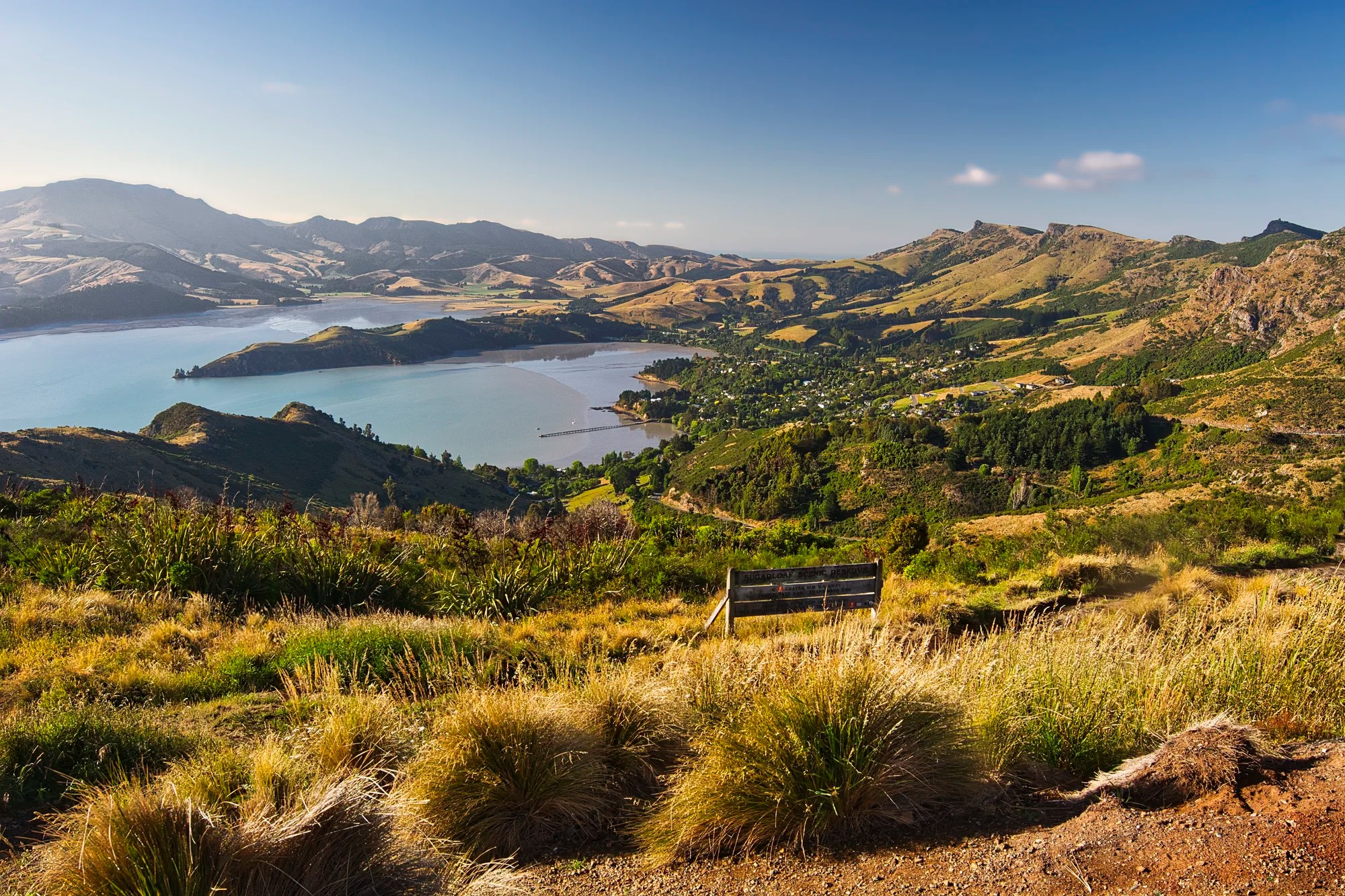
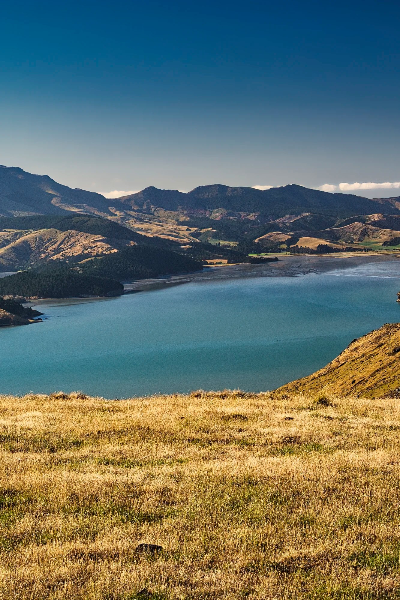
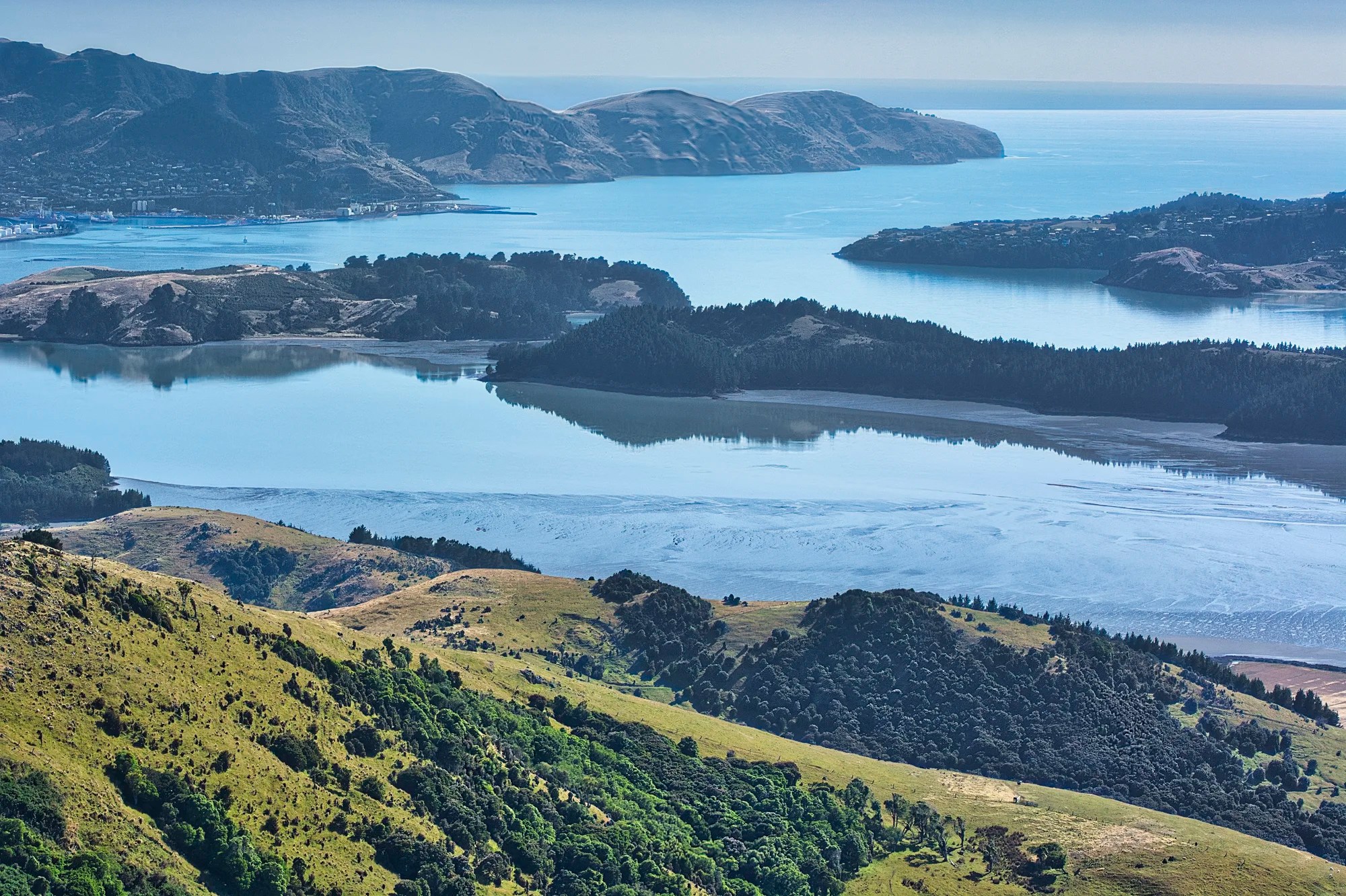
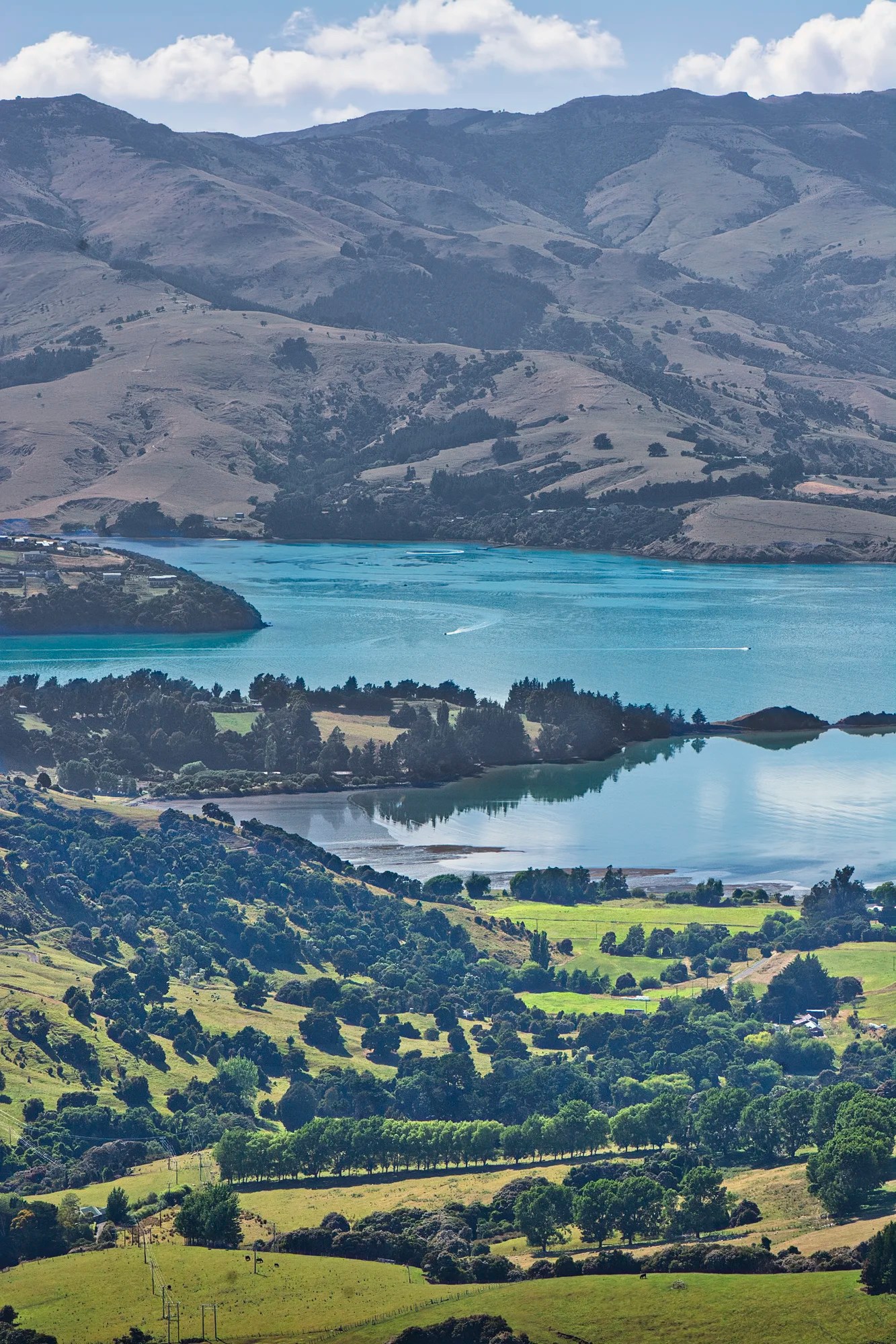
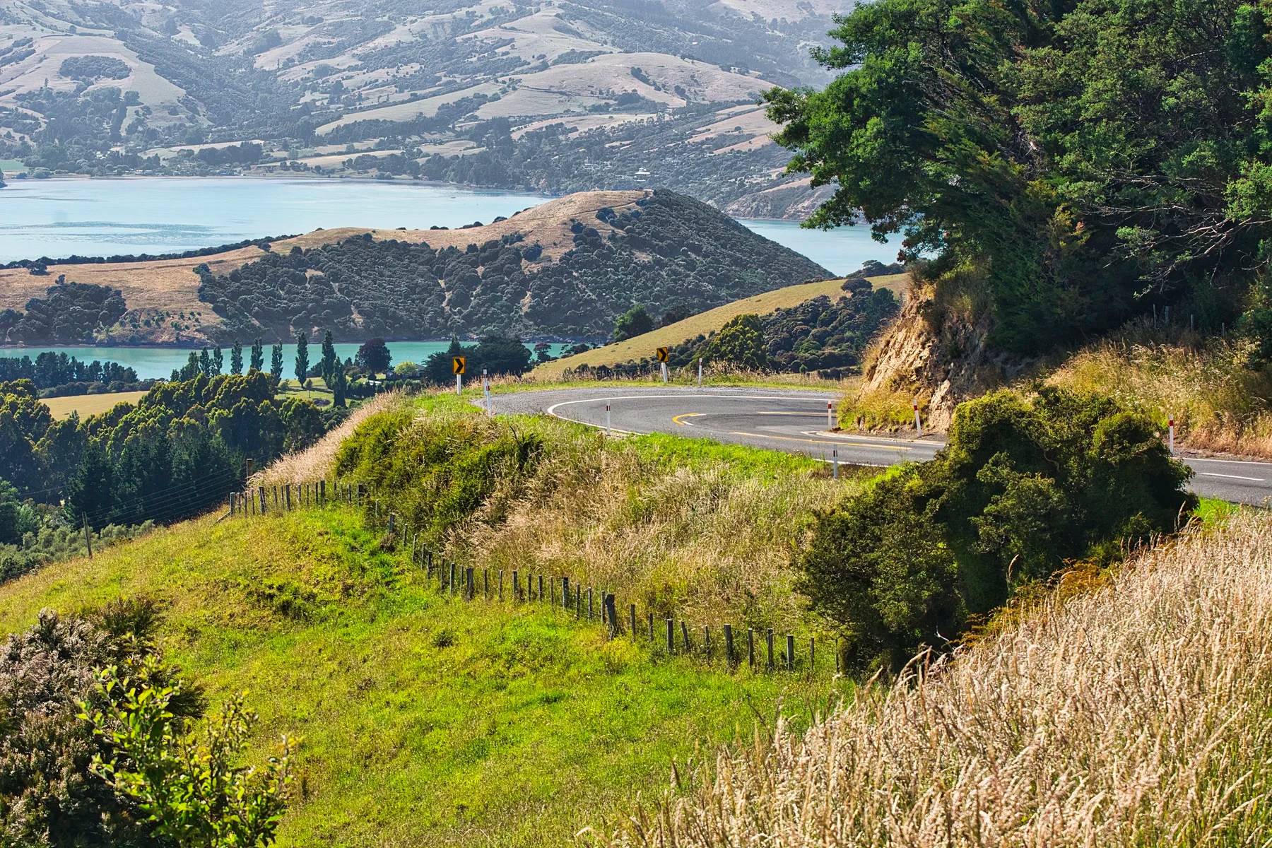
Then we turned left onto the winding Summit Road, the rim of an ancient volcano. The spectacular Sugar Loaf Scenic Reserve (G4.8) was one of our favourite viewpoints.
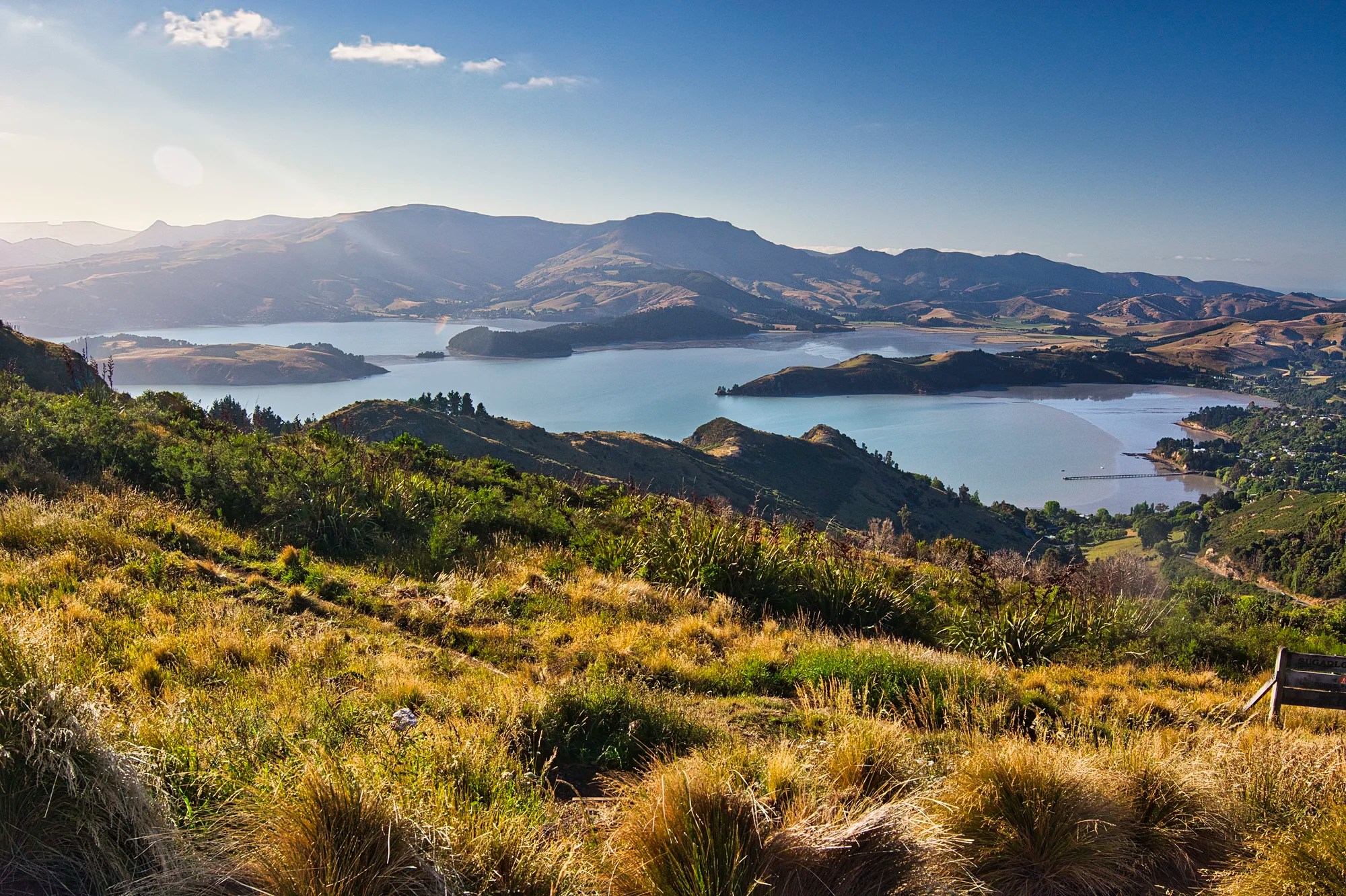
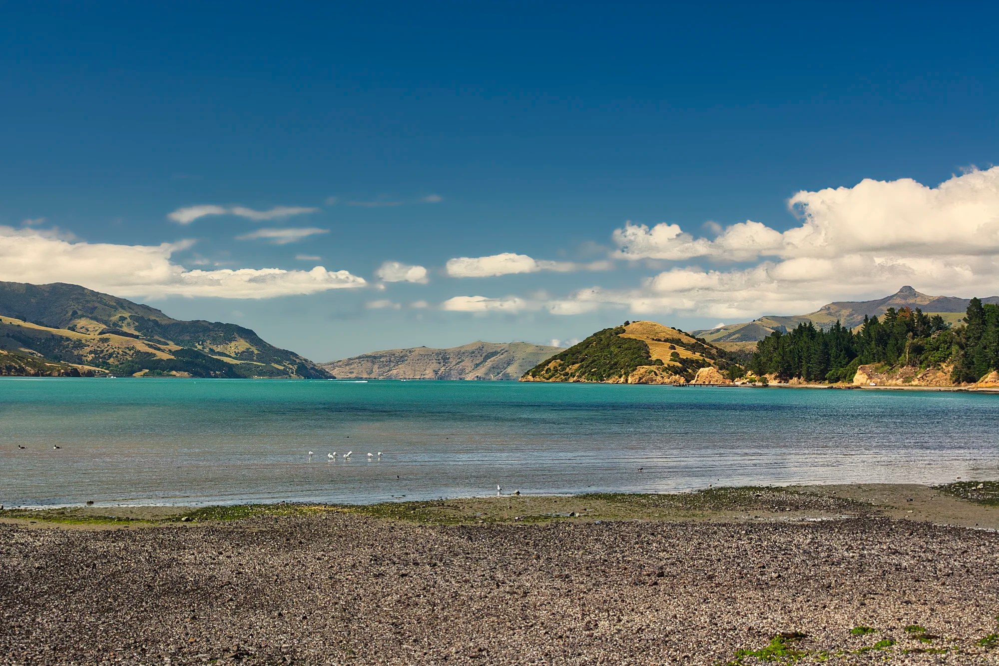
Below us stretched Lyttelton Harbour (the term for the water, not the port). The fingers of land are peninsulas except for Quail Island on the left.
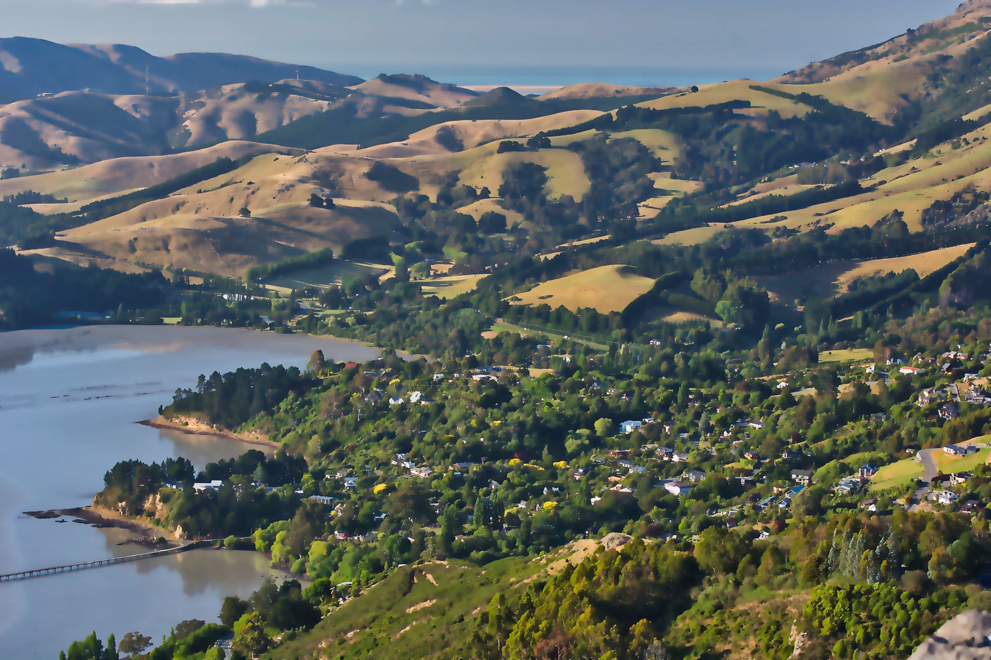
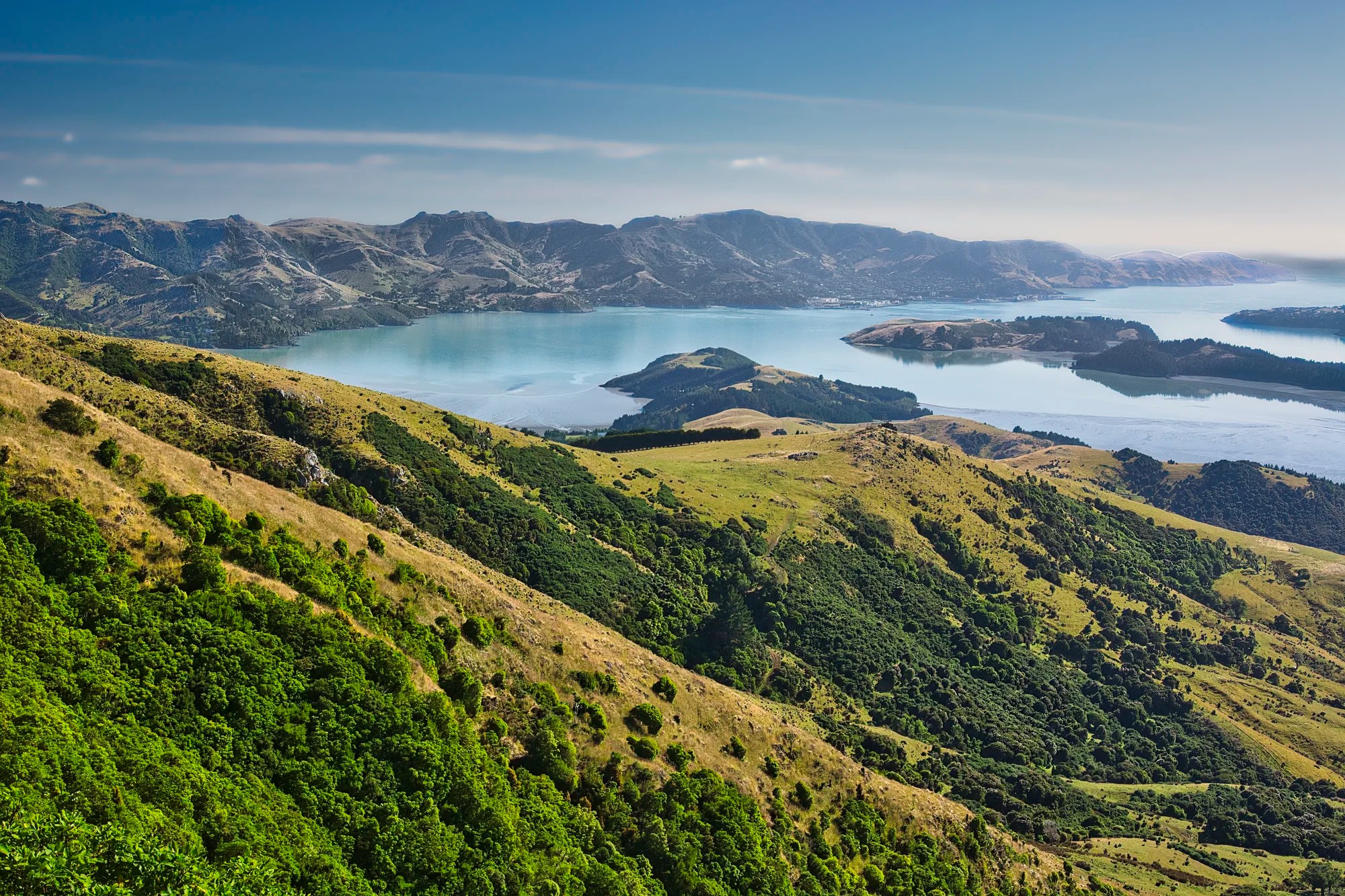
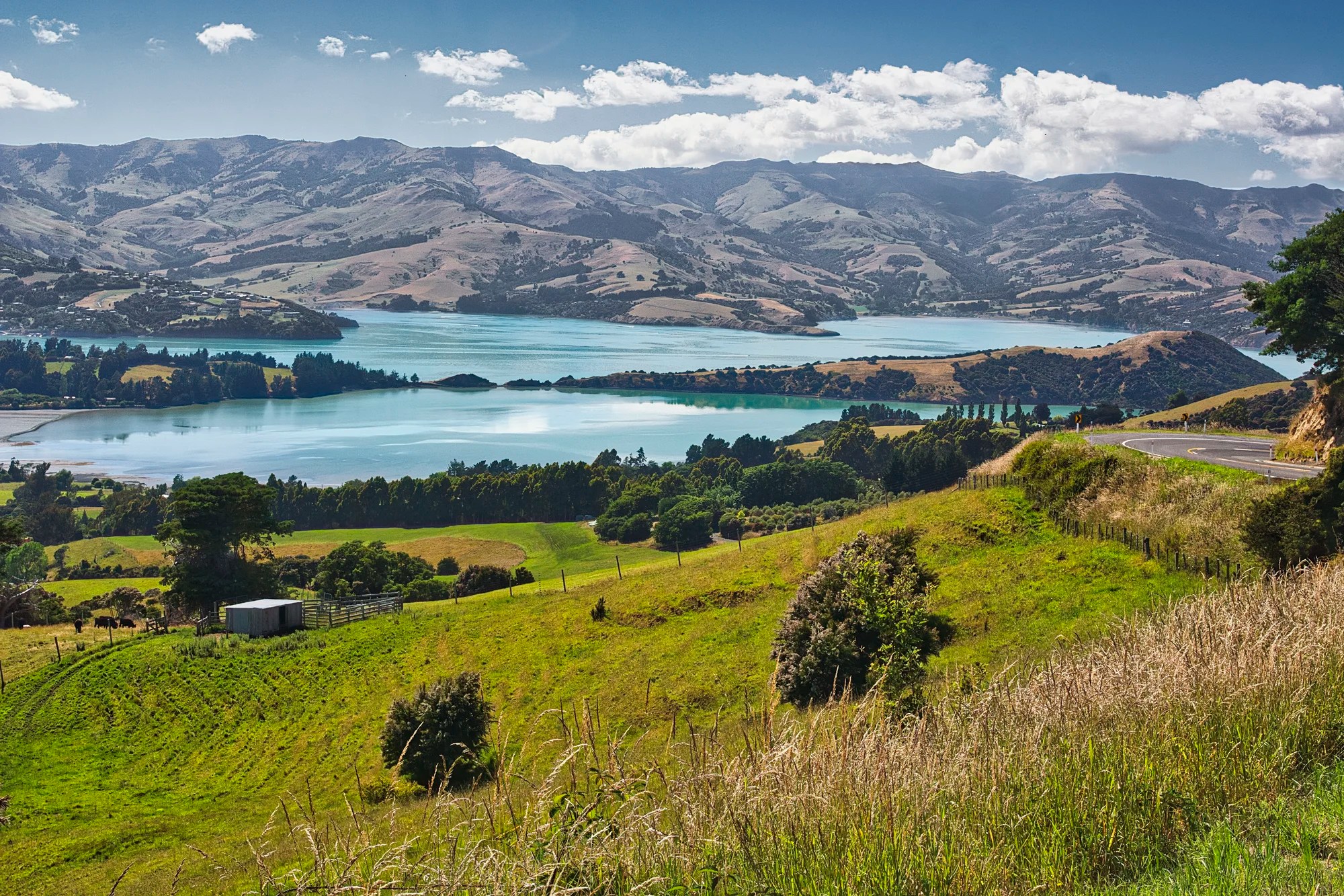
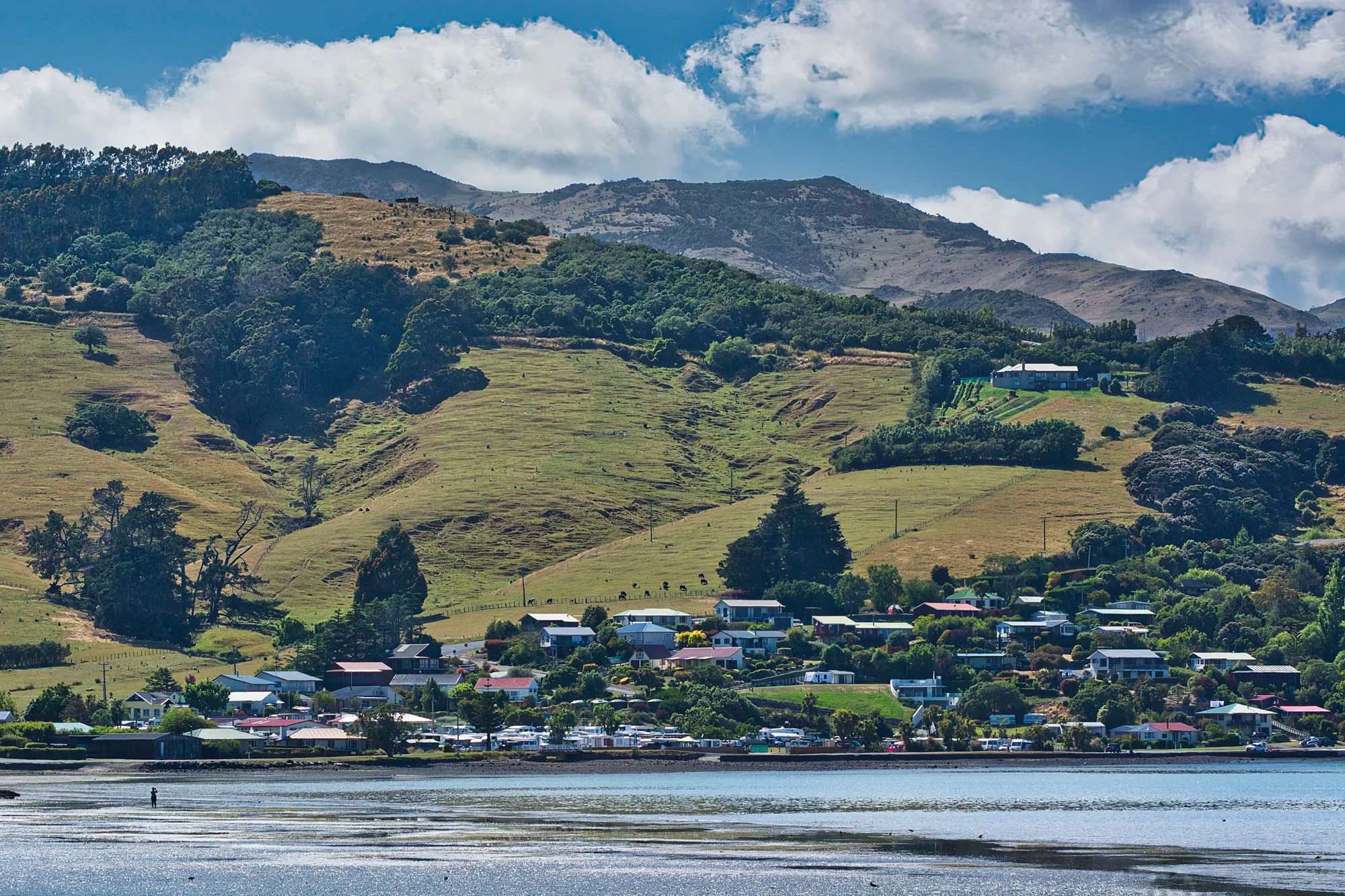
Governors Bay
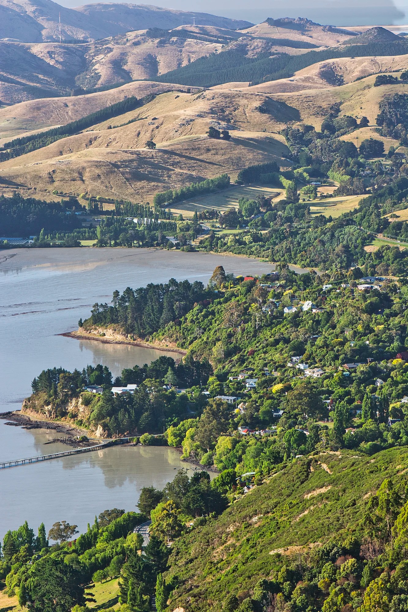
Far below us is Governors Bay (town). This is a 157 mm zoom of the right side of the previous photo.
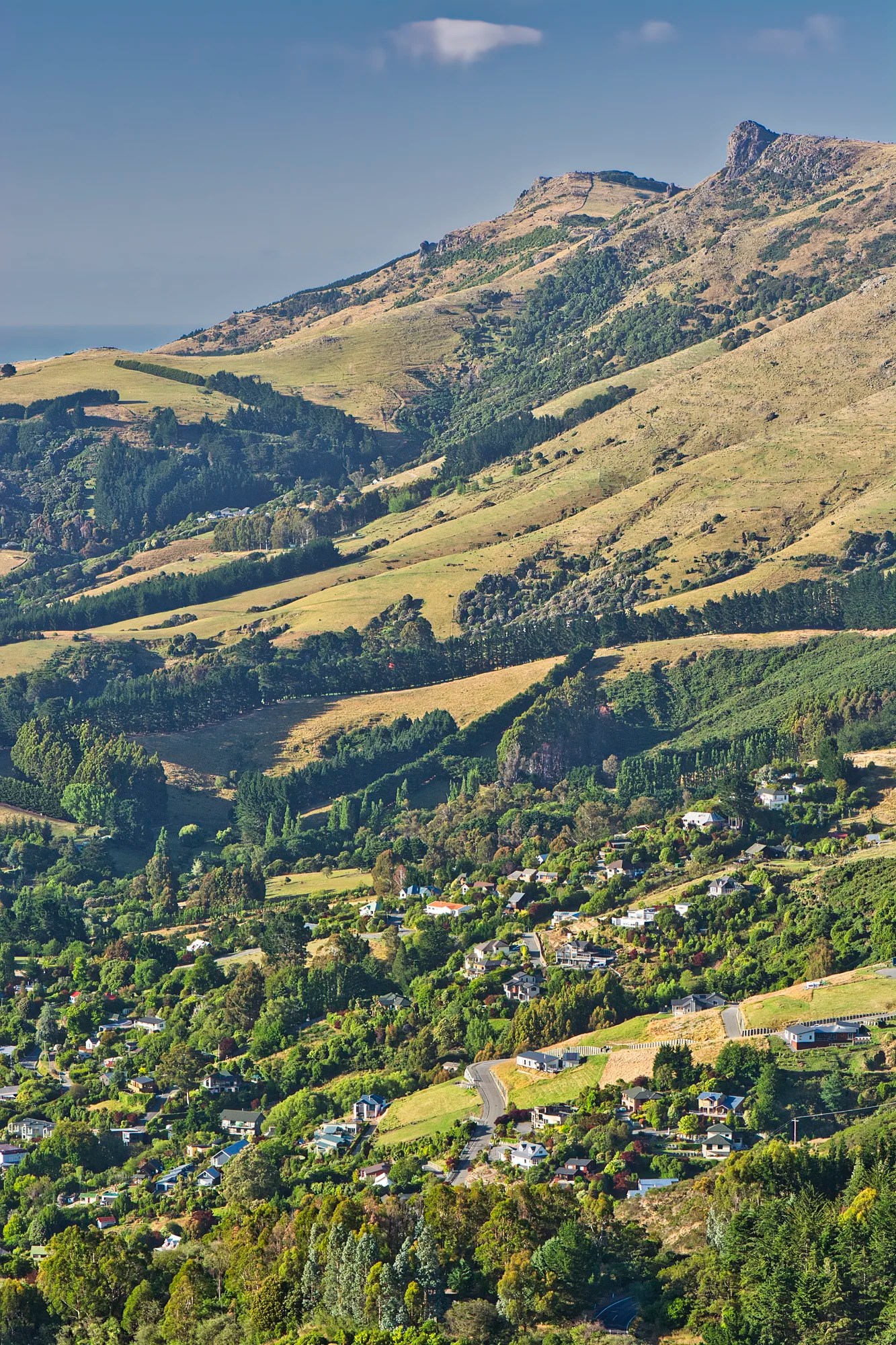
The town has spread up the hills towards Summit Road.
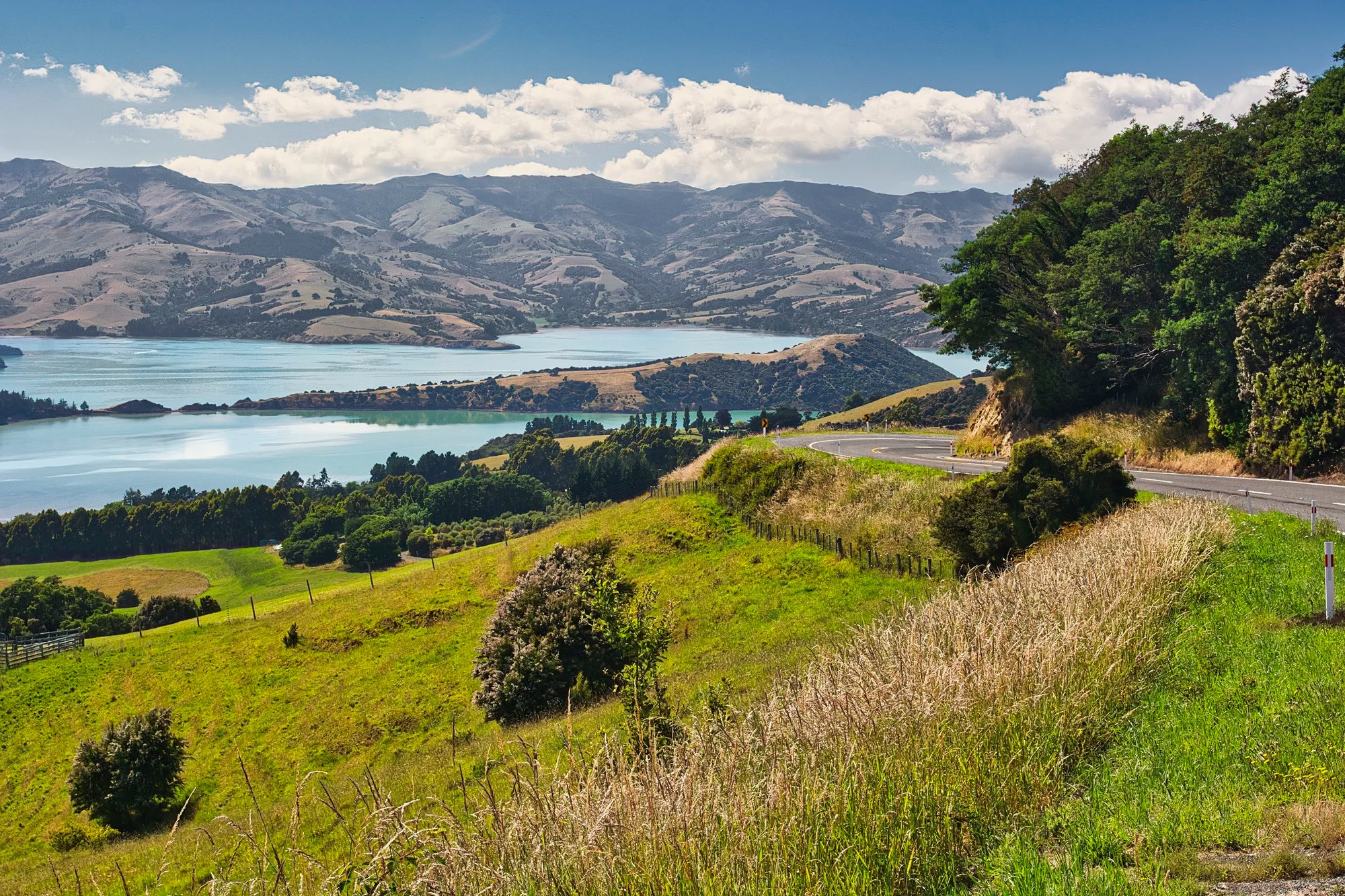
Lyttelton Harbour Viewpoint
We drove further east to Lyttelton Harbour Viewpoint (G4.9) near Rapaki Rock.
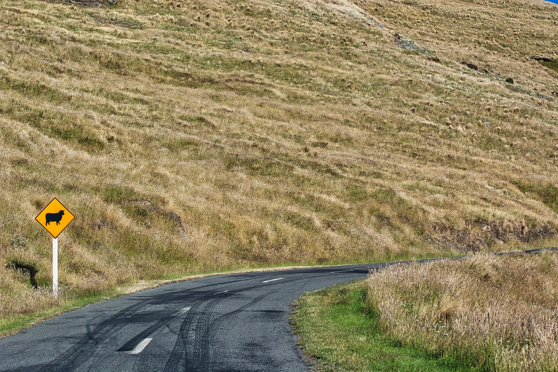
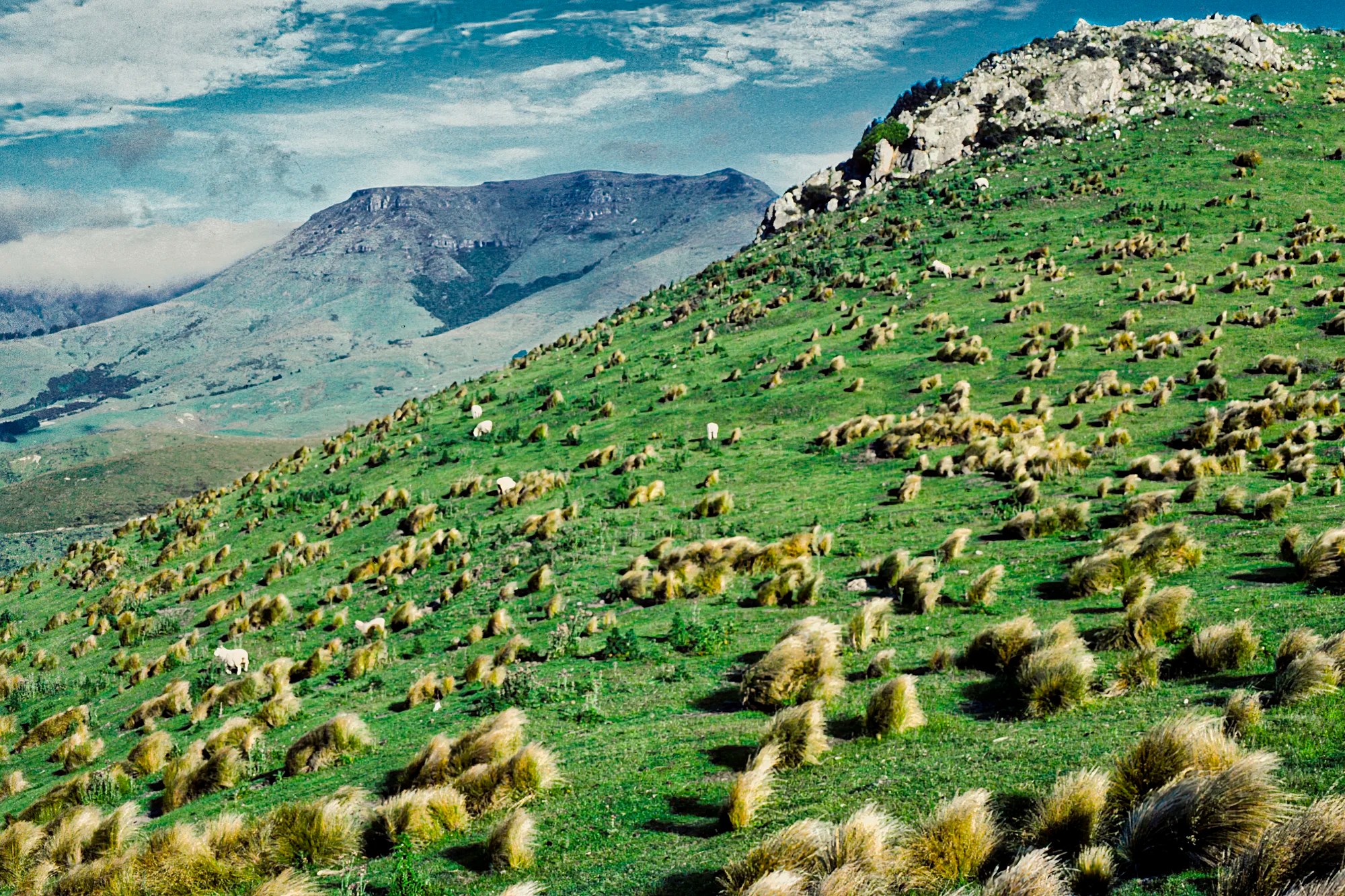
Finally, we turned around and headed west along Summit Road past this sheep sign.
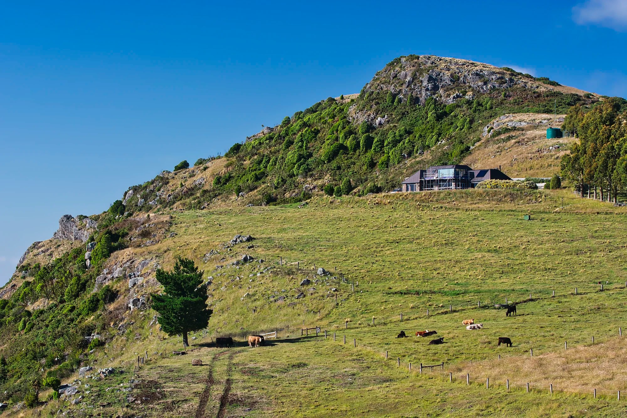
We saw no sheep on the road but the hills are lined with farms. The beauty of NZ will be preserved as long as this remains farmland. NZ will be ruined if they ever change this land to condos or other commercial developments.
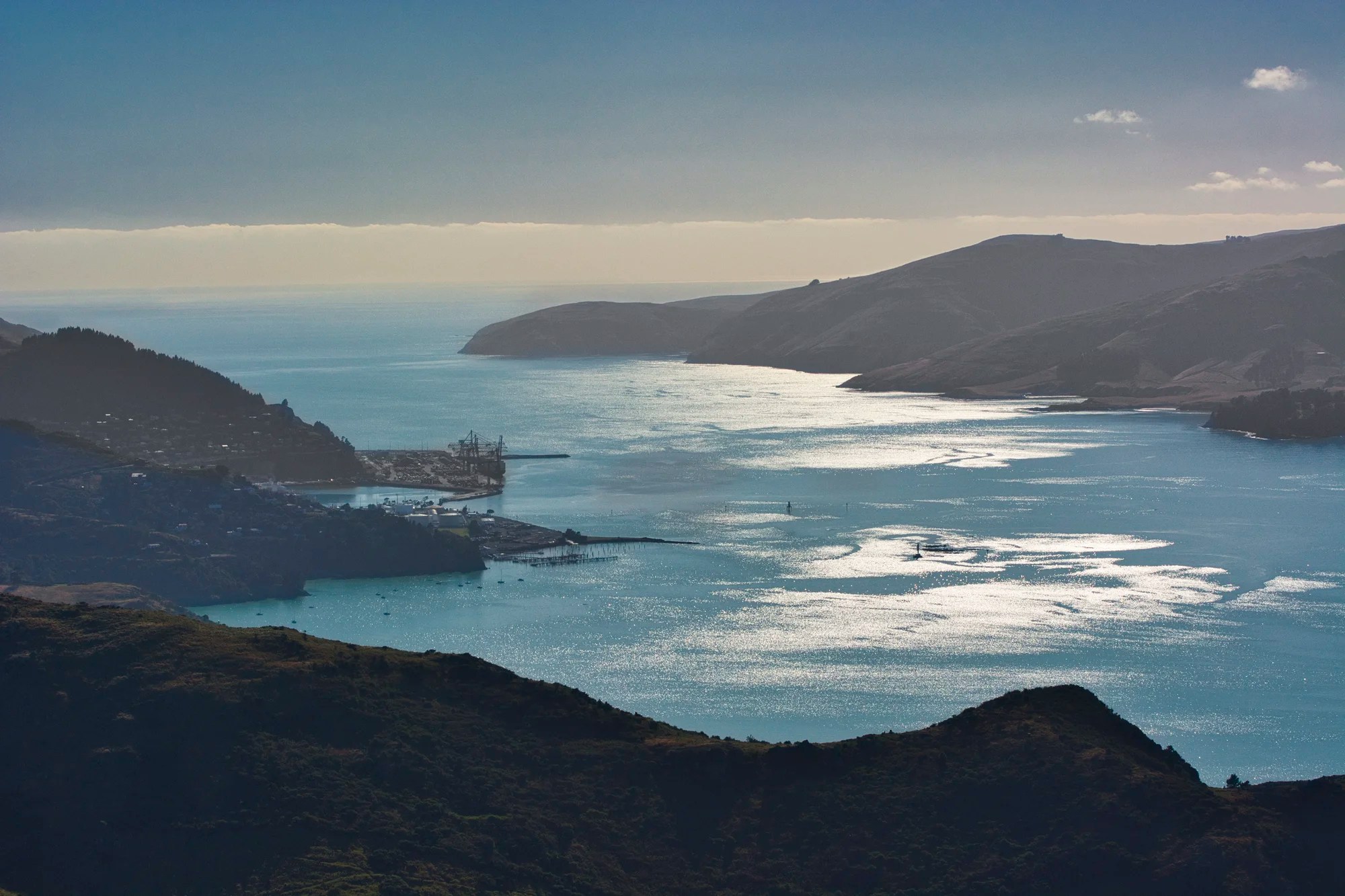
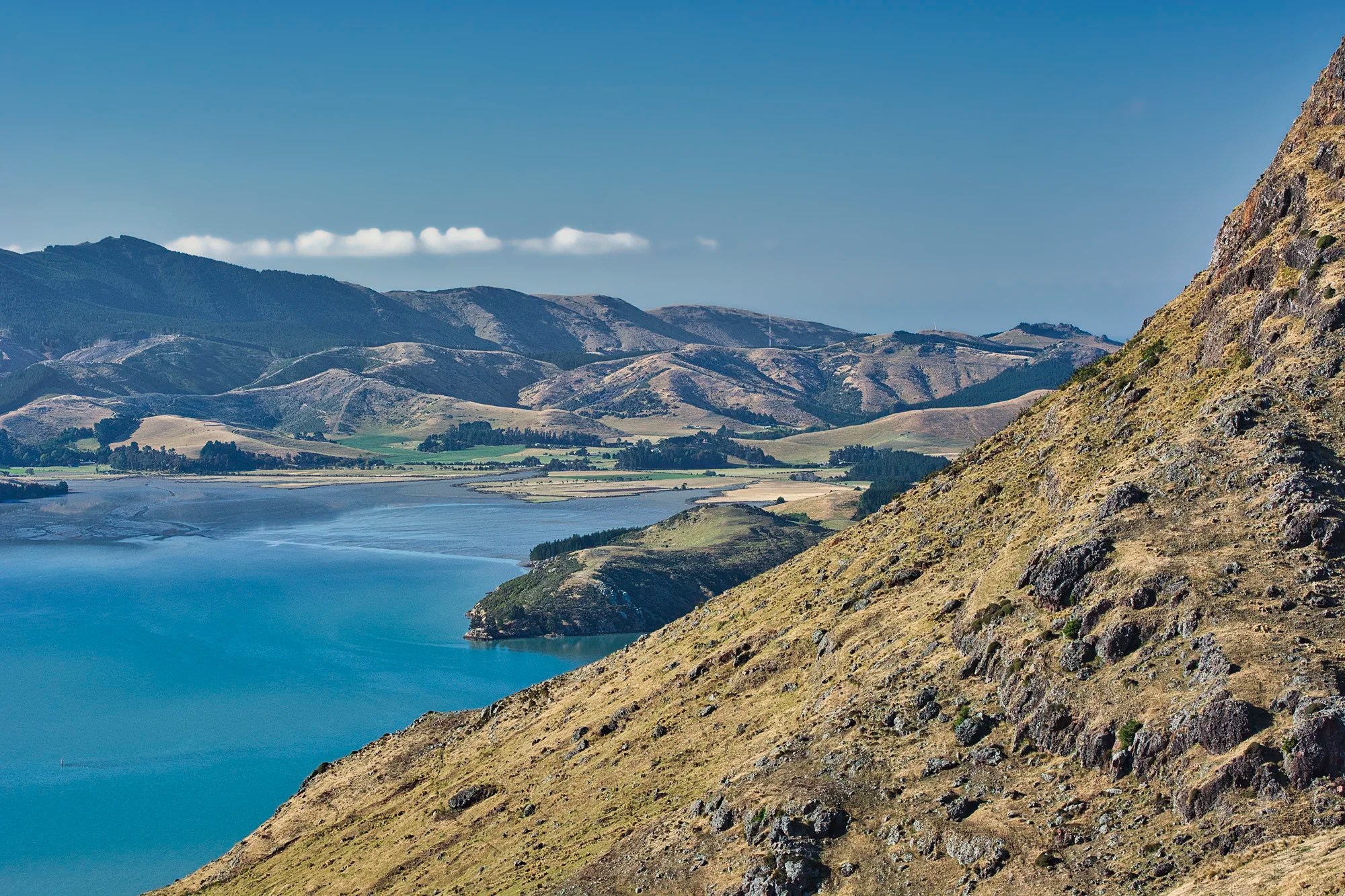
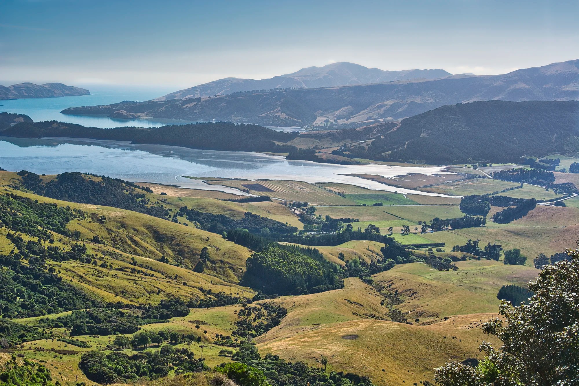
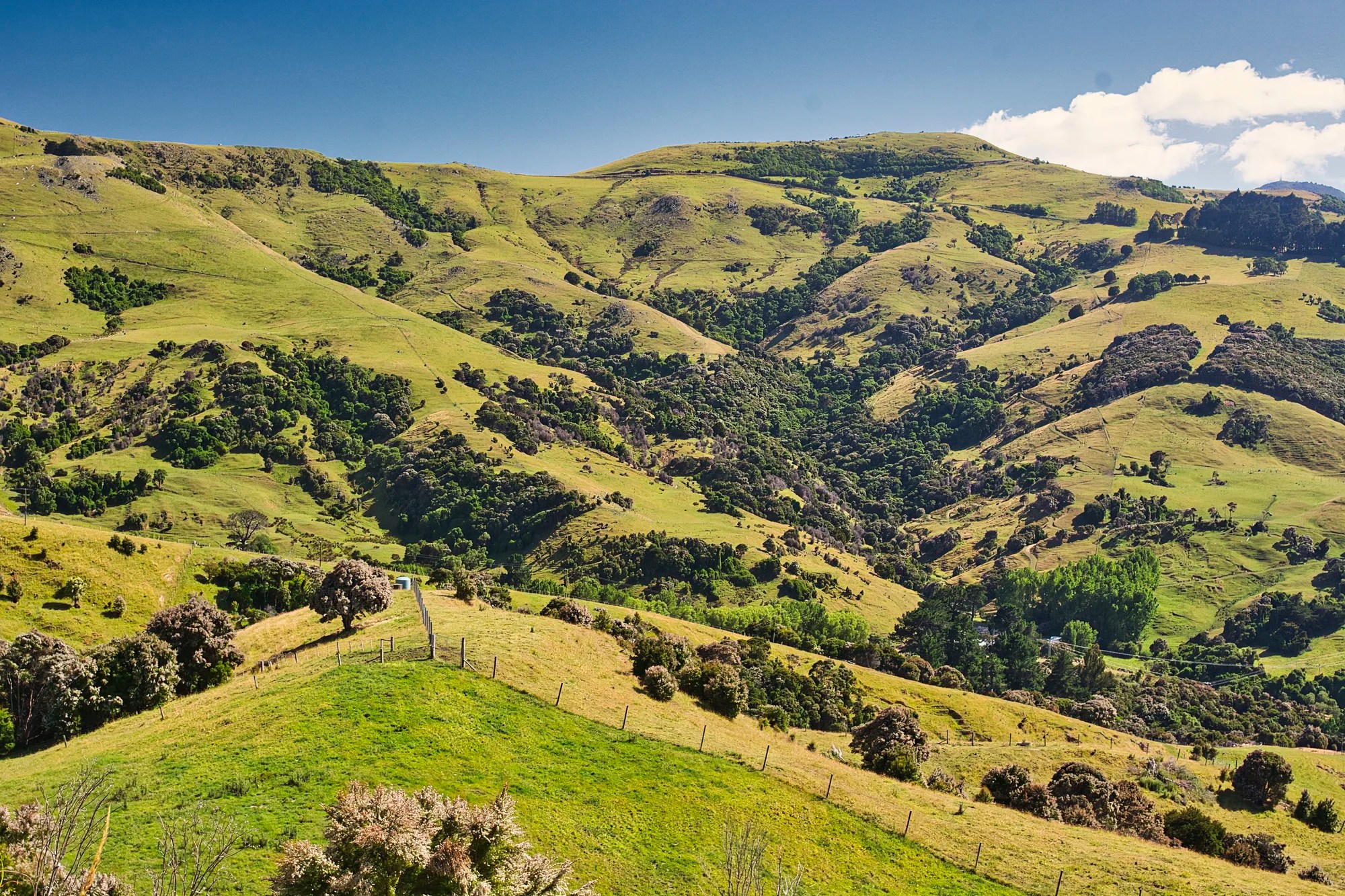
Our next stop was a place simply labelled Viewpoint on Google Maps. Lyttleton Harbour (the port and the water) stretched below us. It was formed by the collapse of the volcanic caldera.
Cooper’s Knob
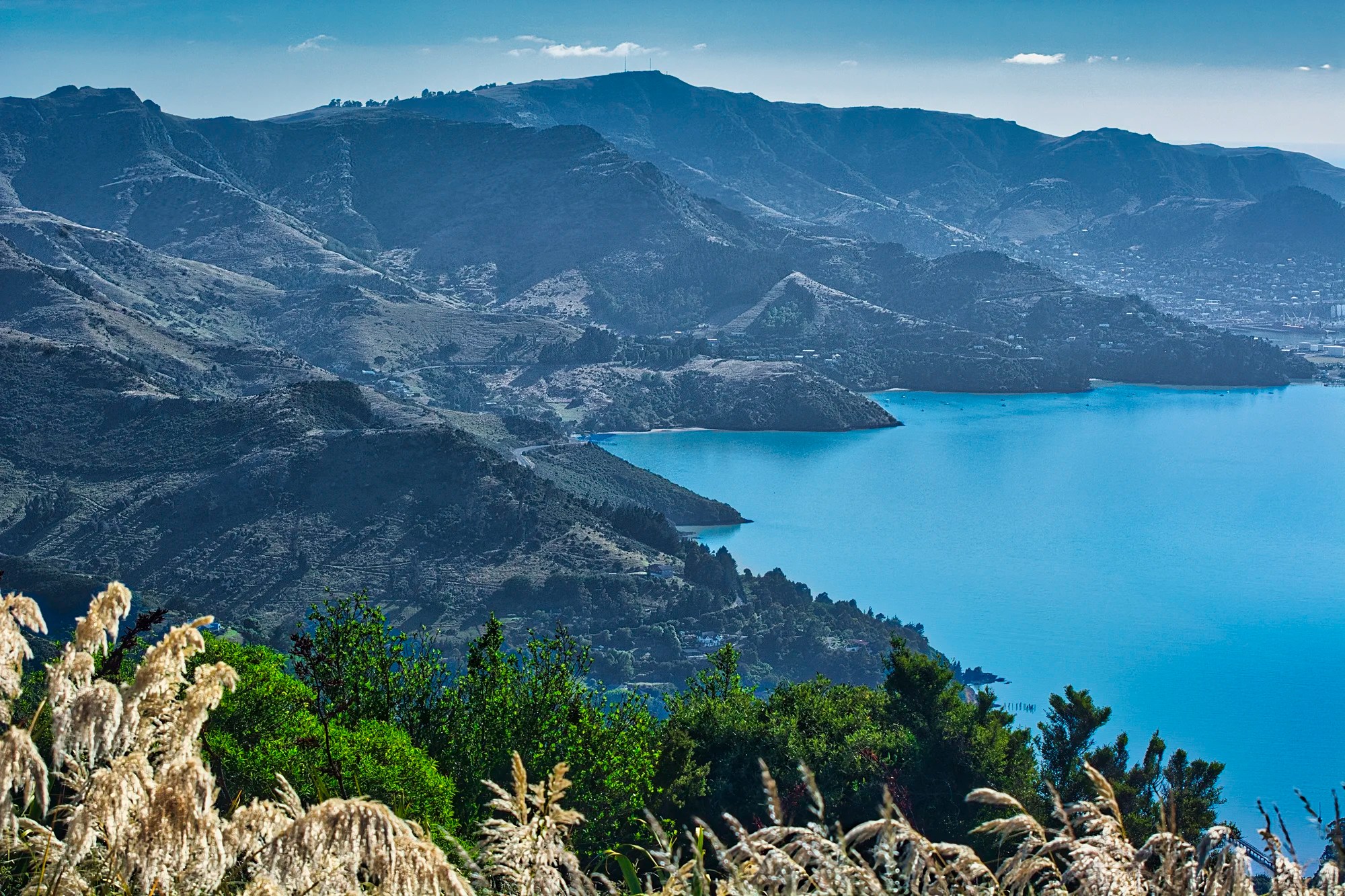
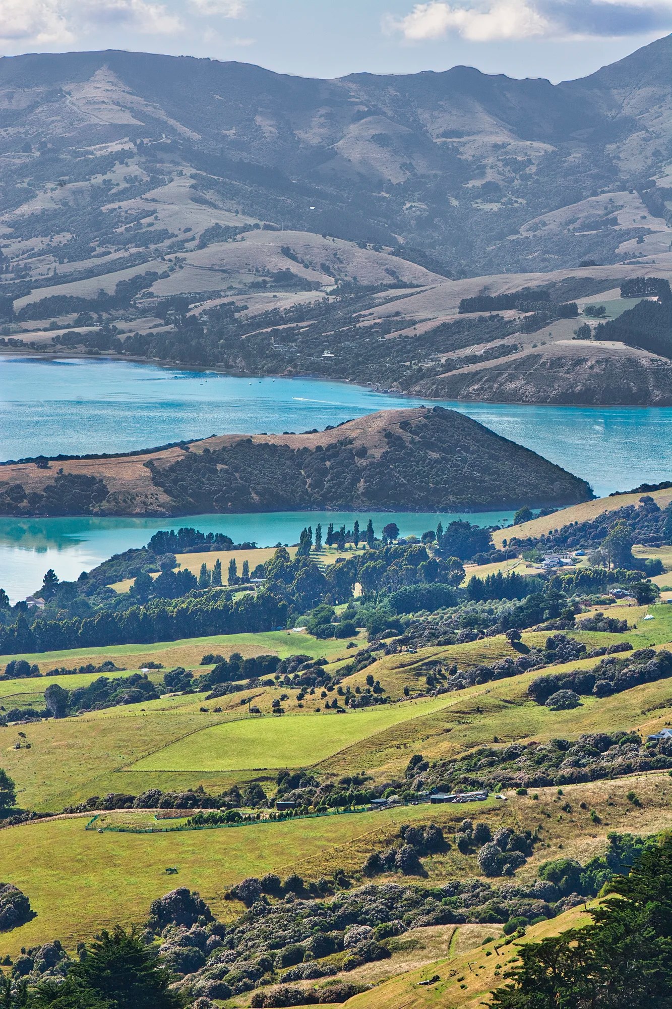
About 15 minutes further west, we arrived at another special vista — Ōmawete Scenic Lookout near Cooper’s Knob.
We also stopped at Ahuriri Scenic Reserve (G5.0).
We continued west until the Highway 75 junction then drove south to Birdlings Flat Beach (G4.5). It was not scenically special. We came here to search for agates, amethysts and other semi-precious stones. We did not find any.
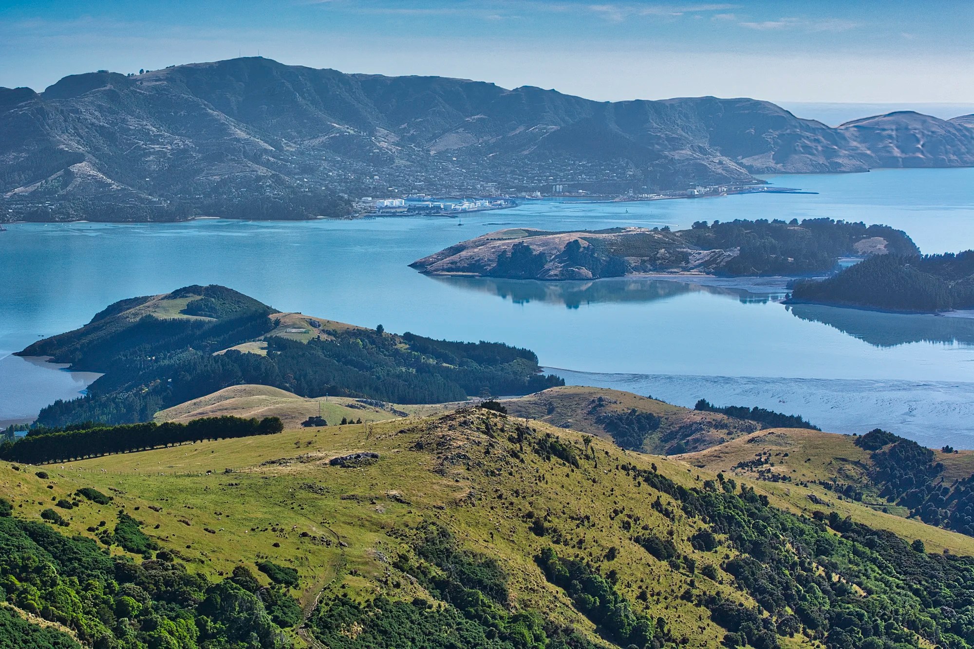
Hilltop Lookout
From Little River, the road winds up the hill and arrives at the Hilltop Tavern and a large car park. Hilltop Lookout Point (G4.6) is our favourite viewpoint judging by the number of photos I took.
Every direction you look has an even better view.
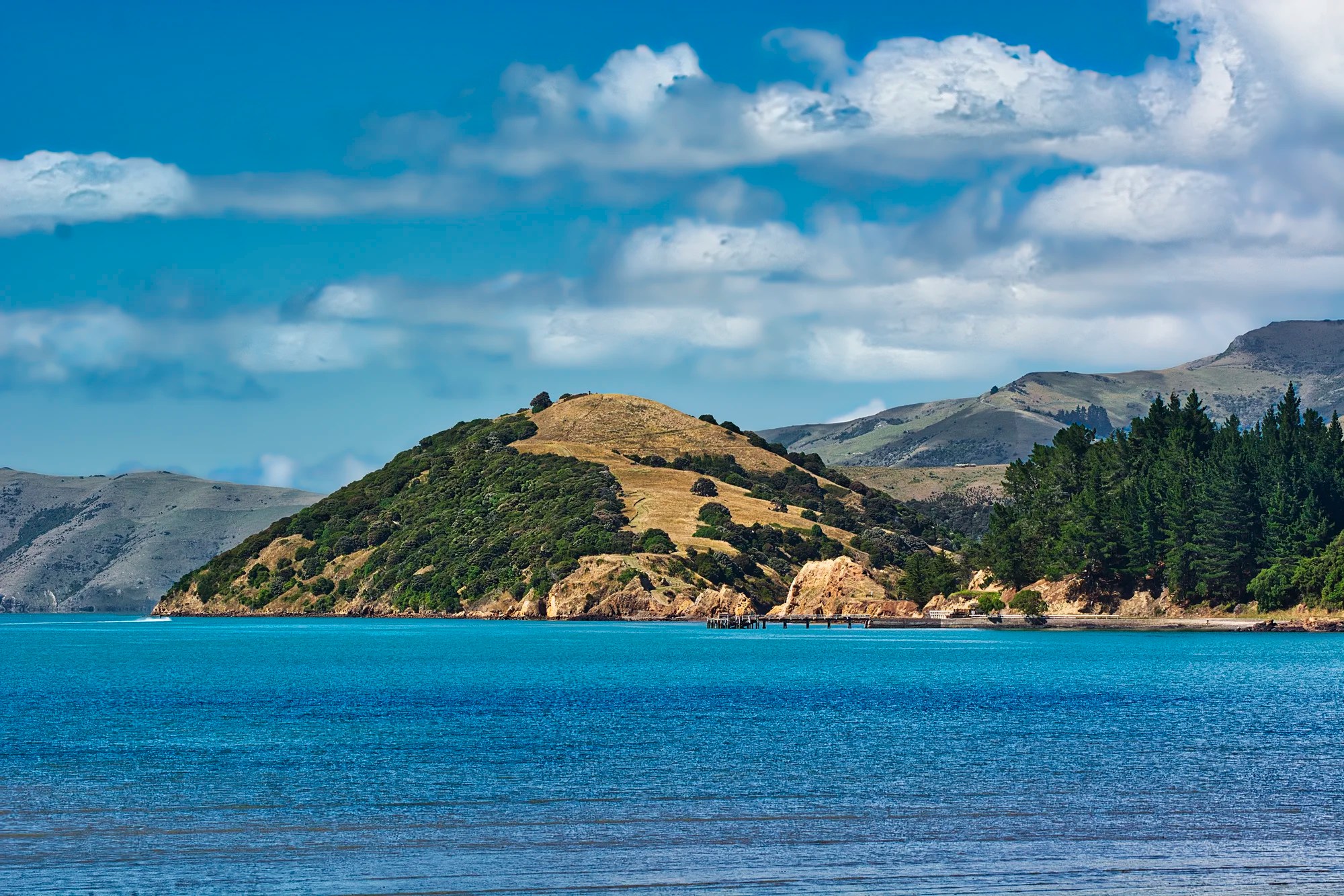
Akaroa Lookout
Google Maps calls this pull-off Akaroa Lookout (G4.7). It’s really a view of the harbour, islands and mountains.
There was a beautiful view of green farmland nestled in steep mountains.
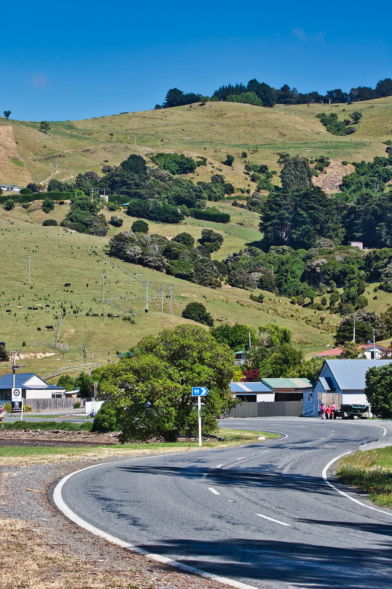
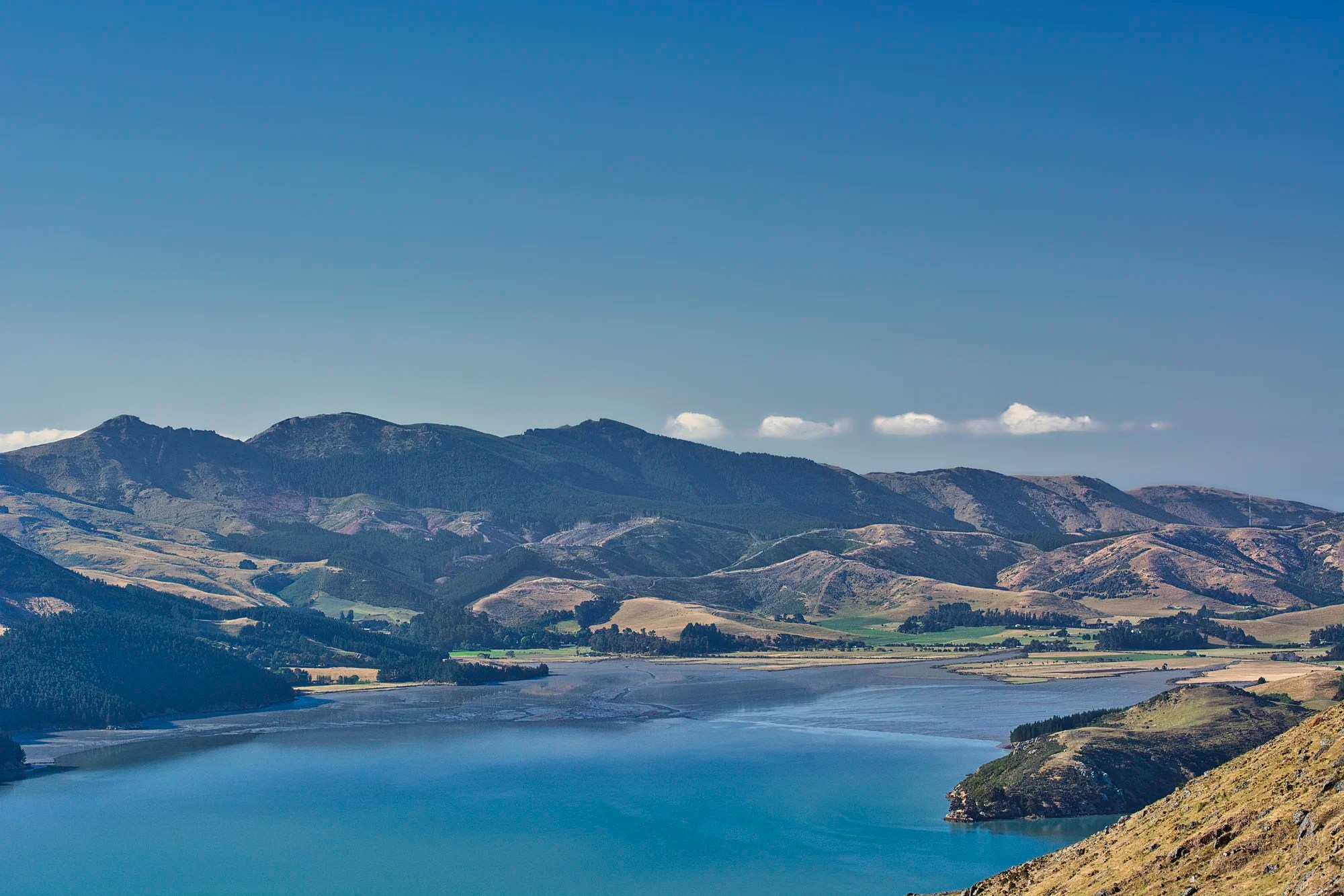
Duvauchelle

We continued east to Barrys Bay Cheese (G4.4). We bought some cheese for a snack. As we drove Highway 75 along the coast we had glorious views of Duvauchelle Bay.
Duvauchelle is one of the few settlements in the Banks Peninsula.
The S-curved road adds something special to the photo. This is called serpentinata, an element that makes an artwork seem more dynamic.
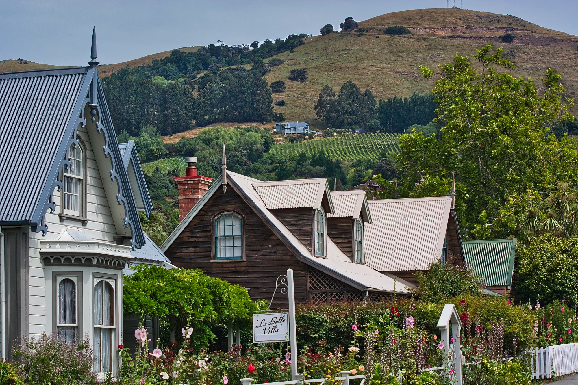
Akaroa
The name Akaroa was derived from the Māori name Whakaroa, which means “Long Harbour”. Akaroa is filled with quaint houses and French names. La Villa Belle (now French Bay House Bed and Breakfast) was particularly attractive.
Contrary to other impressions, this territory was never French. Captain Charles François Lavaud sailed in 1840 to establish a French colony at Akaroa. The French settlers arrived to find out that Britain had signed the Treaty of Waitangi with the Māori on 6 February 1840 and claimed sovereignty over the South Island.
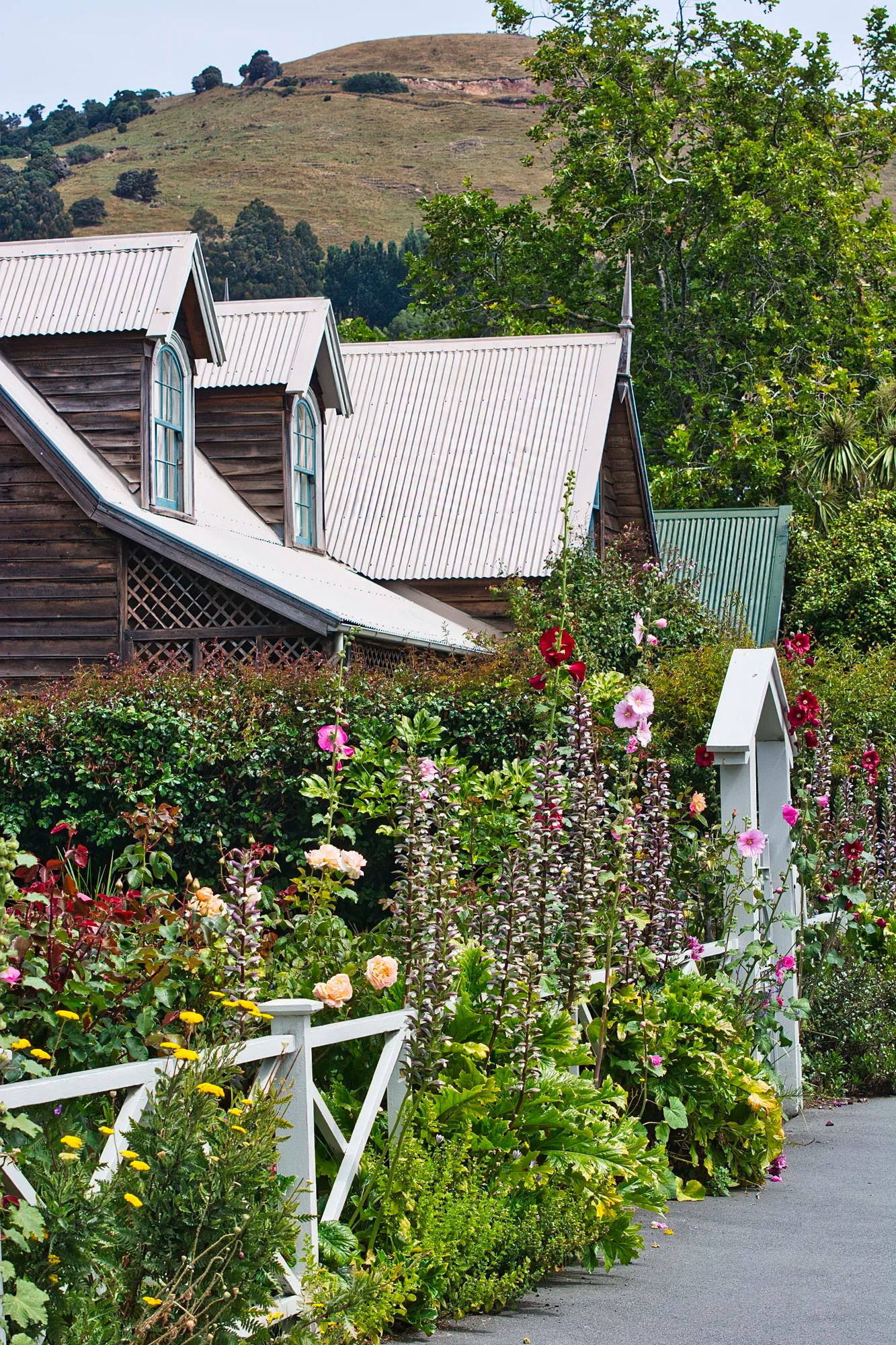
Rue Jolie was one of the most picturesque streets. It comes with botanical gardens of luxuriant flowers.
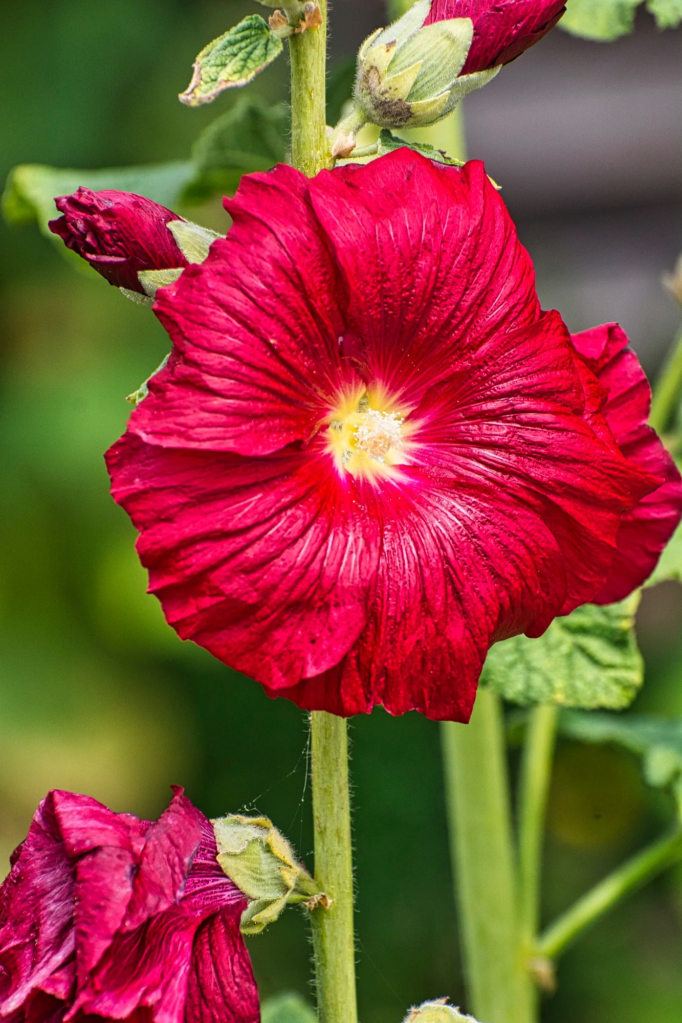
Hollyhocks seemed to be very popular. They can grow up to 2.4 m (8 ft) tall, creating a dramatic effect in gardens. They symbolize ambition and reaching for the sky.
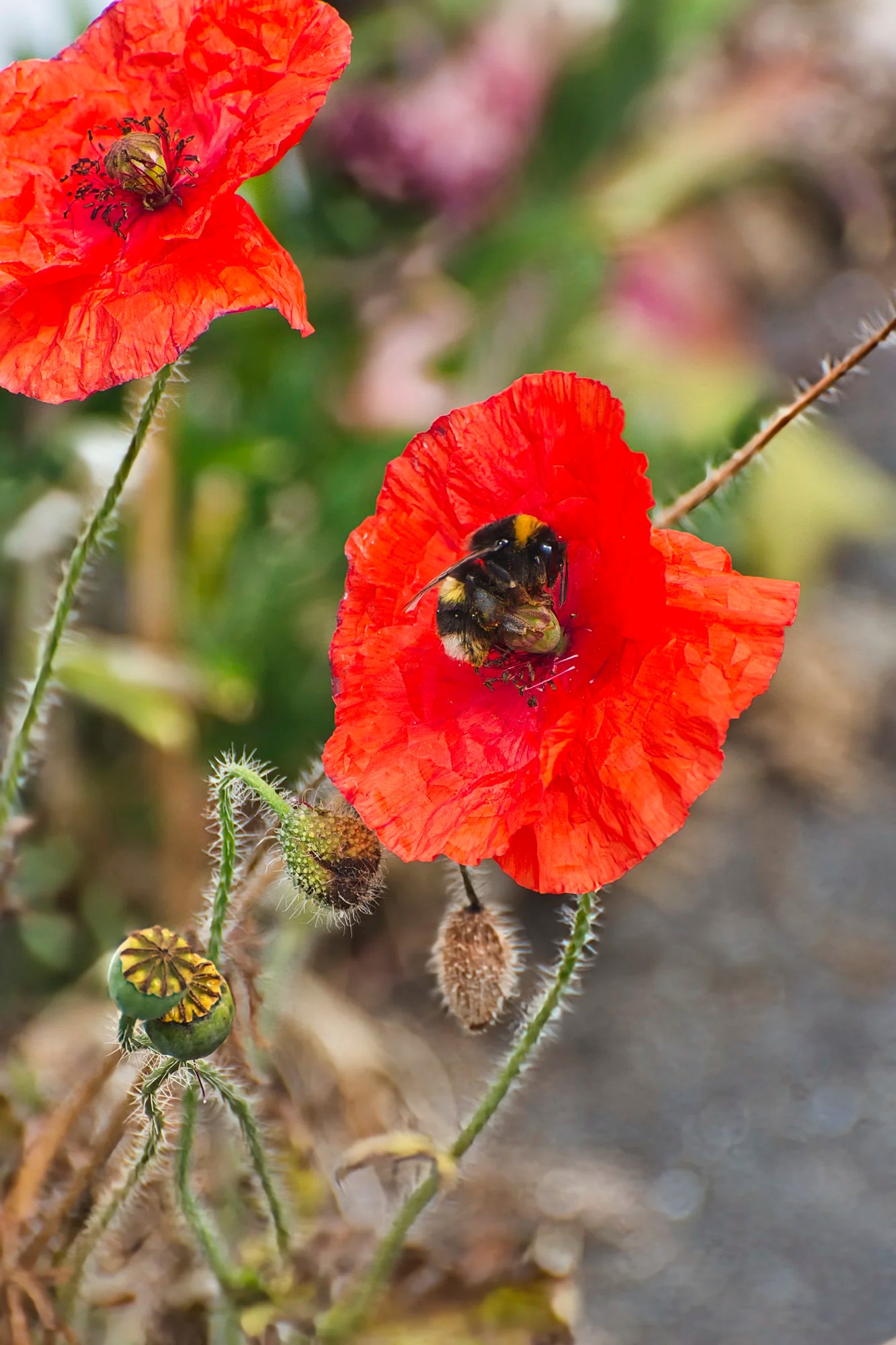
The red poppies were beautiful. In Greek and Roman mythology, poppies symbolize sleep and peace due to their sedative properties.
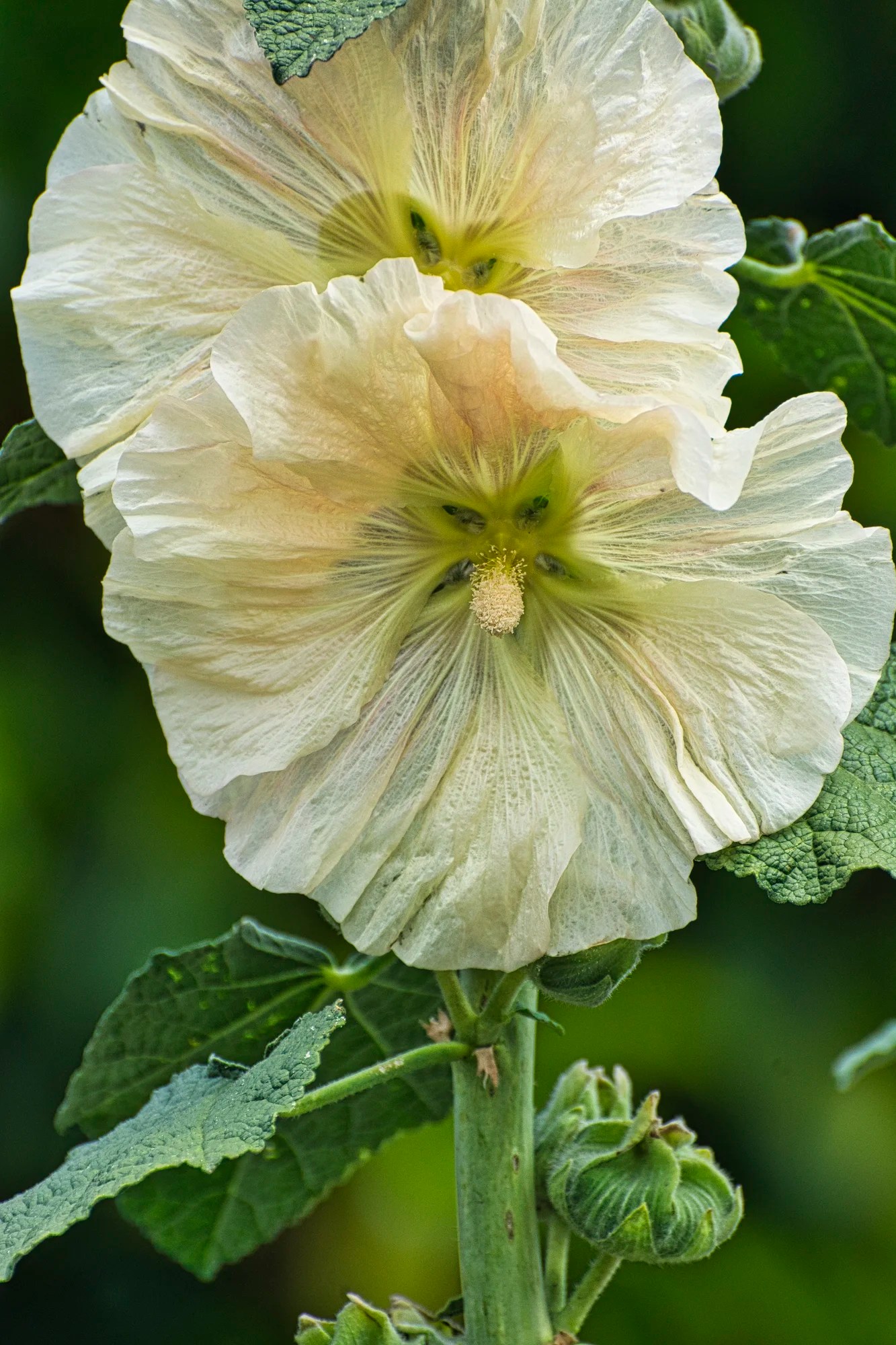
This white Hollyhock feels like tissue. They come in a variety of colours, including pink, red, yellow, purple, and white, often with a distinctive, contrasting center.
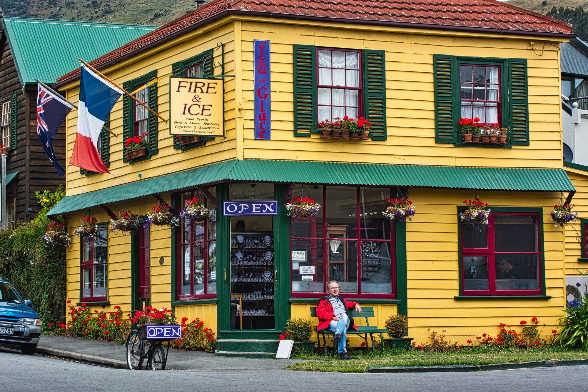
Fire & Ice was a very colourful store on Church Street. They specialize in gemstone jewelry and aromatherapy.
Viewpoints
From Akaroa start to make your way back. Some side trips are Lighthouse Road, where you’ll get some great views back towards Akaroa. The Misty Peaks Scenic Reserve is also worth a look.
I have pinned all the viewpoints to our custom Kaikoura to Christchurch Map to ensure you get the most out of this road trip. I did not record where all the photos were taken. But I have pinned the following likely viewpoints to the map:
- Montgomery Park Scenic Reserve: provides beautiful views of the surrounding landscape.
- Wright Lookout 2: (G5.0) features a beautiful view
- Otepatotu Scenic Reserve (G4.6): features a short but steep hike with two fantastic viewpoints.
- Stoney Bay Peak
- Misty Peaks Reserve: offers stunning vistas of the peninsula’s natural beauty.
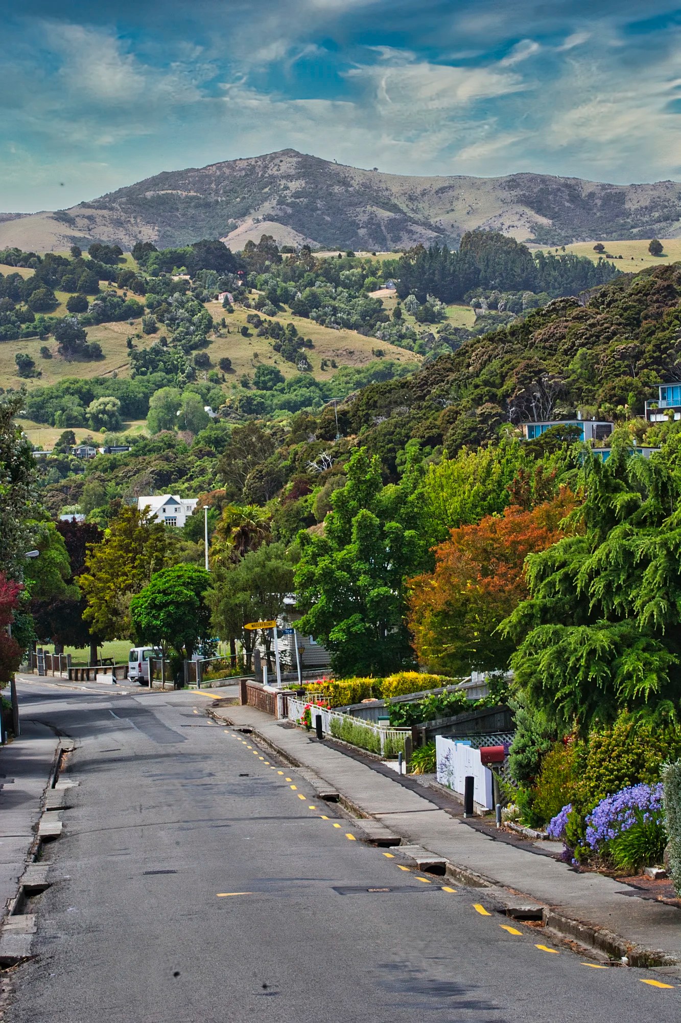
Lyttelton
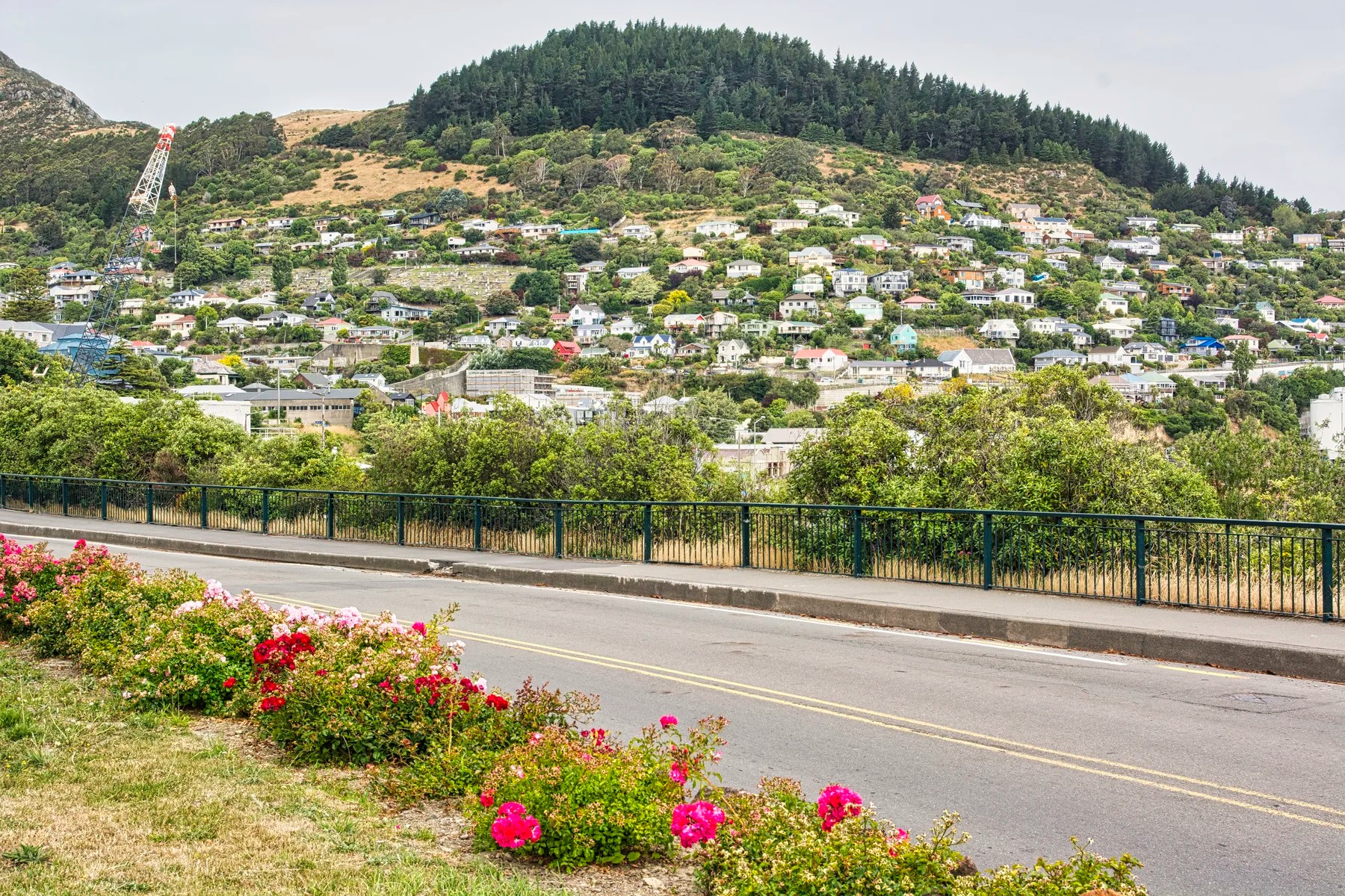
Lyttelton was built up the hills. Old wooden houses with ironwork abounded. Lyttelton is the port for Christchurch and we saw some old green cranes.
If you don’t have a car head to Gondola Summit Station (G4.7) for a taste of Summit Road.
Final Comments on this Itinerary
Christchurch and the Banks Peninsula region are pleasant, relaxing places to visit. This is also the itinerary to see hidden gems. The places included in this route are all highly rated by the people as shown by their Google Maps Ratings.
Do you want more information? Then subscribe for free.
This was only a taste of some of the scenic wonders of the Catlins. If you have other favourites, share your experiences with us. How long is your trip? What questions do you have?
Itinerary Planning
Do you want to learn how to plan an itinerary? Use this ready-made itinerary map to plan your trip.
NZ SI Kaikoura to Christchurch Map
Our NZ Planning Maps include all the possible Points of Interest pinned. Using the Google My Maps app, you can copy or create your own custom maps. Here are some pre-planned itineraries for NZ.
Google Maps Ratings
Google Maps provides a rating from 0 to 5 for all sights, hotels, and restaurants (but not cities). All of our recommendations are appended with the rating (prefixed with a G) from Google Maps. Google Ratings are based on feedback from locals as well as tourists. They are much more reliable than travel booking websites or tourist anecdotes. We consider a score of 4 to 4.39 to be Very Good and 4.4 to 5 to be Excellent.
How Big is New Zealand?
NZ is a large country compared to Europe. It is the size of the UK and half the size of the province of Alberta, Canada.
Booking Accommodation

NZ only has 5 million people. South Island is even smaller with 1 million people. So why is South Island so busy during the summer peak season? Too many tourists go to the same famous places — what I call name recognition. Fewer people are available to work in the hospitality industry for a short tourist season. So there is a lack of accommodation.
If you are going during the Christmas peak season, most Kiwis are on the summer holidays from ca. December 20th to January 20th. You need to book your places at least 5 months ahead.
The best value places were family-run B&Bs (not Airbnb’s) and fully-equipped cabins and tent sites at campgrounds. Use Agoda or Booking to find places for your price range. But verify the quality by the more reliable Google Maps Rating.
Other Places to Add to Your Itinerary
Do you want to see more of South Island? Christchurch not only has a major airport, it also provides a central jumping-off place for all the major tourist sights of South Island:
- Arthur’s Pass NP, Punakaiki, and Franz Josef Glacier;
- Kaikoura, Queen Charlotte Drive, Nelson and Abel Tasman;
- the Southern Alps from Lake Tekapo to Milford Sound;
- Oamaru, Dunedin, Otago Peninsula, and the Catlins.
Here are some of the best places for you:
When is the Best Time to Visit Christchurch?
Here are the average high temperatures and monthly rainfall at Christchurch by season. The month groupings were based on weather similarities, not calendar seasons.
Nov-Apr is the best time to go. It is a maritime climate, so it is perpetual spring rather than hot in the summer.
May-Aug is cold unless you are from a Nordic country and are used to sub-zero temperatures. Sep-Oct is cool.
| Season | Mean High Temp | Avg Rain per Month |
|---|---|---|
| Nov-Apr | 16.2°C 61.1°F | 46.3 mm 1.8″ |
| May-Aug | 9.5°C 49.1°F | 35.6 mm 1.4″ |
| Sep-Oct | 12.5°C 54.5°F | 34.2 mm 1.3″ |
Purpose of Your Trip
What is the purpose of your trip? What are your interests? This itinerary was based on the features that make New Zealand unique…
New Zealand FAQ
The FAQ post answers questions such as:
- Where should I go in NZ?
- What is the best season for travel?
- How much time do I need for NZ?
- How safe is NZ?
Abbreviations
asl = above sea level
DOC = Department of Conservation = Parks NZ
Max Elev = Maximum Elevation above sea level
Kiwi = New Zealander, or a nocturnal flightless bird
NP = National Park
NZ= New Zealand
NZD = New Zealand Dollar
NI = North Island
OW = One Way
RT = Round Trip
SI = South Island
USD = United States Dollar

Leave a comment