

Why Visit the Tasman Coast?
Do you love scenic coastlines and beaches? On this itinerary, you can travel along Queen Charlotte Drive, hike the Abel Tasman Track, and enjoy the beaches in the Tasman area. But, there are many hidden gems, including less-visited beaches besides Abel Tasman NP.
These are part of one easy route straight off the Picton Ferry. Tasman is all about turquoise waters, jagged coastlines, green islands and white sailboats. This is Quintessential NZ without all the tourists.
Author & Photographer: George Mitchell

Our recommendations are not influenced by affiliate links – we have none. Our itineraries, photos, and advice are based on travelling for six months in New Zealand. We are avid hikers, nature lovers and photographers. NZ is one of our favourite destinations.
All of our recommendations are top-rated by Google Maps Ratings, which is based on the opinions of everyone, not just tourists. Each place recommended in our custom NZ SI Picton-Tasman Map is appended with a Google Maps Rating (from G0 to G5). Acronyms can be found in the Abbreviations section.
Tasman Sea Crossing
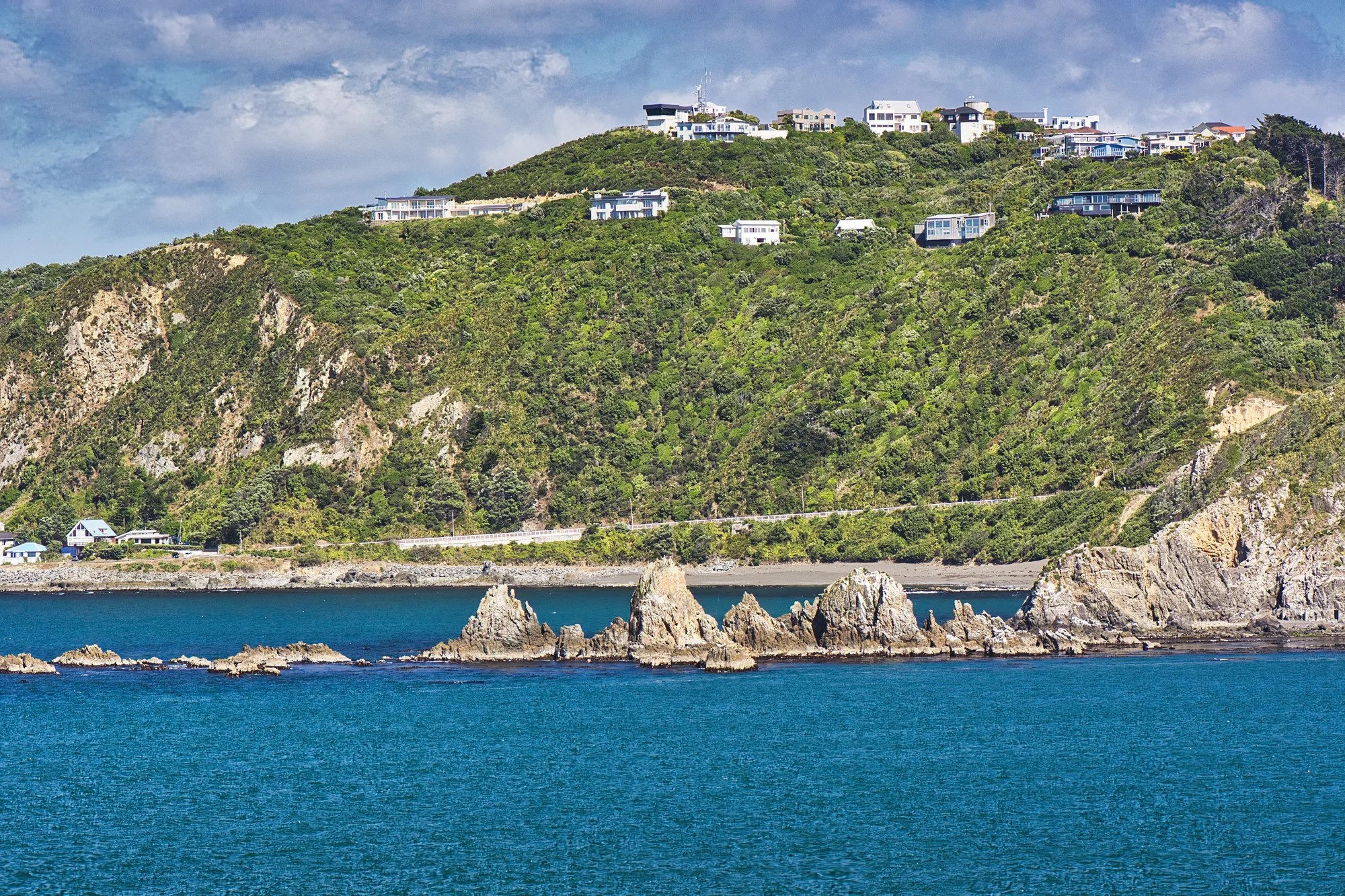
Typically, you get to the South Island via the ferry from Wellington to Picton. The first part of the route goes through Wellington Harbour, passing houses built upon the mountain slopes. Jagged rocks and headlands add to the scenery.
Very little of the trip is in open waters, so it is a very calm ferry ride. The last part of the crossing is through the Marlborough Sounds.
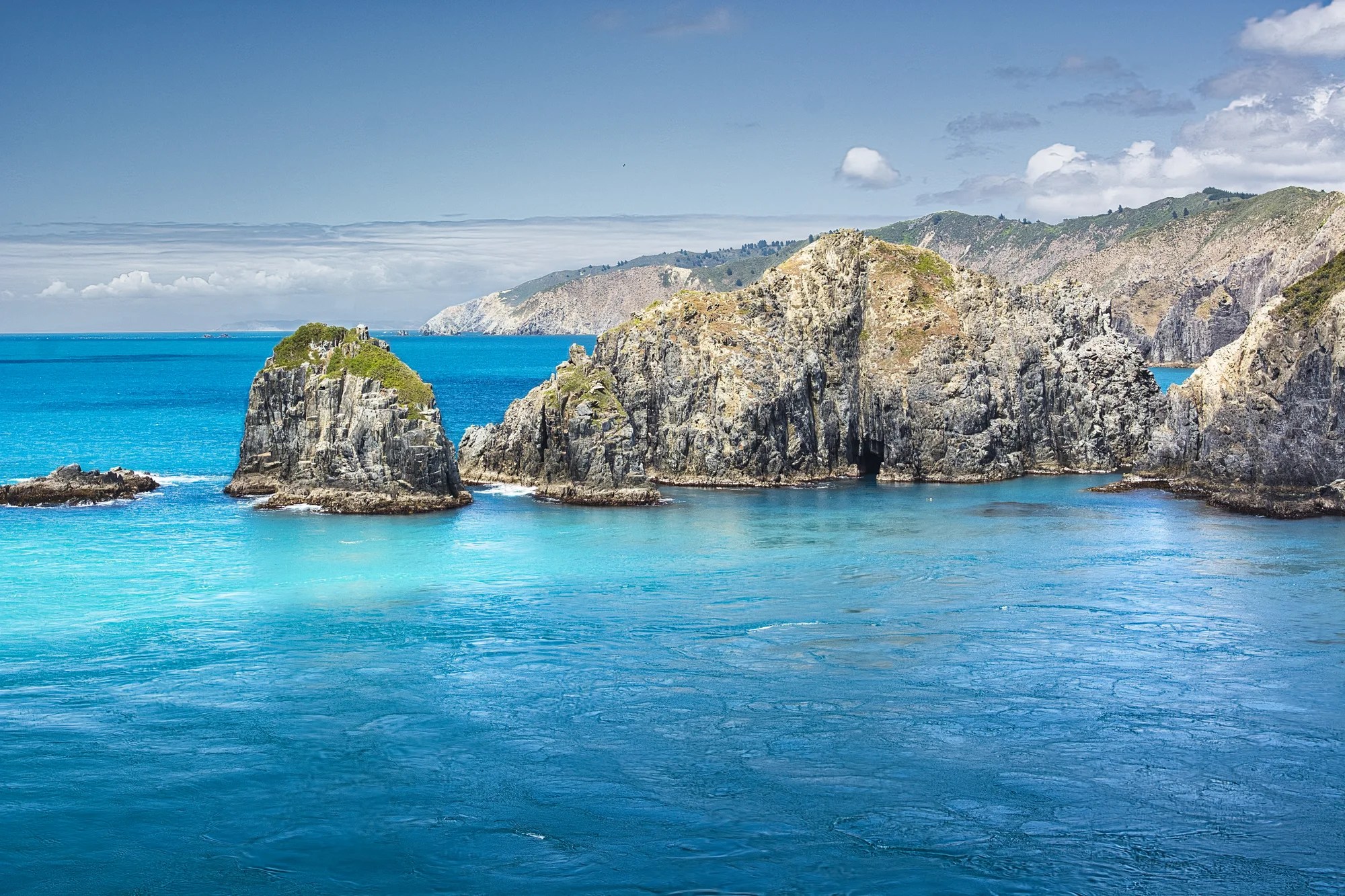
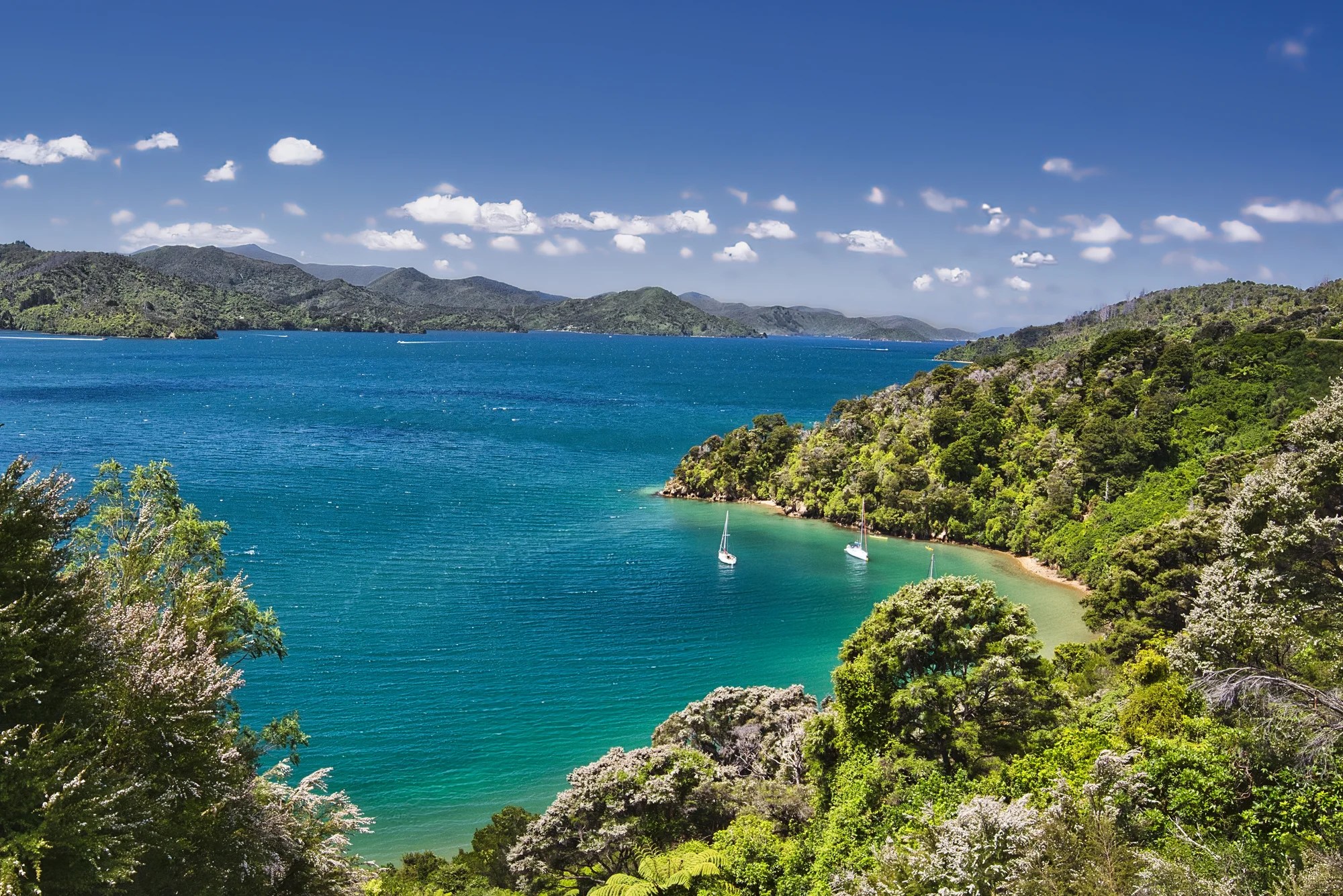
Marlborough Sounds

Treat the ferry as a cruise and enjoy the views. On our third trip, our son used the ferry as a pelagic birding boat trip, looking for seabirds.
The Marlborough Sounds are a vast network of sea-drowned valleys at the northern end of the South Island. They straddle the boundary between two tectonic plates. The Pacific Plate is slowly moving under (subduction) the Australian Plate, creating continental collision and mountain building. The Marlborough valleys were flooded by rising sea levels when the ice age ended 14,000 years ago.
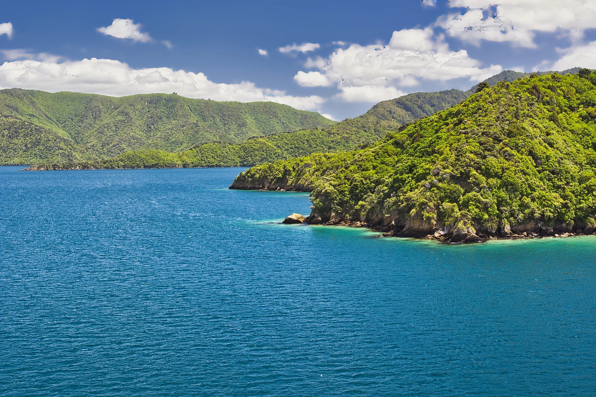
The ferry travels through the jade-green Queen Charlotte Sound dotted with islands. The green colour reminds us that NZ is in the South Pacific.
Who is Abel Tasman?
Abel Tasman (1603 – 1659) was a Dutch explorer who worked for the Dutch East India Company. Indonesia and the famous Spice Islands were a Dutch colony. In 1642, Tasman led an expedition and was the first European to discover and sail between two new islands. He named them Nieuw Zeeland after the Dutch province of Zeeland. The name has persisted. Much later, it was explorer Capt. James Cook in 1769, who triggered interest by Britain.
Picton
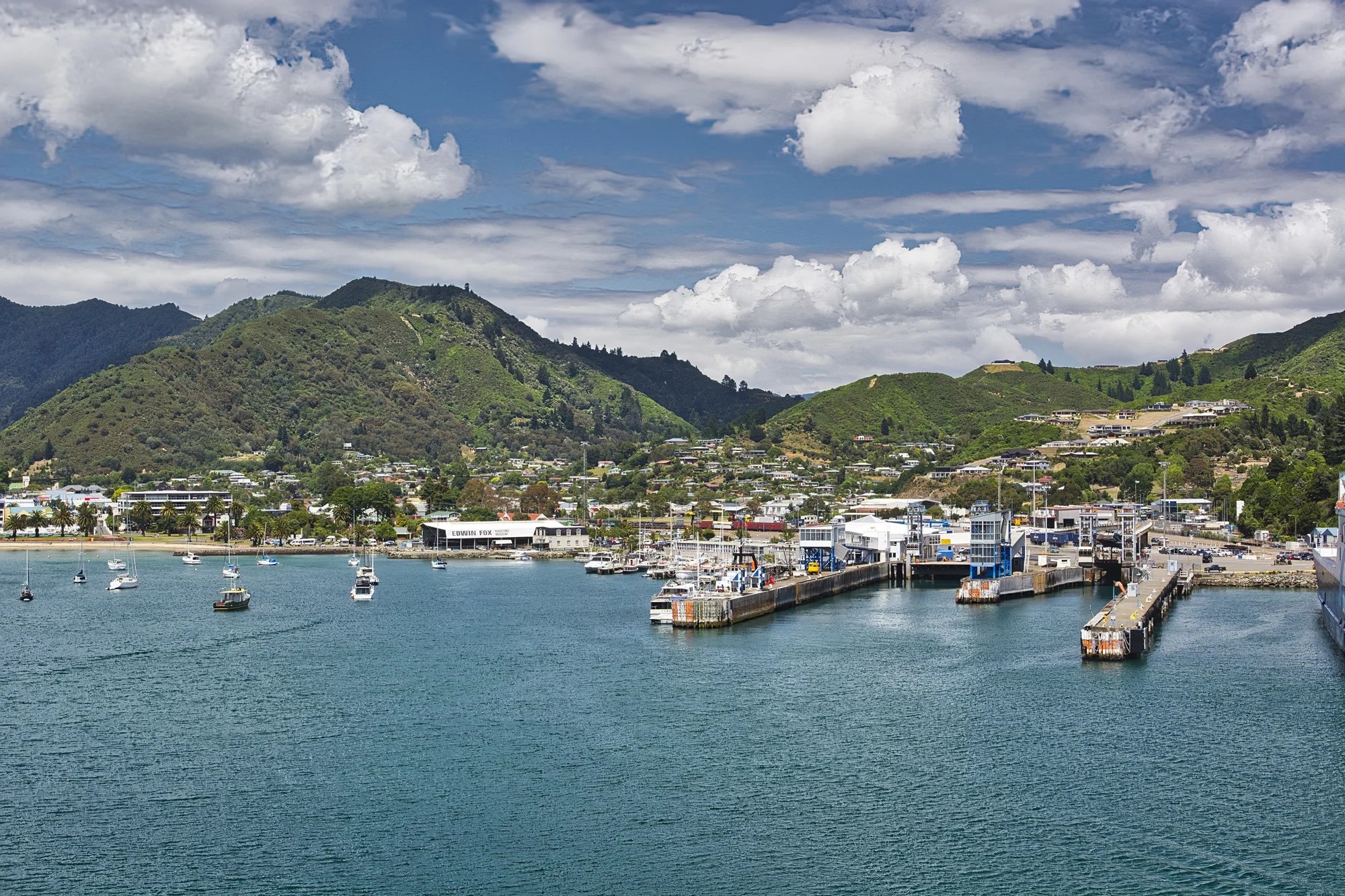
The ferry ends in Picton at the head of Queen Charlotte Sound. This ferry takes 3.5 hours plus disembarking time. Allow half a day for the crossing. Fuel up at a Picton cafe. I don’t remember any other food places until Havelock.
When you rent a car in NZ, some rental companies will not let you take a rental car across the ferry. This saves you NZD 199 for a car in high season. The passenger fare is $75 per person. You drop the first car at the Wellington terminal and pick up the second car at the Picton terminal (or vice versa). We found this seamless.
Queen Charlotte Drive
Our son booked a pelagic birding cruise through the sounds, while we explored Queen Charlotte Drive. It is named after Queen Charlotte of Mecklenburg-Strelitz, the wife of King George III of Great Britain.
I have pinned all the viewpoints to our custom Picton-Tasman Google Map to ensure you get the most out of this road trip.
Picton Scenic Overlook
Picton Scenic Overlook (G5.0) is the first pull-off on Queen Charlotte Drive. This view is in the opposite direction from Picton Harbour.
From here, drive north up switchbacks along Shakespeare Bay. Whenuanui (Becks) Bay is the next viewpoint.
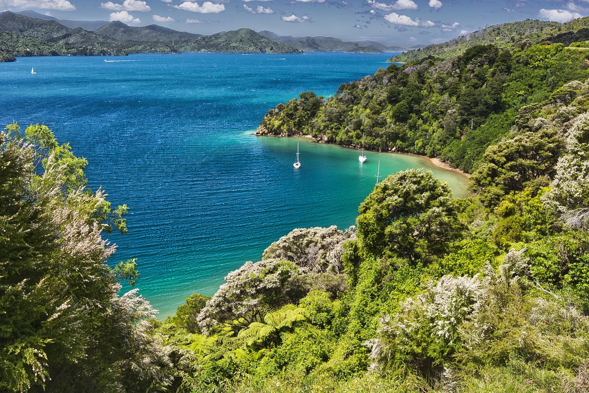
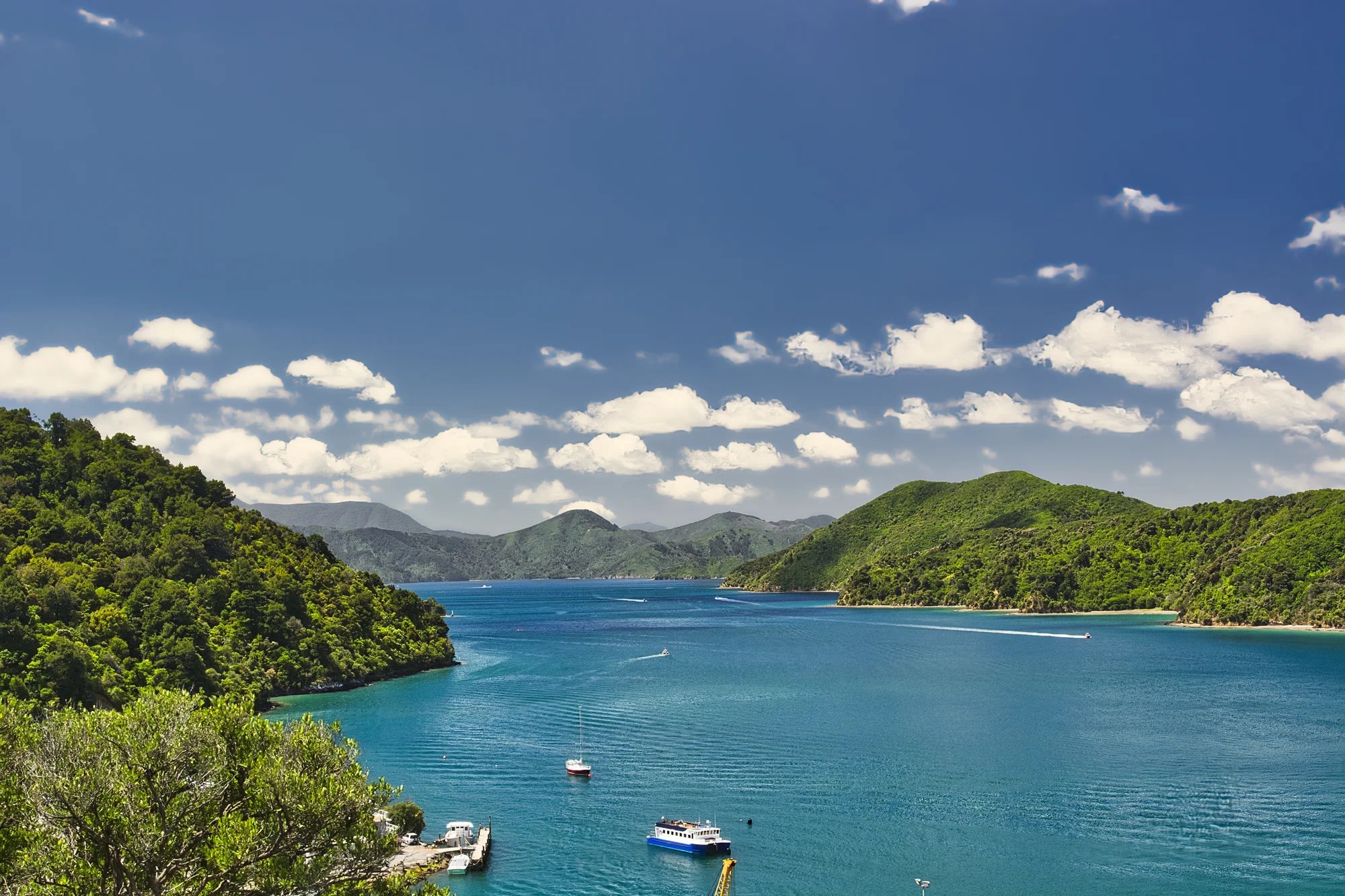
Governors Bay
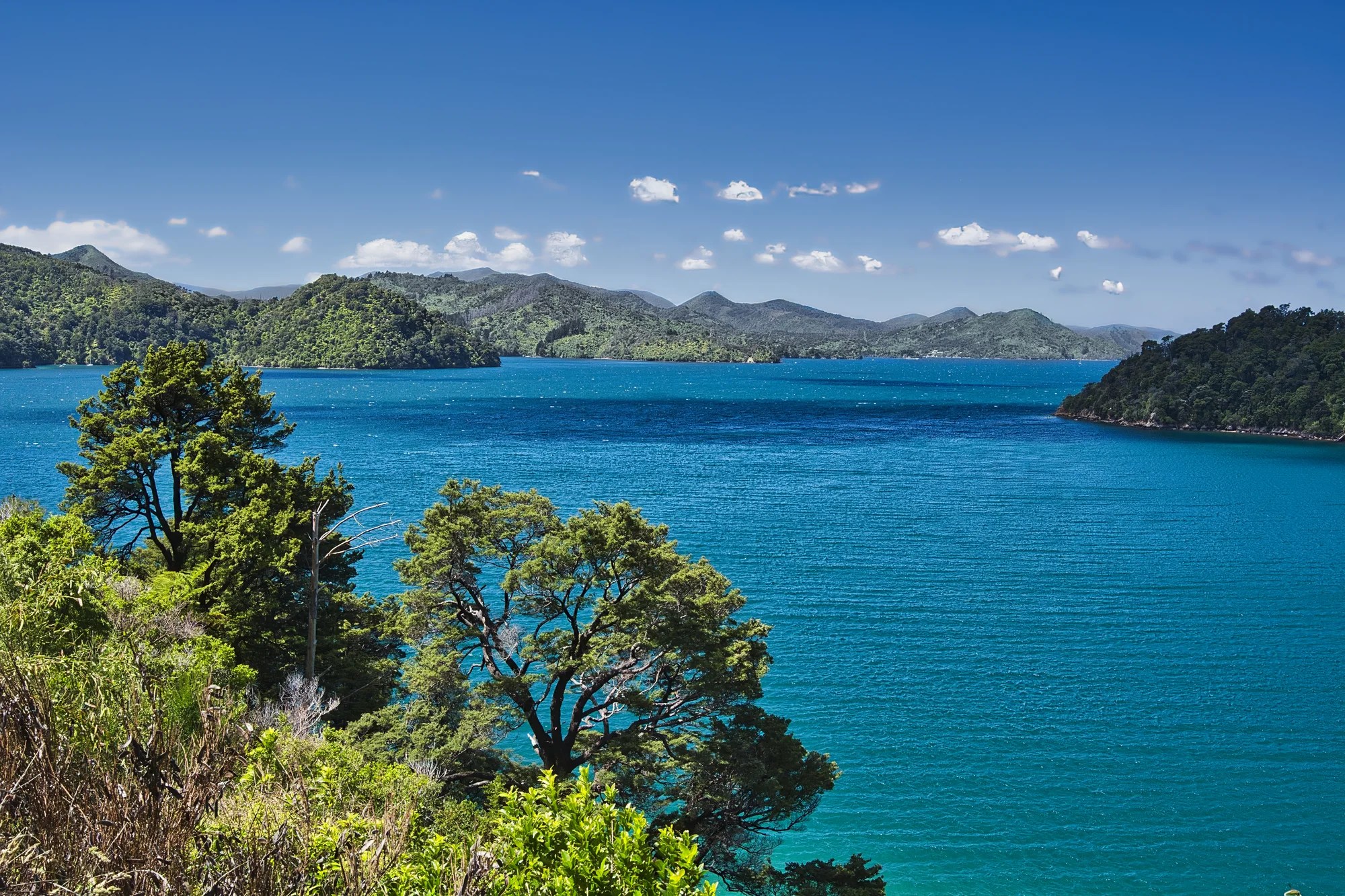
Picton – Governors Bay 10 km 0:17 h
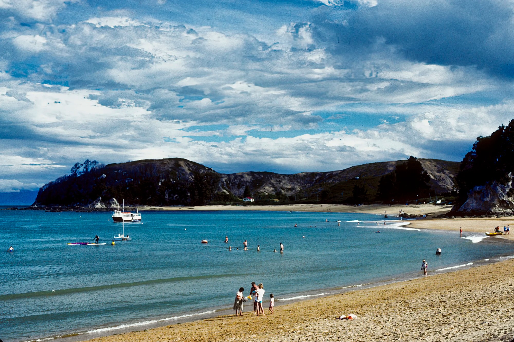
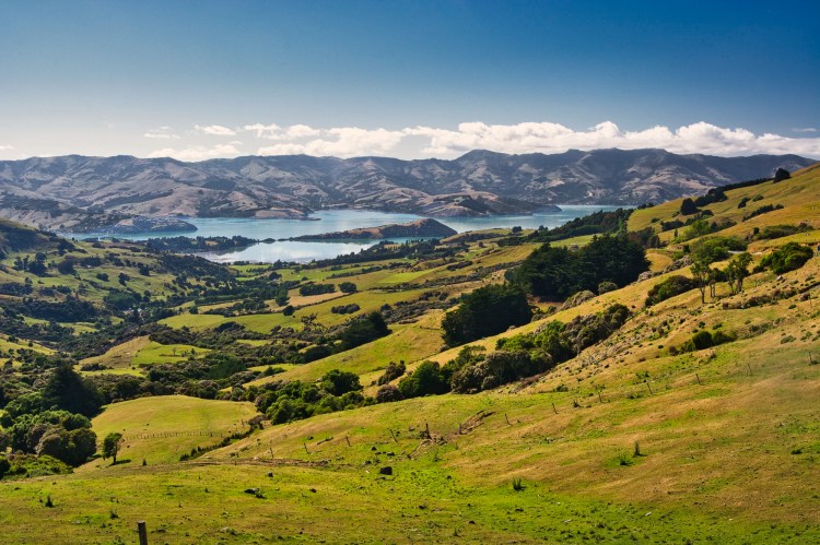
Governors Bay (G5.0) is my favourite view. The turquoise waters, white sailboats and rugged headlands epitomize quintessential New Zealand.
Other views along Queen Charlotte Drive are Ngakuta Bay, Momorangi Bay, and Mahakipawa Arm View.
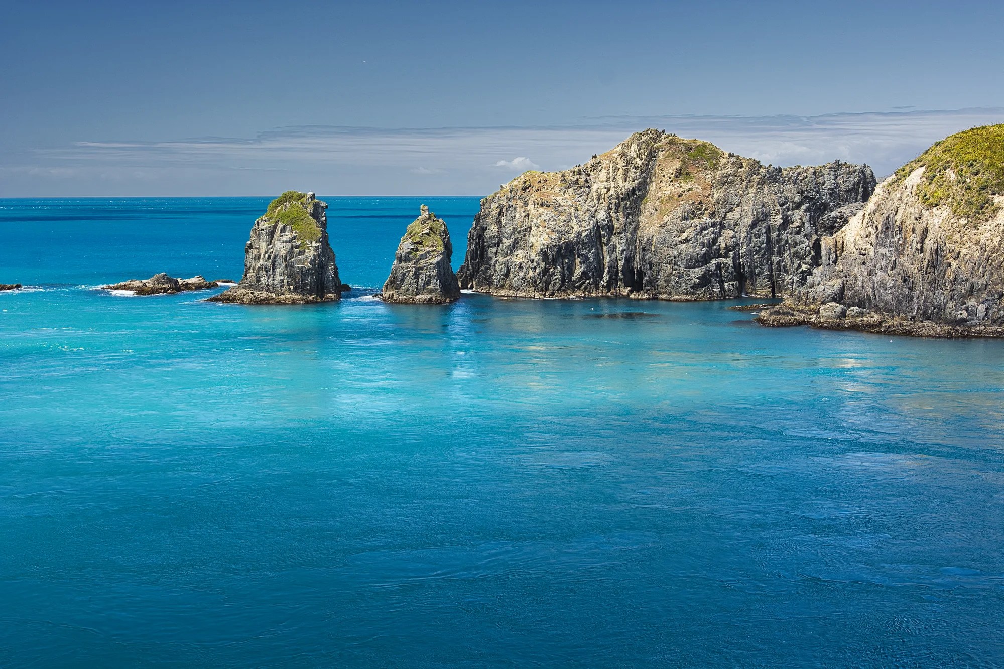
Mahau Sound Lookouts
Picton – Cullen Point 31 km 0:43 h
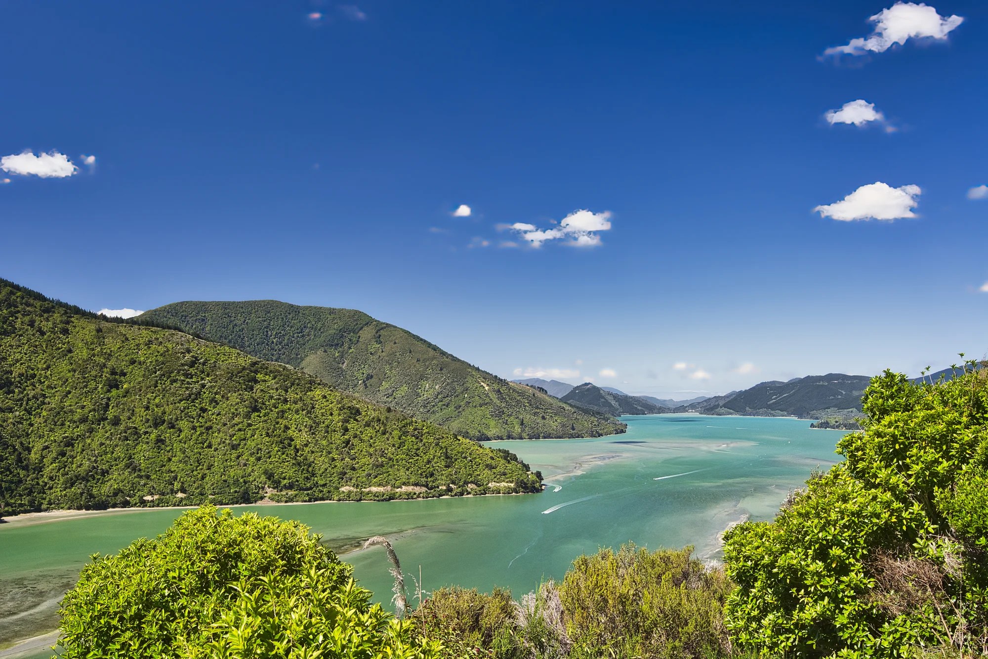
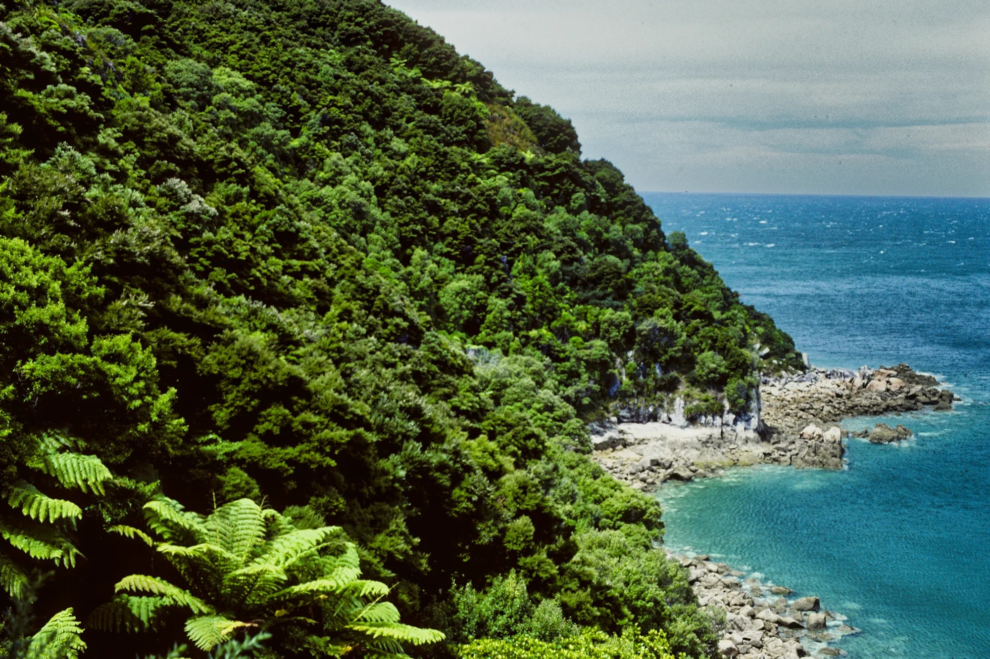
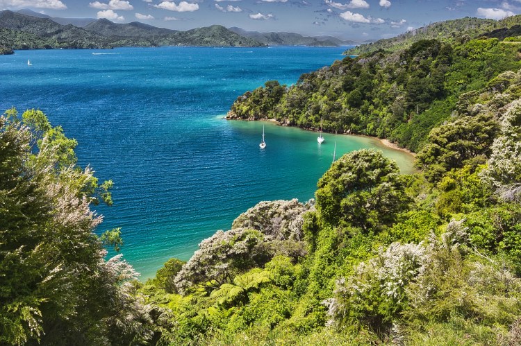
Cullen Point Lookout (G4.5) was one of our favourite views. You need to take an easy, short walk off the highway. Mahaki Paoa is another lookout further on the trail.
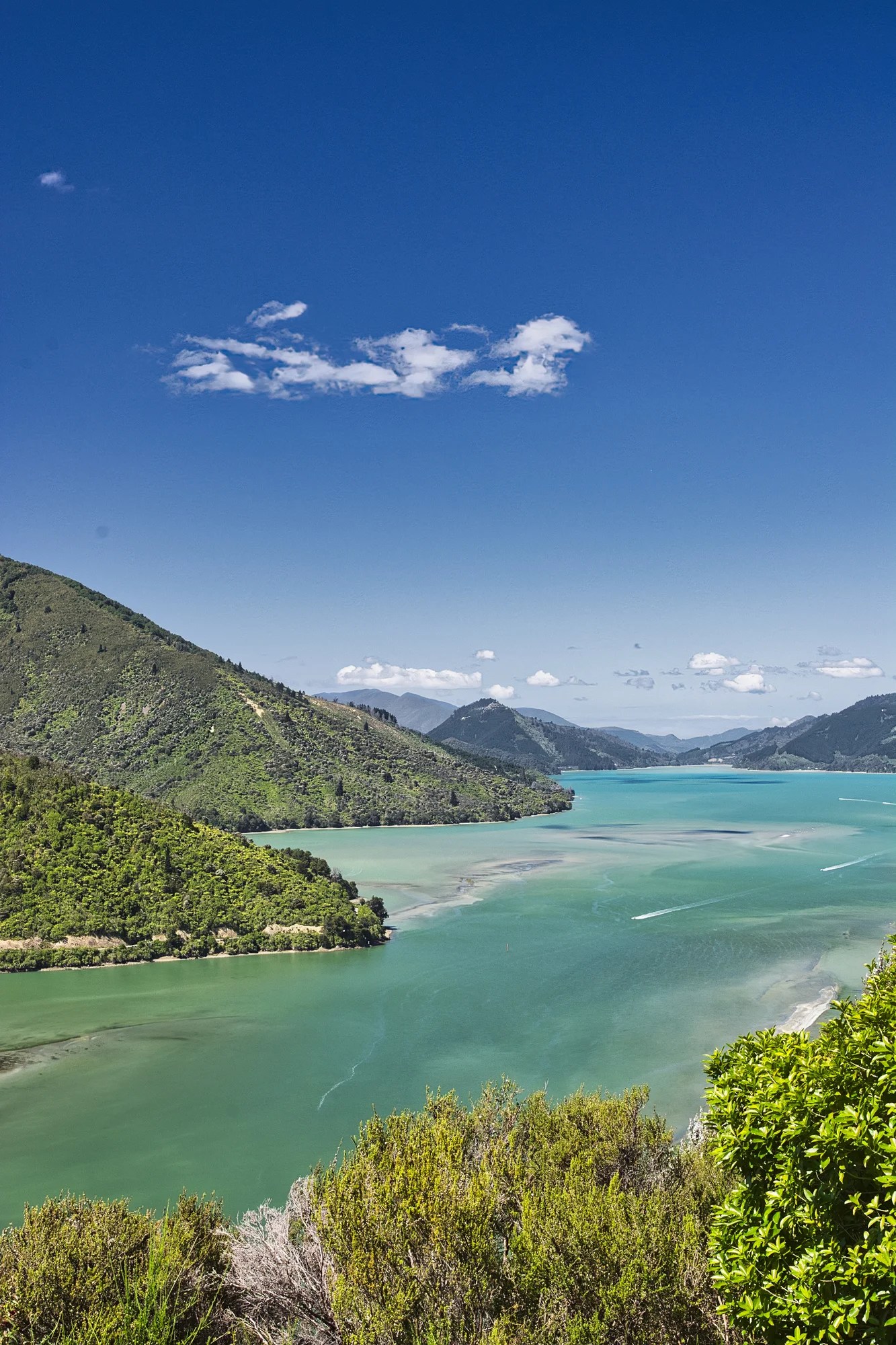
The turquoise waters, green mountains, and jagged coastline epitomize quintessential New Zealand. We were also blessed with good weather!
Havelock
Picton – Havelock 35 km 0:48 h
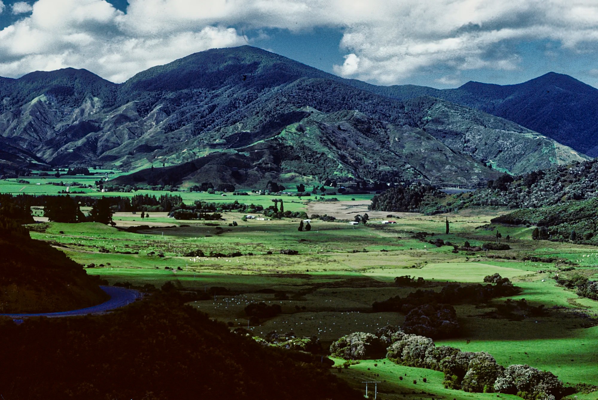
This was a scenic view of a green valley as we arrived in Havelock, where we camped.
On our first trip to NZ, we did the mail boat cruise through Pelorus Sound. People waited at their dock for mail and supplies. One boat came alongside and loaded several crates of fish into our boat. I asked the captain about the fish. The captain asked me to steer the boat while he opened one of the crates and sold us one of the blue cod. He said this is the best fish. It tasted terrific and was tender.
Nelson
Havelock – Nelson 88 km 1:19 h
We got a lift with Reg Urwin to Nelson. Reg insisted on treating us to the most beloved ice cream flavour in NZ. Hokey pokey was invented by NZ in 1953. It consists of vanilla ice cream with small, solid lumps of honeycomb toffee. Hokey pokey is the Kiwi term for honeycomb toffee.
Reg joined the merchant marine at 17 years old. He was on the ship’s bridge when his boat was torpedoed by the Germans. He was the only survivor and was a POW until the end of World War II.
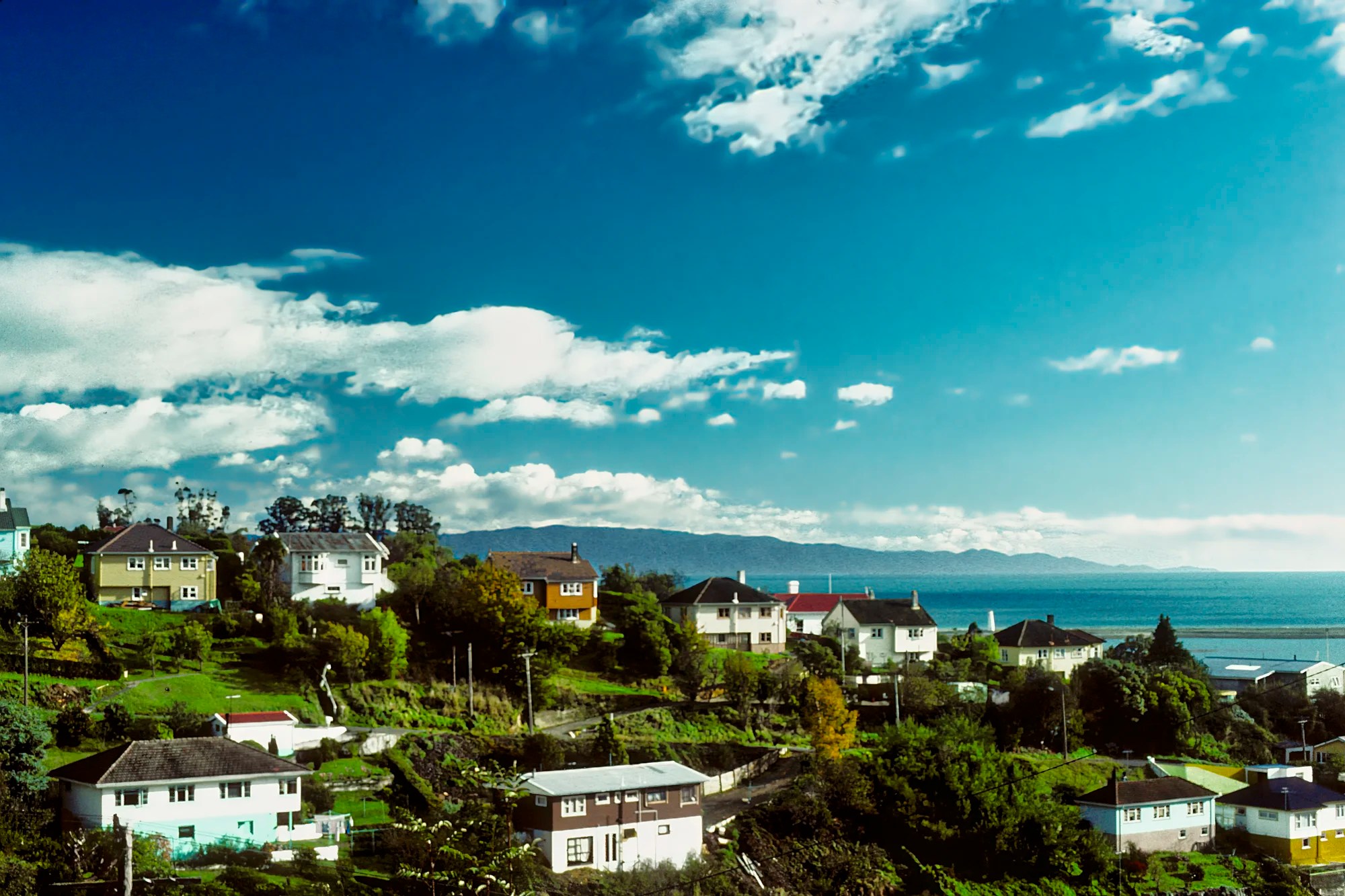
Nelson is a delightful town with a great location on the coast. It has stunning natural scenery, sunny beaches, beautiful arts and crafts, and lots of walking trails.
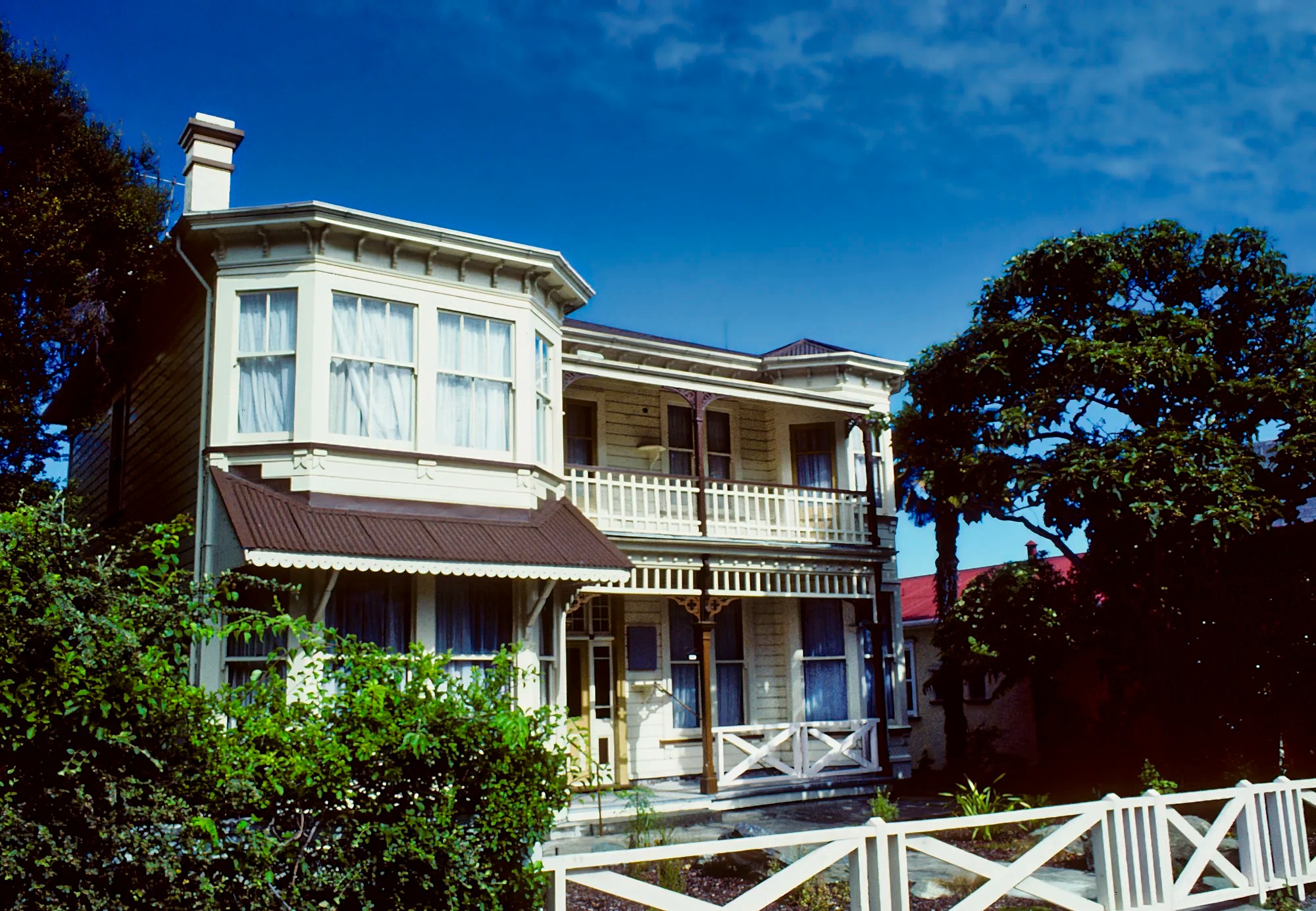
Nelson has many heritage homes. There are self-guided and guided tours for those interested.
Heritage Walks, Nelson City Council
Nelson Heritage Homes, The Prow Org
Nelson Arts & Crafts
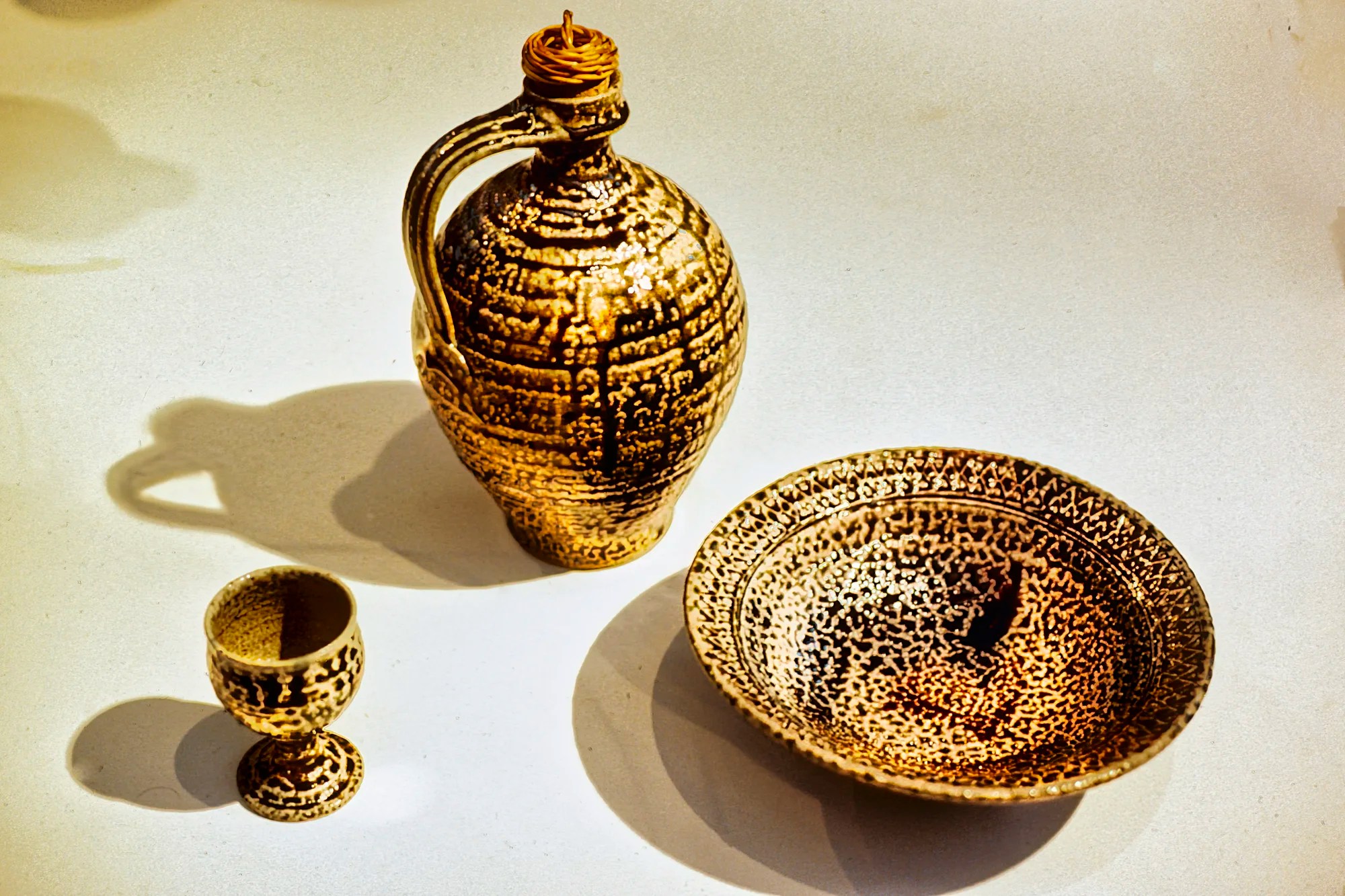
Nelson is renowned for its vibrant arts and crafts scene. There is a wide range of artisanal crafts, including silk painting, jewellery, pottery, weaving, and wood turning. There are many workshops, galleries, and markets you can explore. We particularly liked the weaving shops.
We saw superb salt-glazed pottery by famous potter, Mirek Smíšek. This Czech resistance supporter spent most of World War II in labour camps. He emigrated to NZ in 1951. We recognized the salt-glaze technique because we bought some superb pieces at a New York craft fair. Unfortunately, pottery is not something you can ship home (this was on our three-year backpack trip).
Isel House and Park
Address: 16 Hilliard Street, Nelson
Hours: Tues-Fri 10:00 – 15:00 hrs; Sat 12:00 – 16:00 hrs
Entry Fee: Locals free, Visitors NZD 7.90 donation
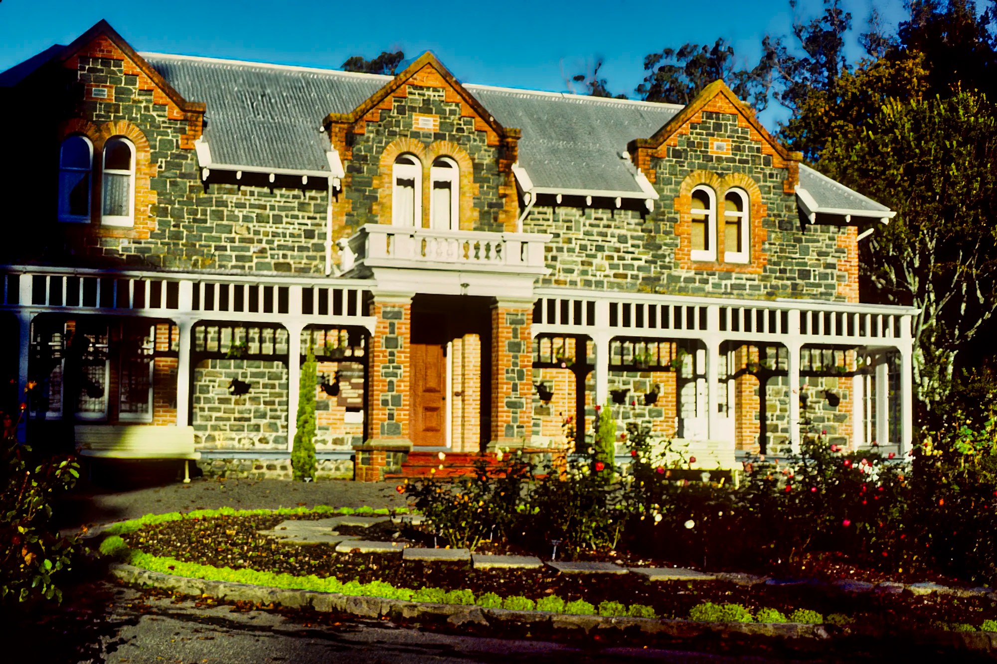
Isel House is a beautiful stone heritage home set among sequoias, oaks, rhododendrons, and other magnificent trees. One of Nelson’s first families, the Marsdens, arrived in 1842. Thomas Marsden was a keen botanist, jeweller, watchmaker, and farmer. He planted a picturesque English-style park, some of which still survives today. We loved Isel Park.
Maitai River
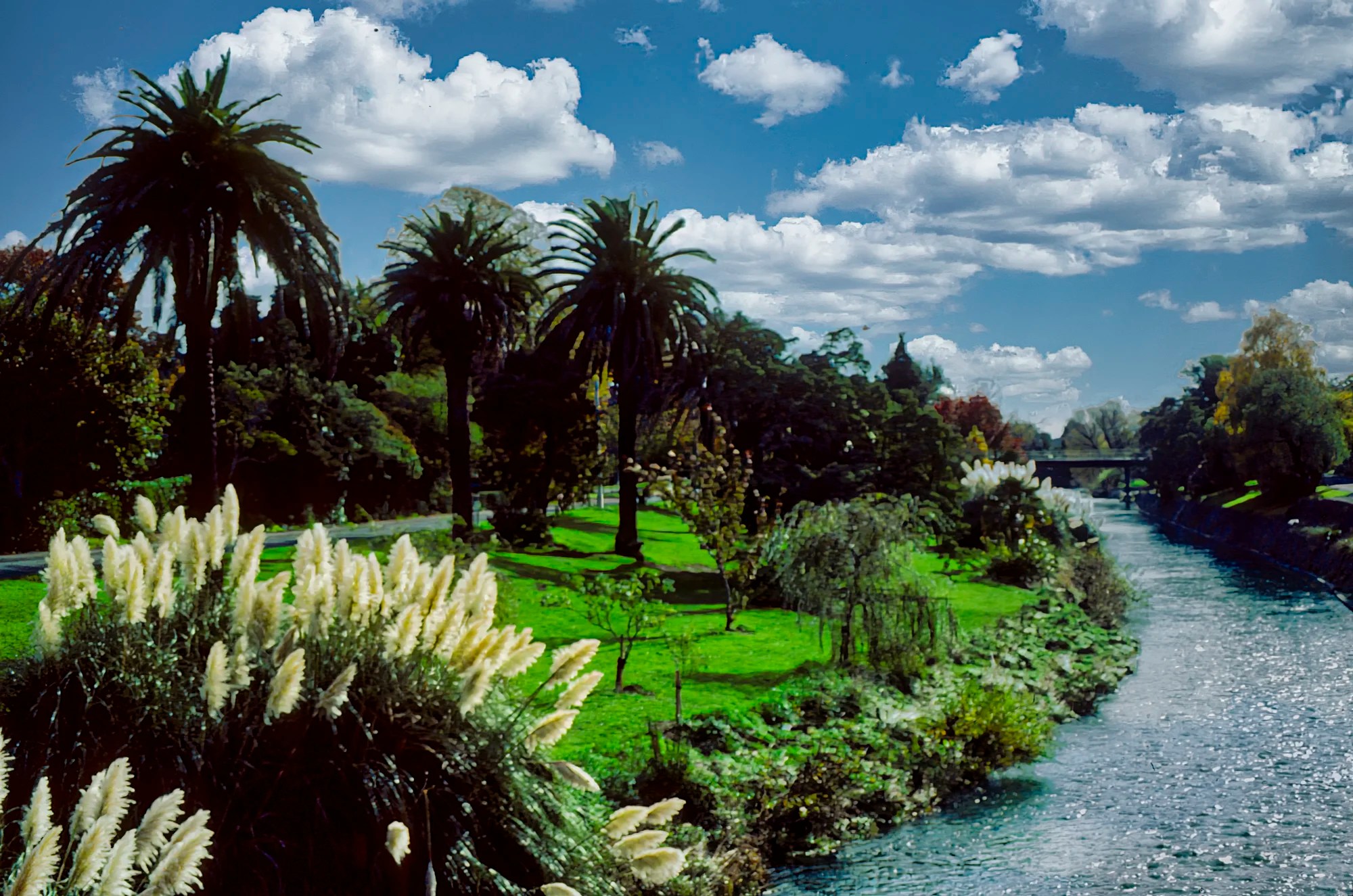
Nelson is full of nice places to have a relaxing walk. Queen’s Gardens is a peaceful refuge of ducks and roses. On Hardy St, we crossed the pedestrian bridge over the Maitai River lined with unusually tall Pampas grass from South America. The river banks are like a park.
Todd Valley
We met Shirley Horrocks, former editor of the Nelson Evening Mail. She invited us to visit Dick Roberts’ ecological farm in Todd Valley. What a gorgeous setting!
Nelson Lake National Park
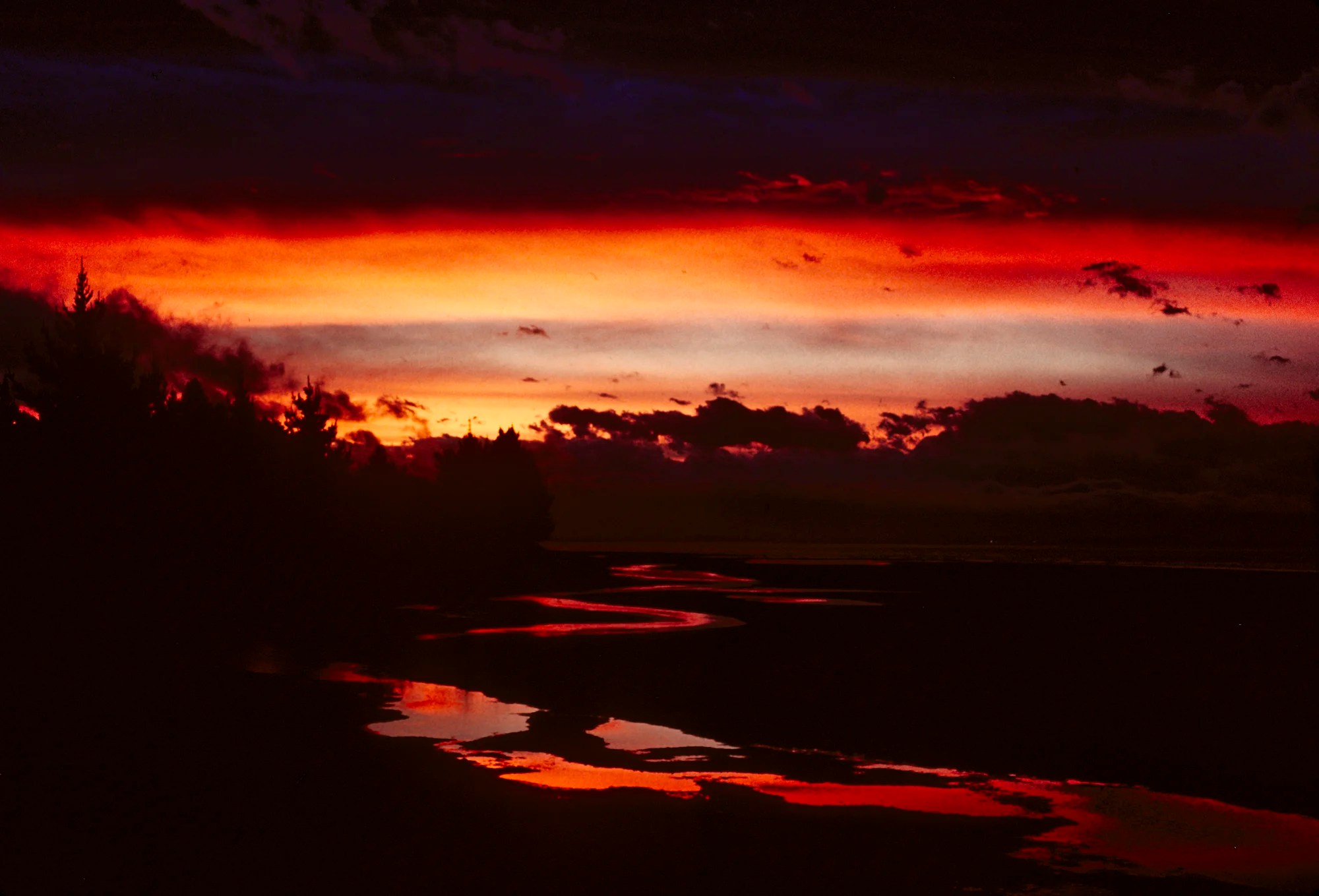
It’s finally time to leave Nelson and move on to the main course. This beautiful scarlet-tinged sunset was taken at Hope Saddle in Nelson Lake National Park. It is south of Nelson. It’s off this itinerary on the way to Westport (on the west coast).
Ngarua Caves
Nelson – Ngarua Caves Lookout 52 km 0:50 hrs
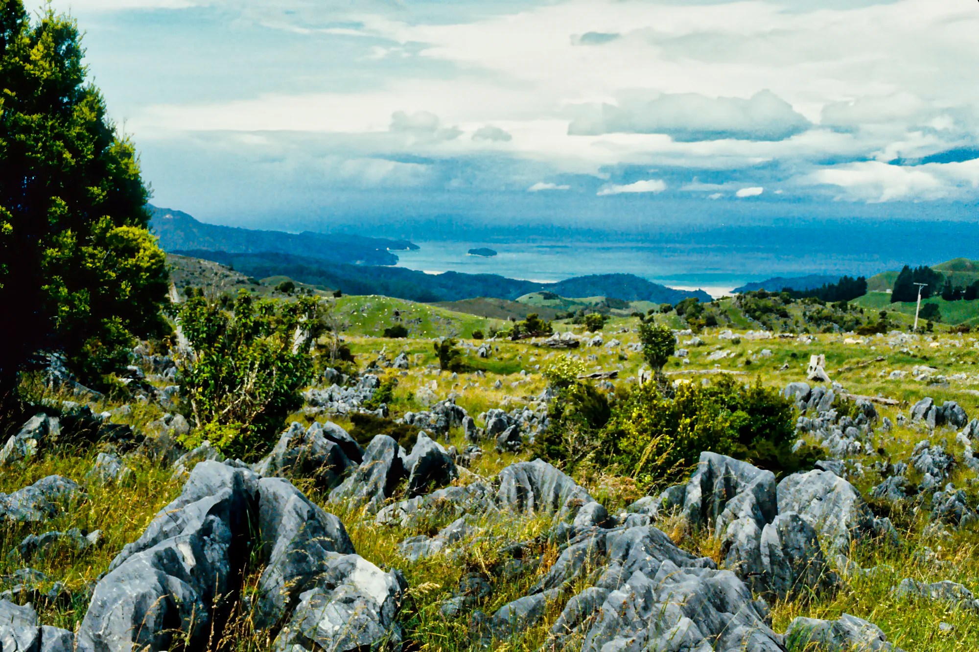
We saw this view with karst formations from the Ngarua Caves Lookout (G5.0). This is the car park for Ngarua Caves (G4.7). Karst is a type of landscape where the dissolving of the bedrock has created sinkholes, caves, and springs. Karst landscape occurs where there are soluble rock types like limestone, marble, and gypsum. Our favourite example is the Dolomites north of Venice.
Takaka Hill
Nelson – Takaka Hill Lookout 53 km 0:52 hrs
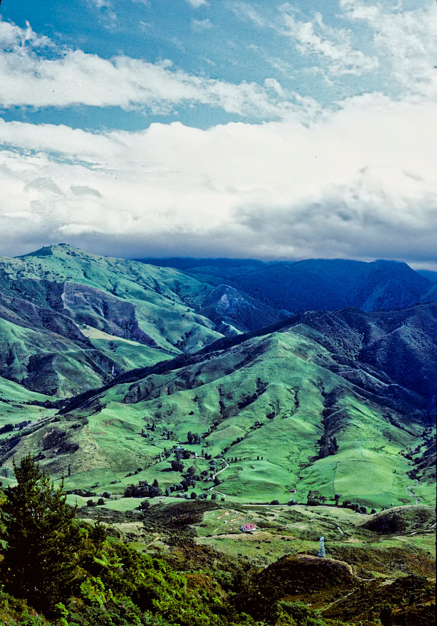
I am not sure which viewpoint this was. But the view of rugged green mountains from Takaka Hill was very special. My mantra about NZ is that getting from A to B is just as exciting as destination B.
Parapara Beach
Nelson – Parapara 108 km 1:39 h
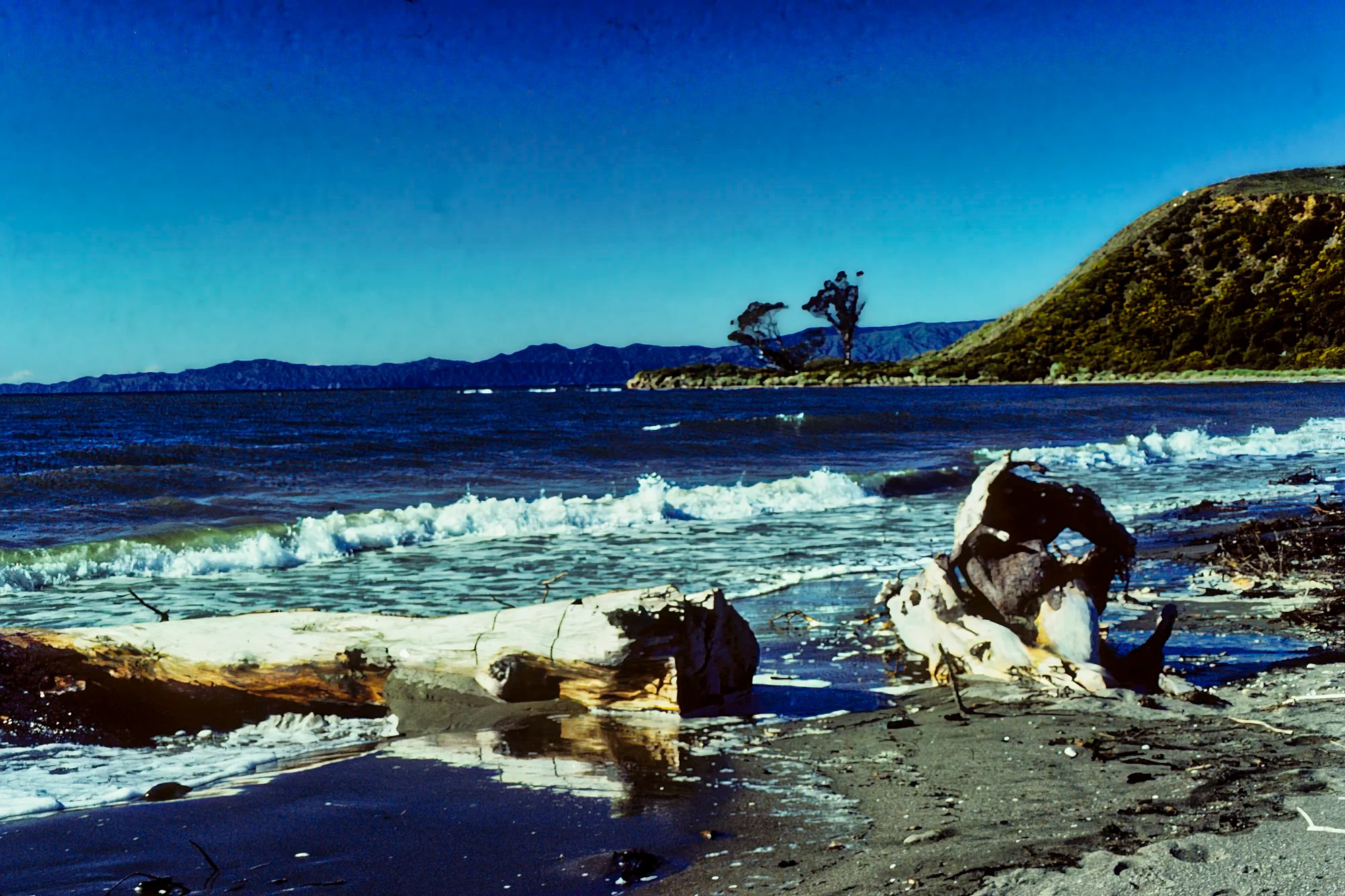
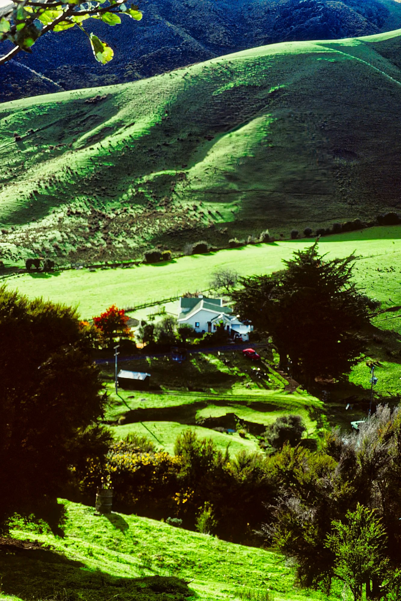
Our first trip to NZ was part of our three-year backpacking trip, We did not rent a car. We met Bert and Grace, who gave us a lift towards Abel Tasman NP. They recently remarried and retired. Grace had definite ideas. She felt people must not live in the past. They sold most of their belongings, their houses in Gisborne and Westport, and made a fresh start in Parapara.
They invited us to stay with them at their wooden house with a verandah overlooking the lagoon in Parapara. This town is located 50 km north of Abel Tasman NP. After a scrumptious breakfast, we walked on shell-strewn Parapara Beach. This is another hidden gem most people overlook.
Pupu Springs
Parapara – Pupū Springs 19 km 0:16 hrs
Nelson – Pupū Springs 96 km 1:33 hrs
Grace drove us south to Abel Tasman. On the way, she stopped to show us the sights. Pupū Springs was an unexpected extra.
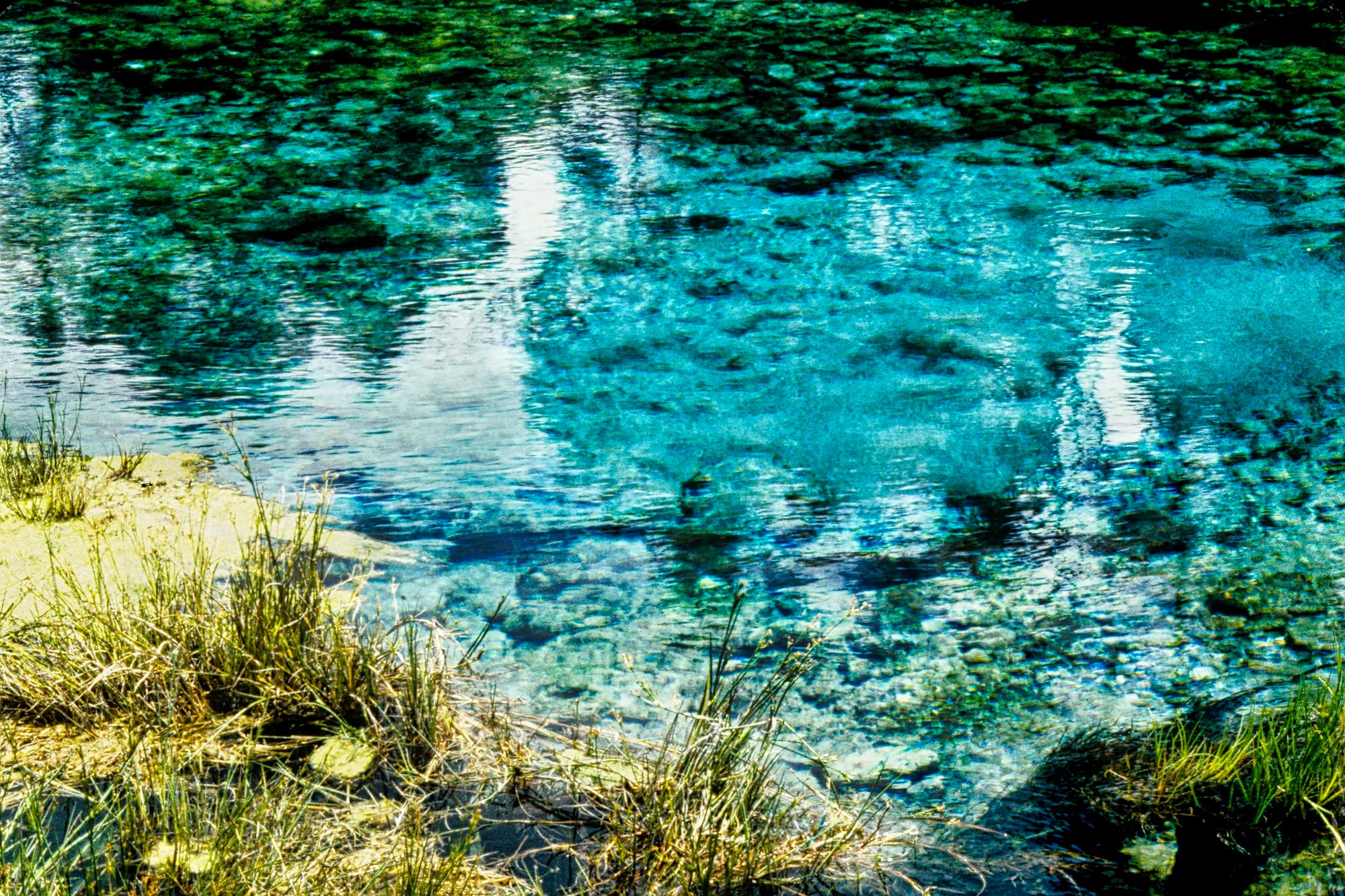
Located near Golden Bay, its real name is Te Waikoropupū Springs (G4.7). We could see vigorous bubbling in the pool. The spring pumps 14,000 litres of water per second or 1,210 million litres per day! The water was so clear and pure. For environmental protection and spiritual significance to the Māori, you cannot even touch the water! For your interest, the water is very cool at 11.7 °C.
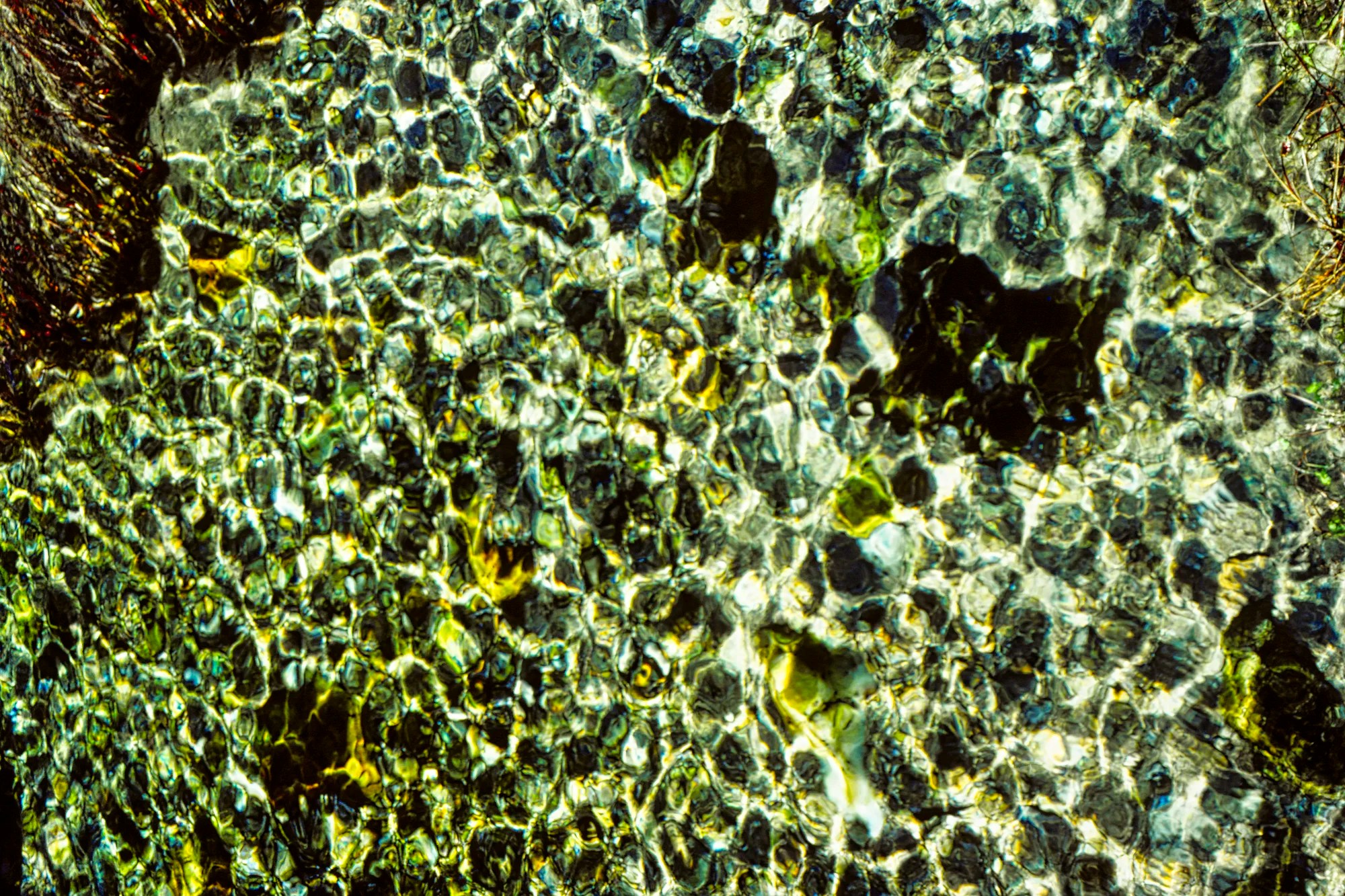
Nearby were the so-called dancing sands, which are produced by changing light and shade over the underlying sand.
Amanita

The mushrooms with bright scarlet caps topped with white spores were amazing. Amanitas form symbiotic relationships with trees, helping them absorb nutrients from the soil. Some Amanita species are very poisonous. We had photographed Amanita muscaria (fly agaric), which has hallucinogenic properties.
Pohara Beach

We stopped briefly at Pohara Beach (G4.8) on our way to Wainui Bay and Abel Tasman NP.
Abel Tasman Coast Track
Nelson – Mārahau 50 km 0:48 hrs.
Nelson – Tōtaranui 118 km 2:14 hrs.
Distance: 60.8 km
Time: 3 to 5 days
The Abel Tasman Coast Track is a four+-1 day hike, depending on the itinerary that you take. This hike is full of golden beaches, turquoise waters, and rugged coasts. The mild climate, golden beaches and lush native bush make it one of the most popular New Zealand Great Walks. The best times to visit this trail are October through May. We went once in May and once in February.
Tidal Bay Crossings
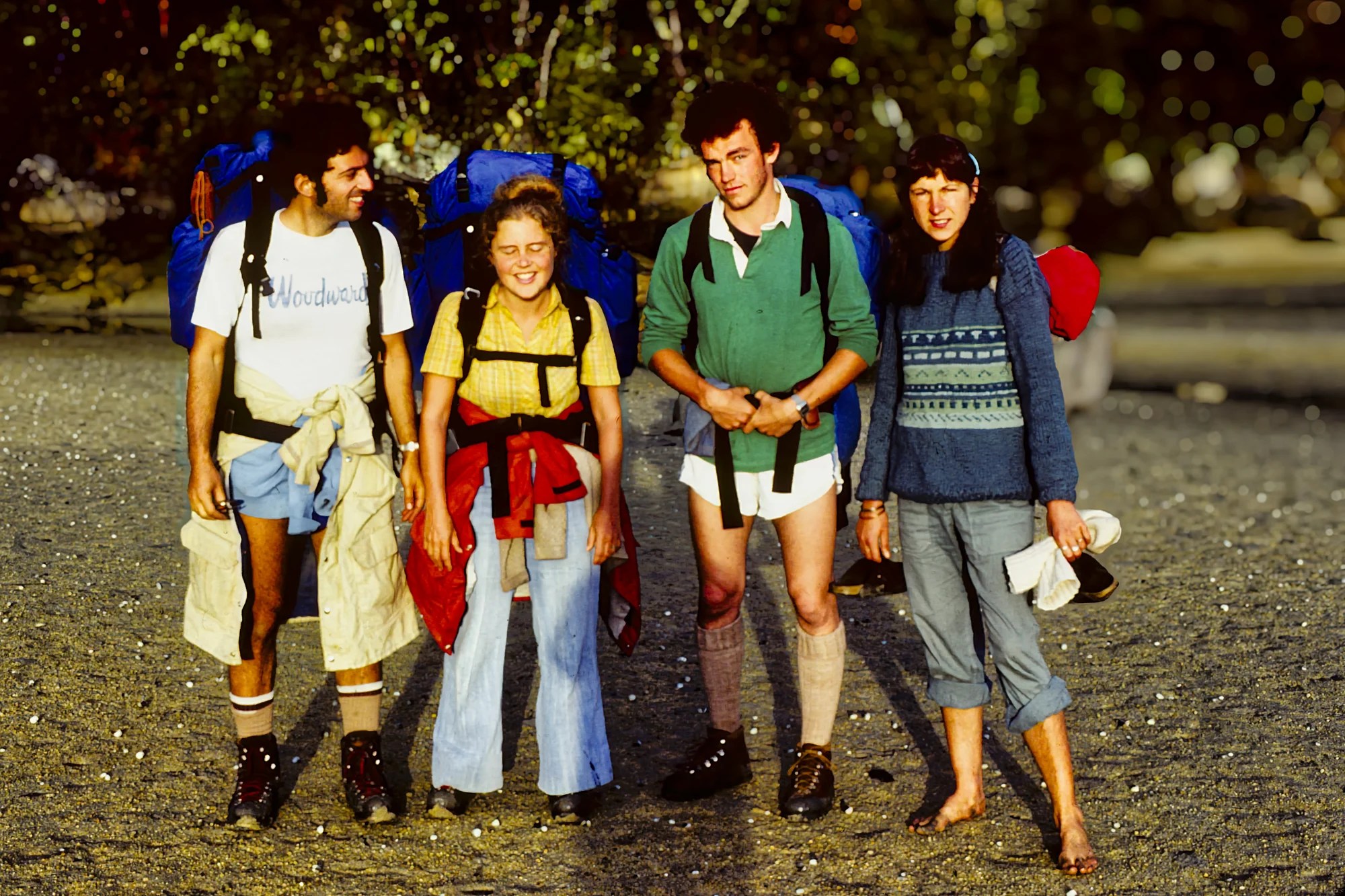
AllTrails rates the Abel Tasman Track’s degree of difficulty as hard. As experienced hikers carrying 10 to 15 kg backpacks, we did not find it that bad. The hike traverses flat beaches but also several climbs.
The main challenge is the tidal crossings. Bays must be crossed between 2 hrs. before and after low tide. Outside of these times, the crossing is dangerous so you must hike the alternate high tide trails. You usually have to take off your hiking boots when the water is high. Awaroa Inlet can only be crossed 1.5 hrs. before low tide, and there’s no alternative track. Make sure you have the tide tables for each day and location.
Accommodation and Fees
There are no fees to do a day walk on the track or for entry into the Abel Tasman National Park. A Great Walk pass is required to stay in the huts, and reservations are essential during peak times.
DOC huts and campsites are located along the Abel Tasman Track. The peak season is October 1 to April 30. During peak season, the cost for Kiwis is lower: NZD 42 per hut and NZD 16 per tent.
| Season | Hut Cost (NZD) per night | Tent Cost (NZD) per night |
|---|---|---|
| October 1 to April 30 | $56 | $24 |
| May 1 to June 30 | $32 | $16 |
| July 1 – August 31 | $26 | $16 |
Abel Tasman Information
Abel Tasman Coast Track, DOC website
Abel Tasman Coast Track, DOC PDF
Abel Tasman Coast Track Info Sheet, DOC PDF
Getting to Abel Tasman
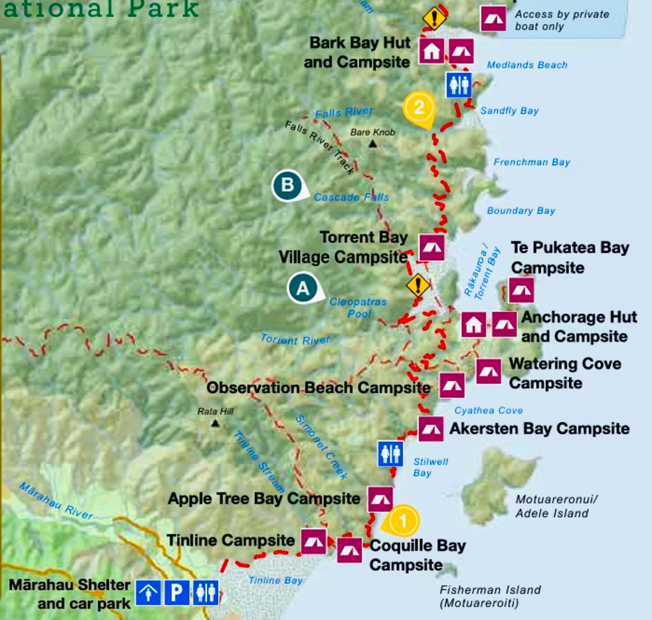
Parts of the coast track are accessible by car. If you have a car, the problem will be getting back to your parking point. On our first trip, we got a ride to Tōtaranui on the deserted park road – we were very lucky. Another option is to drive to Tōtaranui and do two short hikes — one north and one south. On our second trip, we did two short hikes.
If you don’t have a car, Tōtaranui Beach is only accessible by a remote 33 km road or by boat. By contrast, Mārahau is near major highways.
Another option is to take the expensive water taxi from Mārahau to Tōtaranui or any point in between. From there, you can hike the Great Walk back to Mārahau.
Abel Tasman Ferry
Time: 2 hrs.
Sailings leave from Kaiteriteri or Mārahau. Check each boat company for the current times. Make reservations in advance. Also note that during the peak season (December 20 to March 31) all sailings will be available. During the off-season, the number of sailings is subject to demand. There may be only one sailing per day, e.g.
Depart Kaiteriteri 09:20 and arrive at Tōtaranui 11:20;
Depart Tōtaranui 14:40 and arrive at Kaiteriteri 16:15.
The Sailing Itinerary lets you get off or get on at Apple Tree Bay, Anchorage, Torrent Bay, Medlands Beach, Tonga Quarry, Awaroa and Tōtaranui. The boats go along the coast, so you can also use this as a cruise if you don’t plan to hike.
| Company | Cost to Tōtaranui (NZD) |
|---|---|
| Abel Tasman AquaTaxi | $60 |
| Abel Tasman Sea Shuttle | $63 |
| Mārahau Water Taxis | $65 |
Vegetation

Ferns are very common in NZ. Tree Ferns are prehistoric. They only survived the dinosaur Mass Extinction Event in New Zealand and South Africa!

I believe these are crimson rātā trees. Members of the myrtle family, rātā trees are one of the famous native trees in New Zealand. They are best known for their brilliant red flowers that appear in profusion from November to January. They can live for up to 1,000 years!
The rātā was also valued by Māori for its medicinal properties. Crushed and boiled rātā bark was:
- Applied to bruises and open wounds;
- Ingested for the common cold;
- Leaves chewed for toothaches.
Day Hike Options
The Great Walk is four days long and requires advanced booking of huts in peak season. Those on short trips can still see the best of the Tasman Coast by doing day trips to Anapai Beach and Tōtaranui Beach.
Tōtaranui to Anapai Bay
Distance: 3.3 km OW
Hike Time: 1:10 hrs OW
This hike, which can be done in around three hours (return), starts at Tōtaranui Beach. If the tide is out, you can cut across the estuary, which saves a bit of time. From there, it’s an easy uphill hike to the top of the ridge and then down to Anapai Bay.
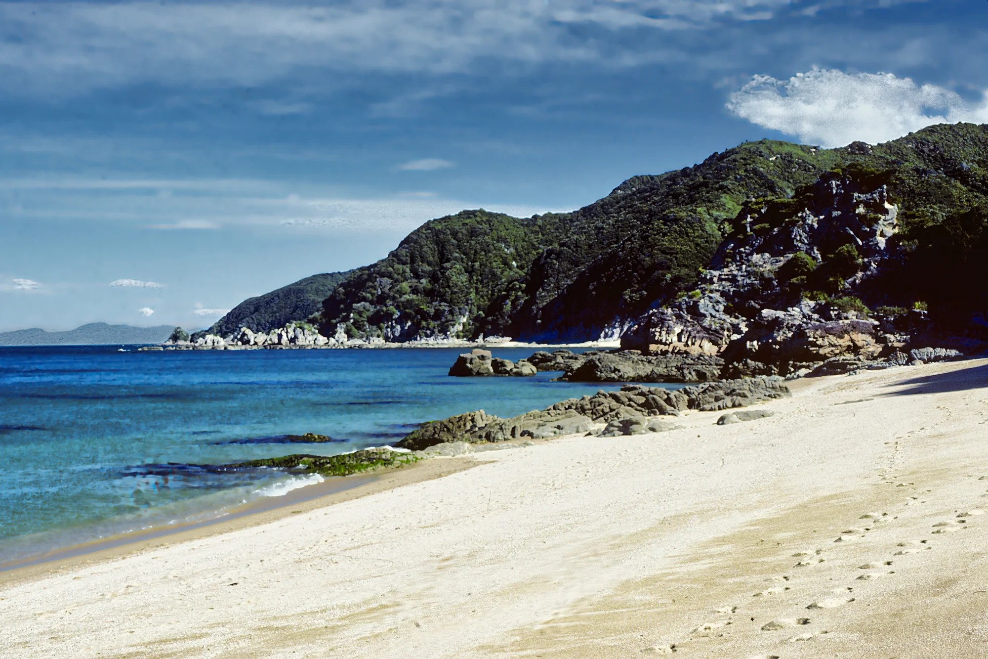
The beach is quite popular and is generally considered one of the best beaches in Abel Tasman National Park. However, there were no people.
Anapai Bay to Mutton Cove
Distance: 3.3 km OW
Hike Time: 1:20 hrs OW
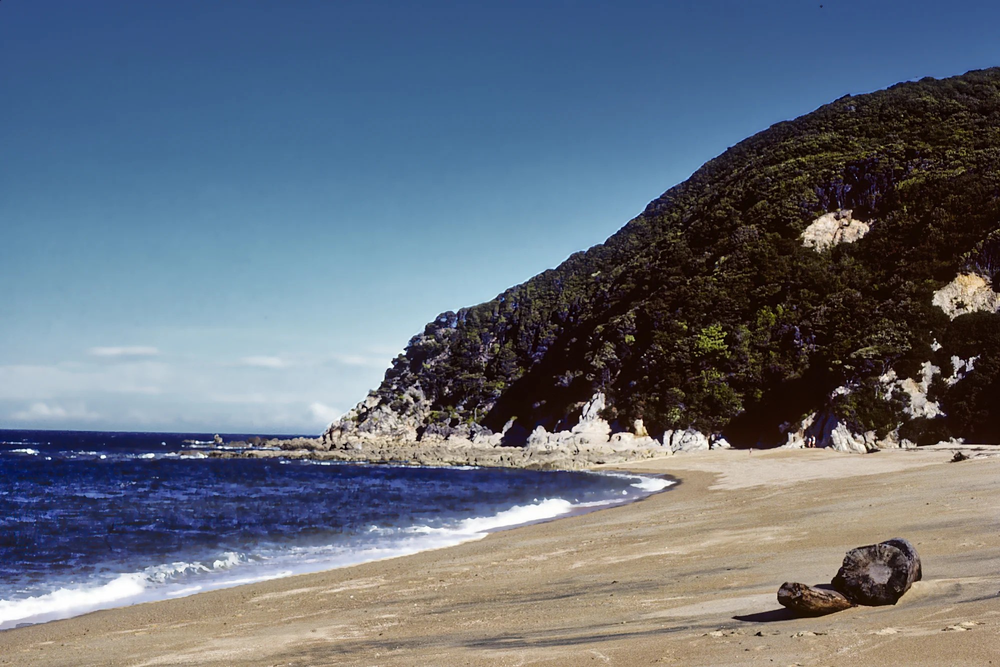
Mutton Cove is another stretch of tan-coloured beach that looks very similar to Anapai Bay. As you can see, it was completely deserted. From Mutton Cove, you can continue to Separation Point.
Tōtaranui to Goat Bay Beach
This day hike is part of the Great Walk and is described below. Tōtaranui Beach is by far the most photogenic sight.
Great Walk Itinerary
We did not start at Wainui Car Park as it was easier to drive to Tōtaranui. Here are the Whariwharangi hiking times for completeness. By the way, Whariwharangi is pronounced fari-farangi. Whare means a home or place. Wharangi is the name of a small aromatic coastal tree,
Wainui Car Park to Whariwharangi
Time: 2 hrs
Distance: 5.7 km
Whariwharangi to Tōtaranui
Time: 3:15 hrs
Distance: 9.8 km
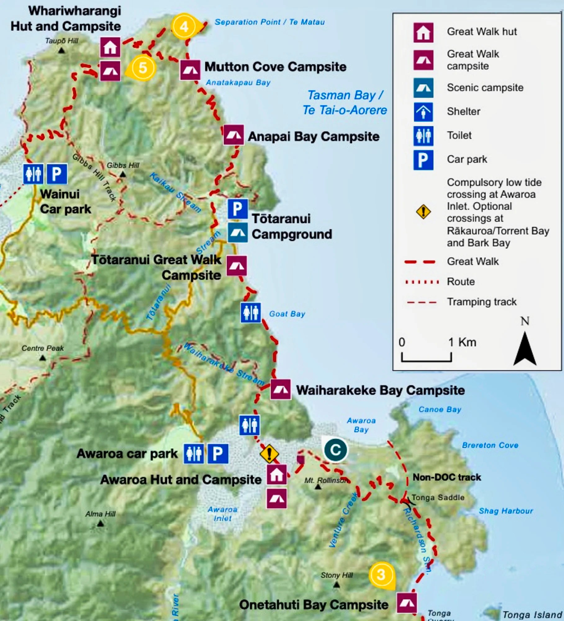
Tōtaranui to Awaroa
Time: 2:20 hrs; actual 3:12 hrs
Distance: 7.1 km
Max Elev: 76 m (250 ft) asl
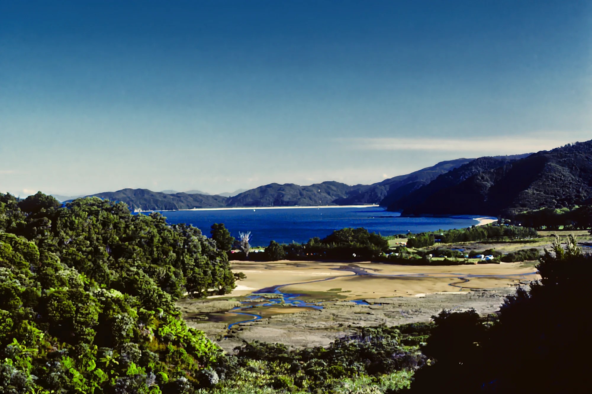
We were left off at Awaroa Saddle. We walked 4 km downhill to Tōtaranui Beach.
One could spend all day here swimming. We left late at 10:53 hrs as low tide at Awaroa Tidal Flats was at 17:50 hrs. The trail skims high up along the beach.
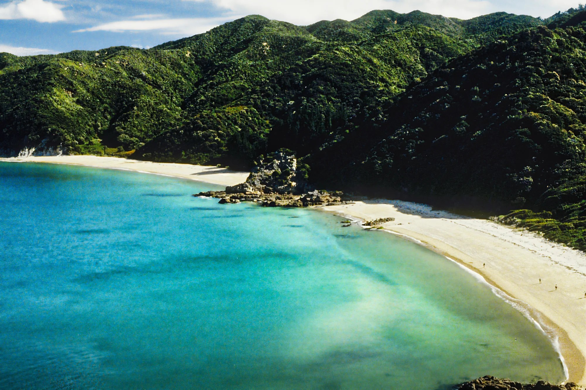
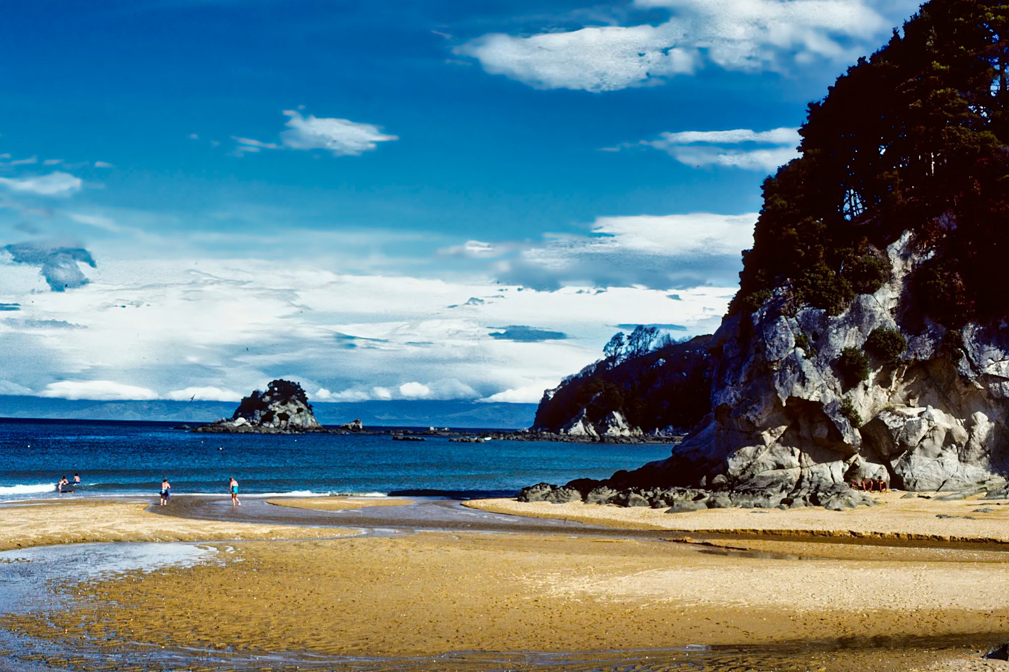
From Tōtaranui Lookout (G4.9) (27 minutes), there were glorious views of jade green waters lapping the golden crescent beach.
The trail crosses Goat Bay Beach (45 minutes) with its grainy but smooth granite pebbles. Here we got lost as we could not find the rest of the trail because of high tide. We later found the footprint sign atop a rock after we scrambled up some rough rocks while getting splashed by the waves. We finally put our hiking boots back on. After some narrow cliff stretches, we descended to Waiharakeke Bay, where we ate lunch on the golden sand.
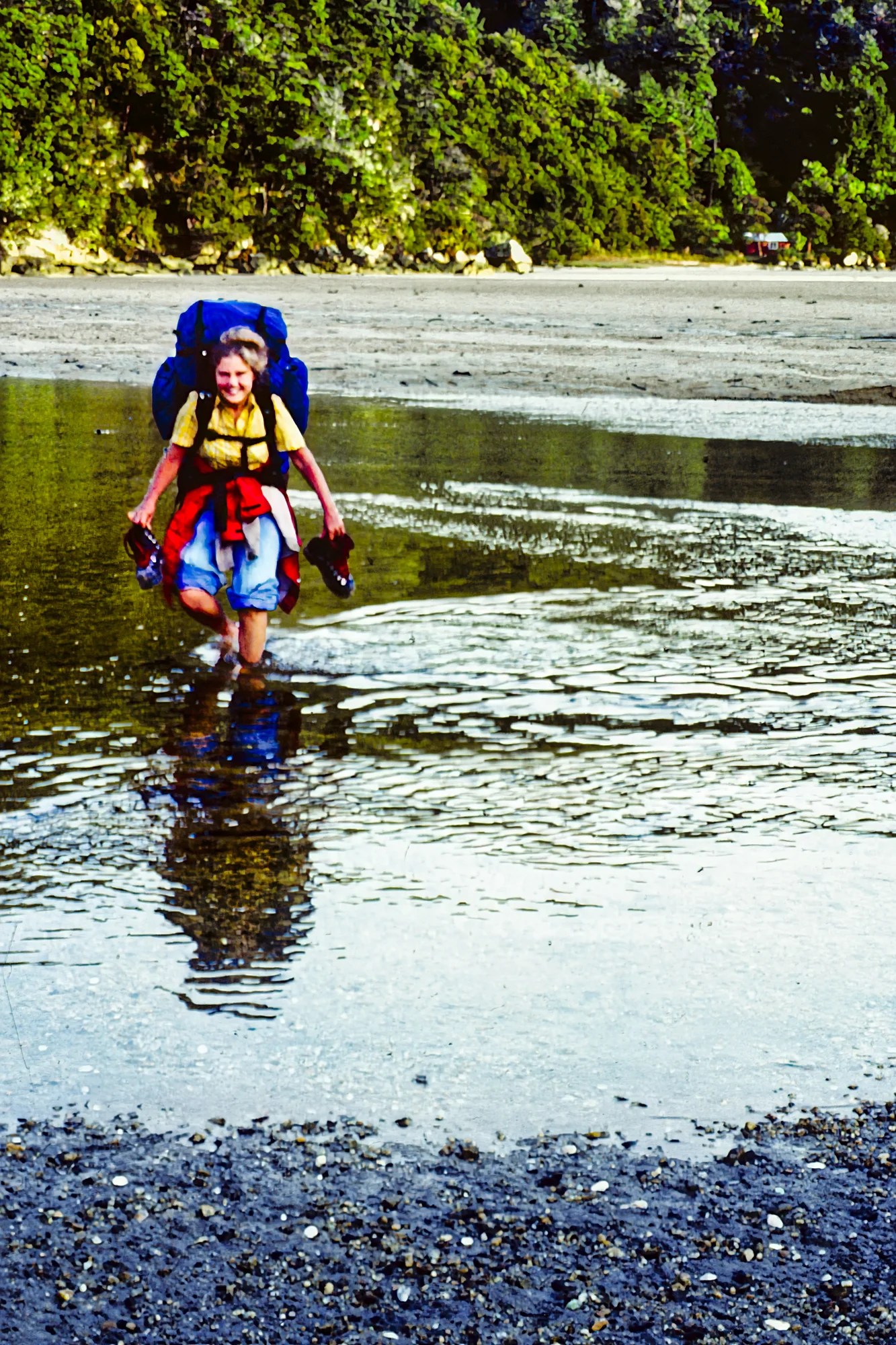
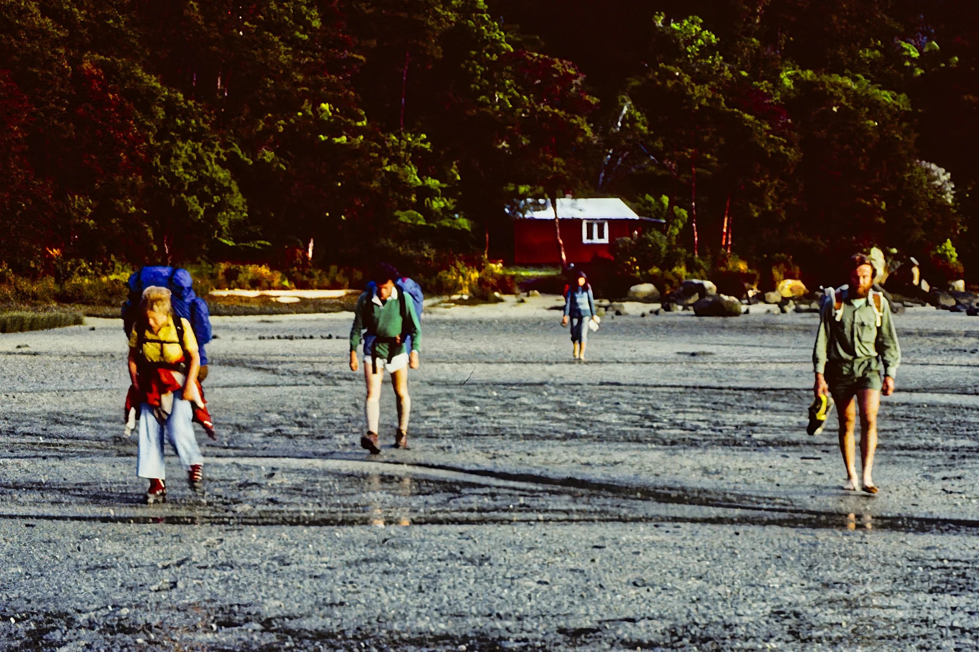
After an inland section, we arrived at Awaroa Inlet just before low tide (15:20 hrs). We tied our hiking boots to our 10 to 15 kg backpacks. We crossed the mud with white shells cracking under our feet. Then we forded the cold Awaroa River up to our knees. We had achieved our first tidal crossing. The hut is near the shore and we could hear waves lapping overnight.
We thought we had Awaroa Hut to ourselves when Alistair and Peter came in late. Alistair is a very happy spirit who loves mountain climbing. Peter is an Australian biking in NZ. We would meet the same people every night though we walked at our own pace.
Awaroa to Bark Bay
Hike Time: 4:15 hrs actual 4:23 hrs
Distance: 11.7 km diary 8 km
Max Elev: 168 m (550 ft)
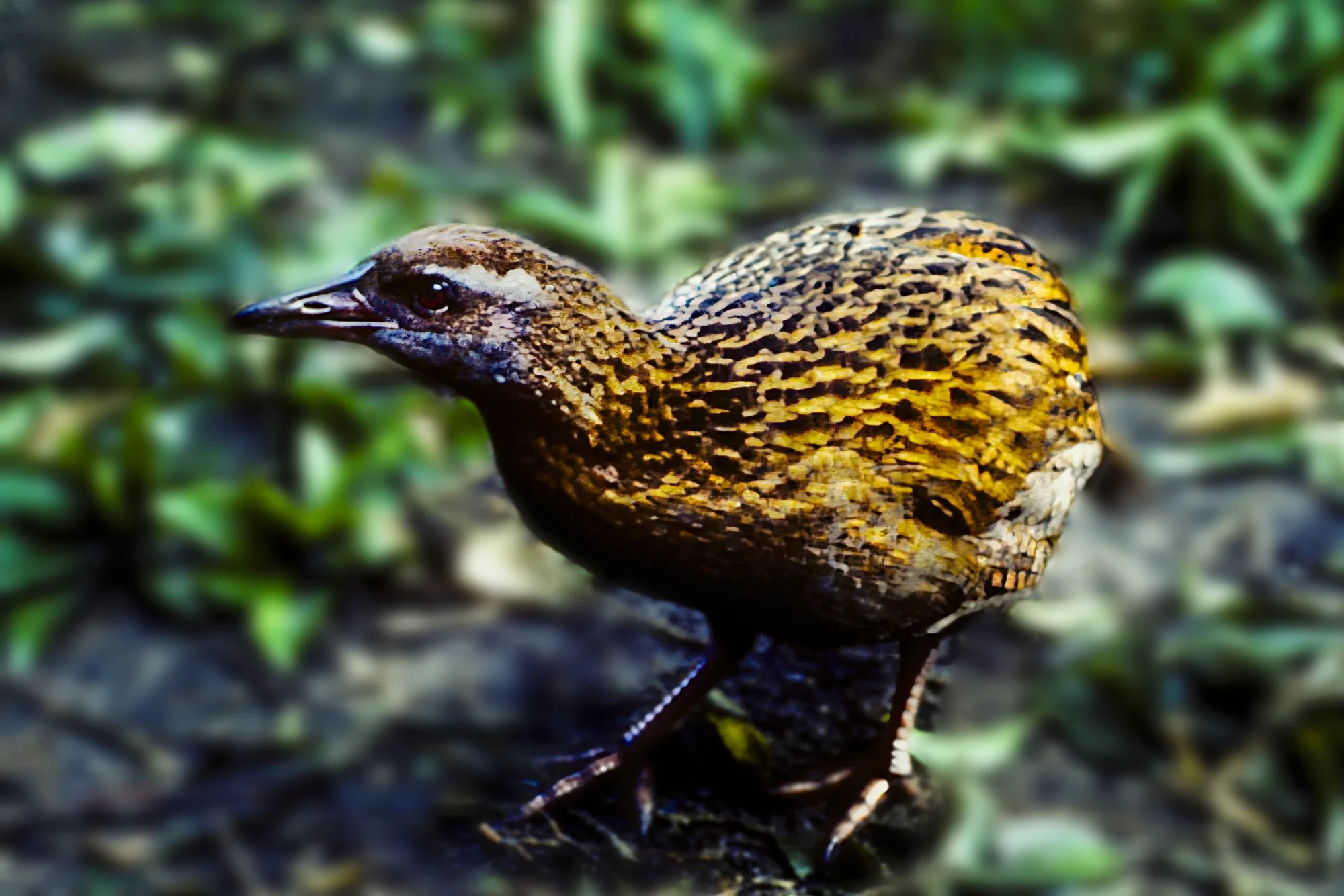
The next day, we arrived at the bach (pronounced ‘batch’, holiday bungalow) of Joyce and Jim Crawford, whom we had met earlier in the trip. After a tea of cheese and honey, they fed bread to a flightless endemic, weak. It was very wary and always bobbing its head.
Then they accompanied us along the trail looking at ferns and trees. They used the same excellent booklet we had bought at Franz Josef Glacier called Field Guide to Common New Zealand Trees and Shrubs. They explained the difference between bracken and ferns (it has to do with sori or spores). At Tonga Saddle, the Crawfords headed back.
We descended through an open area with views of Tonga Beach. Again, we arrived just in time for low tide. The water was only a foot deep but just as frigid.
Tonga Beach was a good place to explore, but it was drizzling. After the tent sites, we climbed ca. 91 m (300 ft) on switchbacks as the trail veered away from the coast.
After the Stoney Hill Track junction, we quickly descended to another bootless tidal crossing. Brrr! We arrived at Bark Bay hut late, as it was getting dark (17:48 hrs), to thunderous cheers from Rita, Peter, and Alistair.
Bark Bay to Torrent Bay
Hike Time: 2 to 3 hrs actual 3:25 hrs
Distance: 7.8 km
Max Elev: 156 m (550 ft)
The rain let up so we took a side track to a lookout for a good view. The rest of the trail was inland.
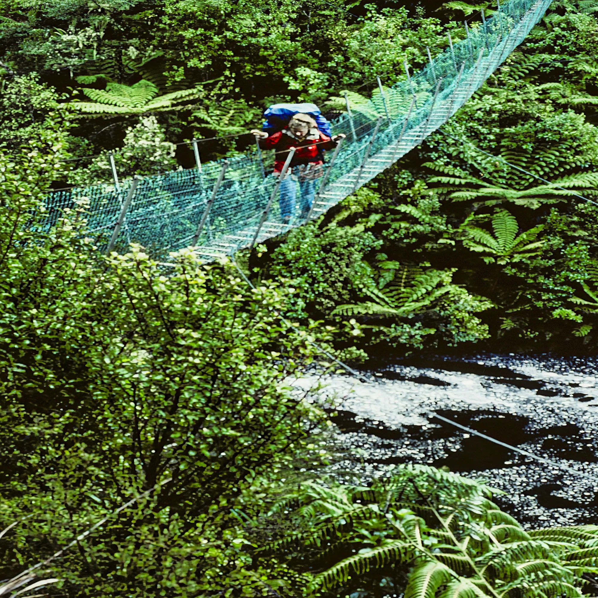
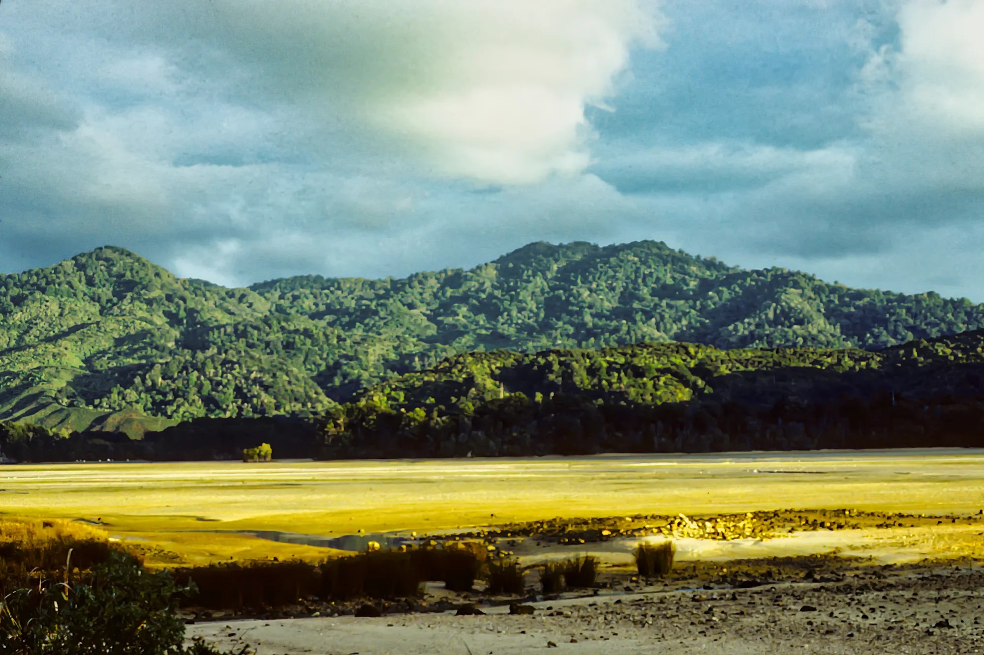
Then came a dramatic crossing over the Falls River. The wire mesh suspension bridge sagged as Corinne crossed. It was a long way down. It is 20 m (65 ft) above the river! We arrived at a bench 23 minutes later and enjoyed the view of emerald-green Frenchman’s Bay.
We continued downhill to Torrent Bay through the village and then on the very muddy all-tide route. Again, the guys had arrived before us and were huddled around the fireplace.
Torrent Bay to Anchorage
Hike Time: 20 minutes
Distance: 0.9 km
We left early so we could cross during low tide. In the end, we had to take our boots off. There were many people in the hut. We decided to leave at noon. After a steep climb to a lookout with great views of Adele and Fisherman Islands. It was too cloudy to see Nelson. Later, there were views of Torrent and Anchorage Bays.
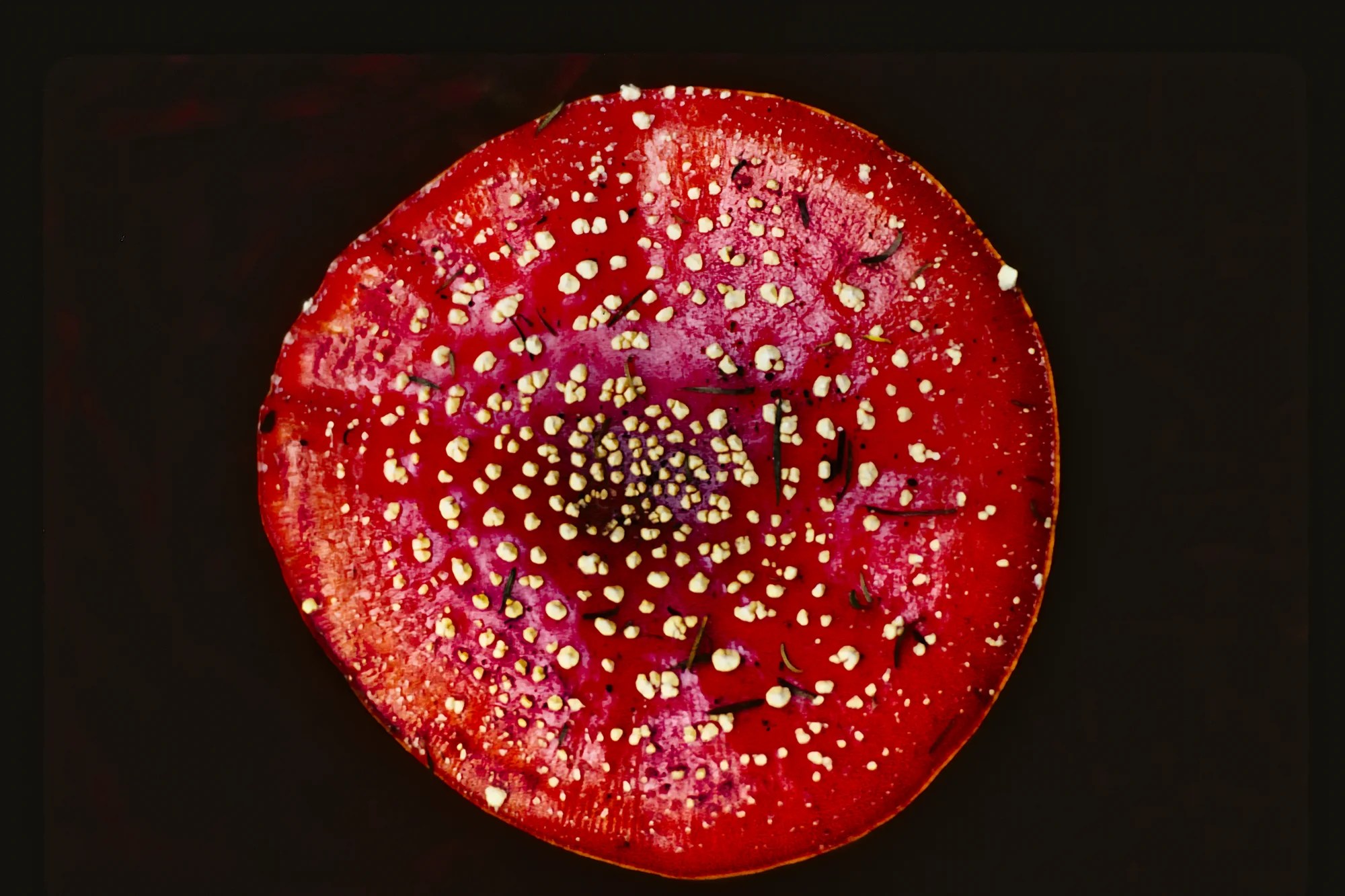
We ate lunch at Stillwell Bay with tree-topped rocks in the water. We saw a field of scarlet mushrooms sprinkled with yellow warts between Appletree Bay and the Coquille Bay tracks. Amanita fungi are very poisonous.
We gradually descended when it began to pour. So we stayed at Mārahau Campground. When we got to the kitchen shelter, Loraine and Keith Smith saw we were soaked. They made us a cup of coffee. By the way, shelters in Kiwi campgrounds are superb and fully equipped. NZ has the best facility blocks of any country we have camped in.
Kaiteriteri
From Mārahau, we went south to Kaiteriteri Beach. Here is another delightful beach.
Final Comments on this Itinerary
The Tasman region is a pleasant, relaxing place to visit. While it is most famous for the Abel Tasman Coast Track, this is also a great itinerary to see hidden gems. The places included in this route are all highly rated by the people, as shown by their Google Maps Ratings.
Subscribe
Get travel tips and advice delivered directly to your inbox. The best part is that it is free.
This was only a taste of some of the scenic wonders of the Tasman area. If you have other favourites, share your experiences with us. How long is your trip? What questions do you have?
Itinerary Planning
Lonely Planet New Zealand — their website
New Zealand, Lonely Planet — the book, but nowadays most people use the internet
Google Maps Ratings
Google Maps provides a rating from 0 to 5 for all sights, hotels, and restaurants (but not cities). All of our recommendations are appended with the rating (prefixed with a G) from Google Maps. Google Ratings are based on feedback from locals as well as tourists. They are much more reliable than travel booking websites or tourist anecdotes. We consider a score of 4 to 4.39 to be Very Good and 4.4 to 5 to be Excellent.
Other Places to Add to Your Itinerary
Do you want to see more of the South Island? Here are some posts to help you plan your itinerary:
New Zealand Questions
How Big is New Zealand?
NZ is a large country compared to Europe. It is the size of the UK and half the size of the province of Alberta, Canada.
Booking Accommodation
NZ only has 5 million people. South Island is even smaller, with 1 million people. So why is South Island so busy during the summer peak season? Too many tourists go to the same famous places — what I call name recognition. Fewer people are available to work in the hospitality industry for a short tourist season. So there is a lack of accommodation.
If you are going during the Christmas peak season, most Kiwis are on the summer holidays from December 20th to January 20th. You need to book your places at least 5 months ahead.
The best value places were family-run B&Bs (not Airbnb’s) and fully-equipped cabins and tent sites at campgrounds. Use Agoda or Booking to find places for your price range. But verify the quality by the more reliable Google Maps Rating.
When is the Best Time to Visit Tasman?
Here are the average high temperatures and monthly rainfall at Nelson by season. The month groupings were based on weather similarities, not calendar seasons.
Nov-Apr is the best time to go. It is a maritime climate, so it is perpetual spring rather than hot in the summer. The best times to hike the Abel Tasman Coast Track are October through May.
Jun-Aug is cold unless you are from a Nordic country and are used to sub-zero temperatures.
May, Sep & Oct are cool, but it is an acceptable time to go with higher precipitation than summer.
| Season | Mean High Temp | Avg Rain per Month |
|---|---|---|
| Nov-Apr | 20.0°C 68.0°F | 60.5 mm 2.4″ |
| Jun-Aug | 12.3°C 54.2°F | 71.8 mm 2.8″ |
| May, Sep-Oct | 15.3°C 59.6°F | 69.1 mm 2.7″ |
New Zealand FAQ
The New Zealand FAQ post answers Frequently Asked Questions (FAQ) such as:
- Where should I go in NZ?
- What is the best season for travel?
- How much time do I need for NZ?
- How safe is NZ?
Abbreviations
asl = above sea level
DOC = Department of Conservation = Parks NZ
Max Elev = Maximum Elevation above sea level
Kiwi = New Zealander, or a nocturnal flightless bird
NP = National Park
NZ= New Zealand
NZD = New Zealand Dollar
NI = North Island
OW = One Way
RT = Round Trip
SI = South Island
USD = United States Dollar

Leave a reply to Nomen Lirien Cancel reply