
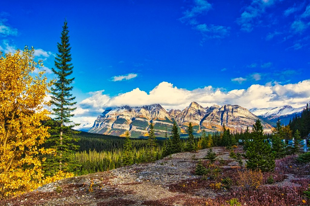
Why You Should Do the Icefields Parkway Drive
The Icefields Parkway is the name given to the spectacular, glacier-lined Highway 93N between Lake Louise village and the town of Jasper. For snowy sierras, gorgeous glaciers, exciting hiking trails, and spectacular turquoise lakes — it is hard to beat the Icefield Parkway itinerary.
Author & Photographer: George Mitchell

Our advice below is not based on a couple of tourist trips. Our recommendations are based on our extensive experience living in Alberta (AB). We are avid hikers, nature lovers and photographers (all photos are my own). The Rocky Mountains were our weekend playground. We often hosted out-of-province friends and family using the itinerary we are recommending.
All of our recommendations are top-rated by Google Maps Ratings, which is based on everyone, not just tourists. Each place recommended in our custom Rocky Mountain Itinerary Map is appended with a Google Maps Rating (G0 to G5).
Should I See Banff or Jasper NP?
One recurrent question is “What are the best places to visit in the Rocky Mountains?” Unfortunately, there are too many tourists thinking that Banff the town and Lake Louise are the ultimate destinations of the Rockies — they are not! They have been spoiled by over-tourism, bus-only roads, plus difficult and expensive parking. Moreover, since the Trans-Canada Highway is now a fenced expressway, there are no more animal sightings along this highway, which is better for the animals.
Another frequent question is, “If I do not have much time, should I visit Banff or Jasper National Park (NP)?” Our recommendation is that you should see BOTH! What, how is that possible?
You can see the best parts of Banff and Jasper NPs by driving the Icefield Parkway. The road from Lake Louise village to the town of Jasper is THE Quintessential Road Trip of Canada, if not North America.
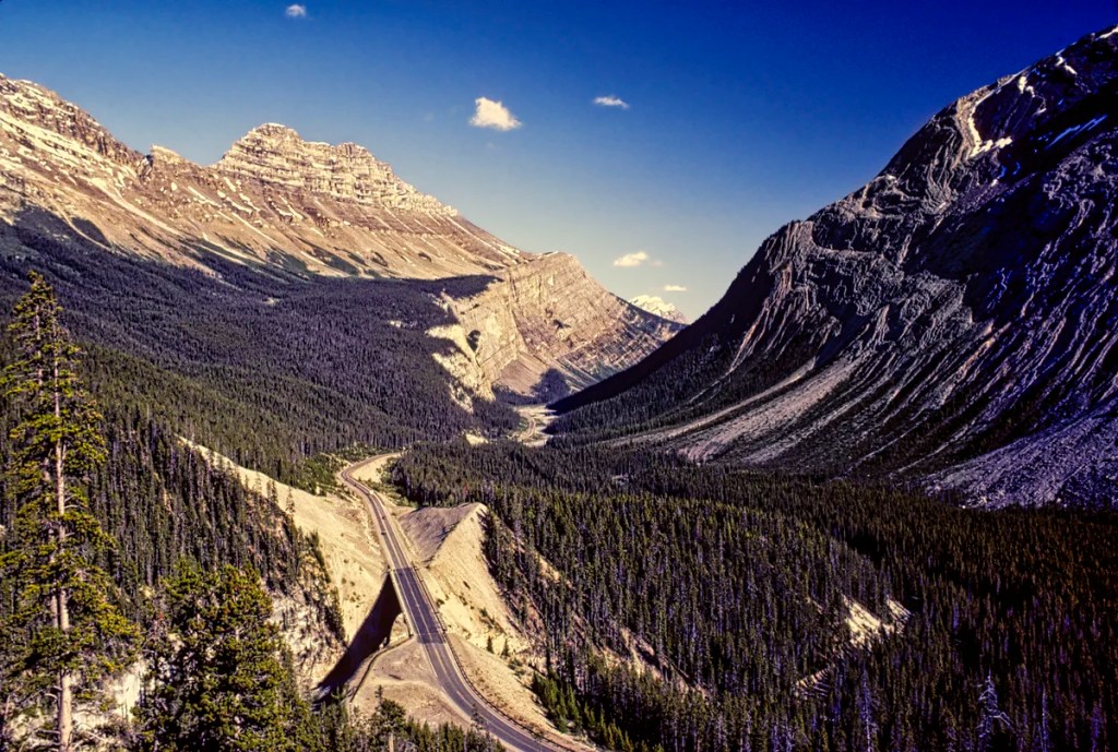
Icefield Parkway is the Best Road Trip
The Icefield Parkway provides 232 km of easy access to rugged Rockies, gorgeous glaciers and vast vistas — all from the luxury of your car. There are not many roads in North America that are this spectacular for this long a distance with minimal human development and commercialization.
For instance, the Going to the Sun road in Montana is only 80 km and requires a reservation. The Sea-to-Sky Highway is 163 km. While it has spectacular moments, most of the sights require getting off the highway, hiking or taking gondolas.
If you just go to Banff and Lake Louise and skip the Icefields Parkway, then you have missed the essence of the Rockies.
The most special aspects of the Canadian Rockies are the glaciers (while they last), the gorgeous turquoise lakes and rivers they created, the rock flour (yes, it’s a real thing), and 3400 km of superb hiking trails. These are the key features of the Quintessential Canadian Rockies.
The Columbia Icefield is not only the largest south of the Arctic Circle but the most accessible. A little-known fact is that the Jasper Dark Sky Preserve is the largest accessible Dark Sky Preserve in the world. This means it’s a great place for stargazing.
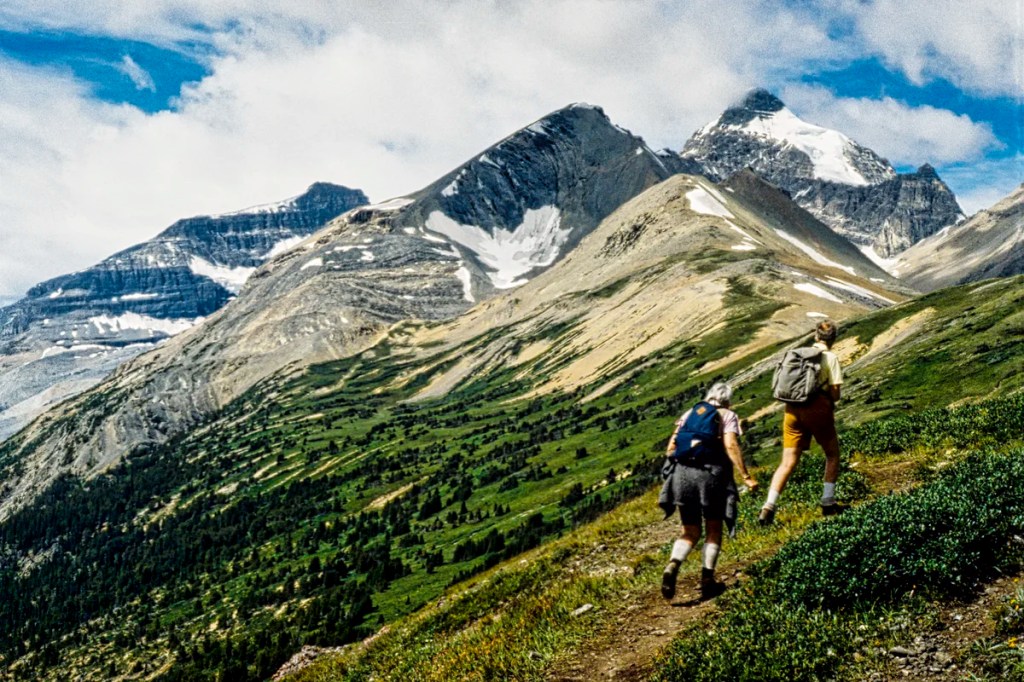
Yes, you can easily drive the road in one very full day. But to get the most out of your trip, you need to get out of your car and spend some time enjoying the hikes and sights. If you only have a few days in the Rockies, we would highly recommend that you spend all of them along this road. You can commute from your base up and down the Parkway.
Best Places to See on the Icefield Parkway
Our advice is not based on a single tourist trip. Our recommendations are based on our extensive experience living in Alberta for many years. We are avid hikers, nature lovers and photographers (all photos are my own). The Rocky Mountains were our weekend playground as well as a vacation destination.
Since most tourists are on a short visit, we are highlighting only our favourite viewpoints. We are also not going to include places like Lake Agnes, Valley of the Five Lakes, or Canmore. Instead, this itinerary focuses on what makes the Quintessential Rockies in a very compact geographical area.
We have pinned these places on our custom Rocky Mountain Itinerary Map. Alternatively, get the detailed Icefields Parkway Map.
Herbert Lake
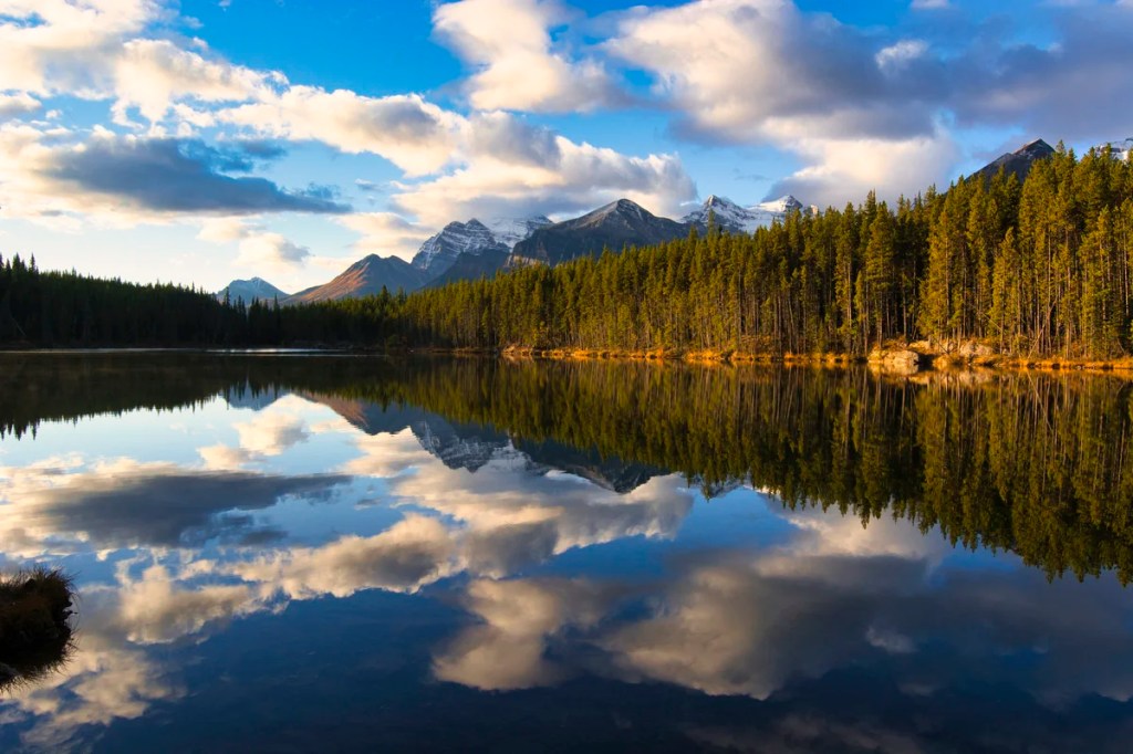
The first stop is only 2.7 km (1.7 mi) from the start of the Icefield Parkway. Herbert Lake is not a must-see, as the mountains appear to be far away and thus it lacks a dramatic backdrop. But the beautiful reflections and crystal-clear water make up for the lack of saturated turquoise colour.
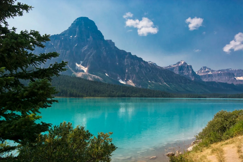
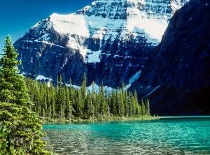
Bow Lake
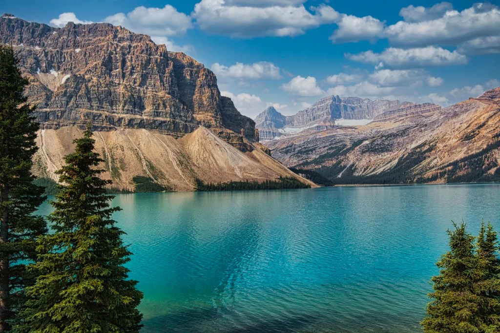
This view is a major pull-off on the west side of the Parkway about 32 km (19.9 mi) further. You are now driving in the subalpine at an altitude of 1920 m (6300 ft). Bow Lake is one of the top five turquoise lakes in the Rockies. As we stated in 15 Things You Must Do in Banff and Lake Louise, we do not include Lake Louise in the top five, as it has been spoiled by excessive crowds of tourists.
Bow Lake comes with a dramatic backdrop of Crowfoot Glacier clinging to the steep cliffs of Crowfoot Mountain. This view is actually 1.4 km (0.9 mi) south of the Bow Lake pull-off.
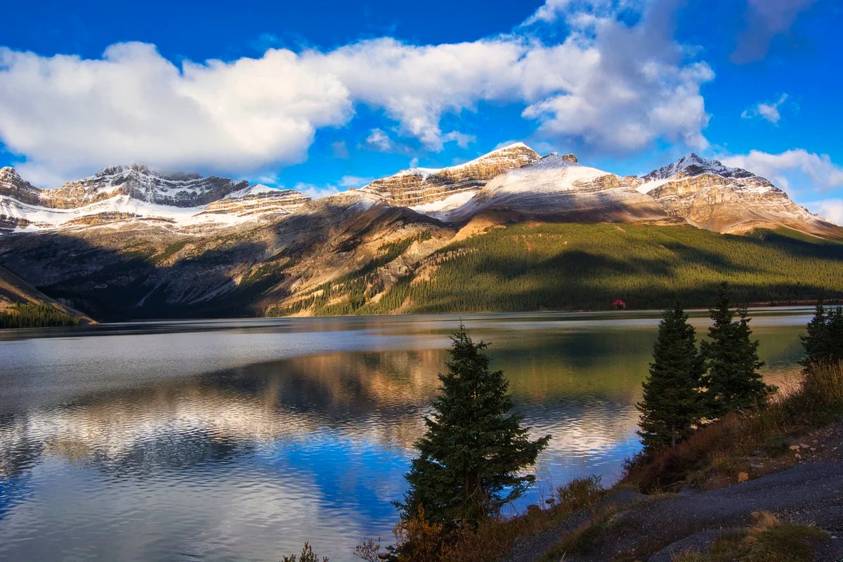
To the northwest are Mt. Jimmy Simpson (right), Mt. Thompson (left), and Bow Glacier (not visible). These are best viewed from the red-roofed Num-ti-jah Lodge on a side road at the end of the lake. There is a very pleasant lakeside walk behind the lodge. One can continue 4.3 km (2.7 mi) further to the foot of Bow Glacier.
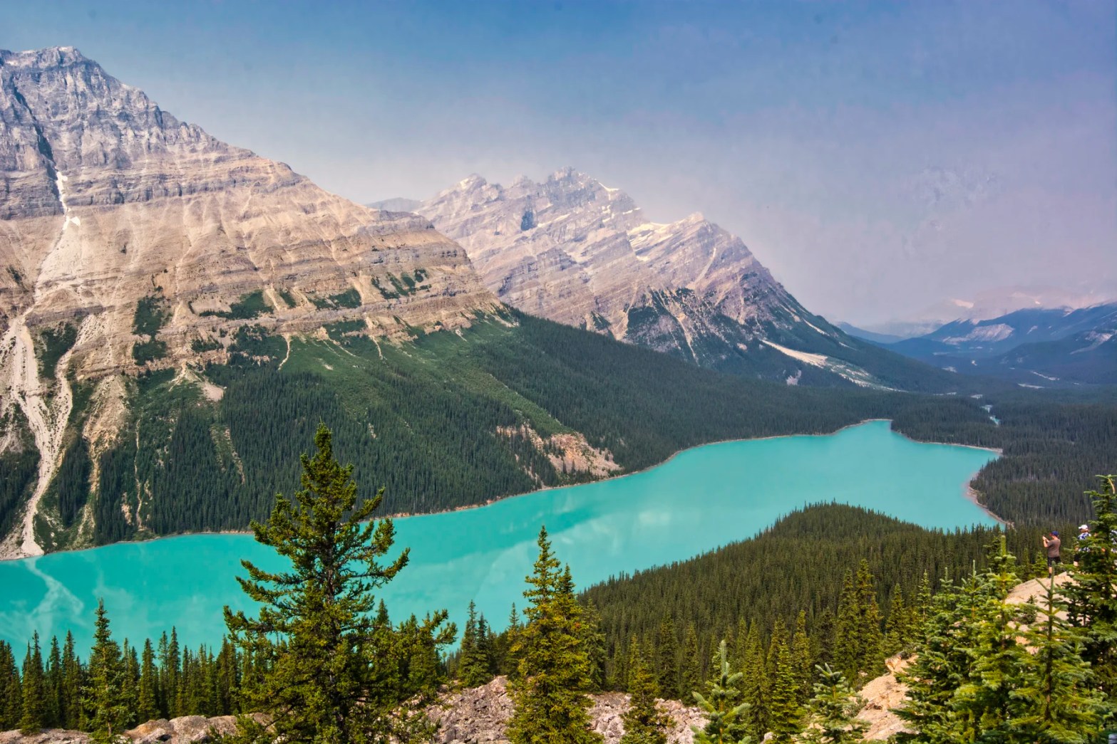
Peyto Lake
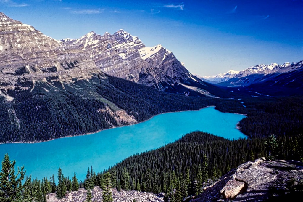
From the Bow Lake pull-off, drive 6.3 km (3.9 mi) to a side road up to Bow Summit at an altitude of 2069 m (6787 ft) – one of the highest points on the Parkway. Peyto Lake is one of the top five turquoise lakes in the Rockies. It requires a short hike that most people should be able to do. Going to the Rockies and missing Peyto Lake is like going to Rome and missing the Pantheon!
Imagine when there was only the train travelling through the Rockies. You got off at Lake Louise and met the first tourist guide in the Rockies, Bill Peyto. You rode horseback for 48 km until you got to this gorgeous lake, which became known as Peyto’s Lake!
Today, you drive an easy 38 minutes. There is disabled parking at the top of Bow Summit. Everyone else has to walk uphill for 20 minutes.
At the top, many of the tourists ignored the railing to get that “perfect shot”. Actually, the viewing platform is just as good a place – except when people get in the way.
Why are the Lakes Turquoise?

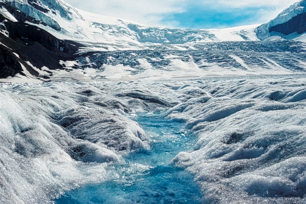
Glaciers can be around 600 m (2000 ft) thick, and they flow downhill — yes, they flow like a river of ice. Glaciers grind rocks below them, creating well-named rock flour — it is so fine that when the sediment in the meltwater hits a glacial lake, it hangs in suspension throughout the water. The rock flour absorbs all colours of the spectrum but reflects back green-blue. This gives all glacial lakes and rivers around the world a spectacular turquoise colour. If you cannot believe in rock flour, go to the Icefield Visitors Centre to see some.
What flowers can you see in the Rockies?
Hiking trails like Peyto Lake are the best place to see wildflowers during the summer – generally mid-July to August. Additional flowers you can see are described in 15 Things You Must Do in Banff and Lake Louise.
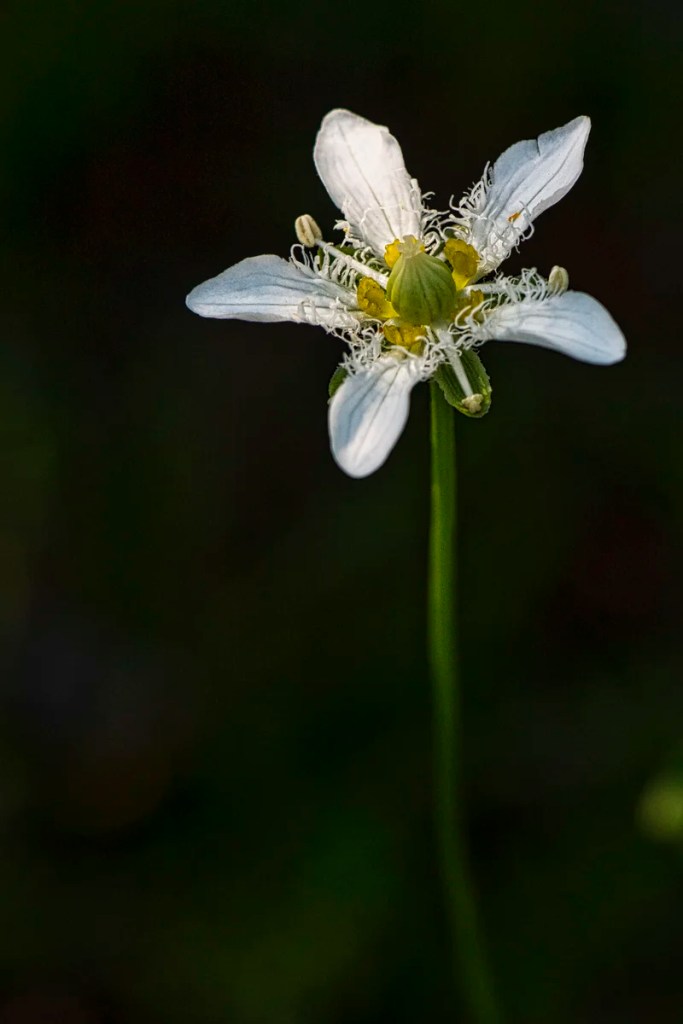
The five-petaled Grass of Parnassus is an alpine flower named after a mountain in Greece.
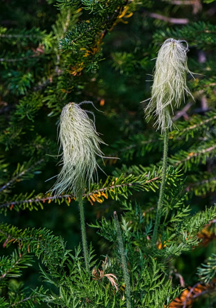
Within days after snowmelt, the white Western anemones start to flower. For this reason, during the summer, we usually see this alpine flower as a shaggy seed head, which is shown in the photo. The fresh stems and seeds of this plant were used traditionally as analgesics and sedatives.
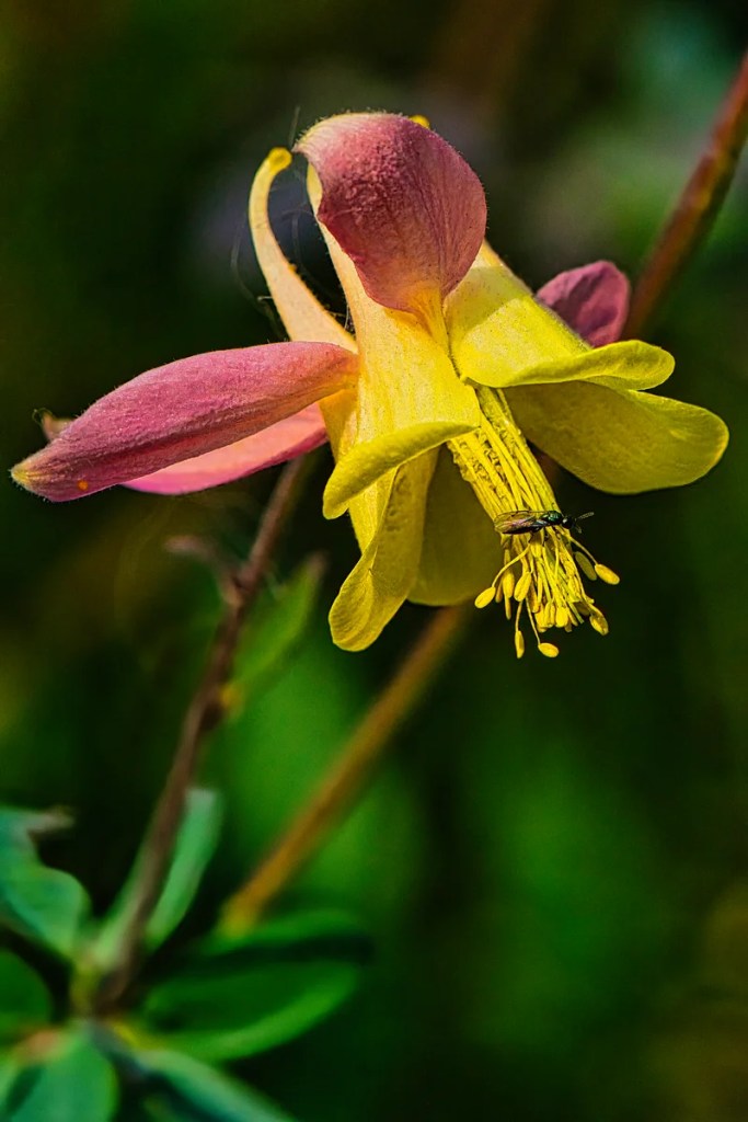
Columbine is a beautiful and quintessential wildflower in Banff NP. It is found in subalpine forests (and in our garden) and is common in early summer.
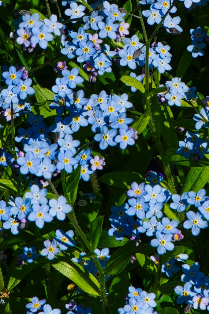
The Alpine Forget-me-not is a powder blue flower common to the Rockies. As it grows at elevations between 7,500 to 10,000 feet, its growing season is limited to June-September.
Waterfowl Lakes
We prefer the views of Waterfowl Lake from the Waterfowl Lakes Campground, 17 km (10.6 mi) north of the Bow Summit turn-off. It is a great camping location, but you must bring food with you as there are no stores.
From here, you can take a 4 km trail to Chephren Lake at the base of pyramidal Mt Chephren (pronounced “kefren”) in the photo. It was named after one of the great pyramids in Egypt.
This view of Mt. Patterson was taken from the Upper Waterfowl Lake.
Mt. Wilson
We must have passed this view a million times, but we never took a picture here. The magical, softer autumn lighting (October) must have attracted us to stop. This unmarked viewpoint is on the west side of the road before the Parkway descends down to Saskatchewan River Crossing, the junction with Highway 11.
Mistaya Canyon
The Mistaya Canyon Trail is an easy 0.5 km, 15-minute (one-way) canyon walk. Mistaya is Cree for grizzly bear. This slot canyon features eroded potholes and limestone walls. Limestone is somewhat soluble in water.
The Mistaya Canyon parking lot is on the west side of the Icefields Parkway, 14 km north of Waterfowl Lakes or 5.2 km south of the David Thompson Highway junction.
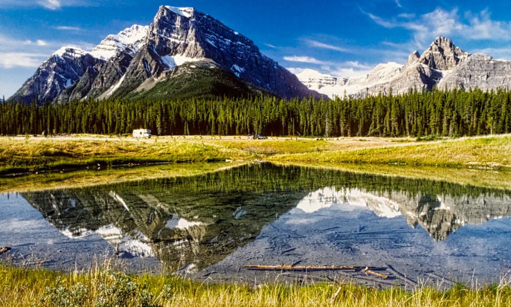
Great Bend
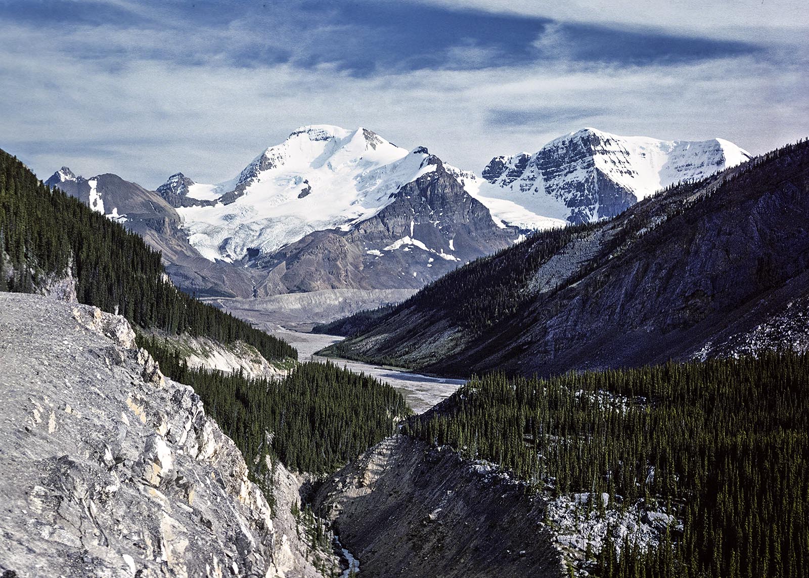
Located 36.4 km (22.6 mi) north of the David Thompson Highway junction, the viewpoint at the top of the “Big Bend” is definitely worth a stop. You have an airplane view from 427 m (1400 ft) above the valley floor. Directly ahead is Cirrus, a 3,270-metre (10,730-foot) mountain.
Notice that the limestone strata of Cirrus Mountain are bent into a huge upward curve. The Castle Mountain Syncline extends from the town of Banff to the town of Jasper! It is amazing to realize that these layers were once flat and below an ocean. This syncline or upward folding of the rock layers was caused by massive tectonic forces.
Even more amazing was that this tectonic force was the Pacific Plate crashing into the North American plate, which uplifted all the mountains, including the Rockies, ca. 65 million years ago. Soon after, the Great Extinction Event wiped out the dinosaurs and ended the Cretaceous Period.
Parker’s Ridge
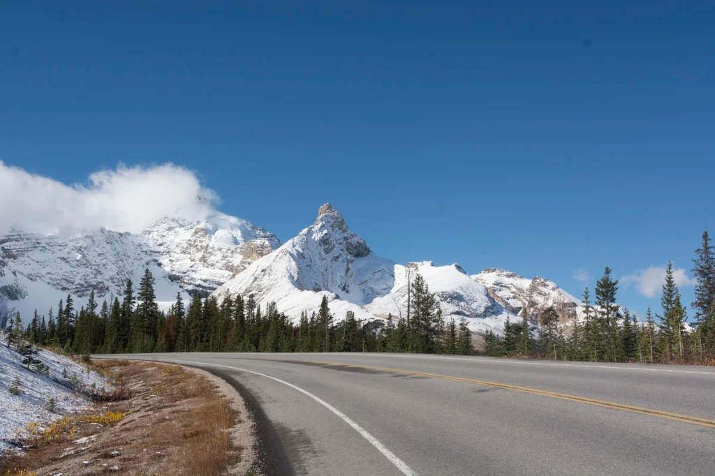
Driving the Icefield Parkway in the fall is magical with lots of snow on the high-altitude peaks and a dusting of snow on the lower-altitude slopes. PS. You need winter clothing if you visit the Icefield Parkway in the fall. Because of the altitude, this region has a sub-arctic climate.
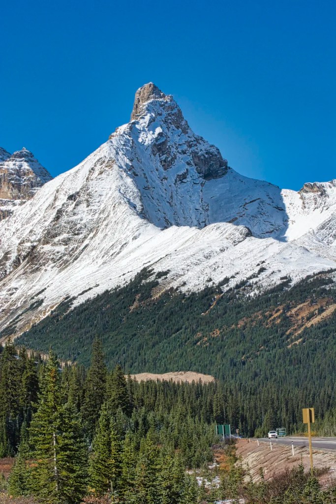
Here is a close-up view of Hilda Peak, located at the Banff NP northern boundary. It consists of 3058 m (10,033 ft) of Jurassic Period sedimentary rock.
After a 5.3 km (3.3 mi) drive from the Big Bend, we have reached the Parker’s Ridge trailhead head but there is too much snow to hike up in early October.
Parker’s Ridge is one of our all-time favourite hikes to take visitors in the Rockies. It is a very steep climb over a short distance. In only 45 minutes, you reach the top, an alpine area with breathtaking 360° views. Would you believe that the typical low-lying shrubs are actually stunted trees?
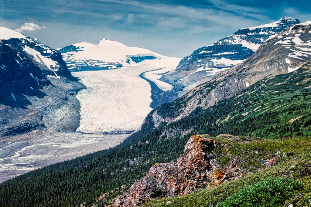
At the end, you will be spellbound by the quintessential 13 km Saskatchewan Glacier spreading below you. It feels like you are an eagle. If you are lucky, you will see mountain goats along the mountain slopes.
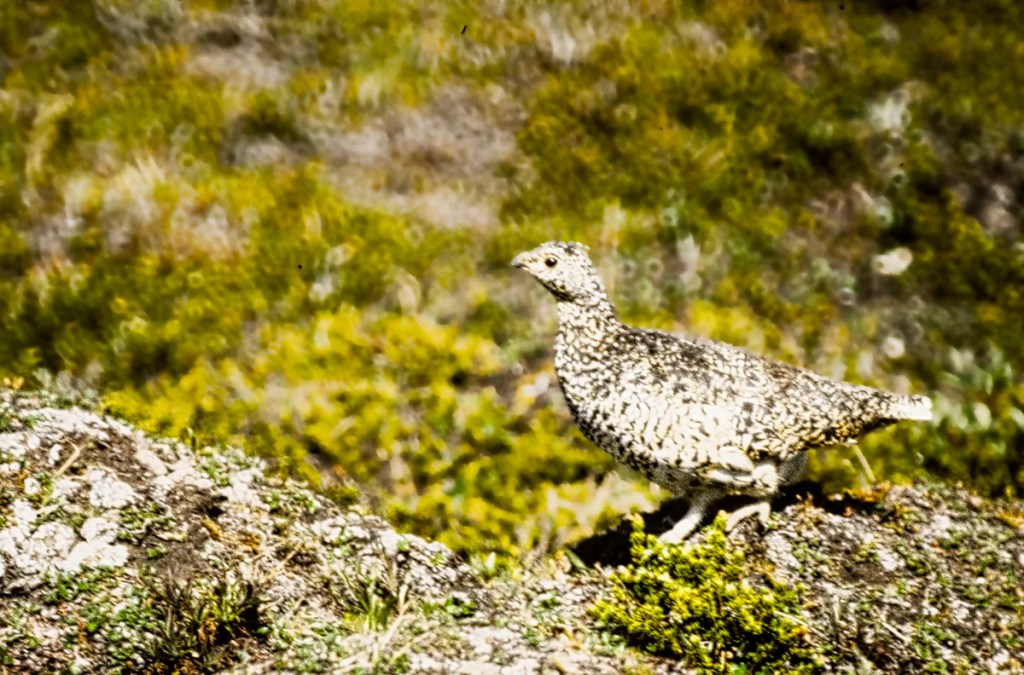
If you have been very good this year, you may see a White-tailed ptarmigan. These birds are amazingly camouflaged against the rocky terrain they walk around. In fact, before I darkened the background, it was very difficult to see the ptarmigan.
Parker’s Ridge Trail:
Distance: 2.4 km 0:45 hrs OW 2.5 hrs RT;
Elevation: 2270 m (7450 ft); gain 275 m (900 ft),
Wilcox Pass Hike

This five-star hike starts near the entrance of the Wilcox Creek campground in Jasper National Park. It rises quickly above treeline to the expansive meadows of this glacier-carved landscape. In fact, you don’t have to do the whole trail to see incredible views of the Columbia Icefield and surrounding mountains.
Wilcox Pass Trail:
Distance: 4 km 0:45 hrs OW 3.5 hrs RT;
Elevation: 2270 m (7450 ft); gain 335 m (900 ft),
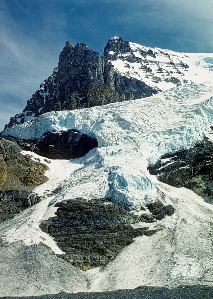
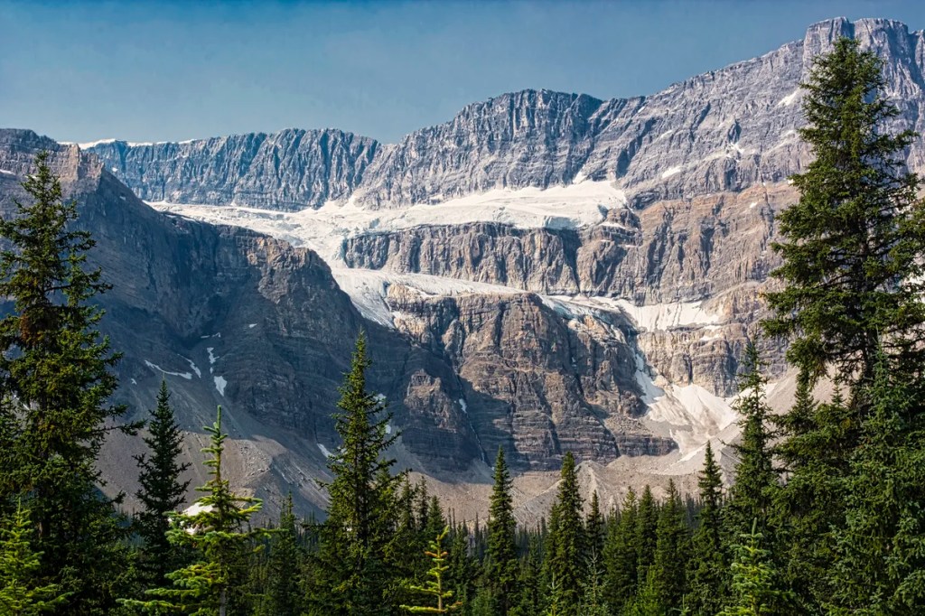
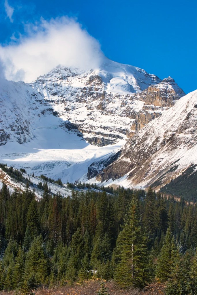
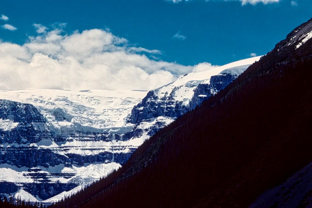
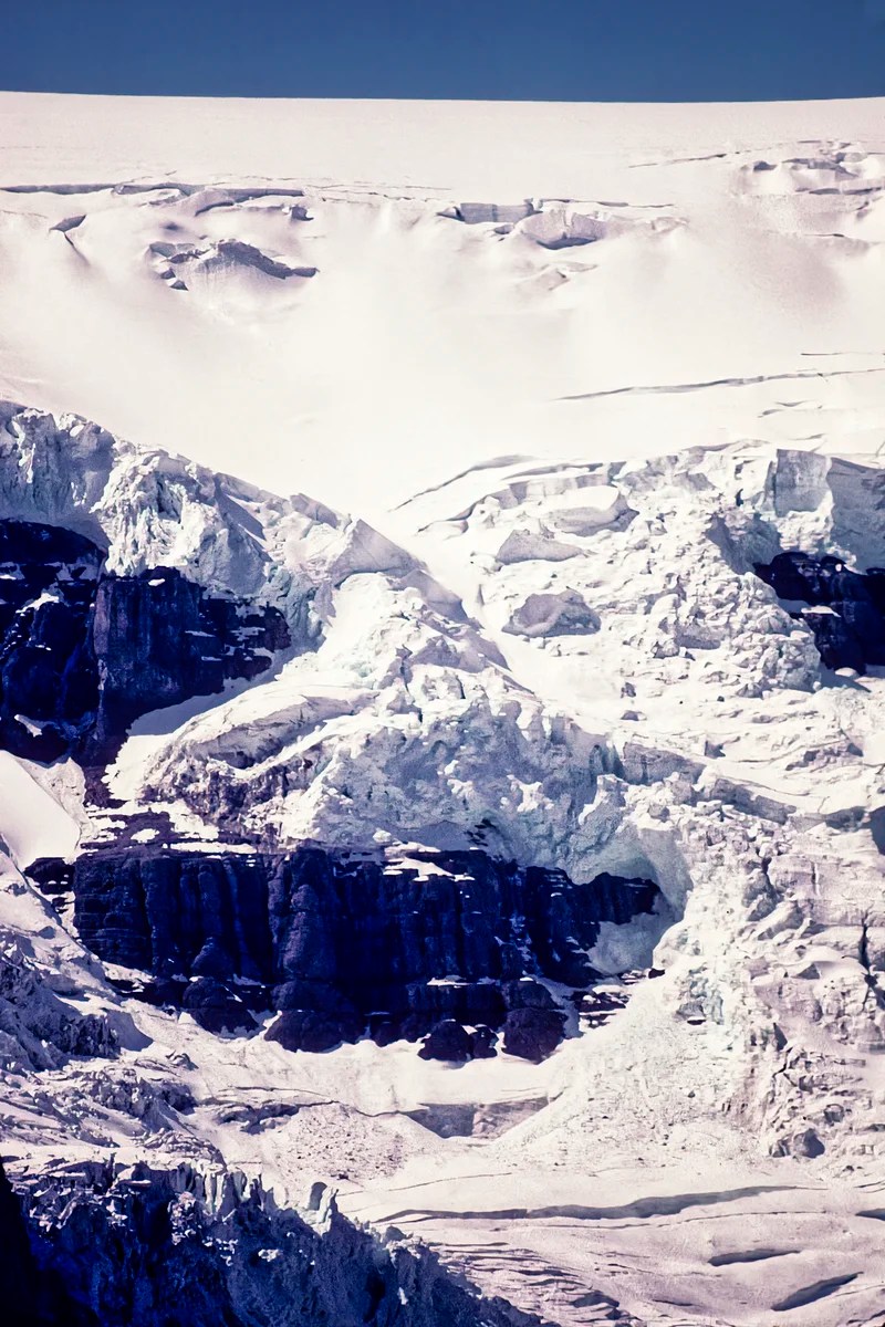
Columbia Icefield
The Icefield Parkway was named for the Columbia Icefield. The road was opened in 1941, but was only modernized and paved in 1961!
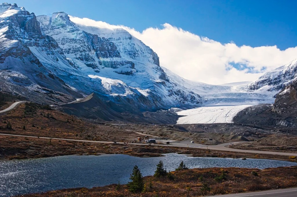
The Columbia Icefield is the largest uninterrupted glacial mass in the Rockies. You cannot actually see the icefield, which is in the “bowl” on the other side of the Athabasca Glacier in the picture above. The icefield is about the area of Omaha, NE and up to 365 m (1198 ft) deep!
Go to the main parking lot for the Columbia Icefield Discovery Centre (DC). There are several things to do here. The boardwalk to the DC on the west side of the parking lot offers many good viewpoints and photo opportunities. With a zoom lens or binoculars, you can see close-ups of the glacier and the mountains. Inside the Visitor Centre, there was an exhibit to show you what rock flour feels like
The Columbia Icefield Adventure includes a glacier bus and the glass Skywalk. You need to park at a separate parking lot for this tour.
The bus drove on top of the glacier, where we saw a crevice. The interpreter reminded us about the dangers of walking on ice. We also learned that we were looking at an icefall, a waterfall of ice. Glaciers can flow downwards even over mountainsides.
We did the glacier bus when it was quite reasonably priced. Today, prices vary by date from CAD 97 to 134 per adult. During peak high season, the prices are higher. The Columbia Icefield Skywalk is a short bus ride to a walk on a glass bridge and costs CAD 37.80.
Alternatively, you can park in the glacier parking lot below the DC and walk to the toe – due to crevasses, it is dangerous to walk on any glacier.
What wildlife can I see in the Rockies?
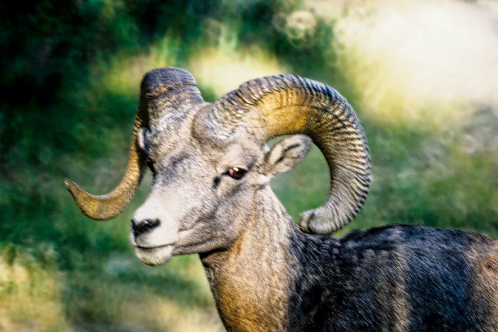
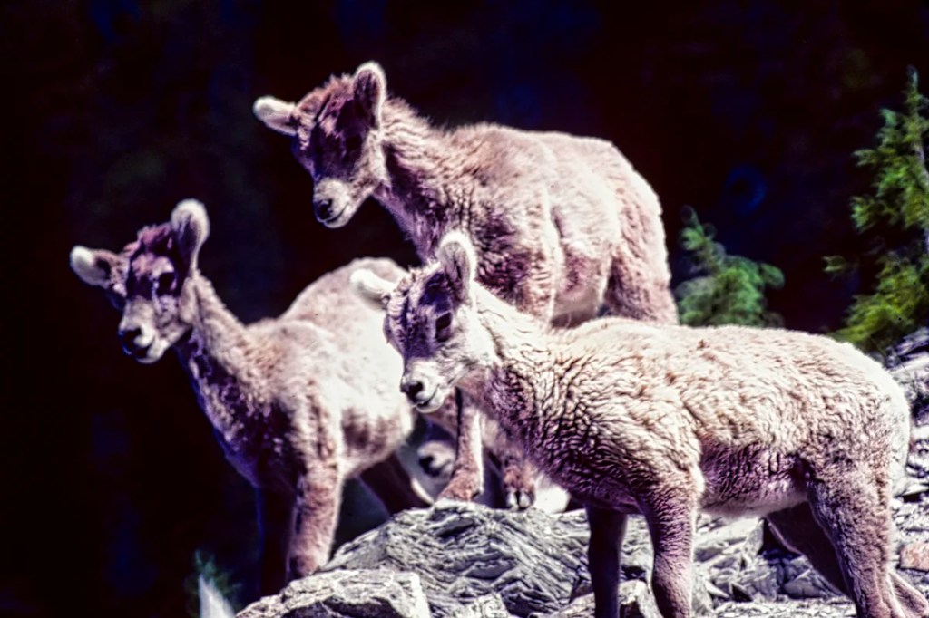
This next stretch of the Icefield Parkway provides a good chance of seeing wildlife in the Rockies, but you have to work at it. Hiking, side roads, dusk and dawn increase the probability of seeing wildlife. You can see Rocky Mountain sheep, goats, marmots, coyotes, wapiti, deer, pika, and bears if you are (un)lucky!
Many tourists used to get mauled by bears and even wapiti. The cardinal rule is never to get too close to foraging wildlife. If they keep eating, you are safe; if not, you have gone too close.
Sunwapta Canyon Viewpoint
Stop at the Sunwapta Canyon Viewpoint, about 6 km (3.7 mi) north of the Columbia Icefields Centre. There is a glorious view of Mt Athabasca in the centre and Mt Andromeda on the right next to the hidden Columbia Glacier. This is the free version of the expensive glass Skywalk.
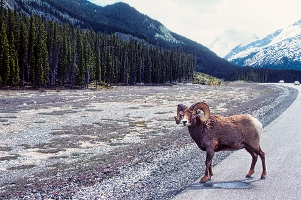
Many times we have seen a convention of bighorn sheep or mountain goats hanging out along the Parkway. This is due to a nearby salt lick on the canyon side of the road. Drive this road section slowly.
Tangle Falls
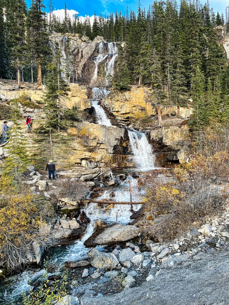
The 48 metre-tall Tangle Falls has a special look as it has four tiers with multiple cascades at the top. It is located ca. 7 km (4.3 mi) north of the Columbia Icefield Centre.
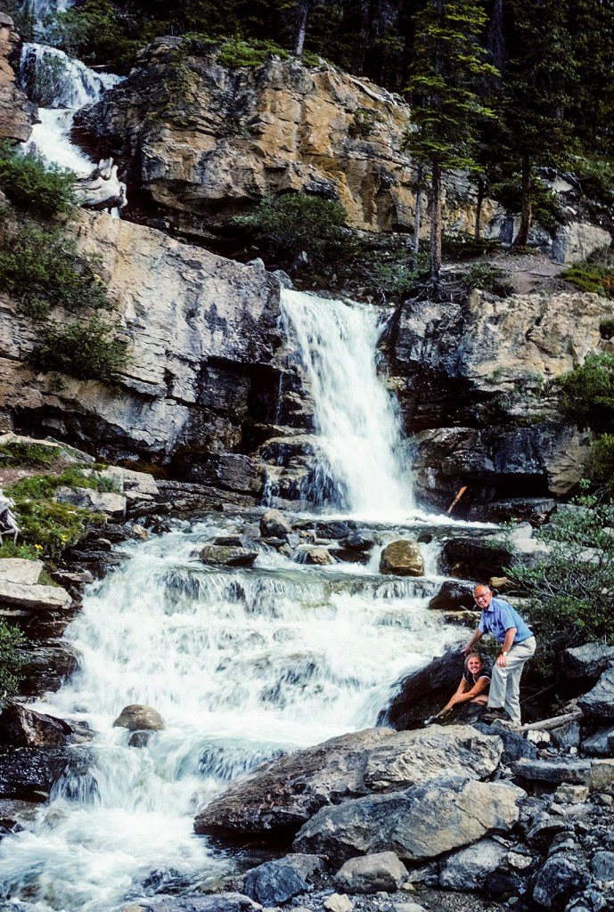
The falls are right on the east side of the Icefield Parkway, so no hike is required. Parking is on the west side of the road, so be careful crossing the Parkway.
Stutfield Glacier Viewpoint
Just under two km (1.2 mi) further north is another spectacular viewpoint. Stutfield is one of the most picturesque glaciers originating from the Columbia Icefield. It seems to pour down a 914 m (3000 ft) cliff.
To help you appreciate the thickness of a glacier, here is a zoom view of the Victoria Ice Falls at Lake Louise. You can feel the thickness of the ice.
So how does the glacier get down the mountain? It falls just like water. Once a glacier achieves ca. 50 m (164 ft) thickness, the pressure from its weight deforms the ice at the bottom. This process of plastic deformation occurs because the ice crystals can slowly bend and change shape without breaking or cracking. Glacier sliding is assisted by a thin layer of water at its base.
The hiking trail to the glacier requires fording the glacial water of the Sunwapta River. BTW, never drink glacial water! The rock flour will give you diarrhea. With that pleasant thought, see you on our much more appetizing post, Jasper & Mt Robson – 7 Best Places to See. This continues our exploration of the Icefield Parkway and other side trips in the Jasper town area.
Final Comments on this Itinerary
This is an action-packed itinerary where you can get away from the crowds of tourists who head to sites that are famous because of name recognition. The places are all highly rated by the people, as shown by the high Google Map Ratings. The most beautiful turquoise lakes are Peyto G4.9, Bow 4.9, Emerald G4.8, Moraine G4.8, and Waterfowl G4.7! All of these lakes are considered more beautiful than Lake Louise.
If you just go to Banff the town and Louise the lake and miss the Icefields Parkway, you have missed the essence of the Rockies.
Subscribe
Get travel tips and advice delivered directly to your inbox. The best part is that it is free.
What things fascinate you? How long is your trip? What questions do you have?
Itinerary Map & Resources
Rocky Mountain Itinerary Map — our custom map with points of interest
The two books below should be available in a bookstore in Alberta and are on Amazon.
- Parkways of the Canadian Rockies (Brian Patton 2008, CAD 24.47) is like bringing a naturalist along to interpret what you should be seeing.
- Canadian Rockies Trail Guide (Brian Patton & Bart Robinson 2022, CAD 29.95) is the best hiking book we have seen or used in all our travels around the world.
- Banff NP Day Hikes Guide & Map (Parks Canada)
- Icefields Parkway Map (Parks Canada)
- Summer on the Icefields Parkway (Parks Canada)
- Jasper NP Day Hiking Guide (Parks Canada)
- Travel Tips page provides advice that applies to any trip (you can access it via the Terra Encounters menu as well).
Where to Stay
Lake Louise has many hotels, but they are very hard to come by and very expensive during high season — which is most of the year due to the excellent skiing. Our favourite places to set up base are the Lake Louise and Waterfowl Lakes Campgrounds. If those two are full, there are other non-reservable campgrounds like Wilcox Creek and an overflow area near Lake Louise. Lake Louise and Waterfowl Lakes are much better locations to commute for the two must-see drives: Icefield Parkway (this post) and Yoho Valley (future post).
After touring the Icefield Parkway, you can stay in Jasper to visit the Athabasca Falls and Mt. Edith Cavell area covered in the next itinerary, Jasper & Mt Robson – 7 Best Places to See. Besides chalets, we have stayed at Whistler’s and Wabasso Campgrounds. The smaller Wabasso was our favourite.
Google Maps Ratings
Google Maps provides a rating from 0 to 5 for all sights, hotels and restaurants (but not cities). All of our recommendations are appended with the rating (prefixed with a G) from Google Maps. As it is based on feedback from tourists and locals, it is much more reliable than travel booking websites. We consider a score of 4 to 4.39 to be Very Good; 4.4 to 5 to be Excellent.
Other Planning Information
We have compiled additional tips and advice. Topics include Rocky Mountains Itineraries, Parks Passes, Travel by Car, Best Time to Visit the Rockies, Other Places to Add to Your Itinerary, and Canada FAQ. You can read these topics in the Ravishing Rockies Portal post.

Leave a reply to Terra Encounters Cancel reply