
Why visit the Lake Wakatipu Area?
The Lake Wakatipu Area has some of the nicest mountain scenery as well as the most exciting hike in New Zealand. Lake Wakatipu and its outlet river have gorgeous blue and turquoise colours thanks to “glacial flour”!
Read on to find out how to make the most of your time — decide which places should you visit, see which photos fascinate you, and get links to our custom Google map and itinerary planning information.
Author & Photographer: George Mitchell
Our recommendations are not influenced by affiliate links – we have none. Our itineraries, photos, and advice are based on non-typical tourist trips since we have stayed in New Zealand for a total of six months over three trips. We are avid hikers, nature lovers and photographers. NZ is one of our favourite destinations.
Getting There
On the first trip we hitchhiked showing a sign that did not state our destination! The sign simply said “Please”, which drew smiles as well as rides. We met Aussies, Europeans, and Kiwis.
The last two trips we had a rental car — it is generally easy to drive in NZ, even if it is on the “wrong side” of the road. We drive on the “right side” of the road. There are two routes you can take to get to Queenstown: Cardrona Pass and Kawarau Gorge. Both are worth doing and were described in our Breathtaking Southern Alps post.
Cardrona Pass
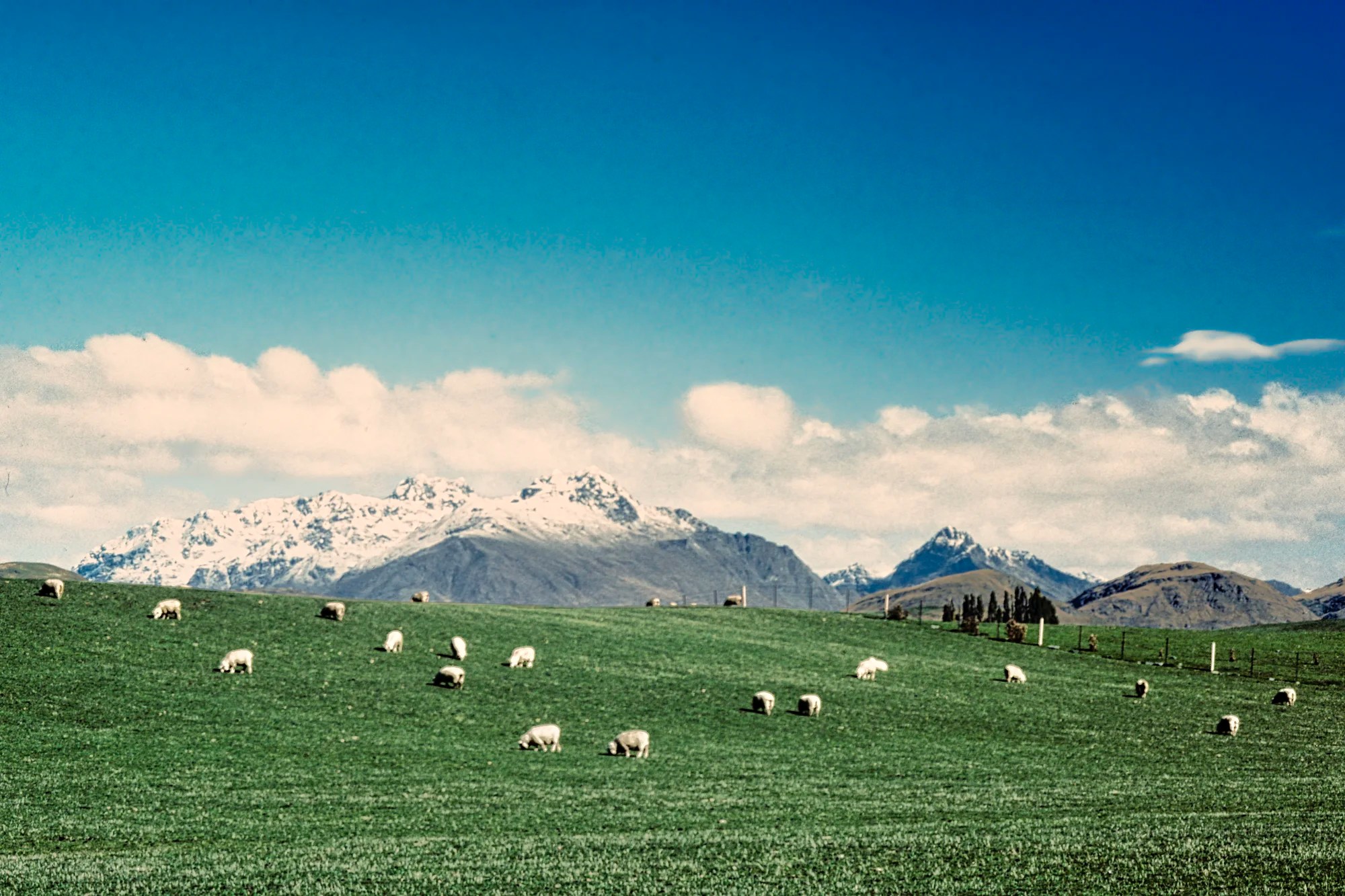
From Wanaka, the direct route goes over Cardrona Pass and Crown Range Road (Route 89) to touristy Arrowtown. On our first trip, this was an unsealed (aka unpaved) road! Sheep sprinkled the grassy slopes and the snowy Remarkables added to the atmosphere.
There is a view called Arrow Junction Lookout (G4.6) near the end of Crown Range Road in the Queenstown area. It is worth the detour if you are coming via Kawarau Gorge. Unfortunately, my slide photo did not weather the years that well.
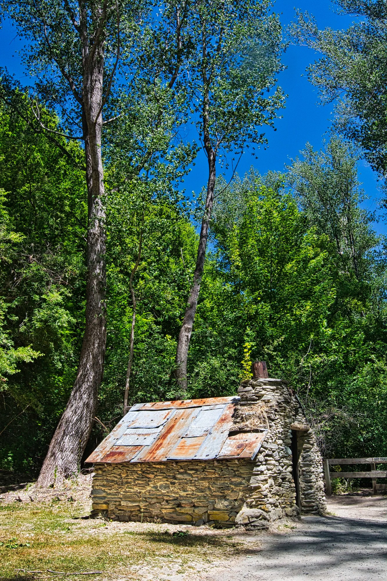
Arrowtown
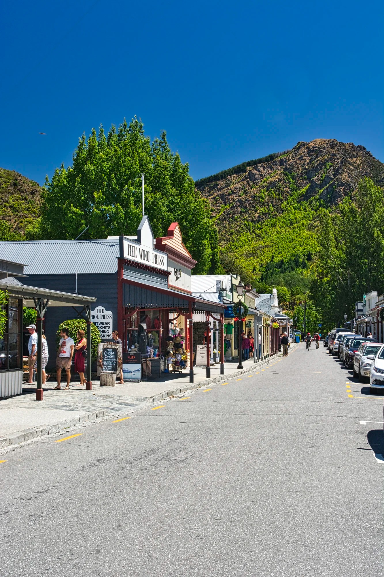
Arrowtown is an old gold rush town. It is a lot smaller and more commercial than the Canadian gold rush town of Barkerville. All the Arrowtown buildings were converted into stores. The Postmaster’s Cottage was the most authentic looking building dating from 1907. It’s now a restaurant (G4.3). In addition to having lunch, Arrowtown has a couple of superb places to get delicious ice cream, such as Patagonia’s (G4.5).
While Arrowtown is very touristy during the high season it is not that bad compared to other places in the world.
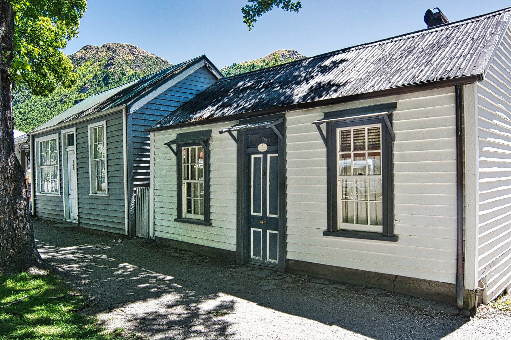
Walking on Buckingham Street east of downtown is a preserved historic district with very old but simple houses from the 1870s!
The old Chinese settlement west of downtown has been restored. The Chinese used to have stores as well. Chinese men fled terrible conditions in Guangdong province (Canton). Cantonese labourers might earn up to NZ£ 14 per year in 1871 (worth NZD 2,473 today)! But as gold miners, they could earn as much as NZ£ 77 per year (NZD 13,600 today). The appeal was irresistible. They were persecuted and were not allowed to immigrate to NZ. This is a far cry from today when NZ has a high 27.4 percent of Kiwis were foreign-born.
Queenstown
We liked Queenstown on our first trip. Today, Queenstown has become over touristed like Banff (the town), Alberta, but without the benefit of being in a national park.
Is Queenstown worth visiting?
If you don’t have your own vehicle, it is an easy place to reach by bus or plane. From here you can book bus-boat tours to Milford Sound and Doubtful Sound and Milford Track guided walks. Other popular activities are the Shotover River jet boat rides (G4.8), zip lining, Lake Wakatipu steamer cruises (G4.8), Walter Peak Farm (G4.7) tours, flight-seeing, et al. There are also a lot of restaurants and cafes.
Today, we avoid Queenstown like a plague. It is overhyped and overcrowded — and comes with traffic jams. The main problem is that there is no bypass highway to take transit traffic away from the town.
In fact, it would be nice if NZ built an expressway or at least a divided four-lane highway from Te Anau to Christchurch that would allow traffic to bypass Queenstown.
Shotover River

We prefer natural areas with minimal human commercialization. If you have a car, a worthwhile day trip is to see two gorgeous glacial green rivers. First drive east on Highway 6 to the bridge over the Shotover River (G5.0). We parked nearby and walked over the bridge to see these scenic views.
Kawarau River
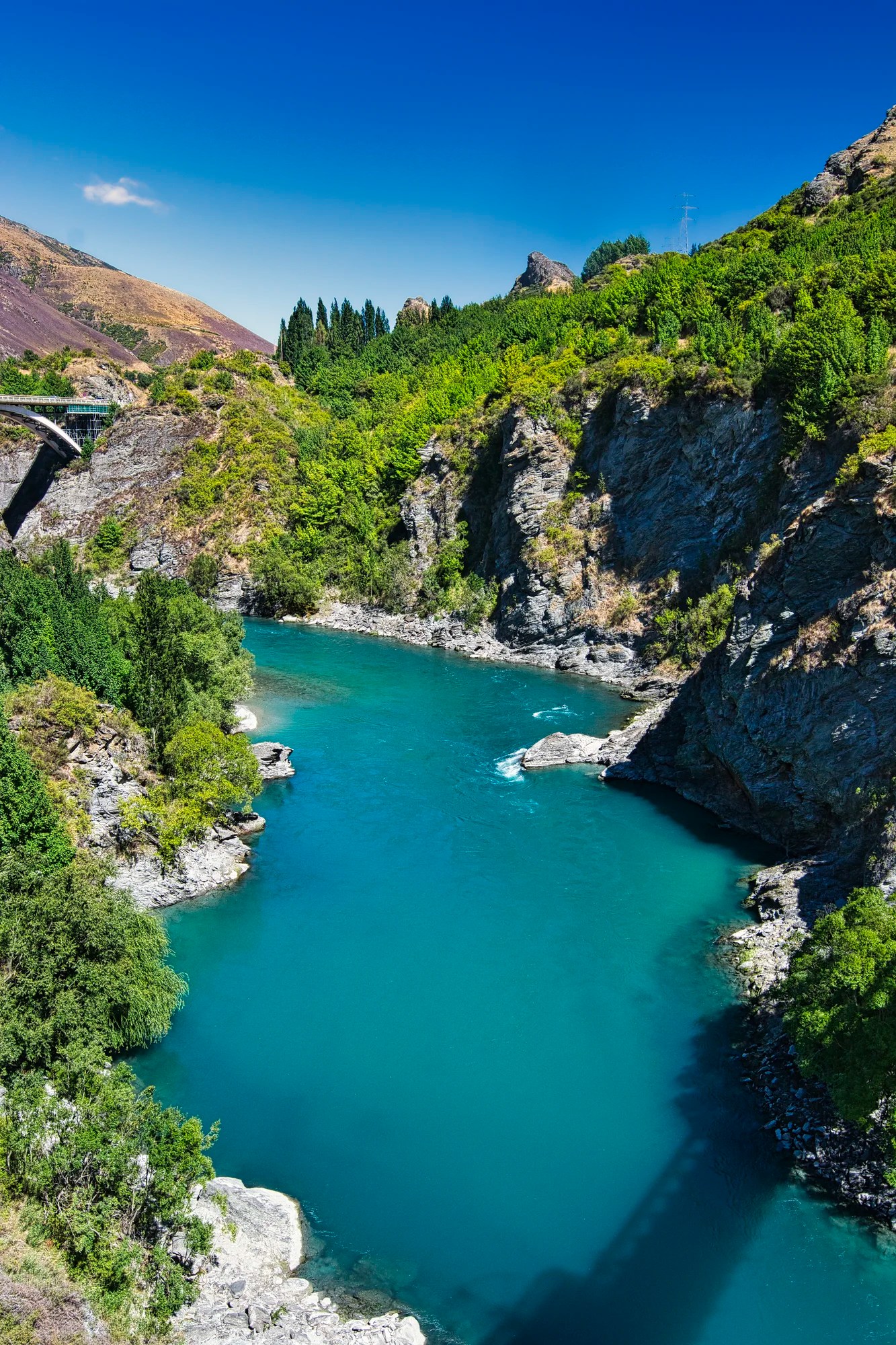
Continue south on Highway 6 and make an optional detour uphill to Arrow Junction Viewpoint (G4.6). Continue south over the Kawarau Gorge bridge. If you do not want to go all the way to Cromwell, do go as far as the AJ Hackett Kawarau Bungy Centre, where bungy jumping was invented. This is where I took the photo the Kawarau River Gorge and bridge above. Continue south to enjoy steep cliffs and the gorgeous green river lined with vineyards. Kawarau is known for Pinot Noir. See our previous post on the Southern Alps that describes the Kawarau River trip.
Coronet Peak
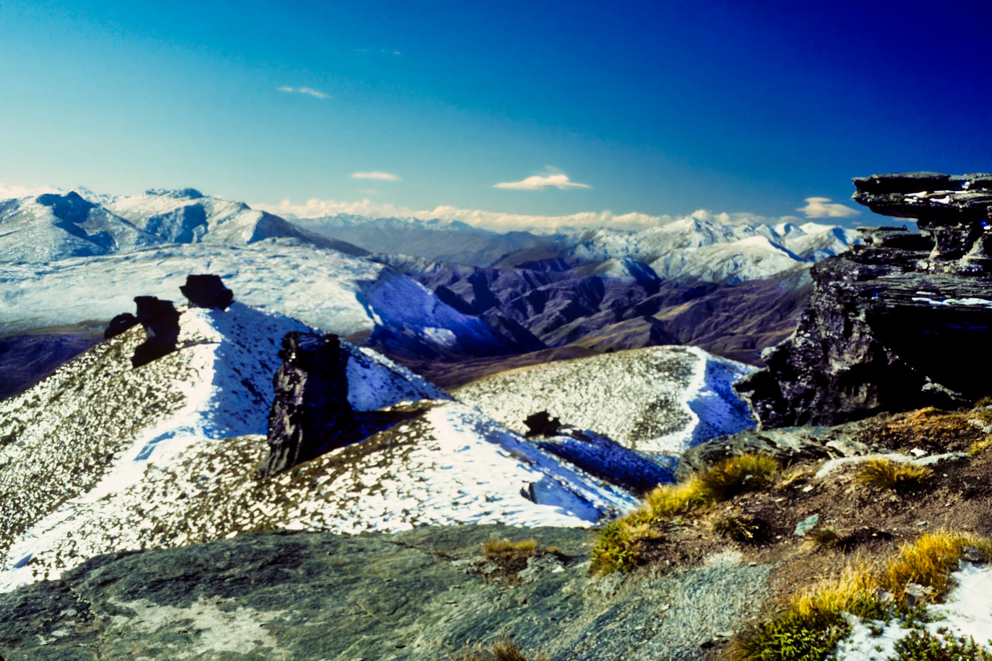
The drive up Coronet Peak (G4.6) was quite steep and winding. But the views from the top were remarkable (LOL). It was April (autumn) so the Remarkable Mountains were sprinkled with early snow. In fact, don’t you think having snow on the tops of mountains makes them more photogenic.
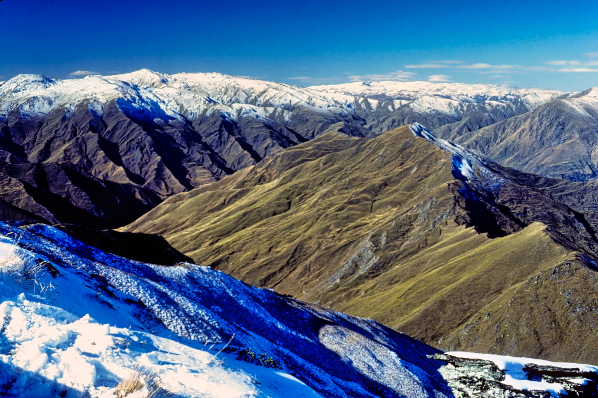
We were met with a sea of white-capped peaks but which direction should I take the photo? This was the Kodachrome slide era so we had to economize on the number of photos we took. It was a cold steep descent!
There are two reasons to painfully drive through the Queenstown traffic. Experienced hikers can do one of our favourite multi-day hikes, the Routeburn Track. The other reason is the drive along Lake Wakatipu to the trail head at the village of Paradise.
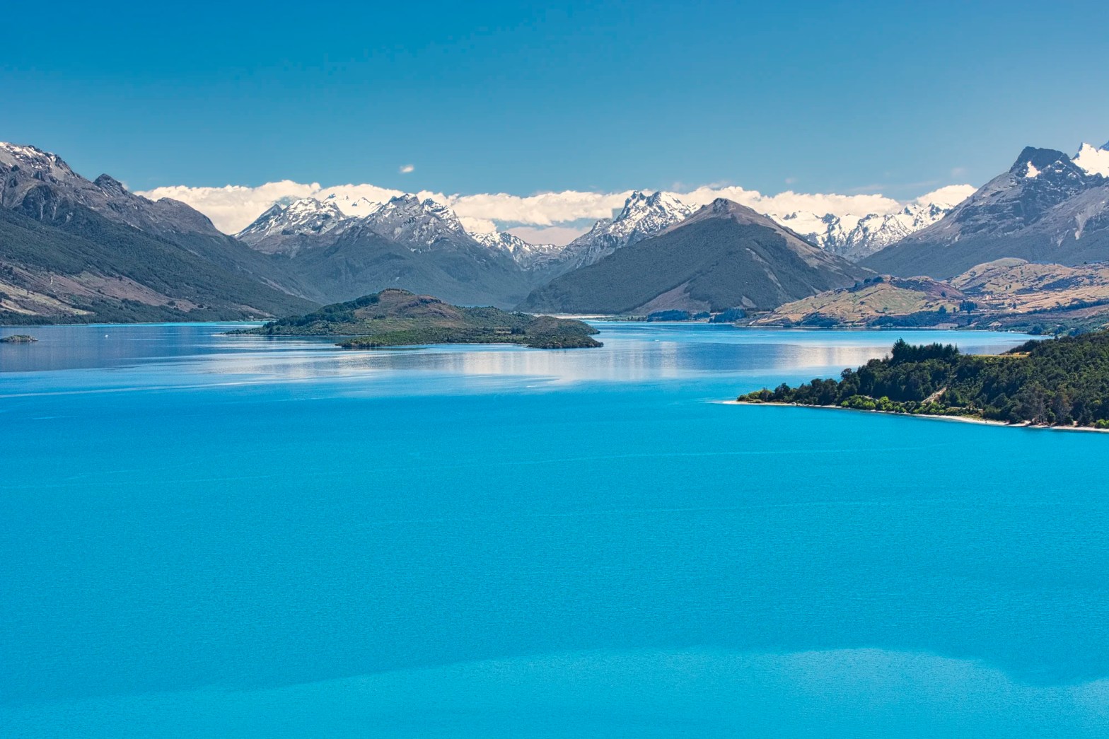
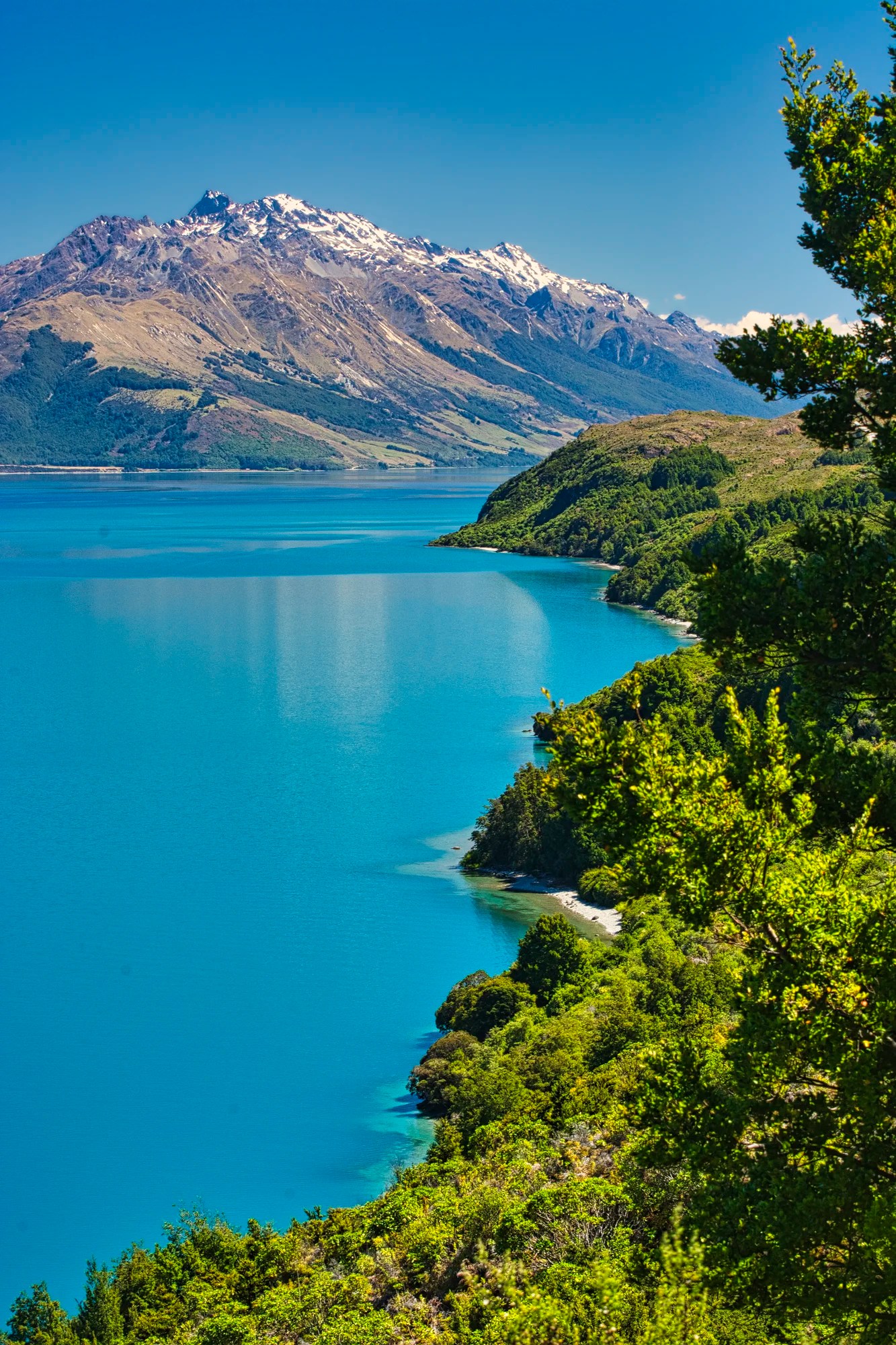
Lake Wakatipu
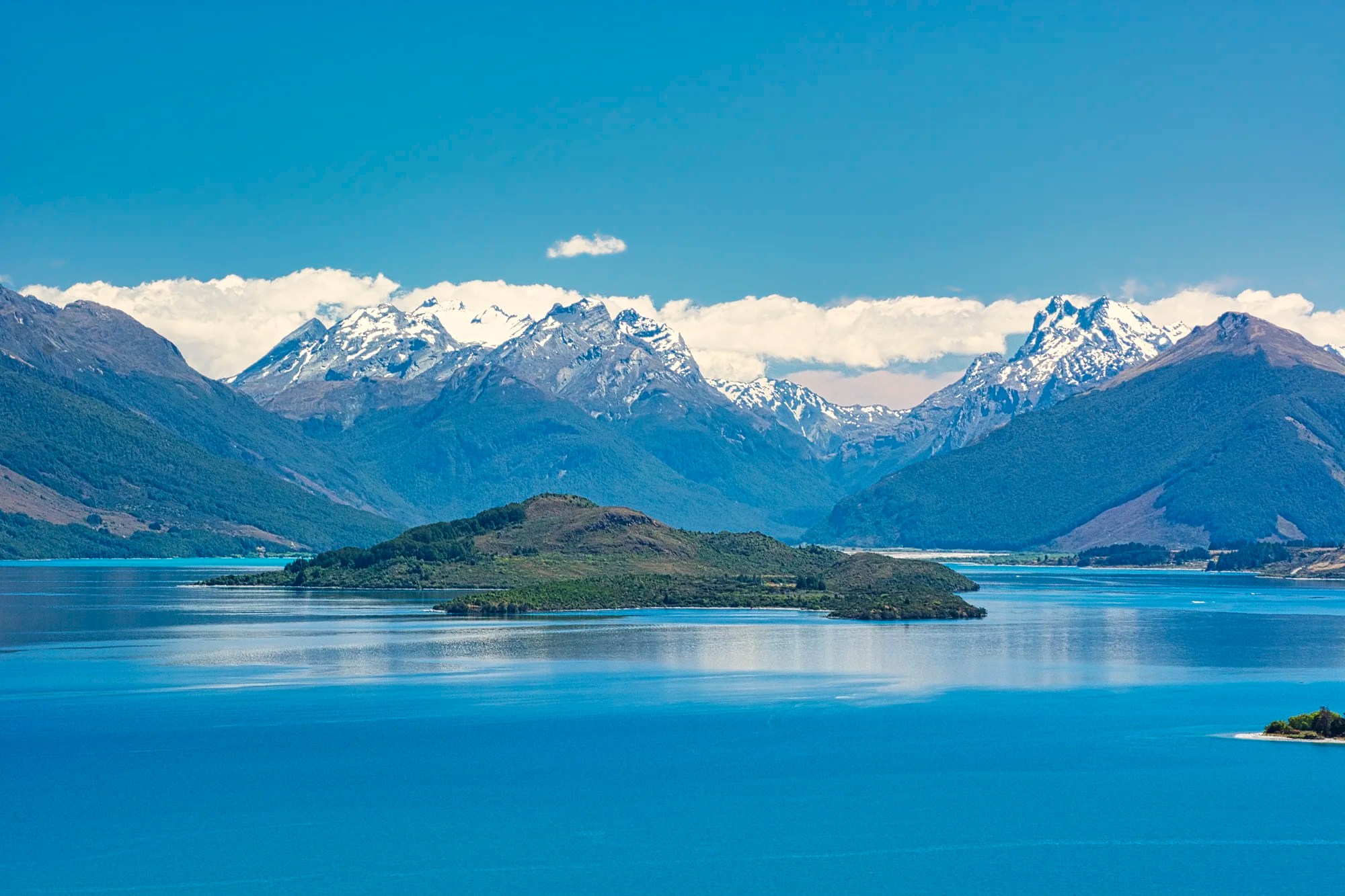
Drive west on the Glenorchy-Queenstown Road. The views from Queenstown are nice but not spectacular. You only see the huge Lake Wakatipu and wonder why we recommended going here. The 80 km long lake was carved by a massive glacier but it doesn’t have the typical glacial green (turquoise) colour.
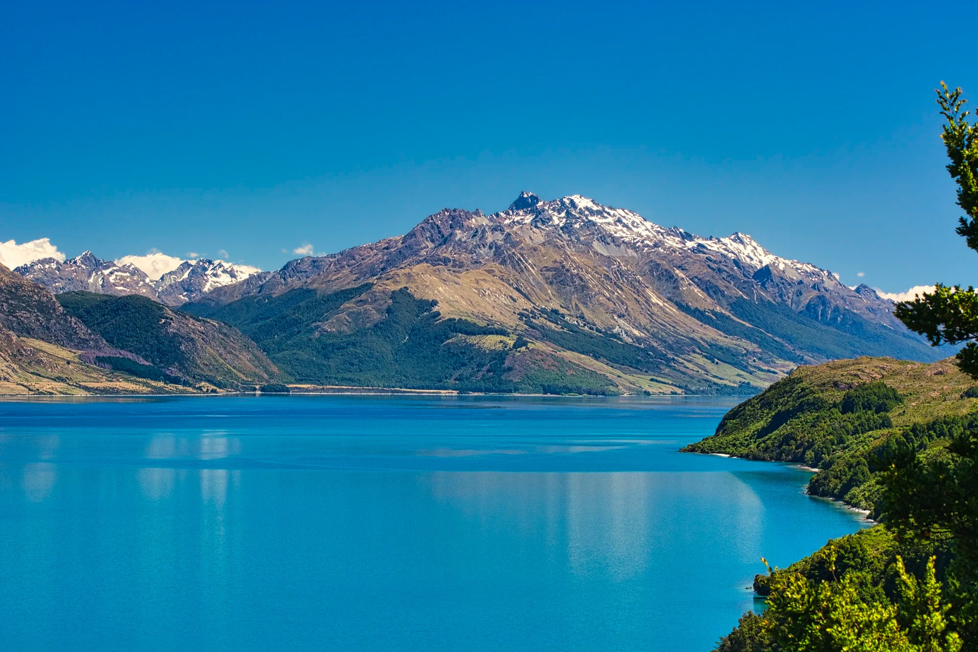
Then the road makes a sharp turn north. At the approximate point “Great View of Lake” pinned on our Lake Wakatipu Map, the views improve. As you approach Pig Island there are viewpoints that blow you away. OMG, this is the view of the Routeburn Track area that we had hiked as backpackers!
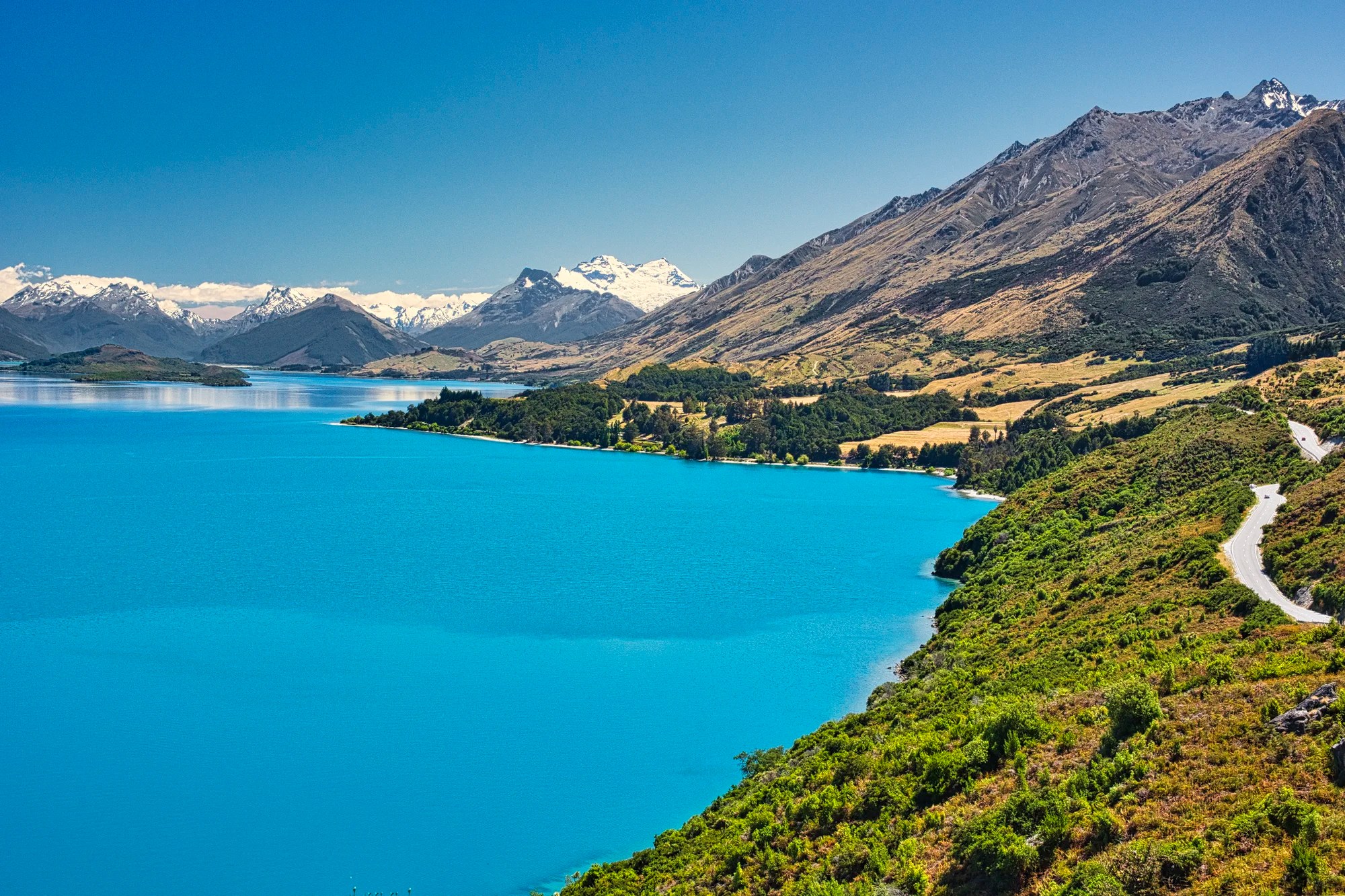
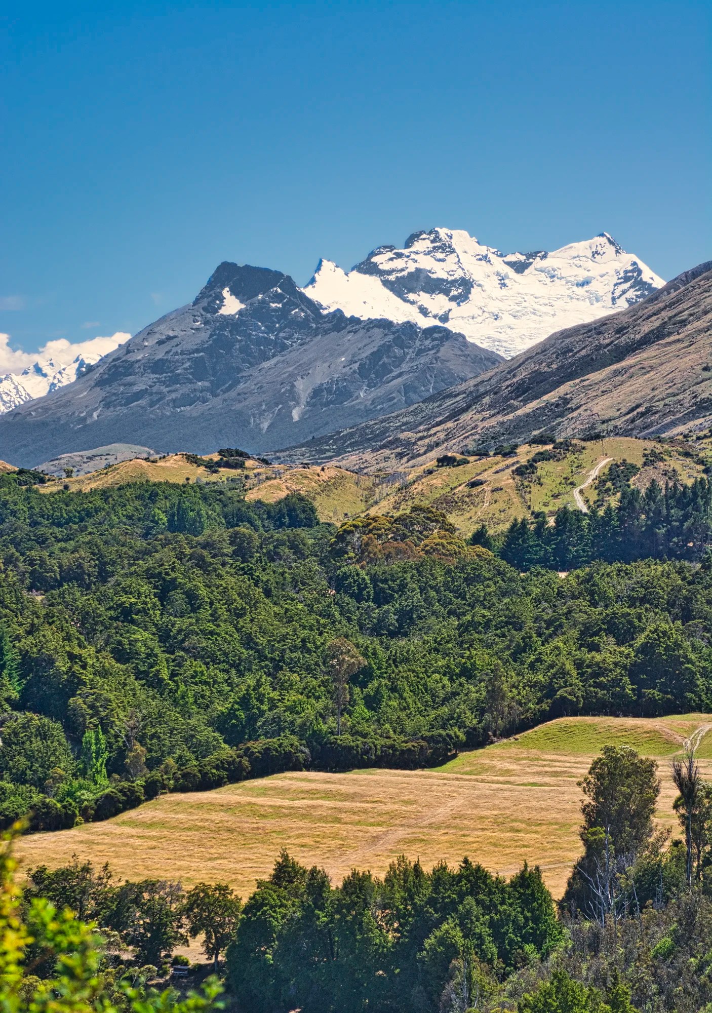
The lake now has that special glacial blue look that is similar to Lake Pukaki. Glacial water is usually turquoise. From this viewpoint you can see Pig Island in the foreground and the Humboldt and Ailsa Mountains, which are part of the Southern Alps.
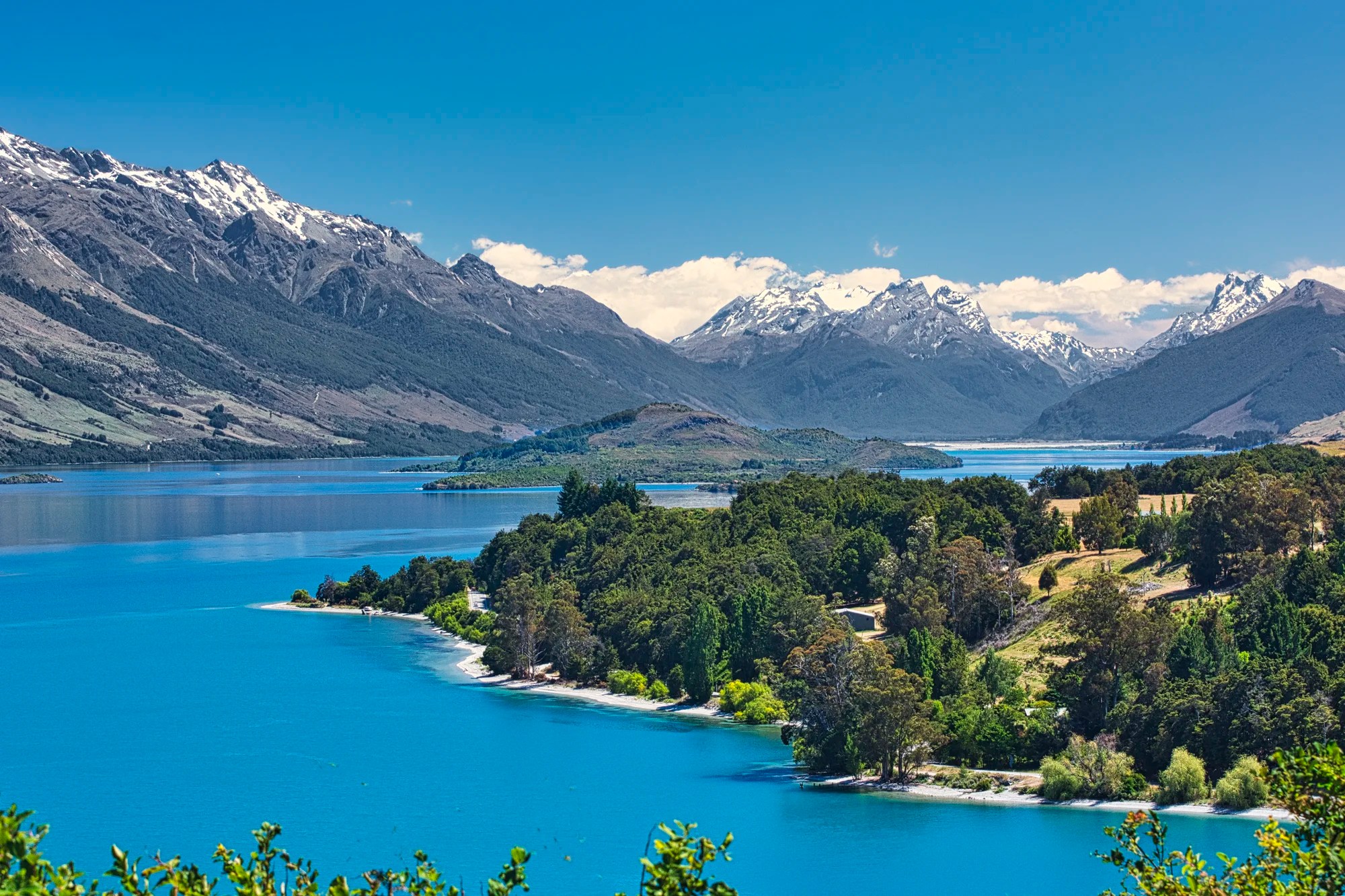
In the village of Paradise north of Glenorchy we started our the three or four day backpack on the Routeburn Track many years ago.
Routeburn Track
Routeburn Track is one of our three favourite multi-day hikes in NZ. In the high season you have to book the huts in advance due to the high demand. NPs are run by Dept of Conservation (DOC; i.e. Parks NZ). Most people do the track with three overnight stops.
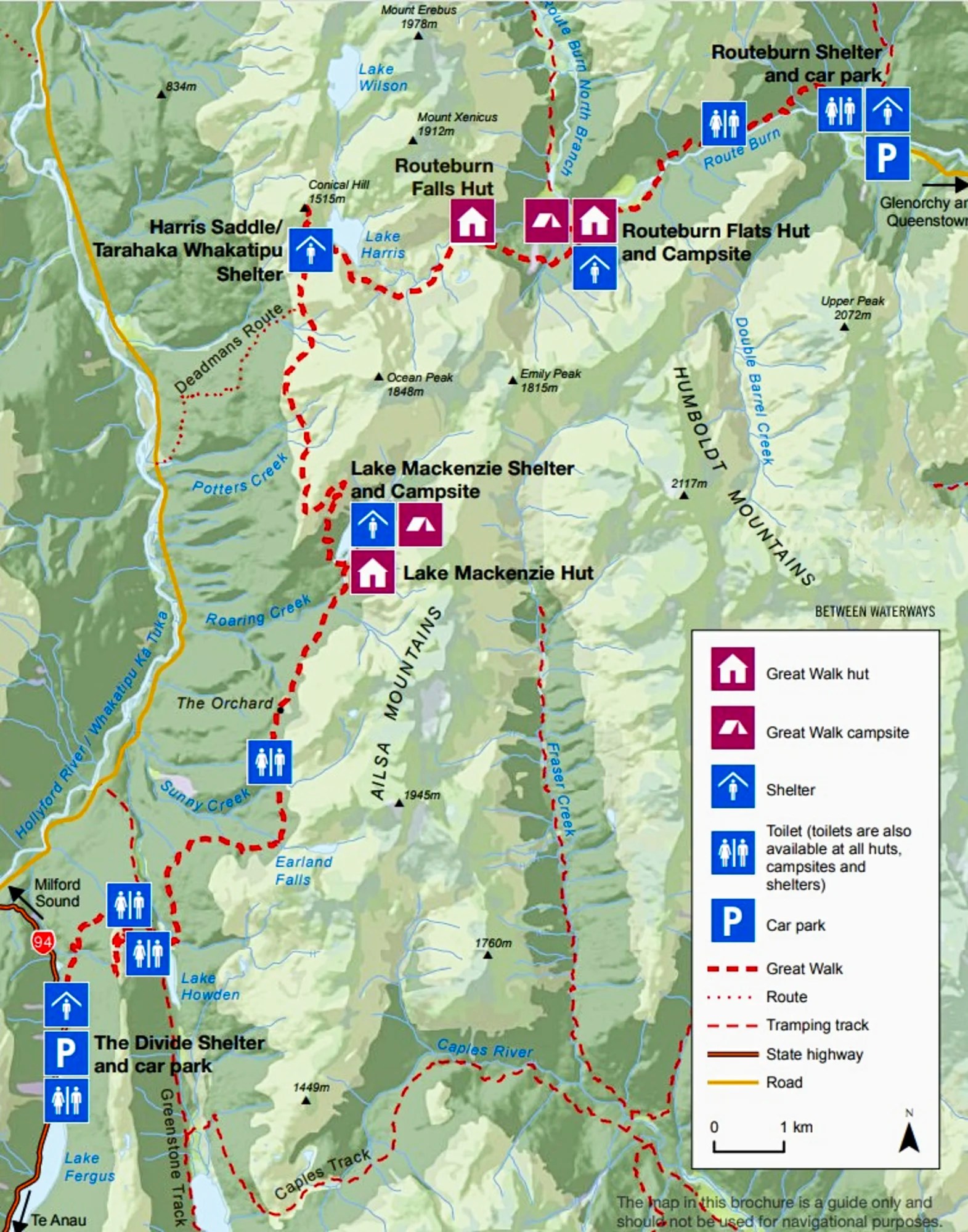
Routeburn Hiking Map and Logistics
We spent 4 nights — the joy of going when there were few tourists and one could just change one’s itinerary. An alternative in the tourist season is to trek 7 km to Key Summit from the Te Anau road (west end) as a day hike.
Distance: 31.5 km Max. Elevation: 1,300 m (4,300 ft)
Elevation Gain: 750 m (2460 ft)
Degree of Difficulty: challenging — not for beginners
Accommodation: 4 DOC Huts and 3 campsites.
Hut Cost: Nov-Apr NZD 65 per night; Jun-Sep NZD 15
Camping Cost: Nov-Apr NZD 20 per night; Jun-Sep NZD 5
During the season (Nov-Apr), the huts have mattresses, heating, toilets, basic cooking facilities, solar-powered lighting, cold running water, and a live-in park ranger. Book huts and campsites for each night well in advance.
Day 1: Trail Head to Routeburn Falls Hut
Distance 9.8 km
Gain: ca. 500 m.
Time: 3 to 4 hrs
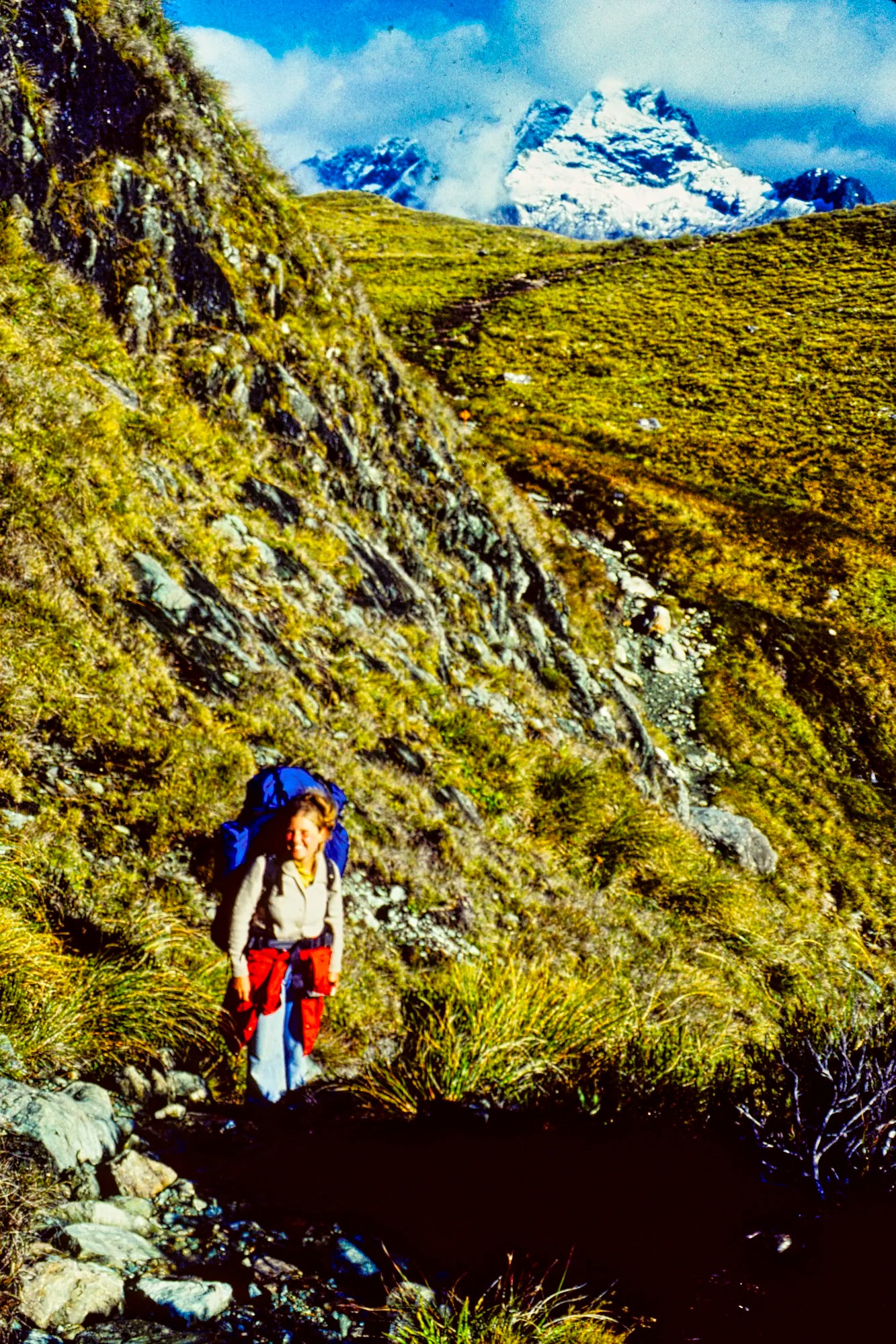
We started the first day at 12:30 hrs. The trail was a gentle incline with many bridges — some were suspension bridges. The third one went over a roaring gorge (13:28 hrs). The trail was fairly level over the open Routeburn Flats until a trail junction 15:10 hrs). We took off our 20 kg backpacks for a rest before beginning a steep ascent. We made it to the Routeburn Hut (G4.7) at the top (16:40 hrs). This was April and there were 20 other backpackers at the 48 bunk hut!
The next day was so rainy we decided to stay another night and wrote letters to family. We welcomed soaked hikers who hiked through the rain.
Day 2: Routeburn Falls to Lake Mackenzie Hut
Distance 10.8 km
Gain: ca. 300 m Loss: 400 m.
Time: 6 hrs
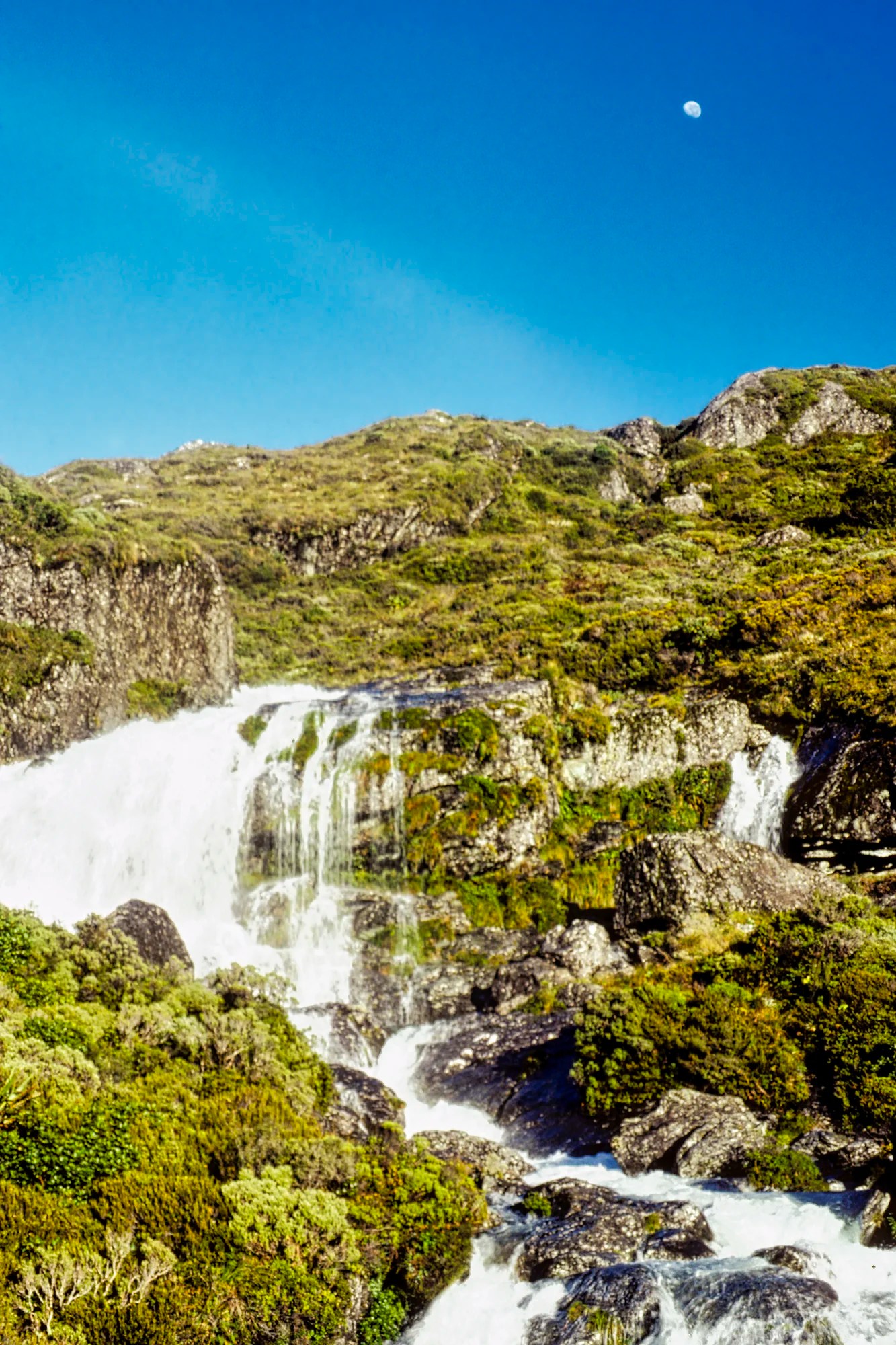
Our patience paid off the next day. We were able to see the very pretty Routeburn Falls with the moon overhead. Then we followed the open golden meadow.
Finally we get views of the rugged slopes that guard this narrow valley.
The trail narrowed to goat size. This hike is for experienced hikers with proper hiking boots. Even with our superb boots, I fell once on the slippery rocks.
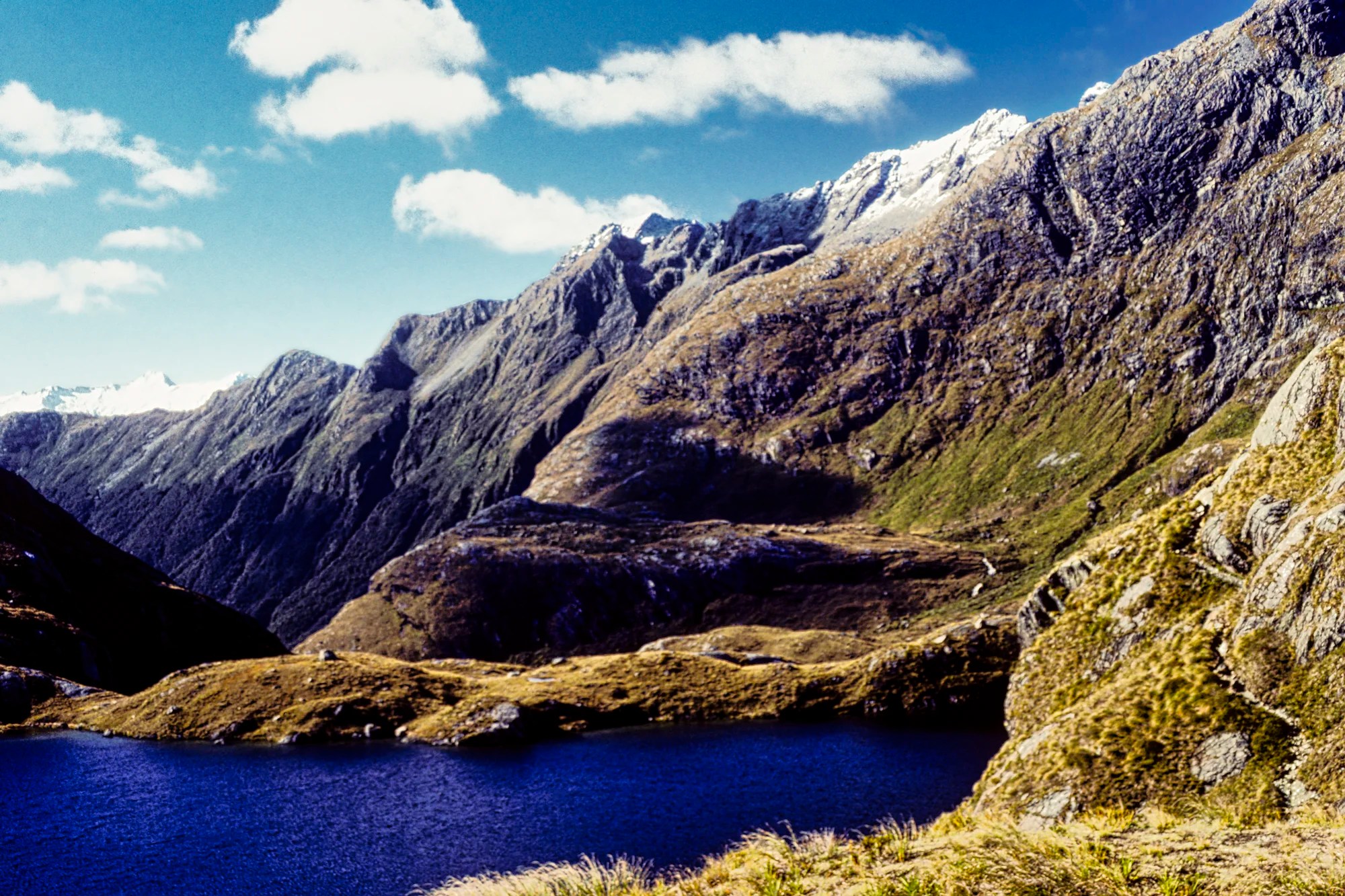
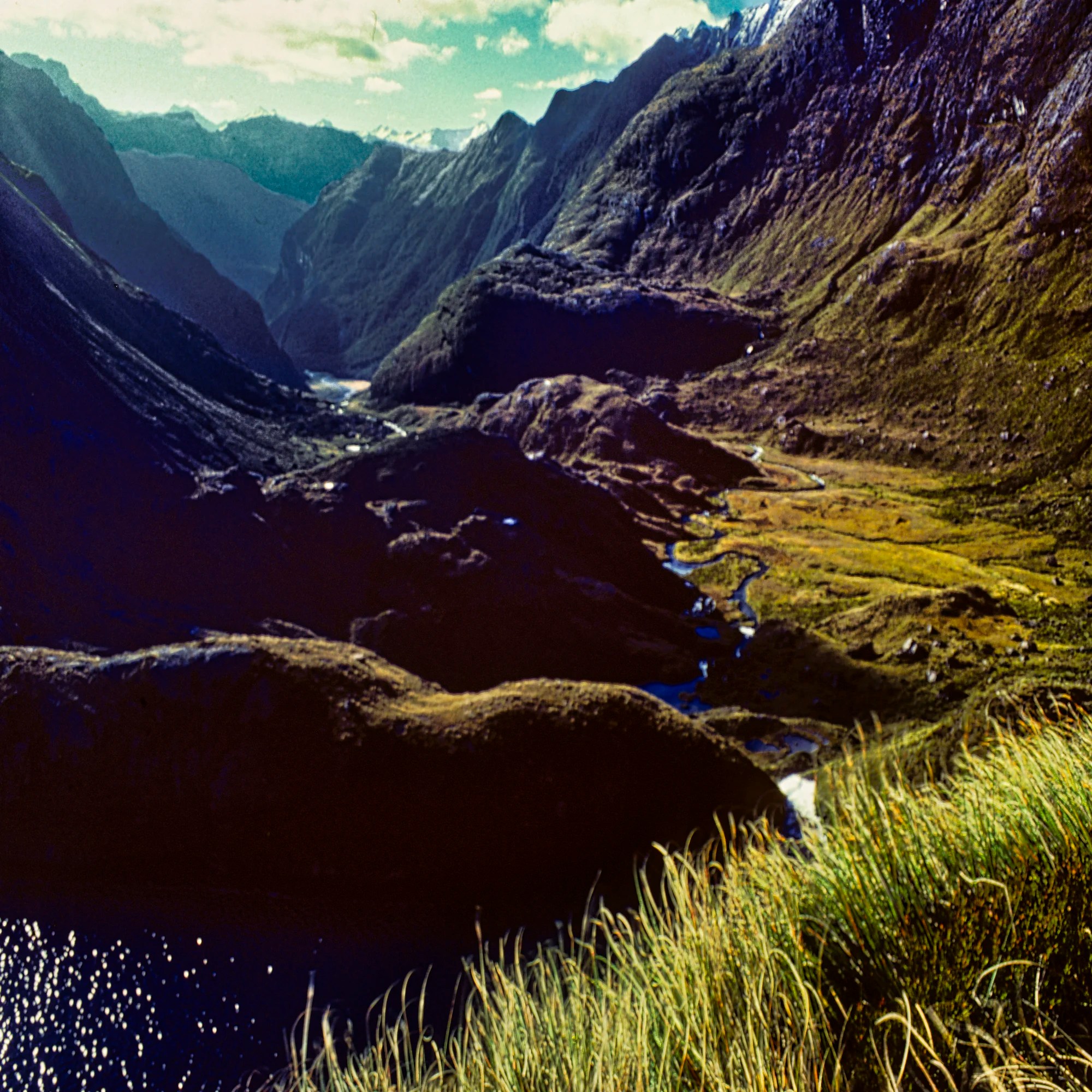
We climbed a moderately steep section and arrived at Harris Saddle at 10:35 hrs (272 m gain over 4.8 km 1.2 hrs). We hiked to the highest point on the trail (1,254 m 4114 ft asl) ‒ at the Lake Harris viewpoint (G4.9) we were surrounded by mountains. While the mountains are not high, the steep-sided Hollyford Valley makes them appear impressive.
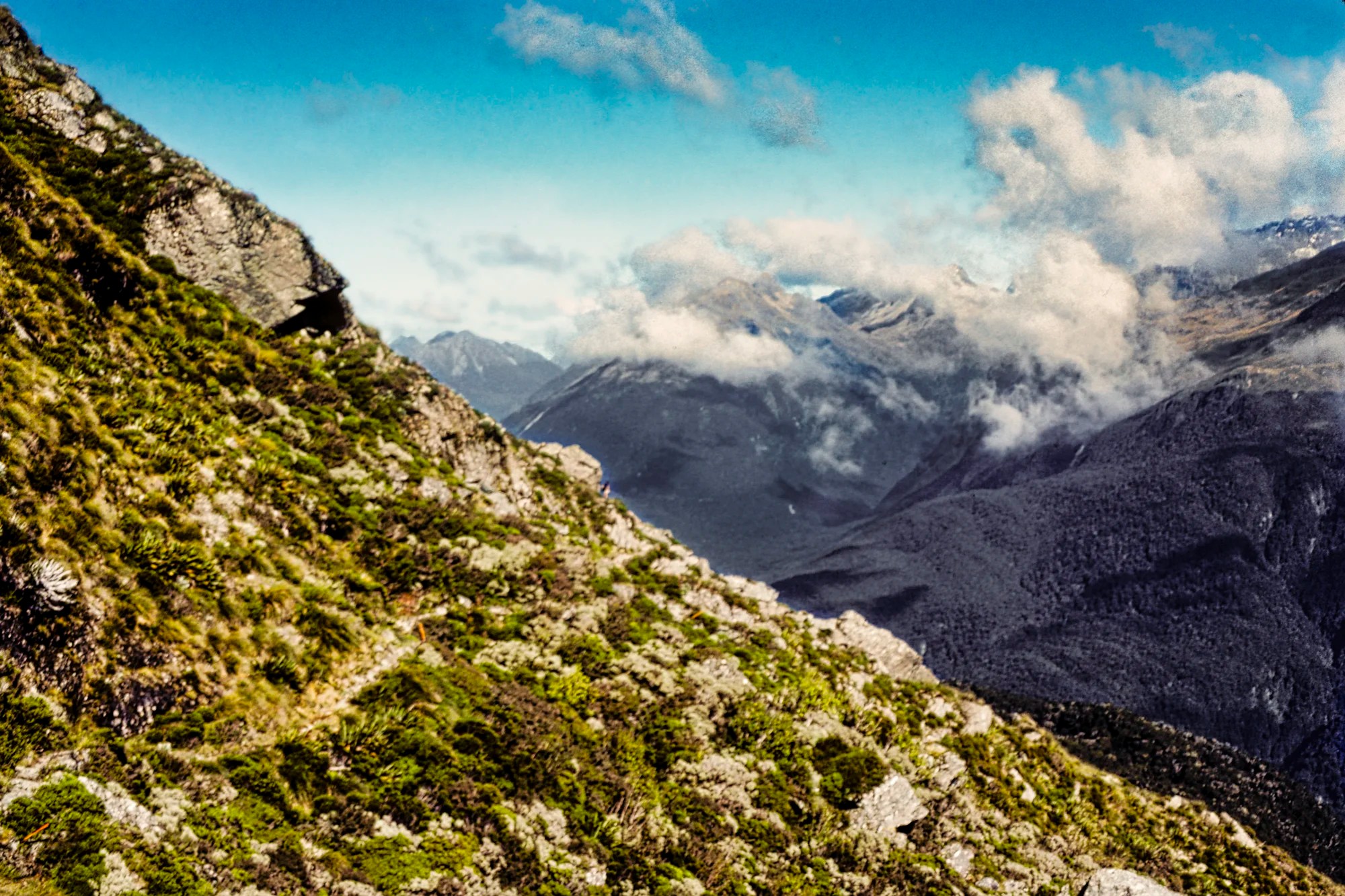
The trail narrowed and threaded many rocks.
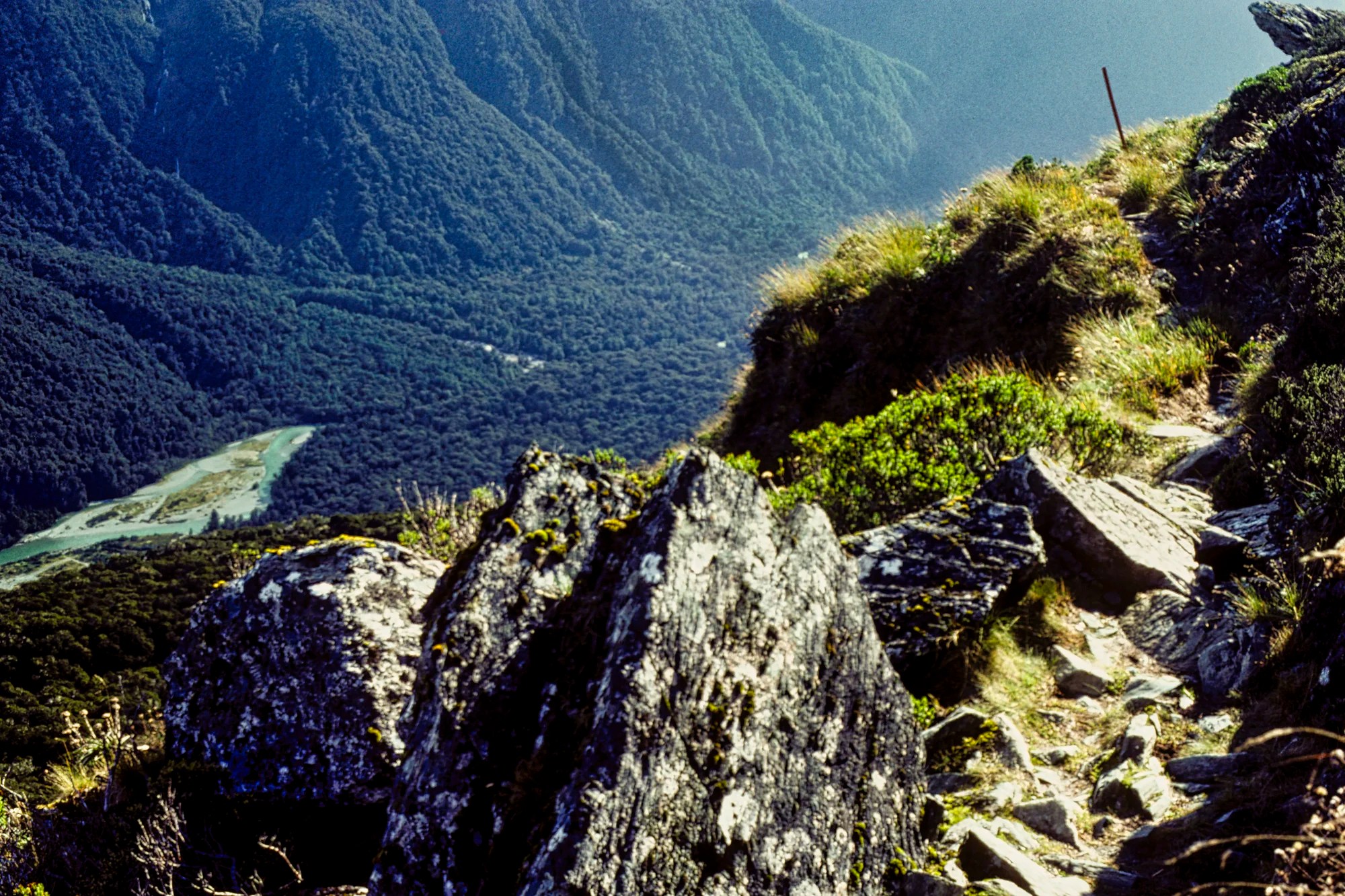
The trail veered sharply to the left and climbed to a lookout. We could see Hollyford Valley as far as Lake McKerrow and Martin’s Bay though it was too hazy for a good photo.
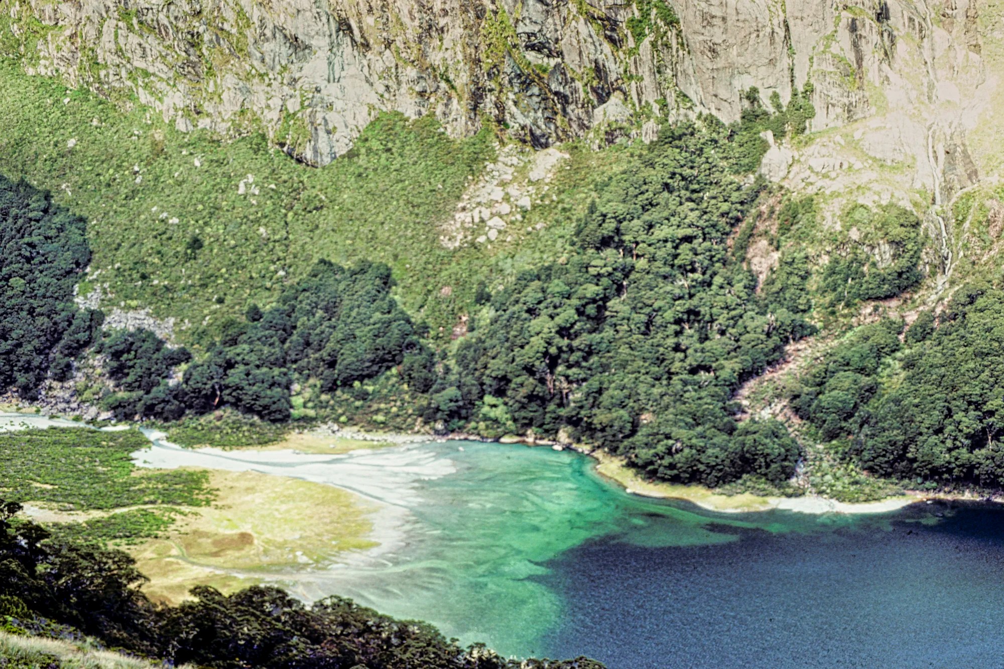
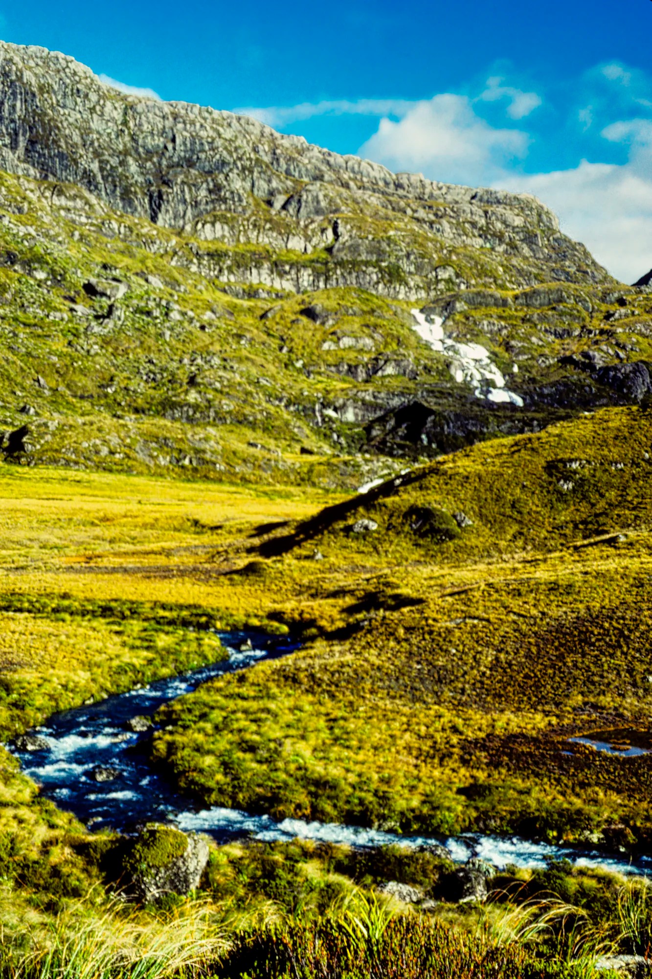
We reached a viewpoint at 15:00 hrs with colourful Lake Mackenzie (G5.0) far below a sheer cliff. An alluvial fan of glacial sediment feeds the lake with particles that are suspended in the water. After hiking down rocky switchbacks, we arrived at Mackenzie Hut at 16:15 hrs. Take care for the loose and slipper rocks on the descent.
Day 3A: Lake Mackenzie Hut to Lake Howden
Distance 8.6 km
Gain: ca. 150 m Loss: 350 m.
Time: 3-4 hrs.

On Day 3 it was pouring, so we left late hoping for the weather to improve. The trail was an obstacle course of running water, rocks, and tree roots. At first we were warm. When we reached the top it began to snow. As our hands were cold, we put on our down gloves. Hey, we are from Canada and we came equipped. Several hikers have died on Routeburn from hyperthermia and snow.
After passing the thundering 174 m high Earland Falls, we arrived at Lake Howden. It took two pots of chicken broth to warm up!
Day 3B: Lake Howden to The Divide
Distance 3.4 km
Time: 1-1.5 hrs
There was a side trail 1.5 hr round trip up to Key Summit (G4.8), also reachable as a 3 hr return day hike from the highway. We descended to the Milford Sound road at the point called the Divide, which has a shelter. It took 45 minutes to complete the trek but there were no views.
We were very lucky and got a lift to Milford Sound with Ken and Marii, commercial artists from Sydney. Otherwise, you need to arrange transportation to Milford Sound, Te Anau, or back to your car in Queenstown. During high season, buses may be too full to get on.
Final Comments on this Itinerary
This is an action-packed itinerary that is very busy during the summer high season. Even though we had rain for half of the Routeburn Track, we still enjoyed it a lot. The places are all highly rated by the people as shown by the high Google Maps Ratings. Remember, the most important “destination” is meeting the people.
Do you want more information? Then subscribe for free.
What things fascinate you? How long is your trip? What questions do you have?
Itinerary Planning
Do you want to learn how to plan an itinerary? Use this ready-made itinerary map to plan your trip.
New Zealand Wakatipu-Fiordland Map
Our own NZ Planning Maps include all the possible Points of Interest pinned. You can create your own custom maps using the Google My Maps app. Here are some pre-planned itineraries for NZ.
Google Maps Ratings
Google Maps provides a rating from 0 to 5 for all sights, hotels, and restaurants (but not cities). All of our recommendations are appended with the rating (prefixed with a G) from Google Maps. Google Ratings are based on feedback from locals as well as tourists. They are much more reliable than travel booking websites or tourist anecdotes. We consider a score of 4 to 4.39 to be Very Good and 4.4 to 5 to be Excellent.
Other Places to Add to Your Itinerary
Here are some beautiful places to add to your South Island itinerary:
Wakatipu-Routeburn References
Routeburn Track Information, DOC
Purpose of Your Trip
What is the purpose of your trip? What are your interests? This itinerary was based on the features that make New Zealand unique…
New Zealand FAQ
The FAQ post answers questions such as:
- Where should I go in New Zealand?
- What is the best season for travel?
- Where should I go? What are the must-sees?
- How much time do I need for New Zealand?
- How safe is New Zealand?
- What apps are useful for travel?
Abbreviations
DOC = Department of Conservation = Parks NZ
Kiwi = New Zealander or a nocturnal flightless bird
NP = National Park
NZ= New Zealand
NZD = New Zealand Dollar
NI = North Island
SI = South Island

Leave a comment