
Do you want to see some of the best glacial green lakes, mountain views in Banff National Park (NP)? Do you want to do exciting hikes? This post describes the drive between Banff (town) and Lake Louise as shown on our Rocky Mountain Itinerary Map.
Author & Photographer: George Mitchell

Our advice below is not based on a couple of tourist trips. Our recommendations are based on our extensive experience living in Alberta (AB). We are avid hikers, nature lovers and photographers (all photos are my own). The Rocky Mountains were our weekend playground. We often hosted out-of-province friends and family using the itinerary we are recommending.
All of our recommendations are top-rated by Google Maps, based on ratings from everyone, not just tourists. Each place recommended in our custom Rocky Mountain Itinerary Map is appended with a Google Maps Rating (G0 to G5).
Banff the town
Banff is a nice mountain town with great cafes, restaurants, and a supermarket. It has great campgrounds — one of which remains open in the winter — and many expensive hotels. But, too many tourists think this is the ultimate destination of the Rockies.
A long time ago, my niece worked in Banff as a bus tour guide one summer. We drove to pick her up for the weekend. We met her flatmates and talked for a while. Then I said, “OK, time to go to the Rockies”. The girls were shocked and said, “But this is the Rockies”. What I meant was that Banff is not the Quintessential Rockies.
What to Do in Banff Town?
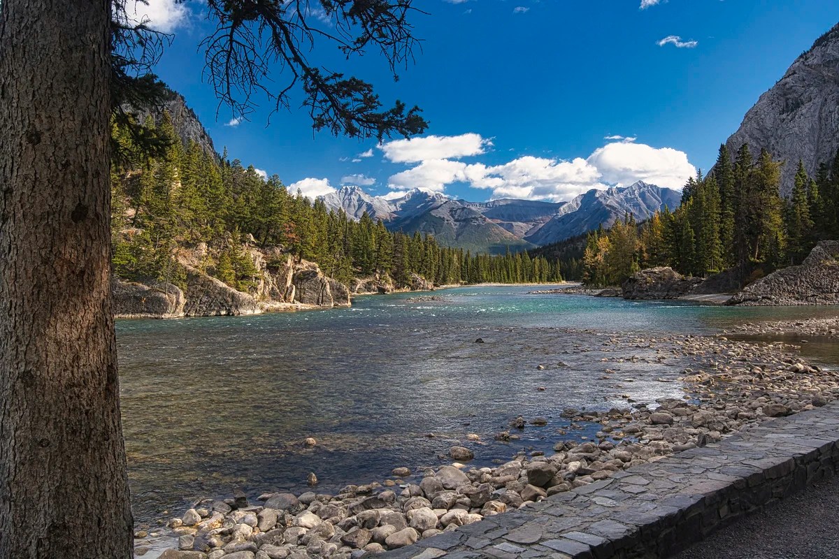
If you do not have a car, there are some interesting places to see in the town area. After getting your tourist literature at the Banff Visitor Centre, walk south on Banff Ave. to fuel up with coffee and snacks. There are some nice buildings along the way. Stop on the bridge over the Bow River for some nice views.
Enter the gates at the park headquarters to the pretty Cascade Gardens. Where have all the flowers gone?
It is much prettier during the summer season.
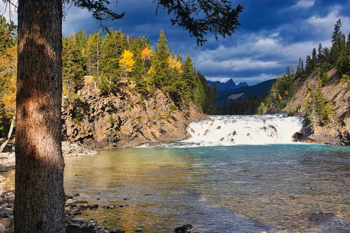
Continue south on Glen Ave. to the Bow Falls Viewpoint. Look northwest for a very beautiful view of the falls.
Also, look east for a view of the Bow River heading to Calgary.
Drive up Spray Ave. to the Banff Springs Hotel for its incredible interior and exterior. The Canadian Pacific Railway (CPR) was built to ensure that British Columbia joined Canada (rather than the United States) in 1871. The railroad led to conflicting land claims after the discovery of the Banff Hot Springs. The government rejected all the claims. It created the first national park (NP) in Canada (third in the world) in 1885. The CPR later built the Banff Springs Hotel and Chateau Lake Louise to attract tourists using extensive advertising.
The Banff Upper Hot Springs are not at the hotel (adults $16.50, swimsuit and towels not included). There is a lower hot springs as well, but drive up Sulphur Mountain to take a dip with a view. It’s an amazing feeling to come here in the winter. You can swim from the shower area right into the outside pool! No need to walk in the frigid outside air – you feel you have conquered the Cold. Water temperature in the pool is kept at circa 38°C (100°F).
Leave it to my friends and I (all swimming instructors) to start swimming laps on our very first visit. We landed in hot water, literally — expect to take a long nap very shortly afterwards!
What to Do Near Banff Town?
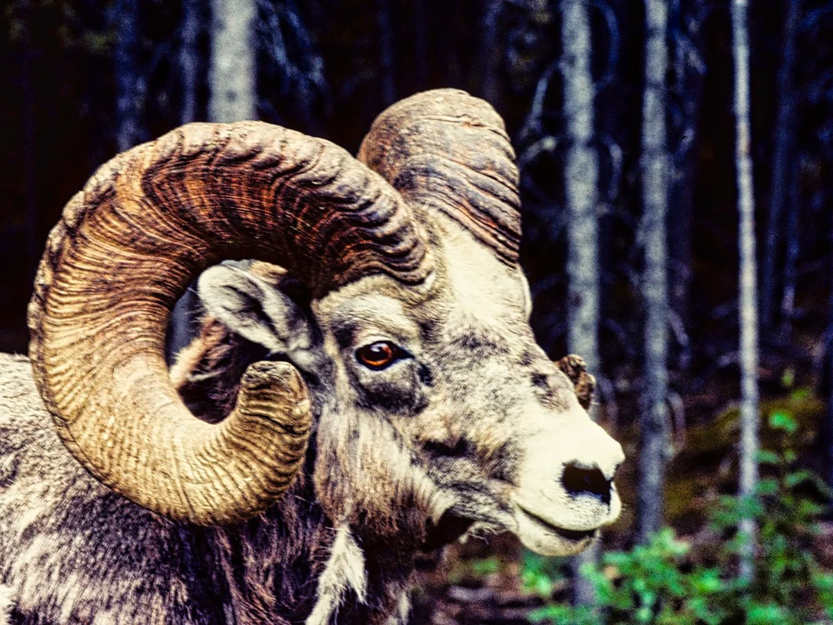
Go along the Minnewanka Scenic Drive. Search for wildlife in the parking lot before a big right turn over the earth-filled dam. We used to see Big Horn Sheep in the parking lot, especially when there were not too many people.
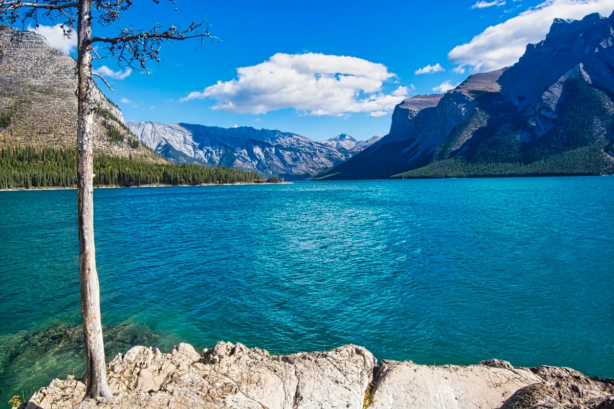
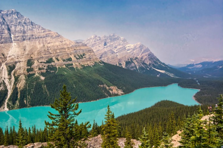
Also, go to the cruise dock and picnic area for views of the gorgeous turquoise lake.
Across Minnewanka (meaning water spirit), the largest lake in Banff NP, the most imposing feature is Mt. Inglismaldie (2964 m, 9725 ft asl) with massive limestone cliffs on top of a grey shale layer.
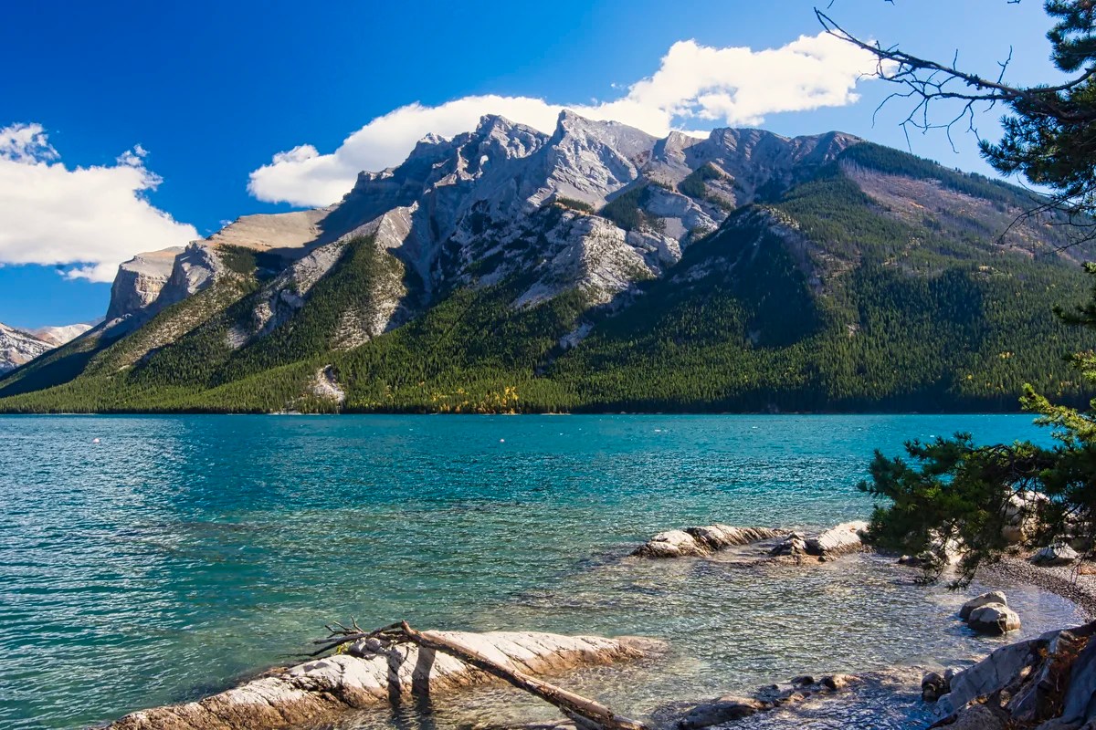
Continue along the scenic drive loop to a view of turquoise Two Jack Lake. This is the picnic area just after the campground entrance.
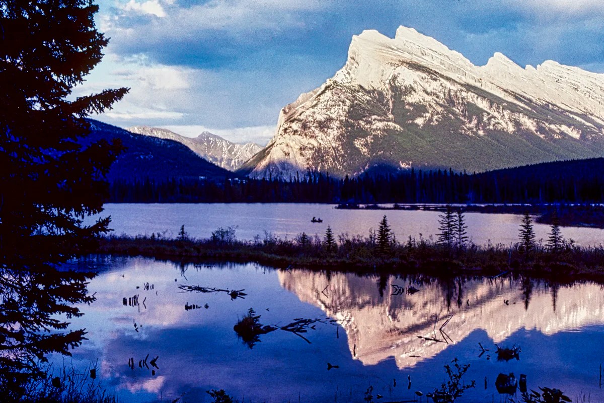
Vermillion Lakes are very attractive for sunsets framed by Mt Rundle. If you have a car or bike, you can drive 3 miles on the Vermillion Lakes Road east, just before the Trans-Canada junction, to this view. There is also a great viewpoint on the Trans-Canada Highway, eastbound only.
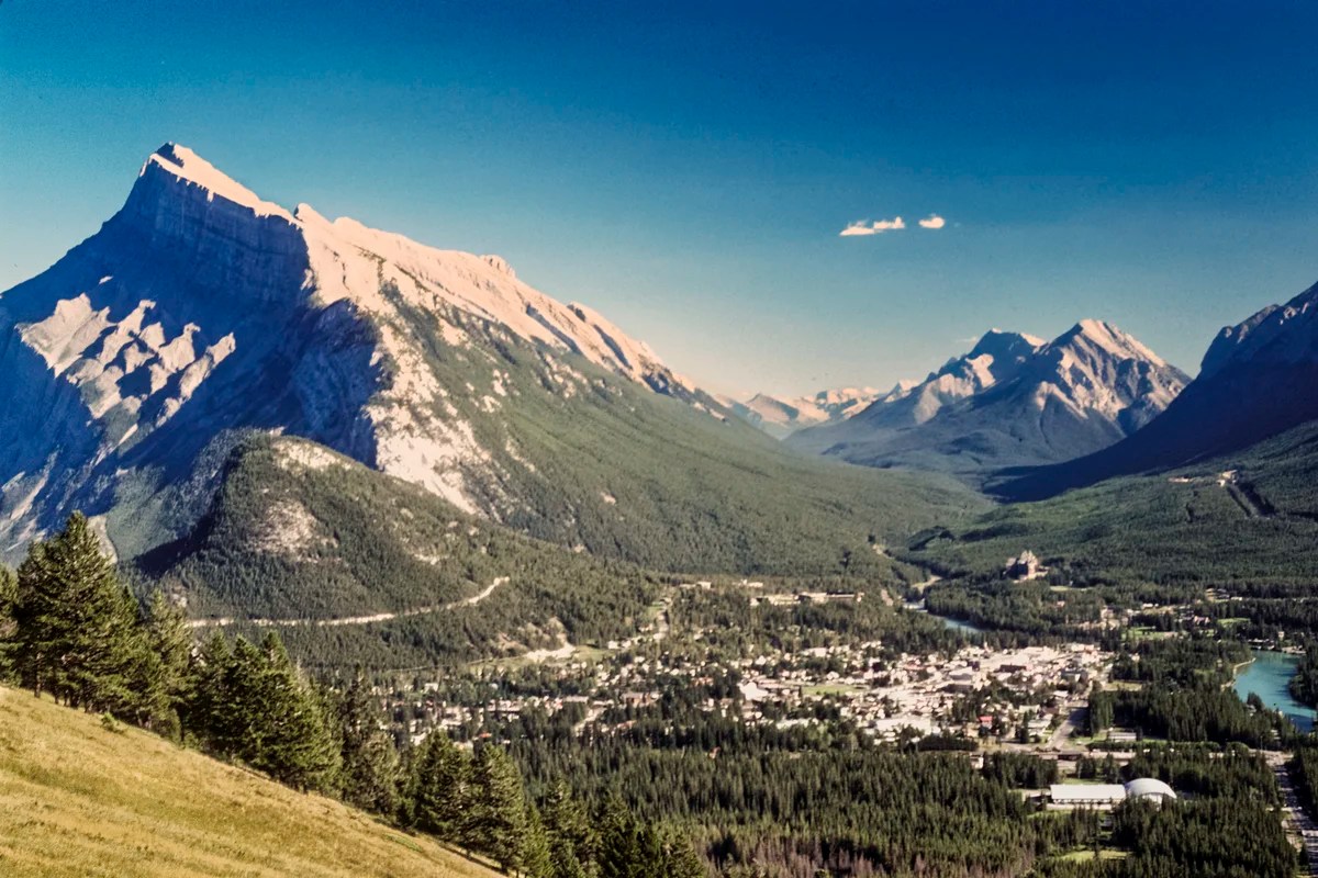
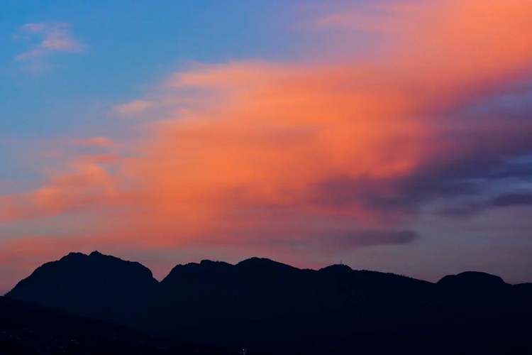
Mt Norquay Road, 3.6 miles one way, has the nice aerial view of Banff shown in the first photo above. The best viewpoint is the highest one.
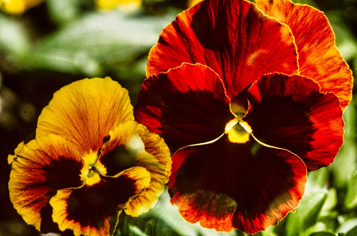
What wildflowers can I see in the Rockies?
The flowers of the Canadian Rockies can be found on many subalpine and alpine hikes, such as Sunshine Meadows. You just need some sunlit areas. The issue is not where but when. Because of the high altitude, the best time for wildflowers depends on when the snow has melted. Sometimes this can be late June; sometimes late July. This means you usually need to go hiking in July-August.
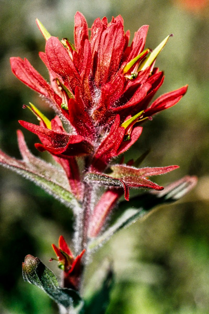
Fireweed and Indian Paintbrush are exceptions as they are low-altitude flowers, often seen along the roads. They are very common. Indian Paintbrush is one of the quintessential sub-alpine flowers from Alaska to the Andes.

Columbine is a beautiful and quintessential wildflower in Banff NP. It is found in subalpine forests (and in our garden) and is common in early summer.
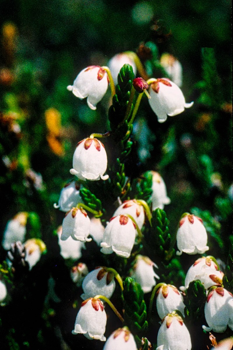
White Mountain Heather is a common alpine flower that blooms early in summer.
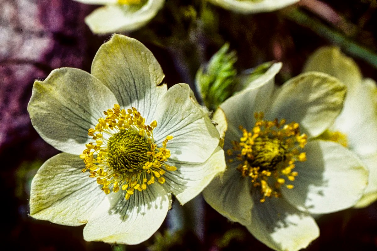
Western Anemone is a common alpine flower and blooms shortly after the snow melts. The blue Alpine Forget-me-not is another typical alpine flower.
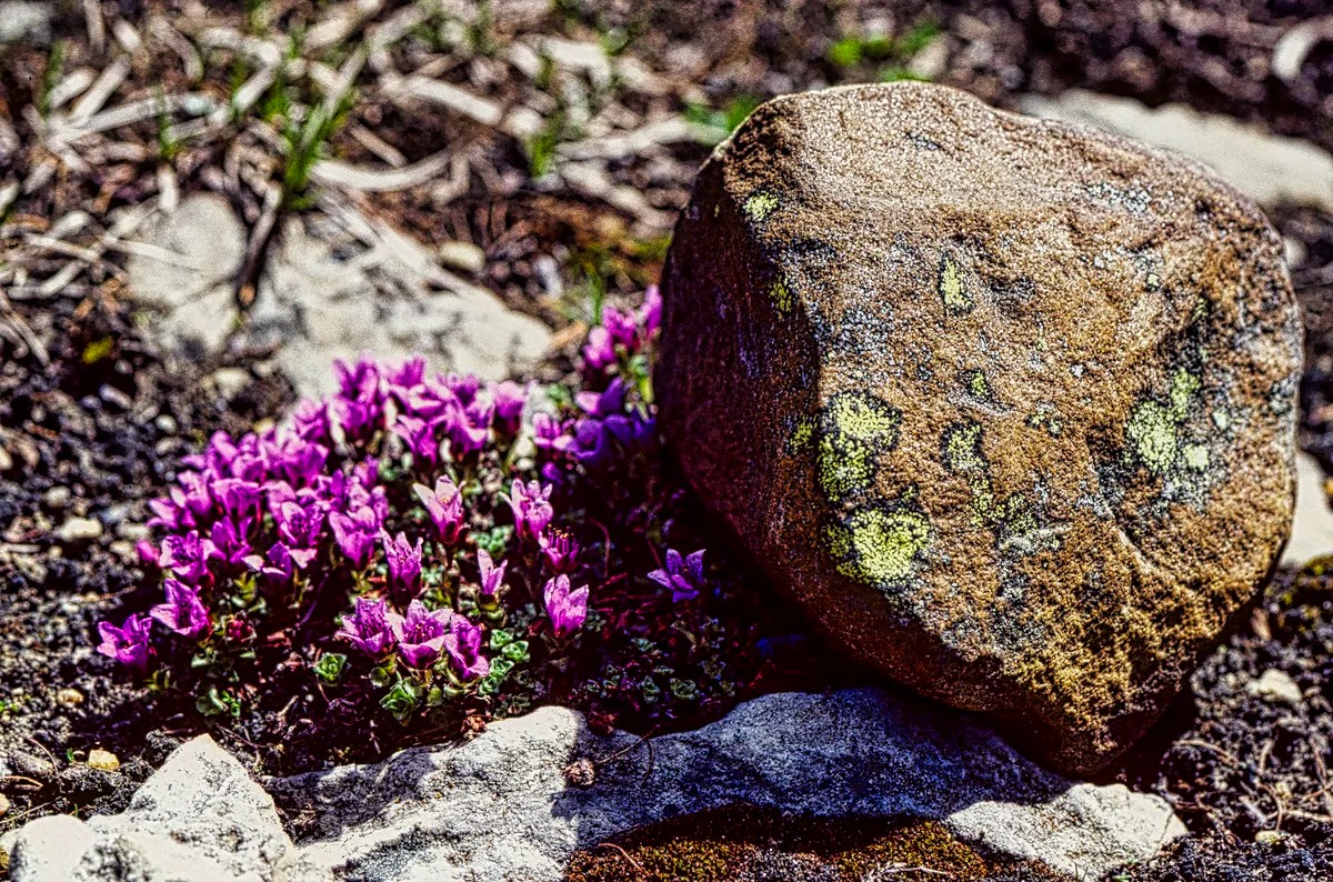
Moss Campion is a pink alpine flower that grows very slowly. So slowly, it does not flower for its first ten years!
Banff Hiking Trails
The following are just two hiking areas you can do if you are based in Banff, the town. There are many more hikes throughout the NP. Some of our all-time favourites are in the post Icefields Parkway – Do Not Miss the Best Road Trip in Canada.
Sunshine Meadows Trails
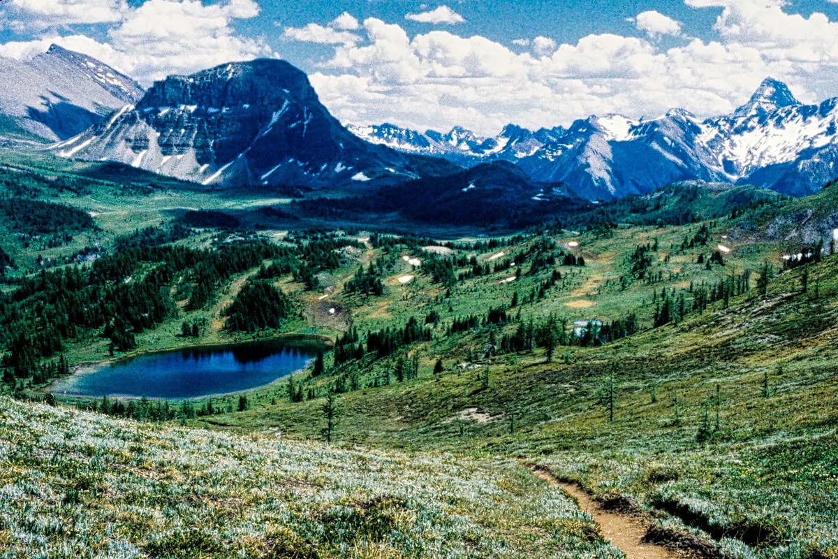
Sunshine Meadows is one of our favourite walks to take visitors, especially if you like alpine flowers and wide-open views. Best of all, you can avoid the hike uphill by taking the bus or gondola (CAD 65) to Sunshine Village, a skiing mecca we really enjoyed in the winter.
Once you are in the meadows, you can hike to Howard Douglas Lake on the way to Citadel Pass. You can see all the way to the pyramidal Mt. Assiniboine (on RHS of the above photo), over 15 km away. It is just you and wild nature — ok, there are lots of hikers as well. There are a few trails to do in this area.
Continue on to a picturesque view of Rock Isle Lake. We did not descend to the lake. Note that the peak flowering may not occur until late July, depending on snowfall.
On one trip, we met a young hiker from NJ who asked to join us when we guided a Swiss friend around the Rockies. The NJ hiker told our Swiss friend, the Rockies are way better than the Alps because when you hike up the mountains, all you see is more mountains. Needless to say, that did not go over well with our very patriotic Swiss guest.
Sunshine Meadows Hikes
5.8 km 2 hrs one way (OW) to Howard Douglas Lake;
9.3 km OW to Citadel Pass, gain 150 m (500 ft), elevation 2360 m (7800 ft); or
backpack 27.2 km 2 to 3 days to Mt Assiniboine, gain 335 m (1100 ft).
Johnston Canyon
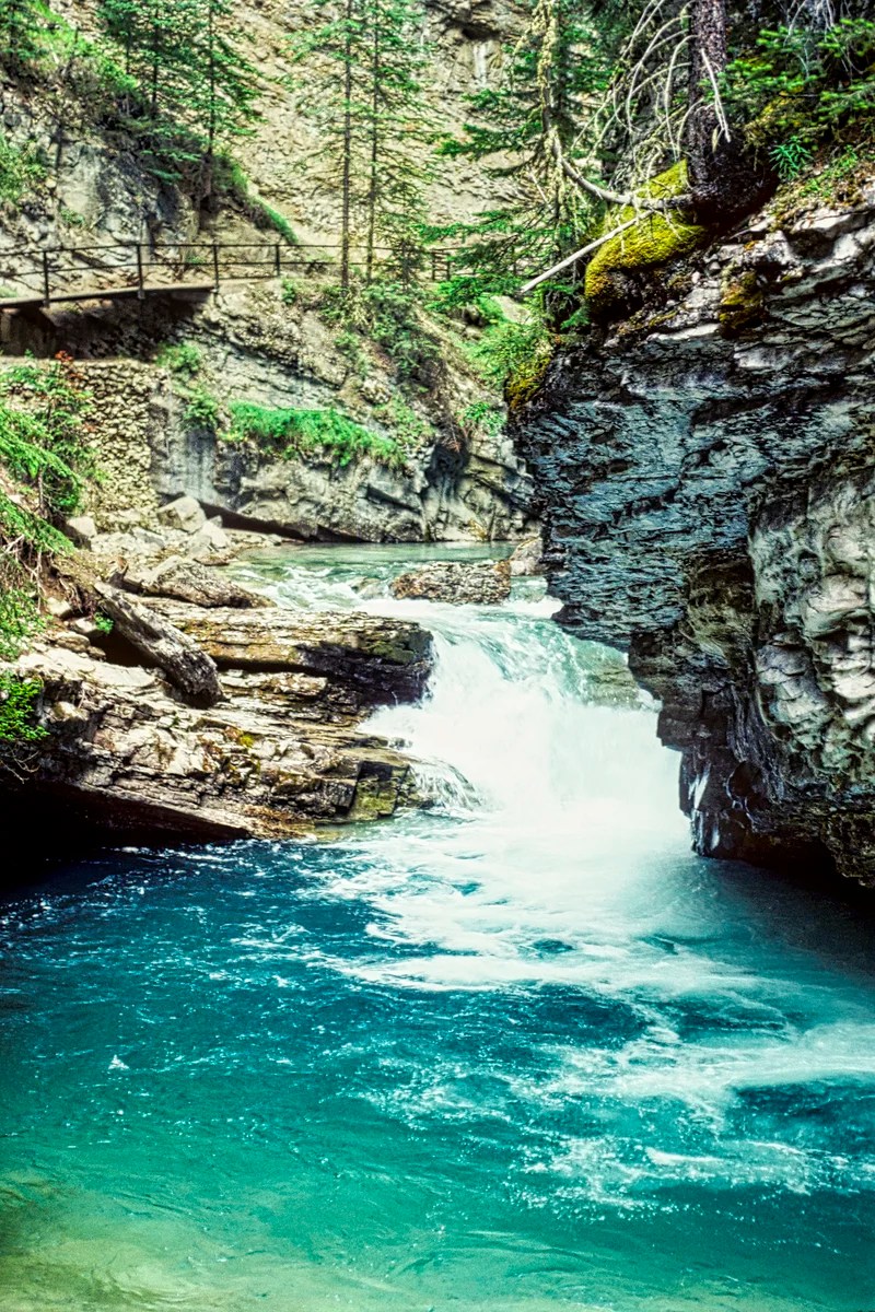
This is a fun walk because you “hike” right inside Johnston Canyon on elevated boardwalks embedded into the sheer canyon walls. Many families go on this popular walk. It is easy and pretty with the gorgeous green water. It is also accessible nearly all year round.
There are waterfalls and lots of semi-circular potholes carved smooth by the water — actually, it was the pebbles and rocks swirling in the water. The walls are made of soluble limestone, which is used today as ingredients for concrete, toothpaste, paint, tiles, medicines and cosmetics. But ask yourself, why is there limestone here?
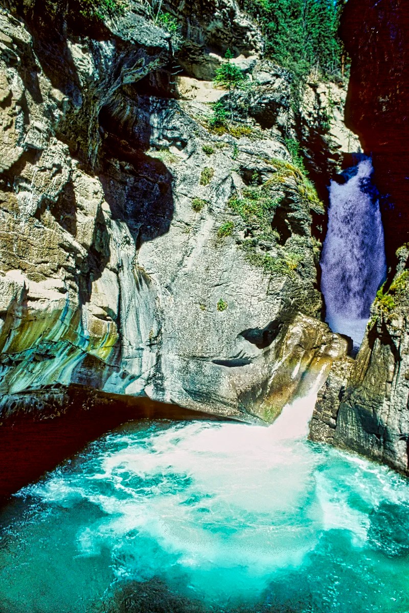
Limestone is composed mainly of skeletal fragments of marine organisms such as coral and mollusks. This means this area was once a shallow tropical ocean. Now we are in temperate, sometimes freezing, Canada. OK, there was no Canada then, just one supercontinent, Pangaea. Moreover, this rock is over 252 million years old! At that point in Terran history, there was the greatest mass extinction — 95% of all life disappeared! And you thought you were just going on a pleasant walk.
The trail ends at the Ink Pots, six clear green springs of 1°C water. You can hike three options, though most tourists only go to the Falls:
- 1.1 km OW to Lower Falls;
- 2.7 km OW to Upper Falls; and
- 5.8 km 2 hrs OW to the Ink Pots; gain 215 m (700 ft).
What wildlife can I see in the Rockies?
The Trans-Canada expressway (Highway 1) in Banff NP is lined with fences to keep the animals out – or is it to keep the humans in? There used to be “bear jams” in the old days when cars would simply stop and block the road to see animals along the road! Now, wildlife bridges lined with trees and other vegetation enable animals to cross over as if they are still in the forest!
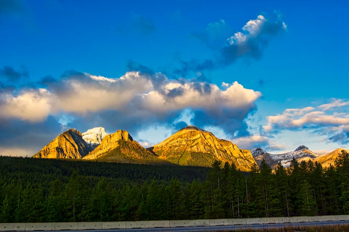
There are mountains all along the road, but the tunnel of tall lodgepole pines prevents you from seeing them. Then, at the Lake Louise campground overflow area, the intersection provides a break in the trees. This is the early morning view we got. It made getting up early worthwhile.
To see wildlife, you need to get off Highway 1 and go hiking or on the smaller roads like the Minnewanka Scenic Loop, Highway 1A, and the Icefield Parkway (Highway 93) to Jasper. You probably need to go searching in the early morning or late afternoon/evening. Note that days last until 22:00 hrs in springtime in Alberta.
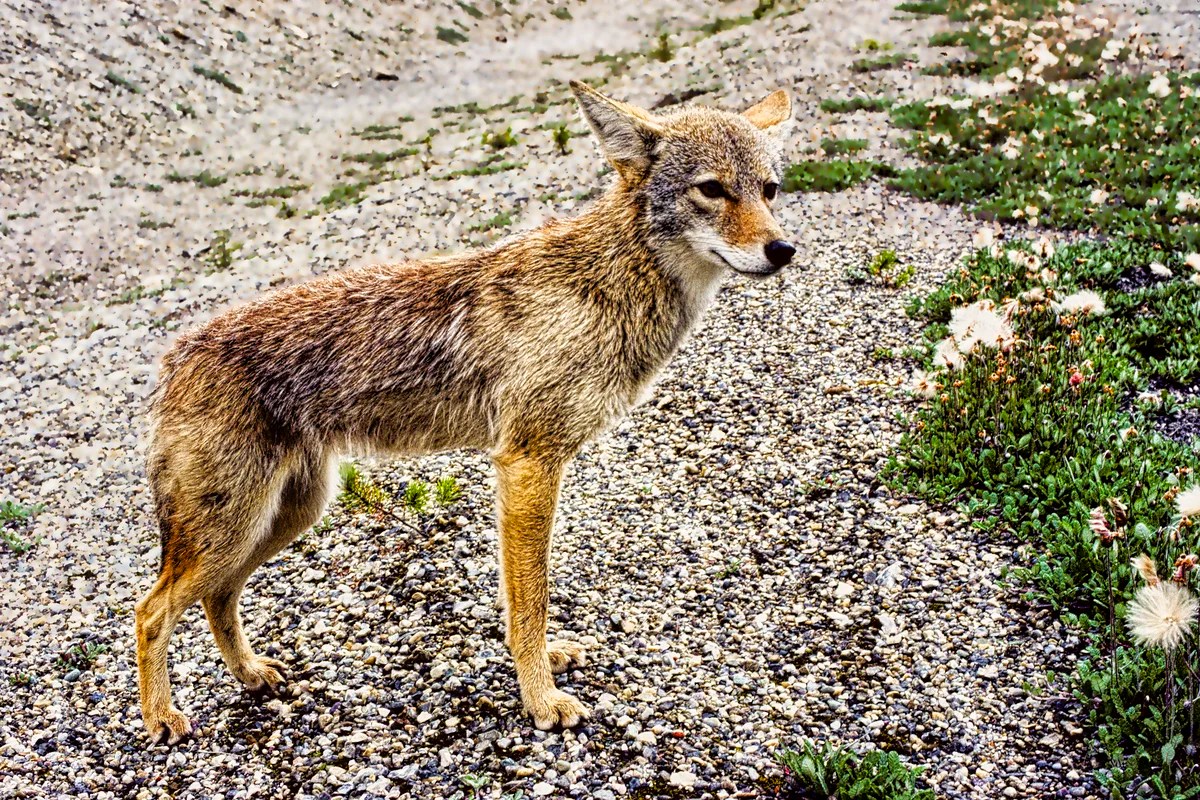
We saw this coyote along Highway 1A near Johnston Canyon. At first, I thought it was a dog walking on the road, but then I noticed no tail wagging. I was able to get fairly close (the photo was cropped), and the coyote just stood there posing for me. In all our ten years living in Alberta, this was the only time we saw a coyote in Banff NP.
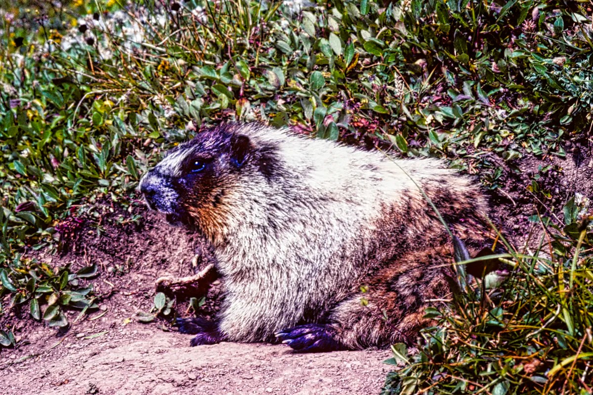
The animals most people want to see are Bighorn Sheep, Mountain Goats, Bears, Moose, Deer, and Wapiti. There are two other animals that we most identify with the Rocky Mountains. They can only be seen by hiking. The marmot lives in ground burrows or rock slides near timberline. They are often seen getting a suntan. The big-eared, tiny pika lives in sub-alpine or alpine rock slides like the Rockpile at Lake Moraine or Mount Edith Cavell in Jasper NP.
What birds can I see in the Rockies?
Birders can enjoy 329 species in the Banff region. Use the Cornell Univ. eBird website to find out what has been seen and where. There are two birds you will have no problem seeing as they come close to you.
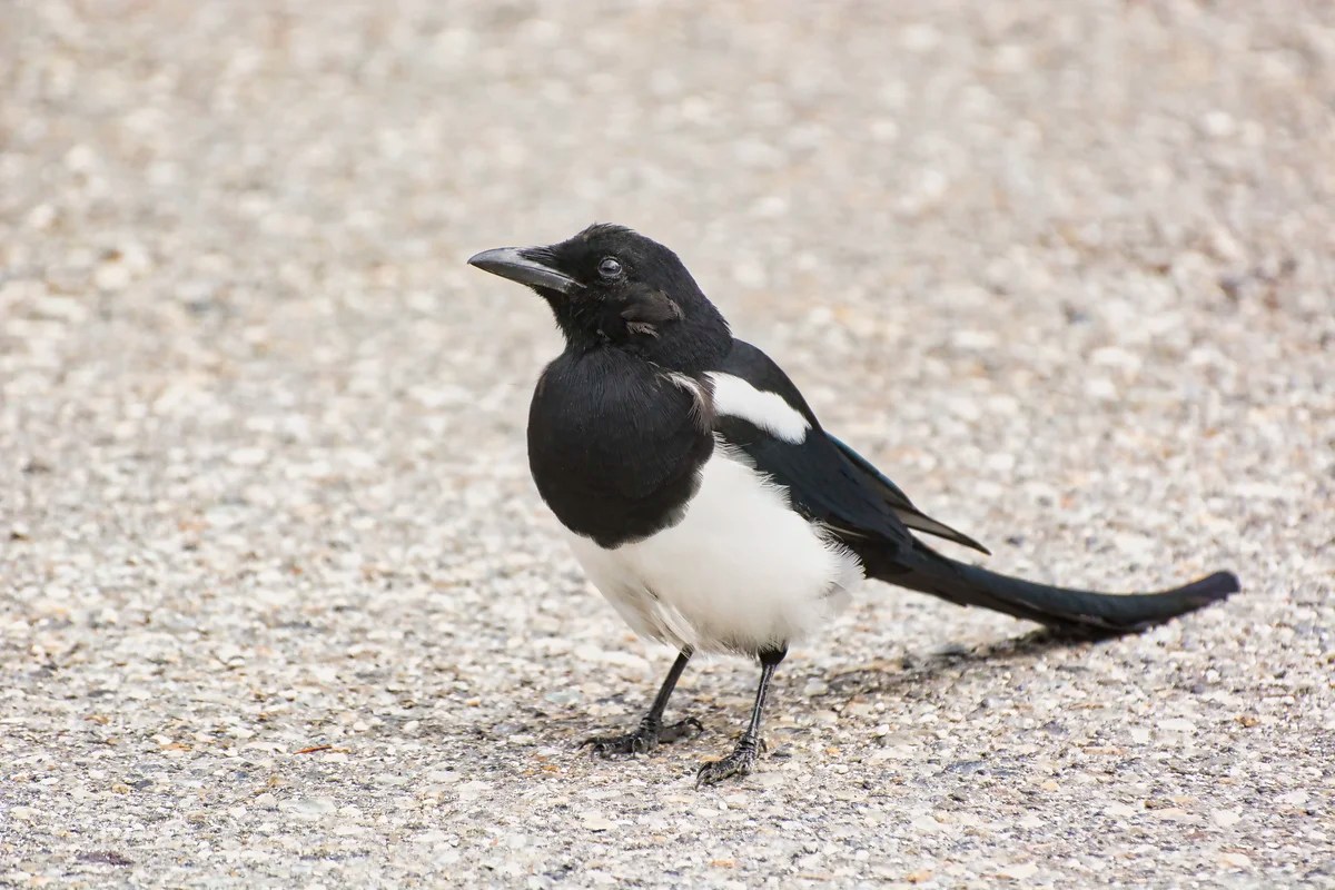
The Black-billed Magpie (corvid family) is found in western North America. While it is primarily black and white, it becomes spectacular when it reveals iridescent blue or blue-green.
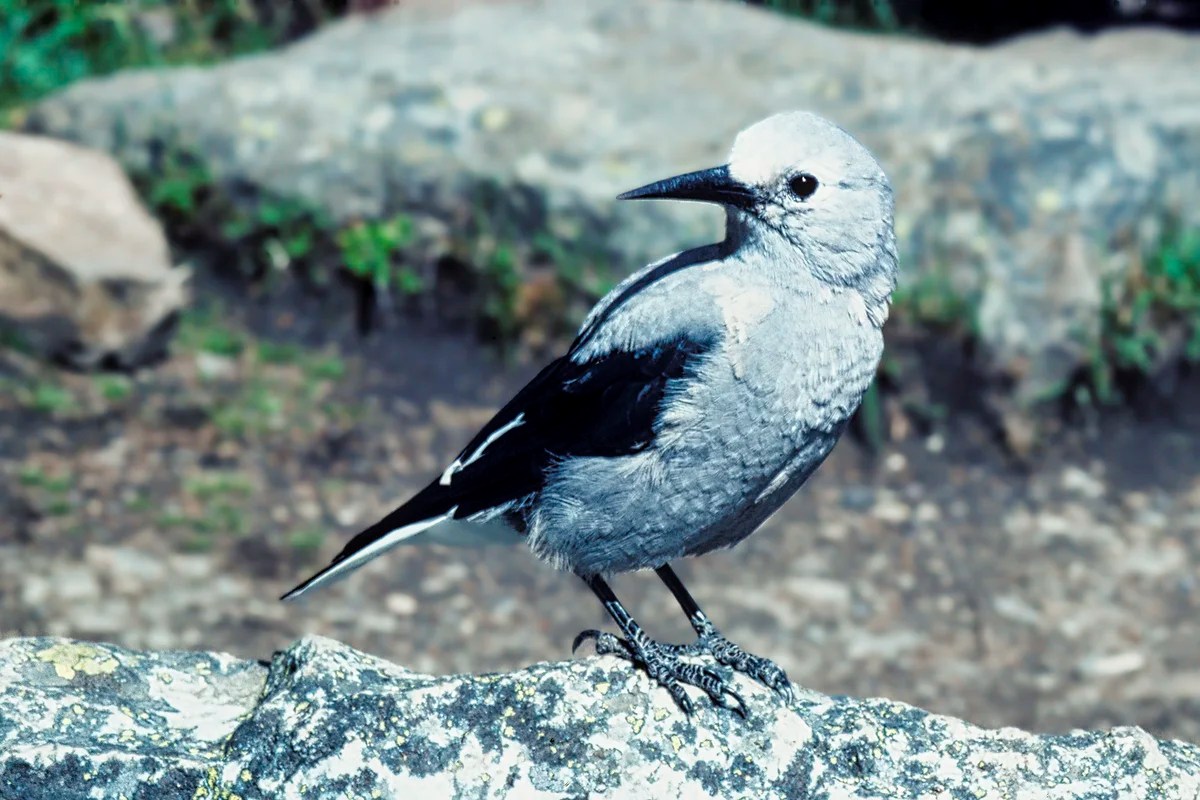
Clarke’s Nutcracker (corvid family) is related to the jays. It is found in coniferous forests at high elevations since it feeds on pine cone seeds.
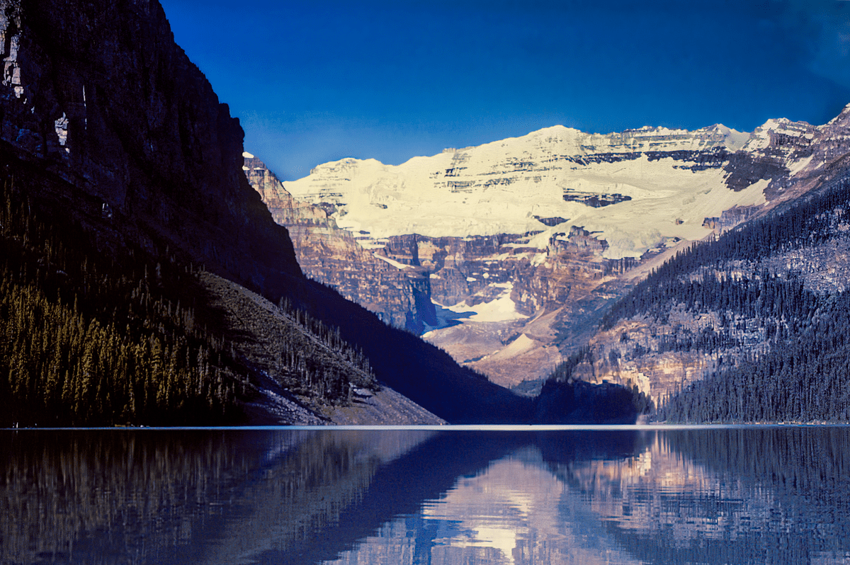
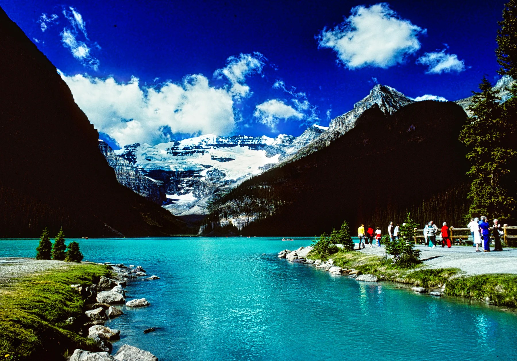
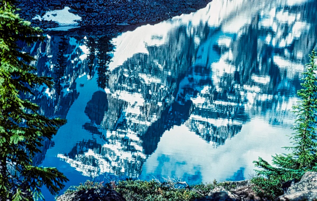
Lake Louise
Lake Louise is the most overcrowded site in the Rockies. For us, it has been spoiled, and you even have to pay $40 to park there! Yes, it’s still worth seeing, but check out the shuttle bus alternatives below. Imagine, the first road to Lake Louise was only built in 1920. Nowadays, in order to find parking in the limited space, come early in the morning. Alternatively, you could come late in the day, but the mountains face east and may be in the shade.
But, in the spring, the days are very long and sunset is at 22:00 hrs. When my in-laws came from Montreal on their first visit (we were working in Alberta), my wife had us doing a morning hike, an afternoon hike and, why not, an evening hike. It is still light after 22:00 hrs! Try to tell your children why they should go to sleep even though it is still light outside!

What to Do in Lake Louise
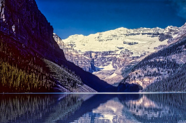
Lake Louise and Mt Victoria
Chateau Lake Louise sits atop the terminal moraine of Victoria Glacier, which today has receded back to the precipice of Mt Victoria in the photo above.

Chateau Lake Louise is a popular venue for weddings. We enjoyed the harp player and the well-dressed guests. We participated in their photo shoot.

But best of all, we loved the wedding dog dressed in a tux! The cuddly-looking Chow Chow was very well-behaved. It is one of the oldest dog breeds in the world, dating back to ancient East Asia.
Lake Louise Hiking Trails
You know this area has the busiest hiking trails when they provide tea houses at the end. We have not gone here since Banff NP became over-touristy.
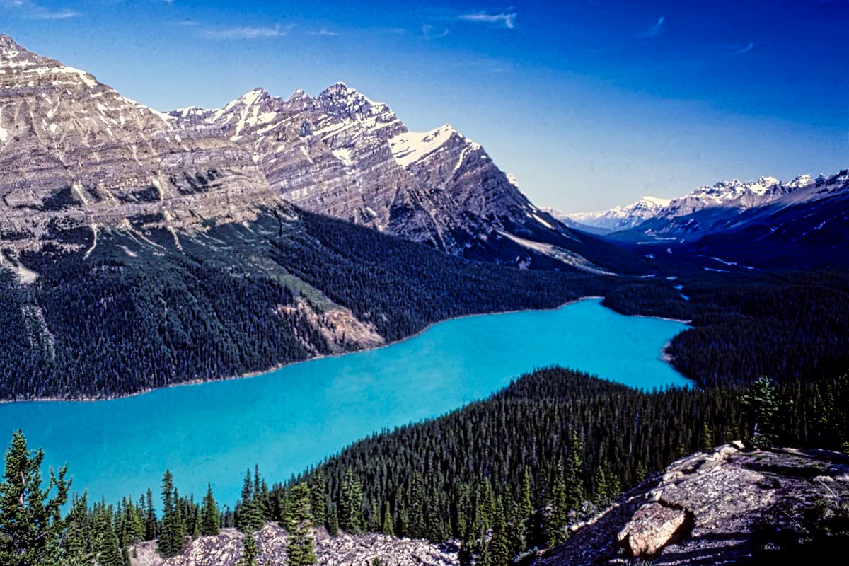
The glaciers give this lake its beautiful turquoise colour. But what causes the blue-green colour? You’ll have to read the itinerary, Icefields Parkway – Do Not Miss the Best Road Trip in Canada.
Some of the best views are:
- Near the tiny bridge at Chateau Lake Louise for the view above. The lake outlet lets you minimize the number of tourists in the photo.
- Lakeside Walk is flat and accessible if you cannot hike, and is very pleasant since the further away you walk, the fewer tourists. It actually is the first part of the Plain of Six Glaciers Trail
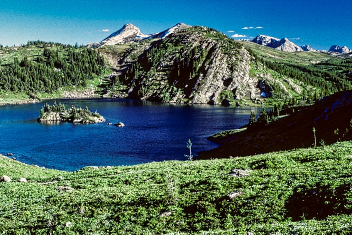
- Lake Agnes (and the Beehives) Trail (map)
3.4 km 2 hrs OW; gain 367 m (1205 ft), elevation 2099 m (6885 ft); the Beehives are another 1-1.6 km further and uphill, offering great views of the Bow Valley - Plain of Six Glaciers Trail (map)
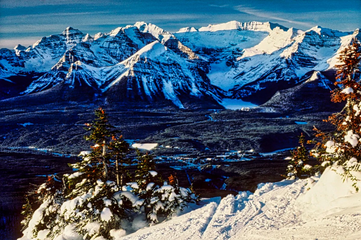
6.6 km 2 hrs OW; gain 670 m (2200 ft), elevation 2410 m (7900 ft) , offering great views of Mt Victoria and Victoria Glacier - Lake Louise Ski Hill for this spectacular aerial view below.
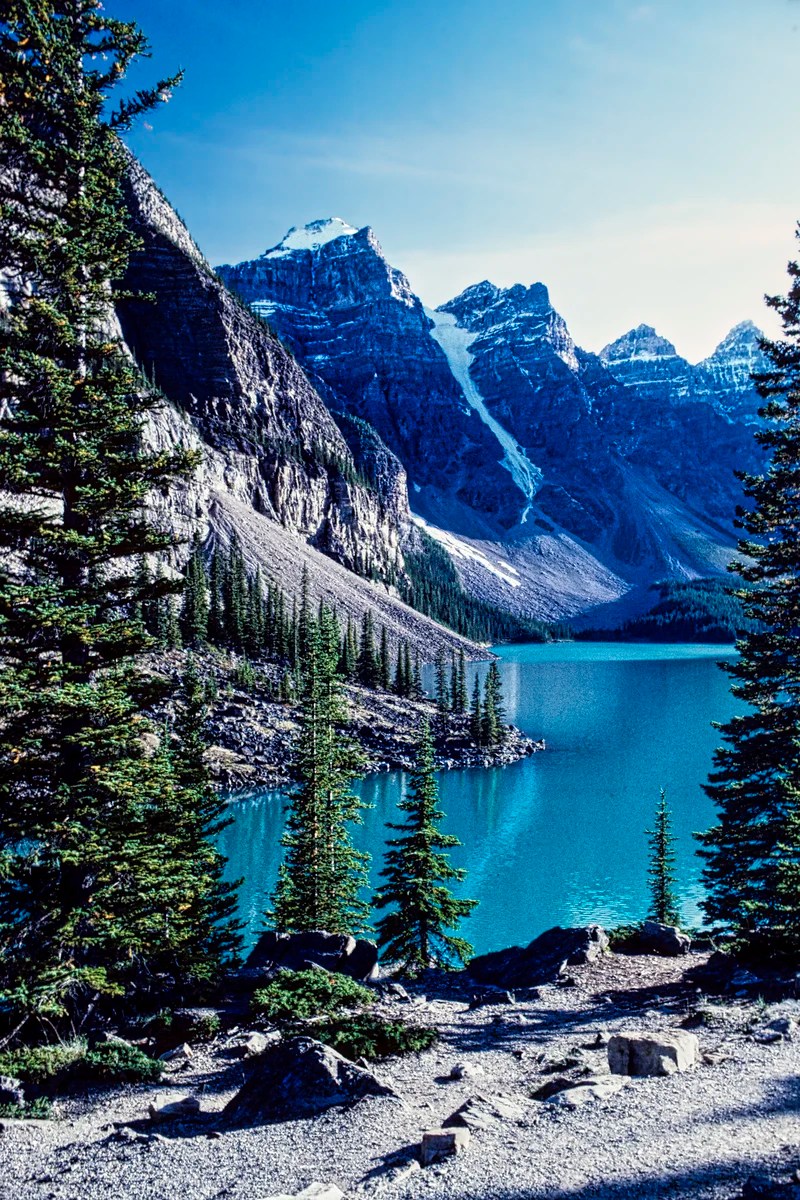
Moraine Lake
The Moraine Lake road forks off at the Lake Louise parking lot and ascends 14 km. You will pass beautiful vistas, but you can no longer drive to Moraine Lake. You must take the $8 shuttle. If you plan on doing the hikes, you need to check out how the return trip works.
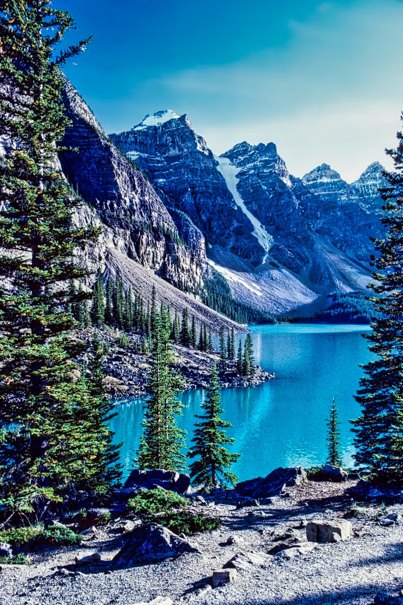
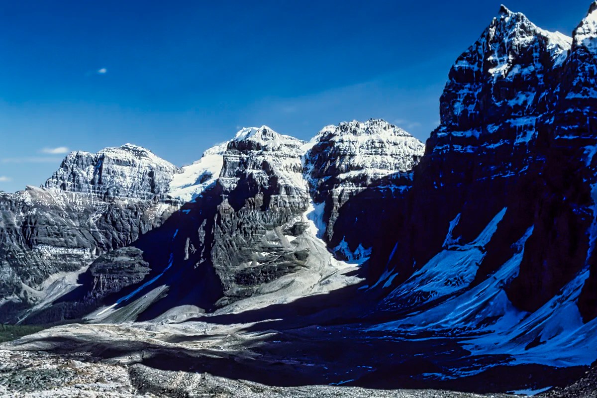
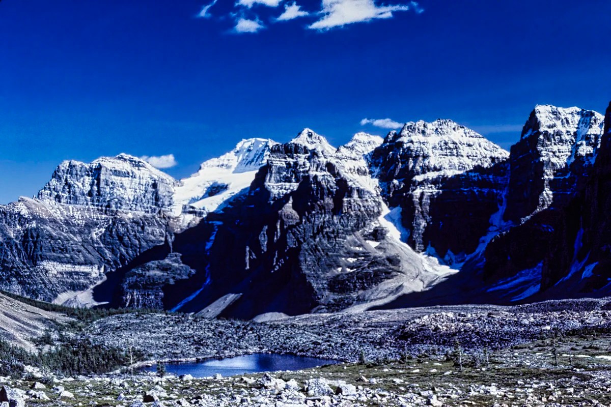
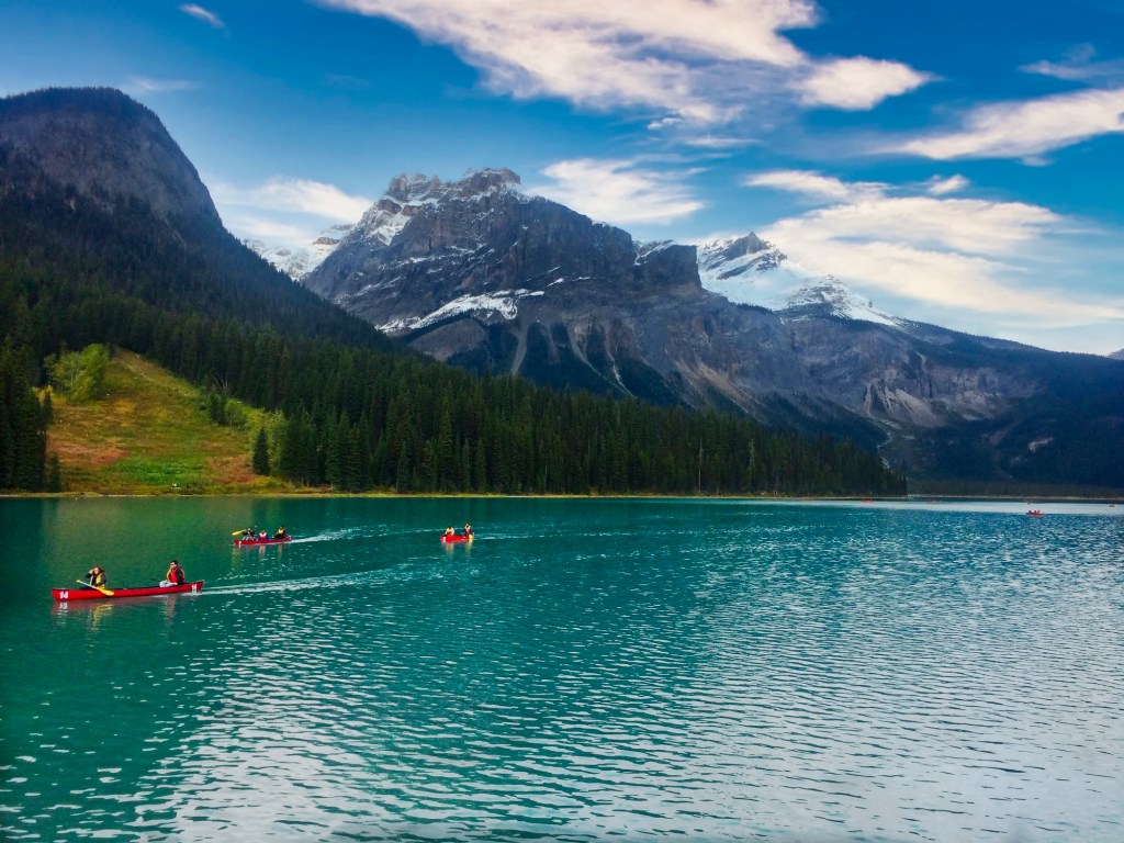
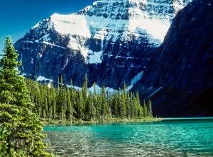
At an altitude of 1884 m (6181 ft) asl, you arrive at one of our top three lakes of the Rockies. Moraine Lake has a majesty about it with gorgeous green-blue water surrounded by ten towering, snowy Wenkchemna (Stoney Indian for “ten”) Peaks. Yes, it’s definitely one of the best views and our top three (Moraine, Emerald and Peyto) do not include Lake Louise! Chacun à son goût!
Moraine Lake Hiking Trails
Due to the frigid winter of high-altitude mountains, the lake is frozen and the road is closed. So, the best time to visit is June to September, possibly October.
Rock Pile Trail

The limited view of Moraine Lake next to the parking lot just does not cut it. Instead, you must walk on the east side of the parking lot and go on the uphill but very short Rock Pile Hike to see these special views. If you come at the end of the day, the peaks and the lake will be in the shade since they face east. This is especially true in late summer.
When we first “discovered” this “trail” decades ago, there were no markings, barriers or stone stairs. It was just a scramble up the rock pile. There were very few people!

Now this short walk comes with lots of interpretive signs and lots of tourists. Would you have stopped at this exhibit? The rock you are about to walk over is a fossilized beach, proof that this area was once at sea level.
Glaciers are nature’s bulldozers, and moraine is the gravel they push ahead. To understand the power of glaciers, consider the vast expanse of the flat Prairies (also known as the Midwest in the USA). This was the result of a massive and up to two-mile-thick icefield that bulldozed most of North America and gouged out the Great Lakes.
The early explorer Wilcox thought the rock pile was a terminal moraine. Hence the name Moraine Lake — but that is a misnomer as it is not a moraine. It is actually a rockslide from the Tower of Babel directly overhead that dammed the lake.
The water is turquoise because it comes from the glaciers surrounding it. What causes the blue-green colour? For the explanation, read the Icefields Parkway – Do Not Miss the Best Road Trip in Canada.
Be on the lookout for the tiny pika (rabbit family) with cute, round ears that hang out on the rocks — or at least used to. Now it is a great place for photographing wedding bunnies!
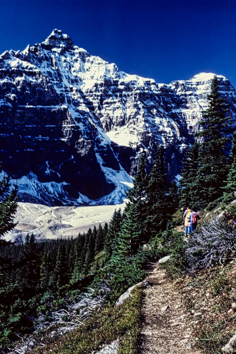
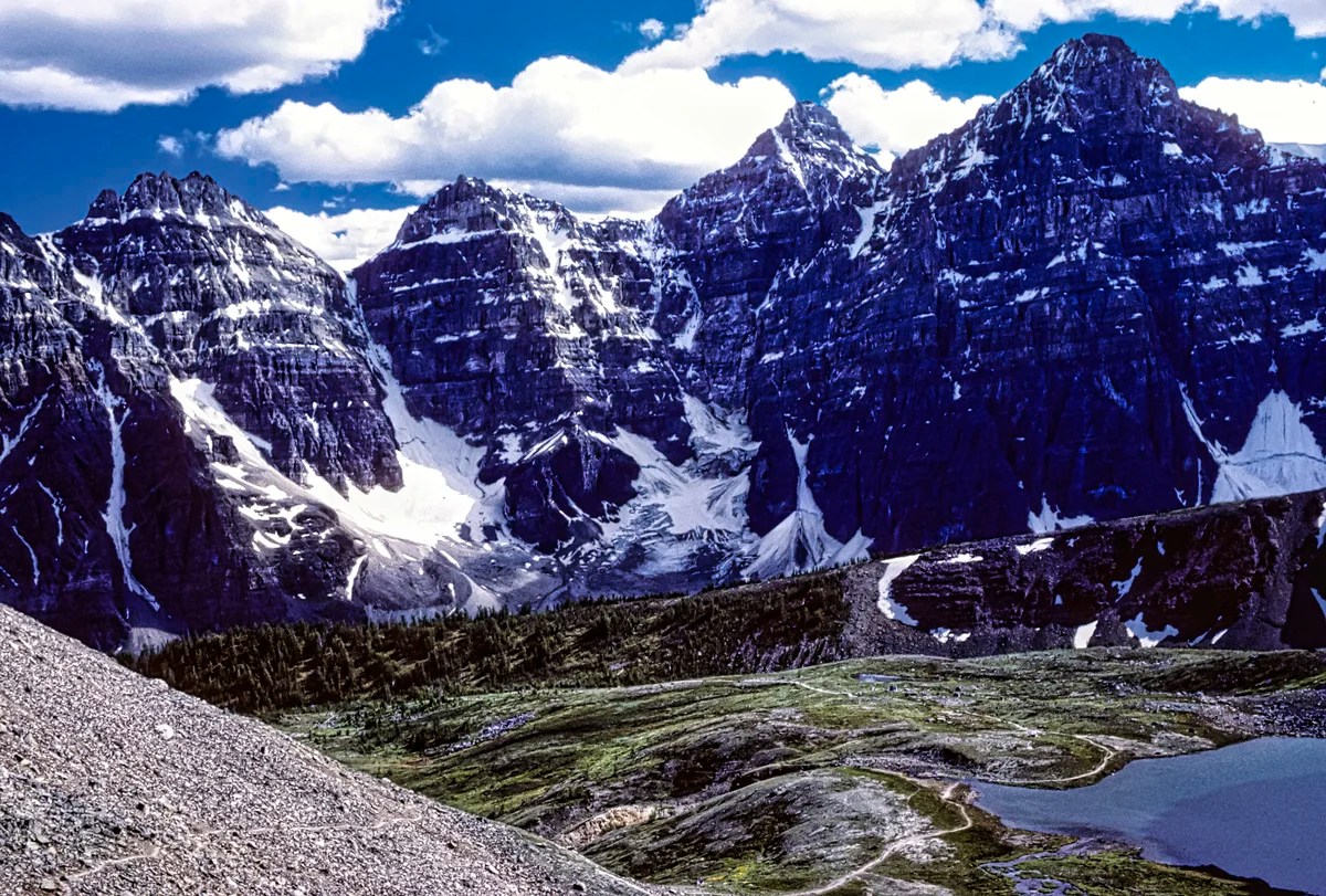
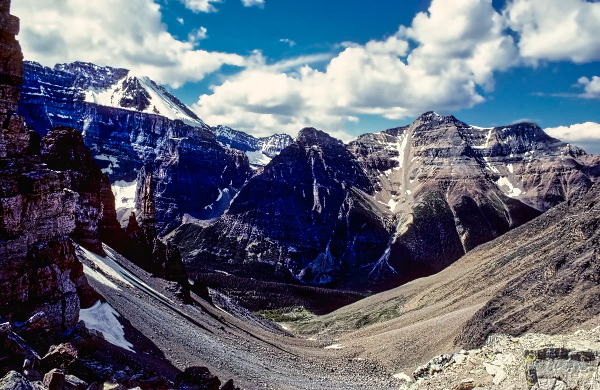
Larch Valley Trails
Some of the best hikes in the Rockies depart from the right side of the very small Moraine Lake parking lot. The first 40 minutes of endless switchbacks through forests are the same for all the trails.
After a steep climb of 457 m (1500 ft) in 2.4 km, you reach the trail junction. Eiffel Lake is to the left, and Larch Valley-Sentinel Pass is to the right.
Eiffel Lake Wenkchemna Pass Trail
The Eiffel Lake Trail offers unparalleled views of the Wenkchemna Peaks. This may be your destination, or you can continue on to the Wenkchemna Pass (5.8 km).
One of the best things about the Eiffel Lake hike is that you will enjoy virtually non-stop views of the Valley of the Ten Peaks the entire way with fewer people.
- Eiffel Lake Trail:
5.6 km 2-3 hrs OW; gain 365 m (1200 ft), elevation 2255 m (7400 ft); - Wenkchemna Pass Trail:
9.7 km; gain 724 m (900 ft), elevation 2600 m (8530 ft);
Larch Valley – Sentinel Pass Trail
From the trail junction, most hikers take the trail on the right to Larch Valley and Sentinel Pass. The trail is especially beautiful on a sunny day in the fall when the larch trees turn golden. But Larch is a coniferous (“evergreen”) tree, the only one that drops its needles.

- Larch Valley Trail:
2.4 km 0:45 hrs OW 2.5 hrs RT; gain 275 m (900 ft), elevation 2270 m (7450 ft); - Sentinel Pass Trail:
5.8 km 3 hrs OW; gain 720 m (260 ft), elevation 2611 m (8566 ft);
Sentinel Pass Views
At the end, you may feel like quitting, and you still have to hike up steep switchbacks (hope you are in shape) to one of the most dramatic views. It is also the highest hiking pass in the Canadian Rockies at 2611 m (8566 ft) asl. The pass is a saddle with extremely steep slopes and clear views on both sides. These photos show the views of the Larch Valley side, followed by the Paradise Valley side.
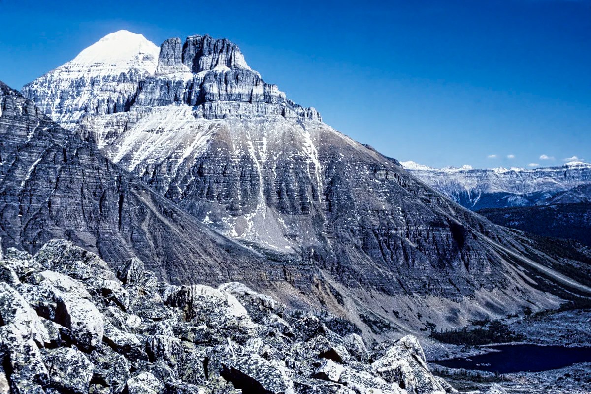
The view further to the left is of the fairly high Mount Temple, 3544 m (11,627 ft) asl. It was named after Sir Richard Temple, Governor of Bombay from 1877 to 1880. It comprises 550-million-year-old quartzite and limestone, which means this rock was originally below the ocean.
It’s a long descent over talus slopes to Paradise Valley. You can exit via this route to the Moraine Lake Road, but you need transportation to get back to your car.
What to Read about the Rockies
The two books should be available in any bookstore in Alberta and are on Amazon.
- Parkways of the Canadian Rockies (Brian Patton 2008, CAD 24.47) is like bringing a naturalist along to interpret what you should be seeing.
- Canadian Rockies Trail Guide (Brian Patton & Bart Robinson 2022, CAD 29.95) is the best hiking book we have seen or used in all our travels around the world.
- Banff NP Visitor Guide (Parks Canada)
- Banff NP Day Hikes Guide & Map (Parks Canada)
- Visiting Lake Louise and Moraine Lake (Parks Canada website)
- Travel Tips page provides advice that applies to any trip (you can access it via the Terra Encounters menu as well).
Where to Stay and Eat in Banff NP
Banff has excellent supermarkets, cafés, and restaurants. Some are listed on the Rocky Mountain Itinerary Map. We are not going to recommend any. Search for a place on Google Maps, and it gives a Google rating based on the opinions of all people, not just tourists. Any rating over 4.4 out of 5 is excellent.
Banff has excellent campgrounds:
a) Two Jack Lake (tent site $24 to $30);
b) Tunnel Mountain Campground (tent site $33) is open all year long, and we have camped there on ski holidays.
The problem in the summer is that they are reservable, and it can be hard to get in at the last minute. Avoid weekends and statutory holidays. There is an overflow area, but it is better suited to vans and trailers. WE used to come here on Thursday night, then get a campsite the next morning.
Hotels are very hard to come by and very expensive during high season, which is most of the year, due to the excellent skiing. When we last checked, all rooms in the summer cost more than CAD 428, except for hostels, which were CAD 125 for a dorm bed. Plus, you have to book well in advance. Summer now extends into September! The rates go “down” to CAD 260 in late September. We were shocked on two return trips in late September at how busy it still was!
Banff is a good base for the places described in this post, but it is not centrally located for the rest of the itinerary; i.e. it requires more commuting time. On the other hand, Banff has better facilities, restaurants, and a supermarket. We would buy all our non-perishable food in Edmonton (or Calgary). Don’t forget to fill up on gas before hitting the more expensive Rockies. We did have a van and a plug-in cooler.
Our favourite places to set up base are the Lake Louise and Waterfowl Lakes Campgrounds. This is because they are much better locations to commute from for the two must-see drives — the Icefields Parkway – Do Not Miss the Best Road Trip in Canada, and Yoho National Park- you will really enjoy these 3 Awesome Sights.
Where to Go in Banff NP
To save you time, we have designed a Rocky Mountain Itinerary Map with estimated distances and driving times. Some layers, such as Accommodation and Food, are initially hidden to keep the focus on the sights. We have included additional points of interest not described in these posts.
This may give the false impression that you only need three days to see the Rockies. This is possible if all you want to do is drive. We would encourage you to stop at all viewpoints and go hiking, especially if you have time and the Parkways of the Canadian Rockies book above.
If you plan to go hiking, taking tours, visiting interpretive centres and programs, then you will need far more days. Banff NP (6,641 sq km) is about the size of the state of Delaware and larger than the province of Prince Edward Island. Then there are three other contiguous parks. Three days is not enough to see the quintessential Rockies.
Parks Canada Passes
The day pass is $11 per adult or $22 per family/group. The annual Discovery Pass is $75.25 per adult or $151.25 per family/group in one vehicle. There are no multi-day passes. There are discounts for children and seniors. The pass grants you access to all 80 Parks Canada sites. The day of departure is included without charge. You simply have to be out of the park by 16:00 hrs.
Parks Canada Shuttles
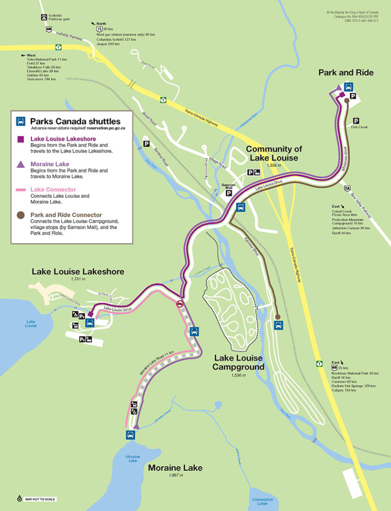
The Parks Canada Shuttle runs every 20 minutes. from Lake Louise to Moraine Lake, and costs adults $8, seniors $4. Parking at the Lake Louise/Chateau parking lot has zoomed up to $37. Pay parking is required from May 16 to October 13 between 03:00 and 19:00 hrs. There are shuttle buses from Lake Louise village to Chateau Lake Louise, which you can check out. There are also buses from Canmore and Banff (town) to Lake Louise.
For more information on prices, routes, schedules and reservations – check out the Banff NP Public Transit Guide and the Visiting Lake Louise and Moraine Lake (Parks Canada) website.
Detailed Itinerary Guides
Here are some itineraries we have triaged from living in Alberta for a long time. See the portal post for general trips and advice.
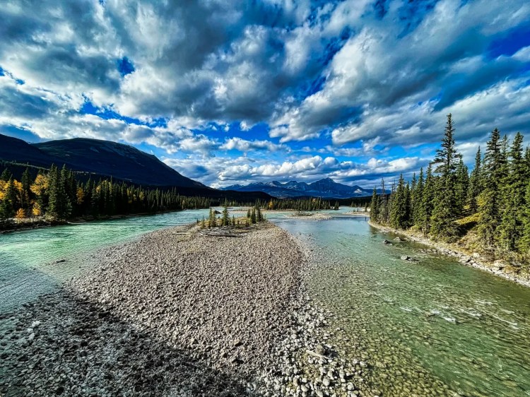
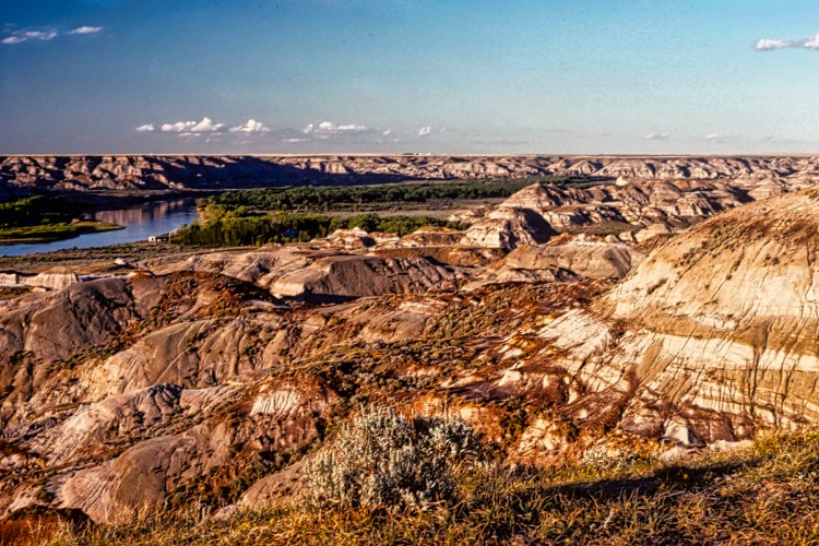
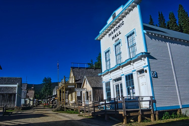
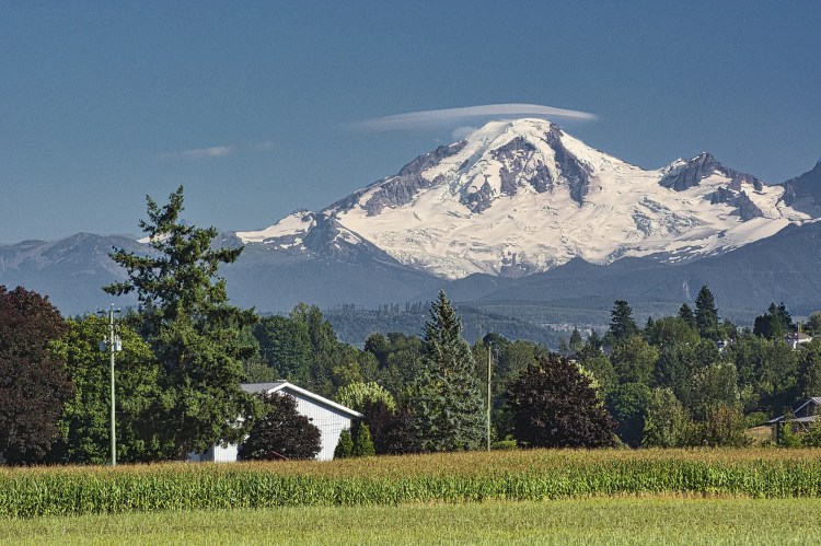
Other Places to Add to Your Itinerary
Here are nearby places you might want to explore:
Final Comments on this Itinerary
This is an action-packed itinerary where you can see the sights close to Banff, the town. Do not be disappointed if you cannot get a shuttle to see Lake Louise. It is famous because of name recognition, but it is not the ultimate destination of the Rockies. There are many equally or more beautiful places.
Subscribe
Get travel tips and advice delivered directly to your inbox. The best part is that it is free.
What things fascinate you? How long is your trip? What questions do you have? If you have been to the Rockies, share your experiences with us.
Itinerary Maps & Resources
Rocky Mountain Itinerary Map — our custom map with points of interest
Banff NP Visitor Guide (Parks Canada)
Banff NP Day Hikes Guide & Map (Parks Canada)
Visiting Lake Louise and Moraine Lake (Parks Canada website)
Google Maps Ratings
Google Maps provides a rating from 0 to 5 for all sights, hotels and restaurants (but not cities). All of our recommendations are appended with the rating (prefixed with a G) from Google Maps. As it is based on feedback from tourists and locals, it is much more reliable than travel booking websites. We consider a score of 4 to 4.39 to be Very Good; 4.4 to 5 to be Excellent.
Other Planning Information
We have compiled additional tips and advice. Topics include Rocky Mountains Itineraries, Parks Passes, Travel by Car, Best Time to Visit the Rockies, Other Places to Add to Your Itinerary, and Canada FAQ. You can read these topics in the Ravishing Rockies Portal post.

Leave a comment