
Why Drive from Horn Head to Ramelton?
Enjoy dramatic hikes and spectacular vistas at Horn Head. Feast on delicious ice cream and cappuccinos at the golden sand Marble Hill Bay Beach. Delight in beautiful views of Ballymastocker Beach. This day trip is a series of inland roads with side trips to coastal cliffs, arches and beaches.

Read on to find out how to make the most of your time — decide which places should you visit, see which photos fascinate you, as well as get links to our custom Google maps and itinerary planning information.
Author & Photographer: George Mitchell

Our content and advice are derived from our personal experience and knowledge, gained from living in Europe for seven years and studying its art and architecture. Our recommendations are not influenced by affiliate links – we do not have any. Ireland is one of our favourite destinations.
All of our recommendations are top-rated by Google Maps, which is based on the opinions of everyone, not just tourists. Each place recommended in our posts and our Ireland North Map is appended with a Google Maps Rating (G0 to G5).
Highway N56
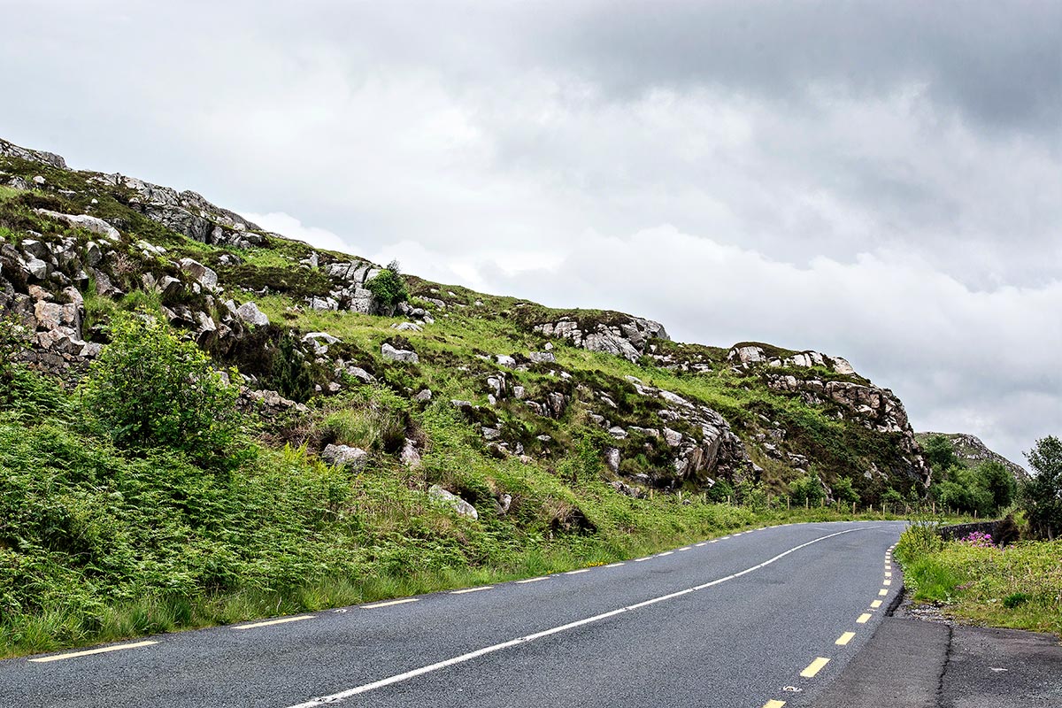
Drive north of Ramelton or Letterkenny on Highway N56 through the karst scenery with rock-strewn outcrops shown above. It is similar to the drive near Glenveagh NP due west of here. The rest of the drive to Dunfanaghy was not remarkable.
Horn Head
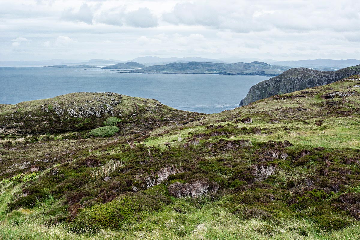
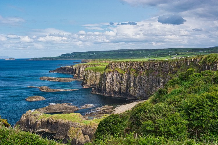
Horn Head (G4.9) is a highlight of this itinerary. BTW, you do not drive to the point called Horn Head on Google or Maps.me. You drive to Lookout Point Horn Head (G4.9) on Google Maps or Coastguard Hill on maps.me. The road dead-ends here. We got one of the last spots in the tiny parking area and walked up Coastguard Hill.
A light rain was falling. The hazy, blue-grey view above is what we actually saw. But despite the haze, we were still blown away by the magnificent vista. Horn Head is certainly the main must-see of the day.
In the photo above, I just added more light, contrast, and reduced the blue haze. The result was better than what I saw when I was there. As you can see, the plateau has plenty of space to walk around in order to take in the 360° view. This is one of the only views of a cliff because you are standing on top of it. So this is very different from the Cliffs of Moher or the Ring of Kerry
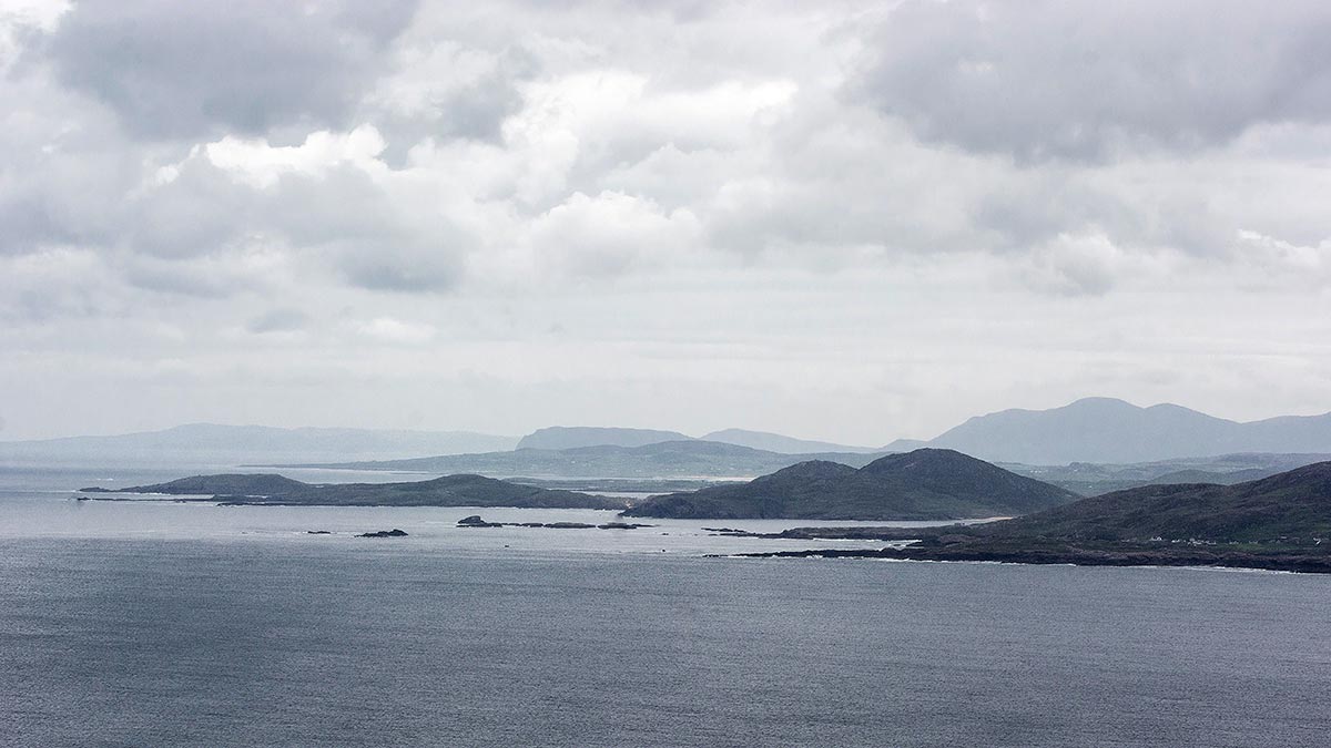
After you descend the hill, turn left and walk past the end of the pavement where the trail begins. Take the short right branch to see the hazy distant islands dotting the exceptional vista.
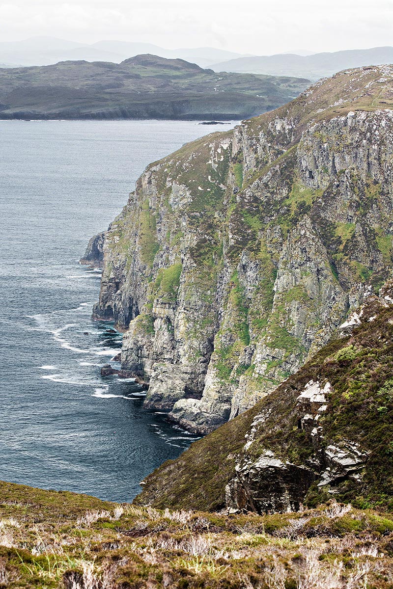
This trail leads to the second view of rugged cliffs. In this photo, I changed the white balance to get rid of the over-the-top blue cast.

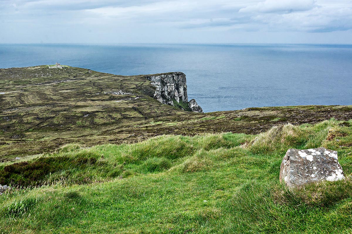
Return to the junction and head towards the watch tower and cliff you saw from Coastguard Hill. Horn Head is an internationally important colony for breeding seabirds, home to species like the European shag and the razorbill.
This trail brings you close to the cliff.

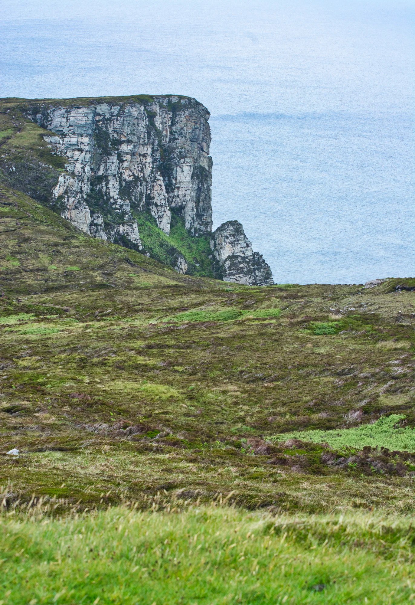
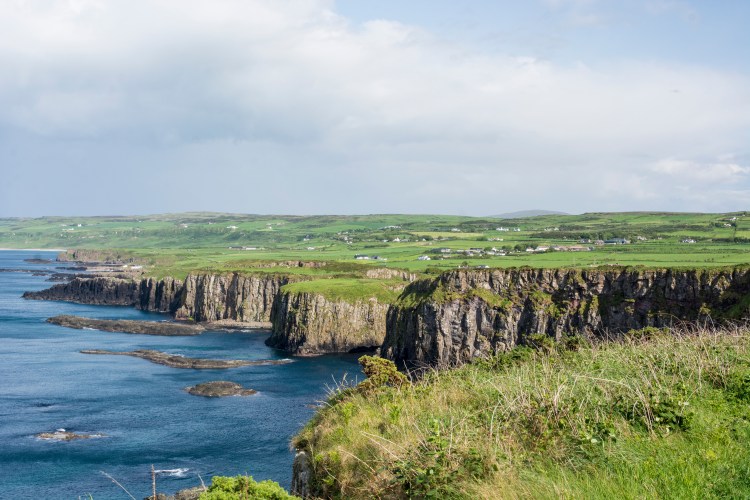
Drive south down the narrow road you came on, but turn left to the roadside Wild Atlantic Way Discovery Point (G4.8) with a wide parking space. Here you get a third view of the cliffs. The cliffs rise about 180 m (600 ft) out of the water, offering stunning views and a scenic drive.
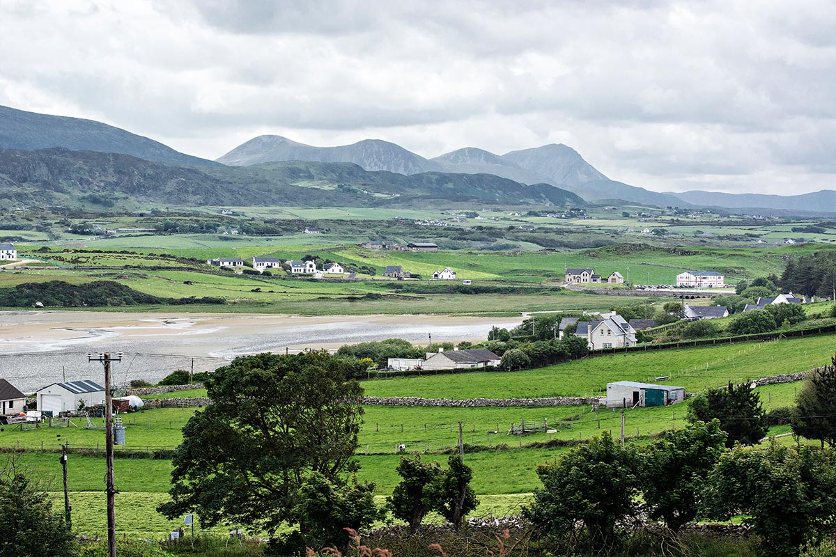
The road back to Dunfanaghy is quintessential Ireland with emerald green pastures crisscrossed by stone fences and framed by distant mountains.
Dunfanaghy
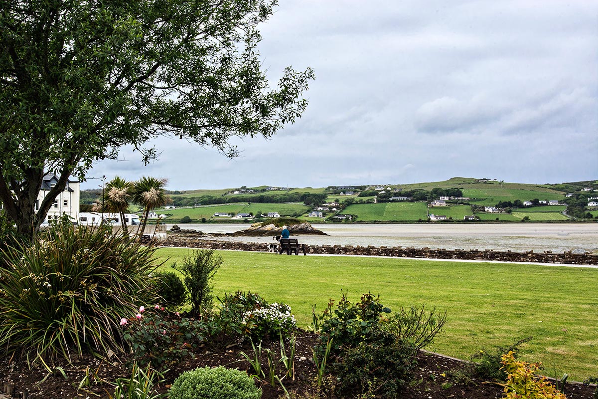
Dunfanaghy (the g in gh is silent) is the largest town on this route. In the town near the market (pubs and cafes) is a small park along the tidal flats. Nearby is Killahoey Beach, a wide expanse of sand.
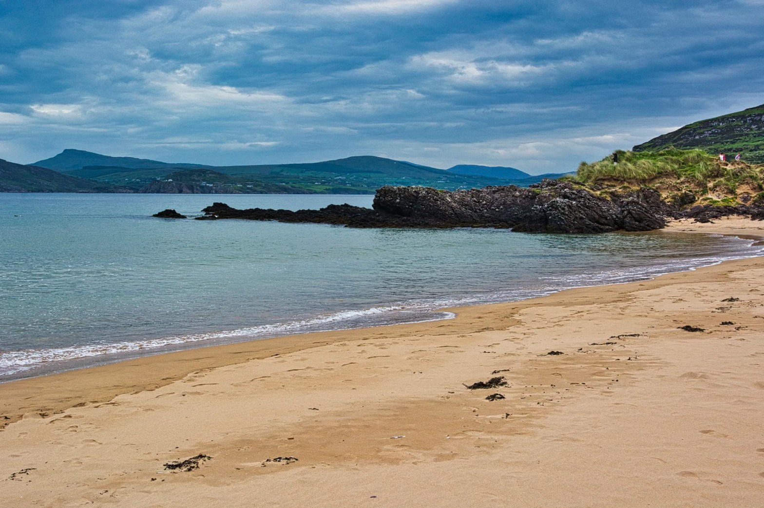
Marble Hill Bay

Marble Hill is a fair-sized beach with several photogenic elements of interest. Park along the road near The Shack Cafe. Imagine owning that huge house right off the beach.
Then there are the turquoise waters framed by rocky headlands. But the not-to-be-missed point of interest is The Shack (G4.7) with very good espresso choices and the best gelato (Mullins brand) we had in Ireland. It was €3.50 for two scoops. Don’t even bother going to the flavourless and more expensive Murphy’s in Killarney or elsewhere. You can also get better specialty ice cream in the supermarkets.
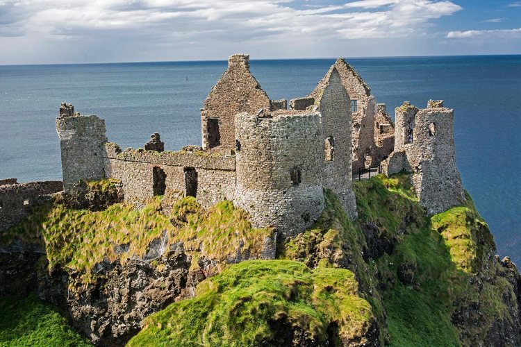
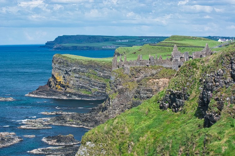
Doe Castle
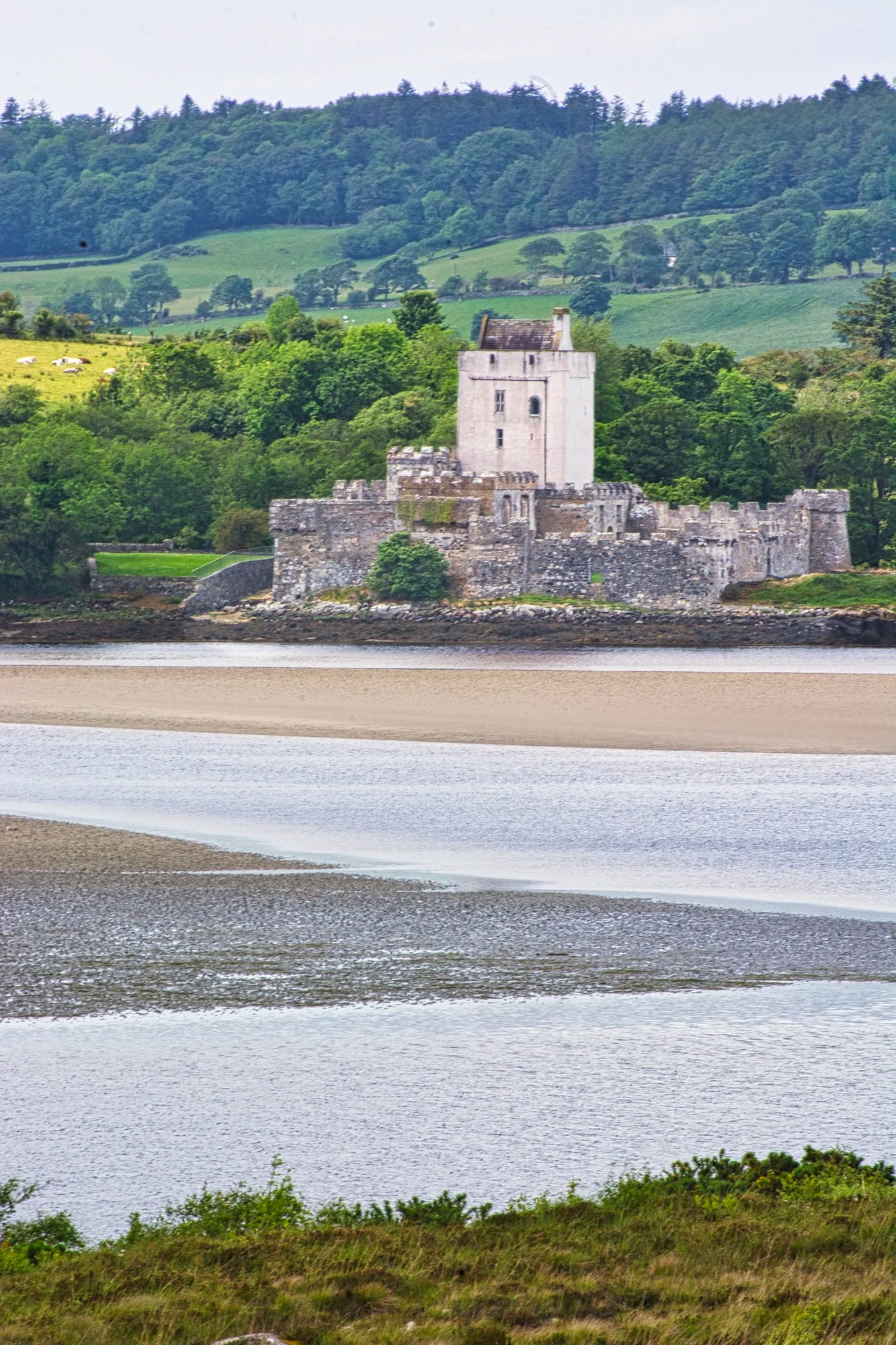
The Doe Castle tower (G4.6) is believed to have been built in the 1420s. Spanish survivors of the 1588 Spanish Armada fleet were sheltered at Doe by the McSweeney Clan chief.
This is also the scene of Ireland’s own Romeo and Judith. Judith was the daughter of the clan chief, Maolmhuire. She was in love with his nephew, Hugh McSweeney. Maolmhuire, suspecting a conspiracy by Hugh, swung his staff to kill his nephew. But Judith stepped in the way and stumbled into the well to her death.
Harry Blaney Bridge
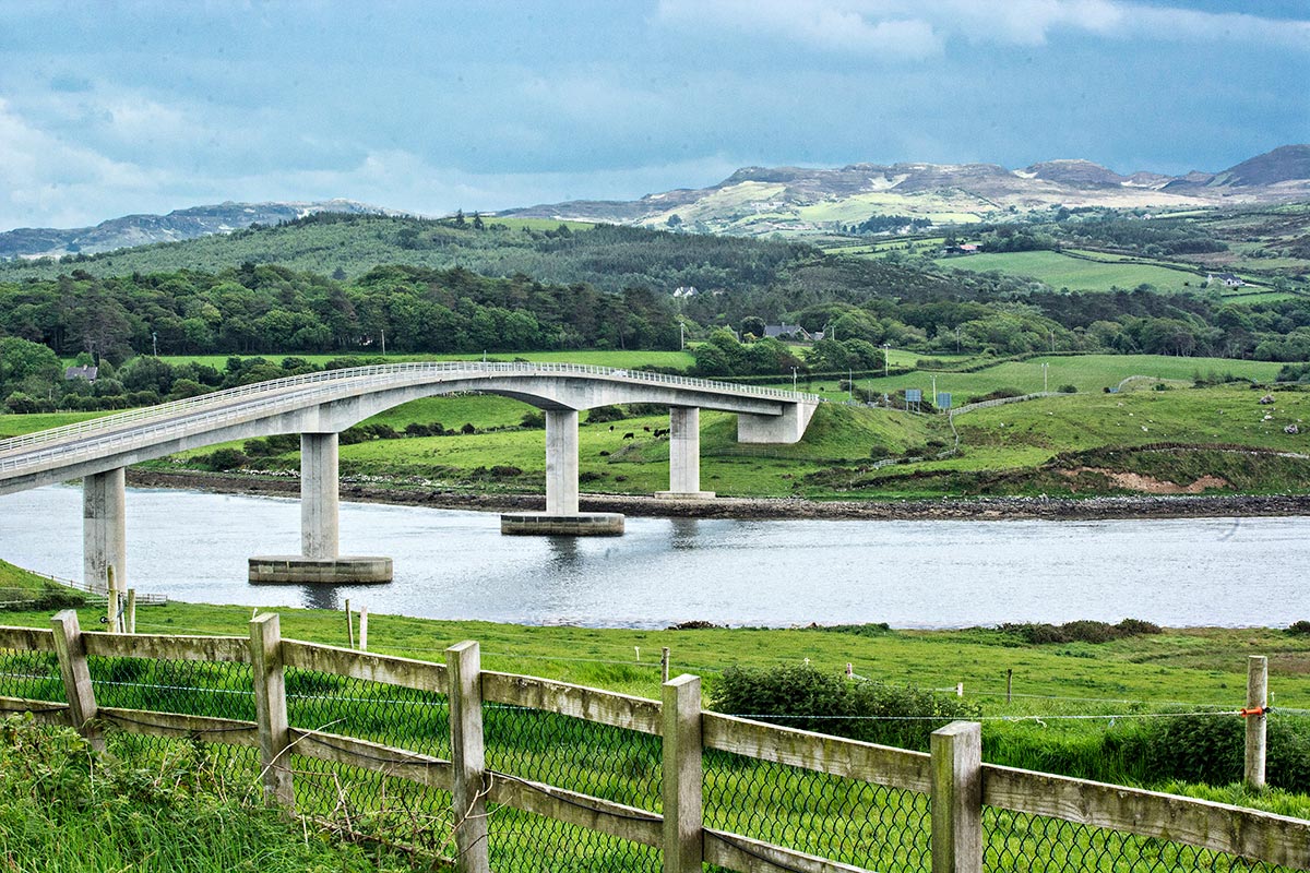
The Harry Blaney Bridge (2008) provides a route to the Fanad peninsula. There had been no ferry service since the 1960s. It is amazing that Harry Blaney got the government to pay €20 million for a low-traffic bridge.
Fanad Head
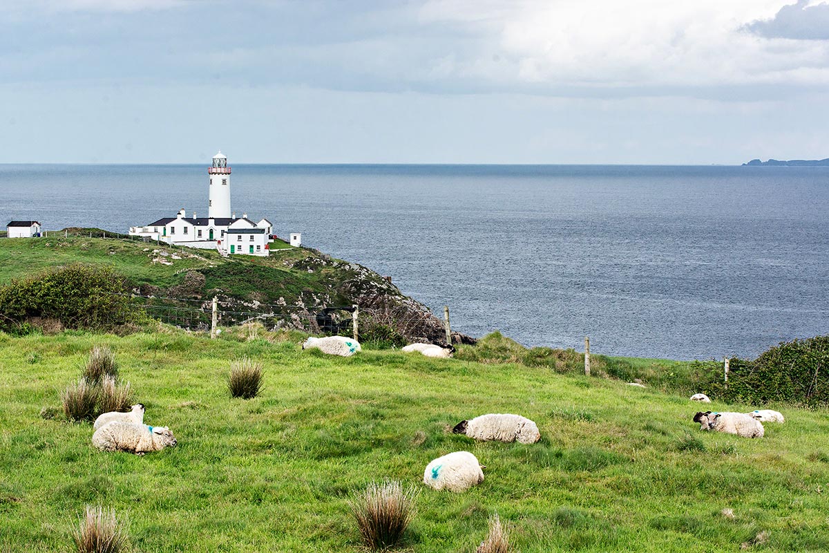
Fanad Head is renowned for its beautiful lighthouse, which was built in 1818 to prevent maritime disasters. The white Fanad lighthouse (G4.7) contrasts with the green grass. Personally, I found Fanad overrated. The tourist literature hyperbole reminds me of the Doers and Dreamers Guide back home, where everything is painted as great.
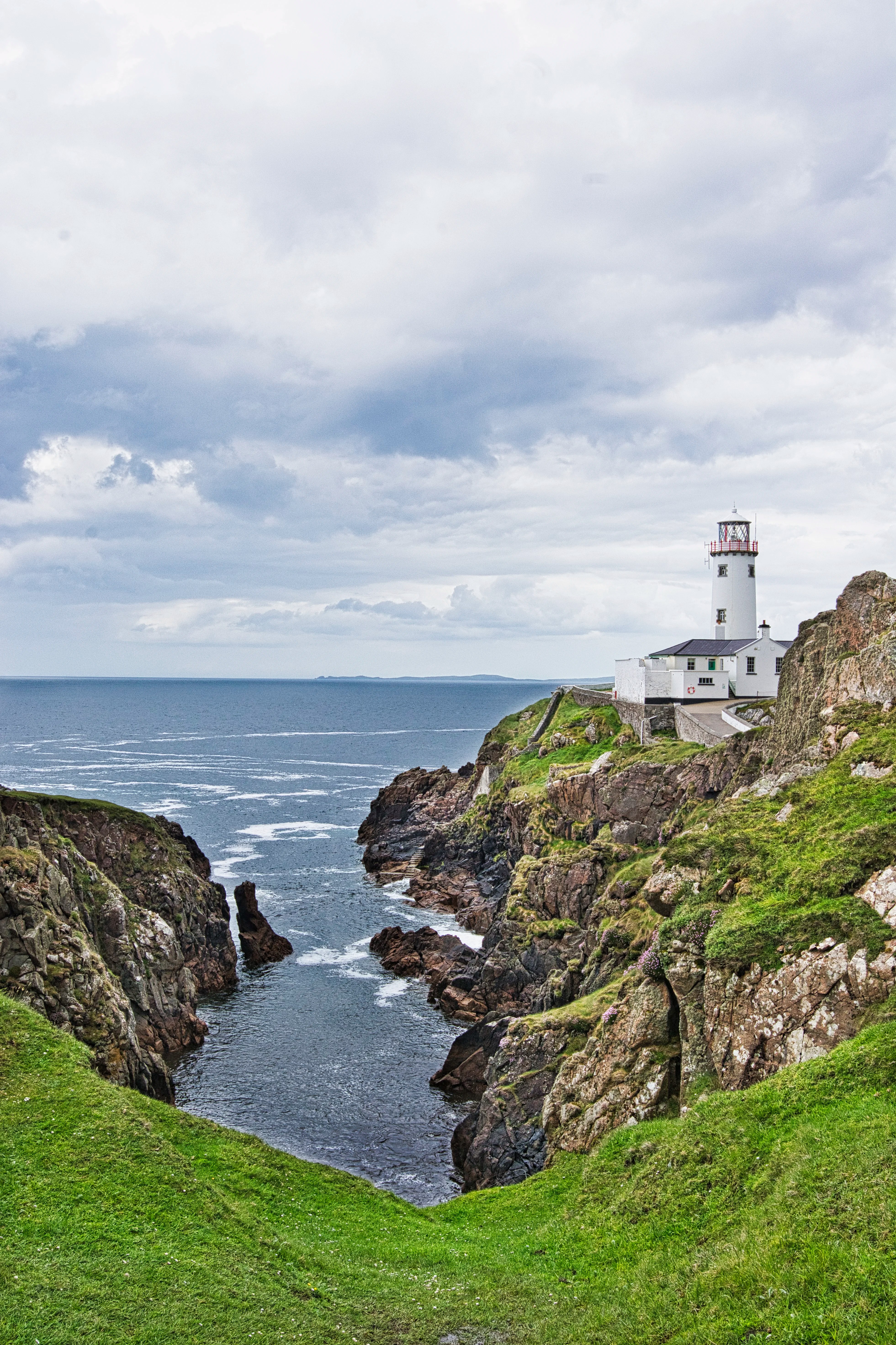
The Signature Discovery Point view (G5.0) from the parking lot was the best, with the Fanad lighthouse towering over a narrow rocky inlet .
Great Pollet Sea Arch
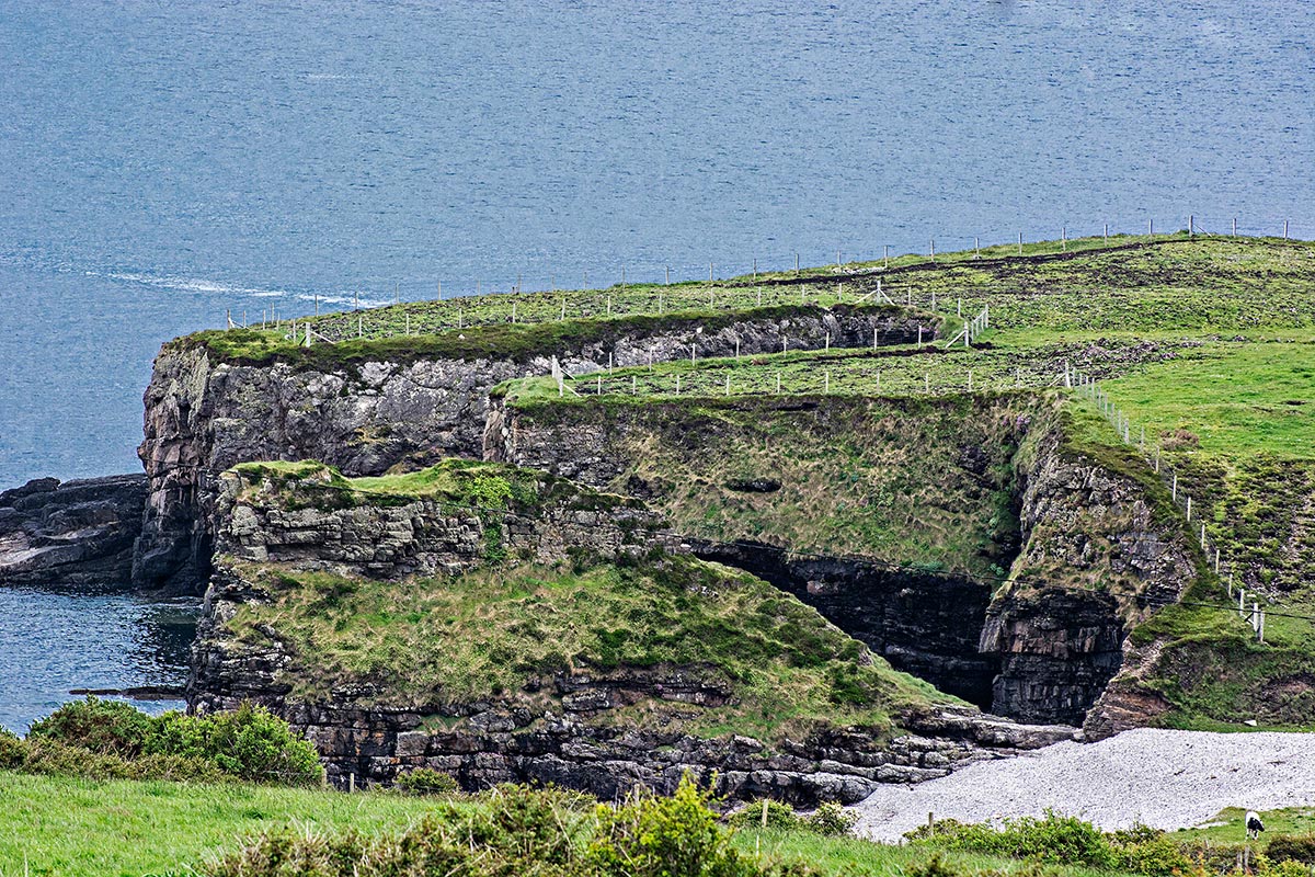
Great Pollet Sea Arch (G4.6) is on private land. The massive sea cave is viewable through the farm gate on the narrow country road. We assumed that the farm would not appreciate tourists, so we did not drive or walk down to see the actual arch on the other side of this headland. But you can see the huge cave cut right through to the sea.
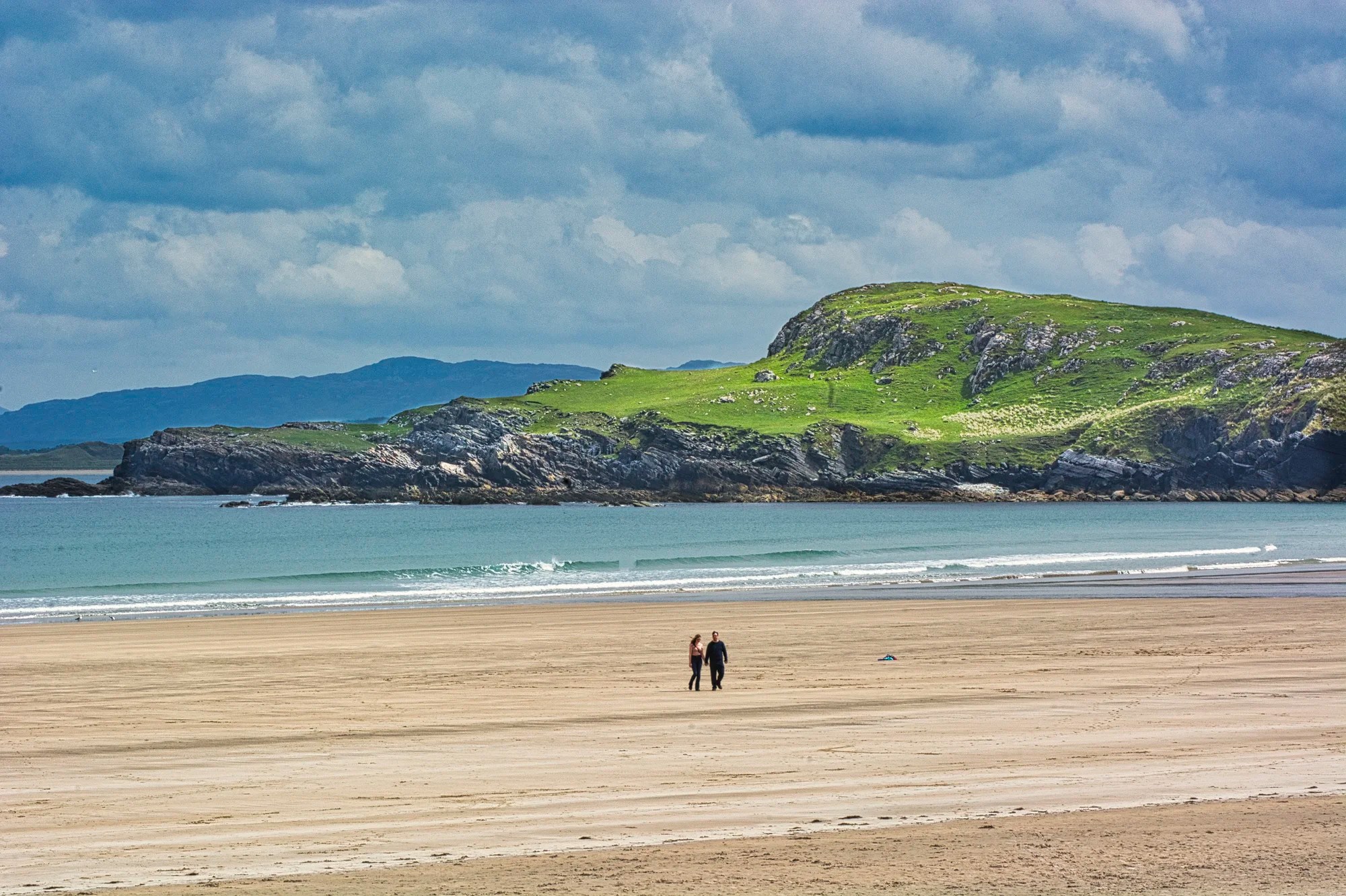
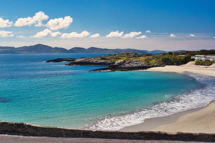
Ballymastocker Beach, Portsalon
Head south from Fanad on Highway R246 to the tiny town of Portsalon. As you pass the golf course, you see one of the nicest beaches of golden brown sand. But there is no access to this beach from the north end, where the town is located. Continue on the road to the south end for beautiful Ballymastocker Beach (G4.8) with a large bathroom facility.
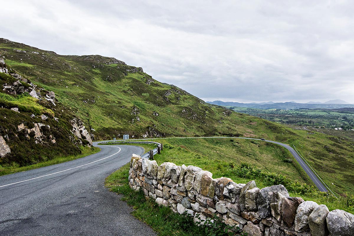
The road from Portsalon to a seaside fort 5 km away is certainly the second must-see of this tour. As the road switchbacks up the mountainside, there is a place on the left to pull over for a drop-dead view.
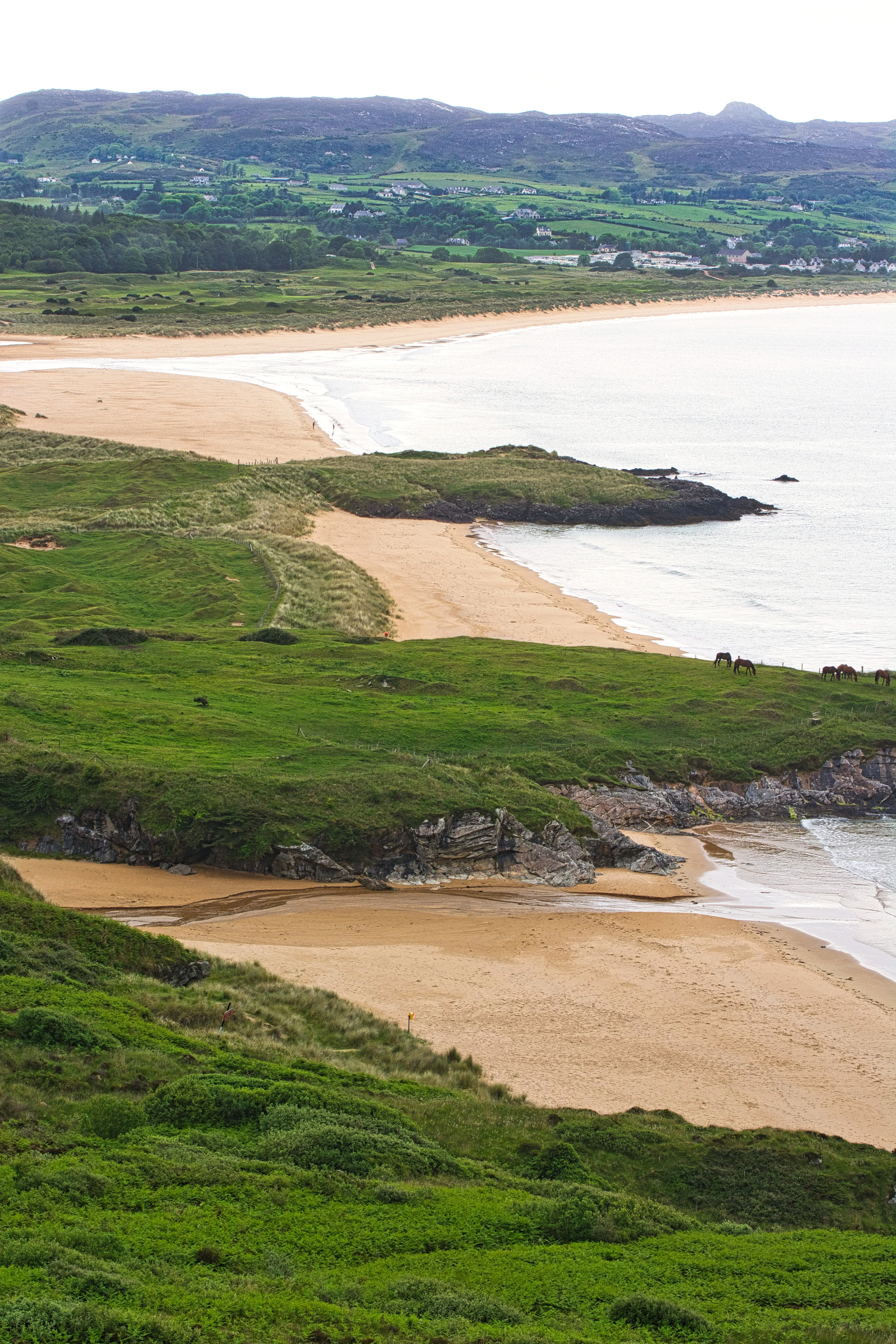
Ballymastocker Beach is a must-visit for a peaceful and picturesque setting, water sports, and nature. The three beaches and intervening grasslands were stunning.

This fort with an underground cave marks the end of the most scenic stretch of the road.
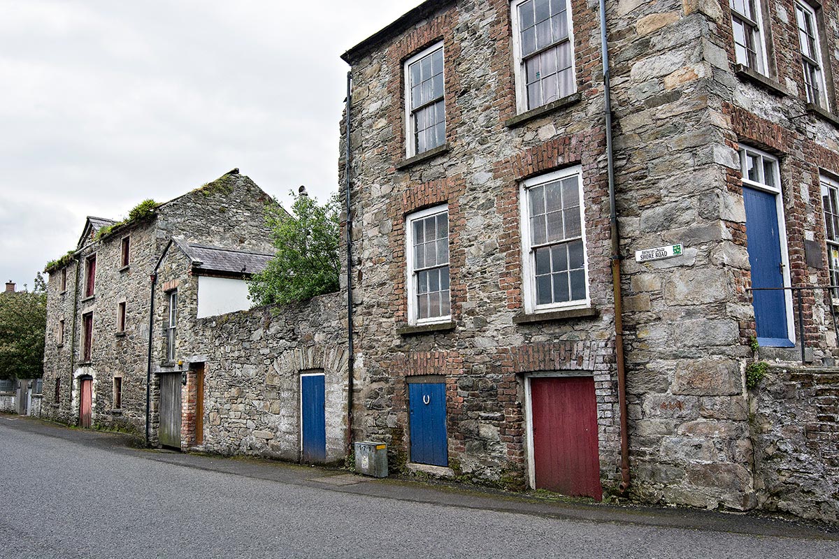
Ramelton
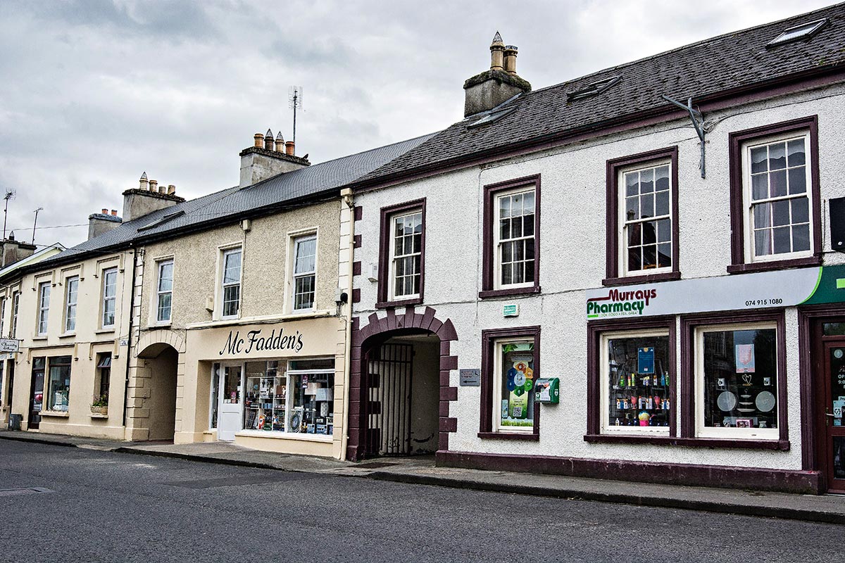
Formerly called Rathmelton, this was a bustling port in the 18th century, trading with New York and Jamaica. As a result, the town is lined with Georgian architecture (1714-1830).
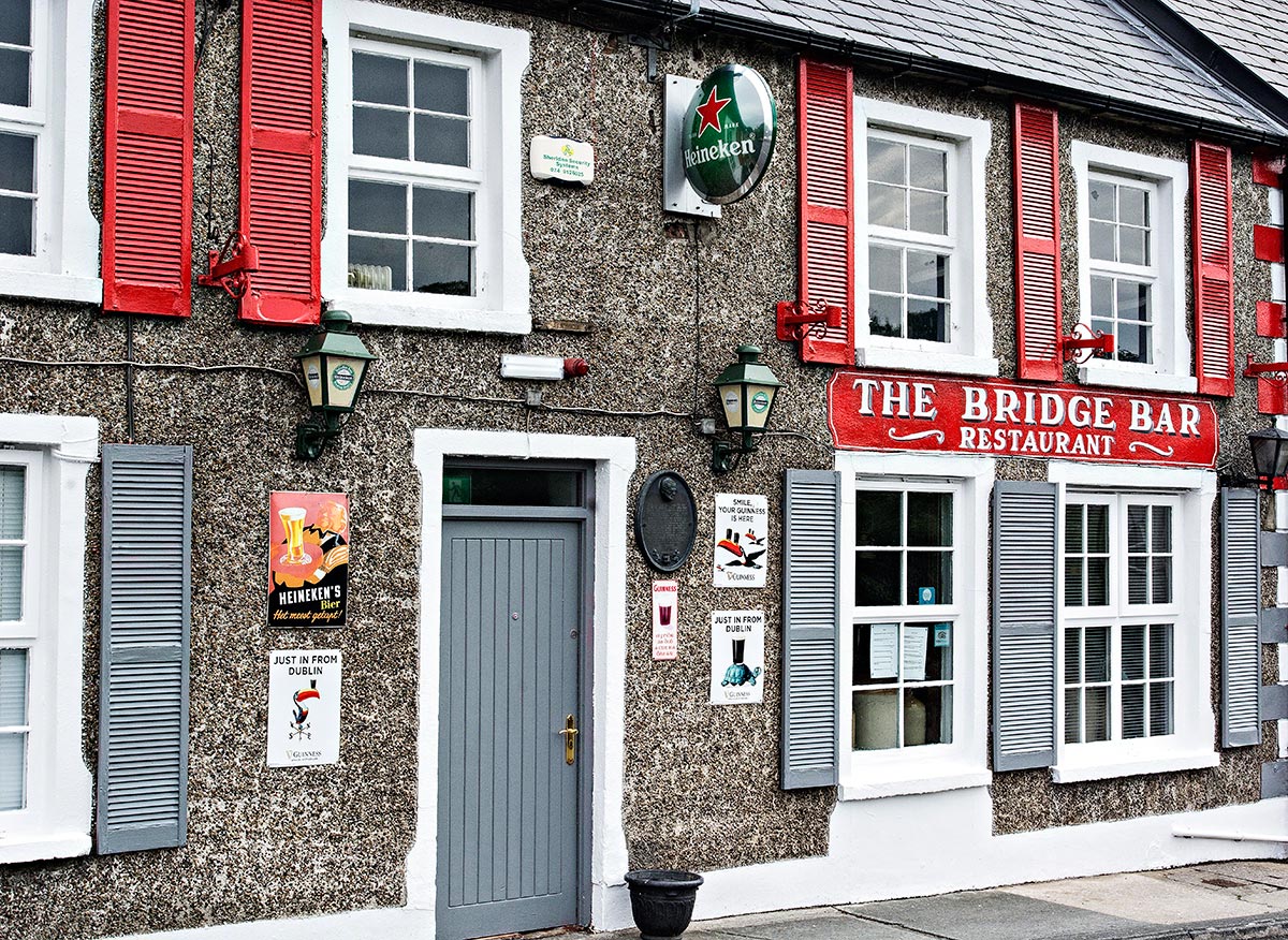
Subdued colours are an element of the Georgian style. Unlike the port towns of Ireland, most of the buildings were drab grey or white except for the Bridge Bar. Clients appreciate the atmosphere and fancy fireplace at the restaurant, which adds to the charm of the place.
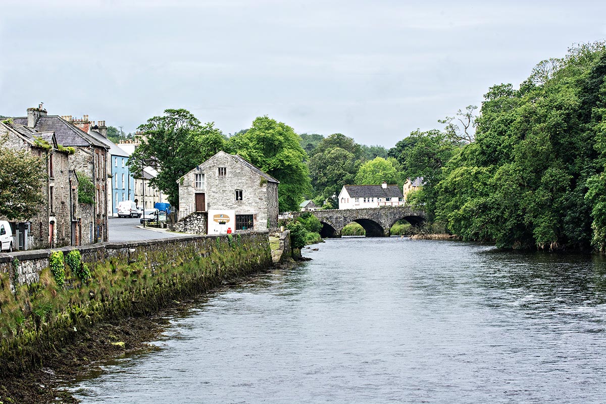
A three-arch stone bridge crosses the River Lennon.
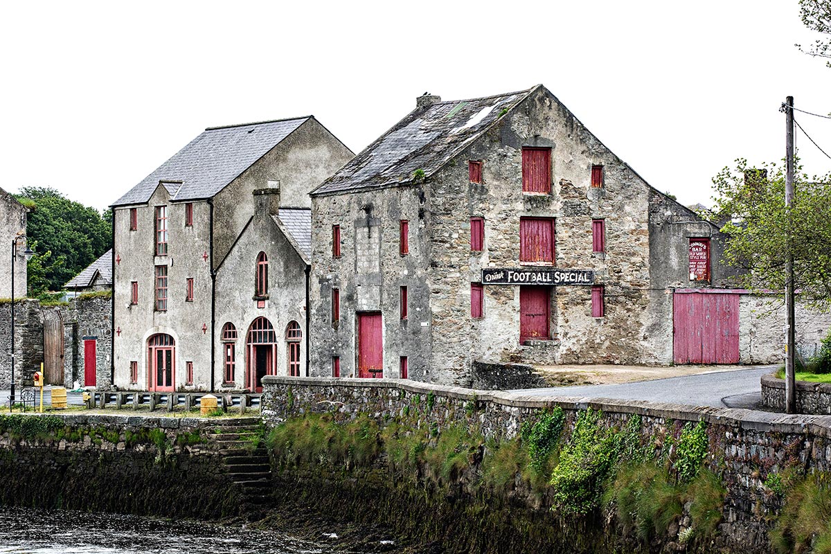
Former factories line the quay.
We loved our Victorian B&B in this quiet town of 1266 people. If you want more supermarket, dining, and nightlife opportunities, then an alternative base would be Letterkenny, with 19,000 people. But 11 km is an easy commute, and we did it every day.
Final Comments on this Itinerary
This is an action-packed itinerary where you can get away from the crowds of tourists who head to sites that are famous because of name recognition. The places are all highly rated by the people, as shown by the high Google Map Ratings. Remember, the most important “destination” is meeting the people.
Subscribe
Get travel tips and advice delivered directly to your inbox. The best part is that it is free.
What things fascinate you? How long is your trip? What questions do you have?
Itinerary Maps & Guides
This itinerary is part of our Best Places for 2 Weeks in the North of Ireland and Ireland North itineraries.
Ireland North Map – our custom Google map
Google Maps Ratings
Google Maps provides a rating from 0 to 5 for all sights, hotels and restaurants (but not cities). All of our recommendations are appended with the rating (prefixed with a G) from Google Maps. As it is based on feedback from tourists and locals, it is much more reliable than travel booking websites. We consider a score of 4 to 4.39 to be Very Good; 4.4 to 5 to be Excellent.
Ireland FAQ
The Ireland FAQ post answers Frequently Asked Questions (FAQ) like:
- Where should I go in Ireland?
- What is the best season for travel?
- What is the best clothing?
- Where should I go? What are the must-sees?
- How much time do I need for Ireland?
- Can I see everything in a week?
- How safe is Ireland?
- How much cash should you take to Ireland?
- Should I pay in Euros or my own currency?
- What apps are useful for travel?
- Should I rent a car? Take a Taxi?

Leave a comment