

Why visit Coromandel?
Is it worth visiting the Coromandel Peninsula? Many tourists visit the idyllic Cathedral Cove but not anywhere else. Coromandel is Quintessential New Zealand with countryside, coastlines, and minimal commercialization.
Read on to find out how to make the most of your time —decide which places you should visit, see which photos fascinate you, as well as get links to our custom Google maps and itinerary planning information.
Author & Photographer: George Mitchell

Our recommendations are not influenced by affiliate links – we have none. Our itineraries, photos, and advice are based on having stayed in New Zealand for a total of six months over three trips. We are avid hikers, nature lovers and photographers. NZ is one of our favourite destinations.
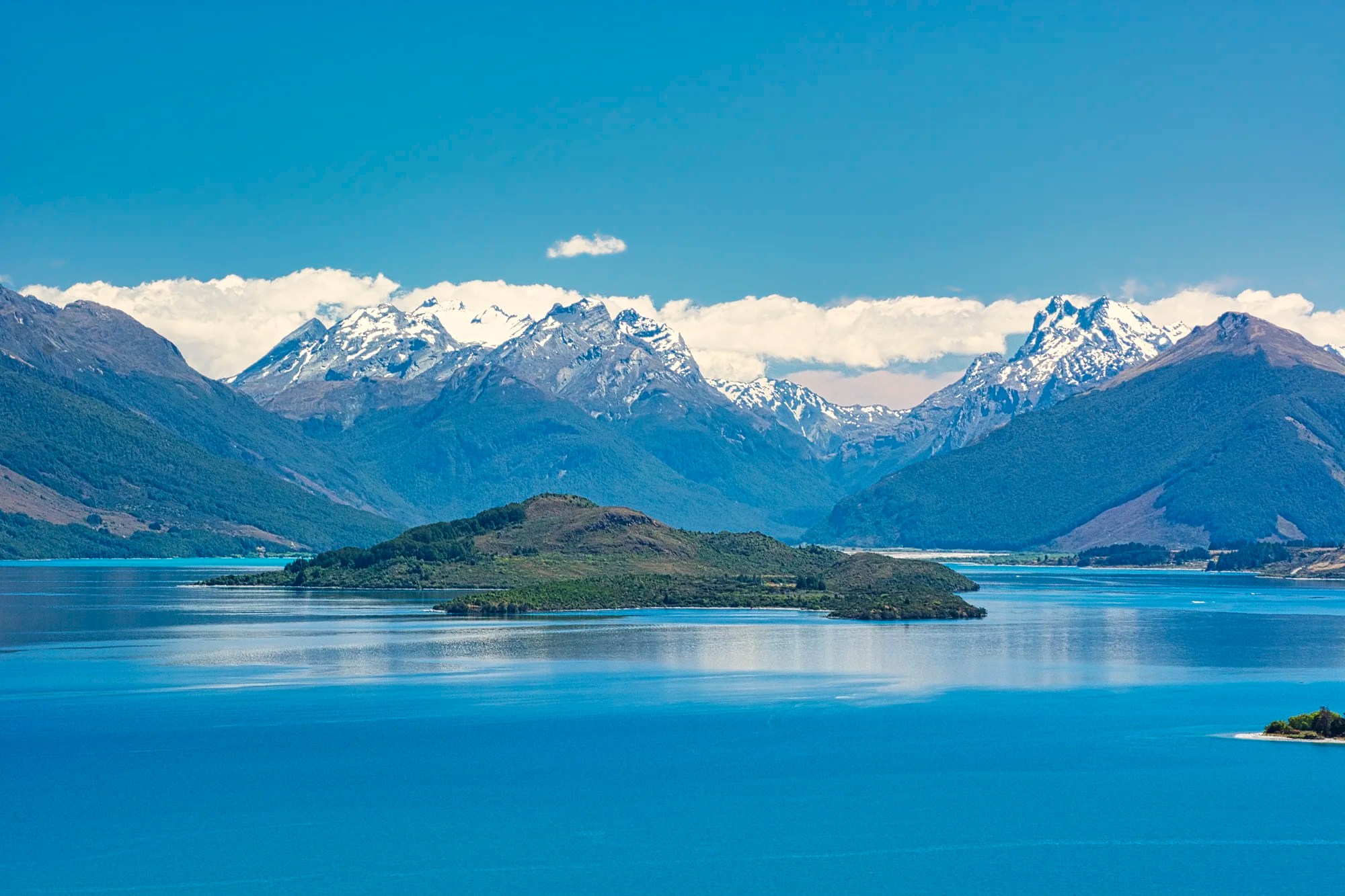
Coromandel Peninsula
On our second trip to NZ, we revisited our Kiwi friends in Wellington. Rosemary and Dave told us to visit places we missed in the Coromandel Peninsula on our first trip. We also went to the Coromandel a third time, accompanying our son on his bird watching vacation. The last two times we had a rental car.
You cannot say Coromandel is off the beaten track as it is close to Auckland. But we mainly met Kiwis wherever we went.
Thames Area
The first stops for birders are the Whangamarino Wetland (just east of Highway 1) and the Pukorokoro Shorebird Centre (G4.6) on the East Coast Road along the waters of the Firth of Thames (Hauraki Gulf). NZ is probably overlooked as a prime bird watching country. But it has many endemic birds. Daniele saw 145 species in 23 days.
Thames
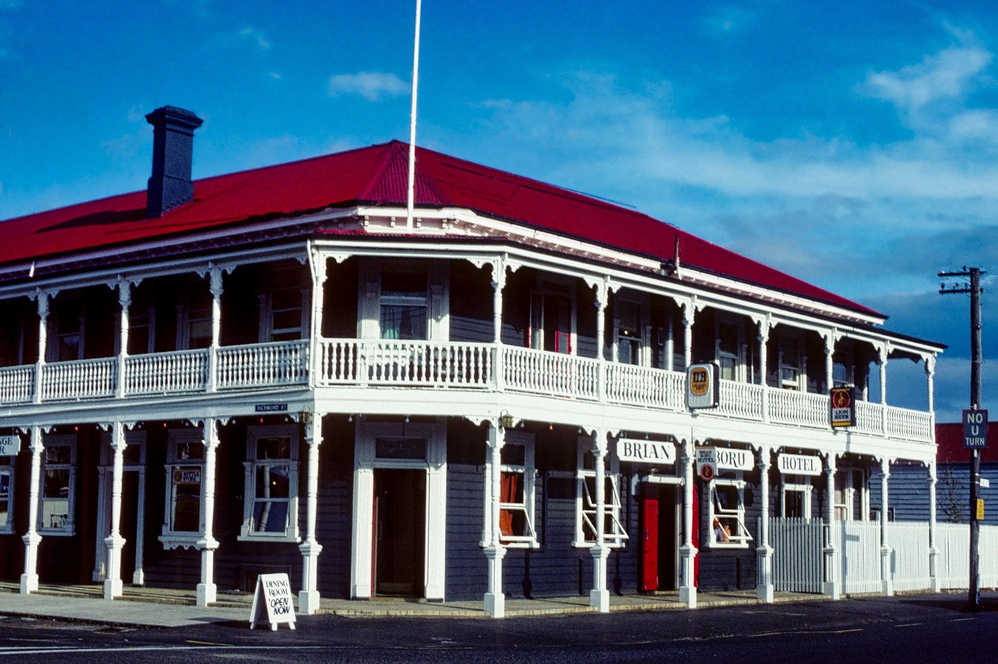
The Coromandel Peninsula only became populated in 1867 when gold was discovered. Within 3 years, Thames had a population of 20,000 and was twice the size of Auckland! The population is 6000 today. Some Victorian buildings remain, like the Brian Boru Hotel. Built in 1867 (and rebuilt in 1905), it has a beautiful wrap-around verandah and a second-story balcony. The hotel was bought by an Irishman from Cork and renamed after a 10th-century Irish king, Brian Boru.
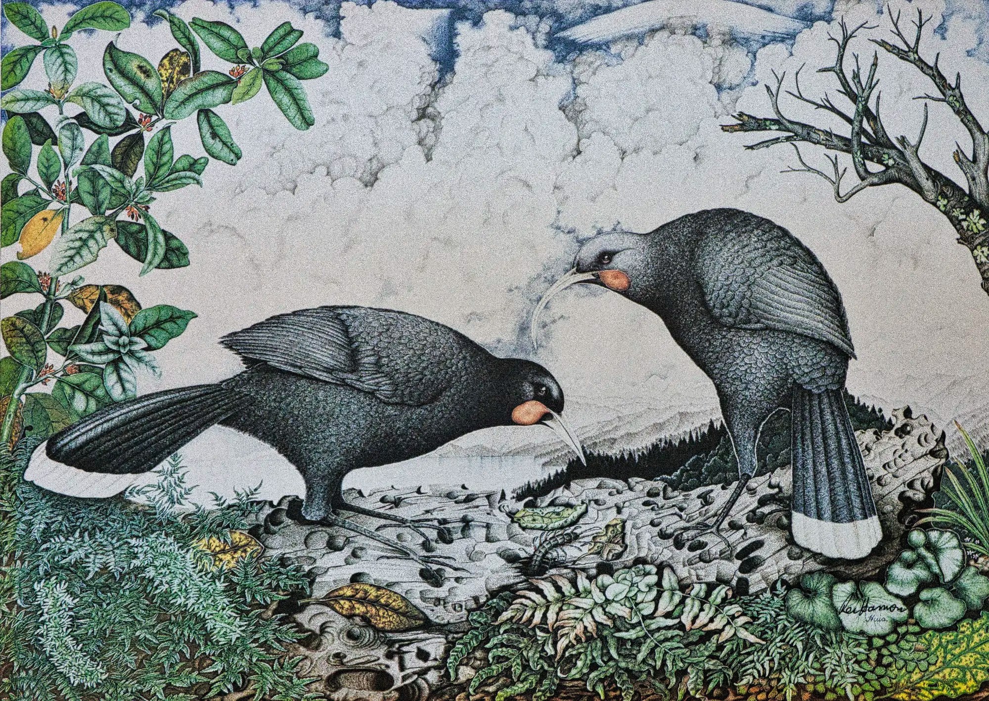
Thames was a good place for lunch, coffee and crafts. We went to the now defunct Rei Hamon Gallery that had paintings, prints, kauri gum, kauri tables, and other items. We loved the incredible pointillist prints that reminded us of impressionist art. We mailed three limited edition prints home.
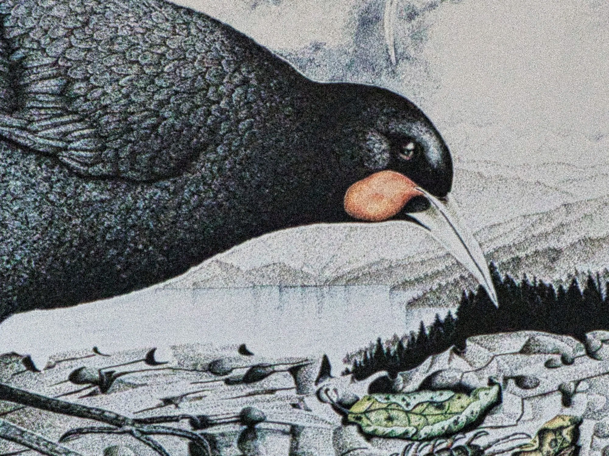
The huia (HOO-ya) is a species of endemic NZ wattlebird. It used its beak to chisel away at rotting wood to get at insects. The bird was regarded by Māori as sacred, but it went extinct in 1907.
Rei Hamon is a famous Maori landscape artist and lithographer who died in 2008. He utilized a self-taught style of pointillism. You can visit the Hamon Art website to see his other prints and learn about his environmental activism.
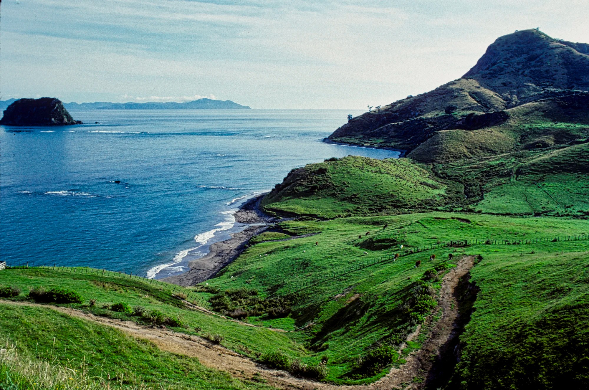
Waiomu
We met 69-year-old Marjorie Gallant, who warmly welcomed us to Waiomu (15 km, 17 mins. north of Thames). Marjorie was very interested in Maori culture. She had learned their language and was active in getting the Maori language taught.
Marjorie was a very positive person and an active hiker. After lunch she was eager for us to visit her area. So we hiked the one-hour Pohue Stream Track. At the beginning we saw homes made out of tram cars disposed by the City of Auckland. At the end of the trail, views opened up of the Hauraki Gulf.
Rapaura Water Gardens
Address: 586 Tapu-Coroglen Rd
Drive: 27 km, 34 min from Thames
Open: 09:00 – 17:00 h daily
Entry Fee: Oct-Apr NZD 15; Family NZD 36; May-Sep NZD 10
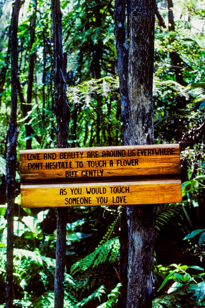
Rosemary told us about Rapaura Water Gardens (G4.5) along the Tapu Coroglen Road. Rosemary particularly liked the signs with cute philosophical sayings.
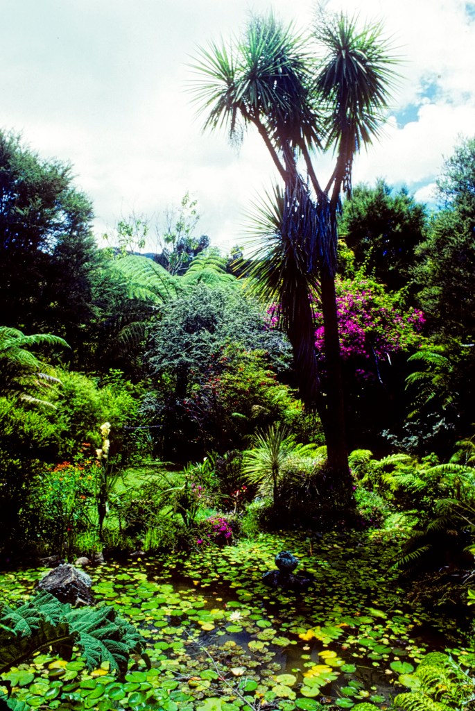
We meandered around beautiful lily ponds with tree ferns and native flowers.
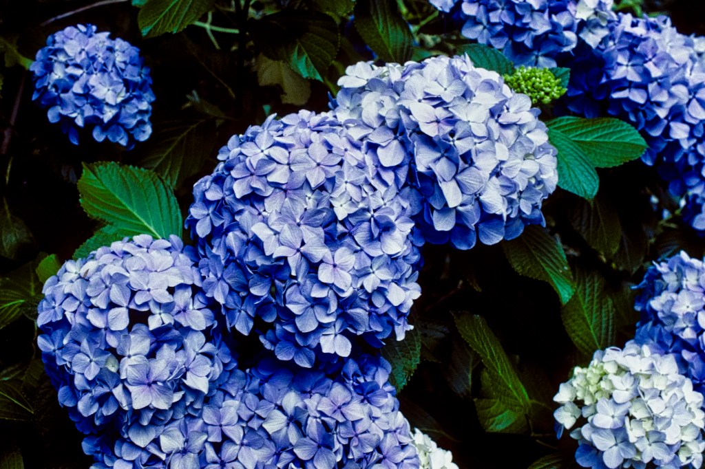
There was also a picnic area, a tea house, and “exotic flowers” (for NZ) like hydrangeas. We spent two hours exploring the gardens. Another place for those interested in flowers is Ngatea Water Gardens (G4.5), west of Thames.
Square Kauri
Drive: 30 km, 39 min from Thames
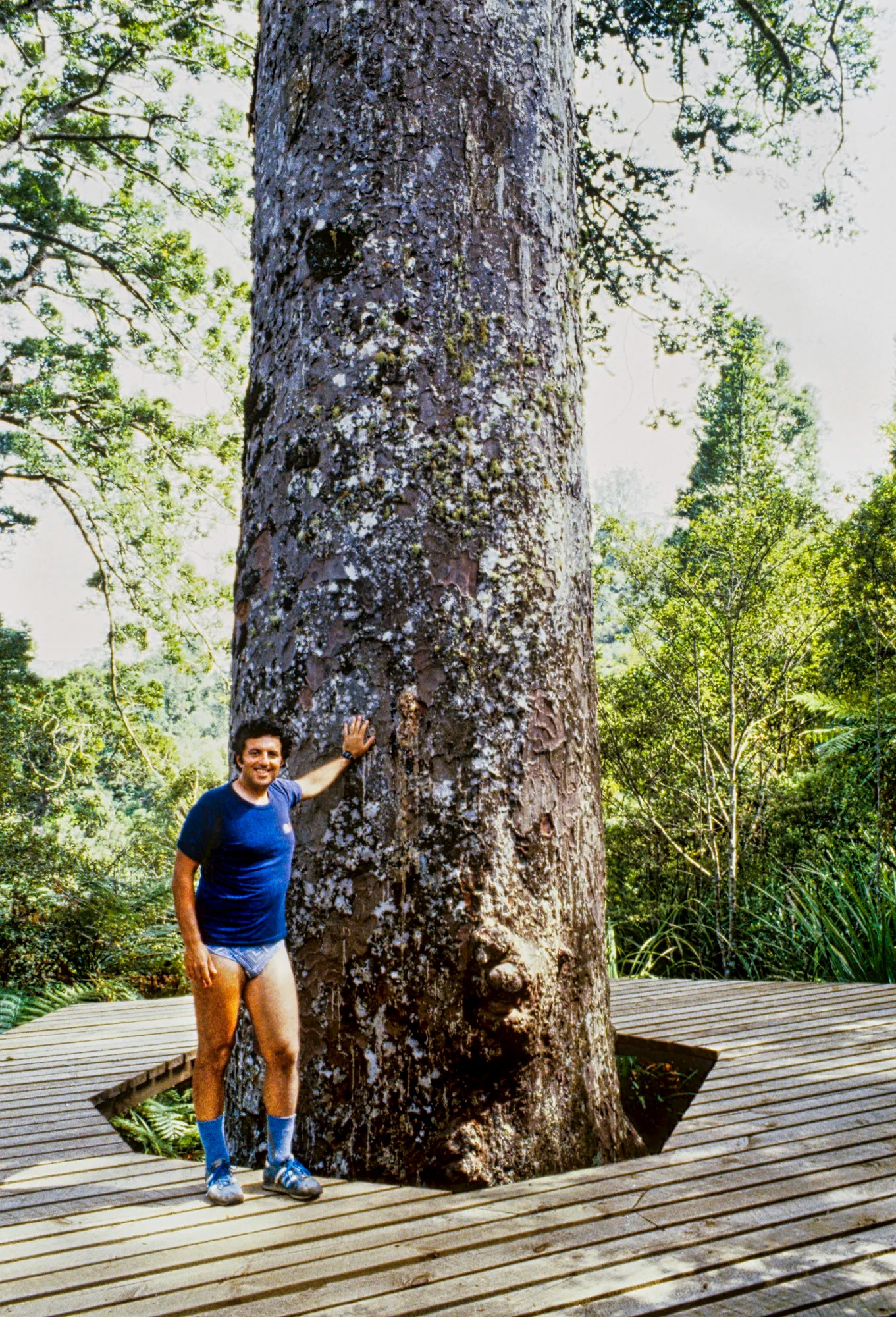
The Square Kauri (G4.5) is 3 km further east on the Tapu Coroglen Road. It is located on a short 150 m 20 min. track. Actually, it is the upper part of the tree that looks square. These trees live for 600 or even 1000 years.
At one point, the Coromandel had been covered with kauri trees. Coromandel is named after the HMS Coromandel naval ship that visited in 1820 to trade for kauri. Most of the kauri have now been logged,d except for some forests that are now protected.
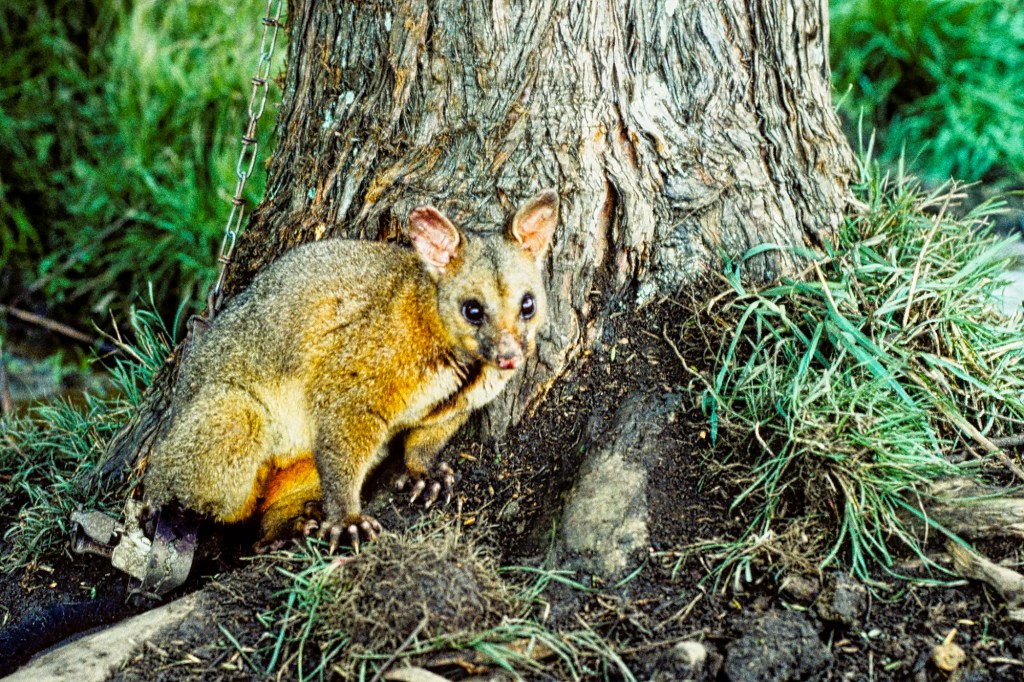
Common Brushtail Possums are marsupials that were first imported from Western Australia in 1837 to establish a fur trade. Possums are considered pests in NZ. Unfortunately, there are not enough predators to control them. They eat native birds and native vegetation, especially pohutukawa and rata trees. They are bad for farmers as they spread bovine tuberculosis. There are extermination projects, and by 200,9 the population of 60 million was reduced by 50%.
Cape Colville Area
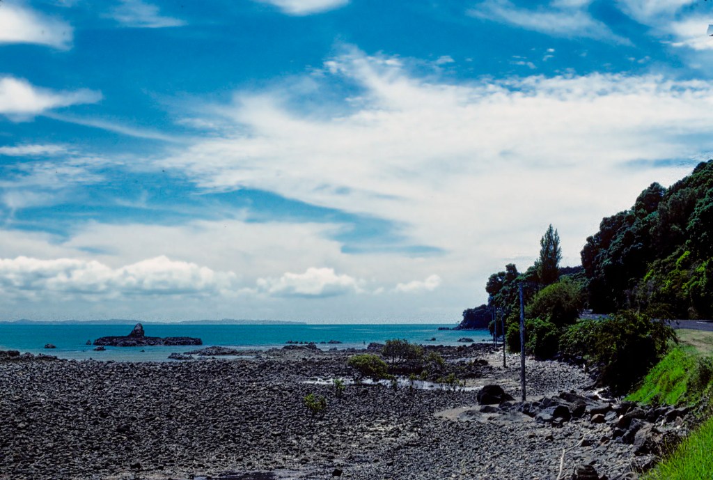
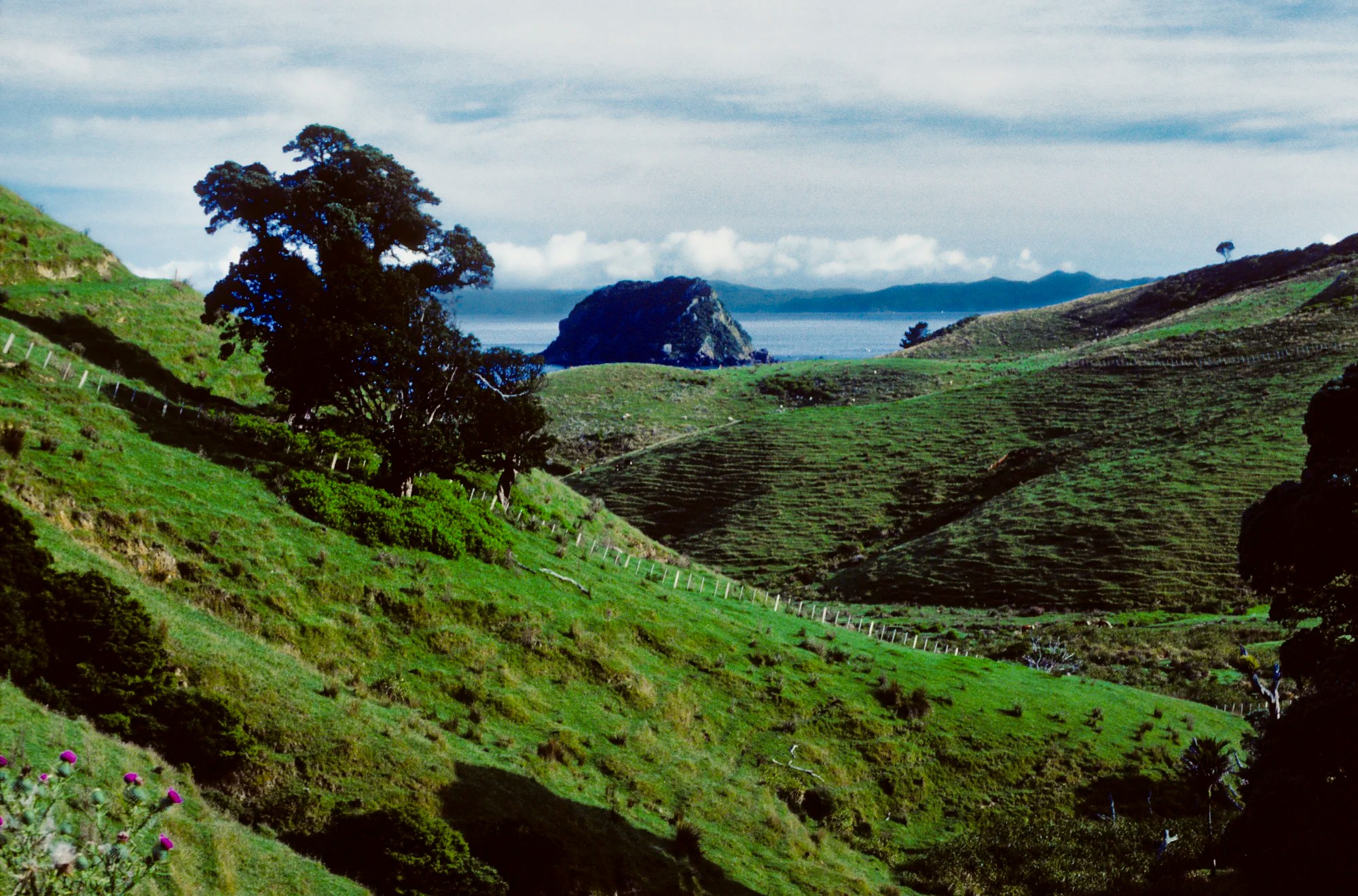
The drive north along Highway 25 was not spectacular as expansive views of water is just not that photogenic. Every once in a while there was a nice viewpoint. At a volcanic plug 16 km north of Tapu, there was a pull off with a dramatic valley (it’s called Coastal Lookout on Google Maps).
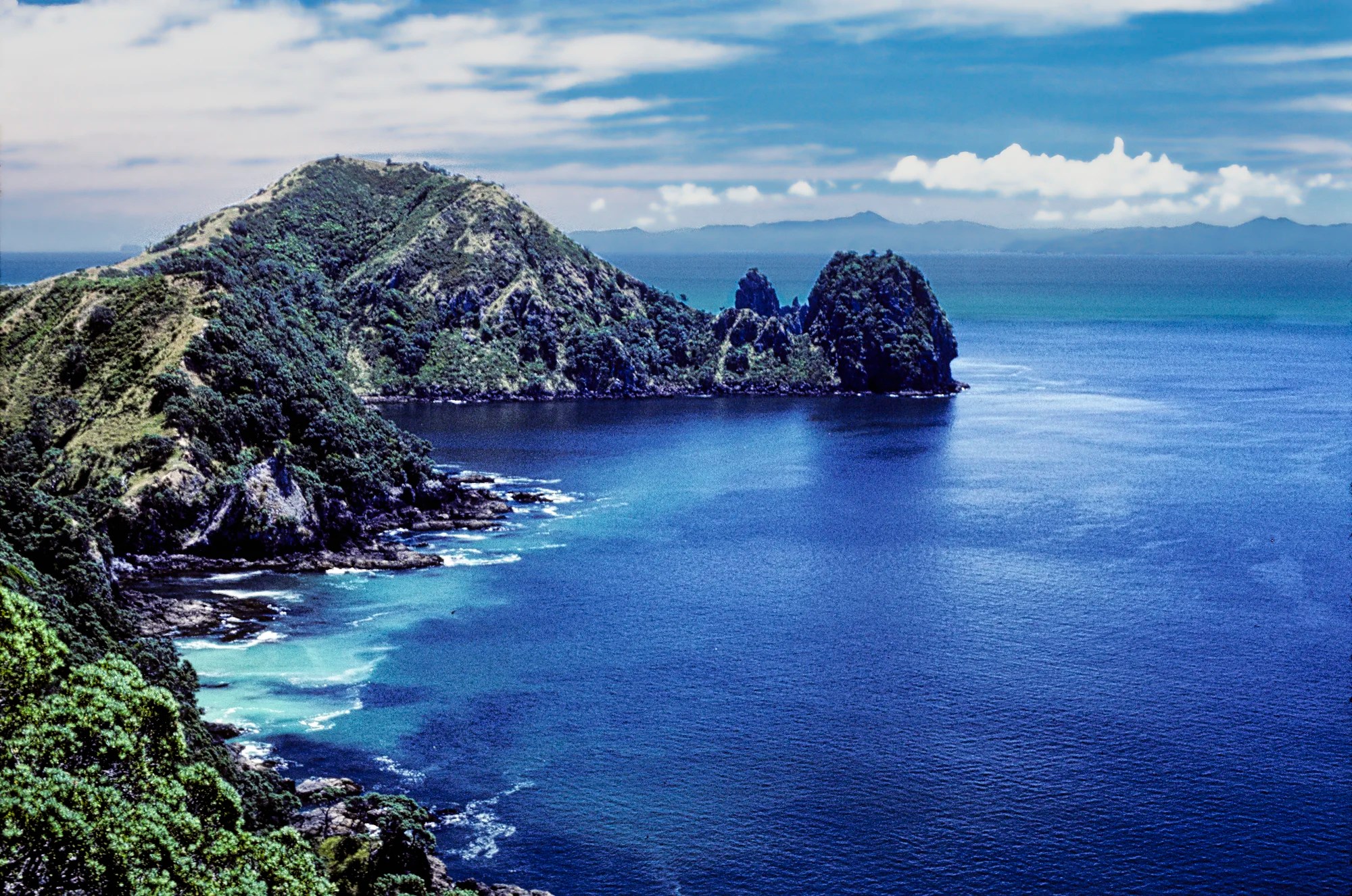
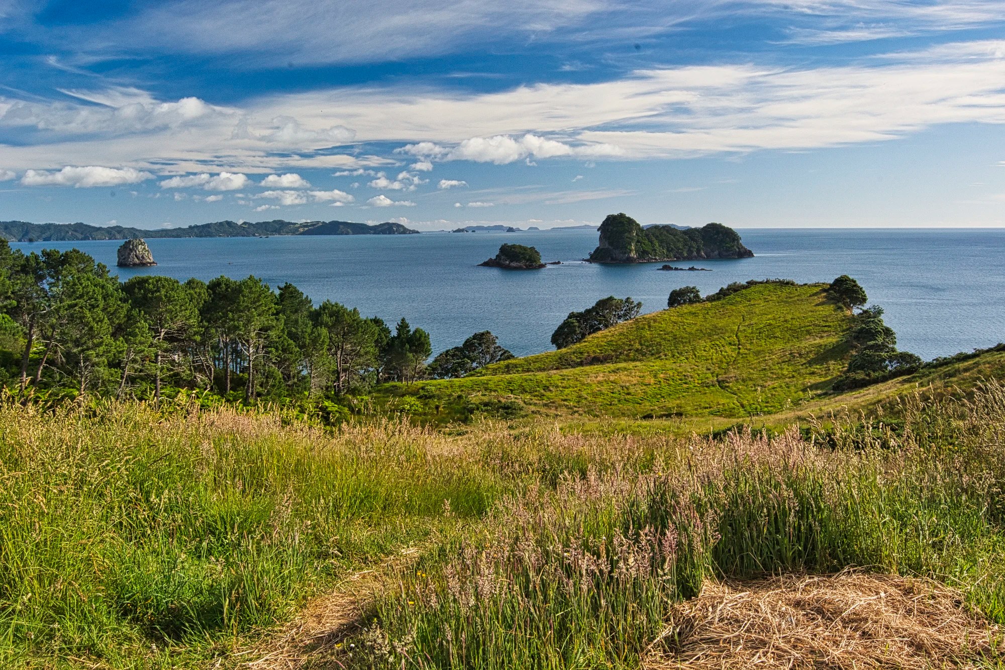
A higher-rated vista is the Manaia Road Lookout (G4.7), 18 km (21 mins.) from Tapu. It had the best views of the day. Beyond rolling farmland, the beautiful green ocean is dotted with islands. It is headlands, indentations and islands that make a view photogenic.
Tokatea Lookout Track
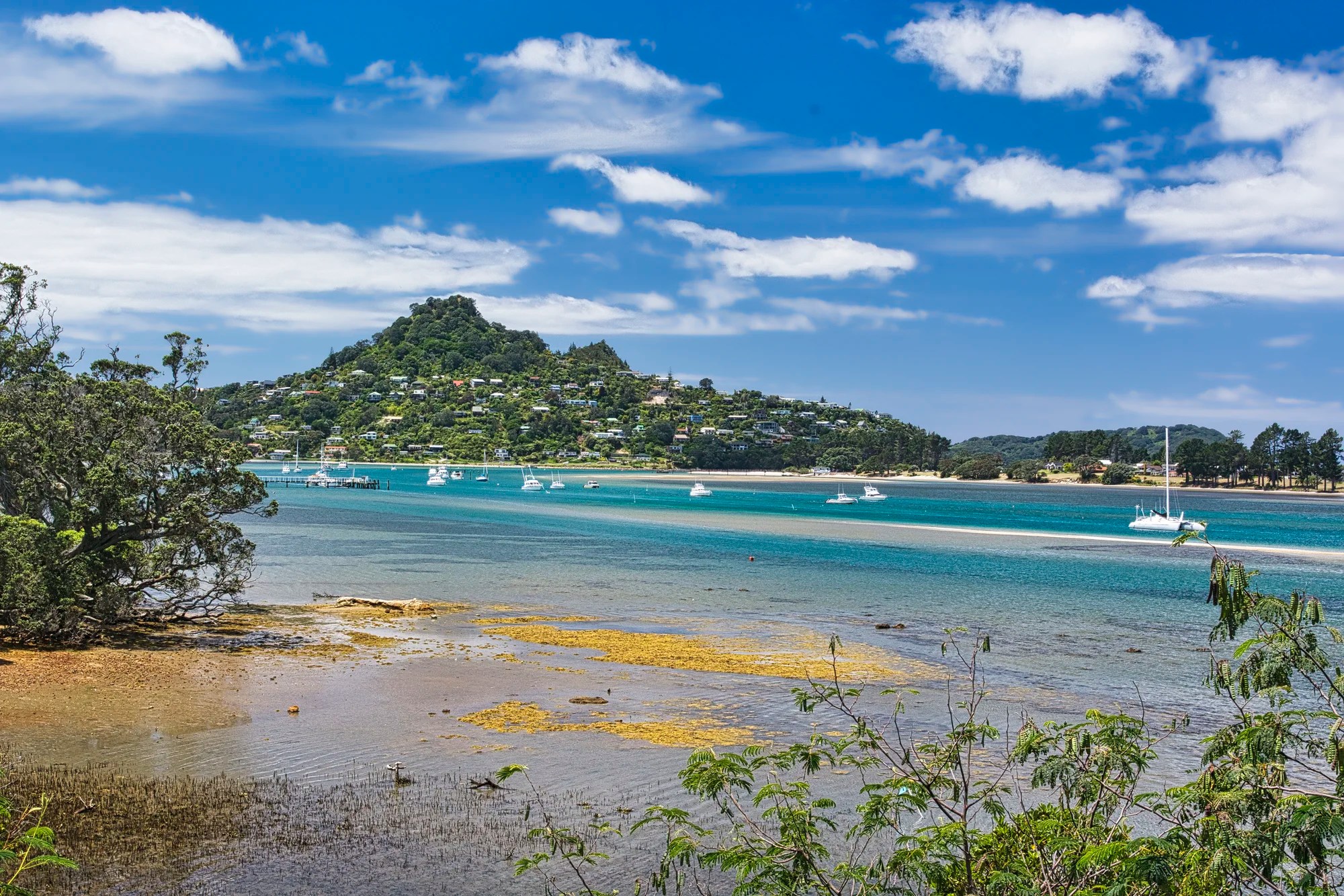
Past the town of Coromandel (35 km, 38 mins. from Tapu), we drove to the Kennedy Bay Road parking (42 km, 52 mins. from Tapu). Here we hiked the short uphill Tokatea Lookout Track (G4.5). This 600 m, 30 min. trail leads to a view of the mainly forested Coromandel Harbour.
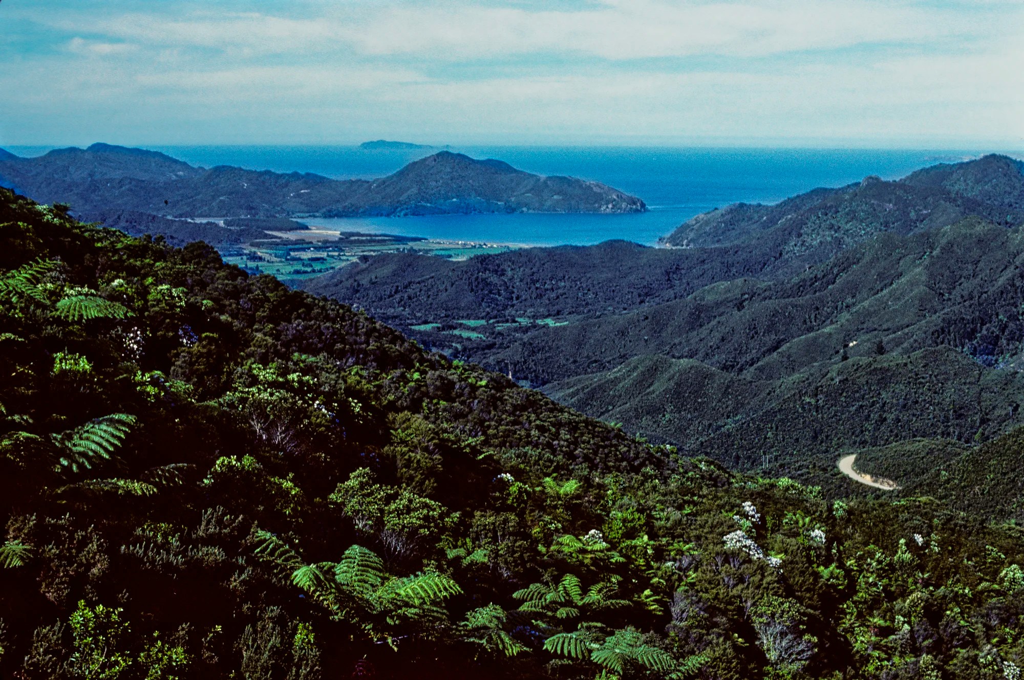
The views improved along Colville Road heading north after the town of Coromandel.
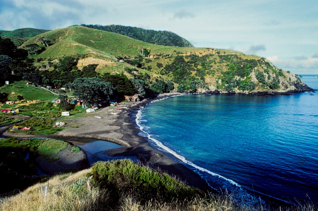
Port Jackson
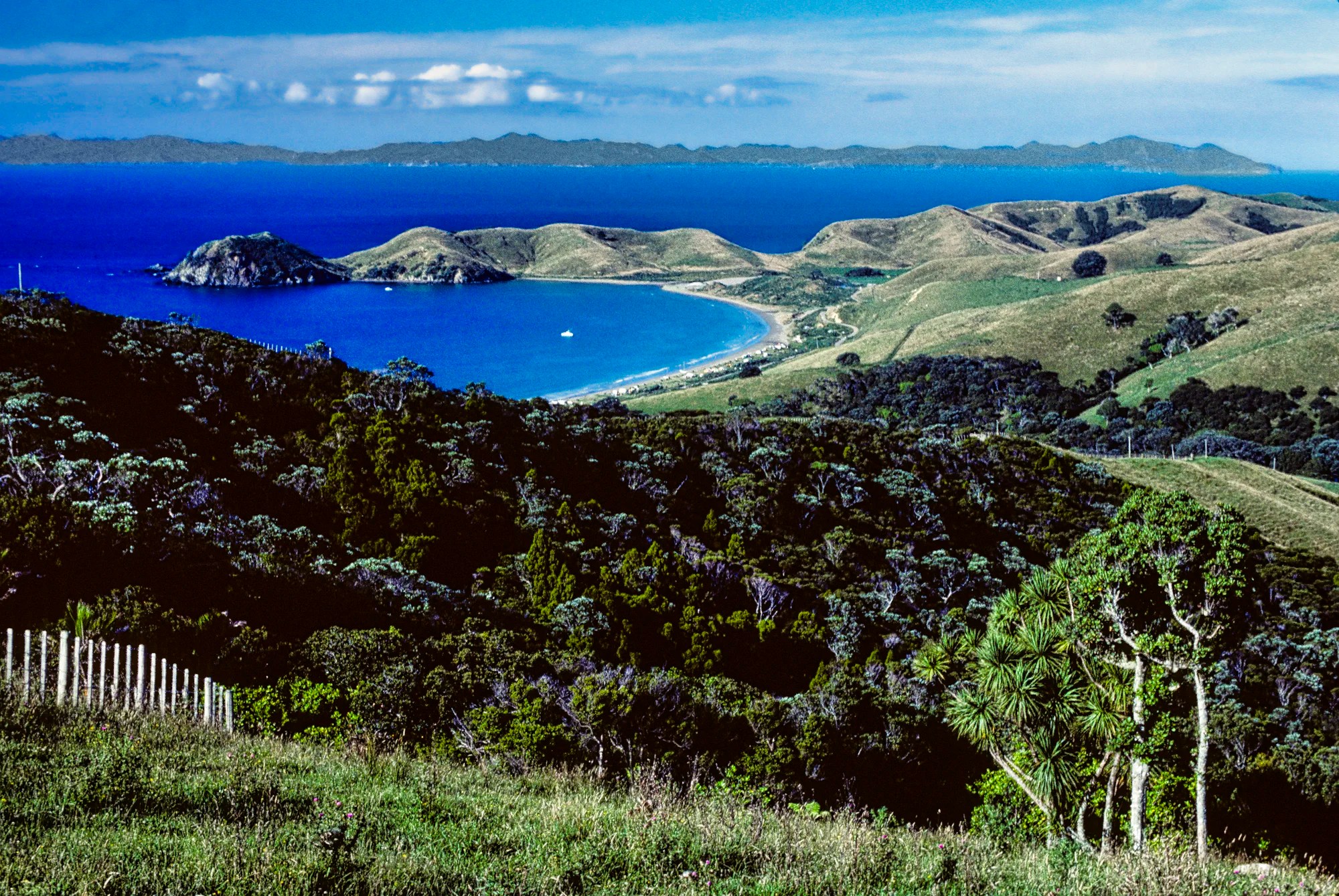
The best view was from a hill overlooking Port Jackson (57 km, 1:30 h from Coromandel). There is a government campground here (NZD 10 per adult).
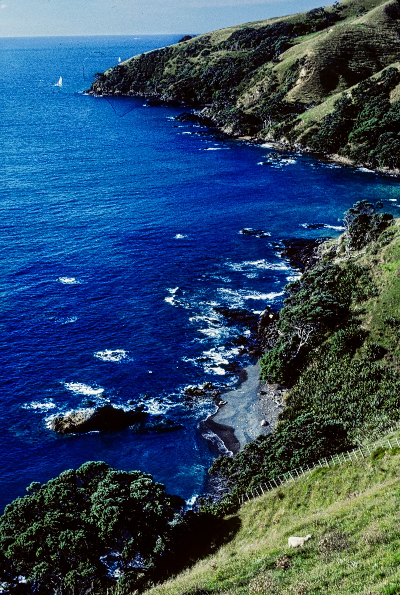
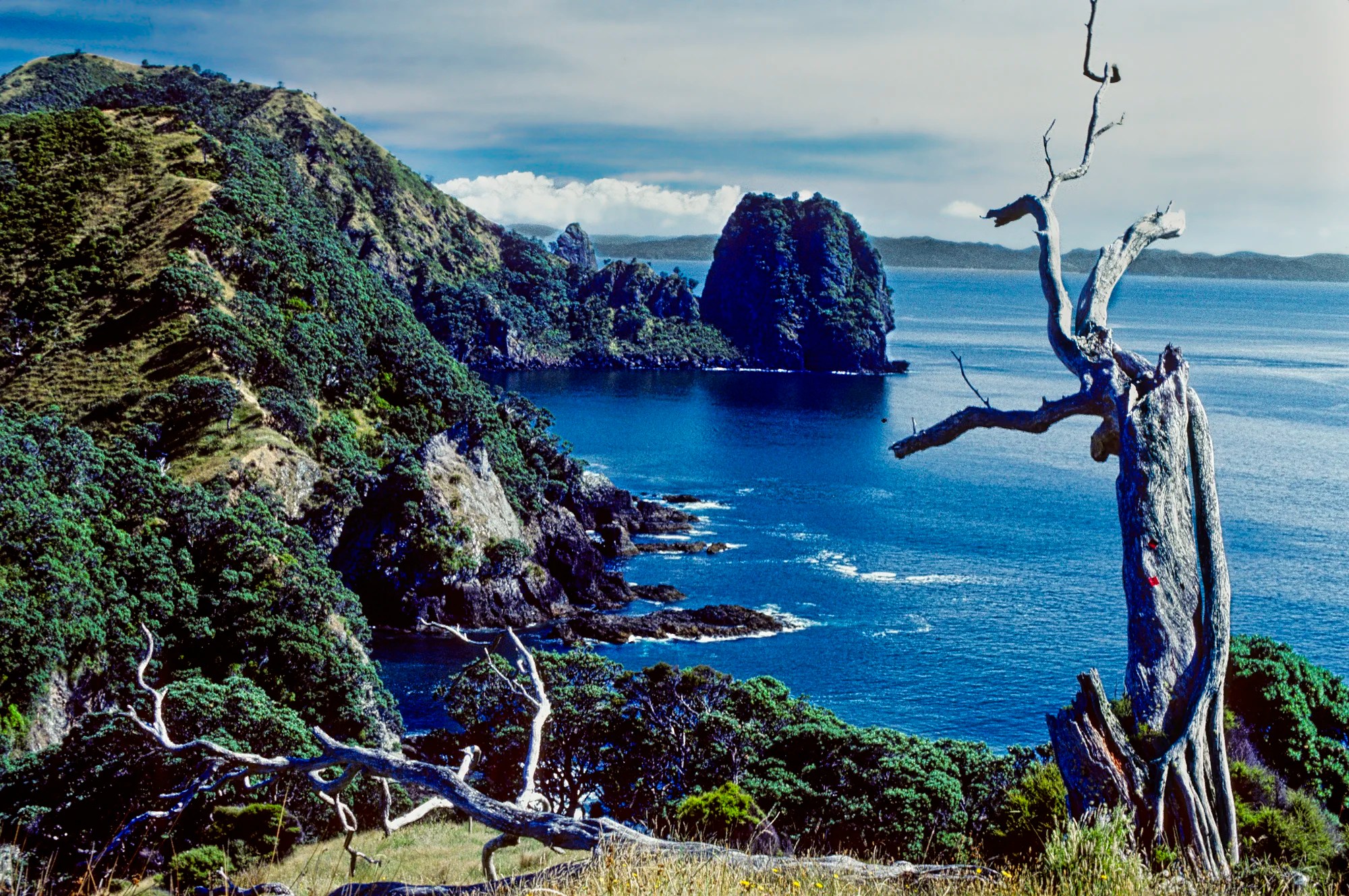
Fletcher Bay Coastal Track
Distance: 20 km 7 hrs RT
Difficulty: Easy
Topographical Map: Coromandel Coastal Track Map
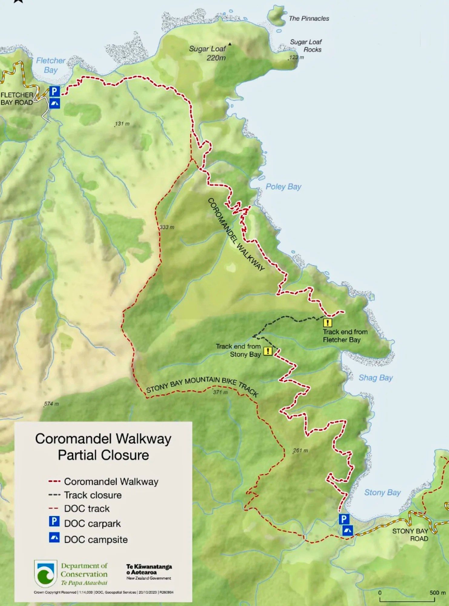
The Coromandel Walkway Track from Fletcher Bay to Stony Bay was a spectacular hike.
I have pinned where I believe we took these photographs on our NZ Coromandel Map.
A middle section of track above Shag Bay – shown with black dashes on the map above – is now closed as it was damaged by landslides. This has severed the trail between Fletcher Bay and Stony Bay.
But the best part of the trail was the northern section from Fletcher Bay to Sugar Loaf.
Whitianga Area
Whitianga is a resort town along the coast. If you don’t have a car, there is a ferry that crosses the harbour and you can walk to nearby sights. Whitianga is the place to find hotels, B&Bs and restaurants. We always camped at campgrounds close to the main tourist sights.
Shakespeare Cliff Lookout
Distance: 0.2 km loop 3 mins.
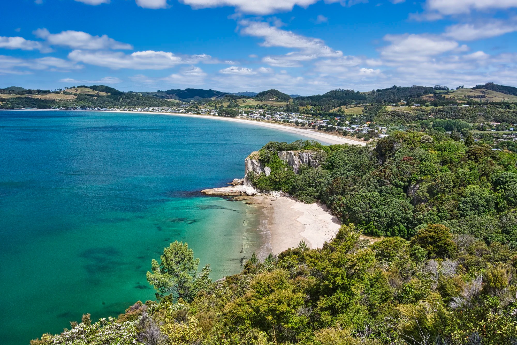
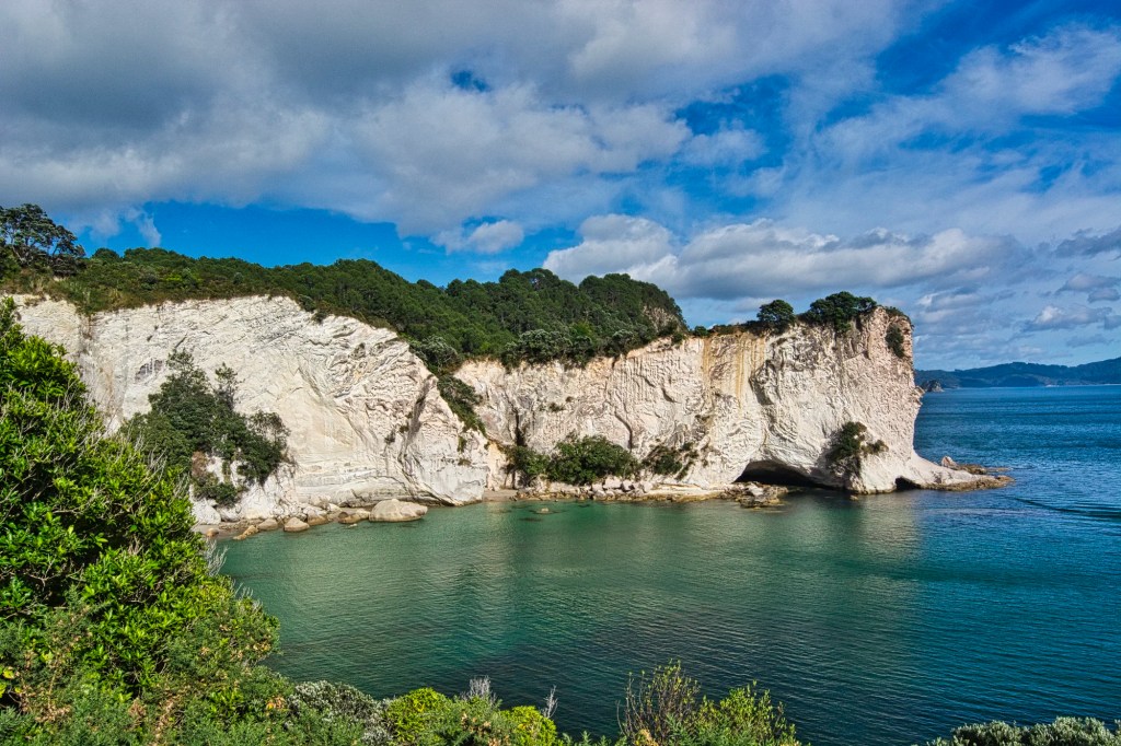
We drove to Cooks Beach and walked an easy loop trail to magnificent vistas at Shakespeare Cliff Lookout (G4.8). It is a quintessential coastal view with turquoise water and golden beaches.
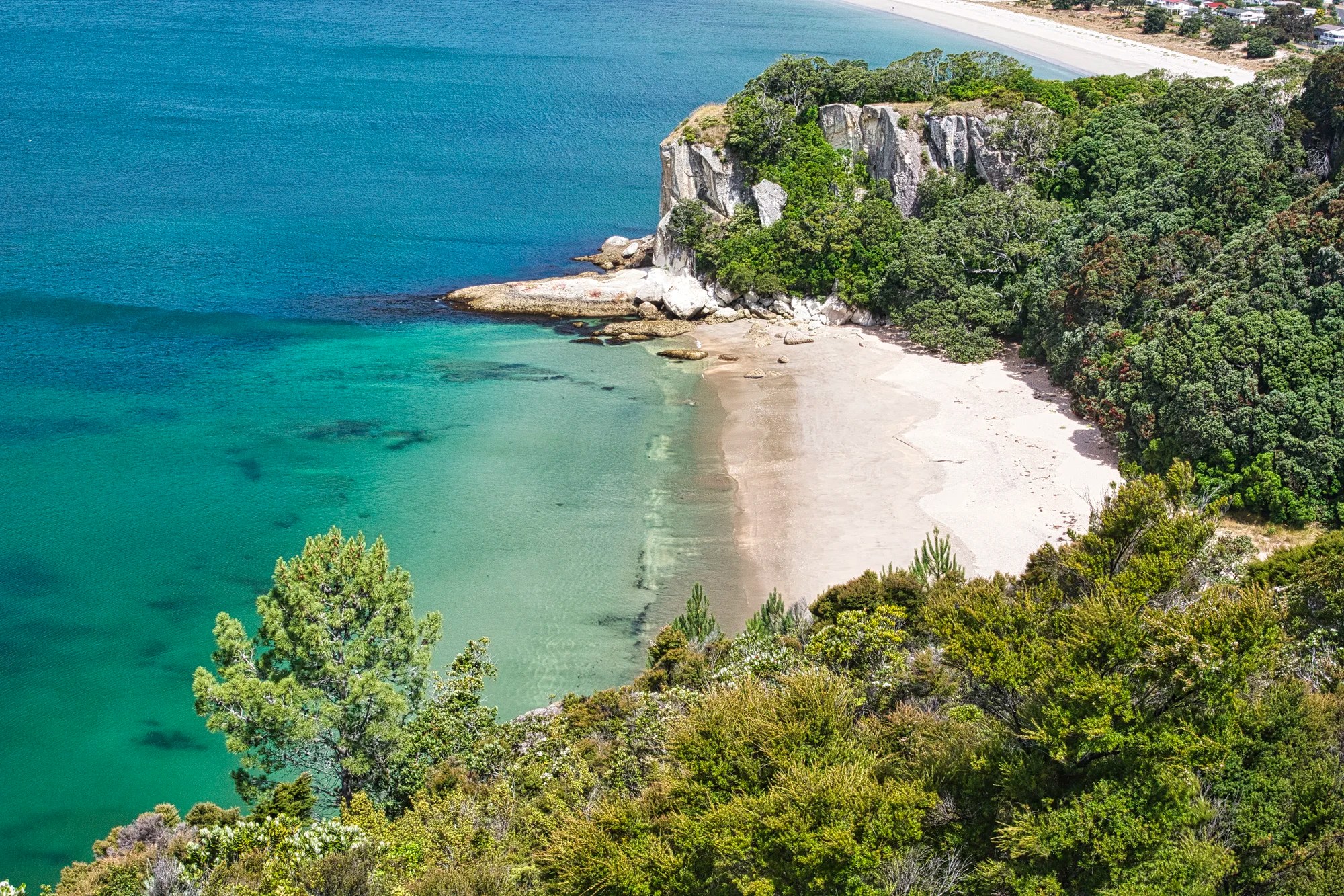
Right below us was the hidden crescent Lonely Bay Beach with no people. In the distance is Cooks Beach (G4.8). Bird watchers should look for tui and kereru birds. Everyone should look for Pohutukawa trees. Farming and possums have reduced pohutukawa forests by a whopping 90%.
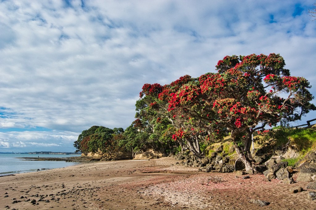
Pohutukawa trees have brilliant crimson flowers. This tree flowers from November to January with peak blooming from mid to late December. Thanks to the timing and the red flowers, it is known in NZ as the Christmas tree.
Regarded as a chiefly tree by Māori, it remains important in Kiwi culture as a symbol of strength and beauty. It is mainly found in the coastal regions of North Island; p.s. This photo was taken further north in Whangaparaoa.
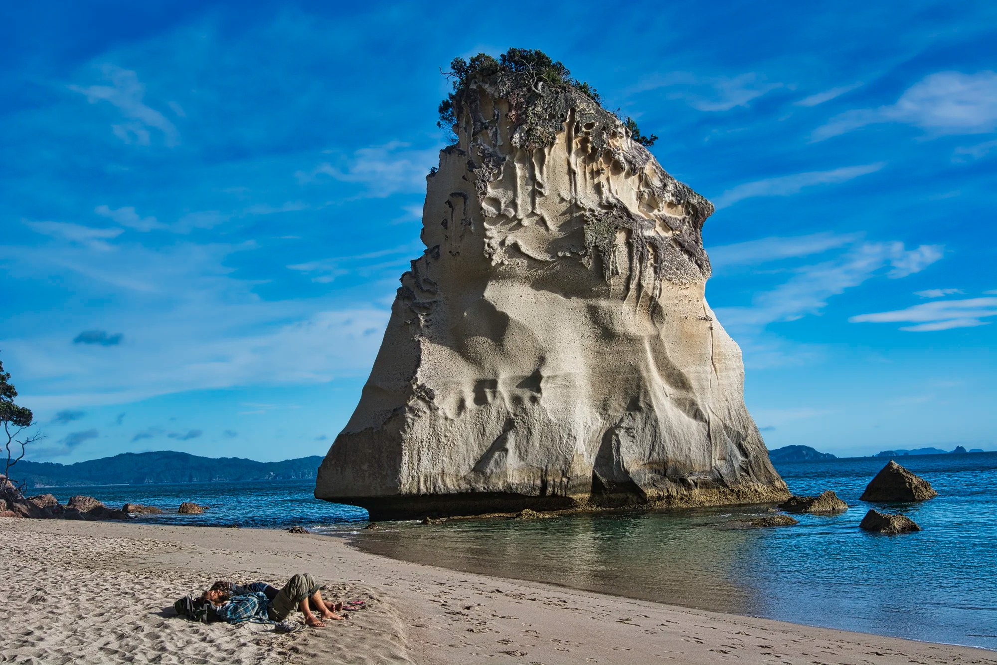
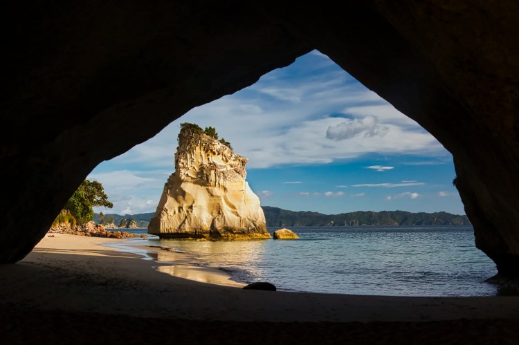
Cathedral Cove
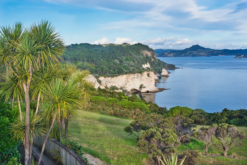
We drove on rural roads to Hahei Beach where we camped on previous trips. Cathedral Cove (G4.7) has the most foreigners of any place in Coromandel but it is very worth visiting. There is a nice vista of the coast from the viewing platform (G4.3) at the trailhead. But you do not see the famous beach with its rock formations. Check the Cathedral Cove Walk post for the status of the damage caused by Cyclone Gabrielle (2023).
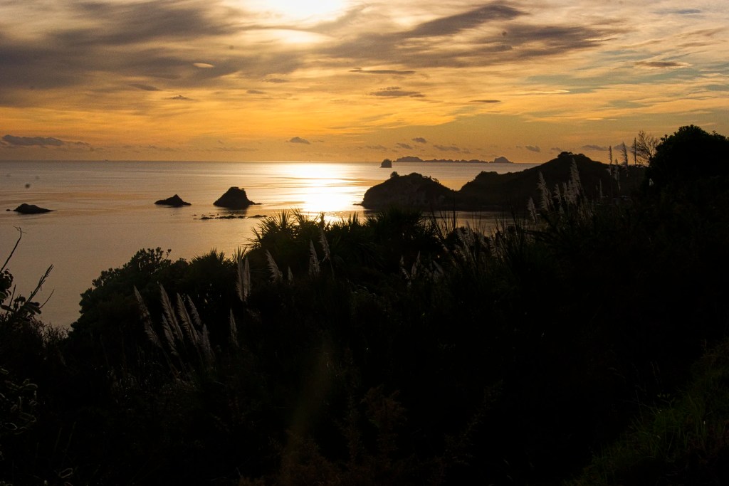
These beautiful “sunset photos” were taken near the platform — but it is not sunset at all. You can see the sun well above the horizon of the underexposed coastline. We walked 10 mins to Gemstone Bay (G4.5), which is rocky and not photogenic.
After another 30 mins, we reached the top of a hill with fantastic coastal views. The trail descends over grass and tussock covered hills with grazing sheep. Rugged islands and outcroppings are scattered over the turquoise water.
After 18 minutes, we reached the huge cliff that overlooks the coves.
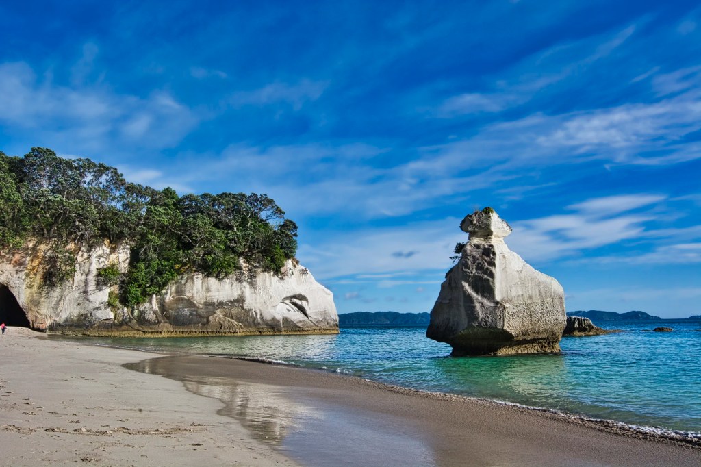
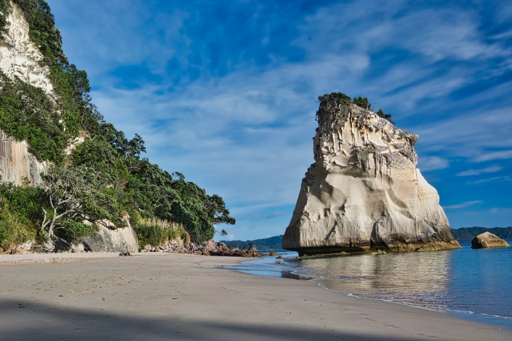
We went down the stairs to a pink-tinted beach with an unusual rock formation, or a stack rock.

The tide was low enough to pass through the “Cathedral Cave” to Cathedral Cove Beach (G4.7).
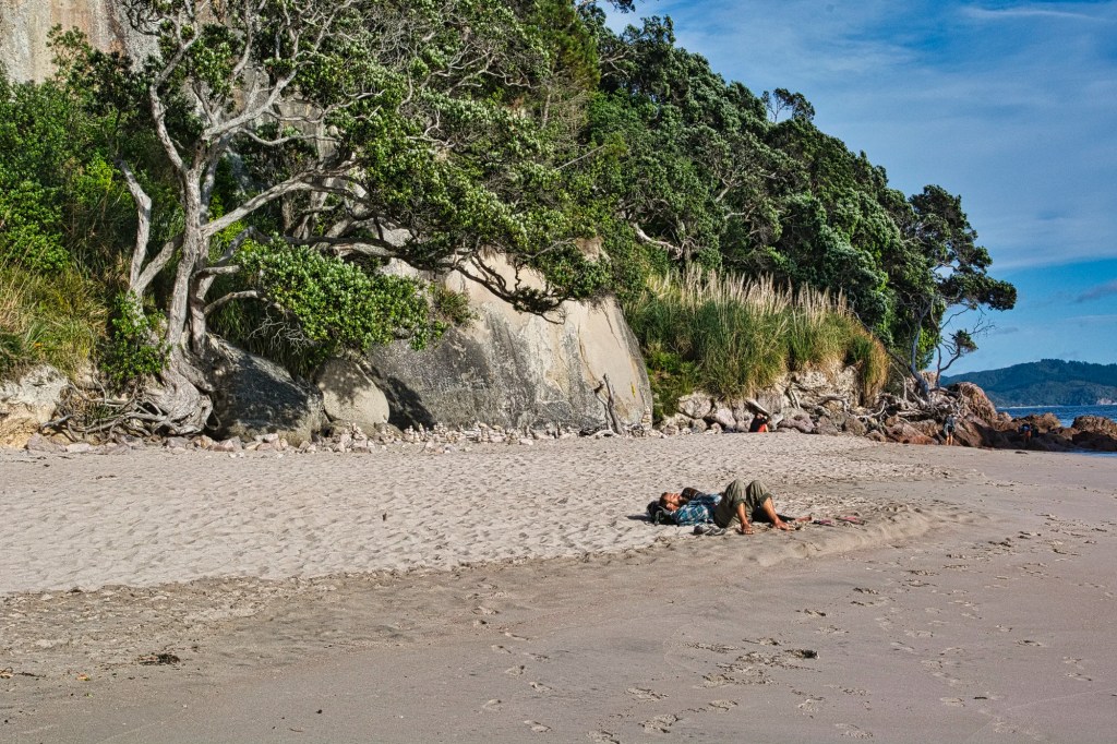
The secluded, sandy beach came with sleeping tourist and gnarled trees. Pohutukawa trees line the paths leading to Cathedral Cove.
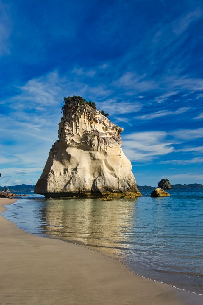
Towering overhead was a large sea stack, Te Hoho (G4.8), which means roaming horse in Maori. We loved the reflection of Te Hoho in the water.
Hot Water Beach
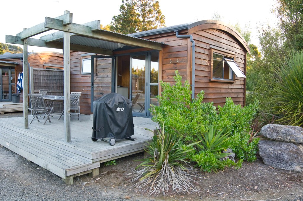
We stayed at the campground near Hot Water Beach (G4.5), which is powered by hot springs under the sand! On our last visit we took a cabin, which are not only less expensive than hotels but are fully equipped to prepare your own meals. It is an alternative to camping and expensive camper vans.
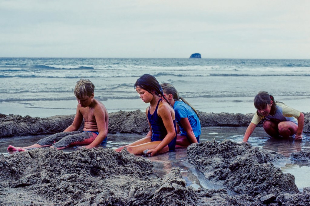
You need to go from two hours before to two hours after low tide — else the hot springs are under the ocean! On our first trip, only a few local children were on the beach. It was basically deserted.

On our last trip, we brought our own child to dig out our hot pool. The campground provided plastic shovels.
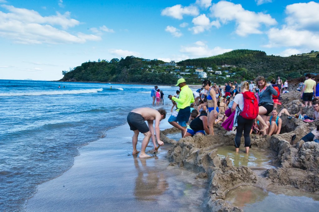
Unlike our first trip, there was a gaggle of tourists. Nevertheless, the experience is incredible.
Tairua
Tairua (G4.5) is a classic resort further south with lots of yachts.
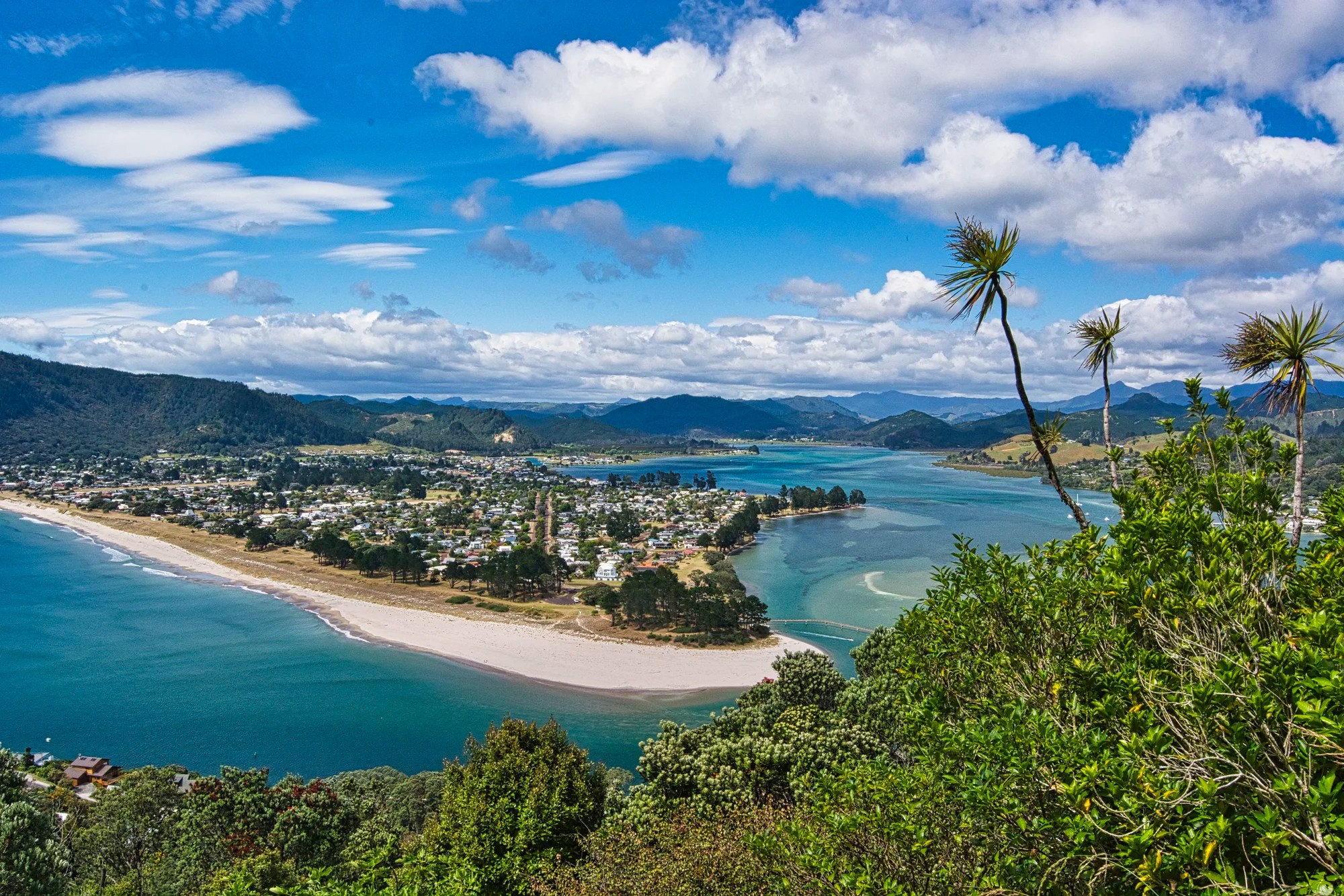
We went birding on the Paku Lookout Track. There was a beautiful view of the river hitting the ocean, with the town of Pauanui on a peninsula and mountains in the distance. Pauanui is Maori for big pāua or abalone. Pauanui is across from Tairua.
Karangahake Gorge
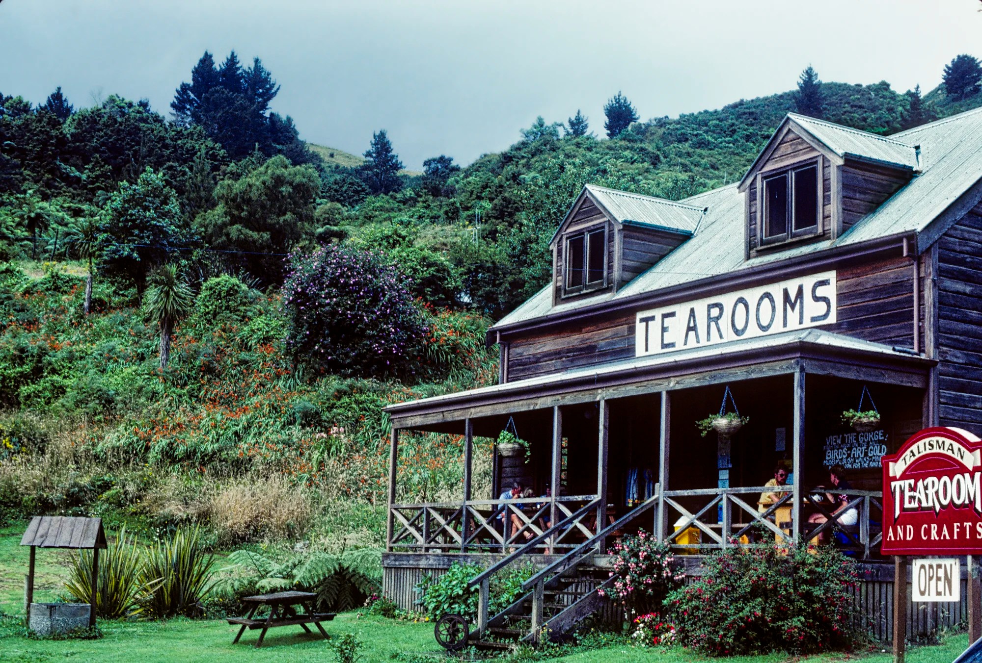
Karangahake Gorge provides a dramatic walkway in a former gold mining area. The only photo we have is the Talisman Tearoom, which is now called the Talisman Café. This reflects the change in NZ from tea drinking to coffee culture. In fact, don’t even look for drip coffee. Most cafés only serve espresso-based drinks. Kiwis also claim to be inventors of flat white, even if Aussies disagree.
Final Comments on this Itinerary
This Coromandel itinerary is frequently overlooked by visitors to NZ but it is definitely worth visiting. It is a more laid back destination with fewer visitors in the off-season. The places included in the itinerary are all highly rated by the people as shown by their Google Map Ratings.
Subscribe
Get travel tips and advice delivered directly to your inbox. The best part is that it is free.
What things fascinate you? How long is your trip? What questions do you have? If you have been here, share your experiences with us.
Itinerary Map & Resources
NZ Coromandel Map — our custom map
Pure New Zealand — NZ Government website
Google Maps Ratings
Google Maps provides a rating from 0 to 5 for all sights, hotels, and restaurants (but not cities). All of our recommendations are appended with the rating (prefixed with a G) from Google Maps. Google Ratings are based on feedback from locals as well as tourists. They are much more reliable than travel booking websites or tourist anecdotes. We consider a score of 4 to 4.39 to be Very Good and 4.4 to 5 to be Excellent.
Other Places to Add to Your Itinerary
When is the Best Time to Visit Coromandel?
Coromandel is one of the warmer places in NZ even in the “winter” months, which we would call spring.
Here are the average high temperatures and monthly rainfall at Coromandel by season. Jun-Aug is the coolest at 14.4°C and rainiest (136.7 mm, 5.4″). Even so, that is much less rain than in the South Island or many other countries.
| Season | Mean High Temp | Avg Rain per Month |
|---|---|---|
| Dec-Mar | 20.9°C 69.6°F | 89.5 mm 3.5″ |
| Apr-May | 18.0°C 64.3°F | 114.5 mm 4.5″ |
| Jun-Aug | 14.4°C 57.9°F | 136.7 mm 5.4″ |
| Sep-Nov | 16.4°C 61.5°F | 93.3 mm 3.7″ |
New Zealand FAQ
The New Zealand FAQ post answers Frequently Asked Questions (FAQ) such as:
- Where should I go in NZ?
- What is the best season for travel?
- How much time do I need for NZ?
- How safe is NZ?
Abbreviations
DOC = Department of Conservation = Parks NZ
Kiwi = New Zealander, or a nocturnal flightless bird
NP = National Park
NZ= New Zealand; NZD = New Zealand Dollar;
NI = North Island
SI = South Island

Leave a comment