
Why You Should Amble the Antrim Coast
The Antrim Coast has some of the nicest coastal scenery as well as the most exciting hike in Ireland. But you need to get off the Antrim Coast Road, which is neither on the coast not as scenic.
Read on to find out how to make the most of your time — decide which places you should visit, see which photos fascinate you, as well as get links to our custom Google maps and itinerary planning information.
Author & Photographer: George Mitchell

Our content and advice are derived from our personal experience and knowledge, gained from living in Europe for seven years and studying its art and architecture. Our recommendations are not influenced by affiliate links – we do not have any. Ireland is one of our favourite destinations.
All of our recommendations are top-rated by Google Maps, which is based on the opinions of everyone, not just tourists. Each place recommended in our posts and our Ireland North Map is appended with a Google Maps Rating (G0 to G5).
The Antrim Coast Road
Today did not start well. As it was cloudy and 30% chance of rain, we drove from Ramelton to see Derry. But there was a roadblock. Our offline Maps.me could not handle the change quickly. But continual roadblocks prevented us from going to the centre of Derry — people were running a marathon! So I made an executive decision — okay, we made an executive decision. We switched to do the Antrim or Giant’s Causeway Coast. We were glad we did! All’s well that ends well.
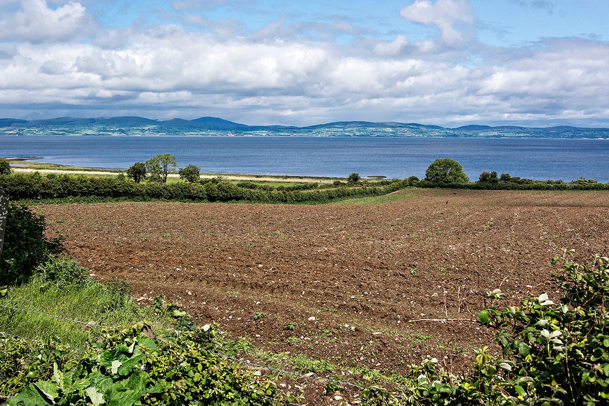
This pull-off was one of the few views “along the coast”. The view is of the Inishowen Peninsula across Lough Foyle.
“The Antrim Coast Road is often praised as Ireland’s most scenic drive.” This is highly debatable. The road does not even travel along the coast.
You need to get off the road to see views and do hikes. Many sites require high fees. Some places are very overcrowded, and the traffic is more aggressive than in the Republic of Ireland. We would hate to drive here in the summer!
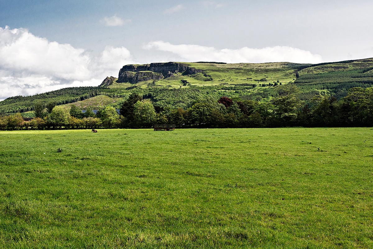
However, it is definitely worth driving, and there are gems that you can enjoy. We got off Highway A2 at the Sea Coast Road (B69). It is a smaller road that goes through farmland but has some interesting mountain backdrops. I believe this is Binevenagh.
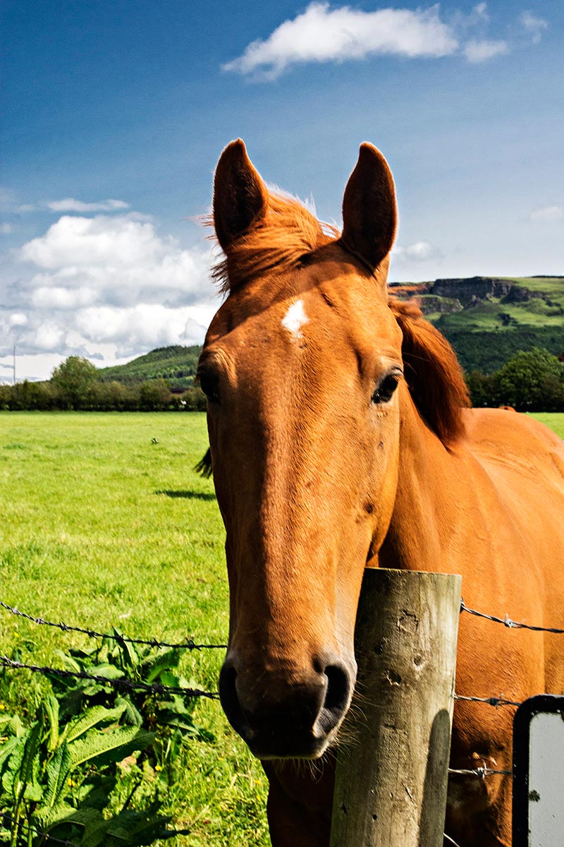
We stopped for a photo at Crindle Stables at the Carrowclare Road intersection. I noticed a slew of horses. I softly whistled and called them in my mind to come over.
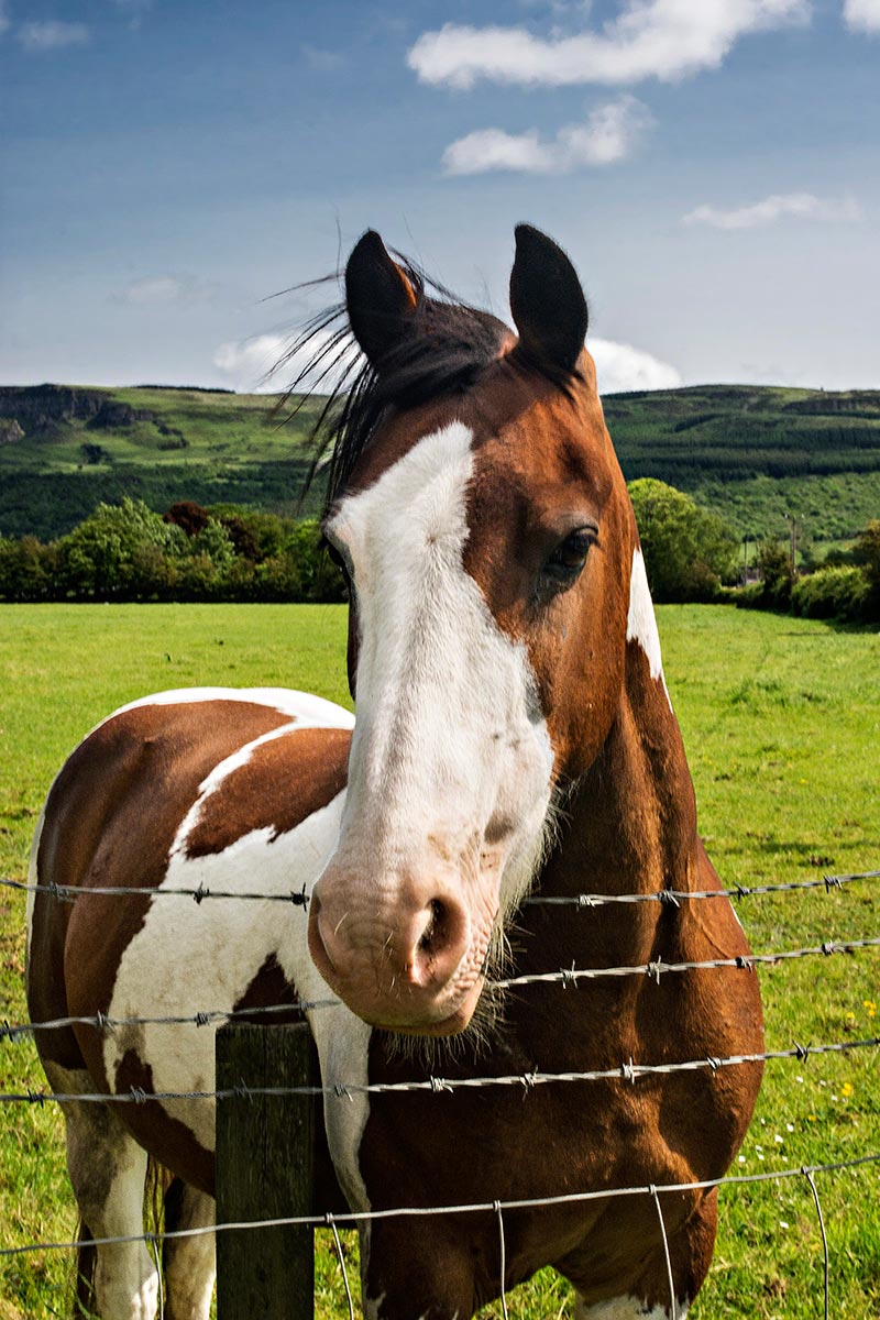
And they did come over — right to me and shoved their heads over the fence inches away from me! It was surreal. I thought they wanted me to touch them. After the experience at the Portacloy Peat Farm when the farmer said not to pet his three-year-old pony because he bites, I chickened out and took their photos instead.
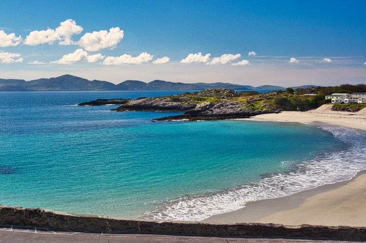
Benone Beach
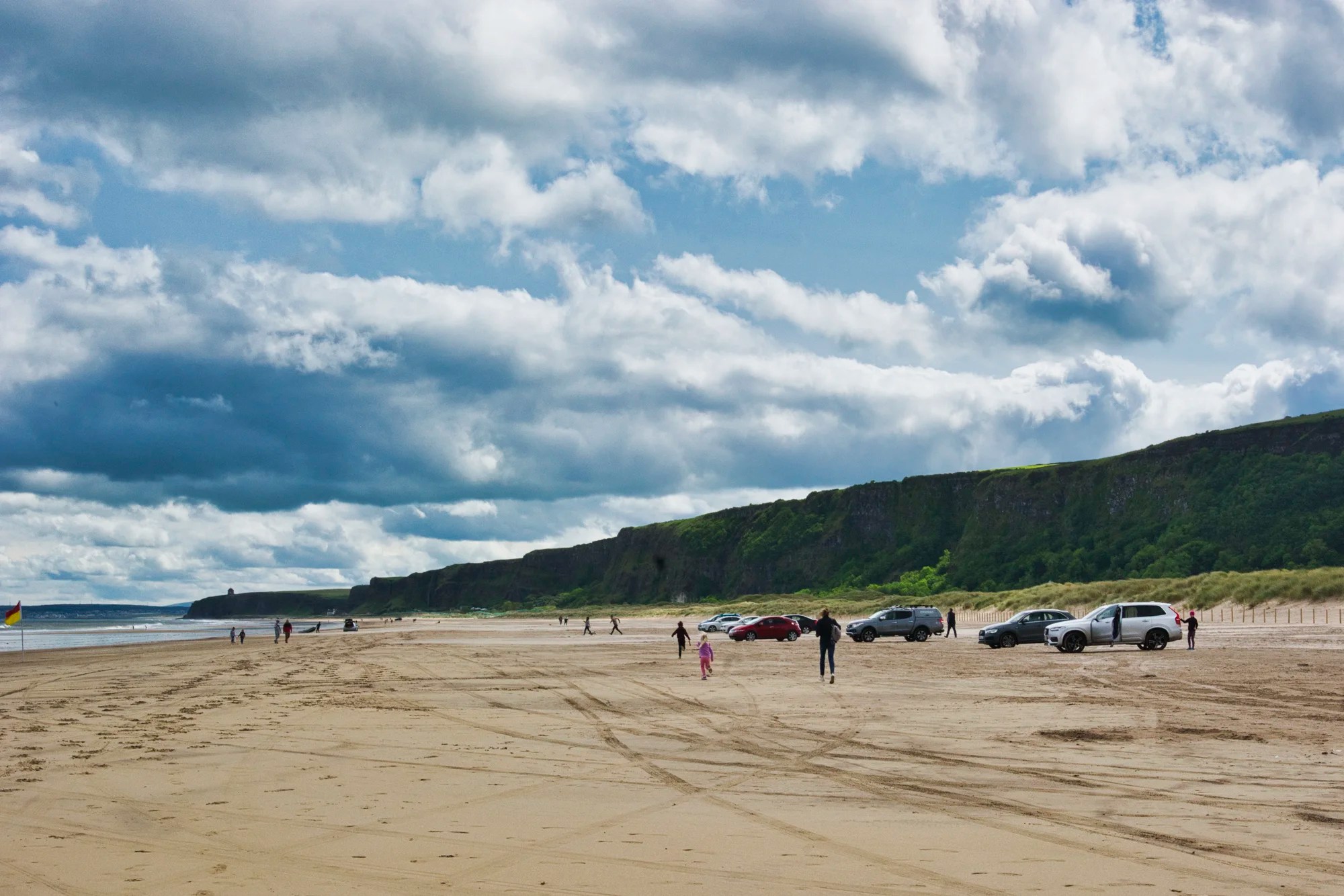
Benone Beach was a huge expanse of beach spoiled by cars and food trucks parked all over the supposedly Blue Flag beach. Blue Flag Organisation is an international body aimed at promoting environmental awareness and sustainable development of areas of natural beauty. I’m sorry, but IMHO car parking on a beach automatically disqualifies the beach as an area of natural beauty.

But it is such a nice beach. Pity! We rested here while the skies gradually cleared.
So what makes a beach spectacular? It is the same visual elements that make great art or photography: texture, depth, colour and curves. Headlands, cliffs, and formations provide texture and depth. S-curves or serpentinata make beaches and art more dynamic.
Downhill Desmesne and Mussenden Temple
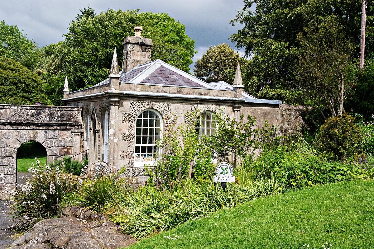
You can see Mussenden “Temple” (fake) from far away on Benone Beach or pay €6.20 per person to the National Trust to see it up close.
Just down the road, we found out the price also includes the Downhill Demesne, which has gardens and the ruins of an 18th-century mansion.
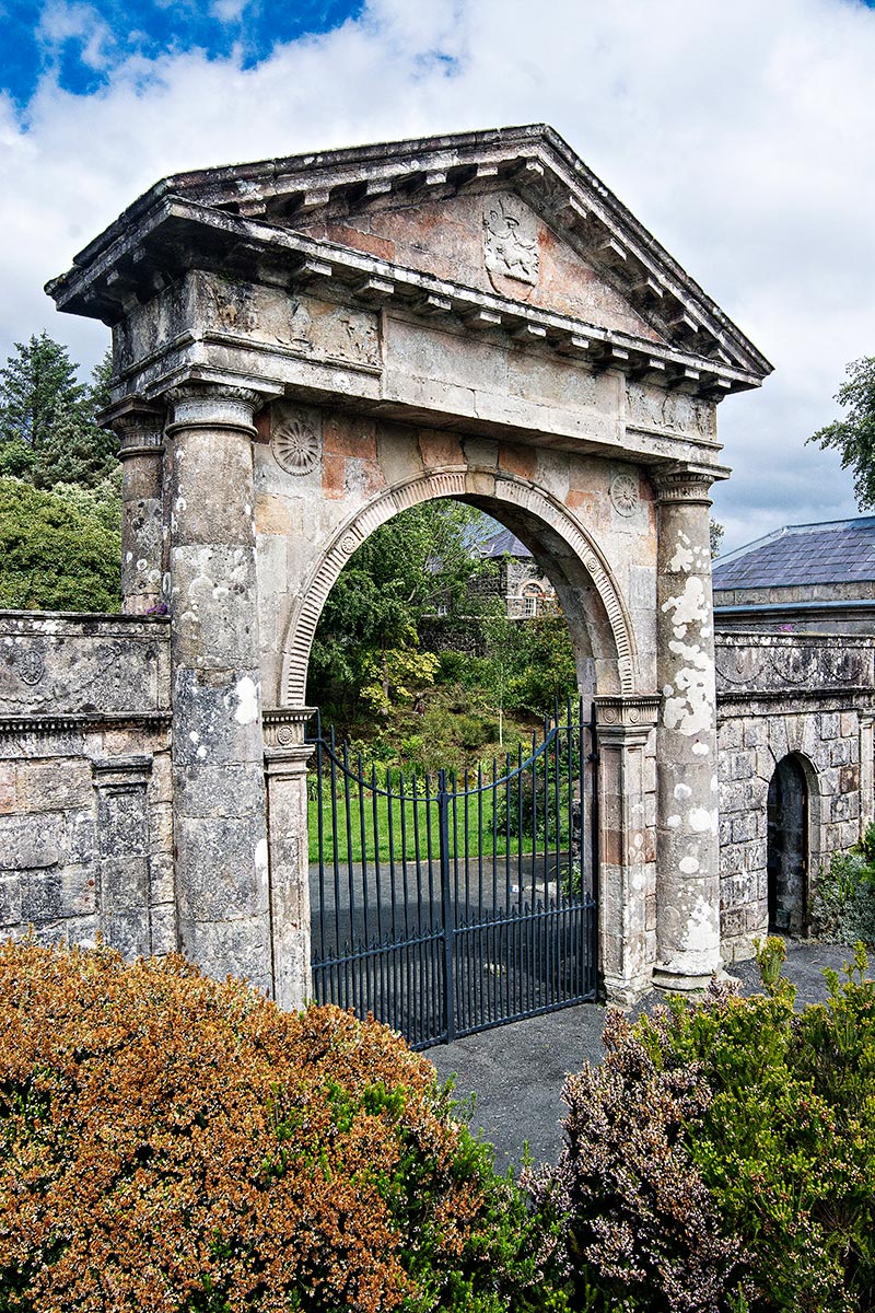
This is the 1784 Bishop’s Gate.
Port Stewart and Port Rush

Next, we drove to Port Stewart Strand, which charges €8 per car (National Trust) to go to a beach you can’t even swim in (too cold). It is also spoiled by cars parked all over the beach. There is a nice view from the hill above the beach. But is it worth going? The beach is long but straight. The water does have some beautiful turquoise colour.
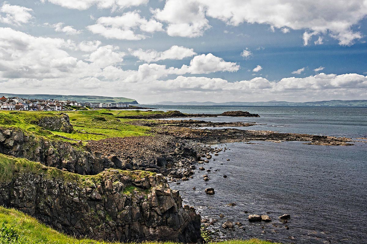
In fact, avoid over-touristed Port Stewart and Port Rush altogether unless you prefer urbanization to nature. This is an example of Joni Mitchell’s classic song Big Yellow Taxi: “They paved paradise and put up a parking lot.” The traffic was horrendous with wall-to-wall cars. We gave up and turned around. Just after Port Rush, there are a few pull-offs with nice views of the rugged coastline.
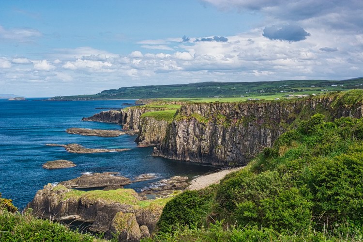
White Rocks
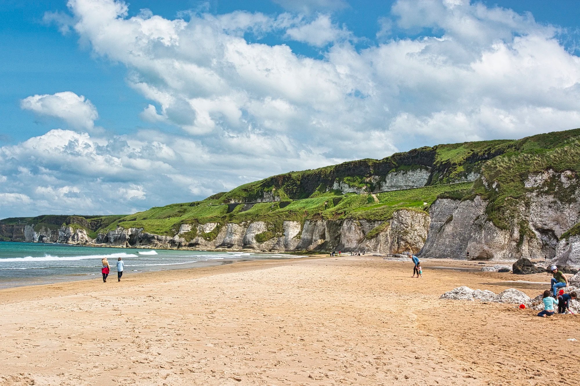
Now comes the great part of this day trip. Drive Highways A2 and B62 to White Rocks and its beautiful beach.

Not only is the beach beautiful and free, but the white limestone cliffs were formed 65 million years ago. You are looking at years and years of dead seashells deposited at the bottom of the sea and compressed into limestone.
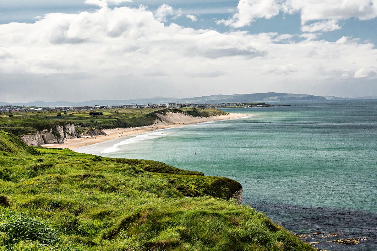
Next, you drive literally on the edge of the White Rocks on the only true coastal part of this road. There are a couple of viewpoints, like this one, looking back on the beach.

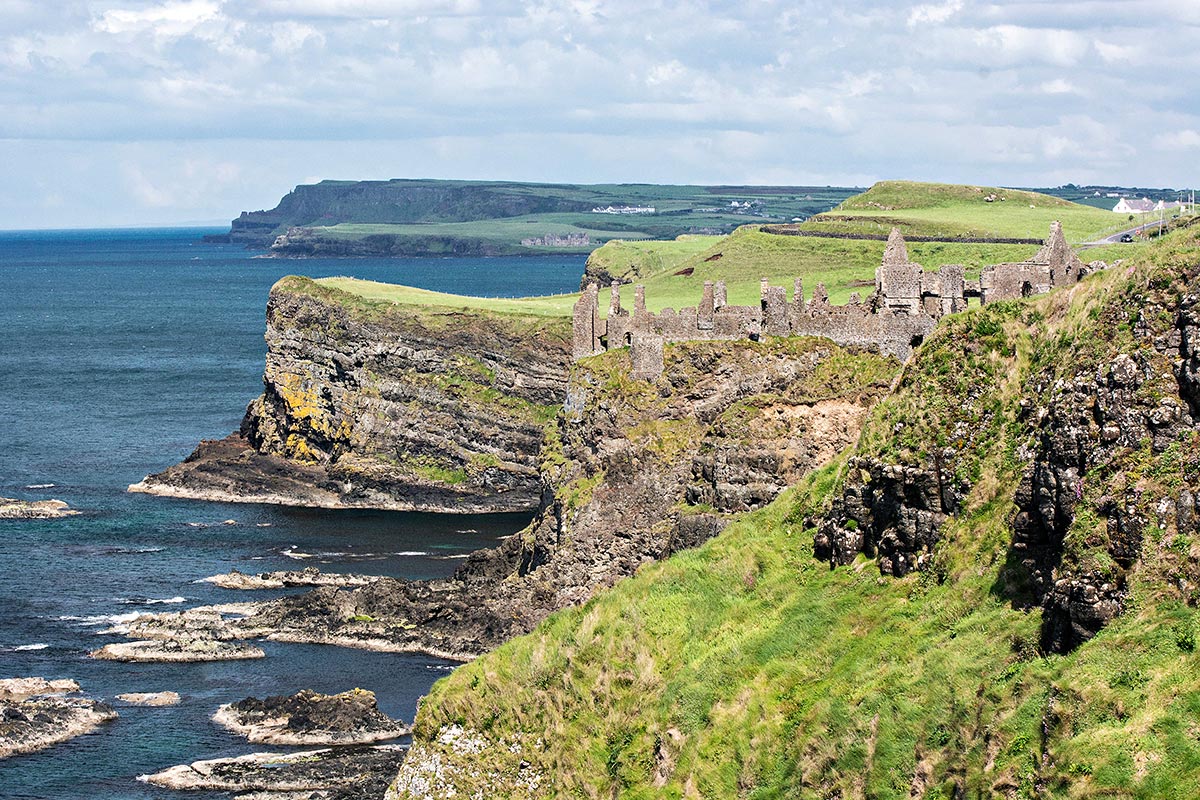
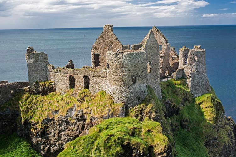
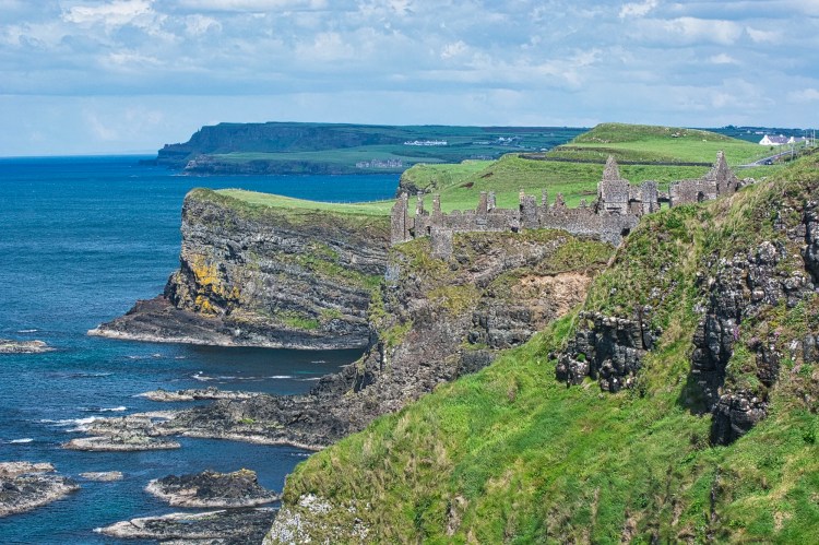
Dunluce Castle

Another viewpoint looks towards Dunluce Castle.
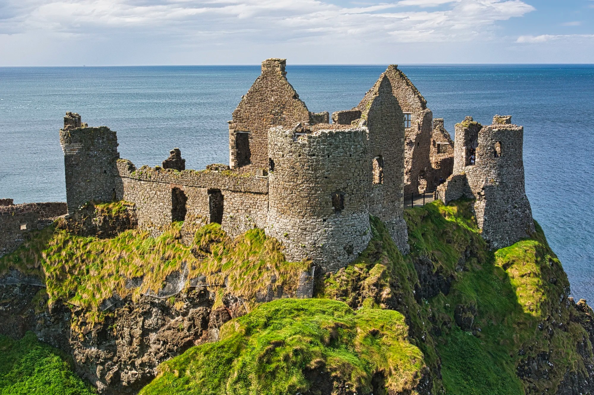
But the best view is right at Danluce Castle. There is a charge to visit the ruins. Otherwise, walk from the parking lot through the low wall and turn right for a superb photo opp.

The roads in Northern Ireland are very good. In contrast, tourist sites are poorly organized. The biggest hassle was getting into or out of the Dunluce parking lot. There are two entrances, one on the west side and one on the east side. Cars are parked along these roads, making them effectively one-lane roads. But cars are going both ways. There was a traffic jam trying to get out! This could be fixed for the minimal cost of a sign. Why oh why do they not make this a one-way road going west to east?
Giant’s Causeway National Park
Next is the famous Giant’s Causeway. They claim that all national parks are free, but you have to park. The choices are the NP parking lot for an extravagant £12.50 per person “parking” fee or free along the highway, IF you can find a place. There was no parking to be had, so we continued east, expecting to try again on the way back. We were there just after the peak visiting time from 11:00 to 15:00 hrs.
Dunseverick Castle
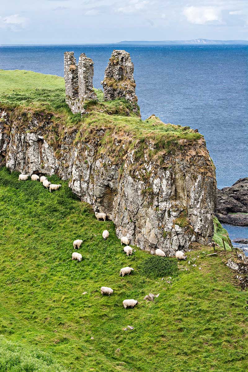
We drove to the Dunseverick Castle ruins further east on the coast. The ruins above are not special.
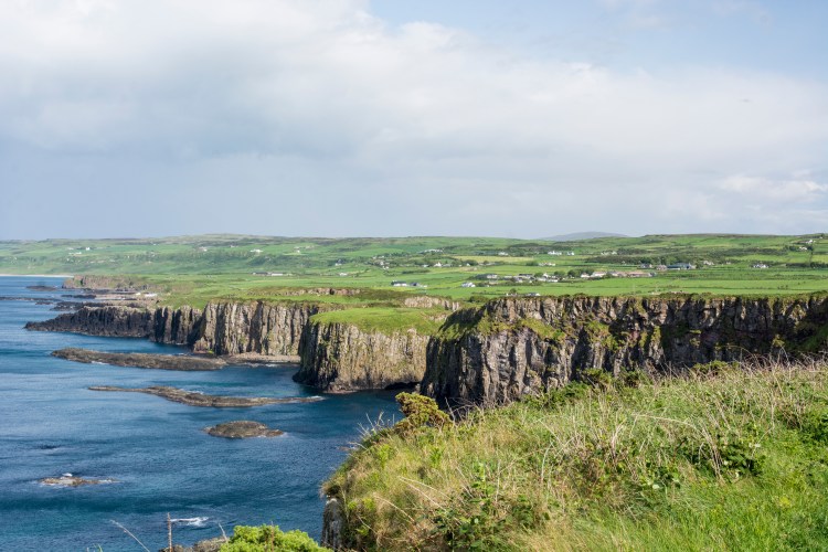
Giant’s Causeway Trail
But Dunseverick Castle is the trailhead for the 7.7 km Giant’s Causeway Trail. National Trust warden, Toby Edwards, claimed this is the best hike (and coast). It was time to find out if he was biased.
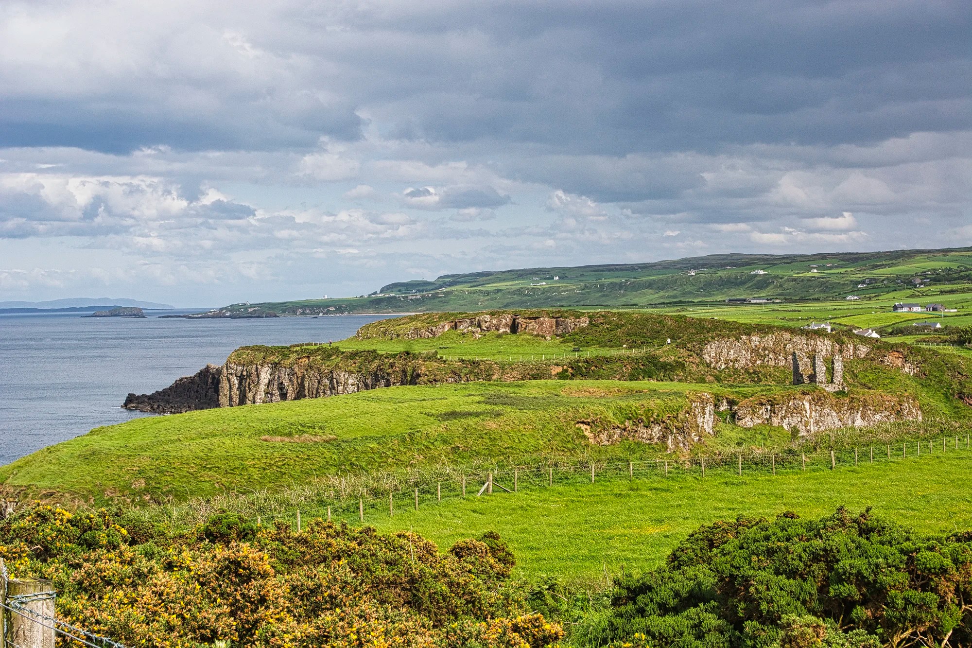
Some web articles stated that the Dunseverick part of the trail was unexciting. So I wasn’t sure how far I would hike. This was the initial view after the picnic area behind the house where we parked.
After a mere five minutes, I was hooked. I had the place all to myself — there were a total of five other hikers, including a nice Dutch couple I spoke with for quite a while, as we covered a wide range of topics from hiking to politics.
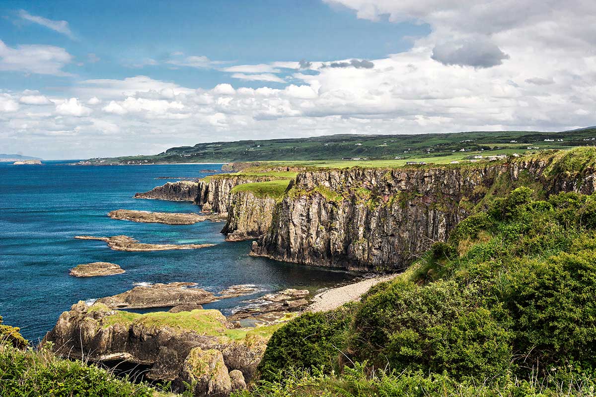
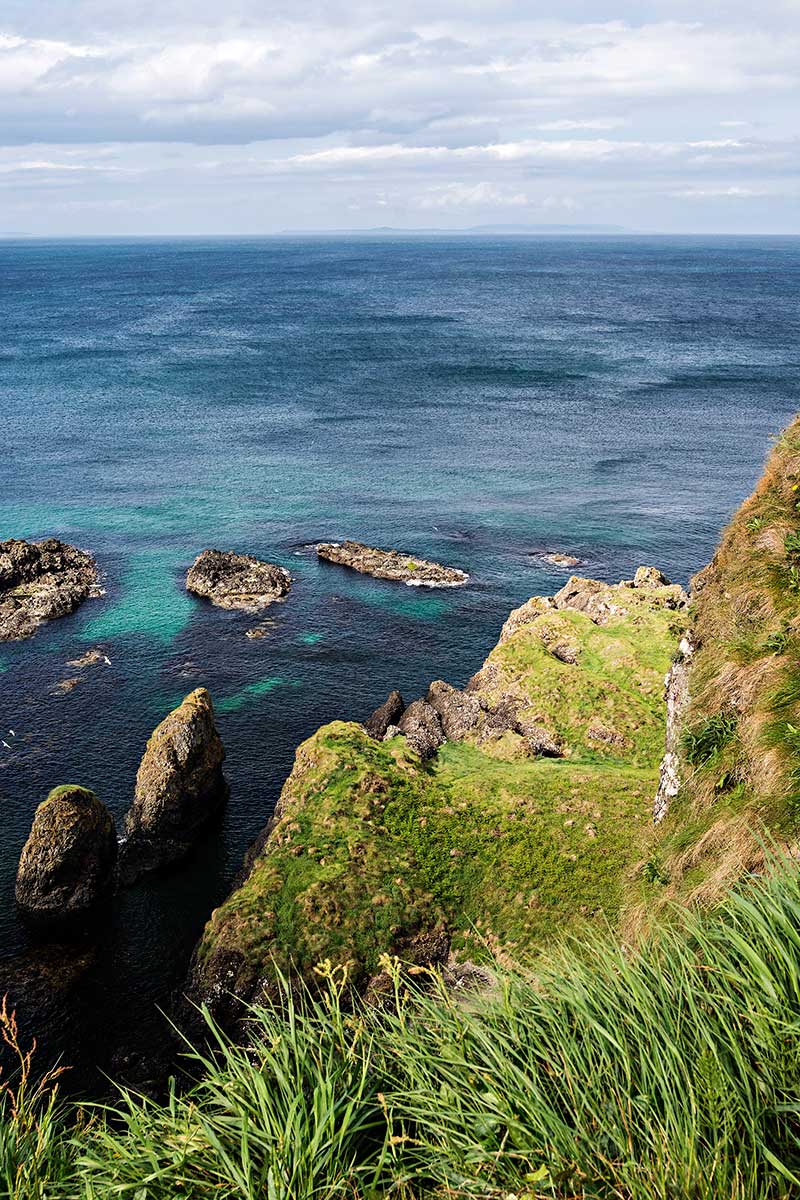
Actually, you don’t need the highest cliffs or the widest beaches to make a hike good. What makes it special are indented headlands, rocky shapes, and constantly changing, photogenic views.
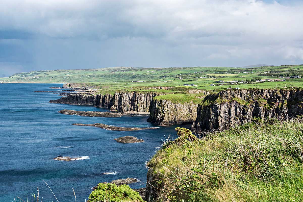
Yes, the sun lighting up the turquoise coast helped, but it also rained. Wait five minutes, and the weather changed again. The views were wide open with picturesque green pastures and mountains in the background. The scenery pulled me in, and I continued my favourite hike in Ireland — sheer bliss.
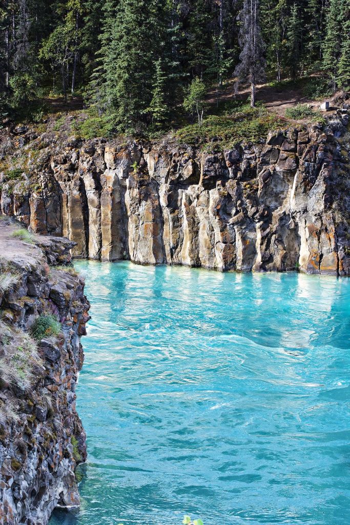
Basalt Columns
It was late in the day, so we headed home via the Giant’s Causeway. There was still no space to park. As I had a glorious time on the trail without any people, I didn’t want to spoil the day competing with gazillion tourists trying to take nature photos of basalt with people standing on top of the columns.
Basalt columns are formed when magnesium and iron-rich lava extrudes from the ground near cooling water, like Svartifoss Waterfall in Iceland, Los Prismas Basálticos in Mexico, and the Yukon River, Yukon in Canada below.
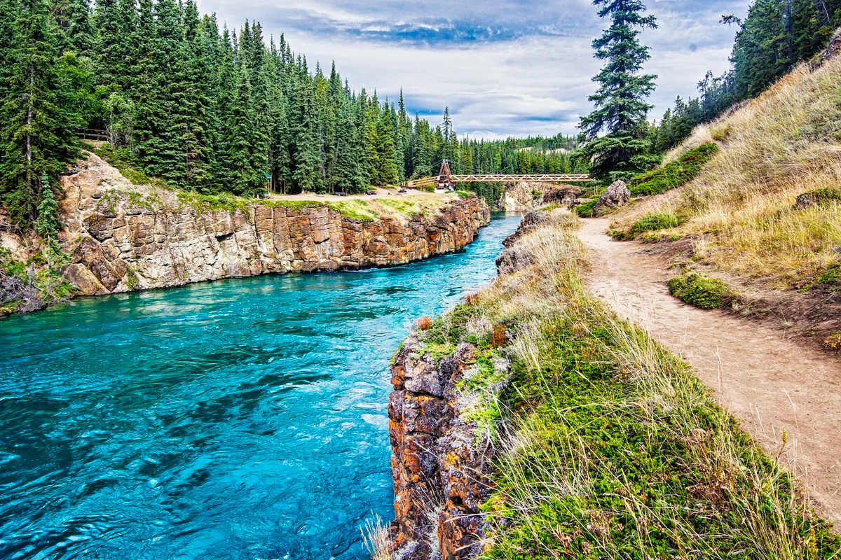
Moreover, we had recently gone to Yukon Green, where only 36,000 people live in a territory that is the same size as California! I had the basalt-lined, glacier green Miles Canyon Trail all to myself. Oh, and it’s totally free!
It was a dangerous whitewater river when the Klondikers rushed up this river to the famous Klondike Gold Rush (1896-1899) at Dawson City. Unlike in California, the gold miners were well-behaved, and land claims were controlled by gold commissioners.
Final Comments on this Itinerary
This is an action-packed itinerary for one of our favourite parts of Ireland. The places we recommend are all highly rated by local people, as shown by the high Google Map Ratings. Remember, the most important “destination” is meeting the people.
Subscribe
Get travel tips and advice delivered directly to your inbox. The best part is that it is free.
What things fascinate you? How long is your trip? What questions do you have?
Itinerary Maps & Guides
This itinerary is part of our Best Places for 2 Weeks in the North of Ireland and Ireland North itineraries.
Ireland North Map – our custom Google map
Google Maps Ratings
Google Maps provides a rating from 0 to 5 for all sights, hotels and restaurants (but not cities). All of our recommendations are appended with the rating (prefixed with a G) from Google Maps. As it is based on feedback from tourists and locals, it is much more reliable than travel booking websites. We consider a score of 4 to 4.39 to be Very Good; 4.4 to 5 to be Excellent.
Ireland FAQ
The Ireland FAQ post answers Frequently Asked Questions (FAQ) like:
- Where should I go in Ireland?
- What is the best season for travel?
- What is the best clothing?
- Where should I go? What are the must-sees?
- How much time do I need for Ireland?
- Can I see everything in a week?
- How safe is Ireland?
- How much cash should you take to Ireland?
- Should I pay in Euros or my own currency?
- What apps are useful for travel?
- Should I rent a car? Take a Taxi?

Leave a reply to Stevie C Cancel reply