
What is Unique about the Canadian Rockies?
Are you planning a trip to the Canadian Rockies but are overwhelmed by the conflicting recommendations of various websites? What should you see on a short trip to the Canadian Rockies? Should you go to Banff or Jasper National Park (NP)? What are the most beautiful sights to see in Yoho, Banff and Jasper? These are typical questions asked by people. This post gives you the best itinerary for a short trip to the Canadian Rockies.
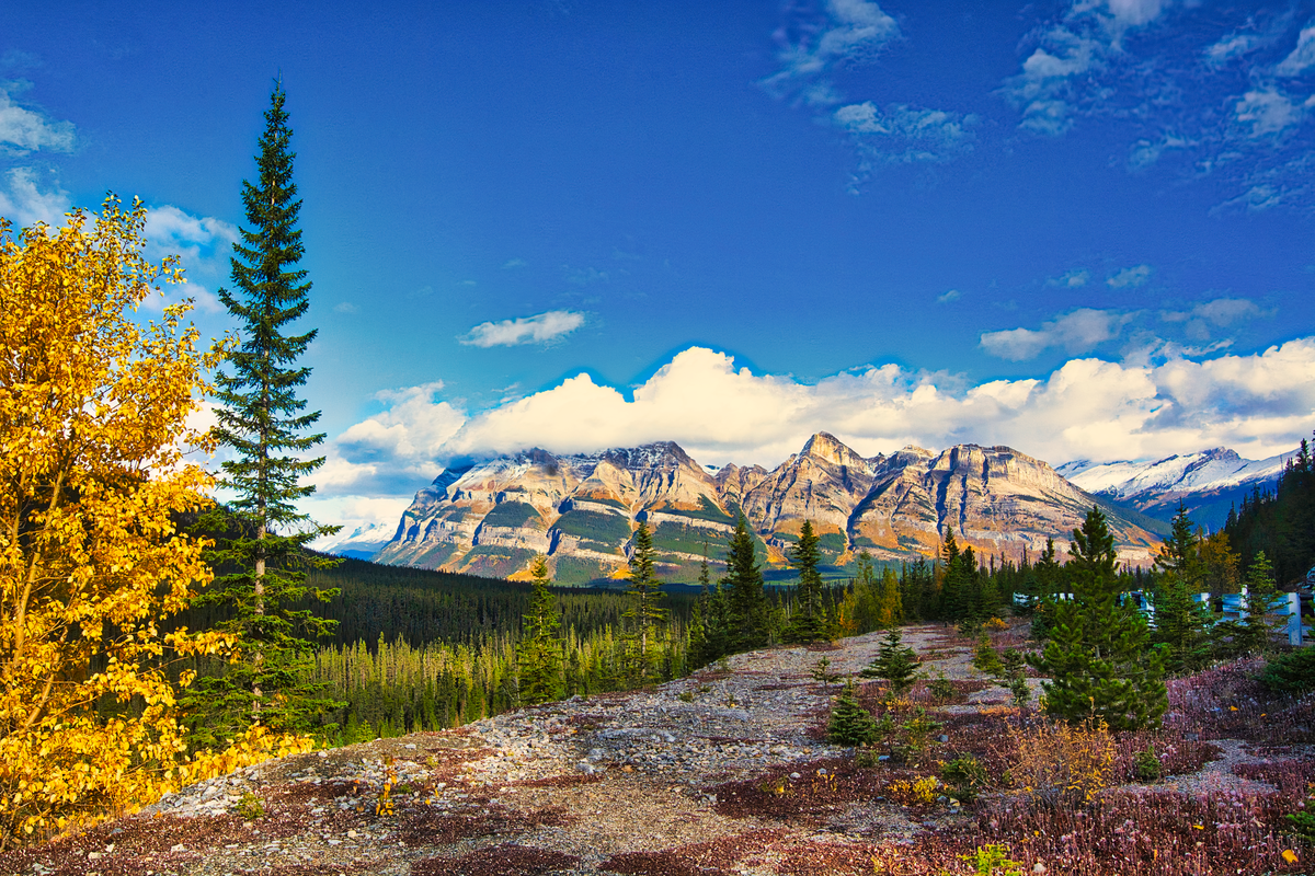
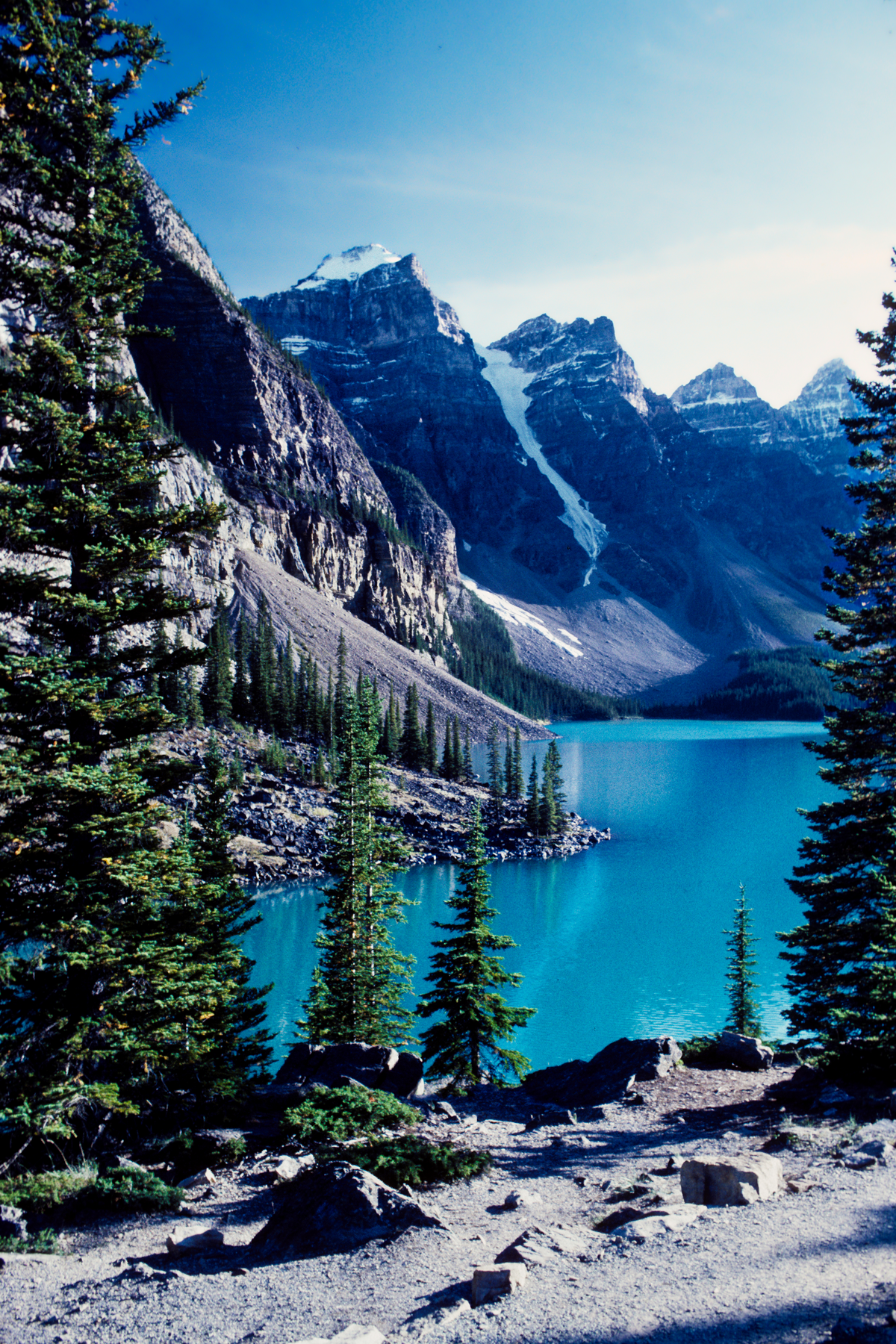
It is the turquoise-green glacial lakes and rivers that make the Canadian Rockies unique. The glaciers falling over the rugged mountains (ice falls) add to the appeal. Autumn brings golden larch colours and dusted white snow to highlight the mountain vistas.
That is why you should spend most of your time along the Icefield Parkway, the least commercialized and most scenic highway in North America. It may be only 232 km long but you need at least 2 full days if not more to do it all. And you will not feel sorry you missed the zoo at Lake Louise. Half of the Parkway is currently closed due to the horrific wildfires in Jasper.
All the points of interest are shown on our Rocky Mountain Itinerary Map and appended with the Google Maps Ratings from G0 to G5.
Author & Photographer: George Mitchell
Our advice below is not based on a couple of tourist trips. Our recommendations are based on our extensive experience living in Alberta (AB) for ten years. We are avid hikers, nature lovers and photographers (all photos are my own). The Rocky Mountains were our weekend playground. We often hosted out of province friends and family using the itinerary we are recommending.
Yoho NP
You can see several spectacular places in Yoho NP, which is in British Columbia (BC), just west of Lake Louise.
Emerald Lake
Golden to Emerald Lake 64 km, 0:48 hrs
Emerald Lake to Icefield Parkway 66 km, 1:06 hrs
Highway 1 Exit to Emerald Lake 9 km, 0:11 hrs
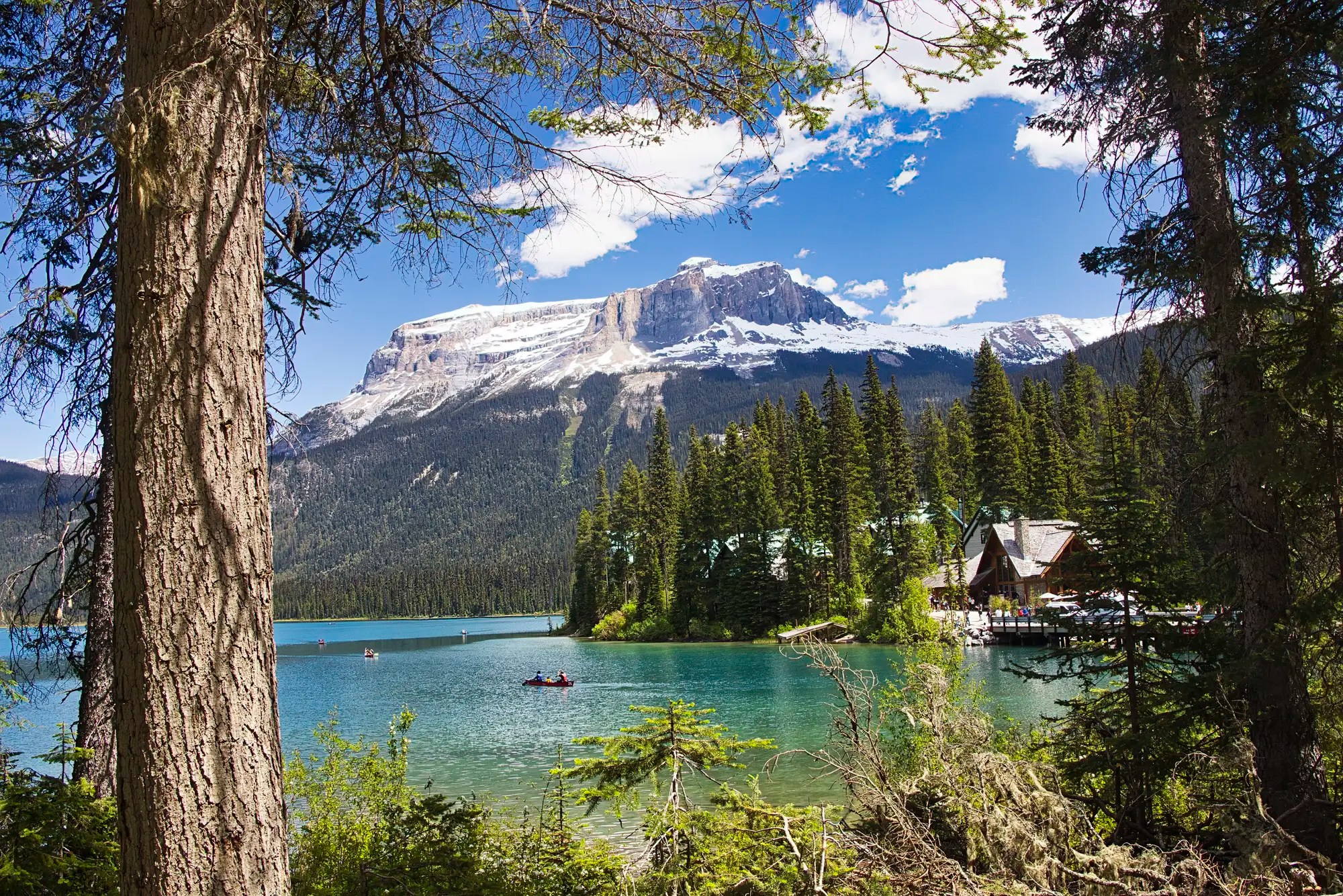
Emerald Lake G4.8 is a gorgeous glacial green lake. Go to this very popular place early in the morning or possibly late afternoon to get parking. We just waited in the parking lot until someone left. Otherwise, park down the road and walk back.
- Hike the lakeshore trail to the left of the Emerald Lake Lodge bridge. It is part of the longer Emerald Basin and Yoho Pass trails. There are many views along the way, unlike the end of this loop trail through the lodge. The further you walk, the less the people.
- The hike to Yoho Pass is a challenging and long 19.2 km round trip trail. We took my inexperienced sister and brother-in-law and they did well, even when we had to cross an overflowing, unbridged stream!
- Canoe the lake to feel “almost alone”: CAD 100/hr.
- Visit the Natural Bridge at the bottom of this road.
Takakkaw Falls
Highway 1 Exit to Takakkaw Falls 13 km, 0:17 hrs
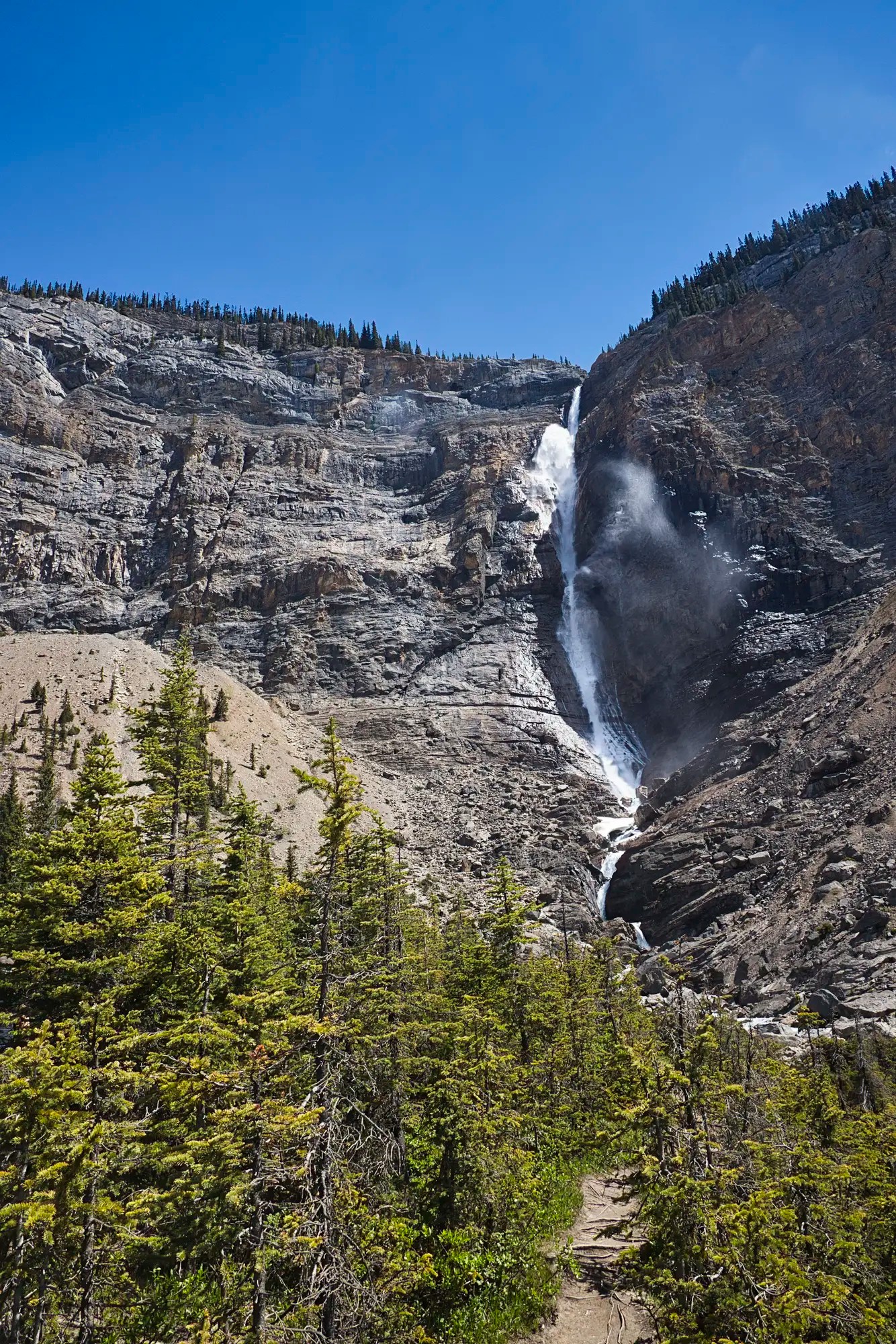
Takakkaw Falls are very impressive. If you are hiking-challenged, at least walk from the parking lot to the bridge. The falls are not only very high, but you can feel the power. All that water is fed by the meltwater of the Daly Glacier. At 373 m (1,224 ft) high, they are the second-tallest waterfall in Canada.
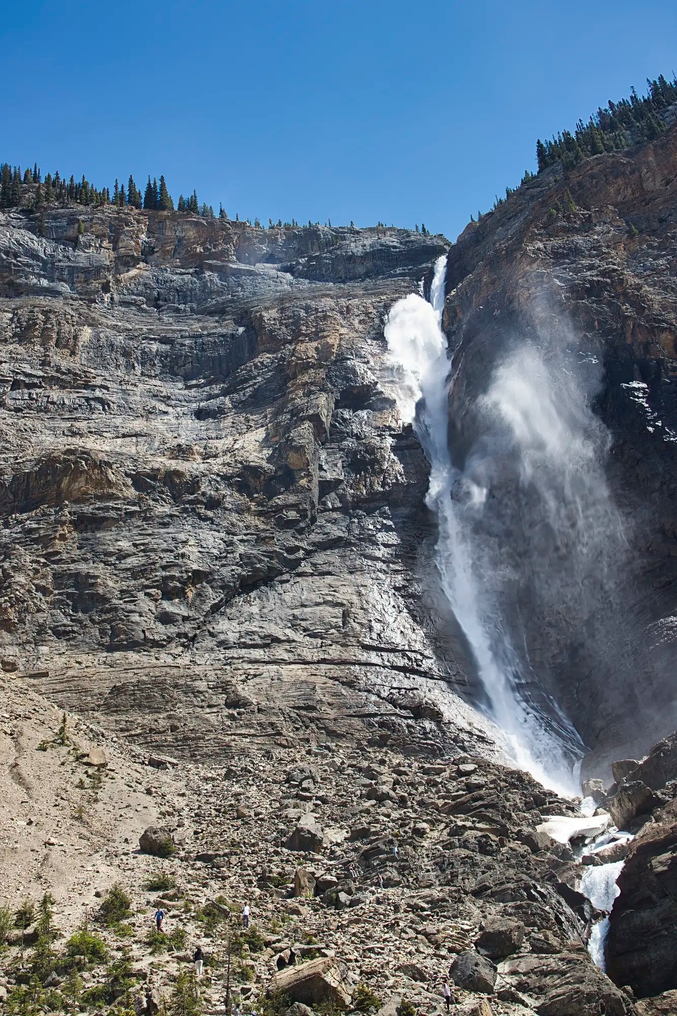
- Enjoy (or not) the harsh switchbacks along this road (trailers and buses are not allowed).
- Stop at the Meeting of the Waters viewpoint.
- Hike the Twin Falls, Yoho Skyline Trail or other trails in the area.
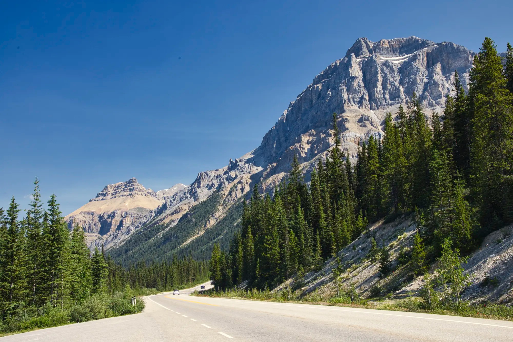
Icefields Parkway
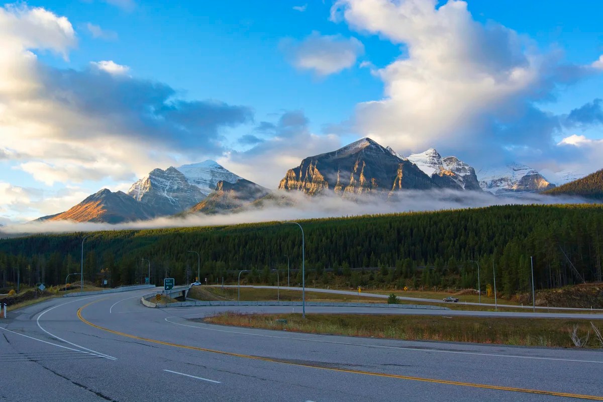
The Icefields Parkway between Lake Louise Village and the town of Jasper provides 232 km of easy access to rugged Rockies, gorgeous glaciers, and turquoise lakes — all from the luxury of your car. Due to the Jasper wildfires the Icefields Parkway is currently closed at Saskatchewan Crossing.
There are not many roads in North America (or the world) that are this spectacular for this long a distance with minimal human development and commercialization. The latter part is the clincher. That is what is so special about the Canadian Rockies. That is why the Icefield Parkway is THE must-do in the Rockies. It is much more scenic than Lake Louise or Banff town.
Herbert Lake
Highway 1 Exit to Herbert Lake 3 km, 0:04 hrs
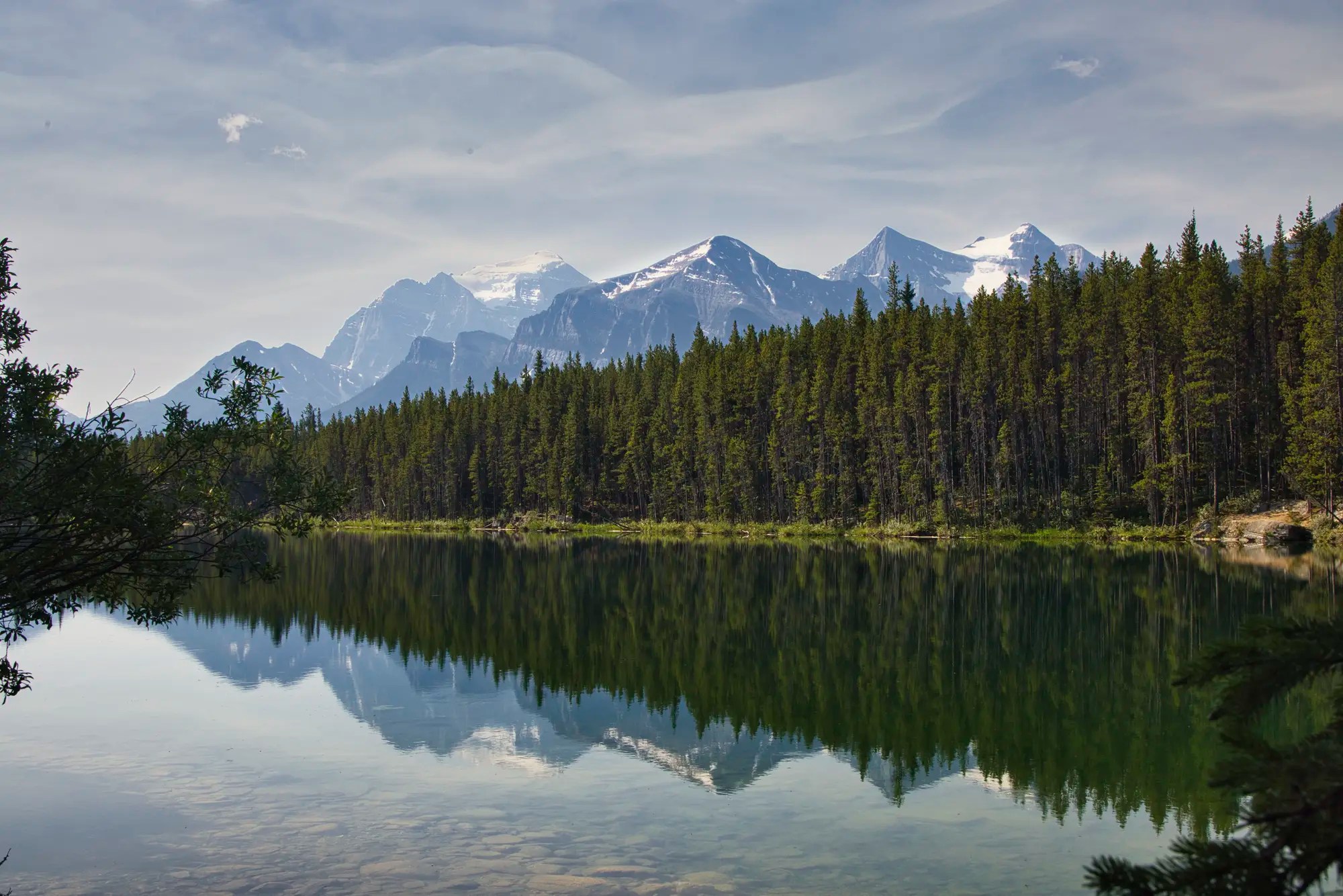
Herbert Lake G4.7 is the first stop on the Icefield Parkway. While it is not one of the turquoise lakes, it is worth stopping for its spectacular mirror reflection of trees and mountains.
Crowfoot Glacier
Highway 1 Exit to Crowfoot Glacier 33 km, 0:23 hrs
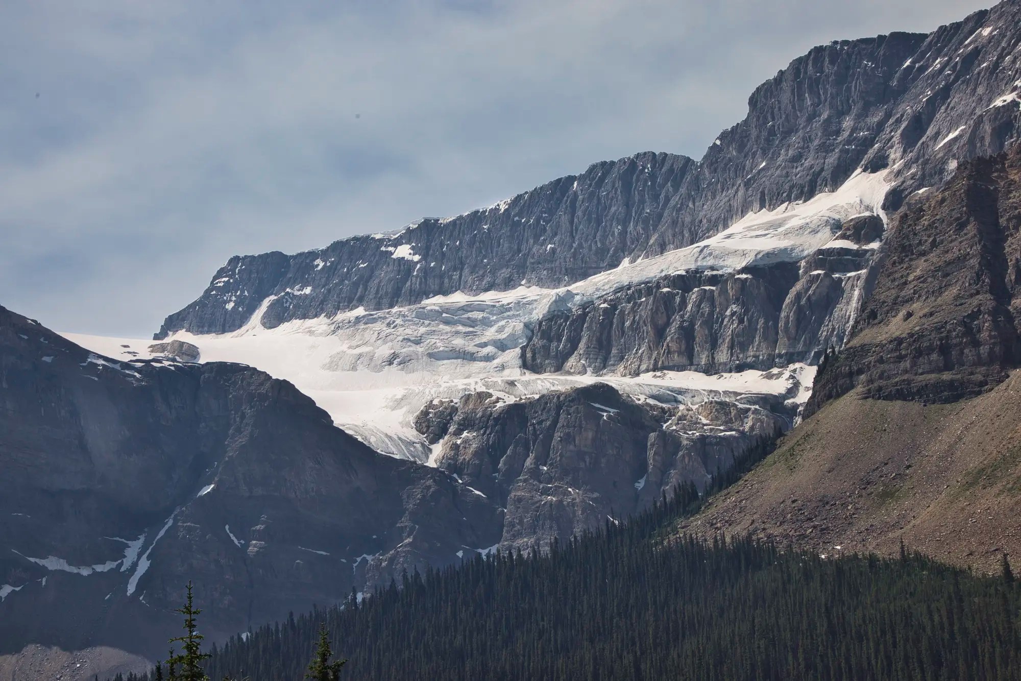
While one of the claws has dropped off, this is still a spectacular view. Crowfoot Glacier G4.8 is very far away and very high up Crowfoot Mountain.
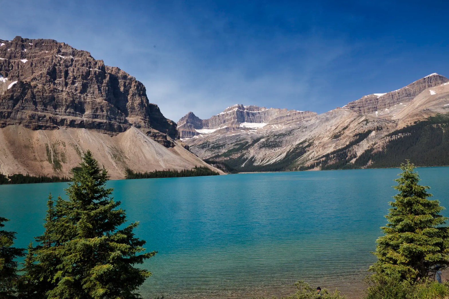
Bow Lake
Highway 1 Exit to Bow Lake 34 km, 0:24 hrs

Bow Lake G4.9 parking is always bursting but this is one of the best turquoise lakes backed by the massive Crowfoot Mountain. Most people do not realize the scale of this view. The lake is 3.2 km (2.0 mi) long. Crowfoot Mountain on the left is 3,055 m (10,023 ft) high.
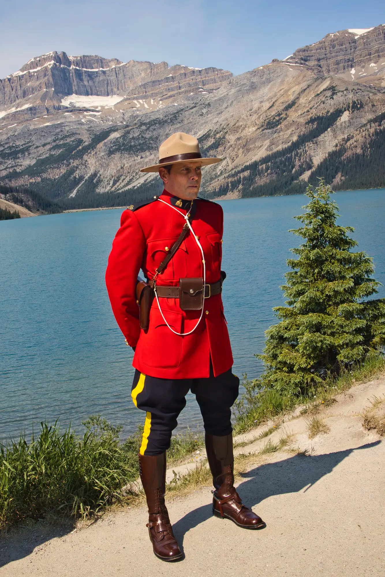
No the Mounties are not looking for unruly tourists. They patrol the Parkway in case there is an emergency since there is no cell phone service to call for help. Today, he was posing with the tourists.
Num-Ti-Jah Lodge, Bow Lake
Highway 1 Exit to Num-Ti-Jah Lodge 36 km, 0:26 hrs
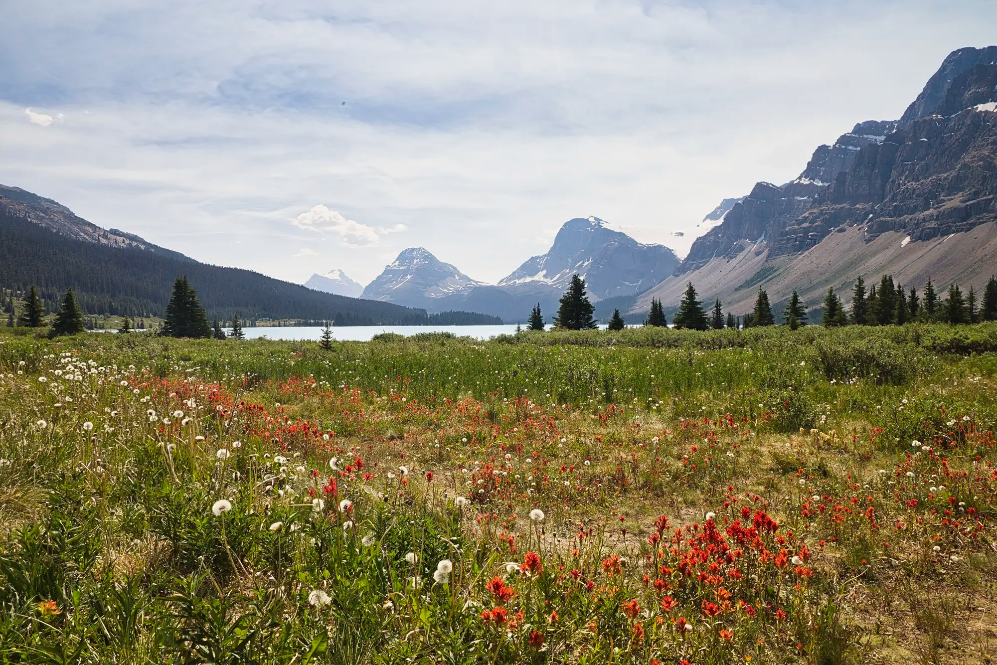
At the north end of the lake is a road to the red Num-Ti-Jah Lodge G4.3. Flowers adorn the fields just east of the lodge.
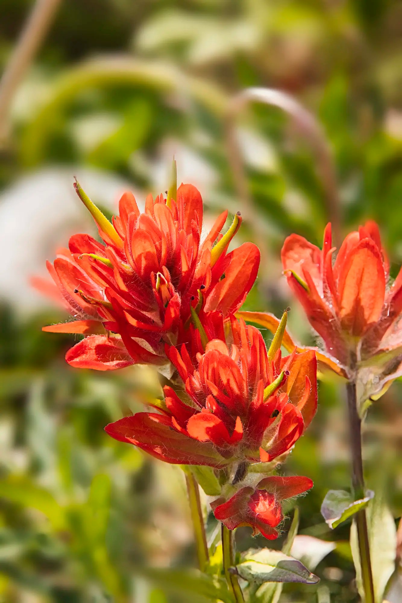
Wildflowers are one reason to visit in the summer. The bright red Indian Paintbrush is one of the more common sub-alpine flowers
Walking on the trail west of the lodge brings you to less crowded views of Bow Glacier and the lake. The 8.9 km trail goes to Bow Glacier Falls (not the same as Bow Falls).
Peyto Lake
Highway 1 Exit to Peyto Lake 41 km, 0:31 hrs
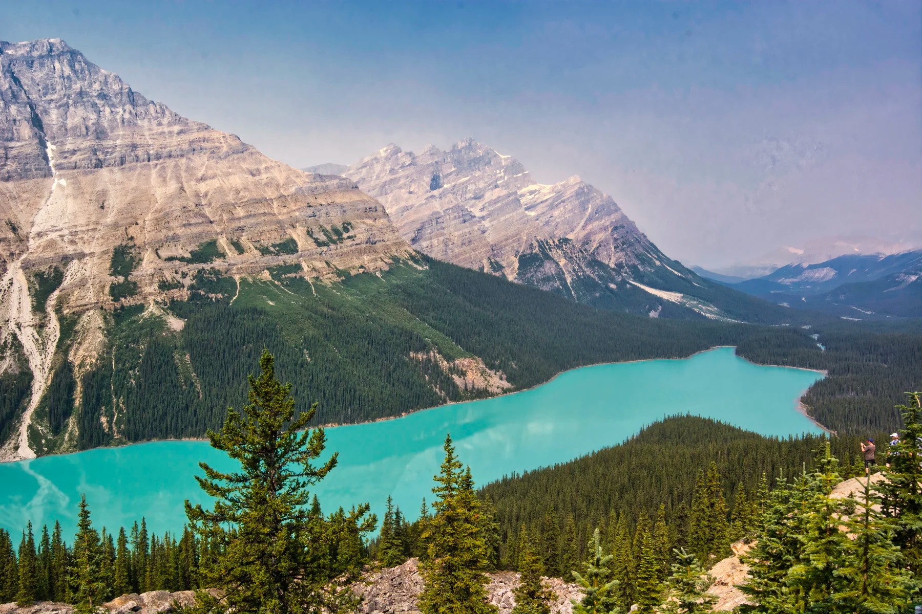
Peyto Lake G4.9 has always been our favourite turquoise lakes years ago when we often were the only people at the viewpoint. But now it has become spoiled by the number of tourists. The 2.4 km trail requires walking 45 minutes partly uphill but even kids can do it. The gorgeous turquoise lakes and rivers of the Rockies were created by glaciers, which grind rocks into rock flour (yes, it’s a real thing) that is suspended in the water and reflects only turquoise light!
Waterfowl Lake
Highway 1 Exit to Waterfowl Lake 58 km, 0:39 hrs
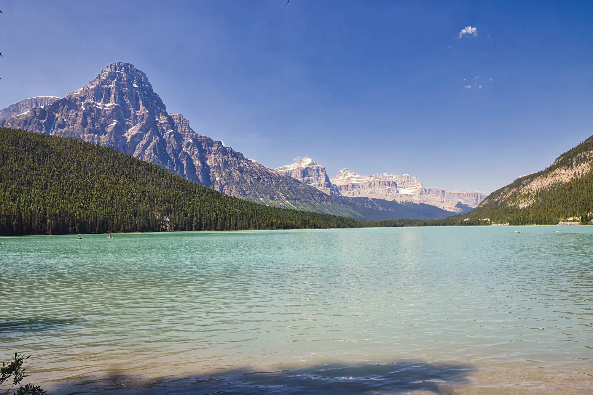
Do not miss the unusual turquoise coloured Waterfowl Lake G4.7. Most tourists stop at the Waterfowl Lake Viewpoint right on Hwy 93. We loved camping at Waterfowl Lake campground where there is a trail to a better and more tranquil view.
Towering over this turquoise lake is the pyramidal Mt. Chephren (3,266 m 10,715 ft). It is composed of sedimentary rock dating back to the Precambrian to Jurassic periods, over 145 million years ago!
Mt. Wilson Viewpoint
This is an unnamed and unsigned pull off on the west side of Hwy 93. It is just before the downhill to Mistaya Canyon and Saskatchewan Crossing. The view is most special in the autumn with the colourful leaves and a dusting of snow on the top of the Mt. Wilson G5.0.
Mistaya Canyon
Highway 1 Exit to Herbert Lake 71 km, 0:48 hrs
A 1.9 km trail G4.8 takes 38 mins to reach the bridge over the Mistaya River with views of the canyon.
At this point you currently need to turn back due to the closure of Jasper NP.
Lake Louise Area
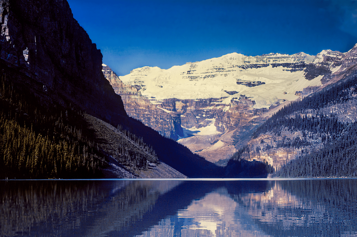
Times have changed since we first moved to Alberta. There are too many tourists thinking that Lake Louise is the ultimate destination of the Rockies. It is not!
Rated by Google Maps as G4.6 out of 5, it is somewhat beautiful. G4.3 would be a more accurate rating during the summer months. We think it is overrated because it is now spoiled by over crowding and long waits for shuttle buses. Did you come to enjoy nature or to see thousands of tourists?
Moraine Lake
The glacial green Moraine Lake is gorgeous. This is the one place worth visiting in the Lake Louise area. The road is closed to cars, and you have to take the $8 per person shuttle bus. Yes, there will still be a lot of people, but this lake is worth a visit. Due to the long lineups for the return bus, you will want to get the most out of this trip and should probably spend most of the day here. Bring your own food for a picnic. Here are the best things to do:
- Hike the short Rock Pile Interpretive Trail to the best view of the lake and the ten peaks, Wenkchemna.
- Canoe the lake to feel “almost alone”.

- Take the half-day hike to Larch Valley or the longer hikes:
a) Larch Valley – Sentinel Pass Trail
b) Eiffel Lake Wenkchemna Pass Trail
Banff the Town Area
There are too many tourists thinking that Banff the town is the ultimate destination of the Rockies. Banff is a very attractive tourist town in the autumn when there are less tourists but it is the opposite of wilderness.
You can no longer see wildlife on the Trans-Canada Highway since it was converted to an expressway and fenced in to prevent wildlife from crossing it. Note the treed overpasses just for wildlife!
However, there are nearby places that are worth visiting.
Lake Minnewanka
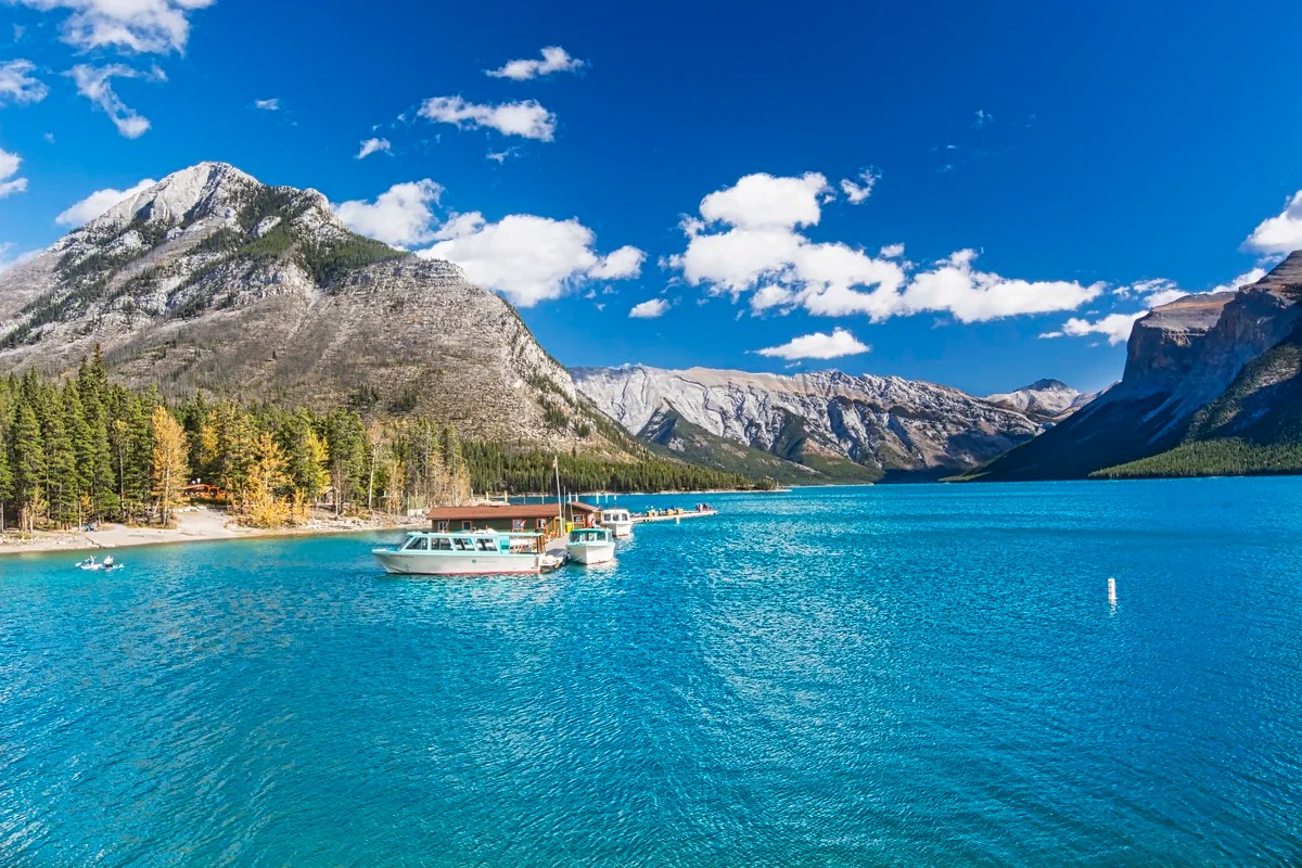
The Minnewanka Scenic Drive is worth doing. Personally, I would not rate Minnewanka and Two Jack Lakes as highly as the lakes on the Icefield Parkway. The colour of Lake Minnewanka G4.8 is gorgeous. We used to bring visitors here in early morning or late afternoon to see the bighorn sheep.
Two Jack Lake
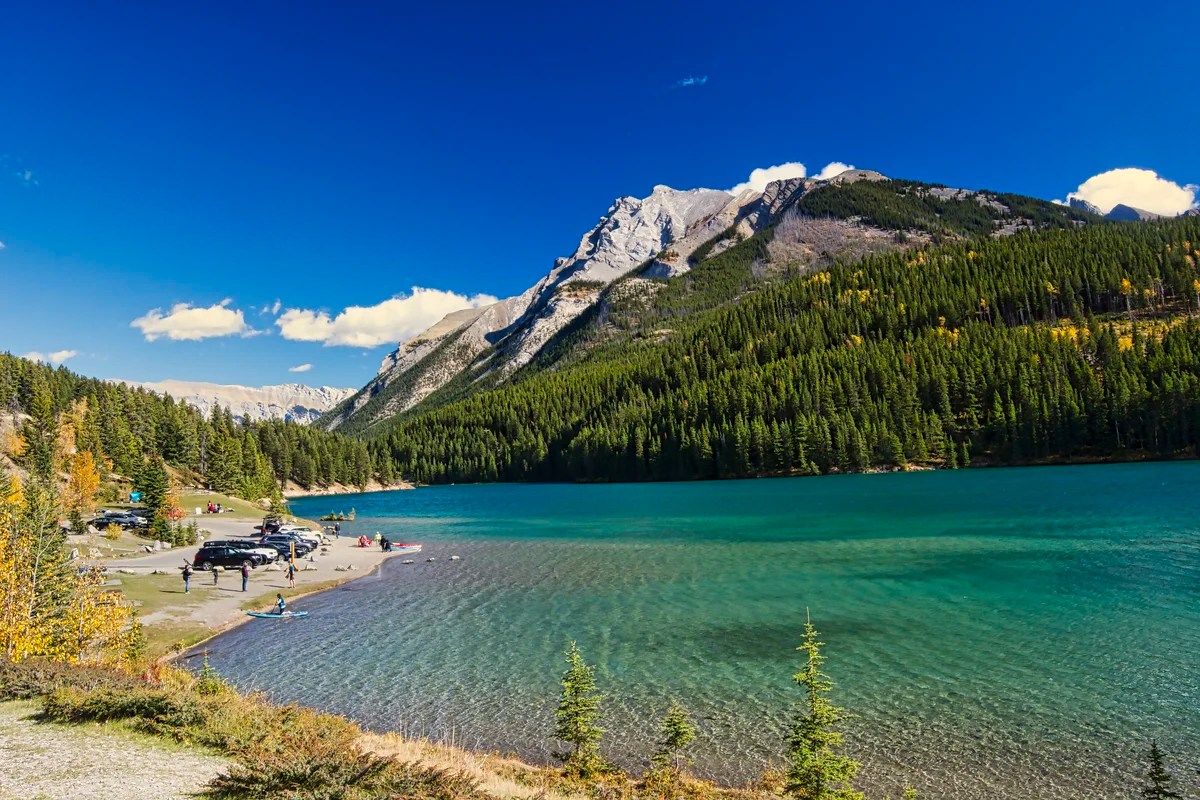
The mountain backdrop is not as spectacular, but the colour of Two Jack Lake G4.8 is gorgeous.
Bow Falls
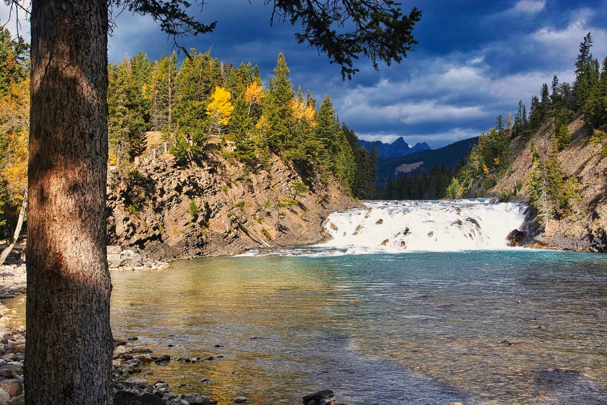
Bow Falls G4.7 and the Park HQ Gardens G4.7 are our favourite places in Banff the town. We only go to Bow Falls in the autumn when there are less tourists.
Johnston Canyon
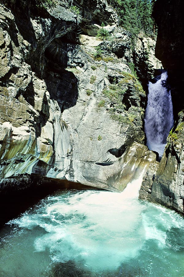
Johnston Canyon G4.7 is a great hike for kids as you walk inside the canyon on a cantilevered bridge. It also has become overcrowded.
But it is even more spectacular when you realized the limestone walls are formed from fossilized sea shells before the greatest mass extinction event — the end of the dinosaur (Cretaceous) era — and the formation of the Rockies 65 million years ago.
Sunshine Meadows

Take the gondola to Sunshine Village G4.7 ski area. Here is a fairly flat Sunshine Meadows full of wildflowers. Please keep on the trail and do not pick any flowers! In the background on the right is a view of the conical Mt. Assiniboine.
Final Comments on this Itinerary
This is an action-packed itinerary where you can get away from the crowds of tourists who head to sites that are famous because of name recognition. The places are all highly rated by the people as shown by the high Google Map Ratings. The most beautiful turquoise lakes are Peyto G4.9, Bow 4.9, Emerald G4.8, Moraine G4.8, and Waterfowl G4.7! All of these lakes are considered more beautiful than Lake Louise.
If you just go to Banff the town and Louise the lake and miss the Icefields Parkway, you have missed the essence of the Rockies.
Do you want more information? Then subscribe for free.
What things fascinate you? How long is your trip? What questions do you have?
Travel Tips
Parking
The most important travel tip is to avoid the peak time between 10:00 to 16:00 hrs. This applies to the sights where parking is an issue: Emerald Lake, Takakkaw Falls, Peyto Lake Trailhead, and Athabasca Falls. This means you may want to change this itinerary to go to these places first and then do the other viewpoints.
Driving
Do NOT speed. You may get away with 5 km over the speed limit. But the fines in the NPs are very high especially in construction zones. There can be lots of wildlife on the highways or people stopping to see wildlife or waterfalls. Finally, you are supposed to be on holiday and enjoying nature. You should not try to cram in more things than can be done in a day.
When the Icefield Parkway reopens do not try to see all 232 km in one day. We did the commute from Golden to Jasper to see our favourite places. It took ten hours return!
Food
Bring your own lunch such as canned tuna, cheese, bread, and other foods that cannot spoil in the heat. Use a plug-in cooler or an insulated picnic bag. Eating out cuts into your sightseeing time and quite frankly there are limited restaurant options along the Icefield Parkway.
Accommodation
The best base for accommodation is the Lake Louise village hotels and campground or the Waterfowl Lakes Campground. As accommodation is hard to find, generally you choose a base and commute to the Icefield Parkway from Banff 58 km (45 minutes), Canmore 80 km (1 hr), Golden 80 km (1 hr), or Calgary 183 km (2 hrs). Waterfowl Lakes Campground is 61 km (45 minutes) north of Lake Louise but it is on the prime sightseeing road, the Icefield Parkway.
Itinerary Planning
Our custom planning maps include all the possible Points of Interest pinned. You can create your own custom maps using the Google My Maps app.
Google Maps Ratings
Google Maps provides a rating from 0 to 5 for all sights, hotels and restaurants (but not cities). All of our recommendations are appended with the rating (prefixed with a G) from Google Maps. As it is based on feedback from tourists and locals, it is much more reliable than travel booking websites. We consider a score of 4 to 4.39 to be Very Good; 4.4 to 5 to be Excellent.
Other Places to Add to Your Itinerary
Here are nearby places you might want to explore:
When Jasper NP reopens you can use the following posts to plan your itinerary:
Heading just two hours east of Calgary, you can visit Dinosaur Provincial Park. Here is the world’s richest source of Cretaceous Era dinosaur fossils.
When is Best Time to Visit the Rockies?
Here are the average high temperatures and rain days in Banff by season. I have divided the months by temperature similarity rather than traditional seasons.
Winter (Nov-Mar) is both cold and snowy, but a haven for skiers.
Spring (Apr-May) is warm enough for a road trip. But there will still be snow even at lower elevations. Many lakes may be at least partially frozen, so you will not necessarily see the turquoise colours.
Summer (Jun-Aug) is warm and sunny. This is the best season for wildflowers and hiking when the snow has melted (hopefully).
However these historical averages do not reflect current global climate changes. This past summer the average high was 33 to 36°C when we visited. Summer is also the high season, and you need to book ahead and pay a lot of money unless you are camping.
Autumn (Sep 17°C and Oct 10°C) could be a very beautiful time. You can still go hiking depending on when the first permanent snow starts. But the days are shorter, and it could snow in October – definitely at the higher elevations. On the plus side, the lighting is softer, the autumn foliage is gorgeous and snow highlights the rock layers of the mountains. It is ideal for photography.
| Season | Mean High Temp | Rain Days per Month |
|---|---|---|
| Nov-Mar | -0.8°C 30.6°F | 4.4 |
| Apr-May | 11.5°C 52.7°F | 6.5 |
| Jun-Aug | 21.3°C 70.4°F | 8.0 |
| Sep-Oct | 13.5°C 56.3°F | 5.0 |
Canada FAQ
The Exploring Canada post answers questions such as:
- Where should I go in Canada?
- What is the best season for travel?
- What is the best clothing?
- Where should I go? What are the must-sees?
- How much time do I need for Canada?
- Can I see everything in a week?
- How safe is Canada?

Leave a comment