
What is Unique about Vancouver?
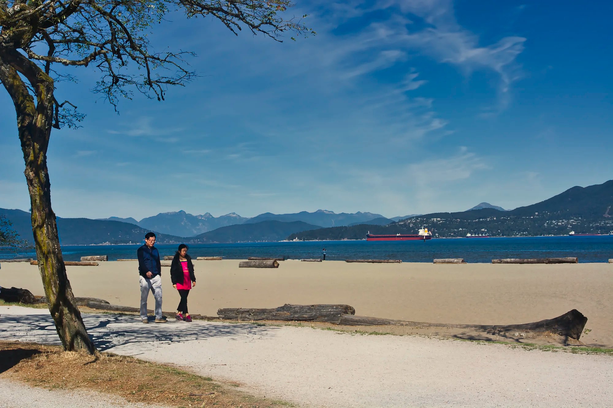
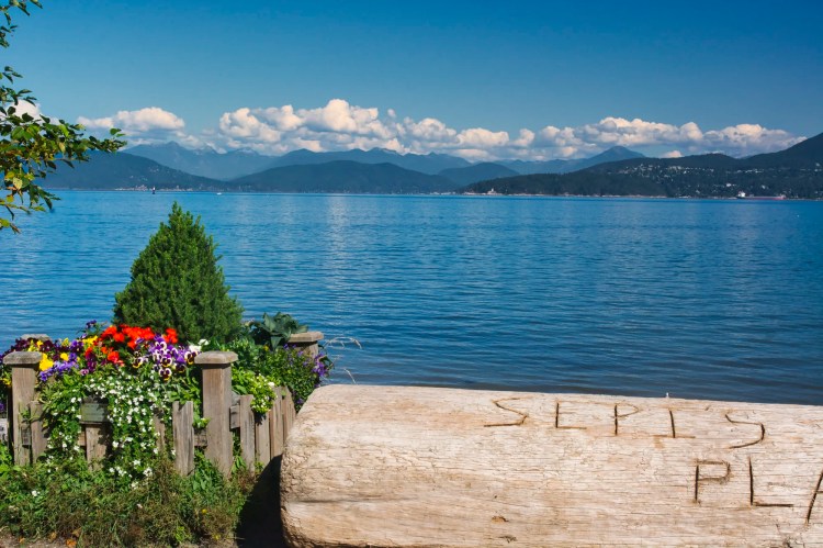
Vancouver is a water wonderland backed by majestic mountains. It is the embodiment of the Chinese landscape painting style called Shanshui (literally mountains and water). You feel like a very small presence in the vastness of the mountains. The city is small and insignificant. You can barely see that there are buildings on the other side of the strait.

To experience this, the first place that comes to mind is Stanley Park, but that is a very overcrowded area. Here are three places where you can appreciate mountains and water which are an essential part of the character of Vancouver. They are not hidden gems because lots of Vancouverites go there. But you will experience real city life at Spanish Banks, False Creek, and Deep Cove.
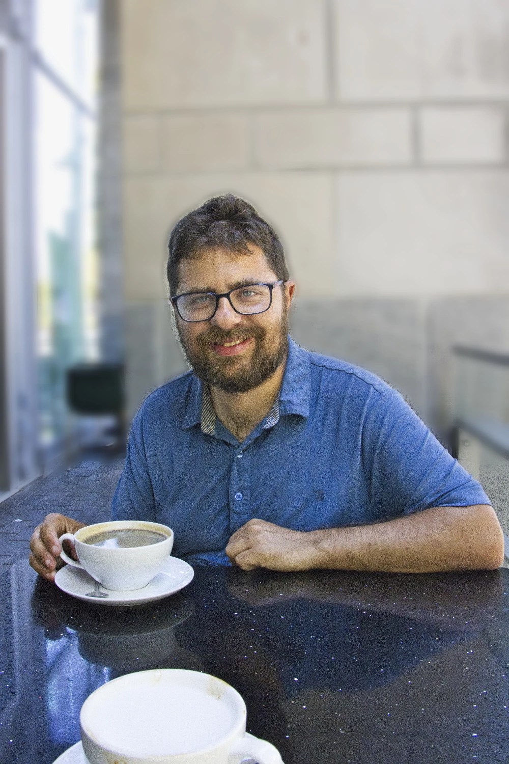
Author & Photographer: George Mitchell

Our advice below is not based on a couple of tourist trips. Our recommendations are based on our extensive experience living in Western Canada. We are avid hikers, nature lovers and photographers (all photos are my own).
All of our recommendations are top-rated by Google Maps Ratings, which is based on everyone, not just tourists. Each place recommended in our custom Vancouver Mountains and Water Map is appended with a Google Maps Rating (G0 to G5).
Spanish Banks
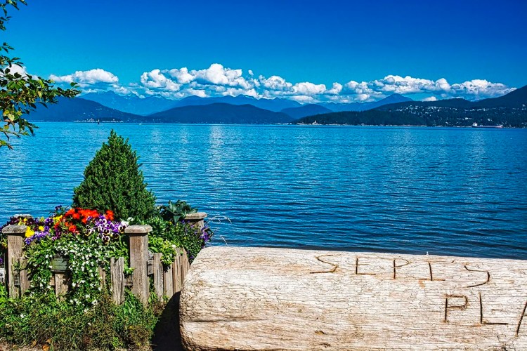
The best place to appreciate how mountains and water have shaped Vancouver is Spanish Banks. Our favourite early morning or late evening walk is a flat trail along the wide beach with views of the coastal mountains. It’s also close to where we live in Vancouver (our son’s place). The scale is so large that you may not notice the city on the other side of the inlet.
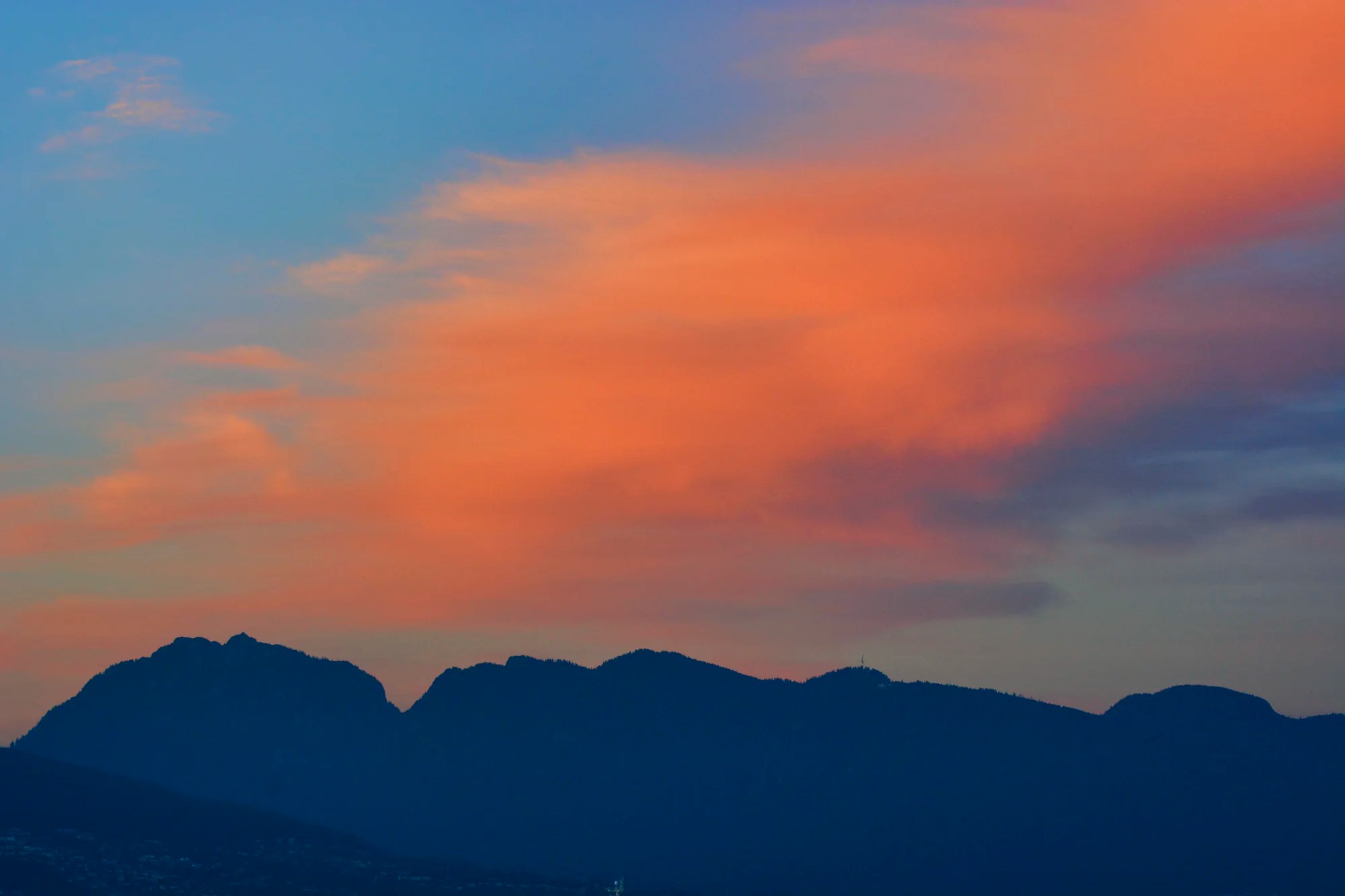
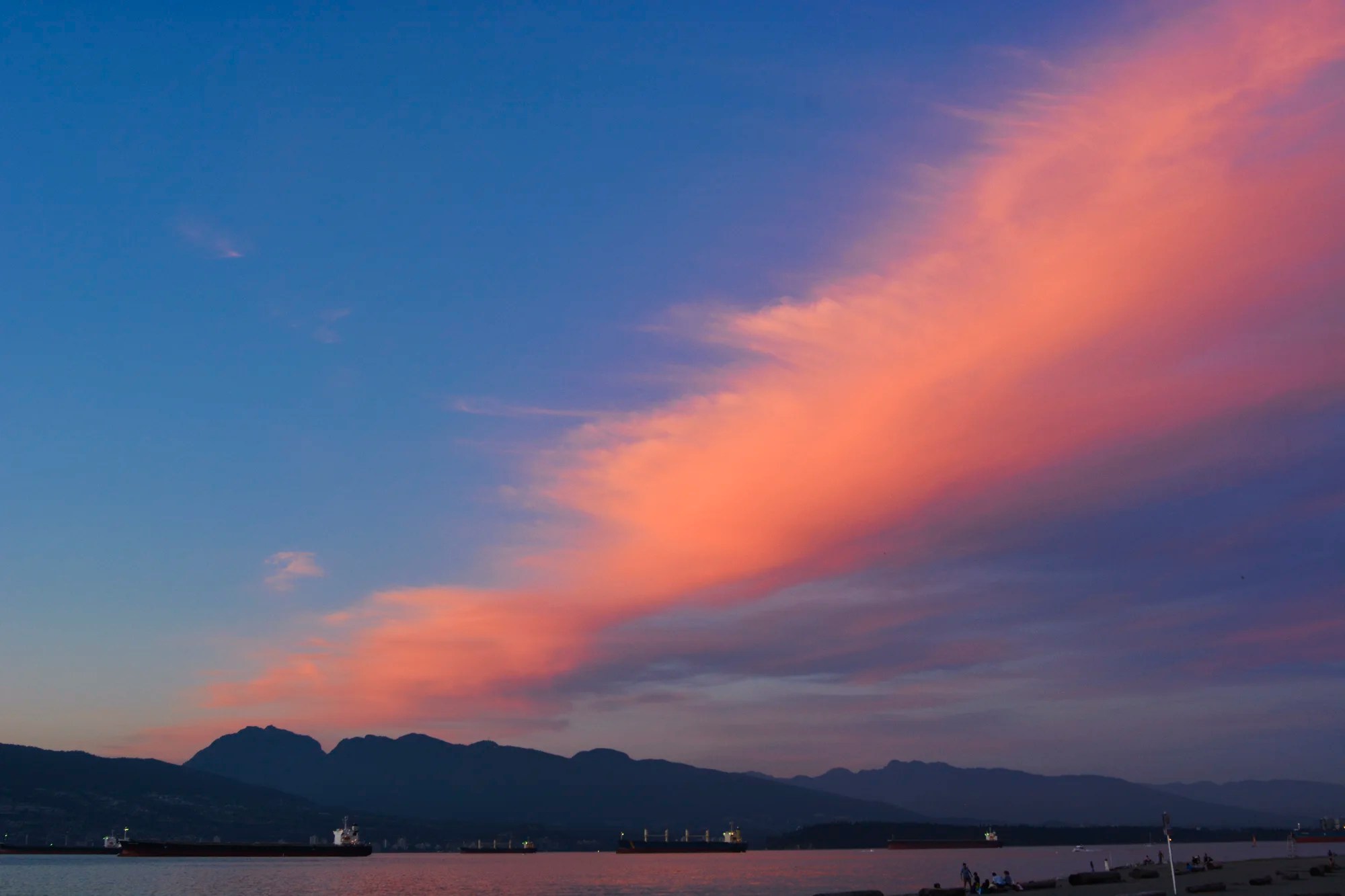
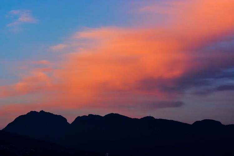
Spanish Banks is also the best place to see and photograph sunsets. Do you see the figure of a reclining woman asleep with her hands resting on her stomach? It is actually not one mountain but a combination of Grouse and Seymour mountains.
These coastal mountains create a micro-climate that provides the warmest winters in Canada. The average maximum temperature in January is 8°C. That’s spring compared to the rest of Canada! Spanish Banks was already described in the West End itinerary of the Vancouver Voyagers post and shown on our Vancouver West End Map.
False Creek
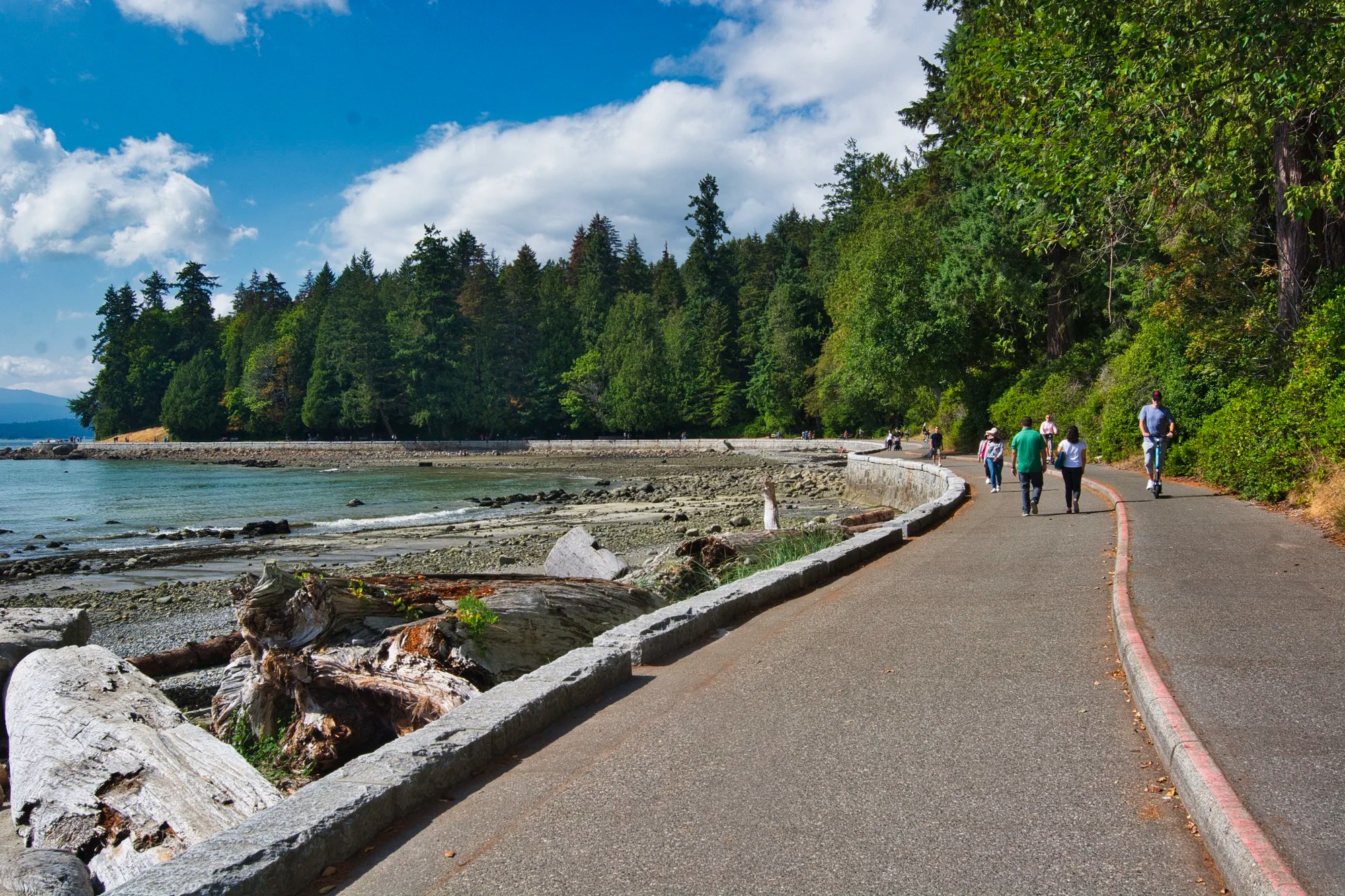
Most tourists and Vancouverites go to Stanley Park and trek or bike the 8.8 km (5.5 mi) Seawall. The Seawall has two lanes. The seaside lane is for walkers and joggers. The outer lane is for bikers.
But the world’s longest uninterrupted seaside path – the Vancouver Seawall – is 22 km (13.7 mi) long. Where is the rest of the walk?
The most relaxing place to visit is the Seawall around False Creek. My son does his daily 14 km walk here. I am trying to keep up to his pace but only for the first 4.4 km (1 hr.) from Granville to Café Gusto. I returned at my own pace taking photos and sightseeing. The itinerary is shown on the Vancouver Mountains and Water Map.

Beautiful flowers decorate the trail. Rugosa Rose is native to northeast Asia and is also known as Japanese Rose. It particularly attracts pollinating insects – note the bee in the photo.

The south side of False Creek was originally the site of major forest product plants and lumber storage facilities. A fire in 1960 totally destroyed this area. Now, condos line both sides of False Creek. An extremely popular activity is sailing. Imagine having a condo right near your sailboat.
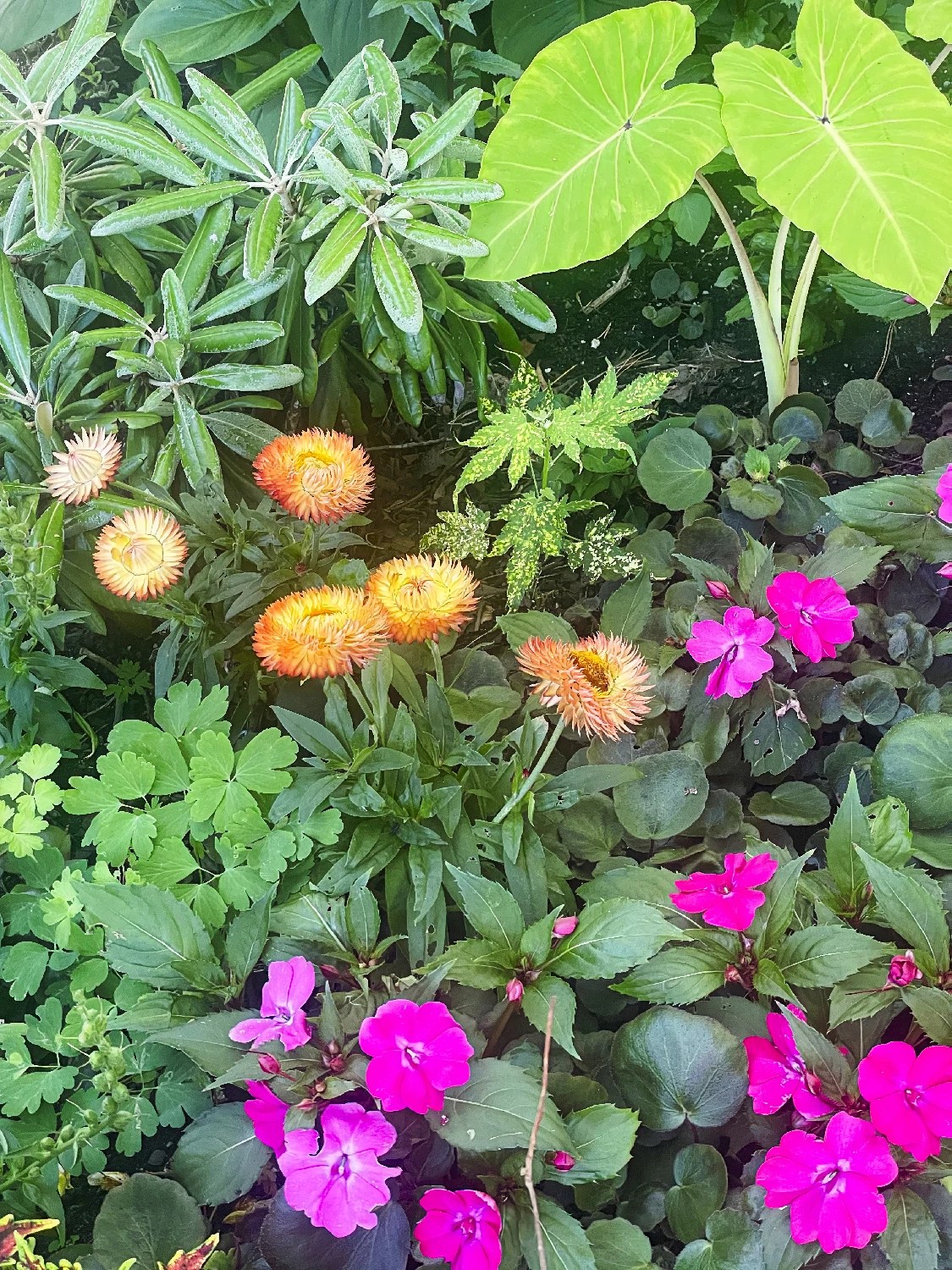
Other features of False Creek are the lawns and gardens incorporated into the landscape. The purple New Guinea Impatiens are native to Papua New Guinea. The orange blooms are Strawflowers.
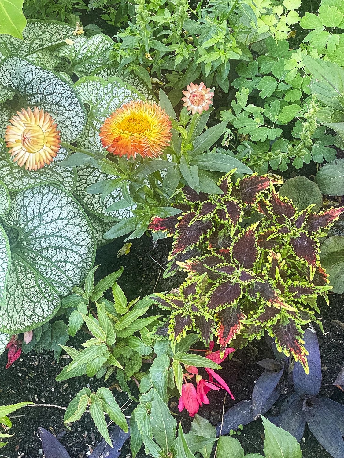
The False Creek Seawall is a free botanical garden. The warm climate allows exotic flowers to be grown outdoors.
The Strawflower, native to Australia, is considered to have anti-inflammatory, antimicrobial, diuretic, anticancer, and antiviral properties.
Common Coleus is native to Southeast Asia and Australia. I love the variegated leaves with multiple colours.
The green veined and white leaves are Siberian Bugloss or False Forget-me-not, which is native to the Caucasus.

False Creek is used for sailing, paddle boarding, and even piracy! Pirate Adventures operates from May 11th to September 29th. They have six sailings between 11:00 and 19:45 hrs. The 75-minute sailing costs $45 for adults and $18 for children > 2 years. The crew dress in costume, do face painting, fight against the evil Pirate Pete, perform skits, and other activities. It is a water theatre.
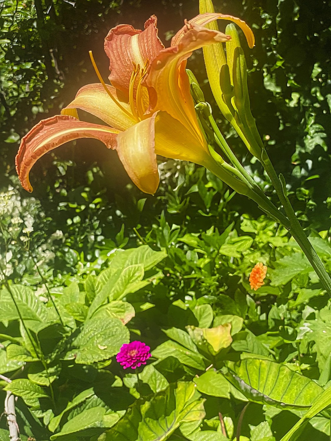
Ditch Lily or orange day-lily is native to Asia. It is not a true lily in the genus Lilium. The leaves and shoots can be eaten raw or cooked when very young
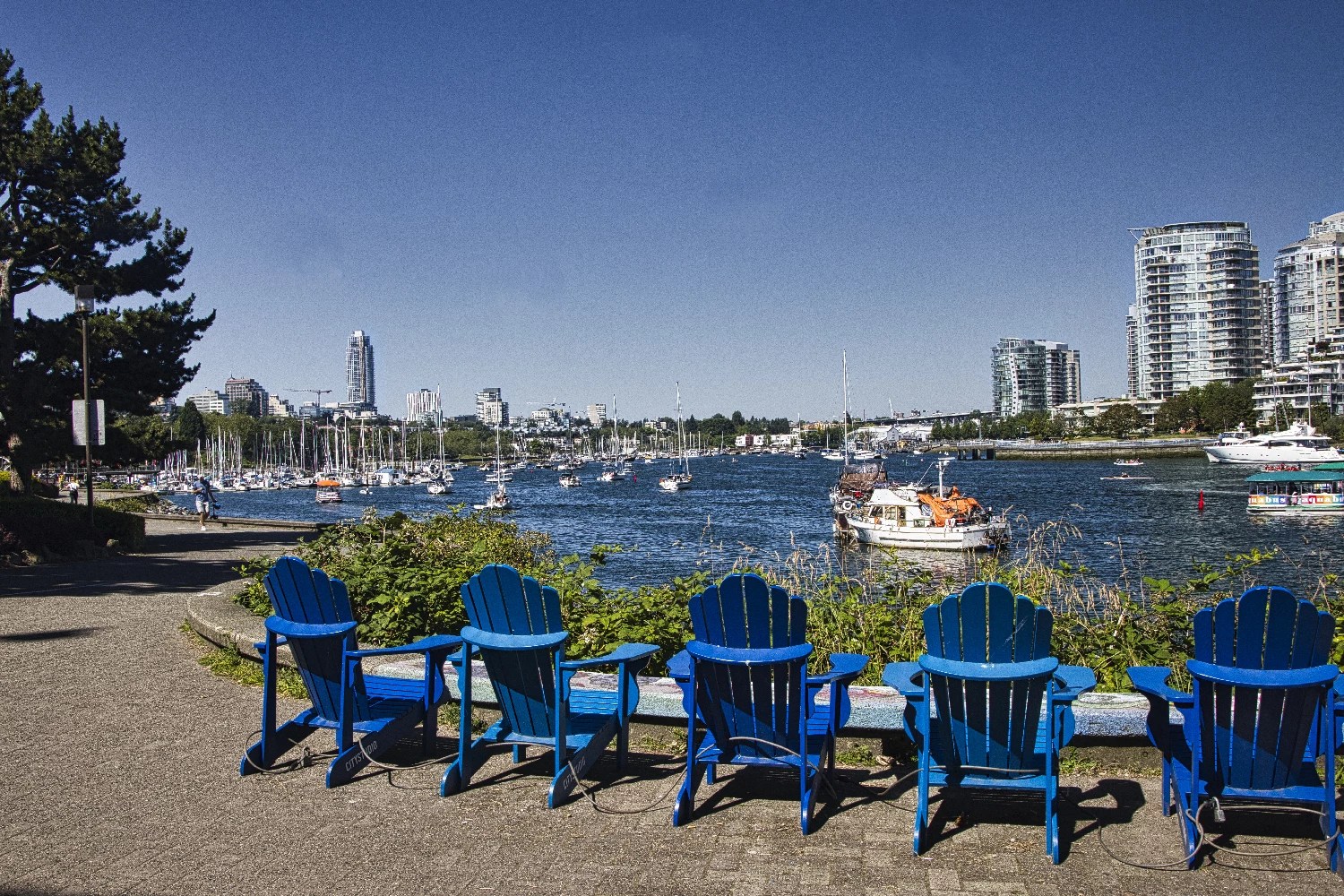
At the Spyglass Ferry Stop (beneath the Cambie Bridge), there were these typical outdoor Adirondack armchairs – except in blue rather than traditional Canadian red.

This area used to be a warren of warehouses and factories. These were cleared to build the Olympic village for the 2010 Winter Olympics. The two house sparrow statues were installed after the 2010 Winter Olympics. The Birds by MacLeod was inspired by Hitchcock’s movie The Birds. This used to be an area for immigration. House sparrows are also immigrants as they are not native to North America.
There are many cafés and restaurants along False Creek. We stopped at our favourite, Café Gusto (G4.5) for delicious cappuccino and panini. All our choices were delicious.
Panino Prosciutto $13.95 Prosciutto crudo, bocconcini, greens
Panino Porchetta $15.95 with mixed greens, mayonnaise
Cappuccino $4.50 to $6.25
Caffe Americano $3.95 to $4.95
We talked politics during our brunch. Afterwards, Daniele continued around the rest of the Seawall to complete his 14 km walk.

The geodesic dome at the east end of False Creek is the Science Museum. Admission costs $35 for adults, $24 for children.
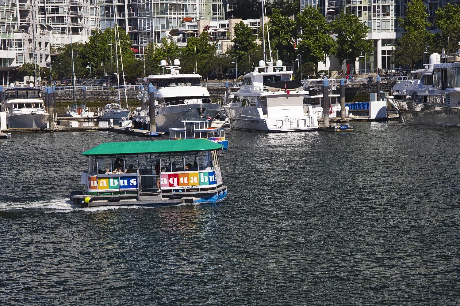
From the Village Ferry Stop, you can take an Aquabus back downtown. Depending on your destination, the ferry costs $3 to 12 for a single trip or $20 for a day pass. The most useful ferry stops will be Granville Island, described below and Hornby Street for downtown. Otherwise, you can walk back the same way if you are living south of downtown.

Alternatively, you can continue around the north side of False Creek. Here you can see the coastal mountains behind the condos. Vancouver is the most densely populated city in North America.
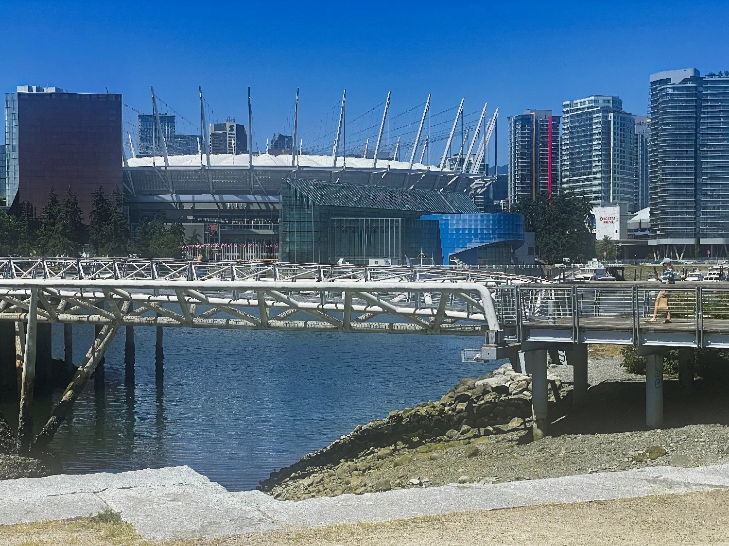
The north shore of False Creek was the location of the Expo 1986 world’s fair. It was later redeveloped into high-density condos and BC Place, the stadium for the BC Lions CFL football team. Another highlight is David Lum Park.
The Seawall continues to the Granville Bridge to complete the loop. From there, you can continue to downtown or along the Seawall to English Bay and Stanley Park.
There are few cafés directly along the Seawall on the north side. You have to walk a couple of blocks north into downtown to get refreshments. There are many cafés and restaurants in the downtown area. Some examples (pinned to the map) are:
Downtown Area Food
G4.6 Fresh Donair 1009 Granville St
G4.4 DD Mau 1239 Pacific Blvd. for Banh Mi
G4.5 Sombreros Taqueria (Mexican) 1151 Homer St. The mixed tacos 4 for $10 were excellent and very tasty.
Granville Area

From the deck of the Granville Bridge, you feel like you are in an airplane. You can peer down on the condos, marinas and passing boats.
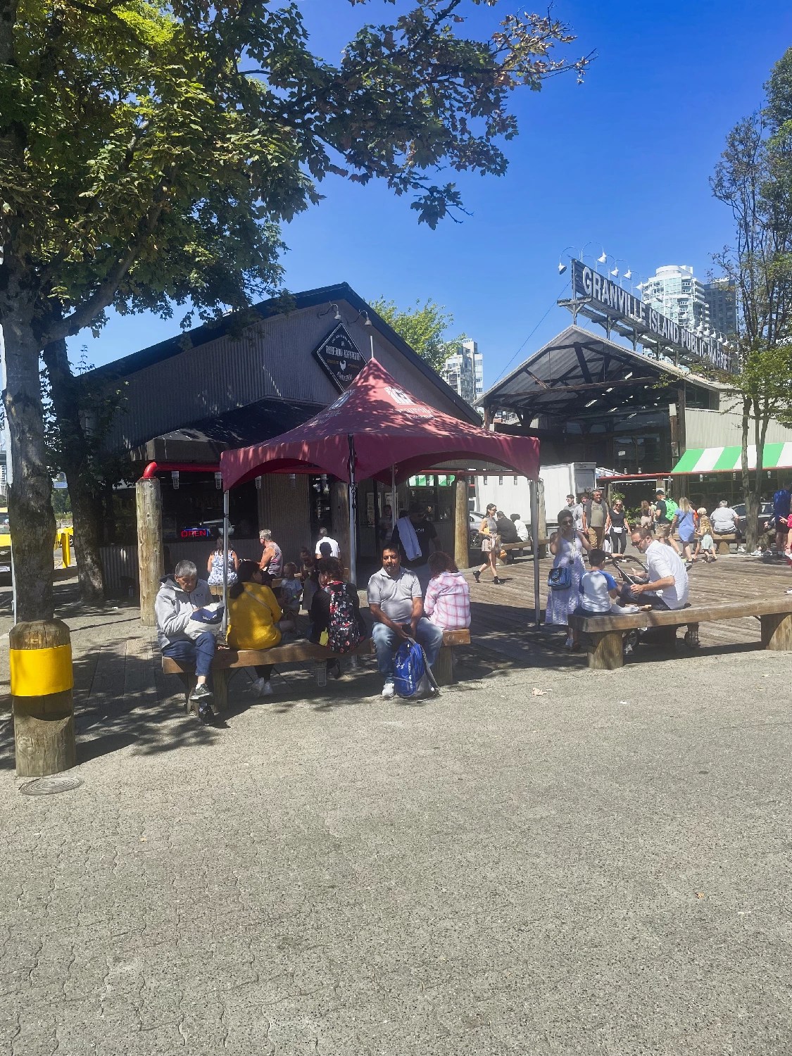
At the end of the walk, below the south end of the bridge, is Granville Market.
Here you can drop into the market or go craft shopping.
Or you can eat at one of the restaurants. There are long lineups for the famous Lee’s Donuts place though I prefer the Honey Doughnuts in Deep Cove.
Granville Area Food
G4.6 Granville Island Market
G4.3 Lee’s Donuts
G4.6 Carnitas El Rolys 1605 W 5th Ave pork carnitas
G4.7 Les Amis du Fromage 1752 W 2nd Ave for cheese
G4.4 Beaucoup Bakery 2150 Fir St
G4.6 Plaisir Sucré 2668 Arbutus St coffee, croissant
G4.5 Suika 1626 W Broadway for Japanese
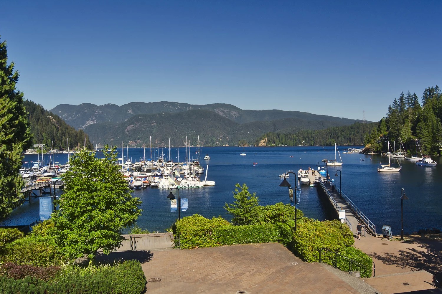
Deep Cove
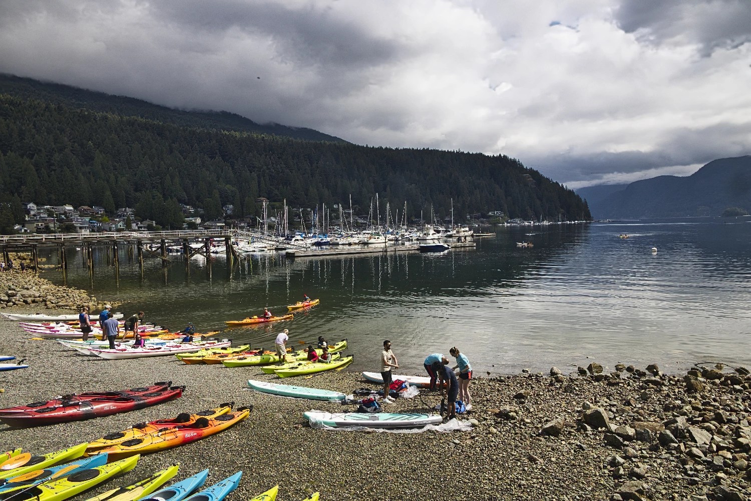
Deep Cove is a picturesque village at the easternmost edge of North Vancouver. We have been going to Deep Cove for years, when it was really a hidden gem. However, it has been discovered at least by Vancouverites. Perhaps it is because of all the Hallmark movies that have been filmed here. In fact, the Vancouver area is the most frequent filming location for Hallmark. Despite all the people, the setting is still serene.
We park along Rockcliffe Rd. to the right of Gallant Ave. Parking is very difficult — don’t go on weekends or midday.
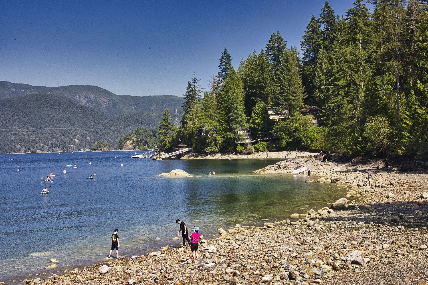
Deep Cove is small, but you can do a short walk along the right side of the cove to Deep Cove Park and a residential area after the cedar forest.
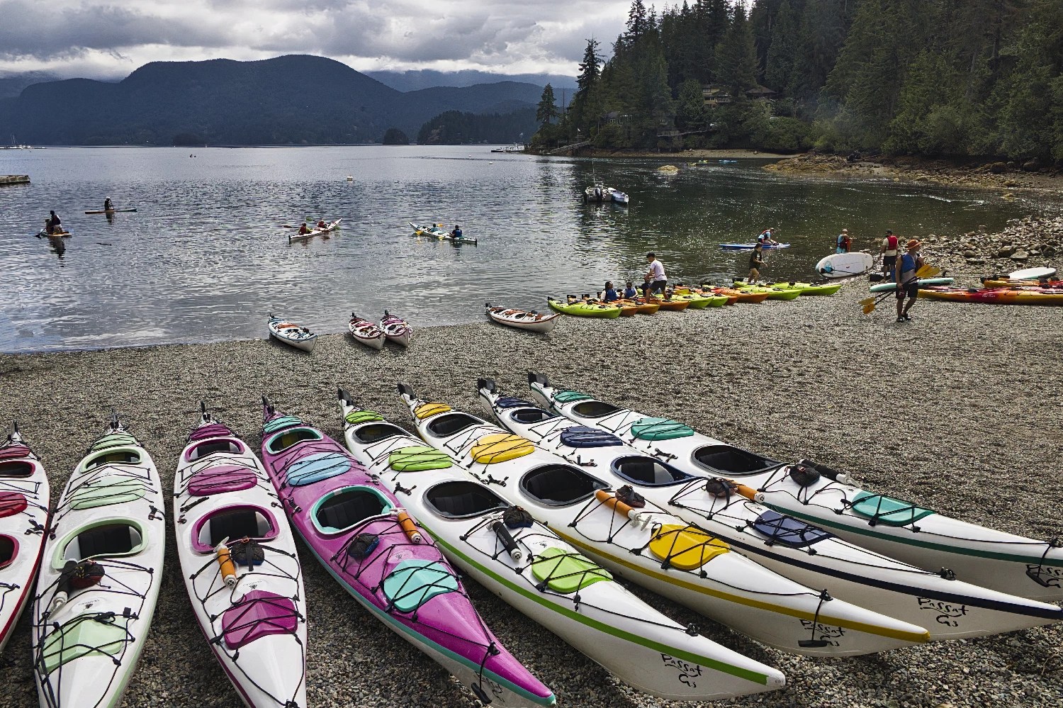
Head north to the boat rental building and toilets. Deep Cove is extremely popular for kayaking and paddleboarding on calm waters.

Deep Cove Kayak rents a single kayak or paddle board at $49 for 2 hrs., $72 for 3 hrs., and $115 per day.

Continuing north to Panorama Park. There are many plants with a few flowers but lots of views of the harbour.
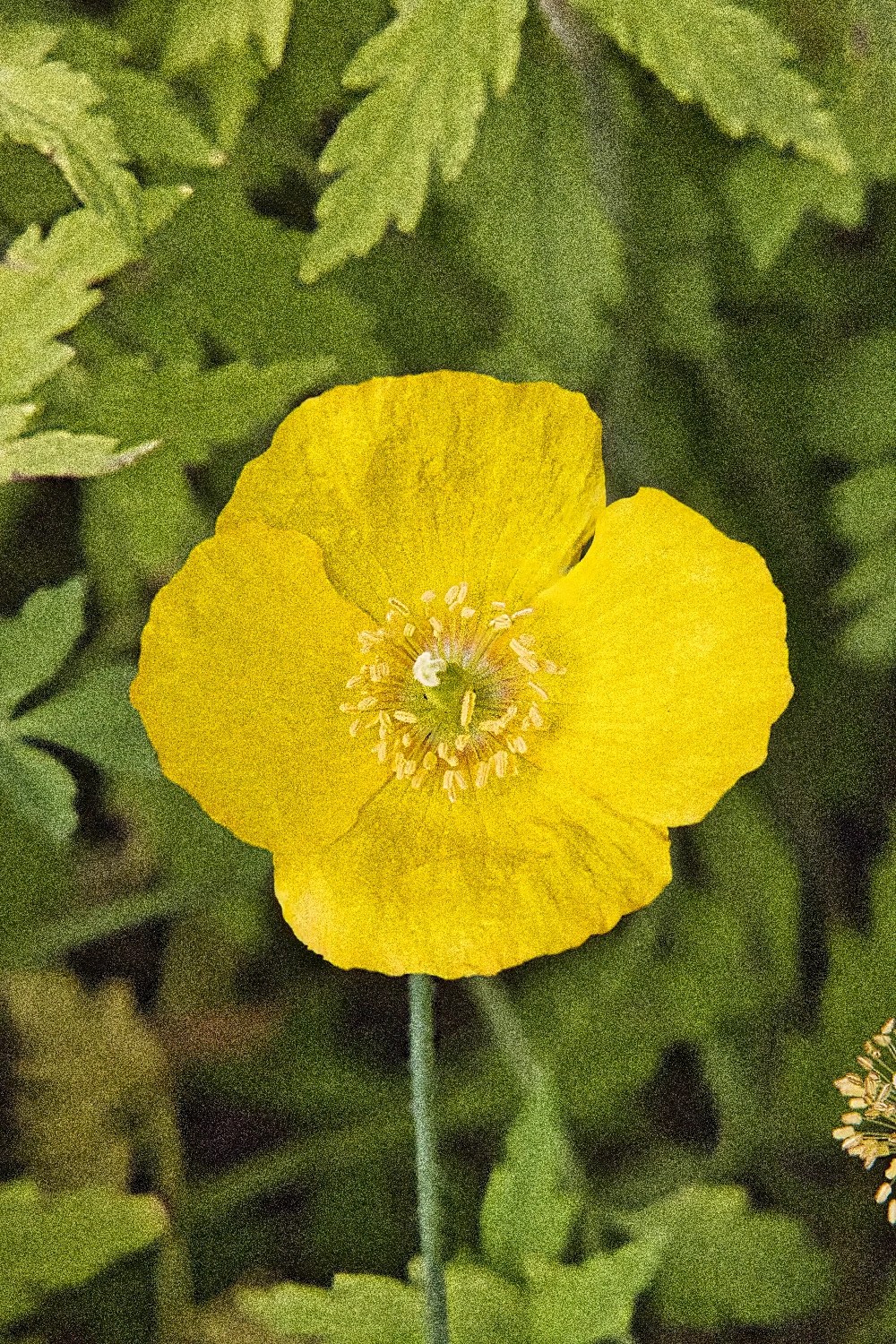
The Icelandic Poppy is found in Asia and North America but not in Iceland! They are common to sub-polar regions and do not do well in hot climates.

A lookout balcony at the bottom of Gallant Ave. provides a slightly higher view of the cove.

The short Gallant Ave. is the only place to walk in the town for cafés and restaurants.
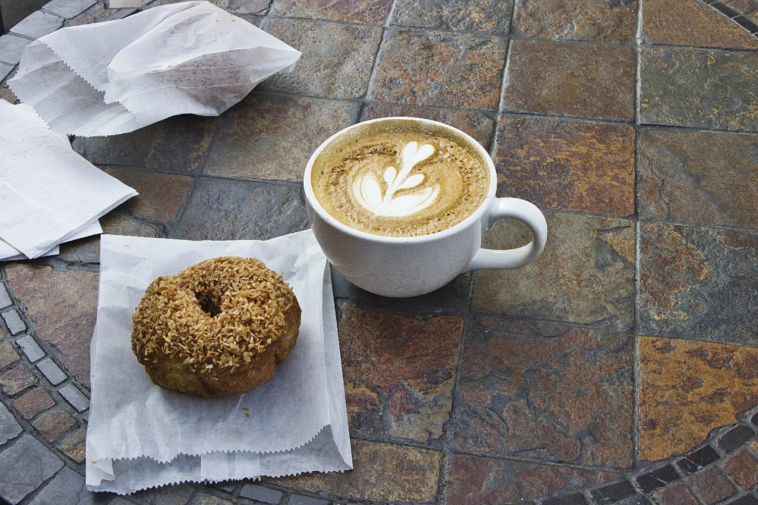
Every time in Deep Cove, we make our pilgrimage to Honey Doughnuts for delicious doughnuts and cappuccino.
G4.3 Honey Doughnuts 4373 Gallant Ave,
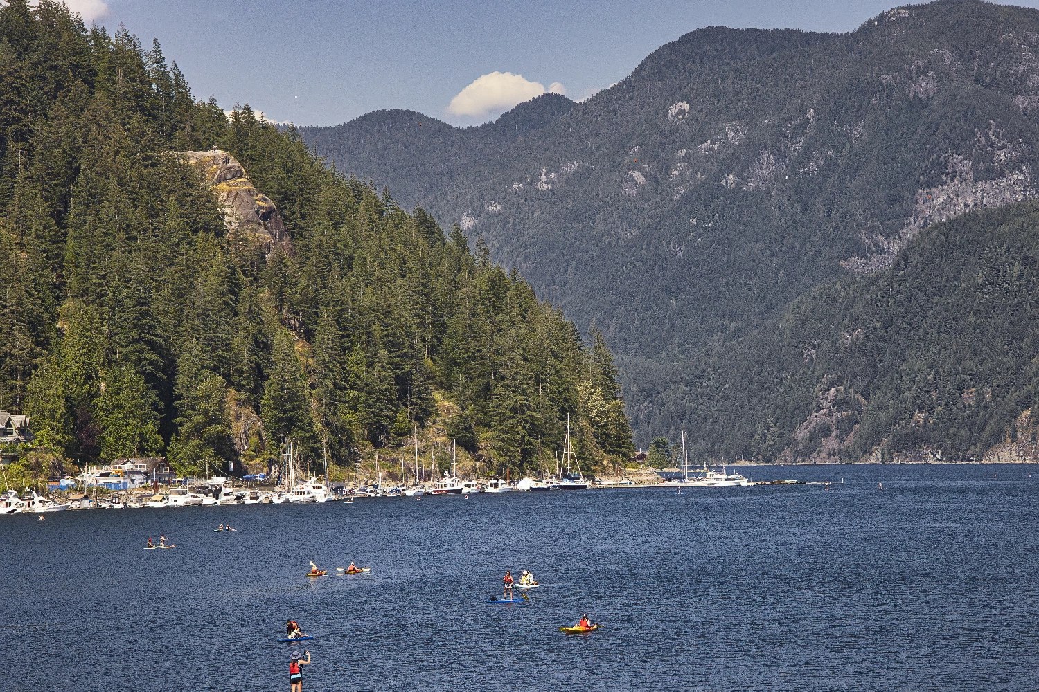
Beyond the charming village, one only sees undeveloped towering mountains. No wonder it is a popular setting for movies.
Walking even further east is the popular Quarry Rock hike, which provides panoramic views of the protected wilderness of Indian Arm.
Final Comments on this Itinerary
This is a relaxing itinerary where you can get away from the crowds of tourists. Even though Vancouver is a large city, it is much more relaxing compared to the overcrowded Banff the town and Louise the Lake.
These three places let you experience life in Vancouver.
Subscribe
Get travel tips and advice delivered directly to your inbox. The best part is that it is free.
What things fascinate you? How long is your trip? What questions do you have?
Itinerary Map & Resources
Vancouver Mountains and Water Map
Google Maps Ratings
Google Maps provides a rating from 0 to 5 for all sights, hotels and restaurants (but not cities). All of our recommendations are appended with the rating (prefixed with a G) from Google Maps. As it is based on feedback from tourists and locals, it is much more reliable than travel booking websites. We consider a score of 4 to 4.39 to be Very Good; 4.4 to 5 to be Excellent.
Other Places to Add to Your Itinerary
Here are nearby places you might want to explore in or near Vancouver:
When is the Best Time to Visit Vancouver?
Here are the average high temperatures and rain days in Vancouver by season, based on weather similarity rather than traditional calendar dates.
Winter (Nov-Feb) is both cold and rainy. Snow is very rare. Oct is cool but can be nice.
Summer (Jun-Sep) has always been warm and sunny when we have visited. However, these historical averages do not reflect current global climate changes. This past summer, the average high was 25-29°C. This is not hot compared to the tropics, but hot compared to the usual weather. Vancouver apartments are neither well-insulated nor have air conditioning.
| Season | Mean High Temp | Rain Days per Month |
|---|---|---|
| Nov-Feb | 8°C 46.4°F | 14.75 |
| Mar-May | 13.3°C 55.9°F | 11.7 |
| Jun-Sep | 20.8°C 69.4°F | 5.25 |
| Oct | 14.0°C 57.2°F | 12.0 |
Canada FAQ
Fun & Interesting Facts about Vancouver

The Exploring Canada post answers Frequently Asked Questions (FAQ) like:
- How do you plan a trip to Canada?
- How safe is Canada?
- What is the best season for travel?
- Can I see everything in 2 or 3 weeks?
- What are the best places to see in Canada?

Leave a comment