
Are You Overwhelmed?
Are you planning a trip to the Canadian Rockies but are overwhelmed by the conflicting recommendations of various websites or social media? What should you see on a 5 or 7-day trip to the Canadian Rockies? Should you go to Banff, Jasper or Yoho National Park (NP)? What are the most beautiful sights to see in the Rockies?
These are typical questions asked by people. As long-time previous residents of Alberta, we will give you the best short itinerary for the Canadian Rockies. We have added suggestions at the end to tailor this for longer trips.
Author & Photographer: George Mitchell

Our advice below is not based on a couple of tourist trips. Our recommendations are based on our extensive experience living in Alberta (AB). We are avid hikers, nature lovers and photographers (all photos are my own). The Rocky Mountains were our weekend playground. We often hosted out-of-province friends and family using the itinerary we are recommending.
All of our recommendations are top-rated by Google Maps Ratings, which is based on everyone, not just tourists. Each place recommended in our custom Rocky Mountain Itinerary Map is appended with a Google Maps Rating (G0 to G5).
The Best Short Rockies Itinerary
The Rockies are a wilderness that is 57% the size of Switzerland. Many visitors to the Rockies either have a limited time or budget. We have designed this itinerary to give the biggest bang for the buck for a one-week trip. The route from Emerald Lake to Icefields Parkway to Jasper, the town, is the most scenic and uncommercialized highway in North America. Here you will find the most beautiful turquoise lakes, glaciers, waterfalls, and easy hikes in all of the Rockies. This means you do this itinerary first before going anywhere else.
You may ask why a 261 km (162 mi) route needs three days. The point of visiting the Rockies is to experience it, not just drive by it. You need time to walk/hike, take tours/cruises, photograph, and absorb the atmosphere. We drove all the way to Jasper last year with walks at Maligne Canyon and Edith Cavell. We got back to our B&B at 22:00 hrs.
If you have a longer time then read our suggestions at the end of this post. We will also answer questions that we have seen on social media. We will explain what places we left out and why.
Day 1 Yoho NP
Canmore — Emerald Lake 116 km 72 mi 1:20 hrs
Banff — Emerald Lake 93 km 58 mi 1:05 hrs
Lake Louise — Emerald Lake 39 km 24 mi 1:05 hrs
Golden — Emerald Lake 62 km 39 mi 0:45 hrs
You can see a couple of spectacular places in Yoho NP, which is in British Columbia (BC).
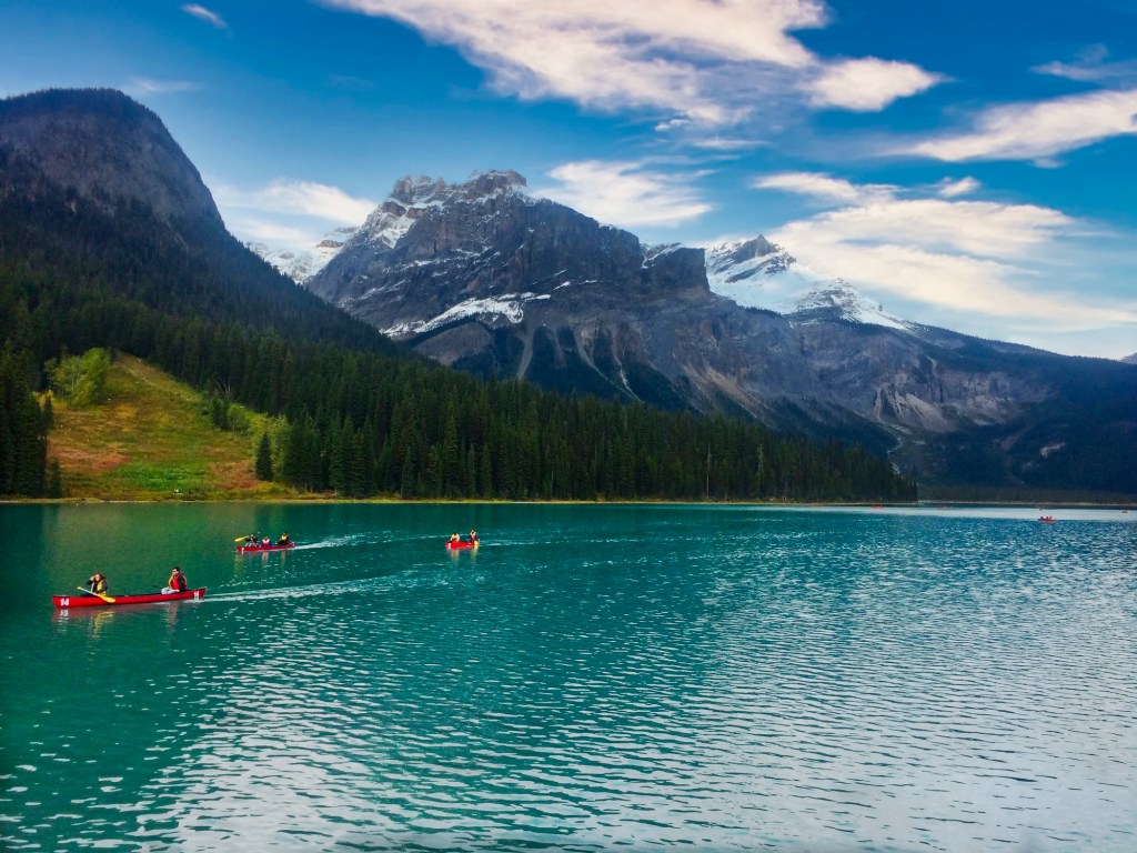
Emerald Lake
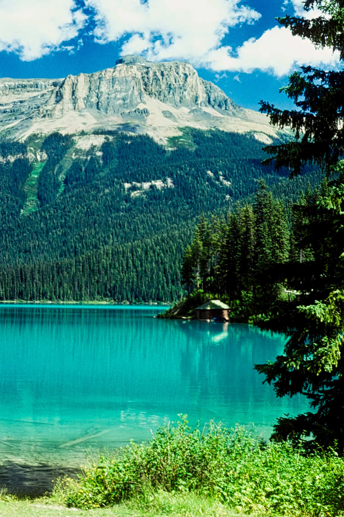
Emerald Lake (G4.8) is a gorgeous glacial green lake. Go to this very popular place early in the morning or possibly late in the afternoon to get parking. We just waited in the parking lot until someone left. Other wise people park along the road and walk.
- Hike the lakeshore trail to the left of the Emerald Lake Lodge bridge. It is part of the longer Emerald Basin and Yoho Pass trails. There are many views along the way, unlike the end of this loop trail through the lodge. The further you walk, the fewer the people. Yoho Pass is a challenging and long 19.2 km round-trip trail. We took my inexperienced sister and brother-in-law, and they did well, even when we had to cross an overflowing stream!
- Canoe the lake to feel “almost alone”. A canoe rental costs $25 per hour or $75 for a full day in 2025, plus paddles and life jacket rentals.
- Visit the Natural Bridge (G4.7) at the bottom of this road.
Takakkaw Falls
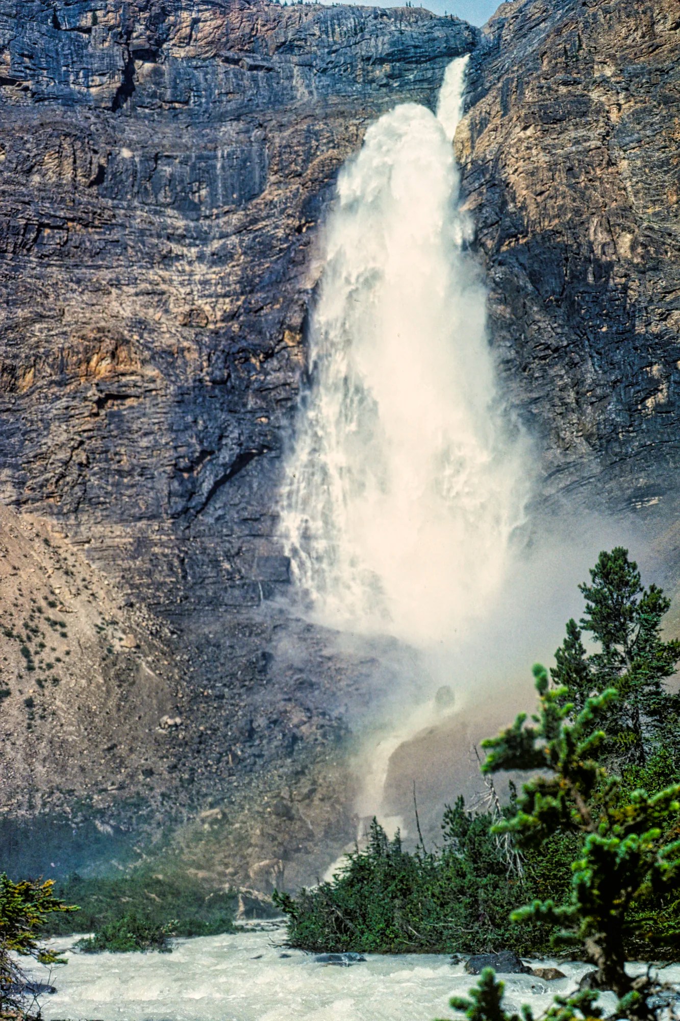
Takakkaw Falls (G4.8) are impressive and very high waterfalls.
- Stop at the Meeting of the Waters (G4.4) viewpoint.
- Enjoy (or not) the harsh switchbacks along this road (trailers and buses are not allowed).
- Hike part of the Yoho Skyline Trail.
Day 1 Icefields Parkway
Canmore — AB-93 Exit 102 km 63 mi 1:05 hrs
Banff — AB-93 Exit 59 km 37 mi 0:40 hrs
Golden — AB-93 Exit 78 km 48 mi 0:52 hrs
AB-93 — Peyto Lake 41 km 25 mi 0:30 hrs
The Icefields Parkway (Highway AB-93) travels between Lake Louise Village and the town of Jasper. It provides 232 km of easy access to rugged Rockies, gorgeous glaciers, and turquoise lakes. There are not many roads in North America that are this spectacular for this long a distance with minimal human development and commercialization.
In fact, we think it is the best scenic highway in Canada, if not North America. The most special aspect of the Canadian Rockies is the glaciers (while they last), the gorgeous turquoise lakes and rivers they created, the rock flour (yes, it’s a real thing explained in the blog), 3400 km of superb hiking trails, and the wildlife. These are the key features of the Quintessential Canadian Rockies.
Note: Drive under the 90 kph or any reduced speed limit. People and animals are crossing in many locations. Tickets are very expensive.
Herbert Lake
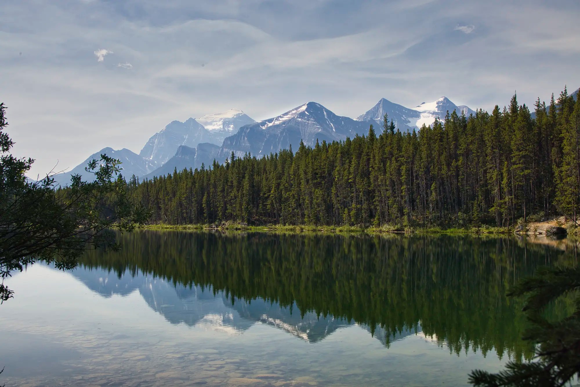
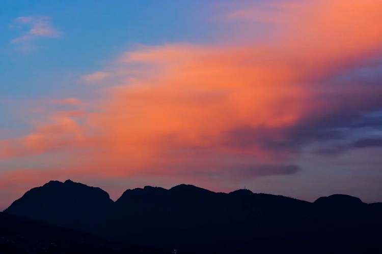
There are good early morning dawn views of the range of mountains at the Icefields Parkway junction and Herbert Lake (G4.7). You have to walk down from the parking lot to the edge of the lake.
Bow Lake
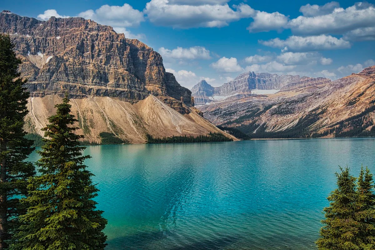
There are three pull-offs worth stopping at: Crowfoot Glacier (G4.8), Bow Lake (G4.9), and The Lodge at Bow Lake (G5.0), where you can see wildflowers and the Bow Glacier (G4.7).
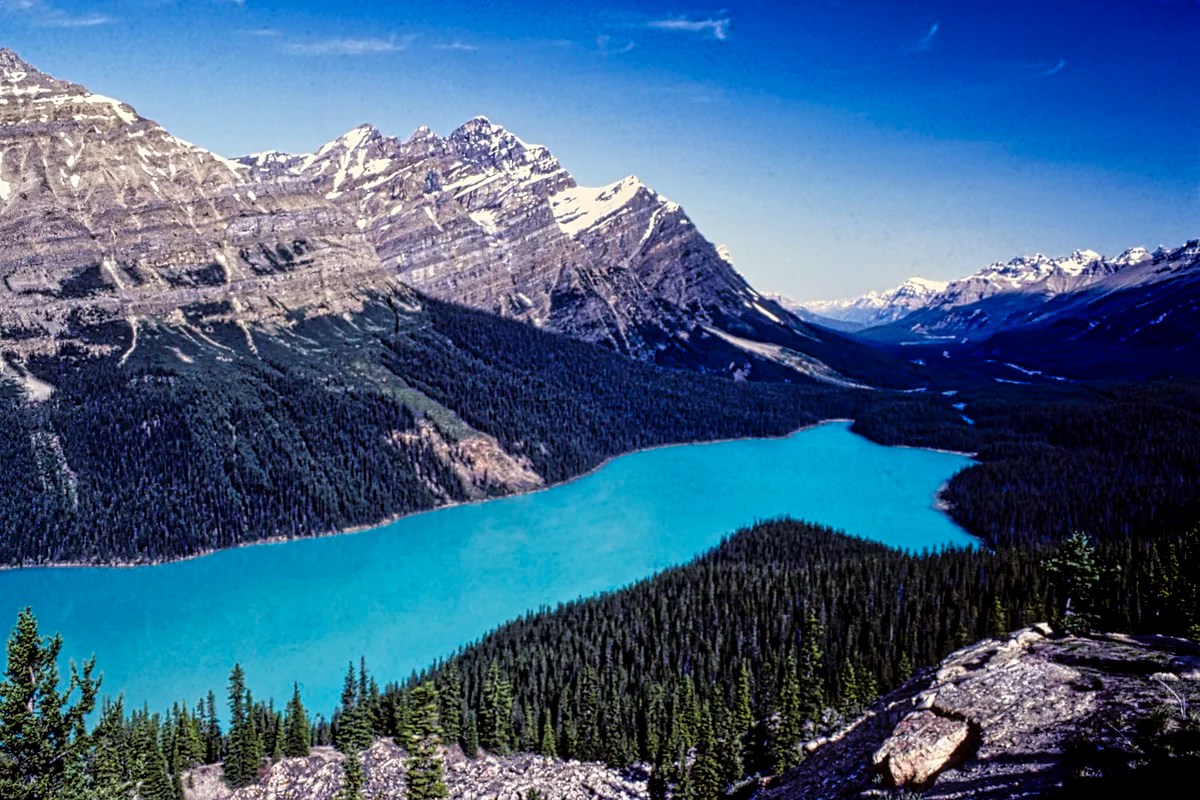
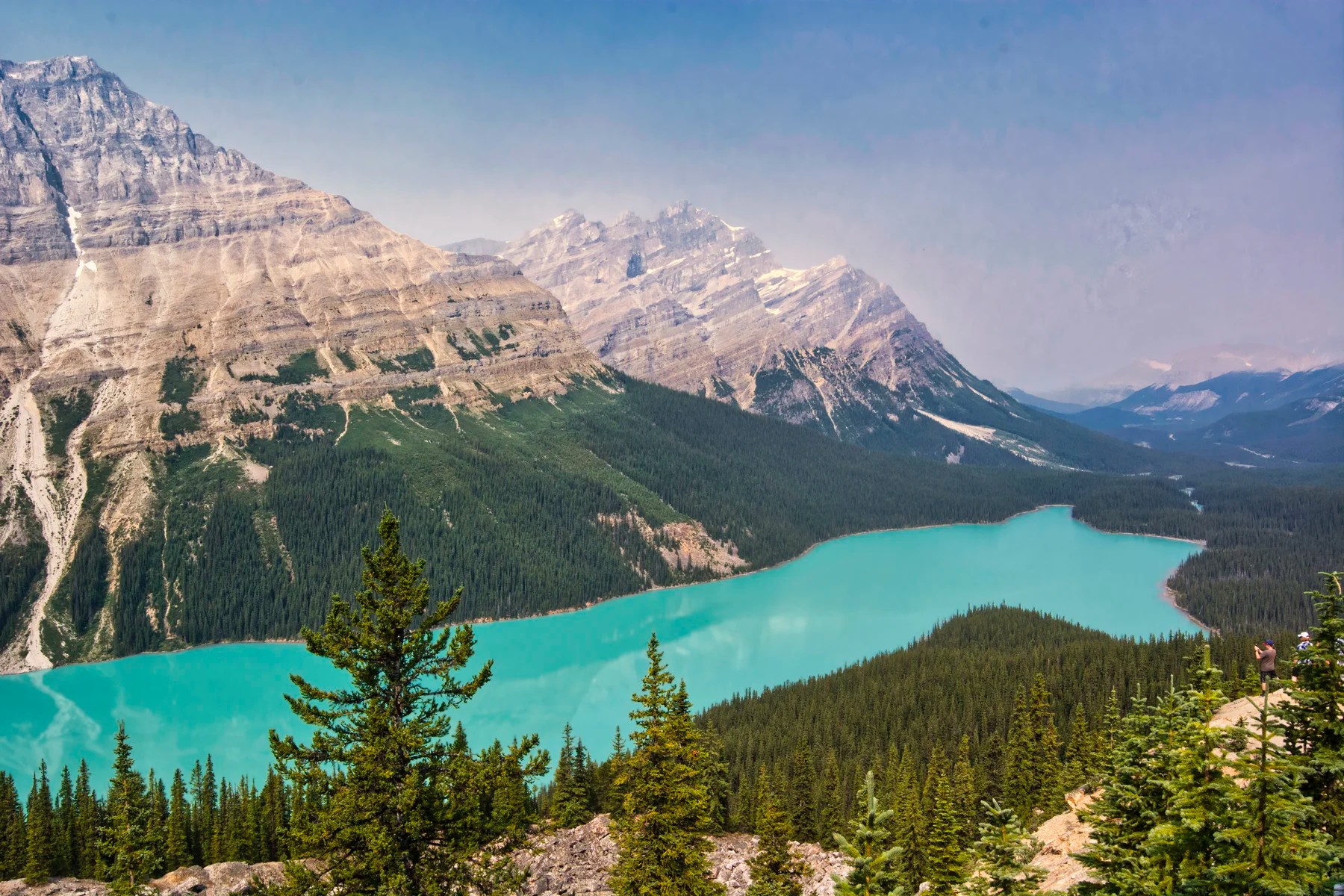
Peyto Lake
Peyto Lake (G4.9) is one of the top five turquoise lakes in the Rockies. It requires a short hike that most people should be able to do. Going to the Rockies and missing Peyto Lake is like going to Rome and missing the Pantheon!
Peyto Lake Trail:
Distance: 1.2 km (0.75 mi), 2:00 hrs RT;
Elevation: 1880 m (6168 ft); gain 44 m (144 ft),
The disabled parking lot cuts out the climb
Day 2 Icefields Parkway
AB-93 Exit — Peyto Lake 41 km 25 mi 0:30 hrs
Peyto Lake — Icefields Centre 86 km 63 mi 0:56 hrs
Peyto Lake — Tangle Falls 59 km 37 mi 0:40 hrs
Peyto Lake
If you ran out of time on day 1 or the weather was bad, then you get a second chance to do the Peyto Lake walk (G4.9). I call it a walk because the trail is now paved. Kids do this hike. It is one of the best short hikes it all of the Rockies.
Waterfowl Lake
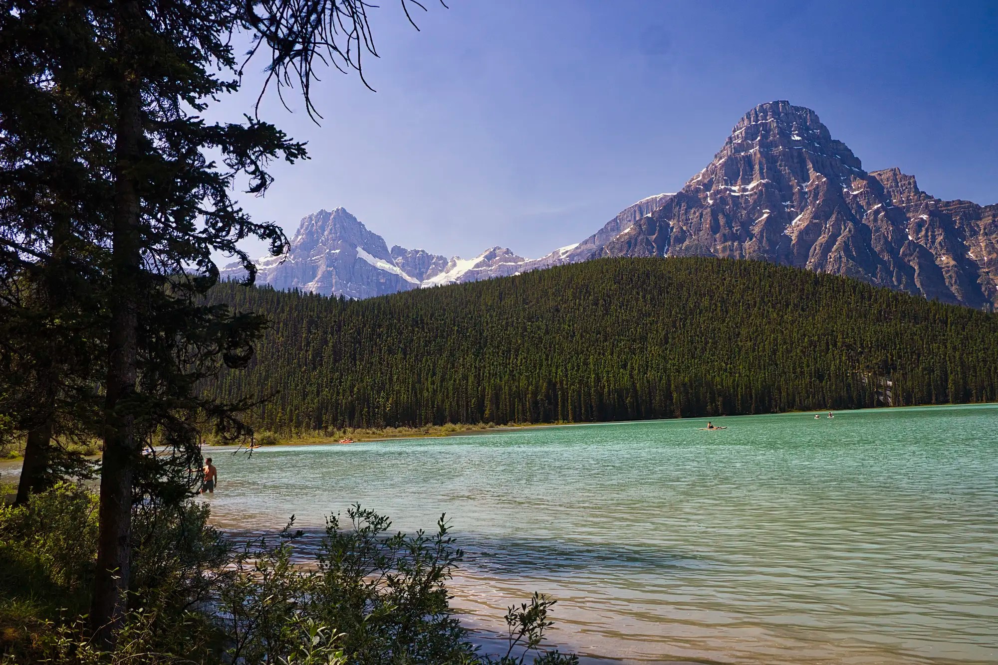
There is a pull-off on the Parkway for a view of Waterfowl Lake (G4.8) and Mt. Chephren (G5.0). But we prefer the lake walk from inside the campground.
Big Bend
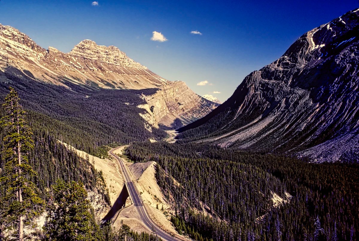
Located 36.4 km (22.6 mi) north of the David Thompson Highway junction, the viewpoint at the top of the “Big Bend” (G4.7) is definitely worth a stop. You have an airplane view from 427 m (1400 ft) above the valley floor. Directly ahead is Cirrus, a 3,270-metre (10,730-foot) mountain.
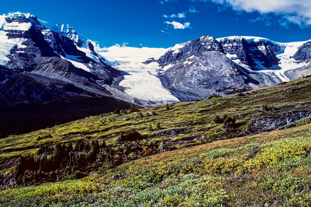
Parker’s Ridge Trail
Parker’s Ridge (G4.9) is one of the best short hikes in all of the Rockies for its Saskatchewan Glacier view. Parker’s Ridge Trail is a steep 45-minute climb. Allow about half a day because you will want to enjoy the views, wildflowers, and wildlife that you may see. All our guests completed this hike.
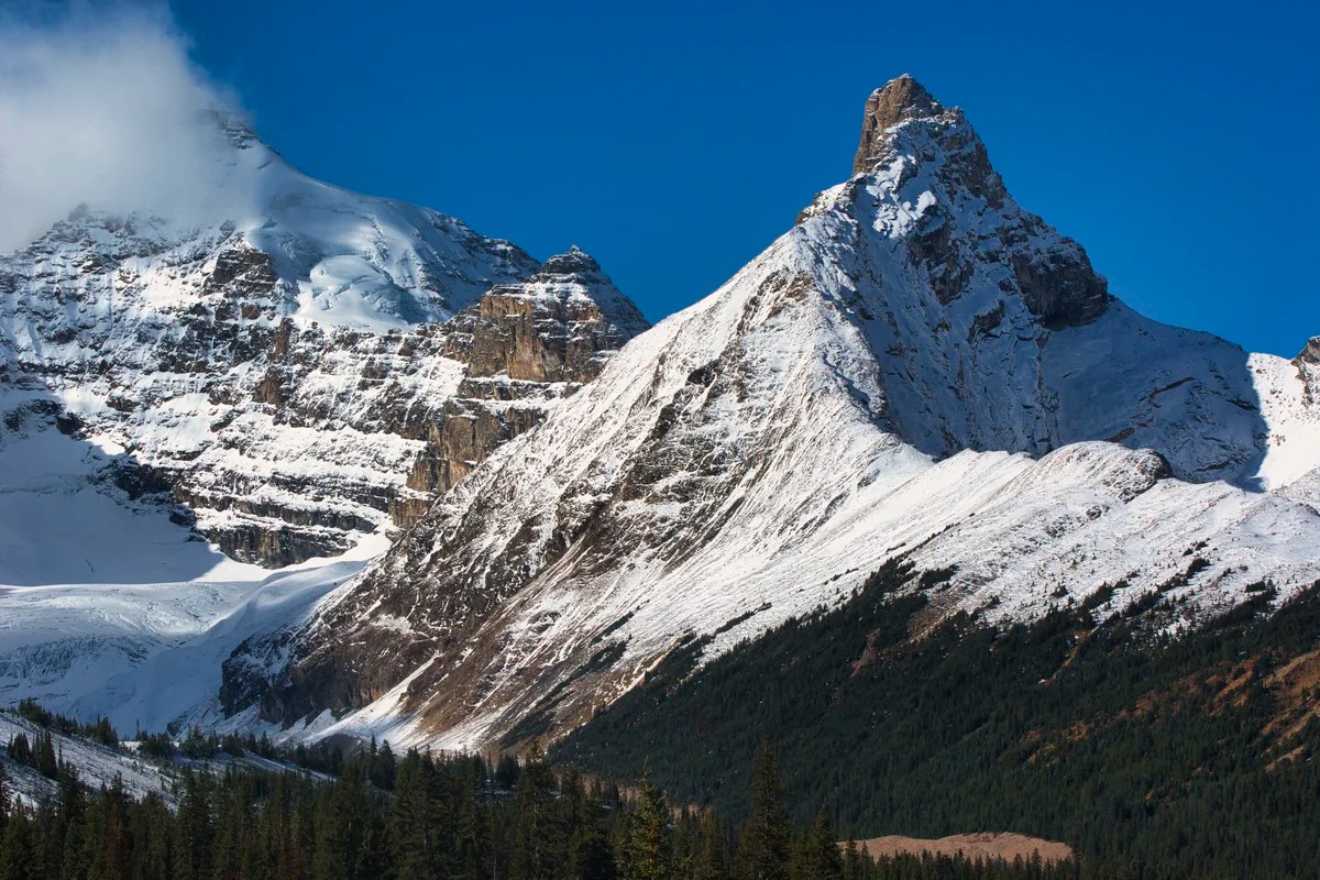
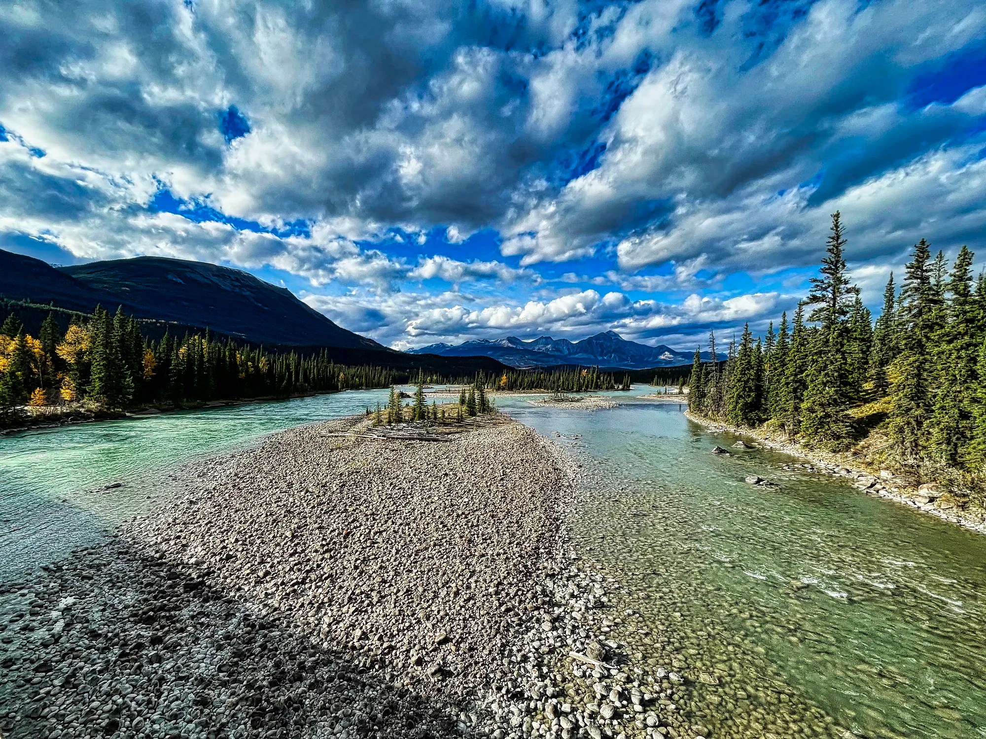
We stopped just before the Parker’s Ridge trail parking lot for this gorgeous snow-dusted mountain view in the autumn.
Wilcox Pass Hike
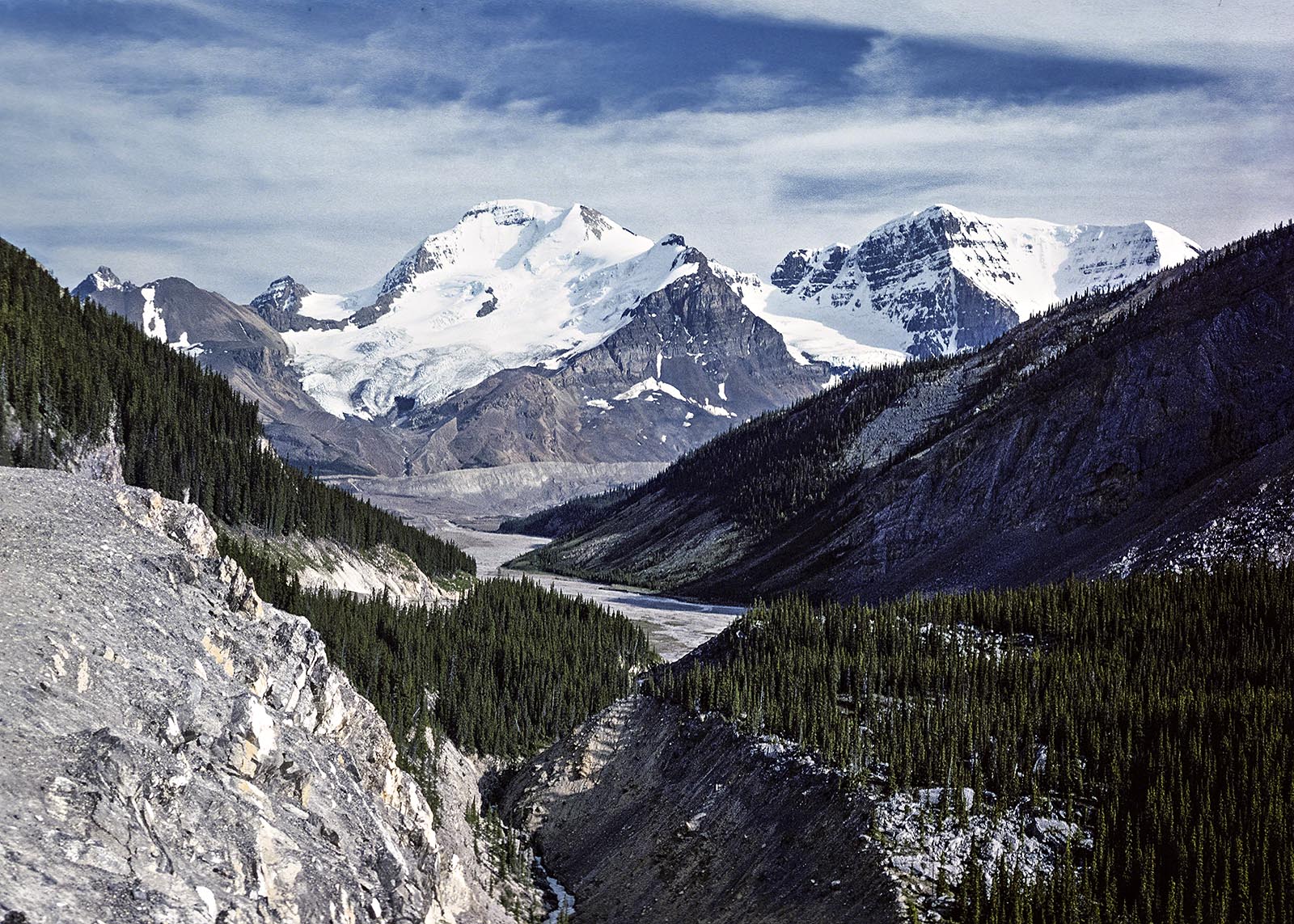
Wilcox Pass Trail (G4.8) is a five-star hike that starts near the entrance of the Wilcox Creek campground (G4.6) in Jasper National Park. It rises quickly above treeline to the expansive meadows of this glacier-carved landscape. You don’t have to do the whole trail to see incredible views of the Columbia Icefield and surrounding mountains.
Wilcox Pass Trail:
Distance: 4 km, 1:45 hrs OW, 3.5 hrs RT;
Elevation: 2270 m (7450 ft); gain 335 m (900 ft)
Columbia Icefield Centre
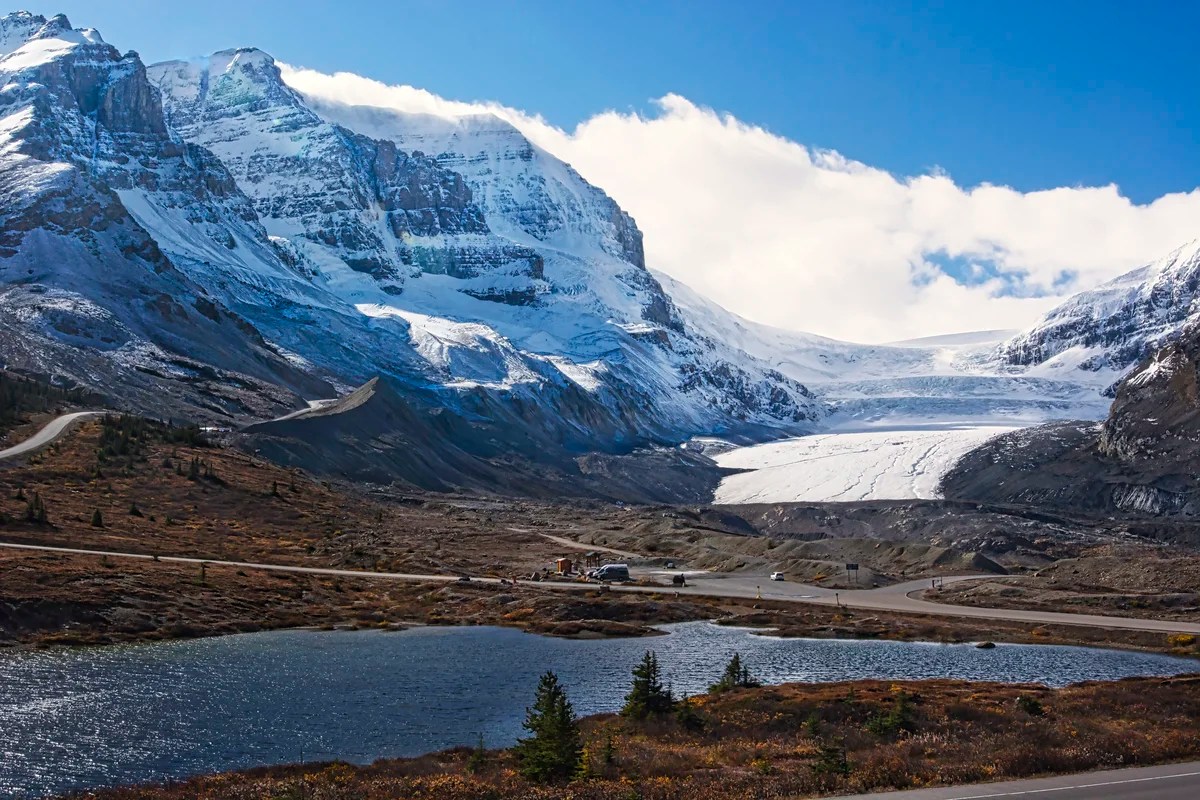
There are expensive glacier bus tours on the Athabasca Glacier (G4.8) and the glass Skywalk. A no-cost option would be the do-it-yourself short walk to the toe of the glacier from the lower parking lot. There are great views from the upper parking lot (reserved for tour buses) at the Icefield Centre (G4.5).
Day 2 Accommodation
For accommodation, stay in Jasper (preferred), 102 km, 1:15 hrs away. Or camp at Wilcox Campground (closest) or Wapiti, Whistler, and Wabasso (closed for 2025) Campgrounds near Jasper. If you are not going to Jasper (not recommended), then return to Golden, Lake Louise, Banff or Canmore.
Day 3 Jasper
Jasper town — Mt. Edith Cavell 14 km 9 mi
Mt. Edith Cavell
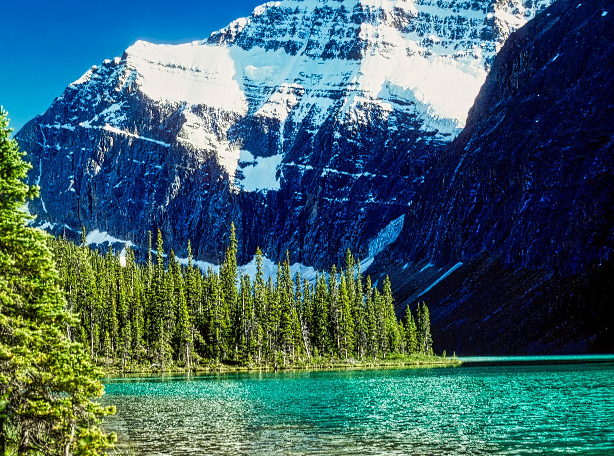
The road leading to the Mt. Edith Cavell parking lot is narrow and winding, with tight switchbacks. Large motor homes and trailers are not permitted. This panorama of Mt Edith Cavell is one of my favourite views in all of the national parks. It also comes with gorgeous glacial green Cavell Lake and a couple of great hikes.
Path of The Glaciers Trail
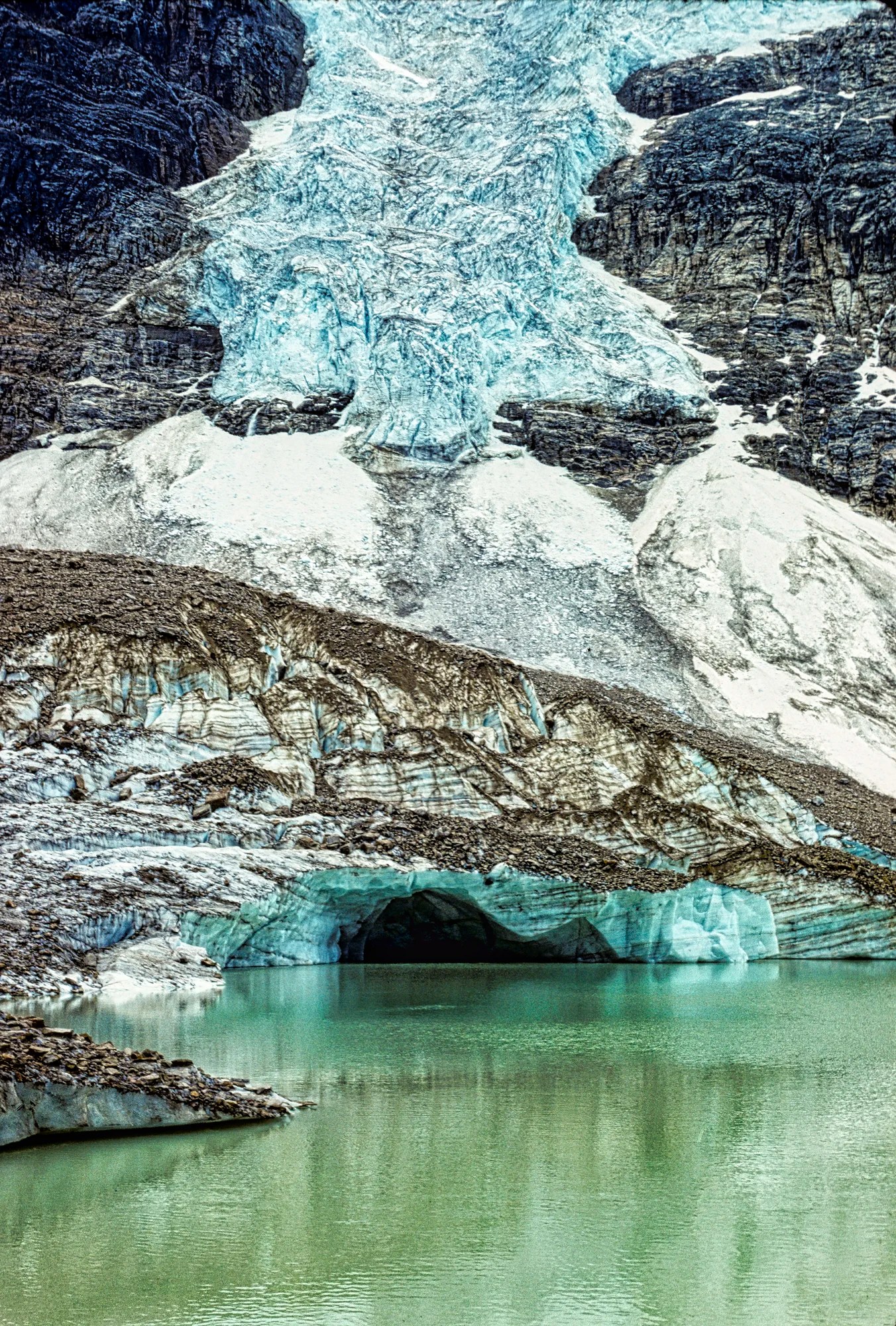
The Path of the Glaciers or Angel Glacier Trail (G4.9) is the mandatory hike. It is a mostly paved walk to the foot of Cavell Glacier and the tarn with Angel Glacier hanging above.
Angel Glacier Trail:
Distance: 3.2 km (2 mi), 1:00 hrs OW;
Elevation: 2135 m (7000 ft); gain 305 m (1000 ft)
Cavell Meadows Trail
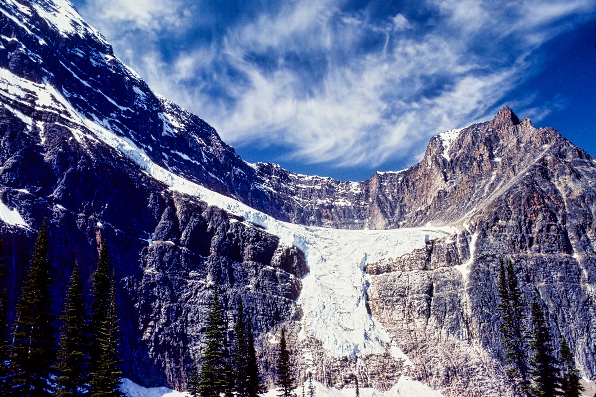
The Cavell Meadows Trail climbs steeply to the alpine meadows. It has the best views of the whole valley as well as a straight on view of Angel Glacier.
Day 4 Maligne Lake Road
Jasper town — Maligne Lake 50 km 31 mi 1:00 hr
If you plan to do the lake cruise or hike, then drive to Maligne Lake first.
Maligne Canyon
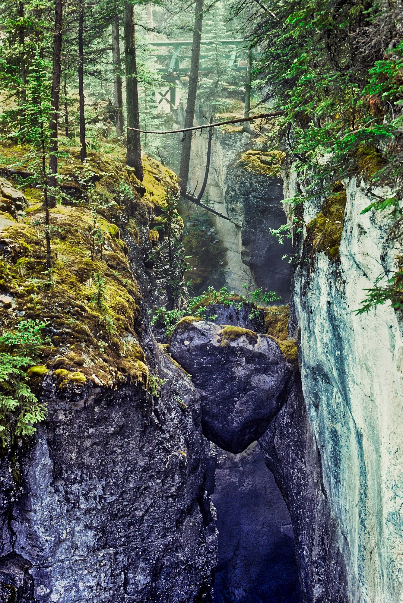
Maligne Canyon (G4.8) is more of a walk than a hike and definitely worth doing. The canyon is very soluble limestone formed from the skeletal remains of marine organisms. Cephalopod, brachiopod and crinoid fossils are embedded in the rocks on the way to the first bridge. Ripple marks prove that this 365 million-year-old layer was the bed of a tropical sea before the Rockies were uplifted. It’s hard to believe that Canada was once tropical and had dinosaurs.
Maligne Lake
Maligne Lake (G4.8) is a very peaceful, scenic area, especially compared to Lake Louise. At least do the flat walk south of the parking lot along the lakeshore. You can also do the boat cruise to Spirit Island (G4.8) and one of the two hikes.
Opal Hills Trail
At 2.6 km on the Opal Hills Trail (G4.7), you reach the alpine meadows. We gazed at past the wildflowers to extensive views of Maligne Lake resting 307 m (1010 ft) below us. You feel like you are flying.
Opal Hills Trail:
8.2 km 4.0 hrs RT; gain 305 m (1000 ft), elevation 1980 m (6500 ft);
Day 5 Icefields Parkway Southbound
Jasper Exit — Sunwapta Falls 54 km 34 mi 0:36 hrs
Jasper Exit — Tangle Falls 95 km 59 mi 1:00 hrs
Jasper Exit — Icefield Centre 102 km 63 mi 1:06 hrs
Jasper Exit — Lake Louise Exit 238 km 148 mi 2:36 hrs
Athabasca Falls

You can feel the power of the water being forced through a narrow gap. This was carved by the Athabasca Glacier when it was 72 km (45 mi) longer. The photo shows how close you can get to having a personal encounter with Athabasca Falls (G4.8). Don’t just go to this busy view to take your selfie. Walk the trail down to the lower potholed canyon for more views.
Sunwapta Falls & Canyon
On the way south, stop at Sunwapta Falls (G4.7), which requires a short walk from the parking lot. The next must-sees are Stutfield Glacier Viewpoint (G4.8), Tangle Creek Falls (G4.7), and the Sunwapta Canyon Viewpoint (and wildlife viewing).
If you only have 5 days (6 nights), then this would be the end of your itinerary. If you have more time, then continue south to see more amazing sights.
Day 6 Moraine Lake
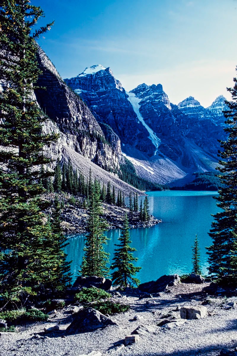
The glacial green Moraine Lake (G4.8) is gorgeous. This is the one place worth visiting in the Lake Louise area. The road is permanently closed to cars. You have to take the $8 per person Parks Canada shuttle bus or the more expensive private shuttles. Yes, there will be a lot of people, but this lake is worth a visit. Due to the long lineups for the return bus, you will want to get the most out of this trip. You should book the shuttle to see Moraine Lake first. If you like canoeing or hiking, you should probably spend most of the day here. Bring your own food for a picnic. Here are the best things to do:
- Walk the short Rock Pile Interpretive Trail (G4.9) to the best view of the lake and the ten peaks, Wenkchemna.
- Canoe the lake to feel “almost alone”.
- Do one of the two hikes to Larch Valley or beyond.
Sentinel Pass and Wenkchemna Pass Trails
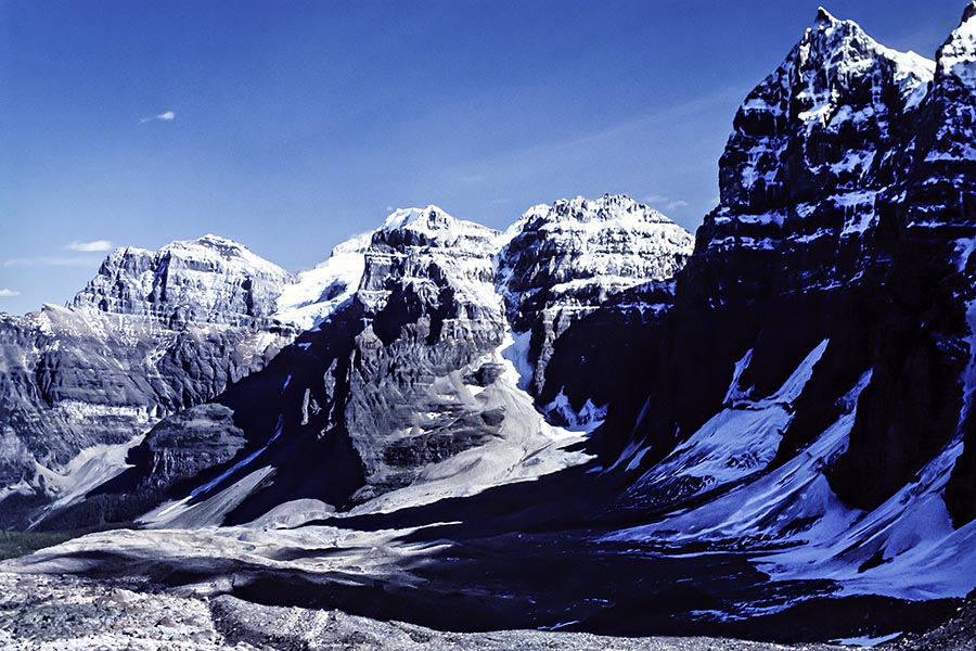
There are two hikes to Larch Valley or beyond – Sentinel Pass and Wenkchemna Pass. These are some of our favourite hikes in the Rockies
- Larch Valley Trail:
2.4 km 0:45 hrs OW 2.5 hrs RT; gain 275 m (900 ft), elevation 2270 m (7450 ft); - Sentinel Pass Trail (G4.9)
5.8 km 3 hrs OW; gain 720 m (260 ft), elevation 2611 m (8566 ft); - Wenkchemna Pass Trail (G5.0)
9.7 km OW full day; gain 365 m (1200 ft), elevation 2255 m (7400 ft);
Day 7 Sunshine Meadows
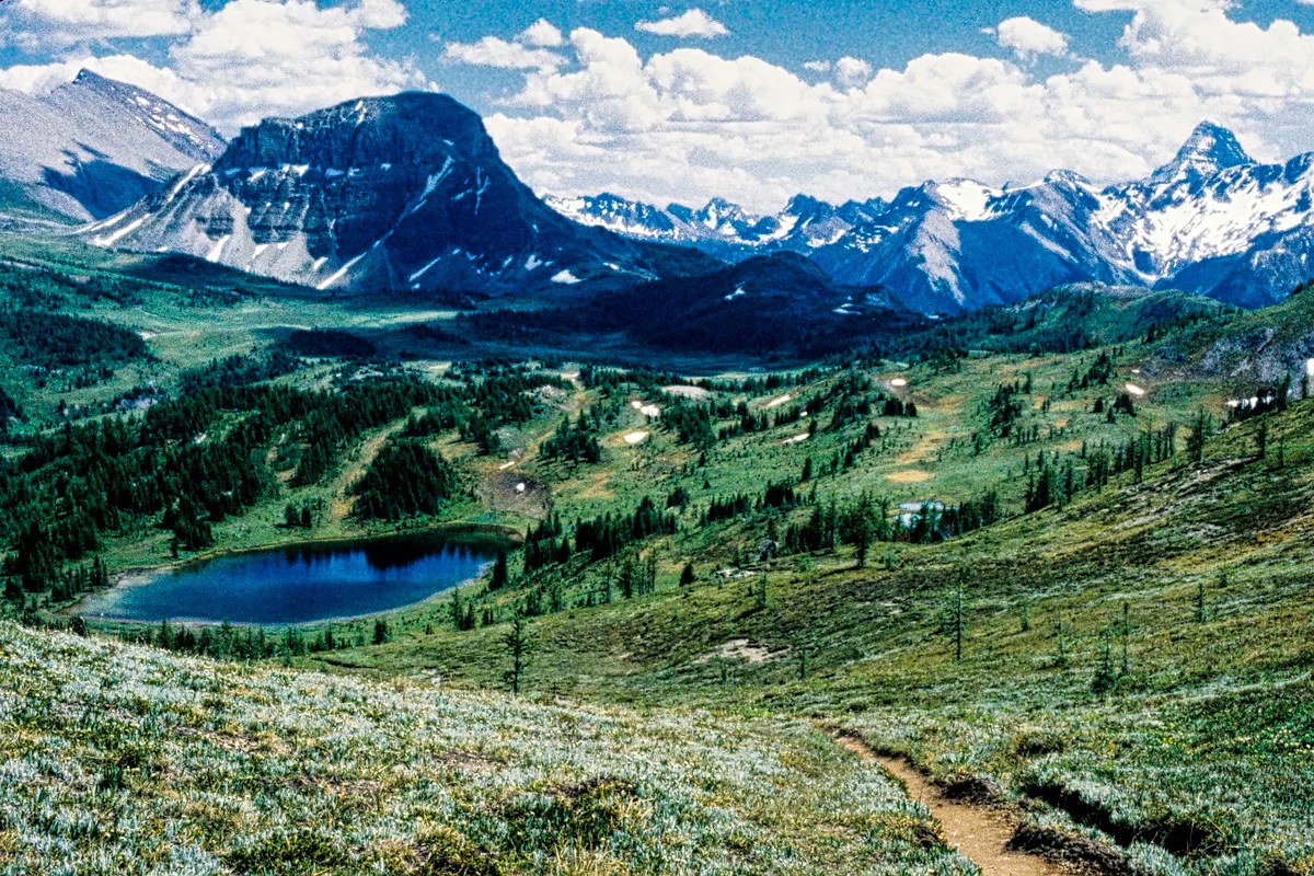
Sunshine Meadows (G4.9) is one of our favourite walks to take visitors, especially if you like alpine flowers and wide-open views. Best of all, you can avoid the hike uphill by taking the bus or gondola (CAD 65) to Sunshine Village. In winter, this is a skiing mecca that we really enjoyed.
Sunshine Meadows Hikes
5.8 km 2 hrs one way (OW) to Howard Douglas Lake;
9.3 km OW to Citadel Pass, gain 150 m (500 ft), elevation 2360 m (7800 ft).
Bow Falls
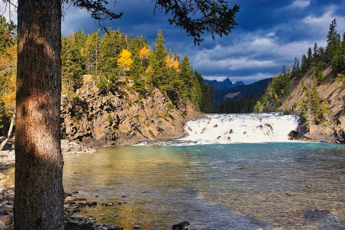
If you only did a short walk in the Sunshine Meadows, here are a couple of more places to visit. Within Banff, the town, drive over the bridge, then south on Glen Ave. to the Bow Falls Viewpoint (G4.7). Look northwest for a very beautiful view of the falls.
Minnewanka Scenic Drive
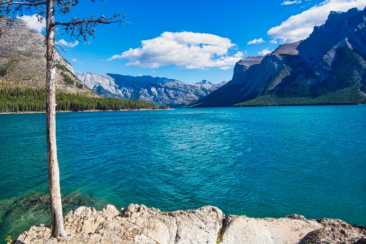
Go along the Minnewanka Scenic Drive (G4.8) to search for wildlife in the parking lot before a big turn of the road to the right over the earth-filled dam. We used to see Big Horn Sheep in the parking lot, especially when there were not too many people.
Detailed Itinerary Guides
If you have more than 7 days (8 nights), then use the following detailed guides to expand your itinerary. Also read the section Other Places to Add to Your Itinerary for places outside the Rockies.
For more details, see the following travel guides and maps:


Frequently Asked Questions (FAQ)
Should You Travel by Car?
Banff and Jasper are just two of the seven contiguous parks in the Canadian Rockies. Their combined area is 57% of the size of Switzerland. They host only three towns of ca. 13,000 residents compared to 8.7 million people in Switzerland. There is no public transportation between the towns of Banff, Jasper and Golden. To see the best sights of the Canadian Rockies, drive your own vehicle.
What if you do not want to rent a car?
You can still visit the Rockies. However, you are limited to staying at the towns of Canmore, Banff, or Lake Louise. These locations have bus service from Calgary and shuttle service between these locations.
Where Should You Stay?
Only the villages that existed in the 19th-century Rockies are still here. They are owned by Parks Canada and cannot expand without the approval of Parks Canada, which is rarely given. Everyone has to commute. Accommodation is busy and booked well in advance. The options are Banff town, Lake Louise Village, and Jasper town inside the parks. The other options are Golden and Canmore, outside the parks. Hotel accommodation is either expensive or more expensive.
If you want the most touristy locations and facilities, then your choice is Banff and Canmore. Our favourite place was Lake Louise village because it has the most central location to the most important sights. We would stay in Banff in the autumn.
Camping
The only inexpensive option is to camp. In Jasper NP, we used to camp at Wabasso. It was burnt down by the 2024 forest fire and is being reconstructed. Wapiti Campground is operating at reduced capacity for 2025. Whistlers and Miette Campgrounds are fully open.
In Banff NP, we camped at Lake Louise, Tunnel Mountain and Two Jack campgrounds. Our favourite First Come First Served (FCFS) campground was Waterfowl Lake in the middle of the Icefields Parkway. Most FCFS sites do not fill up until 16:00 to 17:00 hrs.
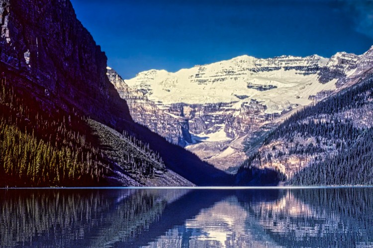
Why are Banff Town and Lake Louise Excluded?
Except for food and accommodation, do NOT go to Banff town and Lake Louise… seriously! Times have changed since we first moved to Alberta. Too many tourists think that Banff town and Lake Louise are the ultimate destinations of the Rockies. They are not! They are the opposite of wilderness.
As long-time previous residents of Alberta, we have a different take than most tourists. You should not spend your time lining up with thousands of tourists to get shuttles or walk on trails. Lake Agnes (G4.8) and Johnston’s Canyon (G4.7) are the most heavily used trails in the Rockies. They are not wilderness experiences. Similarly, you should not spend your time in Canmore-Bow Valley, the Banff Gondola (G4.7), or even Kananaskis. The expensive Columbia Icefield Skywalk (G4.4) is definitely not worthwhile.
Should you go to Glacier NP, Montana?
If you are on a less than two-week trip, I disagree with going to Glacier NP. It takes 4.5 hours each way to drive 408 km (254 mi) south. You have to return to Calgary as you cannot leave a Canadian rental car in the USA (and vice versa). The main sight is the 50-mile (80 km) long Going-to-the-Sun Road. We loved it, but now it is spoiled by overtourism. From June 13 to September 28, you need a vehicle reservation to enter between 07:00 and 15:00 hrs. The road is only open from mid-June to mid-October.
The Going-to-the-Sun Road does not compare. The Emerald Lake to Icefields Parkway route provides 261 km (162 mi) of easy access to uncommercialized wilderness. Here you will find the most beautiful turquoise lakes, gorgeous glaciers and mountain views. The Icefields Parkway is open year-round.
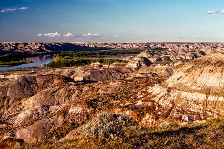
Should you go to Dinosaur Provincial Park?

If you have more than a week, then absolutely. This is the best and closest must-see to the Rockies. Dinosaur Provincial Park (G4.8) is the world’s richest source of Cretaceous Era fossils. The best reason to visit Dinosaur PP is the interpretive program. Book a guided fossil safari to find your own bones. Even if you gave up dinosaurs after age six, come here and you will reignite your inner fossil hunter.
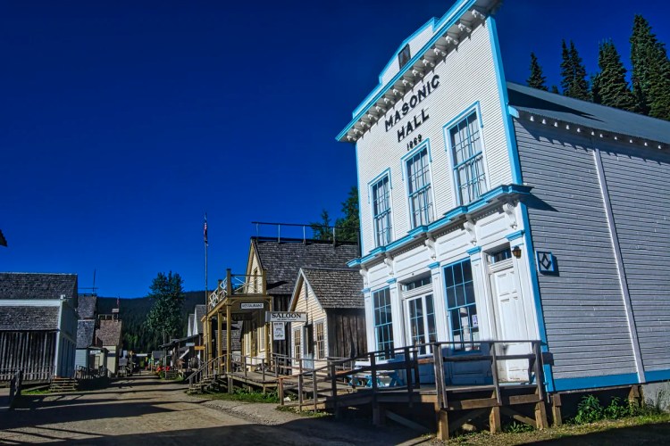
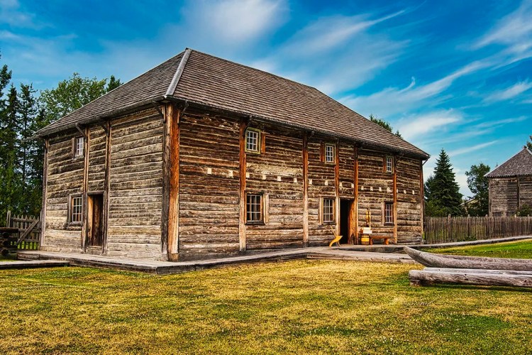
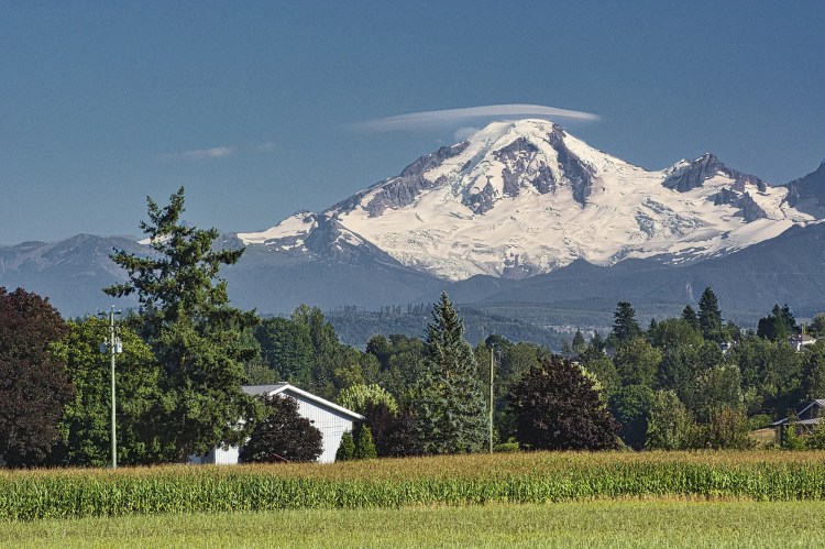
Other Places to Add to Your Itinerary
Here are nearby places you might want to explore:
Final Comments on this Itinerary
This is an action-packed itinerary where you can get away from the crowds. Most tourists head to sites that are famous because of name recognition. Our recommendations are all highly rated by the people, as shown by the high Google Map Ratings. The most beautiful turquoise lakes are Peyto G4.9, Bow G4.9, Emerald G4.8, Moraine G4.8, and Waterfowl G4.7! We prefer all of these lakes to overcrowded Lake Louise (G4.7).
If you just go to Banff town and Lake Louise and miss the Icefields Parkway, you have missed the essence of the Rockies. It is like going to Paris and missing the Eiffel Tower.
Subscribe
Get travel tips and advice delivered directly to your inbox. The best part is that it is free.
What things fascinate you? How long is your trip? What questions do you have? If you have been to the Rockies, share your experiences with us.
Itinerary Map & Resources
Rocky Mountain Itinerary Map — our custom map with points of interest
Google Maps Ratings
Google Maps provides a rating from 0 to 5 for all sights, hotels and restaurants (but not cities). All of our recommendations are appended with the rating (prefixed with a G) from Google Maps. As it is based on feedback from tourists and locals, it is much more reliable than travel booking websites. We consider a score of 4 to 4.39 to be Very Good; 4.4 to 5 to be Excellent.
When is the Best Time to Visit the Rockies?
Here are the average high temperatures and rain days in Banff by season. I have divided the months by temperature similarity rather than traditional seasons.
Winter (Nov-Mar) is both cold and snowy, but a haven for skiers.
Spring (Apr-May) is warm enough for a road trip. But there will still be snow even at lower elevations. Many lakes may be at least partially frozen so you will not necessarily see the turquoise colours.
Summer (Jun-Aug) is warm and sunny. This is the best season for wildflowers and hiking when the snow has melted (hopefully). If you want to go in high season, you need to book your accommodation well in advance. Even campsites should be booked. However, there are First Come First Served (FCFS) campsites that were not full when we visited just a few weeks ago. Avoid regular and especially long weekends as they are booked by the locals well in advance.
However, these historical averages do not reflect current global climate changes. This past summer, the average high was 33 to 36°C when we visited. Summer is also the high season, and you need to book ahead and pay a lot of money unless you are camping.
Autumn (Sep 17°C and Oct 10°C) could be very beautiful time. You can still go hiking depending on when the first permanent snow starts. But the days are shorter and it it could snow in October – definitely at the higher elevations. On the plus side, the lighting is softer, the autumn foliage is gorgeous and snow highlights the rock layers of the mountains. It is ideal for photography.
| Season | Mean High Temp | Rain Days per Month |
|---|---|---|
| Nov-Mar | -0.8°C 30.6°F | 4.4 |
| Apr-May | 11.5°C 52.7°F | 6.5 |
| Jun-Aug | 21.3°C 70.4°F | 8.0 |
| Sep-Oct | 13.5°C 56.3°F | 5.0 |
Canada FAQ

The Exploring Canada post answers Frequently Asked Questions (FAQ) such as:
- Where should I go in Canada?
- What is the best season for travel?
- What is the best clothing?
- Where should I go? What are the must-sees?
- How much time do I need for Canada?
- Can I see everything in a week?
- How safe is Canada?

Leave a comment