
Why Visit Washington State?
Are you searching for a quick getaway? Washington State offers volcanoes, glaciers, hikes, coastal and mountain views. Here is a short itinerary to see some of the most scenic spots. We had no idea how beautiful Washington was.
Author & Photographer: George Mitchell

Our recommendations are not influenced by affiliate links – we have none. Our recommendations are based on our extensive experience living in Western Canada. We are avid hikers, nature lovers, and photographers (all photos are my own).
All of our recommendations are top-rated by Google Maps Ratings, which is based on everyone, not just tourists. Each place recommended in our custom Washington State Circuit Map is appended with a Google Maps Rating (G0 to G5).
Washington Itinerary
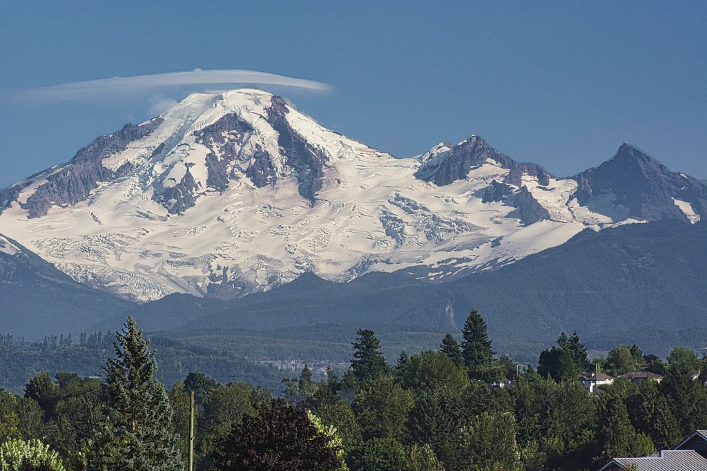
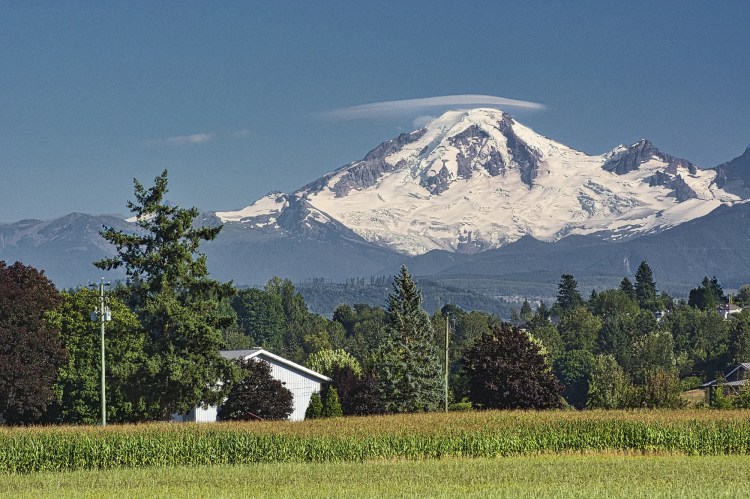
You can start this itinerary in Portland, Seattle, Victoria, Abbotsford, or Vancouver. Our son lives in Vancouver and often heads south to follow his passion, bird watching. So we drove on this itinerary together. The most direct route is via Abbotsford, where there are great views of glacier-clad Mt. Baker. Mt. Baker-Snoqualmie is a national forest run by the USDA. It protects Mt. Baker and Picture Lake.
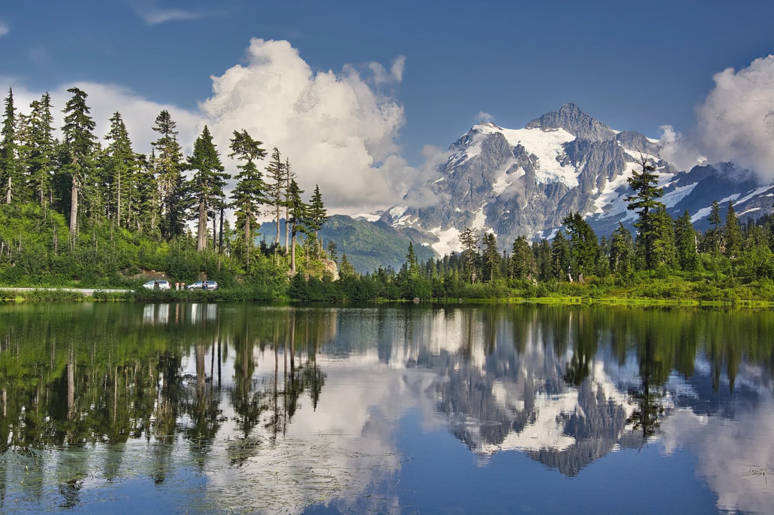
Picture Lake
Abbotsford, BC – Picture Lake 46 mi (74 km) 1:16 hrs.
Vancouver, BC – Picture Lake 89 mi (144 km) 2:11 hrs.
Seattle, WA – Picture Lake 135 mi (218 km) 2:39 hrs.
Picture Lake is only 89 mi (144 km) from Vancouver and 46 mi (74 km) from Abbotsford – close enough to be called our backyard.
From the Sumas border crossing, we took Highways 547 and 542 east past the town of Glacier and Nooksack Falls (G4.6). Then we climbed up switchbacks for 13.7 mi (22 km). Even when we parked, we had no idea how beautiful this was going to be.
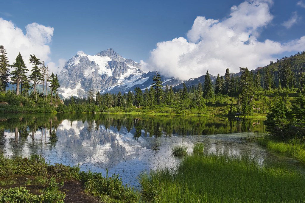
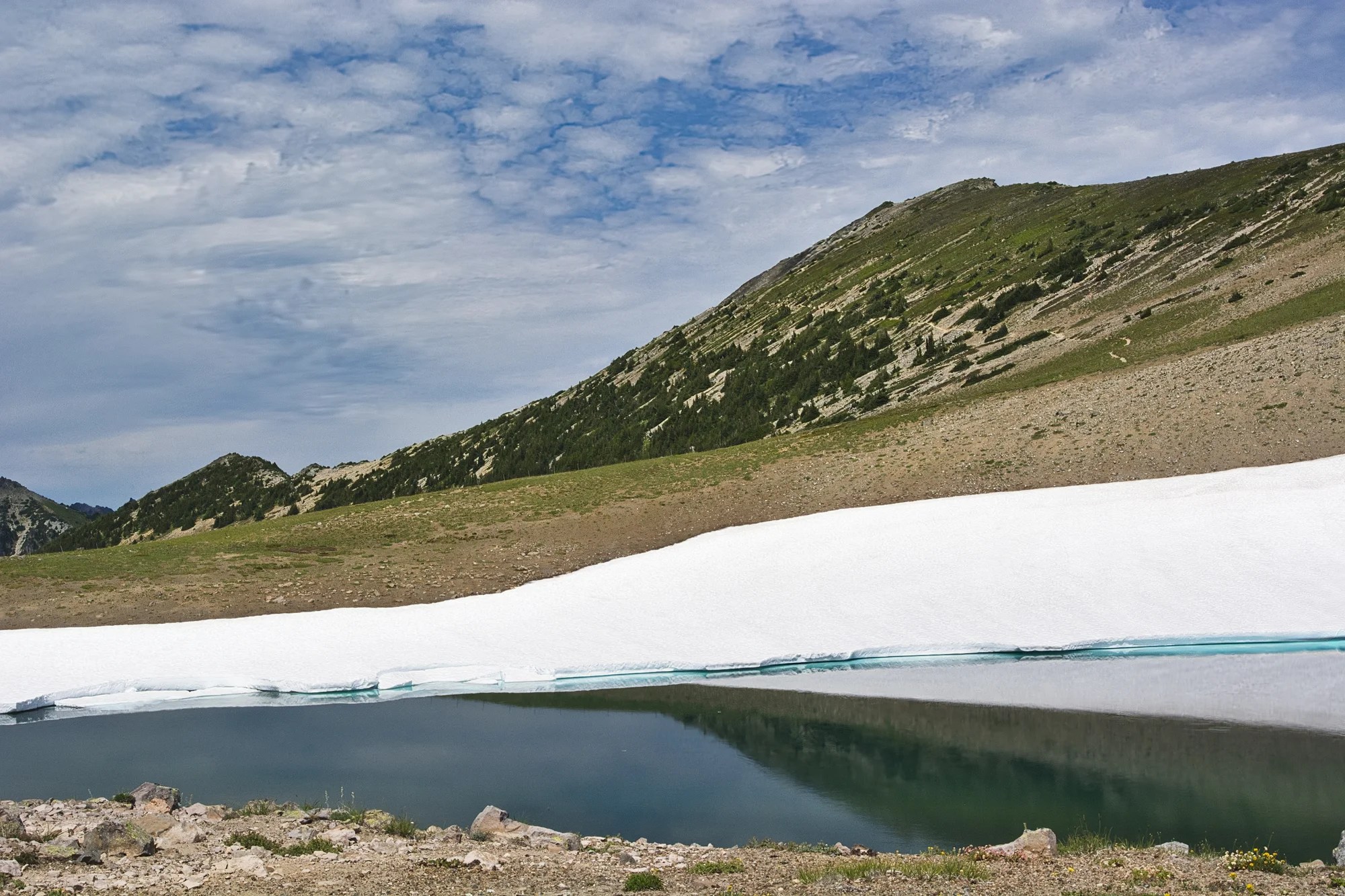
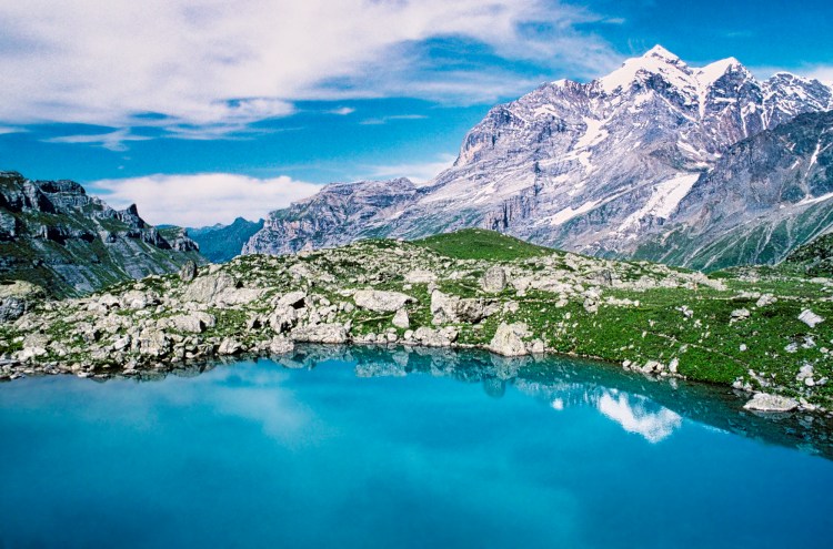
We walked about half way around the lake and then we realized what all the fuss was about. Here we saw Mount Shuksan reflected in the picture perfect lake.
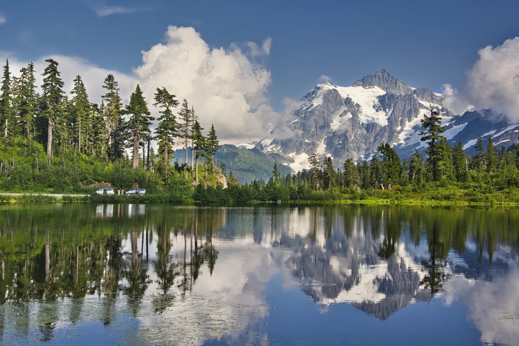
Even though the lake was not still, it was a spectacular view. We were blessed with sunny weather. This is a kettle lake in a depression carved out by an ancient glacier. Slowly, the lake is being filled by soil erosion and will eventually become a meadow.
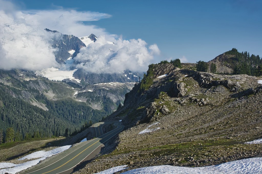
Artist Point
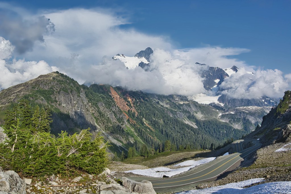
Then we drove further uphill on the same road to Artist Point (elev. 5141 ft, 1566 m). Here we enjoyed another panorama.
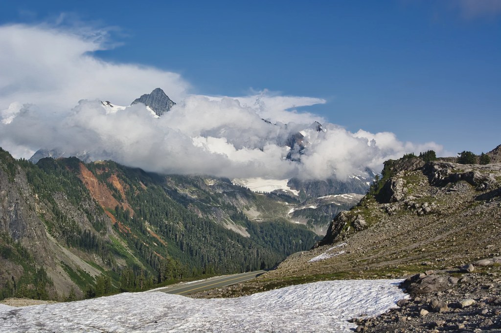
There was still quite a bit of snow on the ground in August!
Picture Lake Information
Distance: 0.6 mi (1 km)
Elevation: 4,157 ft (1267 m)
Entry Fee: $5 self-paid via box or
Included with the America the Beautiful pass
Season: Jul – Oct or whenever the snow is gone
Cell Service: none
Picture Lake-Artist Point Trails
There are several trails in the Artist Point area. Some of the shorter ones are:
Artist Ridge Trail: 1.0 mi to impressive views of Mounts Baker and Shuksan.
Fire & Ice Trail: 0.5 mi interpretive trail to a scenic viewpoint.
Panorama Dome Trail: 1.5 mi to impressive views of Mount Baker.
Mount Rainier National Park
Seattle, WA – Sunrise Point 93 mi (150 km) 2:01 hrs.
Picture Lake – Sunrise Point 221 mi (356 km) 4:38 hrs.
Vancouver, BC – Sunrise Point 226 mi (363 km) 4:20 hrs.
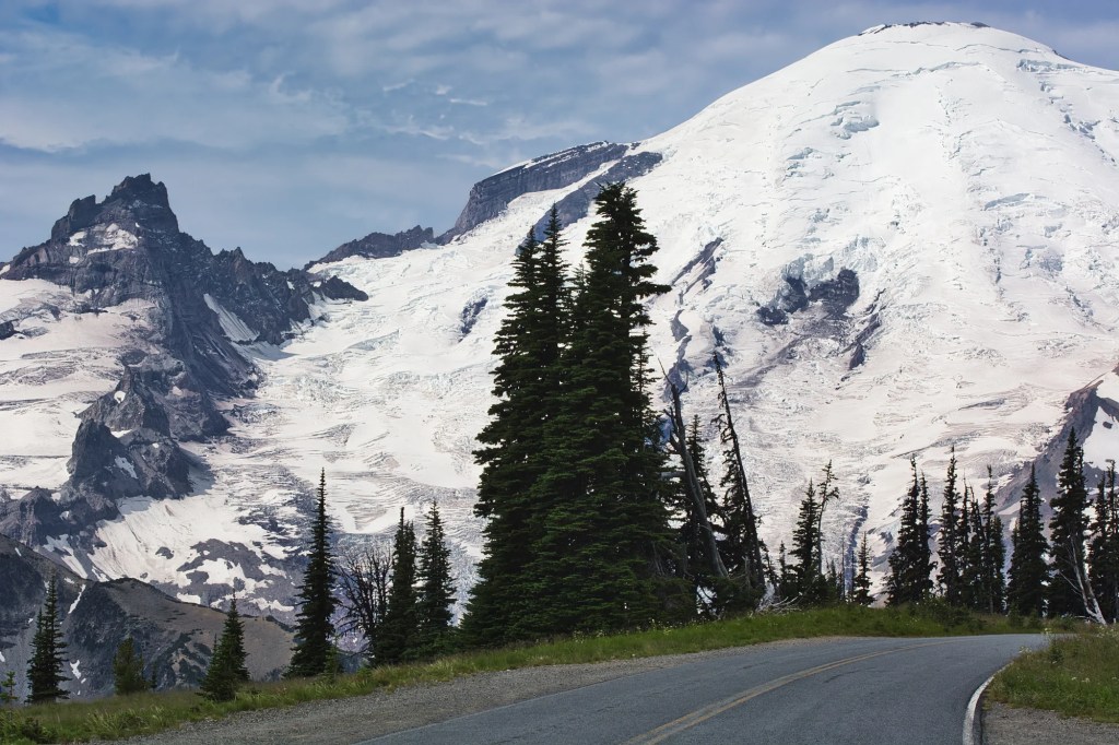
Mount Rainier is a remarkable and iconic peak. But where did it get its name?
Admiral Peter Rainier
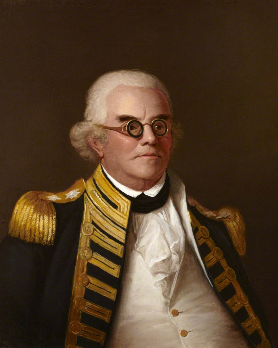
Capt. George Vancouver named Mount Rainier (1792) in honour of his friend. Admiral Peter Rainier served during the Seven Years’ War, the American Revolutionary War and the Napoleonic Wars. He was also a Member of Parliament (MP) for Sandwich. BTW, this is the origin of our word sandwich. The Earl of Sandwich ate food this way so he could stay at the gaming table!
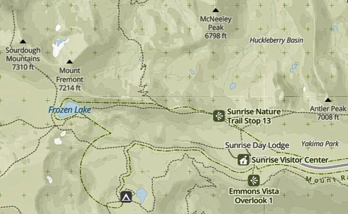
Sunrise Point Lookout
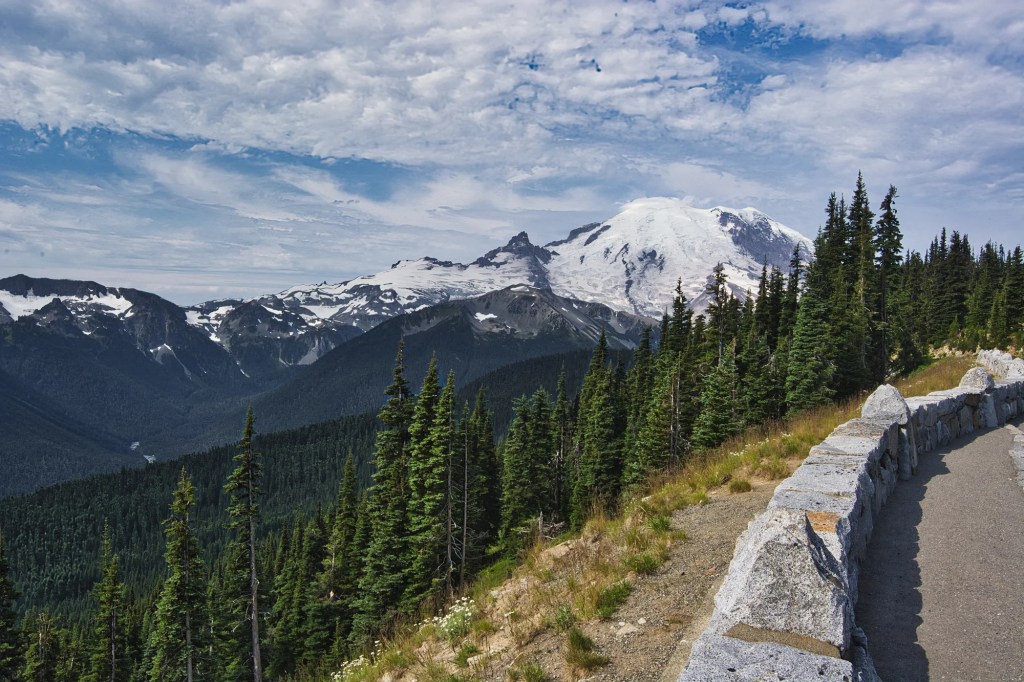
We loved the spectacular Sunrise Road, travelling through the northern area of the park. Even if you don’t hike, you will enjoy the endless views of mountains and meadows. It is located off Highway WA-410. The first major pull-off was the Sunrise Point Lookout (G4.9).
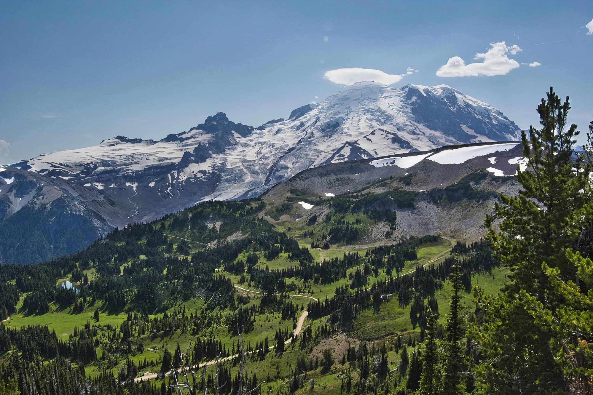
Here you’ll see the most beautiful alpine views that include five volcanoes; Mount Rainier, Mount Baker, Glacier Peak, Mount Adams, and Mount Hood.
Sunrise Lake
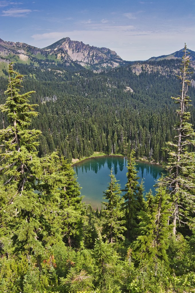
On the right side of the Sunrise Point Lookout was this beautiful turquoise Sunrise Lake (G4.7) with a verdant mountain backdrop.
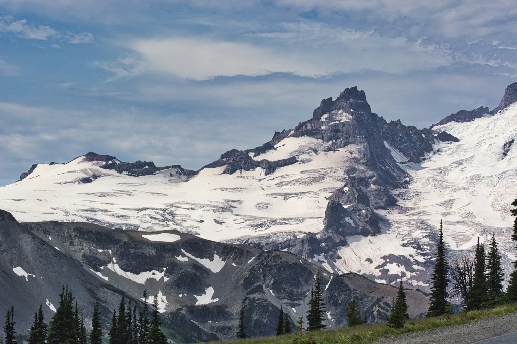
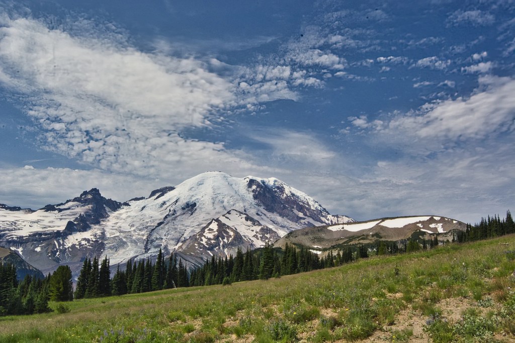
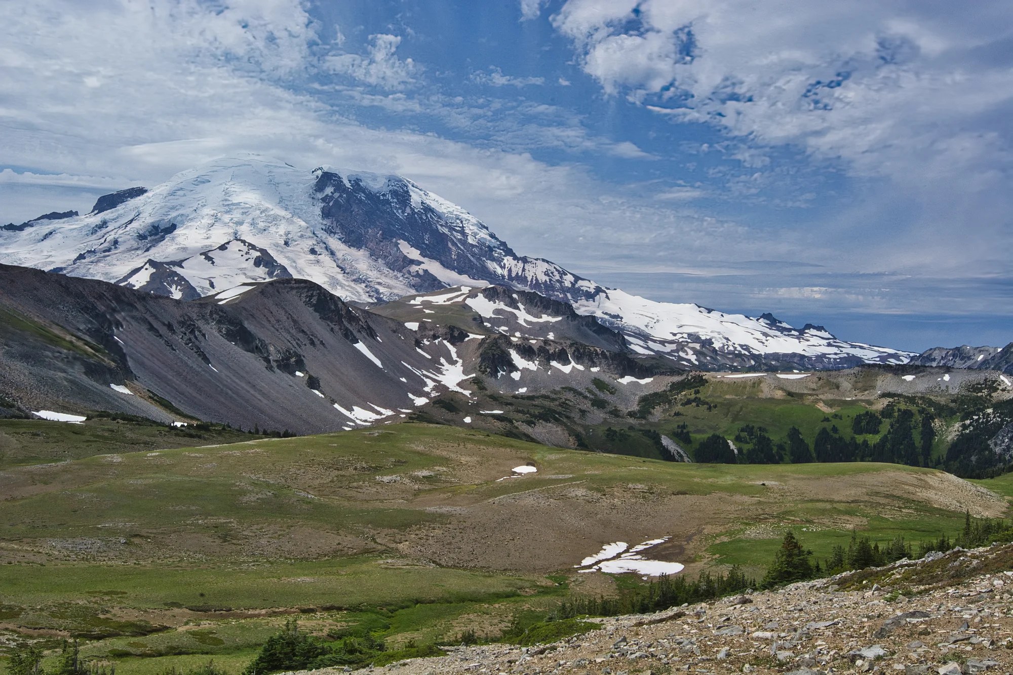
The road brings you closer and closer to the very prominent Mount Rainier towering 14,410 ft (4,392 m). The next thing you should notice are the 25 major glaciers. The glaciated area covers over 35 sq mi (90.6 sq km)!
The most recent recorded volcanic activity was between 1820 and 1854. Mount Rainier is almost twice the size of St. Helens. It is considered one of the most dangerous volcanoes in the world due to its potential for future eruptions and proximity to populated areas.
Mount Fremont Lookout Trail
Distance: 5.7 mi (9.2 km) RT
Elevation Gain: 1108 ft (338 m)
Hiking Time: 3 to 4 hrs RT
Trail Head: Sunrise Visitor Center parking lot
This was the most “exciting” hike I have been on in terms of what happened (more later). The trail is considered moderately difficult. Experienced hikers will find it easier than that. I assume this rating is due to the elevation gain. You definitely need hiking boots or hiking shoes as most of the trail is covered in small rocks and pumice, porous glassy lava balls. Pumice can be slippery, so you need good traction.
Sunrise Meadows
We drove to the Sunrise Visitor Centre trailhead at 6,400 ft (1951 m) elevation. Near the Visitor Centre are meadows of wildflowers and great views. Non-hikers (those without hiking shoes) can easily enjoy themselves on the nature trail or the first part of the Sourdough Ridge Trail.
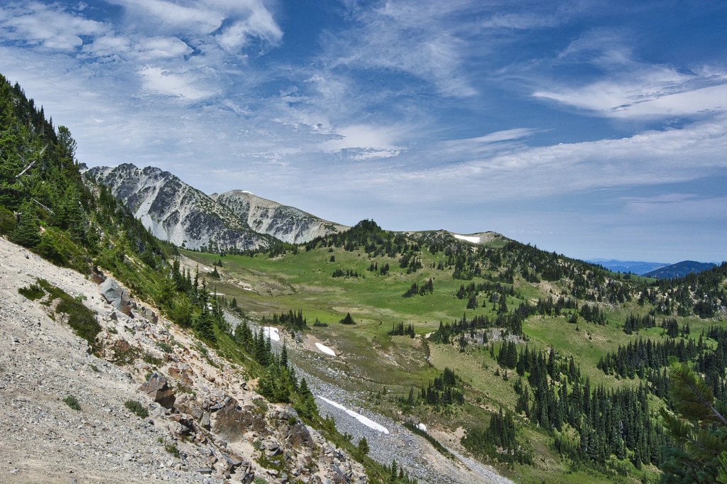
The trail heads steadily uphill, gaining 400 ft (122 m) in just over half a mile (800 m). Ten minutes later we reached the top of the ridge. Here was a stunning view of tan volcanic rock contrasted with light green meadows and dark green trees. It is very photogenic.
This is Huckleberry Basin, seen from Sourdough Ridge Trail. I believe this photo was taken at the point where the trail reaches Sourdough Ridge, ca. 0.3 mi (0.5 km) at 6791 ft (2070 m) elev.
We turned left and hiked west on the fairly level Sourdough Ridge Trail. There were views in every direction.
Frozen Lake
We hiked to the five-way trial intersection at Frozen Lake. It is about 1.3 mi (2.1 km), 45 minutes from the trailhead. This forlorn pond is the water supply for the Sunrise Visitor Centre and is now surrounded by a fence to keep hikers away from the water.
Fremont Lookout Trail
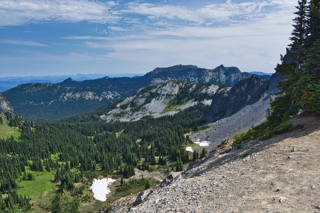
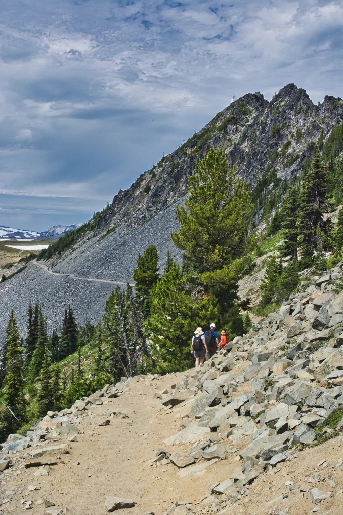
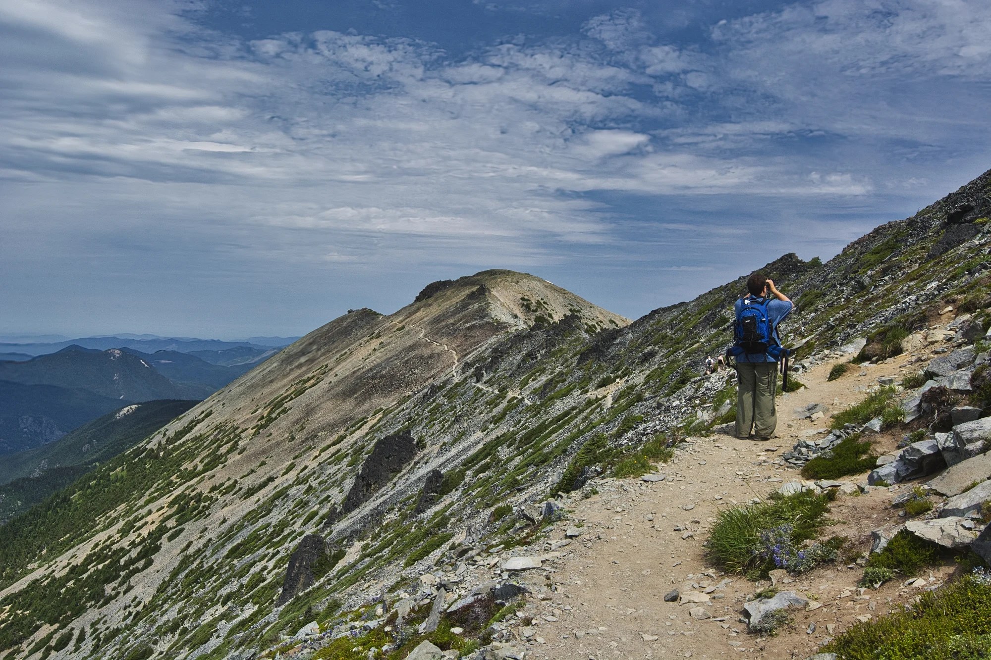
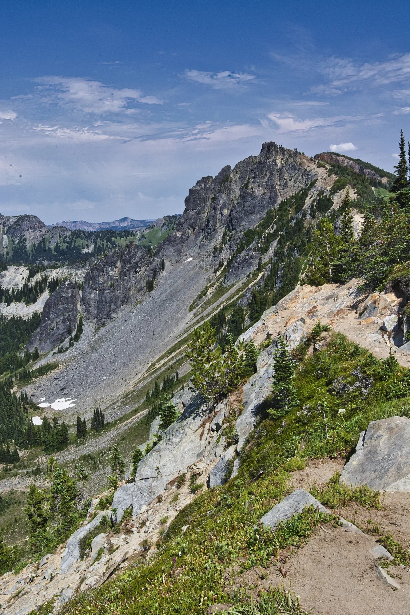
Here we turned right onto the Mt. Fremont Lookout Trail to this view 20 minutes later. The entire trail is scrub and rocks. But it is Mt Rainier and its glaciers that demand your attention.
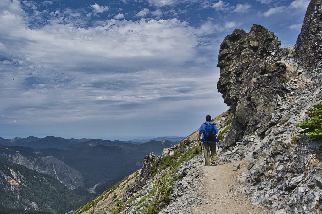
Most of the trail follows the ridge edge with a steep drop off. There are stunning views all along the trail as there are no trees. Suddenly, the heels of my well used Swiss-made hiking boots came off. I told you this was an exciting hike!
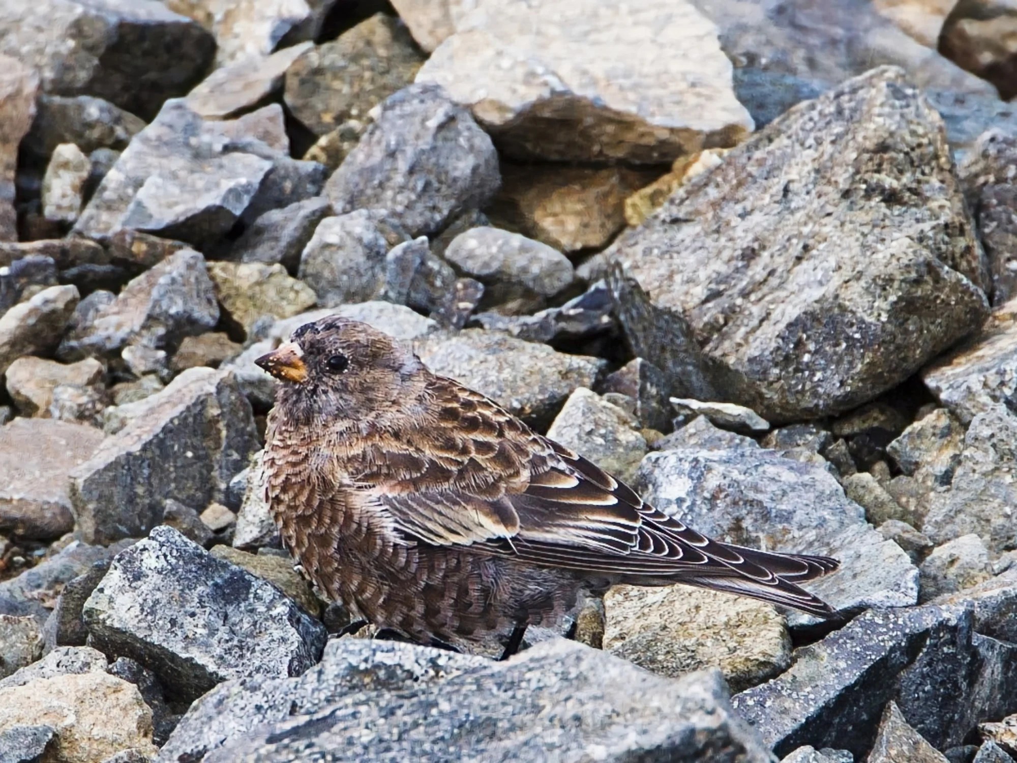
One of the birds our son saw was the Gray-crowned Rosy-Finch. They like to forage on alpine snowfields. This species is common throughout the Pacific Northwest and Alaska. They are the highest altitude breeding bird!
About 40 minutes later, we have nearly reached the Mt. Fremont Fire Lookout (G4.9) built in 1934. You can see it at the end of trail in the photo (on mobile devices only: use the enlarge gesture on the photo to enlarge it). As we walked, layer by layer peeled off my hiking boots until they were toast. I had to walk in my socks. Fortunately we had reached the end point.
Needless to say, it was a painful and slow walk downhill over the pumice pebbles. But I still took time to take photos. You see different things going downhill. On a clear day, hikers can enjoy superb views of Mount Rainier. Even though it was cloudy, it was still spectacular.
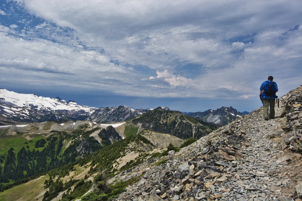
Burroughs Mountain Trail
Distance: Second Burroughs 7 miles (11.3 km) RT
Elevation Gain: 900 ft (274 m)
Hiking Time: 2.5 hrs RT
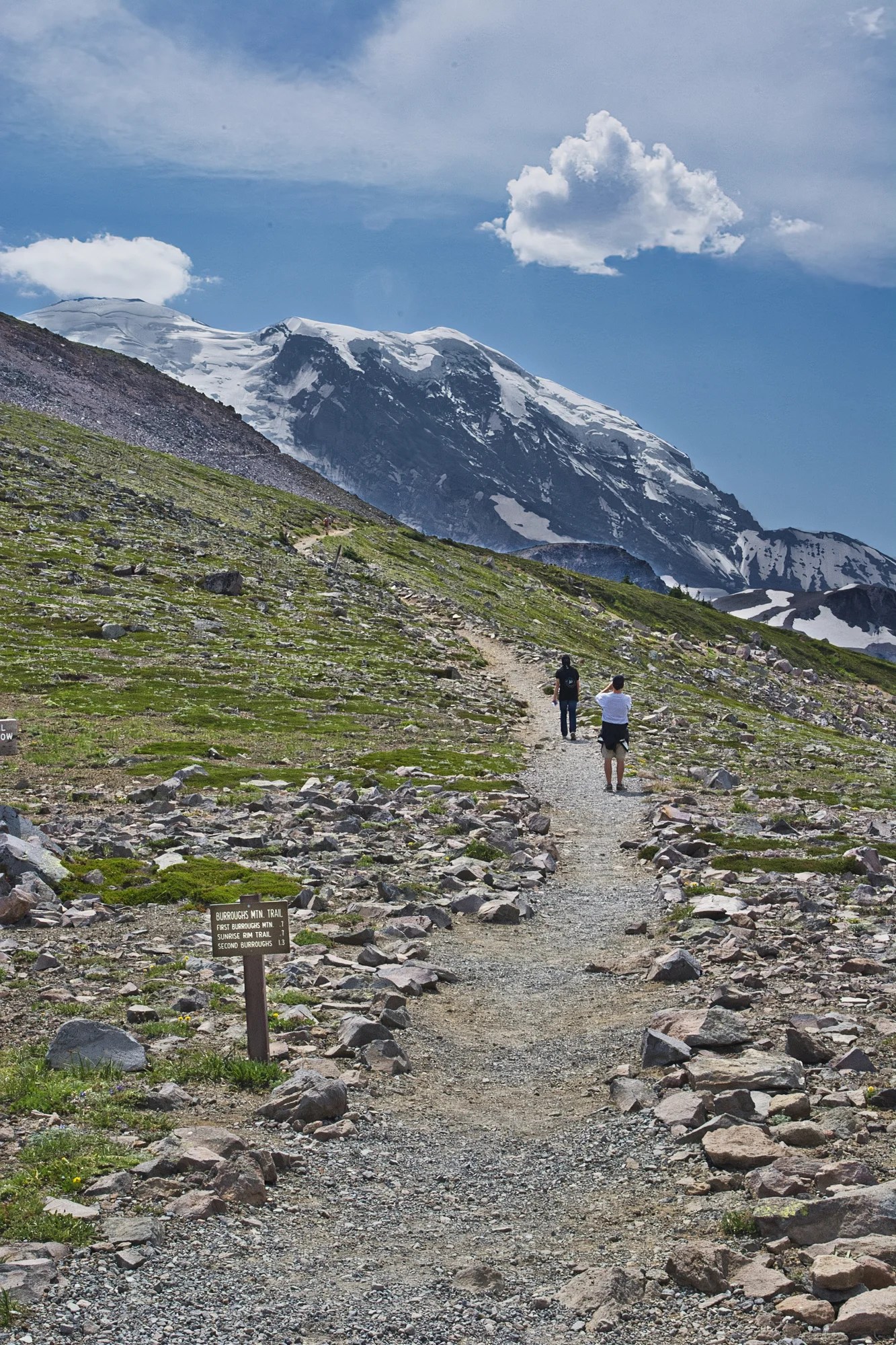
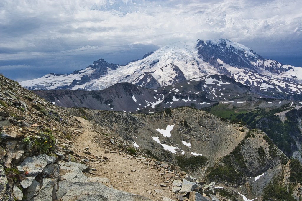
Two hours later, I finally made it back to the five-way intersection at Frozen Lake. The Burroughs Mountain Trail offers dramatic views of Mt. Rainier. This is a view of the top of First Burroughs Mountain at 7160 feet (2182 m). Second Burroughs Mountain (elev. 7402 ft, 2256 m) is a good turnaround point for most day hikers.
Yakima Park
The meadows surrounding Sunrise are known collectively as Yakima Park. This is one of my favourite views. It reminds me of Switzerland due to the open meadows.
Box Canyon
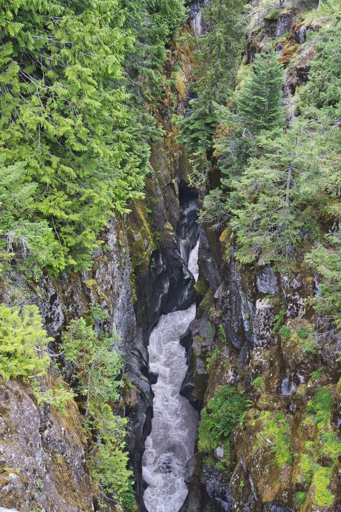
We drove 8.7 mi (14 km) east along the Stevens Canyon Road to Box Canyon. This road is open when there is no snow — typically late May to September. We were amazed at this narrow rushing ribbon 180 ft (55 m) below us.
Box Canyon is a narrow slot canyon carved by the Muddy Fork of the Cowlitz River. In addition to the viewpoint, there is a picnic area, toilets, and a short loop trail.
Mount Rainier Information
Other Rainier Places to Visit
Christine Falls is framed by a picturesque stone bridge.
Skyline Trail is a popular 5.6-mile (9-km) 3.5 hrs. loop trail in the Paradise area. With a 1770 ft (540 m) elevation gain, it allows close views of white Mount Rainier contrasted to green meadows teeming with wildlife.
Nisqually Road (via WA-706) is the most popular access route as it is open year-round.
Mount Rainier Fees and Season
Entry Fee: $30 per week or America the Beautiful pass
Season: Jul – Oct, depending on snow
Timed Entry Permits: required for Paradise and Sunrise areas May 24 – Sept 2 from 07:00 to 15 hrs.
Mount Rainier National Park – NPS
Fire Lookouts of Mount Rainier
Sunrise Road normally opens in late June or early July and closes in early October.
Road Reservations
Visitor numbers to Mount Rainier have soared. A timed entry system is now needed during the summer. There are separate reservations for the Paradise and Sunrise areas. It costs $2 per reservation via the recreation.gov website.
Most slots are made available on April 01 for July and May 01 for August. The time slots are in two-hour increments 7:00-9:00, 9:00-11:00, 11:00-13:00, and 13:00-15:00 hrs. Some slots are saved for a next day timed entry. You can reserve these at 19:00 hrs Pacific Time the night before your planned visit.
If you don’t have a reservation, you can enter these areas before 07:00 or after 15:00.
Sunrise Accommodation
There is no lodging at the Sunrise location. Sleep at the Paradise Inn, Ashford, or Packwood. White River Campground is located just 12 mi (19 km) from the Sunrise Visitor Center.
Mount Rainier Trails
Mount Fremont Lookout Trail, NPS 2020
Mount Fremont Lookout, WTA 2024
Mount Fremont Lookout via Sourdough, All Trails 2024
Tolmie Peak Trail: This 6.5-mile (10.5-km) trail leads to a fire lookout with breathtaking views of Mount Rainier and Eunice Lake.
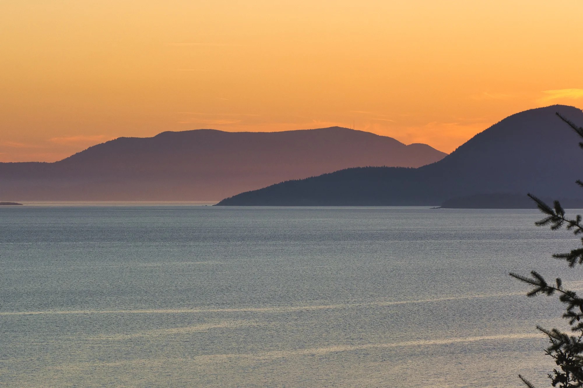
Deception Pass
Seattle, WA – Deception Pass 83 mi (133 km) 1:26 hrs.
Vancouver, BC – Deception Pass 94 mi (151 km) 1:46 hrs.
Sunrise Point – Deception Pass 175 mi (281 km) 3:23 hrs.
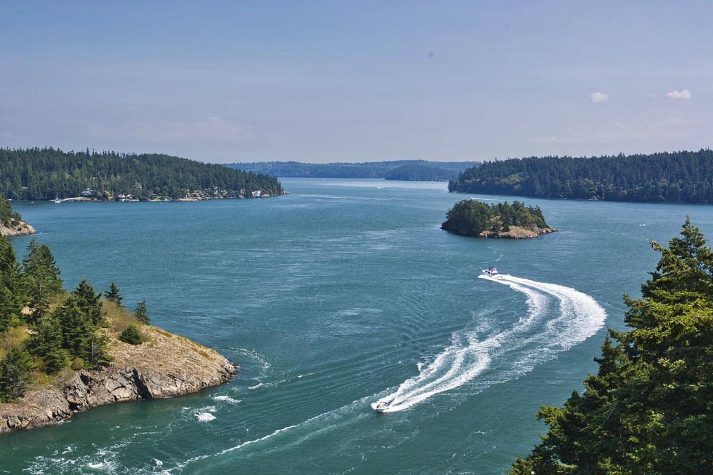
Deception Pass Bridge
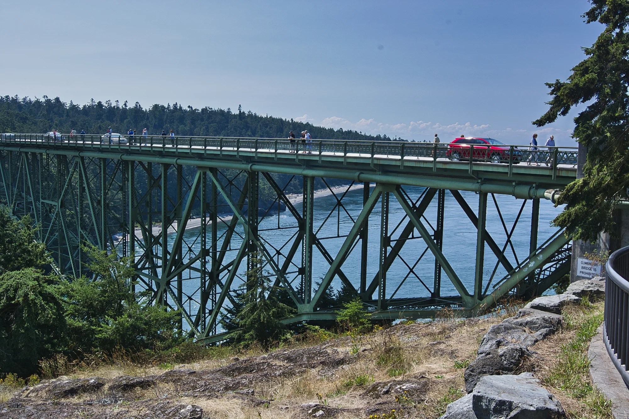
The iconic Deception Pass Bridge spans between Fidalgo and Whidbey Islands. It was built in 1935 as a Great Depression project. When it came time to lay down the final steel span in the middle of the bridge, it did not fit! The weather was so hot that the steel had expanded. They had to wait until 4 AM for the steel to cool enough to complete the bridge!
Before the bridge, Berte Olson, the first female captain in WA, ran a ferry here. She charged $0.50 per car or $11.75 in today’s dollars.
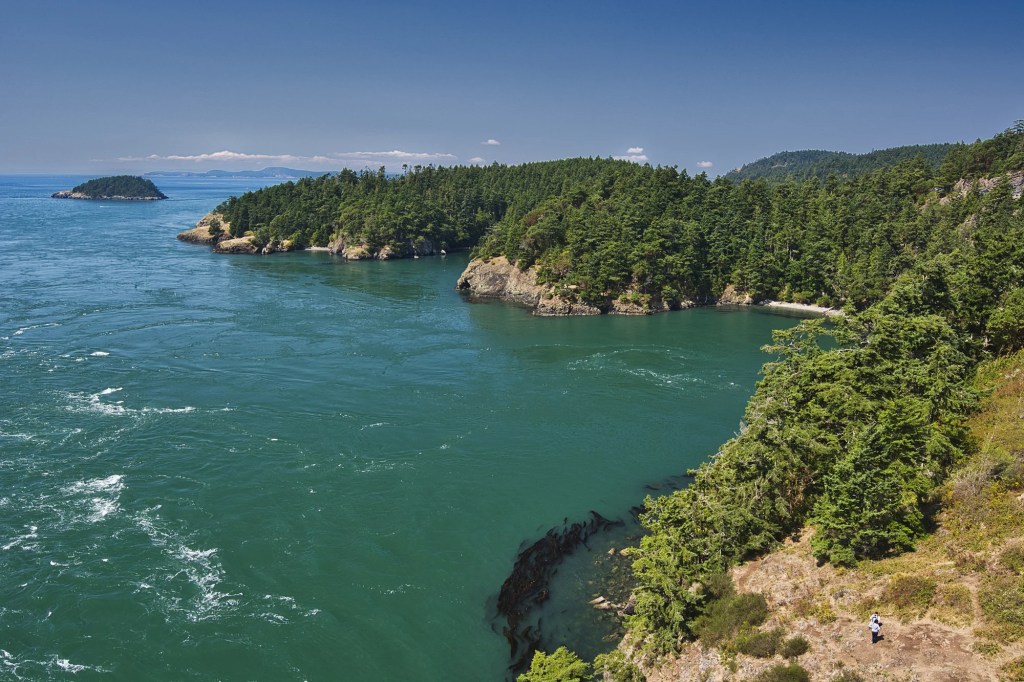
What I didn’t expect was dark emerald green waters of the Pacific Ocean. It is what makes this scene so special.
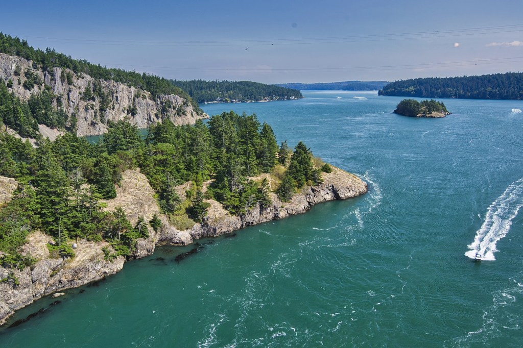
We enjoyed the panoramic views of rugged cliffs and peaceful forests from the bridge. We loved it so much, we must have spent at least an hour here going back and forth along the bridge, which soars 180 ft above the water.
Captain George Vancouver believed the pass was a river’s mouth. His lieutenant sailed around the land. He discovered that it was an island. Vancouver named the island after his lieutenant, Joseph Whidbey. He named the waterway Deception Pass because he had been deceived.
Arbutus Trees
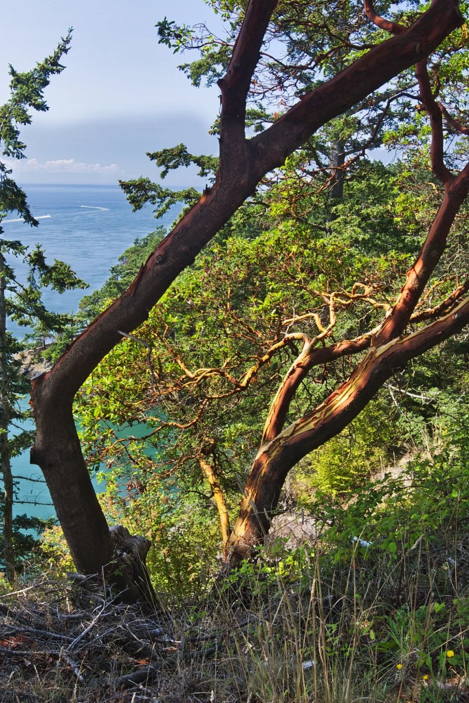
Many years ago, when we first visited Vancouve,r we lived near a street named Arbutus. But we easterners had never seen an Arbutus tree. We were amazed by the wine-red, flaking bark.
Arbutus are native to the Mediterranean and North America – and particularly common along the coast of the Pacific Northwest. Arbutus is the only native broad-leafed tree in Canada that retains its leaves year round.
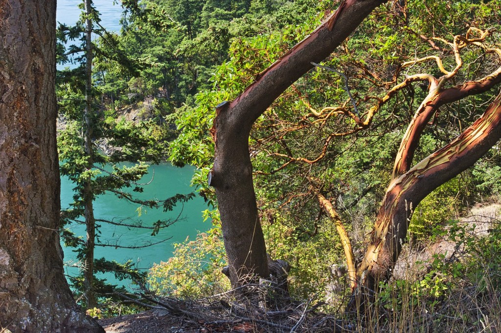
In Native culture, Arbutus symbolizes strength, survival, and resilience. They also use Arbutus bark and leaves for medicinal purposes.
Deception Pass Information
Deception Pass State Park Brochure – Washington State
Deception Pass State Park Website – Washington State
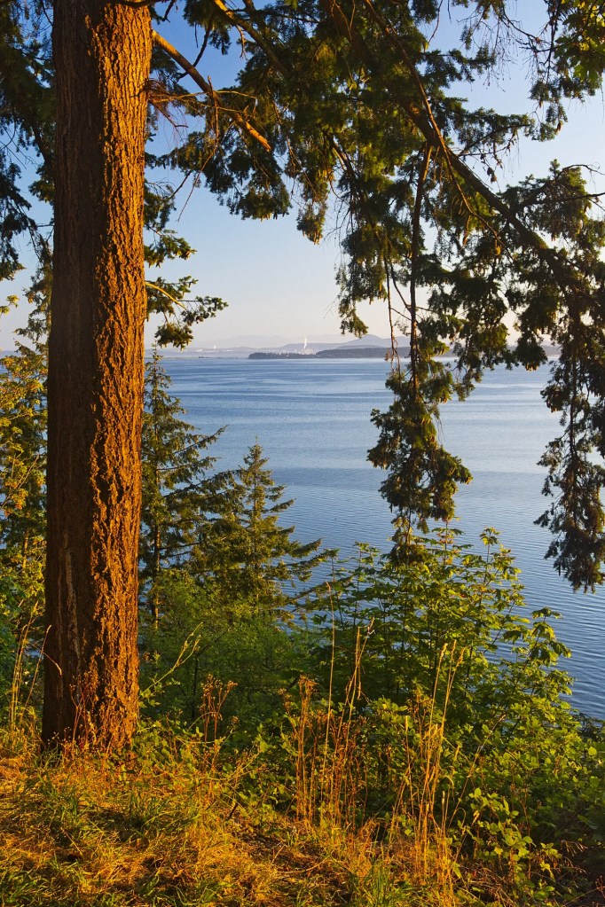
Anacortes
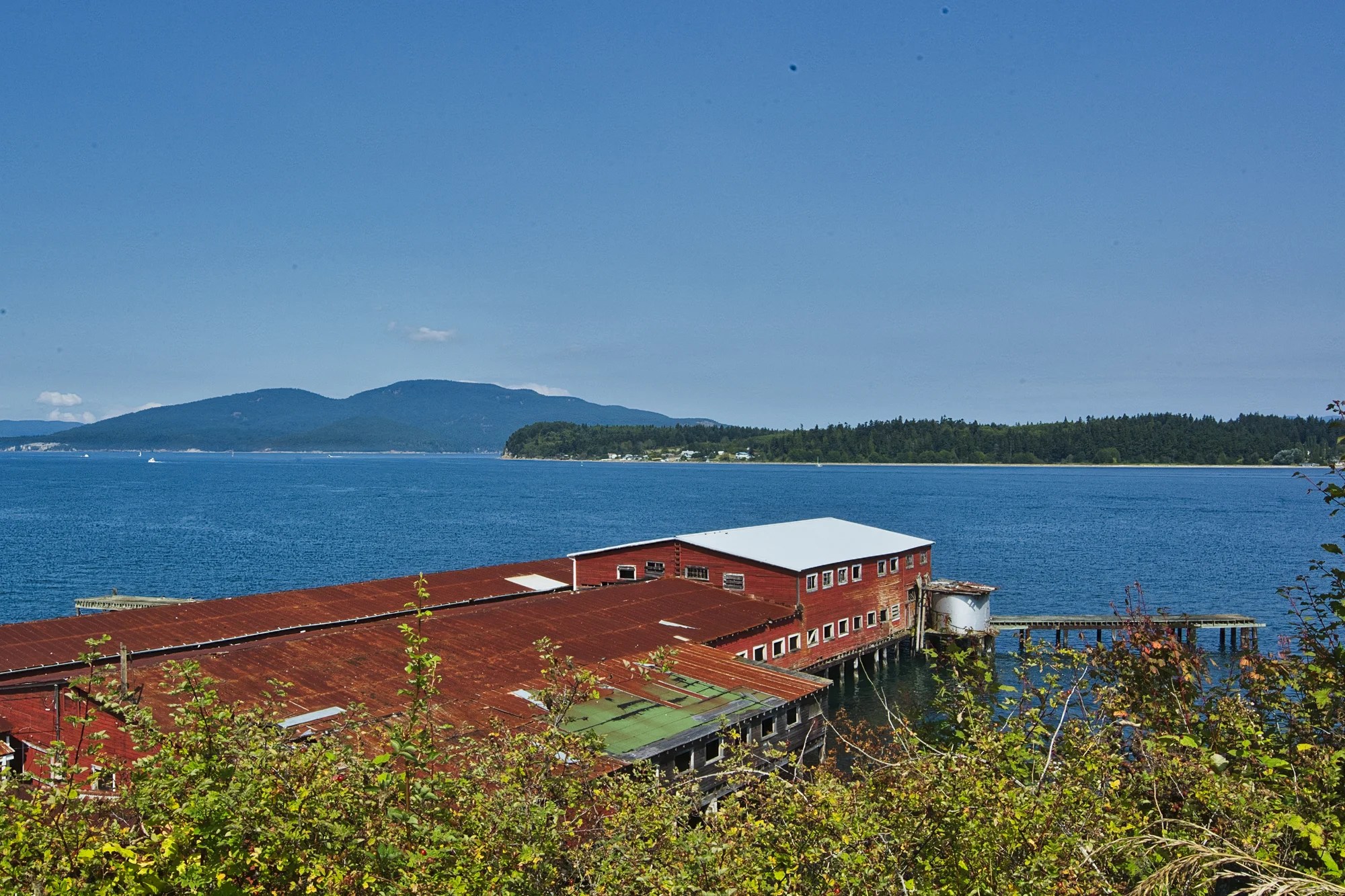
Our son took local roads to go birdwatching near Anacortes. The town is a ferry terminal for the San Juan Islands. We saw this bright red cannery. The Salina Packing Company was built in 1915. By 1922, there were twelve salmon canneries along the Guemes Channel.
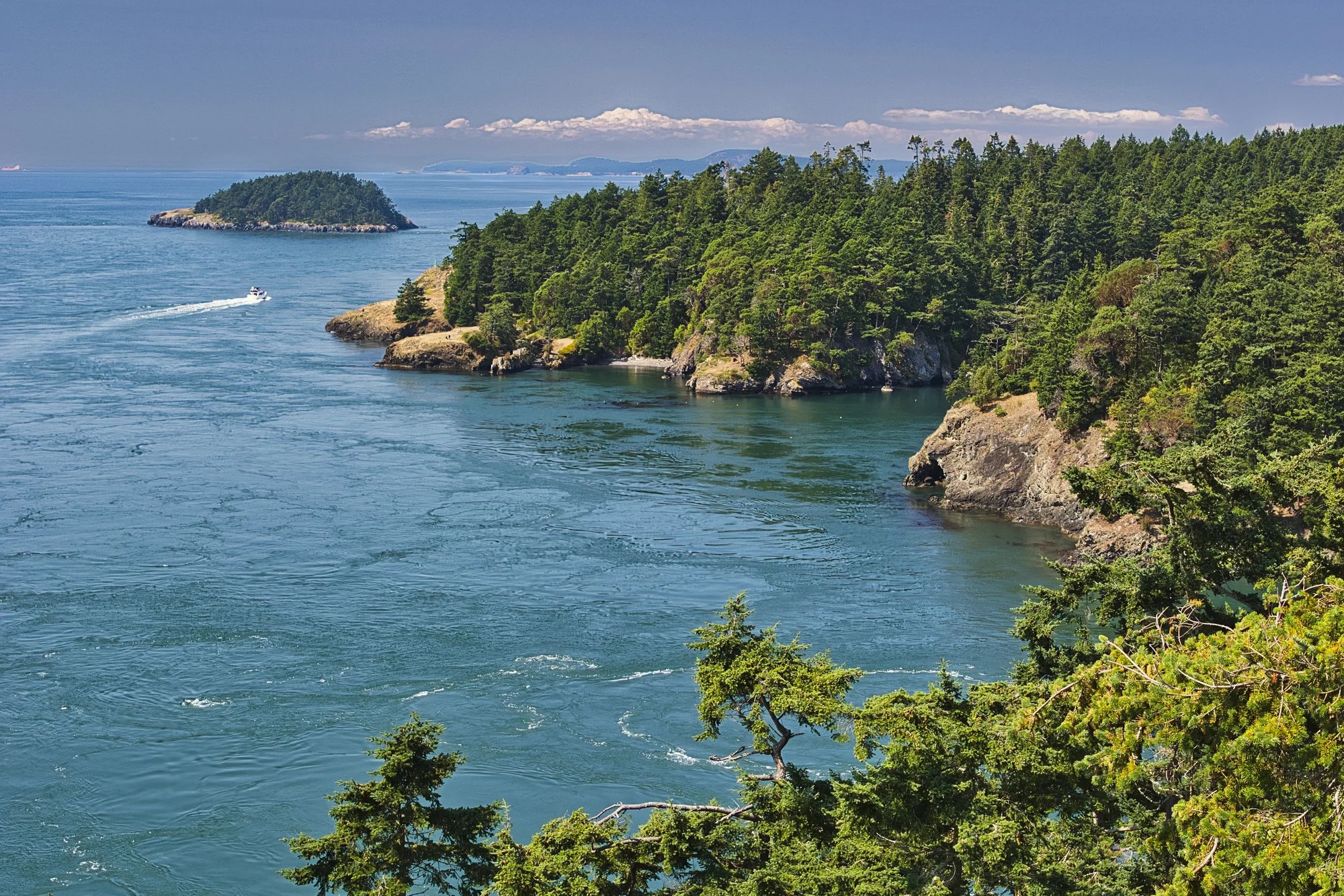
Chuckanut Drive
Deception Pass – Chuckanut 28 mi (45 km) 0:40 hrs.
Vancouver, BC – Chuckanut 63 mi (102 km) 1:19 hrs.
Seattle, WA – Chuckanut 78 mi (126 km) 1:21 hrs.
Chuckanut Drive (Highway 11) was Washington State’s first scenic byway. It begins at I-5 exit 231 in Burlington and continues 20 miles north to Bellingham.
The 24-mile (38.6 km) curvy route hugs the sheer sandstone cliffs of the Chuckanut Mountains.
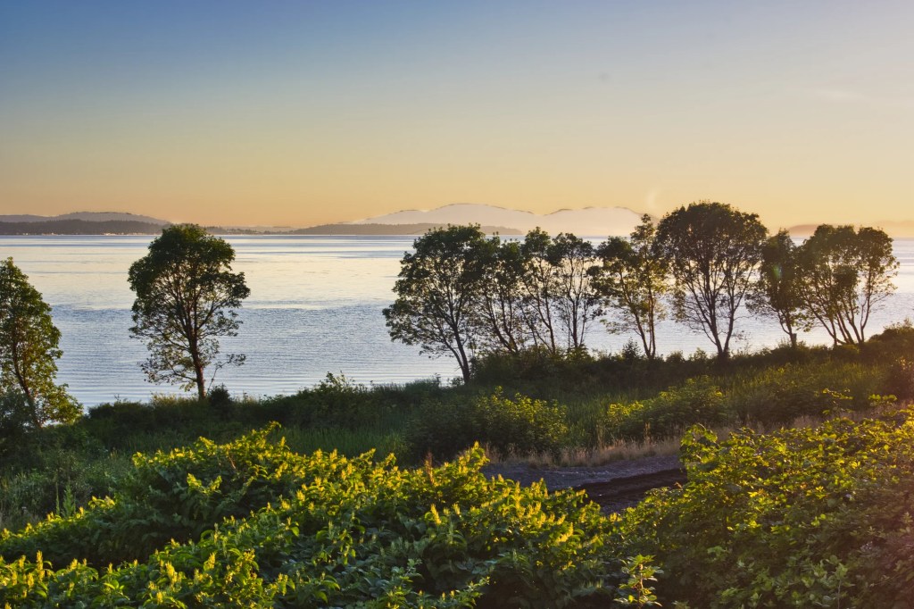
Chuckanut Drive overlooks Samish Bay, offering stunning views of the San Juan Islands and Chuckanut Bay. It was a great sunset drive as we drove back to Vancouver.
Douglas Fir
The Douglas Fir (Pseudotsuga menziesii) is a remarkable tree in many ways:
- Is not a true fir tree.
- Lives between 500 and 1300 years.
- Grows as high as 330 ft (100 m).
- Is strong and durable enough to be used in boat and building construction.
- Is the best timber-producing species in the highest timber-producing places — BC, WA and OR.
- Is named for Scottish botanist David Douglas.
Chuckanut Information
Chuckanut Drive, Scenic Washington 2024
Final Comments on this Itinerary
This is an exciting itinerary where you can see volcanoes, glaciers, meadows and mountains. It’s great for hikers and photographers.
This itinerary lets you experience the spectacular scenery of Washington.
Subscribe
Get travel tips and advice delivered directly to your inbox. The best part is that it is free.
This was only a taste of some of the scenic wonders of Washington. If you have other favourites, share your experiences with us. How long is your trip? What questions do you have?
Itinerary Map & Resources
Google Maps Ratings
Google Maps provides a rating from 0 to 5 for all sights, hotels and restaurants (but not cities). All of our recommendations are appended with the rating (prefixed with a G) from Google Maps. As it is based on feedback from locals as well as tourists, it is much more reliable than travel booking websites. We consider a score of 4 to 4.39 to be Very Good; 4.4 to 5 to be Excellent.
Other Places to Add to Your Itinerary
We have collected some scenic places to visit next time we travel to Washington State. We have added the following places to our Washington State Circuit Map in three main areas.
North Cascades: Diablo Lake, Ross Lake, Washington Pass
Olympic NP: Sol Duc Falls, Hoh Rain Forest, Quinault Rain Forest
Mt Saint Helens: Windy Ridge Viewpoint, Loowit Viewpoint
Here are nearby places you might want to explore:
When is the Best Time to Visit Washington?
Here are the average high temperatures and rain days in Mt Rainier by season based on weather similarity rather than traditional calendar dates. As mountains have alpine weather, they are much cooler than along the coast.
| Season | Mean High Temp | Precip. per Month |
|---|---|---|
| Nov-Mar | 39.8°F 4.3°C | 10.2″ 26.0 cm |
| Apr-May | 54.5°F 12.5°C | 5.3″ 13.4 cm |
| Jun-Sep | 70.0°F 21.1°C | 2.6″ 6.7 cm |
| Oct | 56.0°F 13.3°C | 7.9″ 20.0 cm |
Summer (Jun-Sep) is warm and dry. However, these historical averages do not reflect current global climate changes.
Spring (Apr-May) and October are cooler but roads may not be open due to snow. Winter (Nov-Mar) is both cold and snowy. Many roads will be closed.
USA FAQ
Here are a few things to remember.
Do you need a Passport?
If you are not American, you will need a passport. Furthermore, it must be valid for the length of your planned stay, AND you must have at least 6 months’ validity remaining. This rule applies to most countries in the world.
Do I need Health Insurance?
Definitely – don’t leave home without it! Medical care in the USA is very expensive. If you are members, check if you can get more reasonable insurance via AAA, CAA, or Costco.
Do I need a Car?
If you are going solely to a city, then no. But if you are interested in nature and hiking, then it is a necessity. North America does not have the extensive bus/train network like Europe.
Is the USA the Most Beautiful Country in the World?
Is the United States more beautiful than Canada? New Zealand? Switzerland? These are frequently asked questions on social media. Personally, I don’t like this type of question. If you like nature, you should appreciate all forms of beauty and geography. The United States offers coastal scenery, desert scenery, geothermal scenery, and volcanic scenery. Here is how I responded to these questions.

How Safe is the USA?
Some city areas are not safe. One problem is that people do not go downtown at night. By contrast, Canadian cities are full of people at night.
But as a tourist travelling in the rural areas, state and national parks, you will feel safe. You can see a table with two travel safety indices at the link above.
Abbreviations
BC British Columbia ISO Country-Region Code
elev Elevation
Hwy Highway
km Kilometre = 0.62 miles (mi)
m metre = 1.09 yards
NP National Park
NPS National Parks Service
RT Round Trip
USD United States Dollar
USDA United States Dept of Agriculture
WA Washington State ISO Country-Region Code
WTA Washington Trail Association

Leave a comment