

North Island’s Hidden Treasures
The Northland region of North Island offers a unique mix of rolling green farmland, rugged coastlines, and stunning scenery. Is it one of the most spectacular places in NZ? No. But, it is an ideal itinerary for beach and coastal scenery lovers, and for bird watchers. Another plus is that all the sights are very close to each other. This makes it a perfect itinerary for a less than two-week trip to NZ.

Author & Photographer: George Mitchell

Our recommendations are not influenced by affiliate links – we have none. Our itineraries, photos, and advice are based on travelling for six months in New Zealand. We are avid hikers, nature lovers and photographers. NZ is one of our favourite destinations.
All of our recommendations are top-rated by Google Maps Ratings, which is based on everyone, not just tourists. Each place recommended in our custom NZ North of Auckland Map is appended with a Google Maps Rating (G0 to G5). Acronyms can be found in the Abbreviations section.
North of Auckland Itinerary
North Island (NI) is 75% of the size of South Island. This route only covers the Auckland to Northland Regions of NI. The drive from Auckland Airport to the northern tip of NZ (Cape Reinga) is 634 km, about 9.5 hours one way. This post describes our favourite places in itinerary order and combines experiences from our previous three trips.
Birds

North Island is a birder’s paradise. On our third trip, we accompanied our son on his holiday. Daniele is an expert birder. Overall, he saw 145 species in 22 days. He spotted 80 species just in the Auckland Region! In other words, he saw 55% of all the species of NZ in the first 113 km from Manukau (airport) to Rodney District.
Bird watchers should join Cornell University’s eBird website. You can track the species you see (life list). More importantly, this phenomenal website provides hot spot maps and the latest sightings, including their map location. This was used to plan his itinerary. All the photos in this post are my own, except for three photos taken by Daniele.
Bird watching is a great hobby for your young kids. You only need binoculars. This is how Daniele got into birding at ten years old. It only gets expensive when your child wants the best binoculars and scopes made by Swarovski.
Note: Dogs and other pets are not allowed
in the special predator-free sanctuaries.
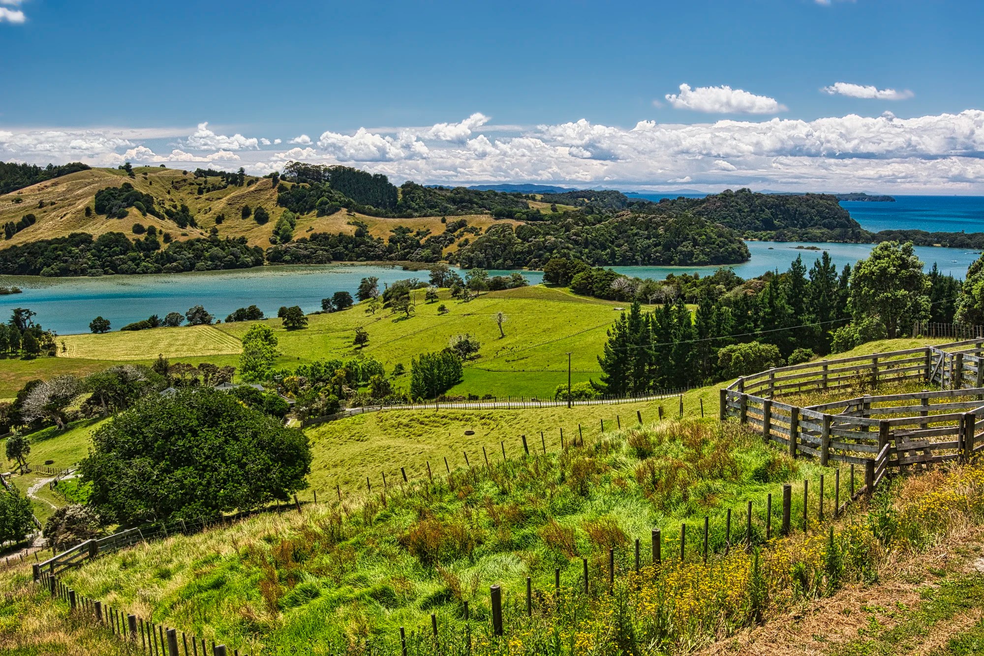
Whangaparaoa Region
Waitākere
Auckland Airport to Mangere WTP 6 km 12 mins.
Auckland Airport to Cascade Kauri Park 81 km 1:53 hrs

Kia ora! This is your Maori welcome at Auckland Airport (AKL). Unfortunately, most tourists are in a rush and don’t get to appreciate the skill of Maori wood carvers.
A mere 12 minutes after leaving the airport, we started birding at the Mangere Wastewater Treatment Plant (WTP) in Manukau City (Auckland). It was a very productive area with 38 species, like the Pacific Black Duck. Next, we hit nearby Ambury Regional Park for the Far Eastern Curlew.
Paradise Shelduck

At Huia Bridge (Waitakere), we saw the Buff-banded Rail and the Paradise Shelduck. This large, colourful duck is endemic to NZ. We know this is a female shelduck because it has a white head. The male shelduck has a black head with slight green iridescence. From Huia Bridge, tourists often visit nearby Whatipu Beach (G4.7) and Piha Beach (G4.8).

Most people visit Cascade Kauri Park (G4.8) for the kauri trees and Nīkau palms. Kauri trees are discussed under Waipoua Kauri Forest below. The Nīkau palm is the southernmost member of the palm family and New Zealand’s only native palm species. The leaves were used to thatch Maori houses. Tui, Bellbirds and Silvereyes enjoy the Nīkau nectar. We came for the Sulphur-crested Cockatoos, high on a ridge opposite the park. These birds are native to Australia, but unfortunately, we did not see them.
Whangaparoa
Auckland Airport to Whangaparoa 67 km 1:00 hrs.
Cascade Kauri Park to Whangaparoa 58 km 0:59 hrs.

We stayed at Whangaparoa Lodge (G4.8), close to delightful Little Manly Beach (G4.6). We did not see dolphins and orcas.

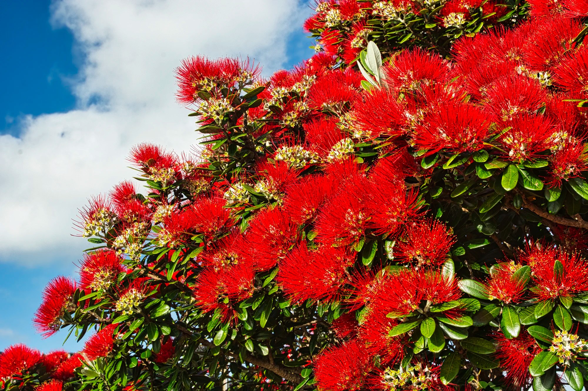
The coastal scenery was even more spectacular thanks to the brilliant red blossoms of the pohutakawas, also known as the Christmas tree.
Shakespear Regional Park
Auckland — Shakespear Park 75 km 1:12 hrs
Whangaparoa — Shakespear Park 8 km 0:13 hrs
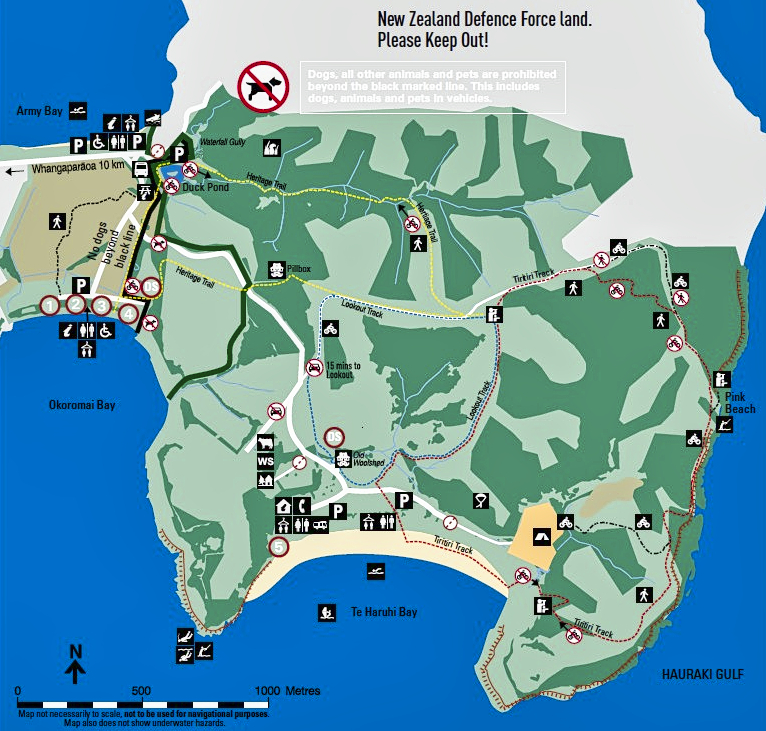
Shakespear Regional Park (G4.8), located at the tip of the Whangaparaoa Peninsula, attracts around 700,000 visitors annually. It is the most visited conservation area in the Auckland Region, probably because it is the closest to the residents of Auckland.
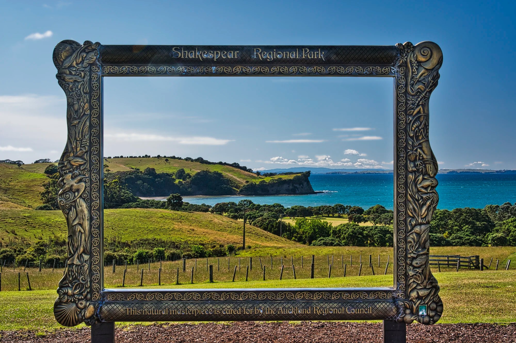
The Giant Frame (G4.8) was used by Kiwis for a family photo shoot.
Predator Fence
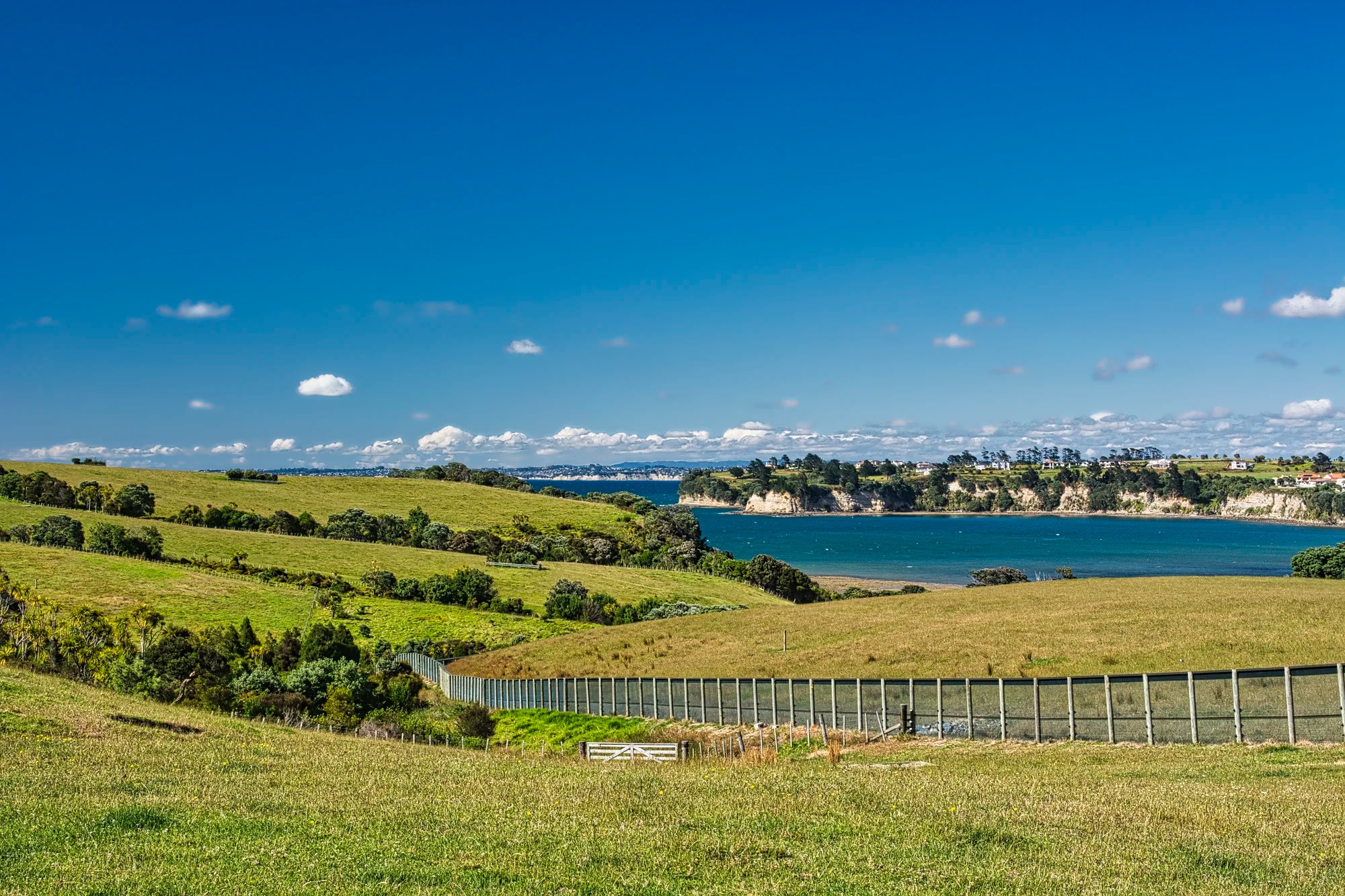
A 1.7 km (1.1 mi) predator-proof fence was built In 2011 across the peninsula. This protects defenseless endemic species including birds migrating from the nearby Tiritiri Matangi island sanctuary. Bird species include pied stilt, quail, peacock, pukeko, parrot, and spur-winged plover.
Predator Free 2050
Predator Free 2050 is working towards an Aotearoa (New Zealand) where native species are safe from extinction and thrive. The Department of Conservation (DOC) is the government’s lead agency responsible for facilitating the programme. Like Parks Canada, DOC manages all National Parks, but it has a wider mandate.
The Predator Free 2050 Movement is a national collaboration of DOC, the Predator Free NZ Trust, Predator Free 2050 Limited, local governments and Māori organizations. As of 2025, Predator Free 2050 oversees 18 conservation projects covering 757,000 hectares across New Zealand!
Zero Invasive Predators Ltd (ZIP) is a company that develops operationally ready, innovative technologies to completely remove stoats, rats and possums from large mainland areas, and then defend those areas from re-invasion.
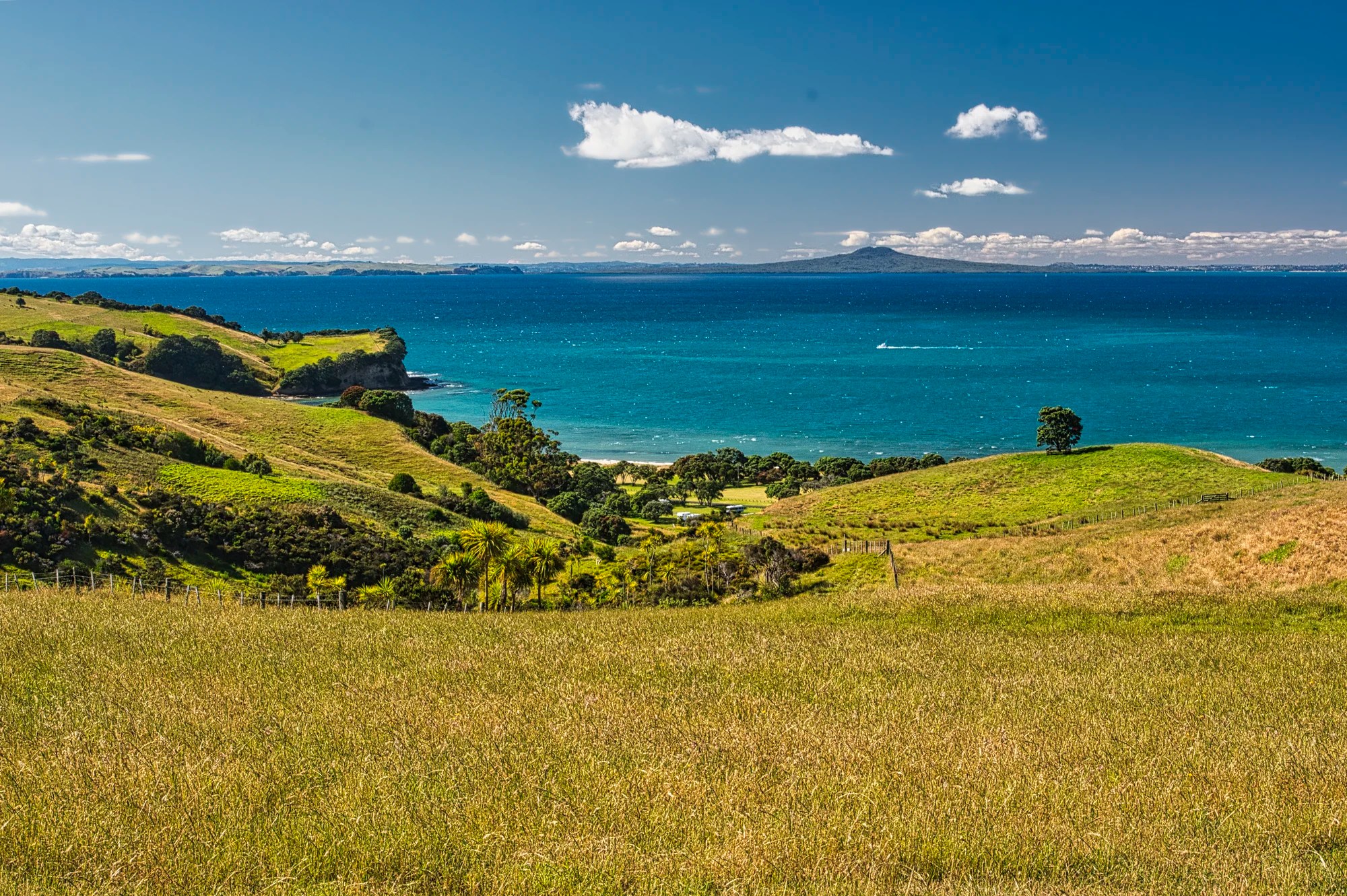
In the distance is Rangitoto Island. Yes, that conical point is a volcano very close to Auckland.
Te Haruhi Bay (G4.9) is a spectacular pohutukawa-lined beach.
California Quail
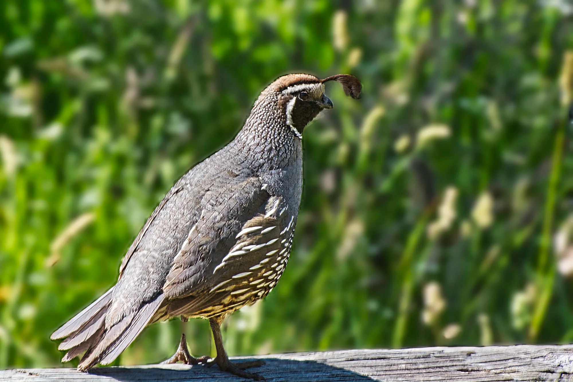
We ate our lunch here and were surprised to see a California Quail with their characteristic teardrop-shaped plumes protruding from their forehead. California quail are native to the western USA. What are they doing here? They were introduced to NZ as game birds in 1862.
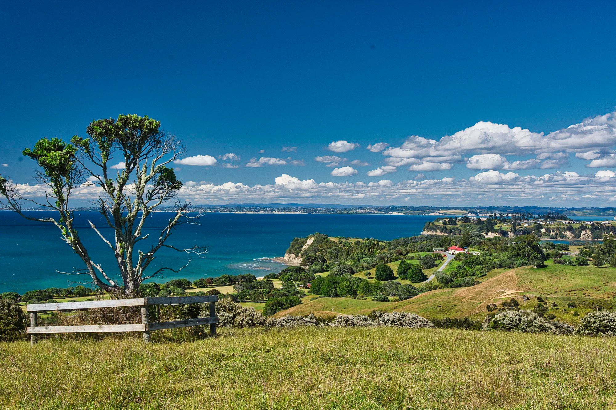
This was the view towards Okoromai Bay (G4.4), which has a beautiful beach. There are a few hikes to do in this park.
Lookout Track: from the lookout car park, take the main farm gate at the east end for the short, easy road walk to spectacular 360-degree views of Auckland, Hibiscus Coast and nearby Islands.
Tiritiri Track: head east of the beach to the cliff for the best view of Tiritiri Matangi Island.
The view from the road as we left Shakespear Regional Park was quite photogenic.
Tiritiri Matangi Island
Whangaparoa — Gulf Harbour 5 km 0:08 hrs
Tiritiri Matangi Island Ferry booking link
Time: 75 minutes from Gulf Harbour NZD 95
Wed-Fri: dep. 9:55 arr. 10:20 return dep. 14:20
Sat-Sun: dep. 9:25 arr. 09:50 return dep. 16:00
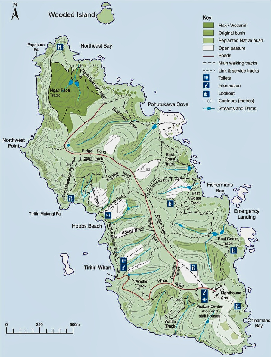
Tiritiri Matangi Island (G4.8) was definitely worth visiting. Our expert birder son stayed there for two nights while we only went for a day trip. Since we had to be back in time to catch the ferry, we had to limit ourselves to a hiking loop in the southern part of the island.
The 2.2 km2 (1 sq mi) island is an open nature reserve managed by the Supporters of Tiritiri Matangi, under the supervision of the Department of Conservation (DOC). It attracts between 30,000 and 32,000 visitors a year, which is the maximum allowed.
Wattle Track
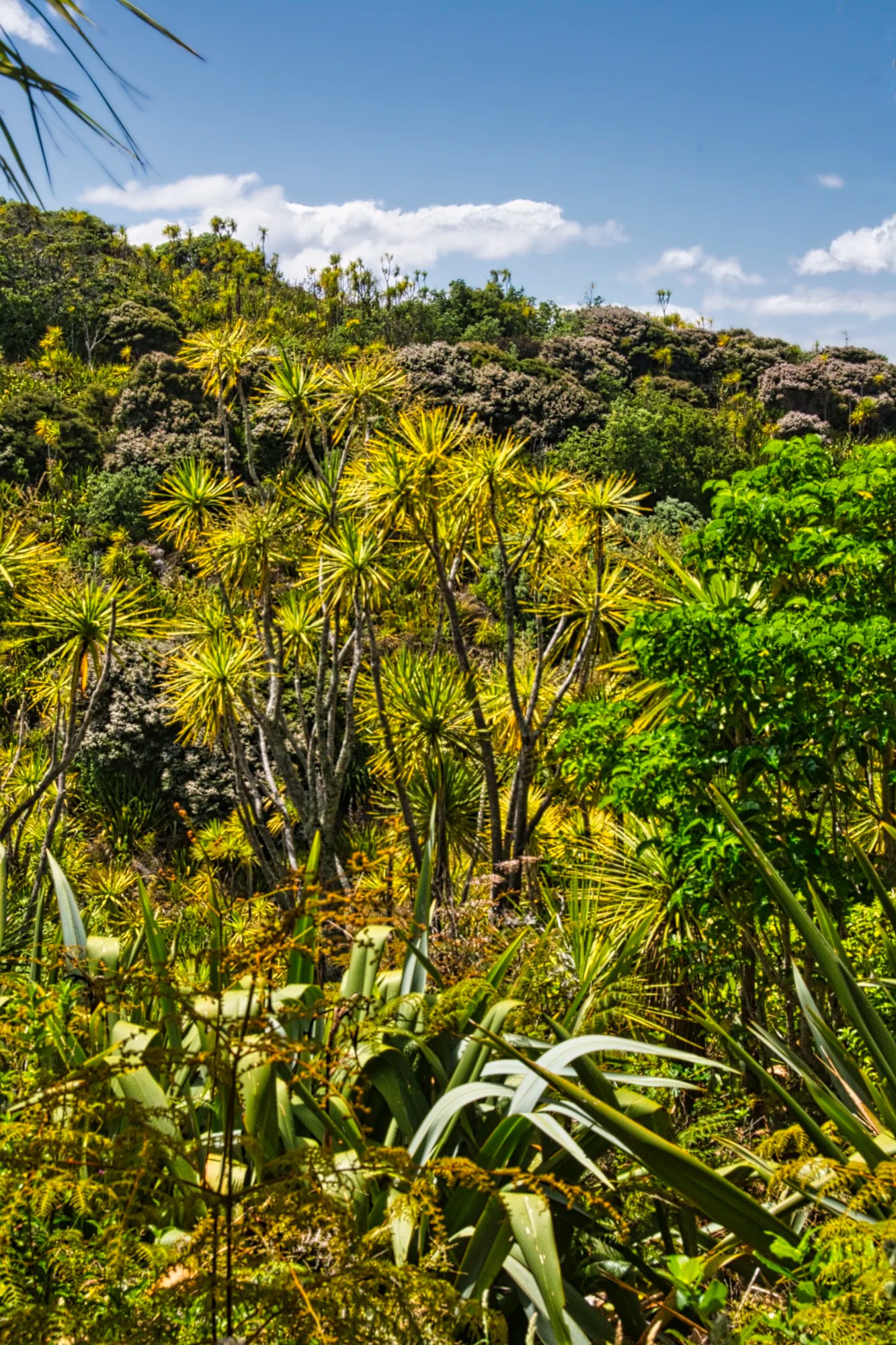
You can take the park truck along the road to the Visitor Centre. This is particularly useful for people who have luggage for sleeping over. Alternatively, we hiked the ca. 600 m from the wharf to the Visitor Centre. We saw typical native vegetation along the Wattle Track, such as these Cabbage Trees.
Tiritiri Matangi Lighthouse
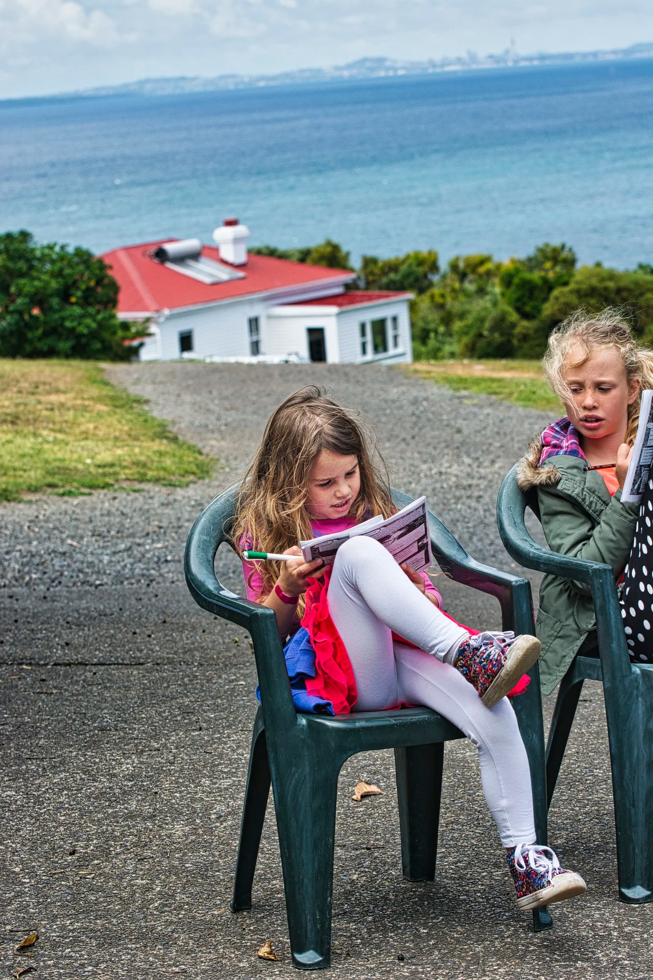
We stopped for a while to eat lunch at the Tiritiri Matangi Lighthouse (G4.8). The nearby Visitor Centre sells cold drinks, chocolate, and complimentary tea and coffee. There is no food available for purchase on the island, which is why Daniele had to bring his own food, water, and utensils. I realized I hadn’t been taking pictures of the Kiwis on our trip. These children were doing the forest ranger “exam”.
Fisherman’s Bay
Next, we took the inland East Coast Track to Fisherman’s Bay.
This was the most scenic coast of the day.
New Zealand Pigeon
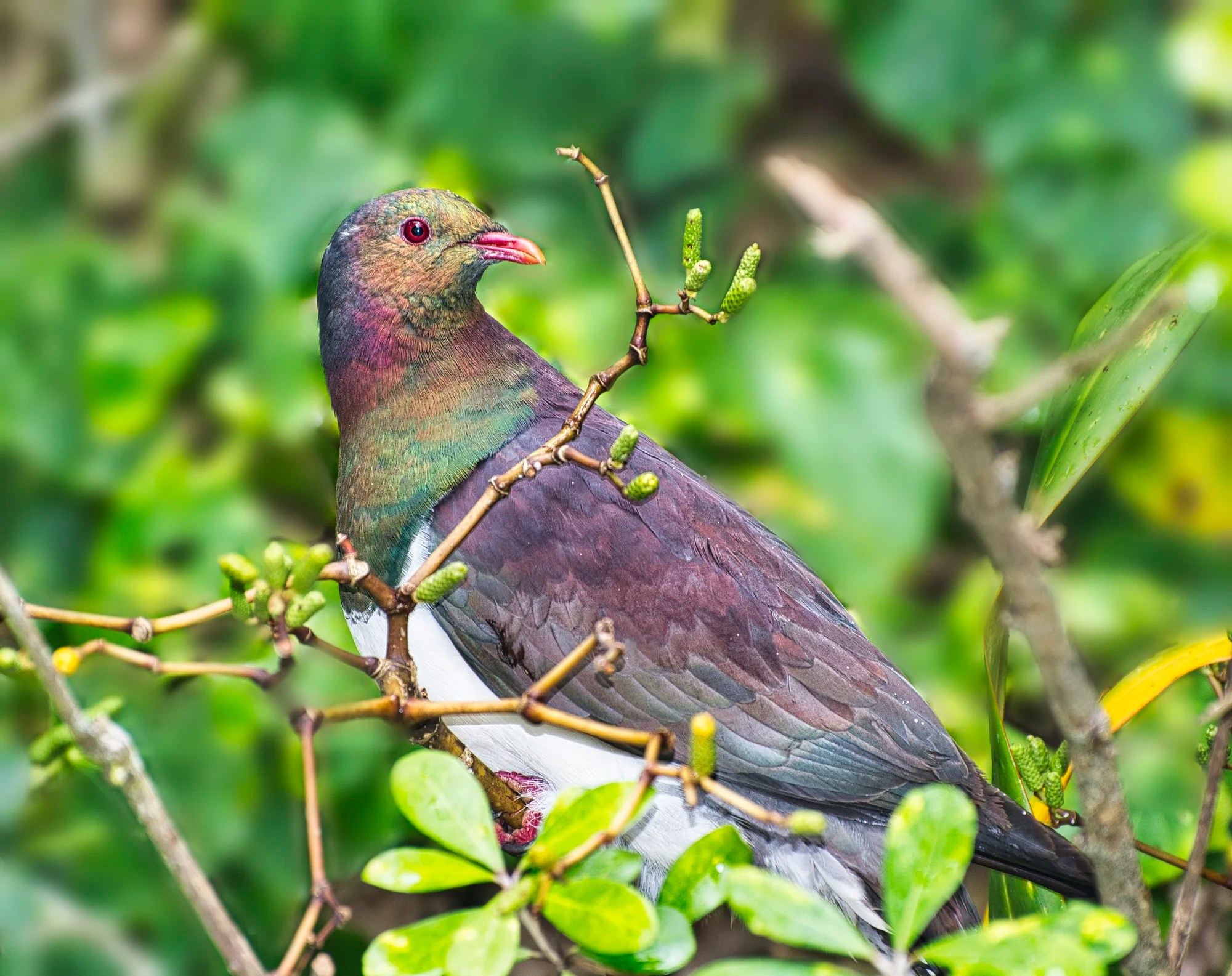
From the bay, we cut due west across the island on Cable Road. Here we had a great time recording several photos of the endemic NZ Pigeon. The NZ pigeon (kererū) is a very large pigeon with distinctive blue-green iridescent plumage, white belly, and red eye. It is hard to miss this bird.
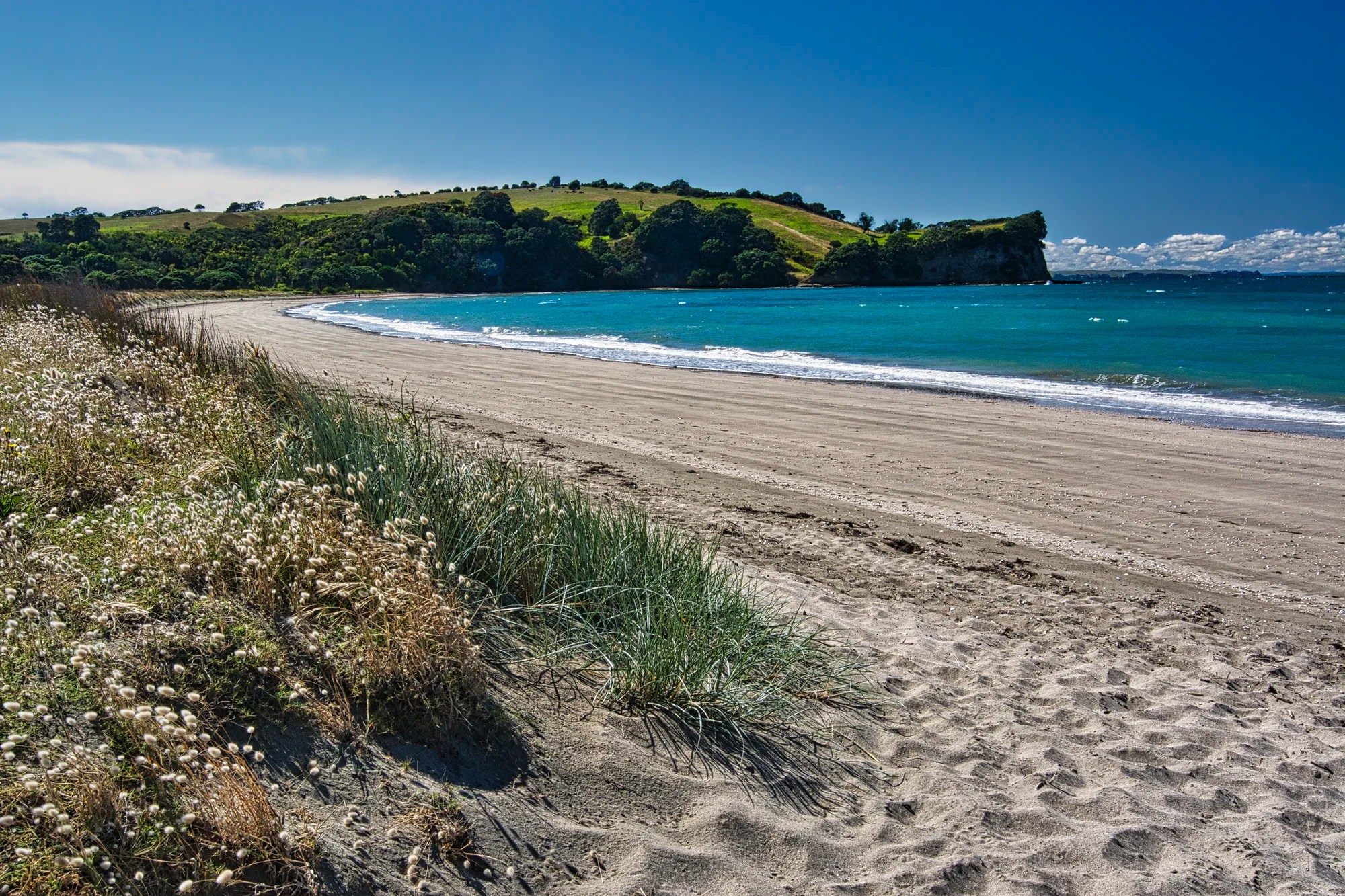
Hobbs Beach
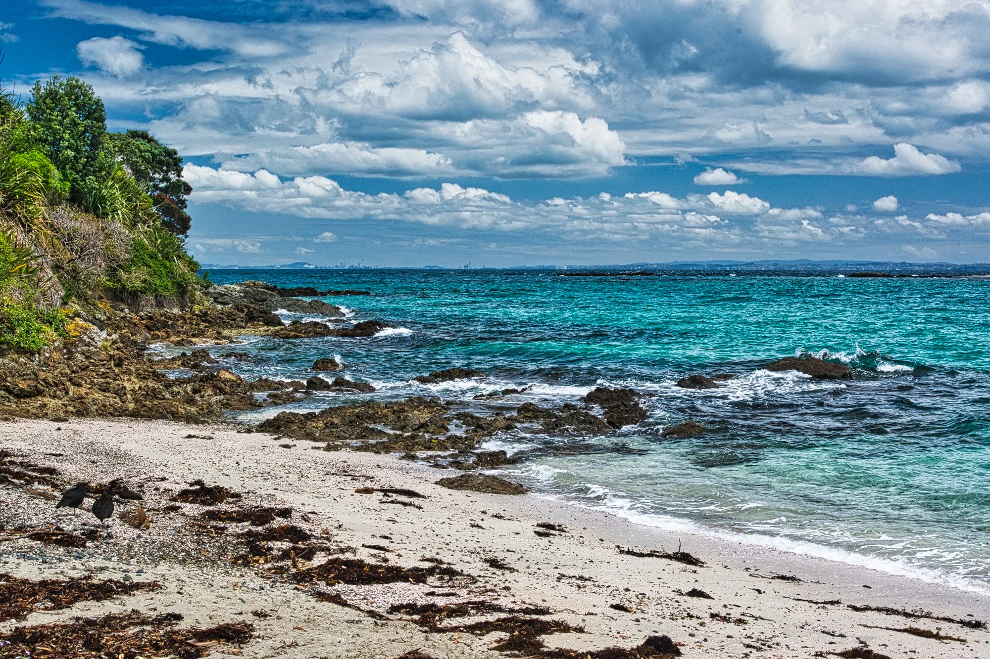
The trail finally reached the west coast with its gorgeous turquoise water and sandy Hobbs Beach (G4.9). This was also a birding hot spot.
New Zealand Dotterel
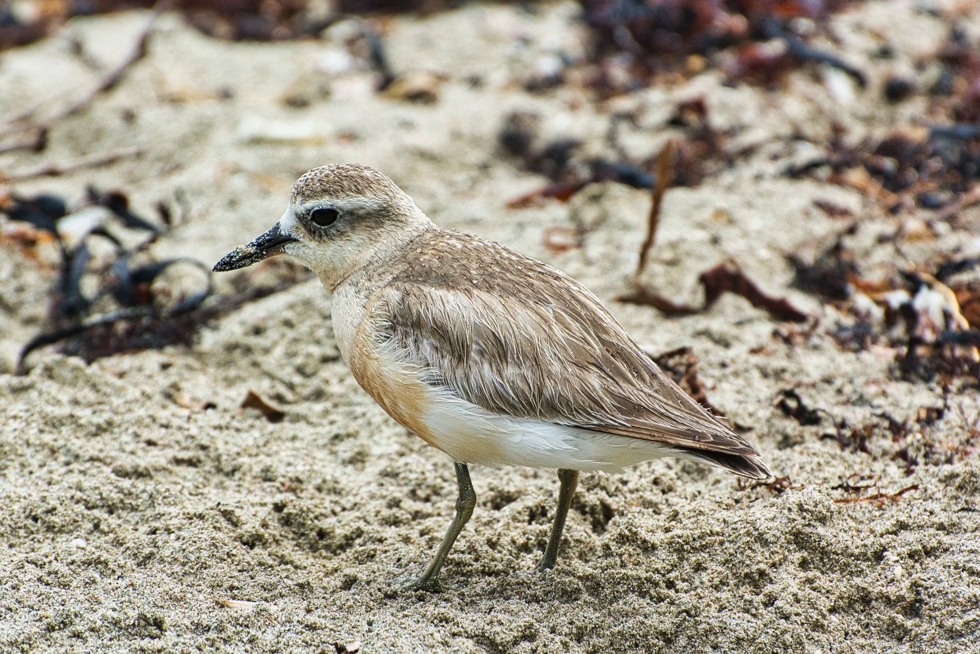
The New Zealand Dotterel (Anarhynchus obscurus) is a cute, small shorebird endemic to New Zealand. They are often seen foraging for small invertebrates, including insects, crustaceans, and mollusks. When breeding, the underparts change from white feathers to shades of orange-red.
They are ground-nesting birds, often making simple scrapes in the sand or gravel to lay their eggs. Their nests are highly vulnerable to disturbance and predation by introduced mammals, like cats, rats, and stoats. That’s why it is an endangered species with only 2,500 individuals remaining.
Variable Oystercatcher
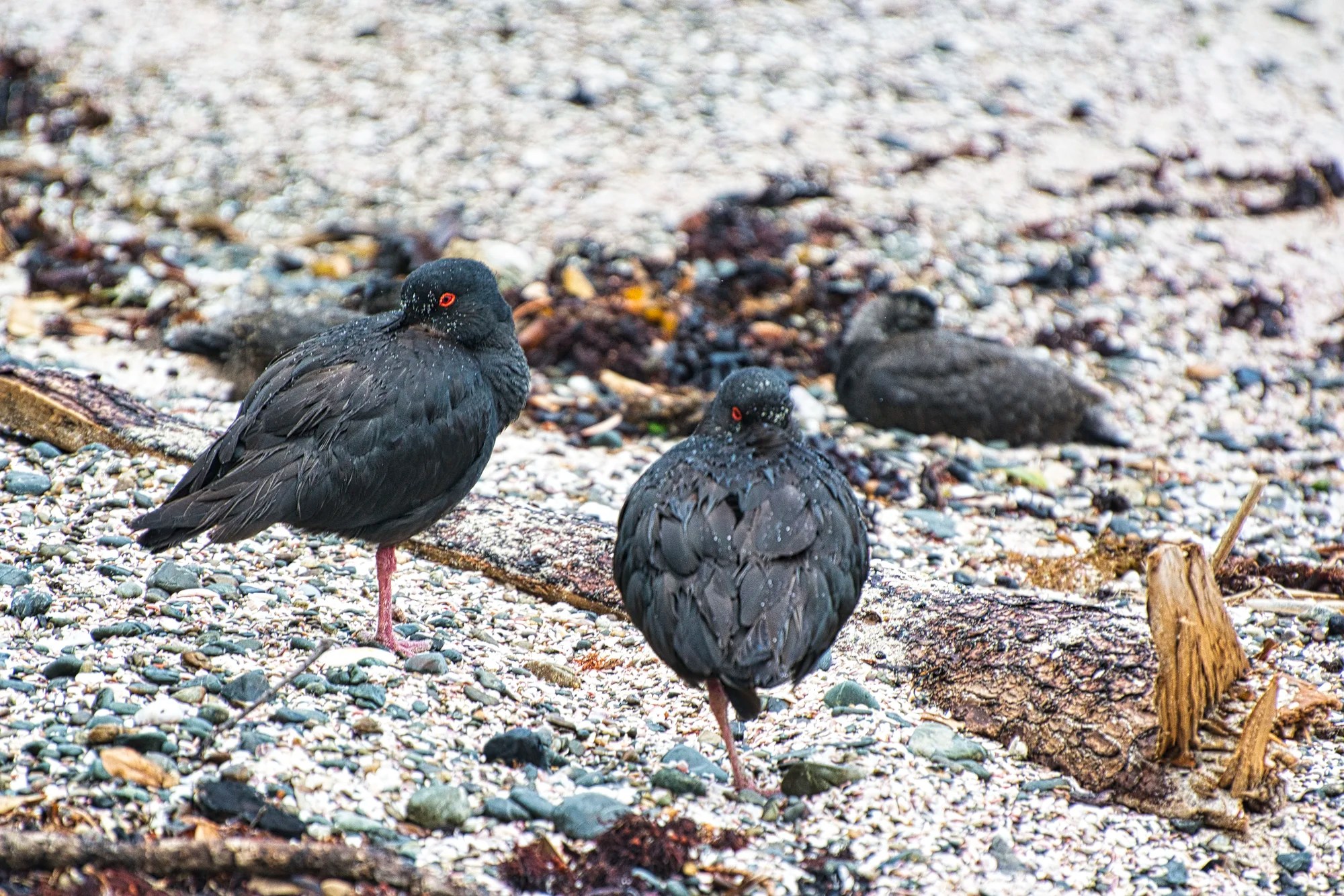
Variable Oystercatcher is a large shorebird endemic to NZ. Adults vary in colour from all black to pied. The word pied means two colours. This coastal bird breeds on sandy beaches, sand spits, and rocky coasts.
Pied Cormorant
We hiked the Hobbs Beach Track to the wharf area, where pohutukawa trees bloom brilliantly red in December. We caught the last ferry back to Gulf Harbour.
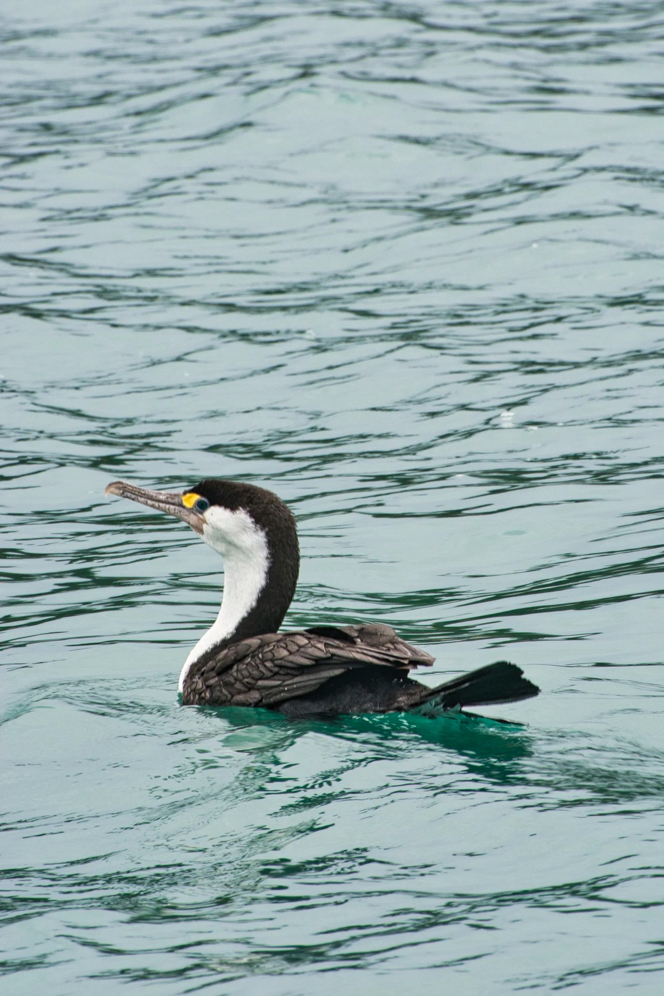
The (Australian) Pied Cormorant (Phalacrocorax various) is found around the coasts of Australasia. It is a large black and white cormorant with a long ivory-coloured bill. Note the black “trousers” that help distinguish it from the Little Pied Cormorant.
Tiritiri Day 2
The second day, Daniele did the other trails on the north and west sides of the island.
Red-crowned Parakeet
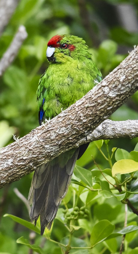
This vibrant emerald-green Red-crowned Parakeet is endemic to NZ. It has a distinctive red crown with small red patches behind the eyes. A metallic blue leading edge is present on the wing.
Stitchbird
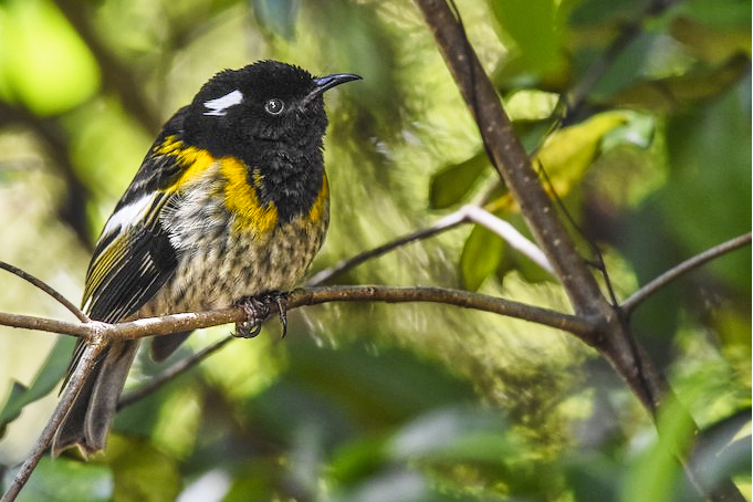
The Stitchbird is a honeyeater-like bird endemic to NZ. It is curious by nature and confidently approaches people at close range. As a result, it is rare and only found on islands. It was extirpated and reintroduced to mainland sanctuaries.
South Island Takahe
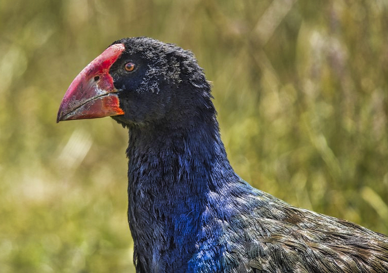
South Island Takahe is endemic to NZ and the largest living rail in the world. Considered extinct, it was famously rediscovered in the Murchison Mountains in 1948. The wild population remains in the Murchison Mountains. Some individuals were relocated to predator-free offshore islands and mainland sanctuaries. Note the distinct iridescent plumage, white undertail, and huge, bright red conical bill that extends onto the forehead. PS: it can’t fly!
Daniele saw 37 species including many endemics such as the melodious New Zealand Bellbird, Red-breasted Dotterel, New Zealand Fantail, New Zealand Fernbird, Little Spotted Kiwi, North Island Kōkako, Variable Oystercatcher, Red-crowned Parakeet, New Zealand Pigeon, North Island Saddleback, Stitchbird, South Island Takahe, the melodious Tui, and Whitehead.
Puhoi
Whangaparoa — Puhoi Pub Hotel 26 km 0:26 hrs
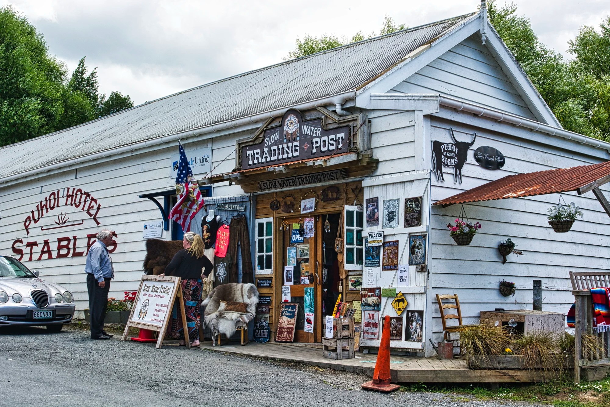
On our next day, we headed north from Whangaparaoa on Highway 1. Our first stop was the Puhoi Pub Hotel & Stables (G4.5), which dates back to 1879.
Puhoi Valley Cheese makes one of the best ice creams. It has a Dutch influence. There is an excellent café called the Art of Cheese. There are cheese platters and a large selection of specialty cheeses for sale. You can also see the cheesemakers at work.
Kawau Bay Region
Whangaparoa — Honey Centre Warkworth 36 km 0:33 hrs
Puhoi Pub Hotel — Honey Centre Warkworth 12 km 0:10 h
Honey Centre Warkworth
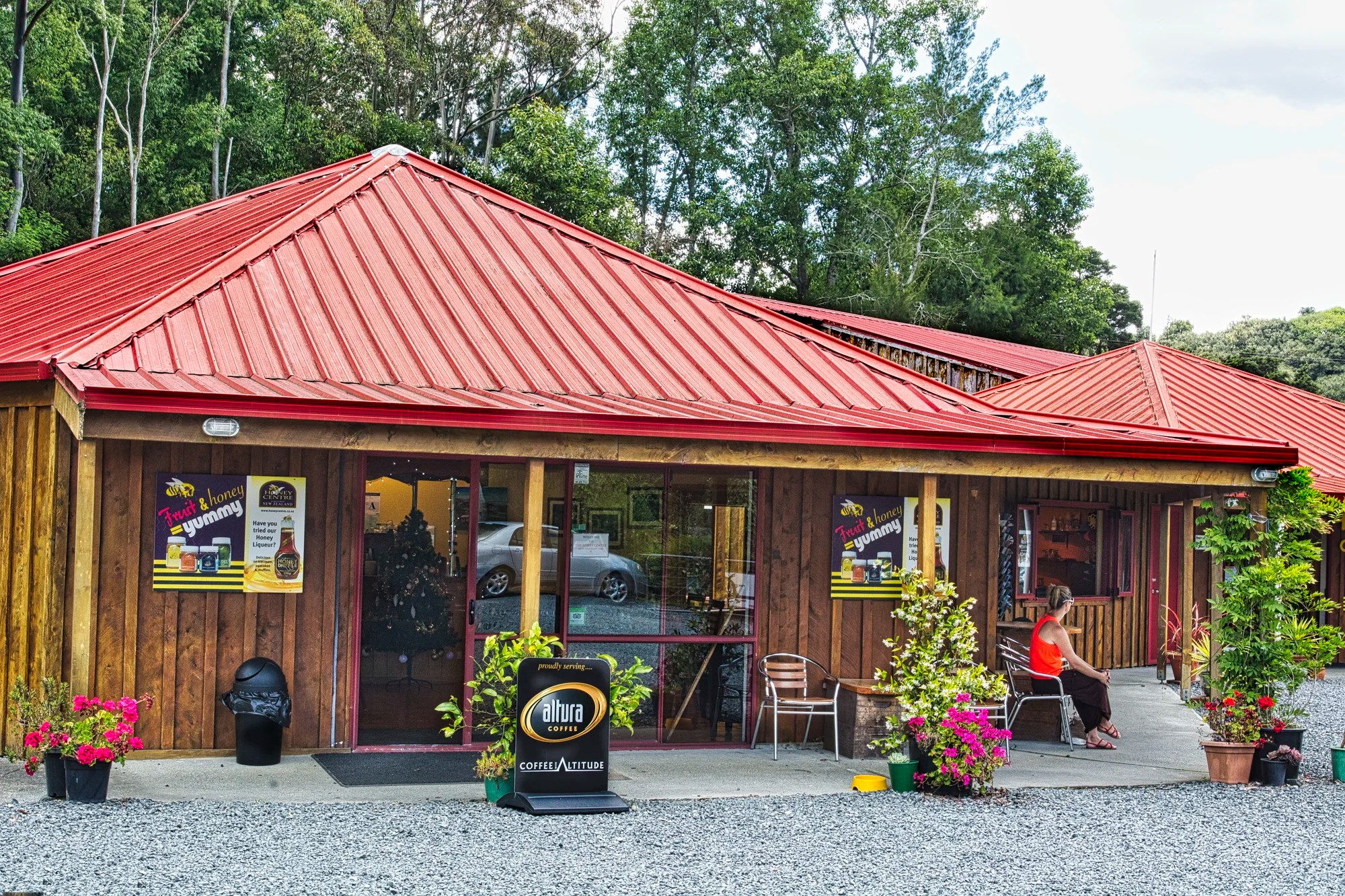
If you have not tried NZ honey, take a detour to the Honey Centre Warkworth (G4.4). Honey in NZ tastes different because of the flowers that the bees pollinate. Bees tend to stick to the same source, which produces different honey flavours. Manuka and rewarewa have strong flavours. Kamahi has a medium-strong flavour. Blackberry was too sweet. Pohutakawa had an awful, nauseating taste. The most unique was Tawari with a mild yet distinctive flavour. The beekeeper said it is probably the finest honey in the world.
To gather a pound of honey, bees fly the equivalent of three times around the world. One bee makes a teaspoon of honey in her lifetime of six to eight weeks. We learned all these facts when we visited (on a previous trip) the Taupo Honey Centre near Huka Falls.
We stayed at The Salty Dog Inn (NZD 140 including breakfast and a fridge) in Snells Beach. You could easily stay in Matakana or camp at the two regional parks. Our son came here mainly to take the Sandspit Birding Tour. While he did that, we visited the nearby attractions.
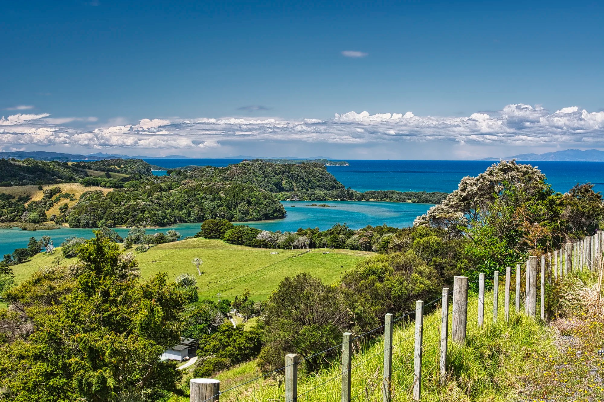
Scandrett Regional Park
Whangaparoa — Scandrett Park 57 km 0:54 hrs
Warkworth — Scandrett Park 19 km 0:24 hrs
Snells Beach — Scandrett Park 7 km 0:09 hrs
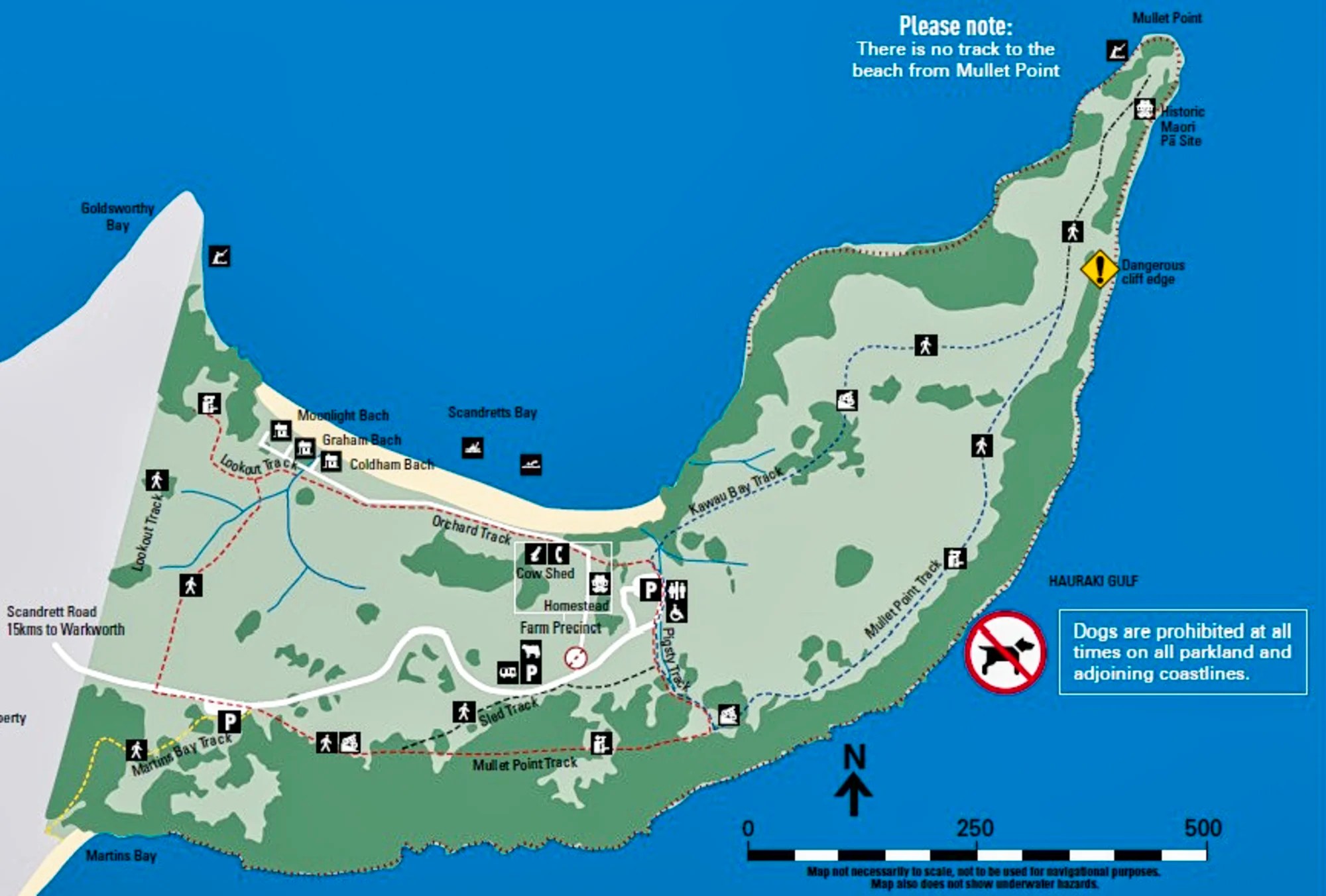
Scandrett Regional Park (G4.7) is located on the northeast tip of the Mahurangi Peninsula. George Scandrett bought the land in 1864 for £550. It became a sheep and dairy farm.
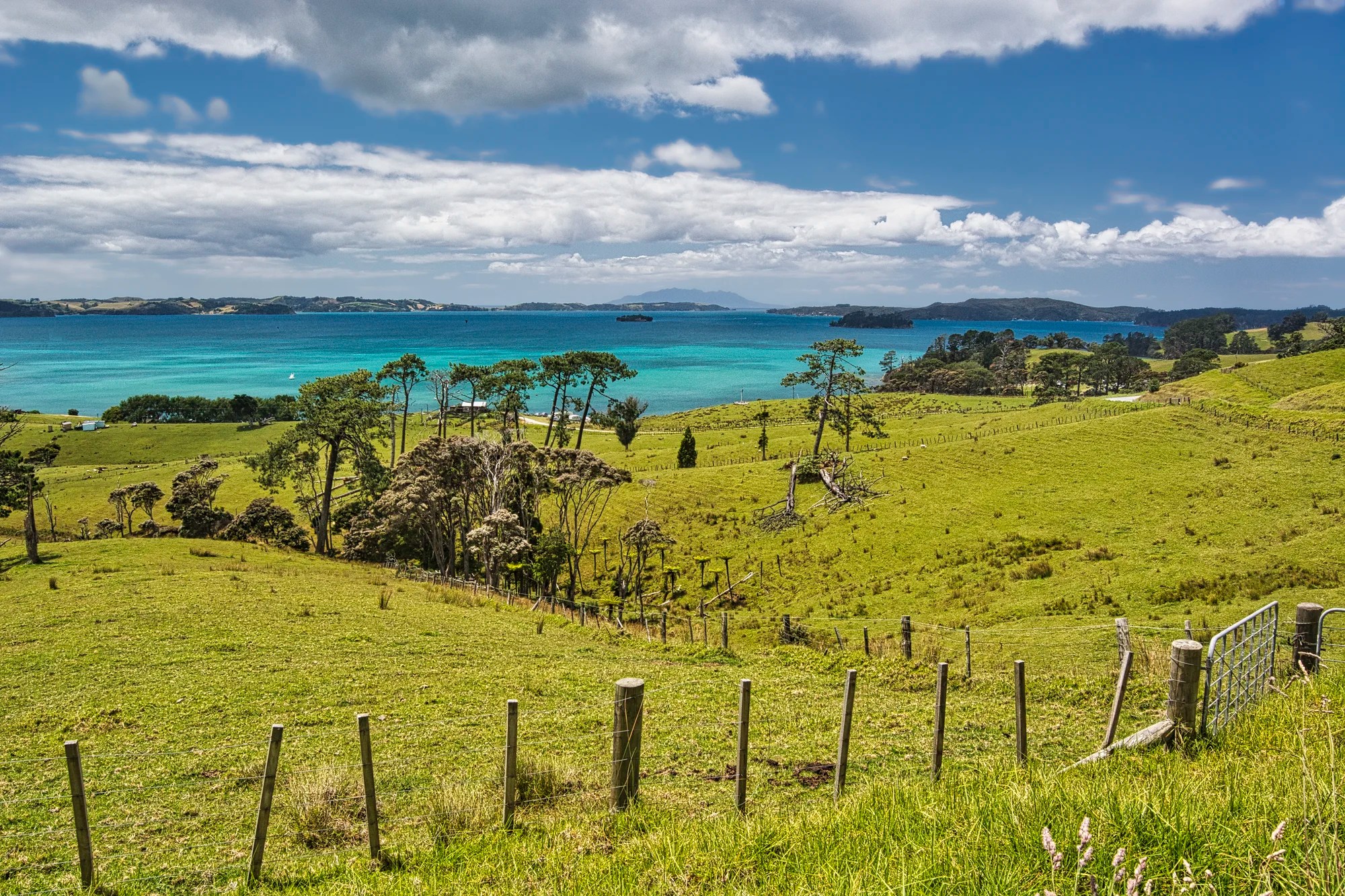
The open meadows along the entry road allowed spectacular views of the multi-toned ocean. Scandrett named the 52-acre farm Lisadian after his hometown in Ireland. The Scandrett Homestead (G4.9) cost £418, the equivalent of NZD 654,212 today.
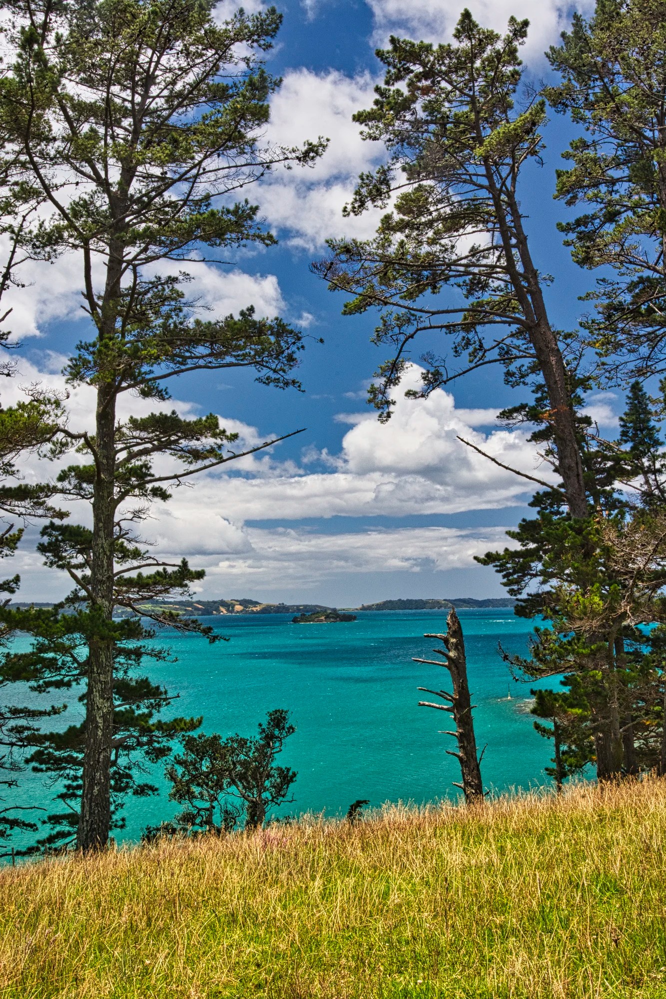
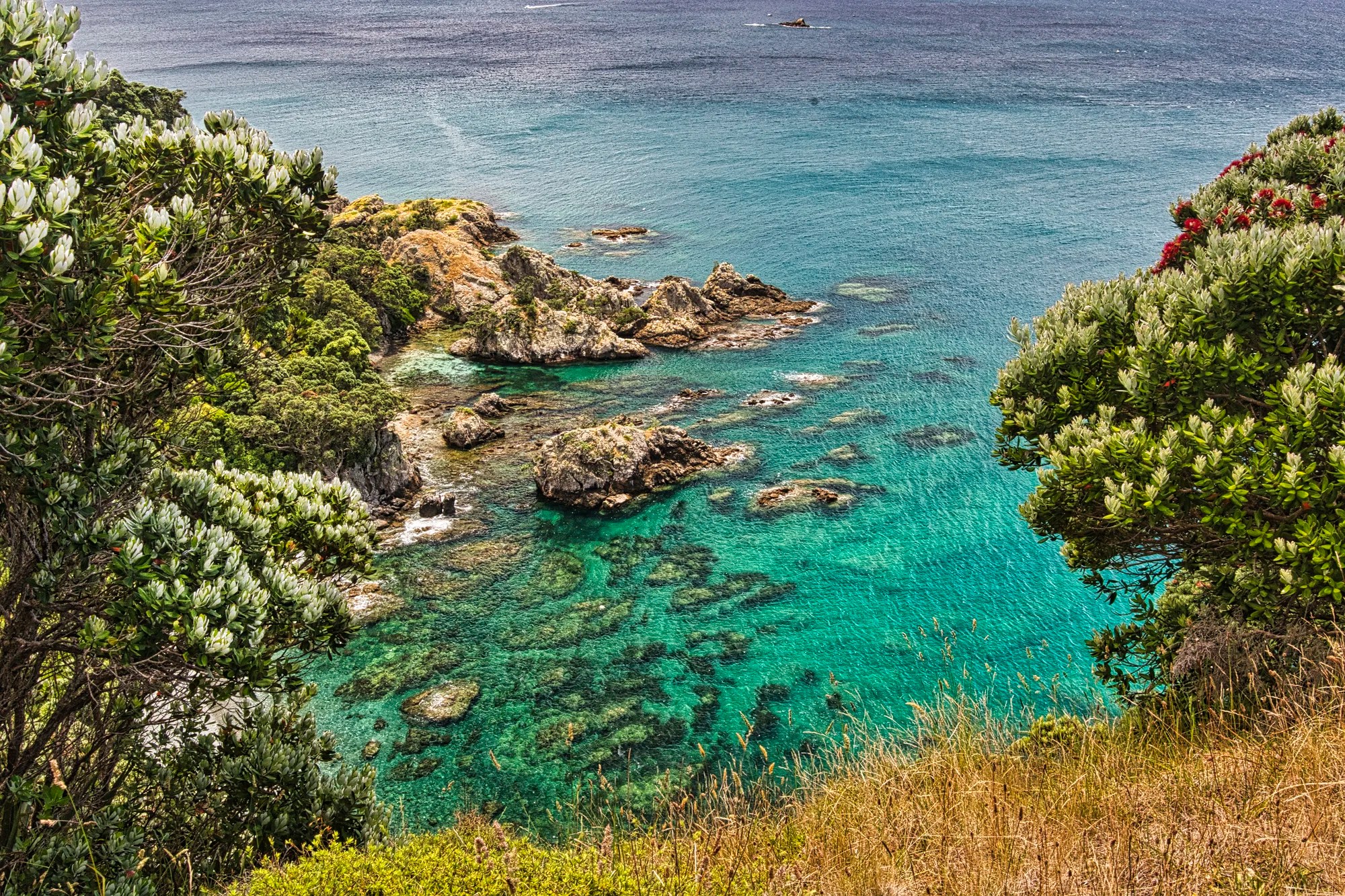
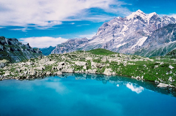
After walking ca. 17 minutes inland on the Kawau Bay Track, there was a breathtaking view through the trees of the turquoise sea.
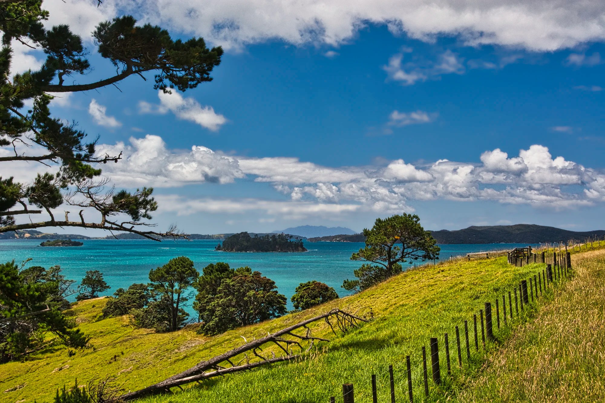
Three minutes later the views opened up. The Kawau Bay Track leads to Mullet Point. I believe we returned via the Mullet Point Track to the homestead.
Now it looks like Christmas with the green sea contrasting with the brilliant red pohutukawa, aka the Christmas tree. On the way home, we stopped off at Angies Bay.
Scandrett References
Scandrett Regional Park Brochure PDF, Auckland Council
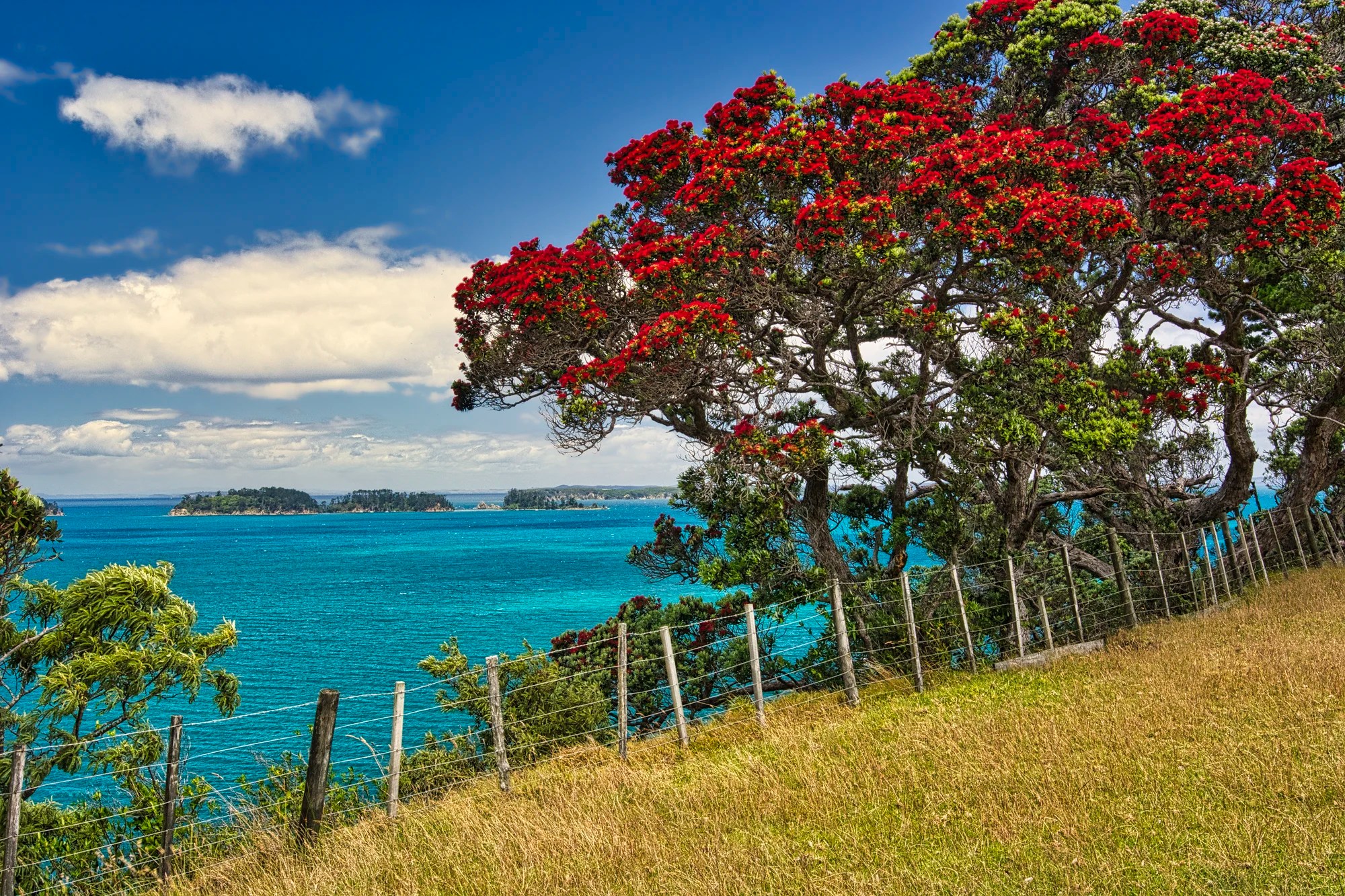
Tāwharanui Regional Park
Auckland AKL — Tāwharanui Park 113 km 1:34 hrs
Snells Beach — Tāwharanui Park 24 km 0:32 hrs
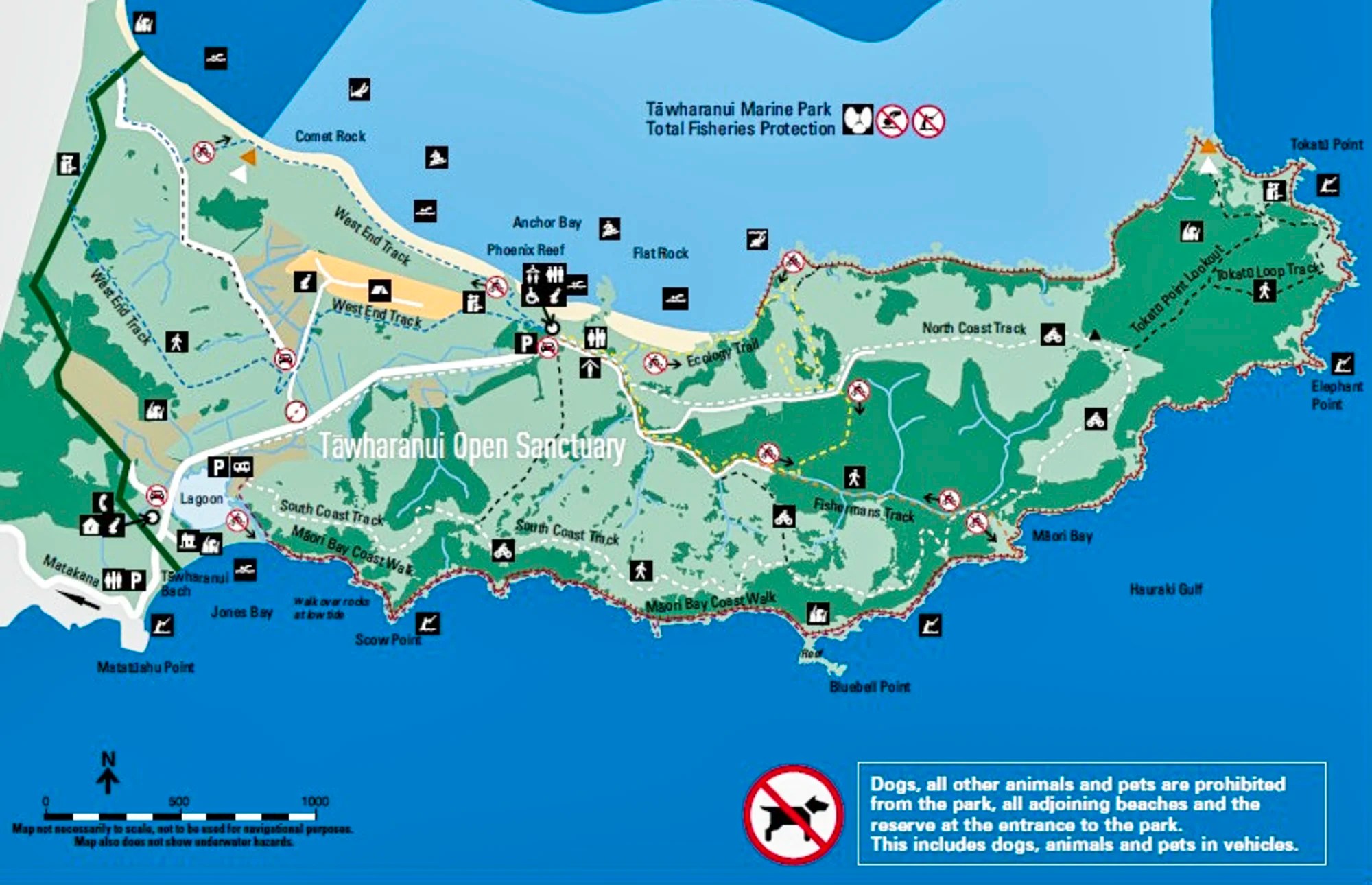
Tāwharanui Regional Park (G4.8) is one of those special gems worth visiting.
NB: The last 6 km of the route is a winding gravel road. The Kiwis fought against paving it! Once a large private farm, the park covers 588 hectares (1453 acres) of land and is owned by the Auckland Council.
A 2.5 km predator-proof fence was constructed in 2004, and poison (usually the product 1080) was applied to kill the existing introduced predators. The park is a haven for 31 species of endemic birds. Wetland birds include the Australasian bittern, spotless crake and fernbird. Coastal birds include the New Zealand dotterel, blue reef heron and Variable Oystercatcher.
The main attraction is Anchor Bay, one of the region’s finest white-sand beaches. There are grassed areas above the beach adorned with colourful pohutukawa trees – a picnic paradise. Two campsites are near the beach (adult NZD 16; child NZD 6.50).
Tāwharanui References
Map and boundaries of Tāwharanui Marine Reserve, DOC, NZ Govt.
Tāwharanui Regional Park, 100% Pure New Zealand website
Matakana
Auckland AKL — Matakana 94 km 1:10 hrs
Snells Beach — Matakana 9 km 0:10 hrs
It happened to be Saturday, so we visited the Matakana Village Farmers Market (G4.5). Here you can sample fresh produce, delicious artisan baking, Italian sausages, chocolate, and olive oil. We bought our lunch here. The freshly brewed coffee was delicious.

But you have to park your dog at the Dog Minders. Donations accepted.
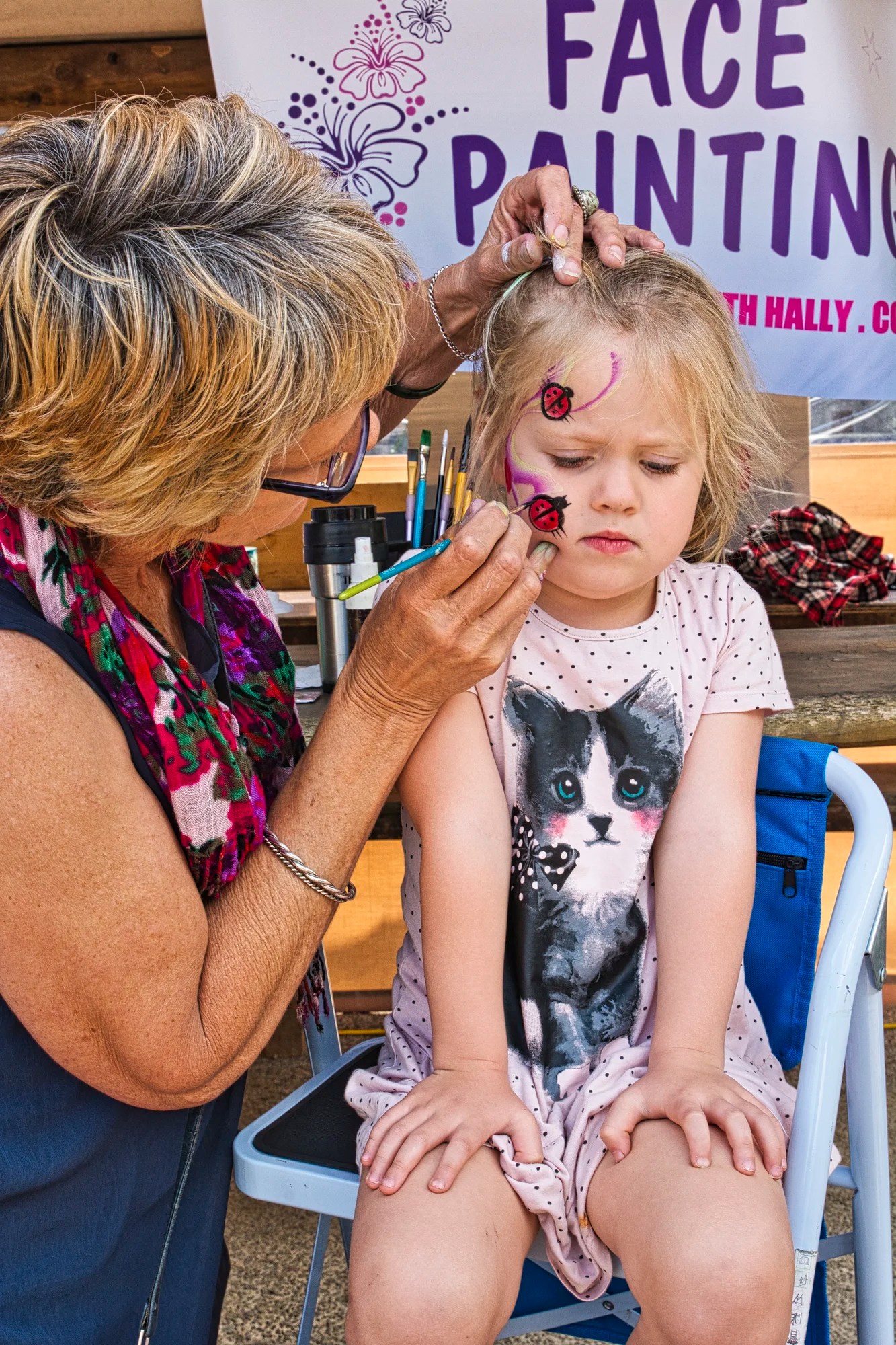
If you are a princess, it’s time for face painting! The market was a chance to meet the locals.
Lothlorien Wines
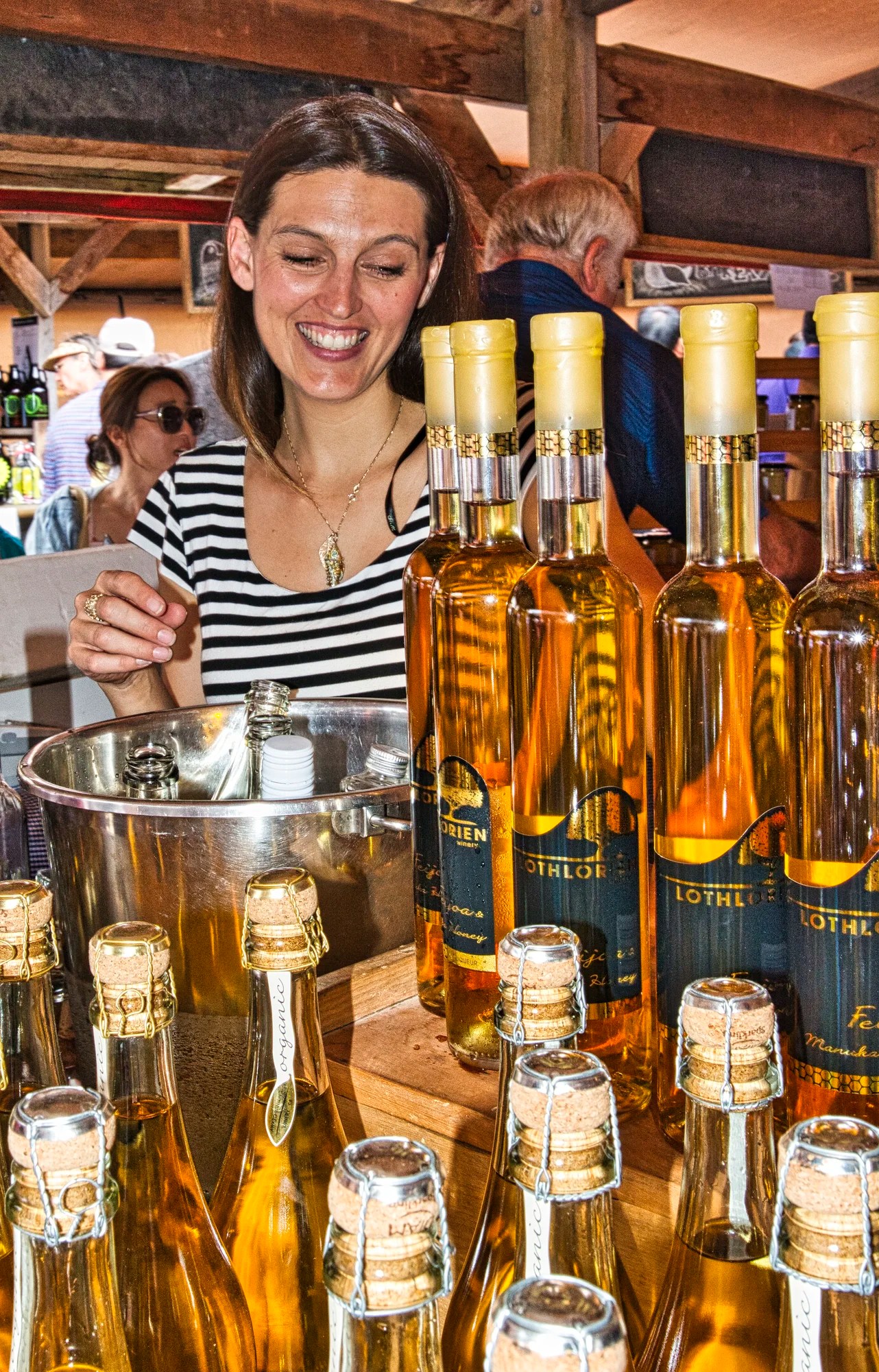
We spoke with a vendor for Lothlorien Winery (G5.0), which is located not far from Matakana. Lothlorien is the golden paradise of the elves in Tolkien’s The Lord of the Rings. It is an appropriate name for this delicious golden wine. It is made from the Feijoa, an oval green, sub-tropical plant that is native to South America but is common in New Zealand. It is sweet with an aromatic bouquet reminiscent of passion fruit, cherry guava, and pineapple. The wine was superb, as shown by its Google rating.
Ascension Wines
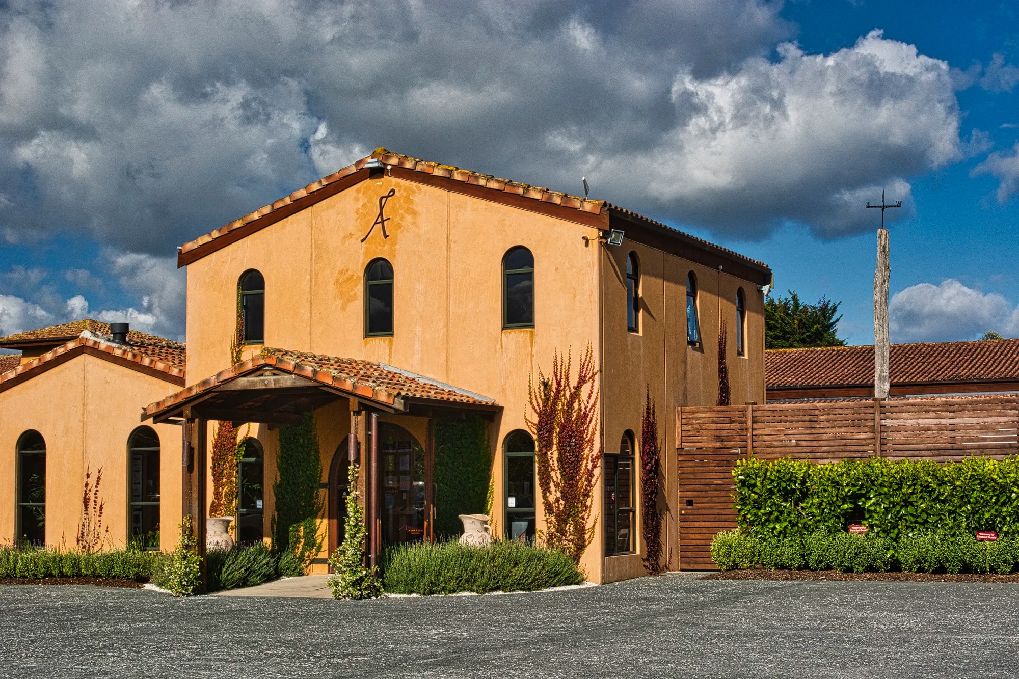
Ascension Wine Estate (G5.0) is known for its handcrafted boutique wines. They specialize in unusual grape varieties like Pinotage, Cabernet Franc, and Viognier. They even grow Sangiovese, the primary grape of Chianti in Tuscany.
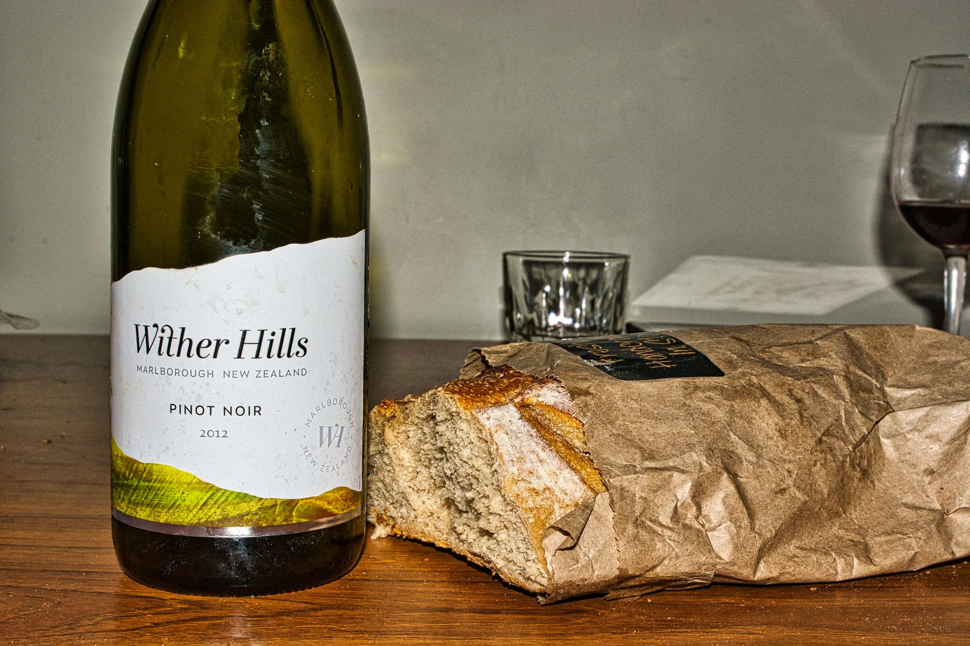
You may not have time to visit the wine-growing areas of NZ. But that should not stop you from buying wines at a store. We tried a very nice Wither Hills (G4.5) pinot noir (rated 91 by sommelier Natalie MacLean).
Waipu River Mouth Wildlife Refuge
Auckland AKL — Waipu River 154 km 1:58 hrs
Snells Beach — Waipu River 74 km 1:05 hrs
The Waipu River Mouth Wildlife Refuge (G4.5) was a mildly productive birding area where Daniele saw 21 species.
We walked ca. 5 km along the beach to a cordoned-off nesting area for the rare Fairy Terns.
Australian Fairy Tern
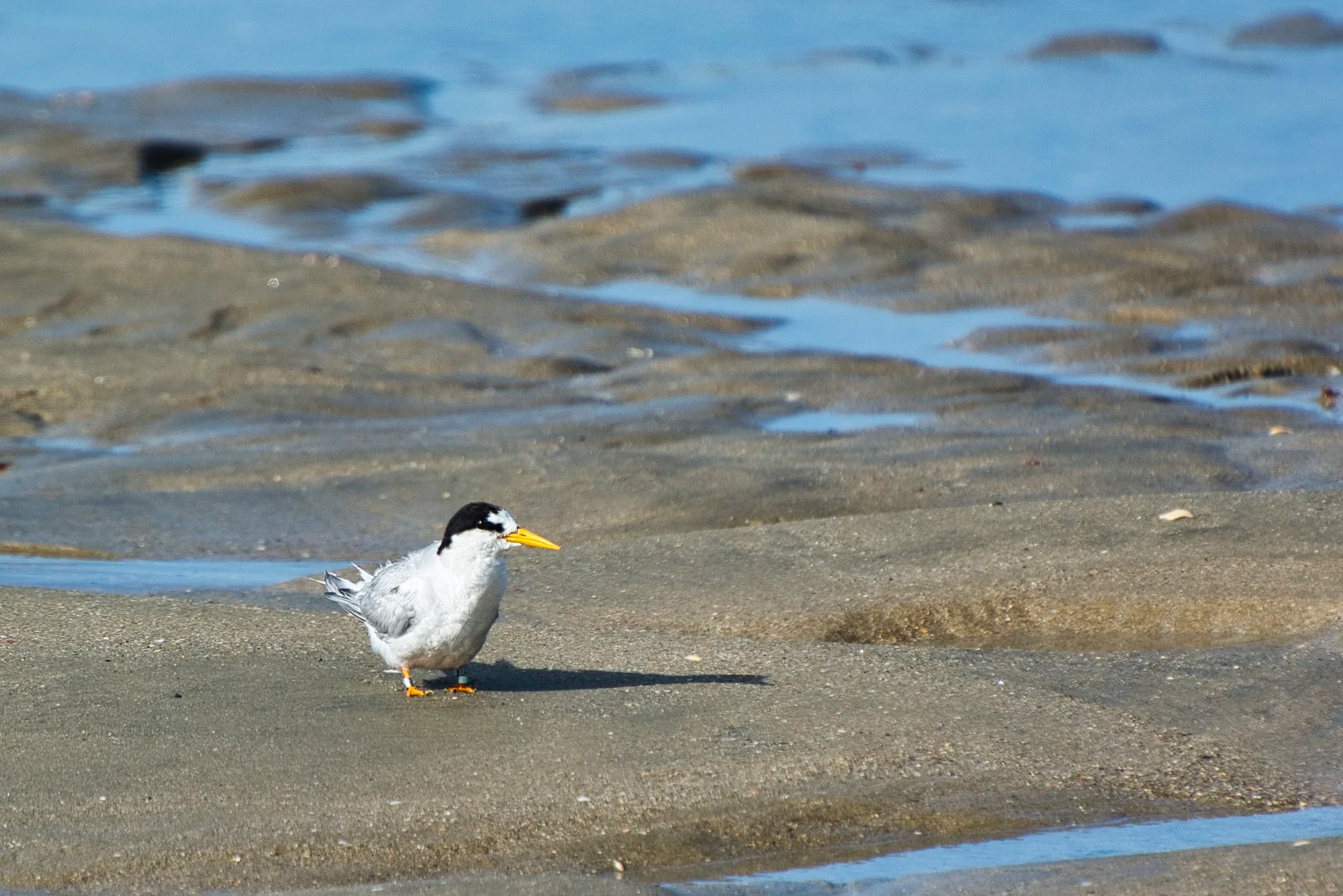
Australian Fairy Tern is found only in Australia and New Zealand. In contrast to the Little Tern, the Fairy Tern has a gap between the black in front of the eyes and the bill. This is one of the best places to see the endangered NZ subspecies of the Australian Fairy Tern.
We headed back 5 km along the beach. It is so hard hiking on the sand.
Variable Oystercatcher
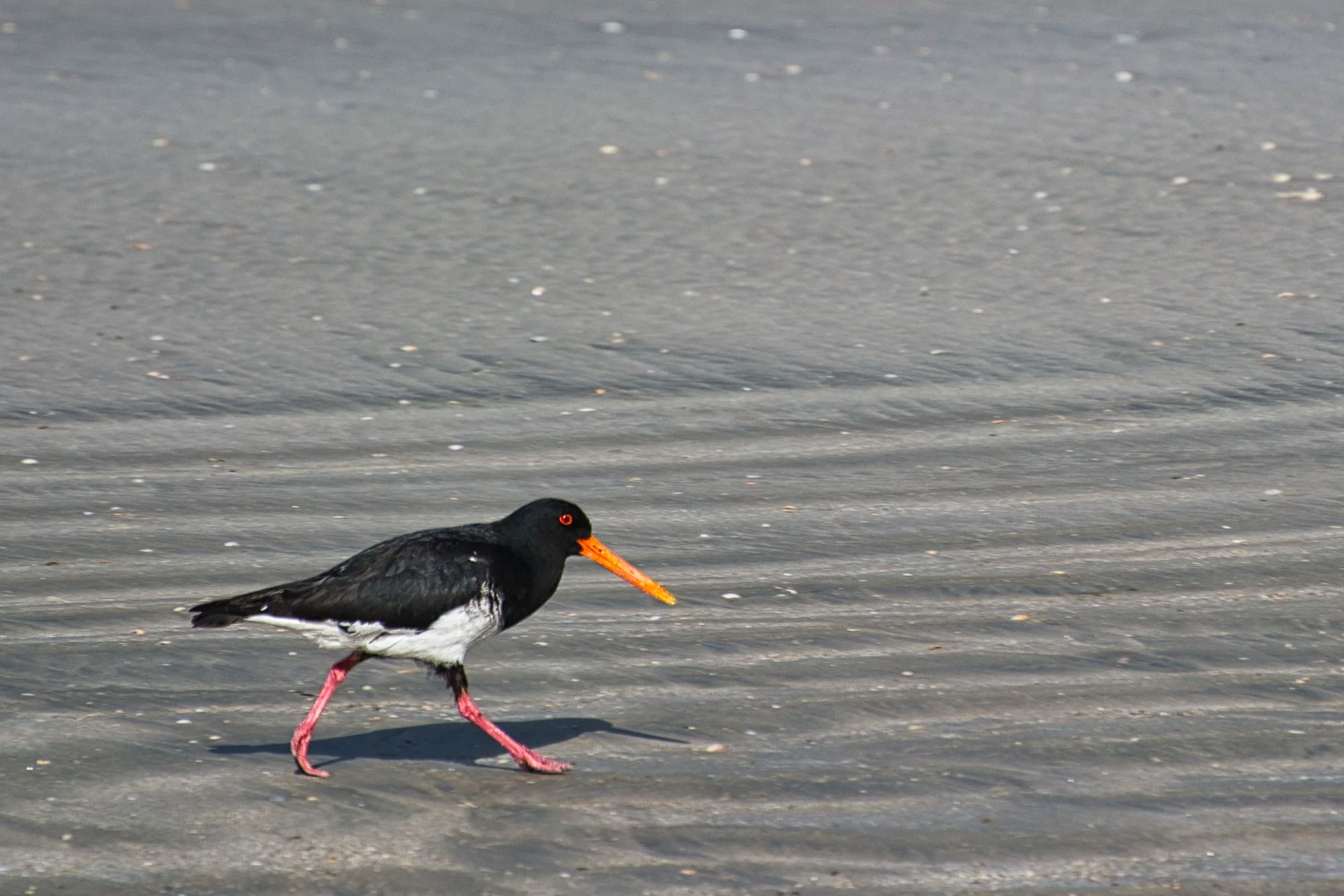
The Variable Oystercatcher is a large shorebird endemic to NZ. Adults vary in colour from all black to pied. This coastal bird breeds on sandy beaches, sand spits, and rocky coasts.
Some of the other species seen by Daniele were the Pied Stilt, Bar-tailed Godwit, Red-breasted Dotterel, Pacific Golden-Plover, and White-faced Heron.
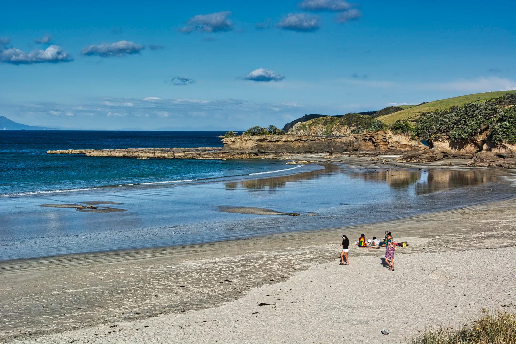
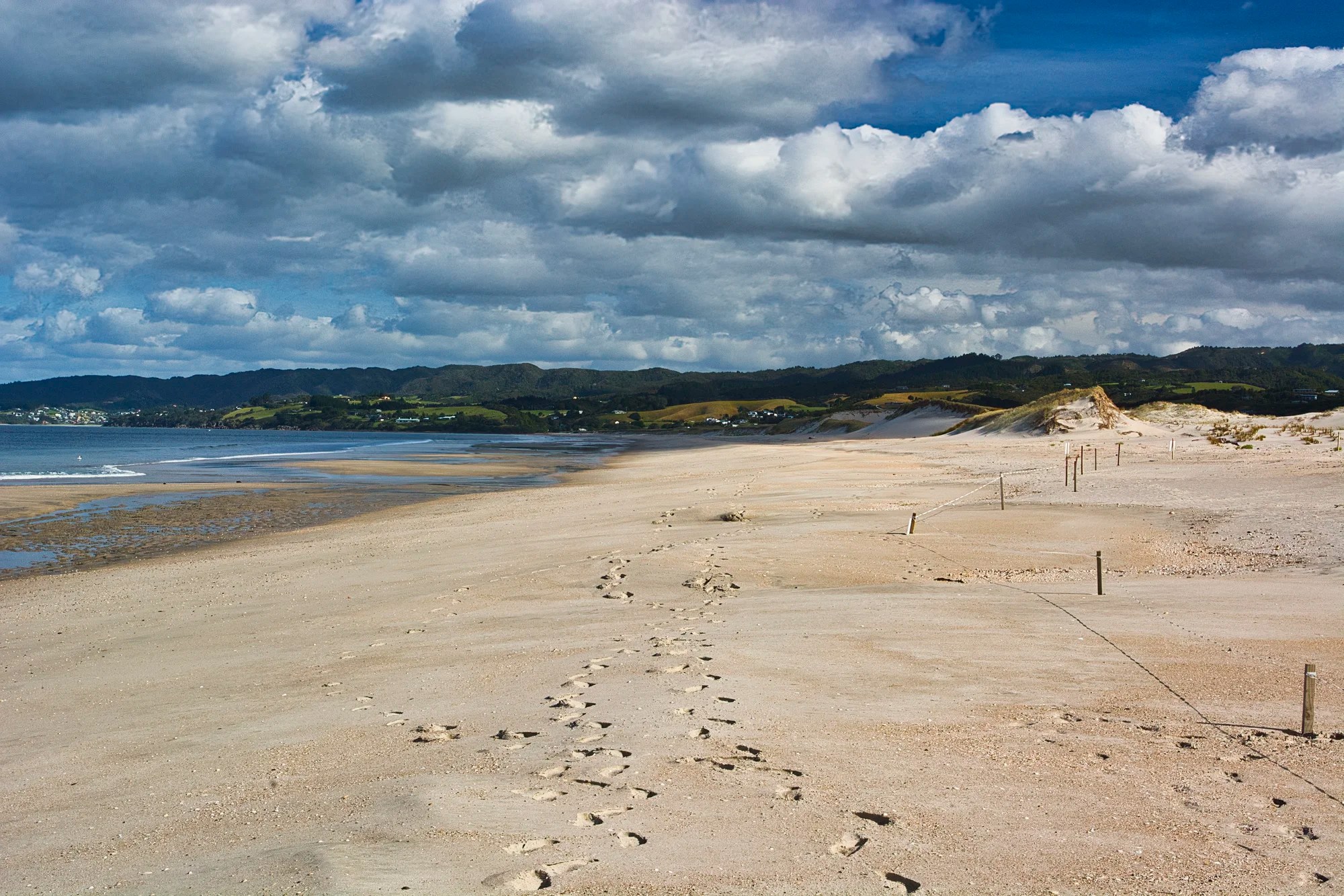
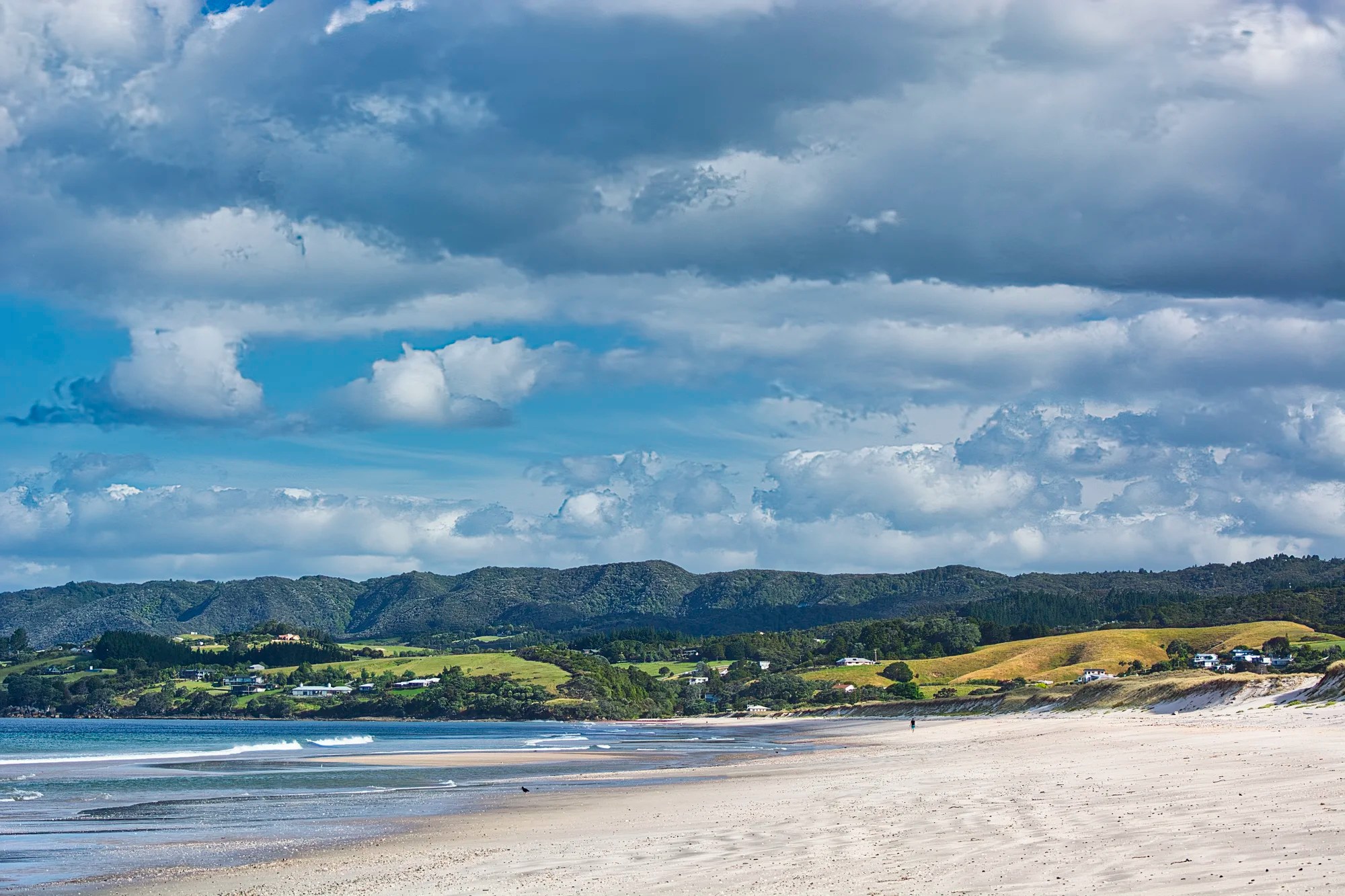
Waipu Beach
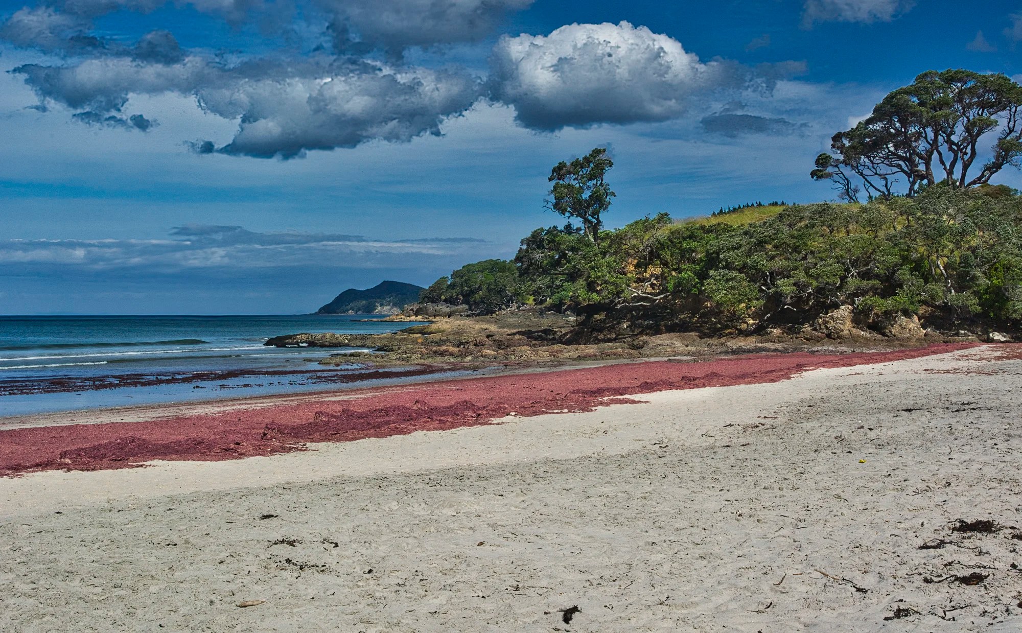
We came for the birds but stayed for the beach. Waipu Beach (G4.7) provided stunning coastal scenery. These “red rocks” are pink seaweed. Also known as sea lettuce, it was washed up on the shore, creating a visually striking contrast against the tan beach and green forest. The pink seaweed is a natural occurrence, resulting from water temperature, nutrient levels, and ocean currents.
Matapouri Region
Whangarei Falls
Auckland AKL — Whangarei 194 km 2:37 hrs
Waipu River — Whangarei 53 km 0:48 hrs
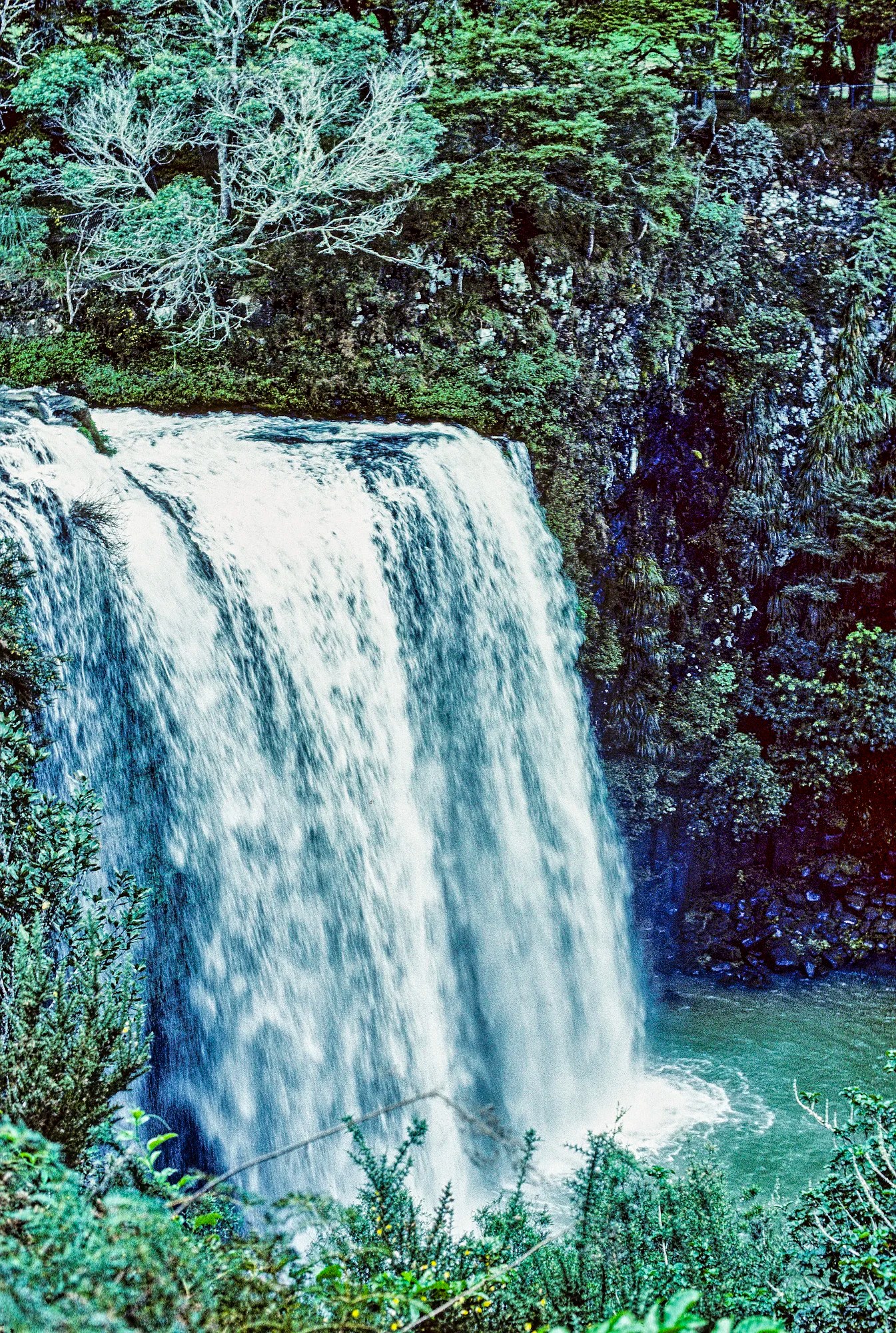
We visited the Matapouri Region on our first trip to NZ. Whangārei Falls (G4.7) cascade 26 m (85 ft) over basalt cliffs. You can view these stunning falls and walk on a loop track (ca. one hour).
Tutukaka
Auckland AKL — Tutukaka 217 km 3:00 hrs
Waipu River WR — Tutukaka 76 km 1:09 hrs
Tutukaka is another town worth exploring. Whangaumu Bay is a hidden gem that provides a peaceful escape. From here, you can also visit many beautiful beaches and coastlines at Kauakarangi Bay (G4.6), Kowharewa Bay (G4.7), Tutukaka Lighthouse Walkway (G4.7), and Kukutauwhao Island Lookout (G4.7).
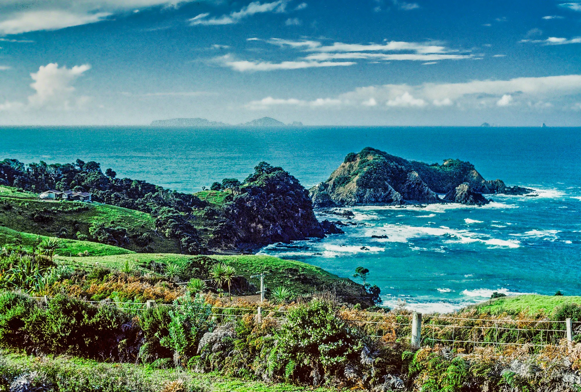
We were told to drive to a viewpoint 300 m up Block Road, but found a view further on Tutukaka Block Road that was even more scenic.
We walked up Scott Road to a view of Parua Bay. There were spectacular views of Whangarei Heads from the McGiven house on a hill.
Matapouri
Auckland AKL — Matapouri 218 km 3:00 hrs
Whangarei Falls — Matapouri 30 km 0:31 hrs
Tutukaka — Matapouri 7 km 0:09 hrs
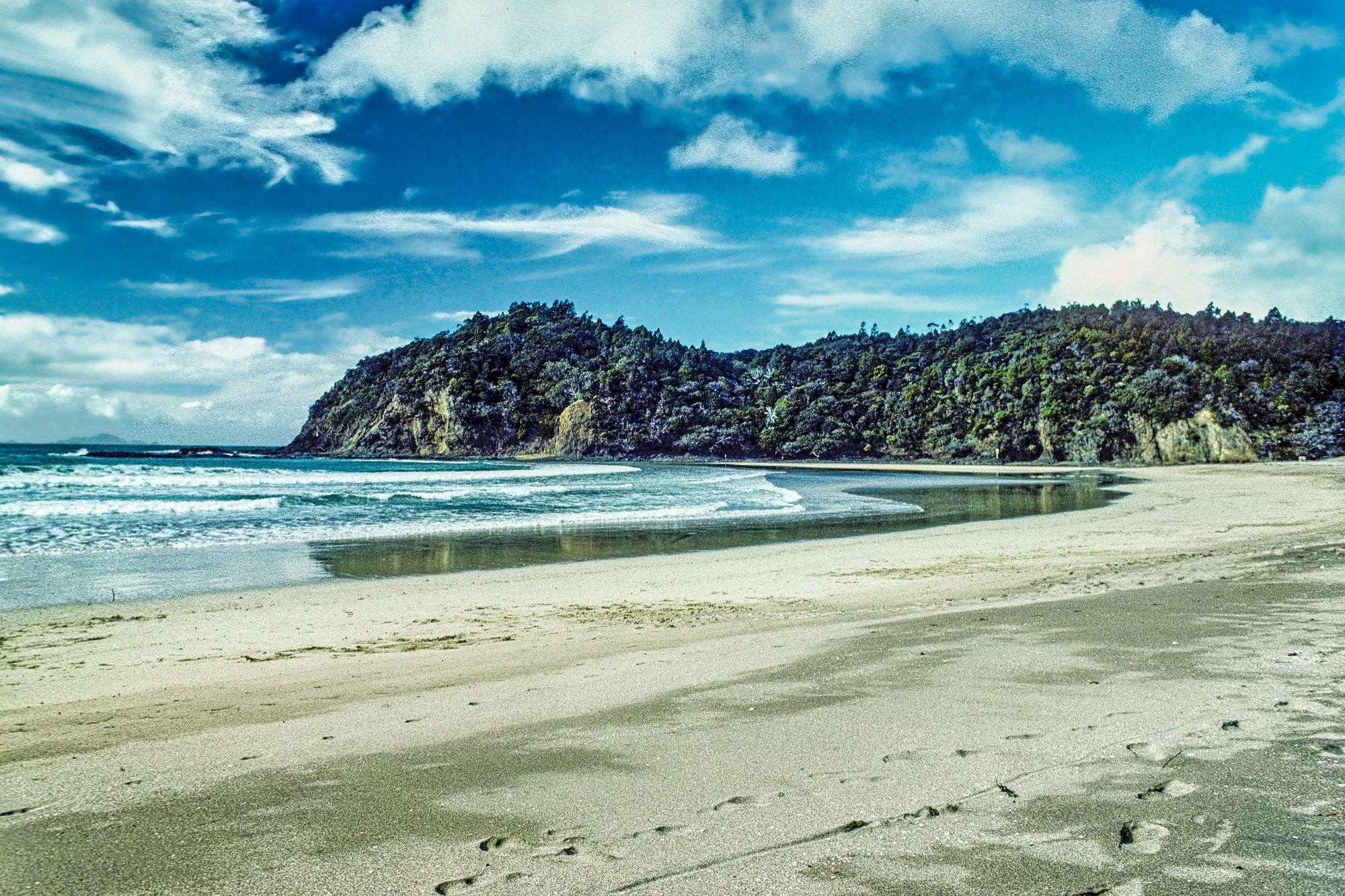
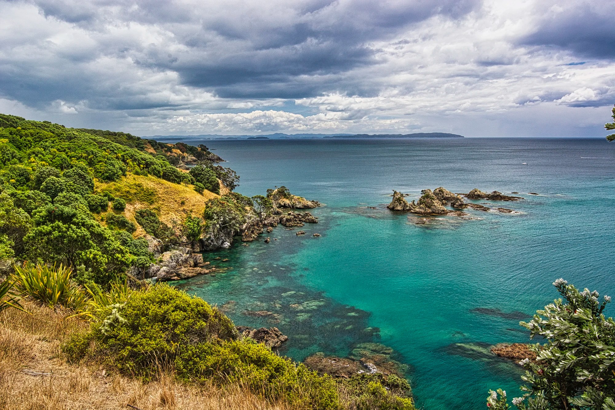
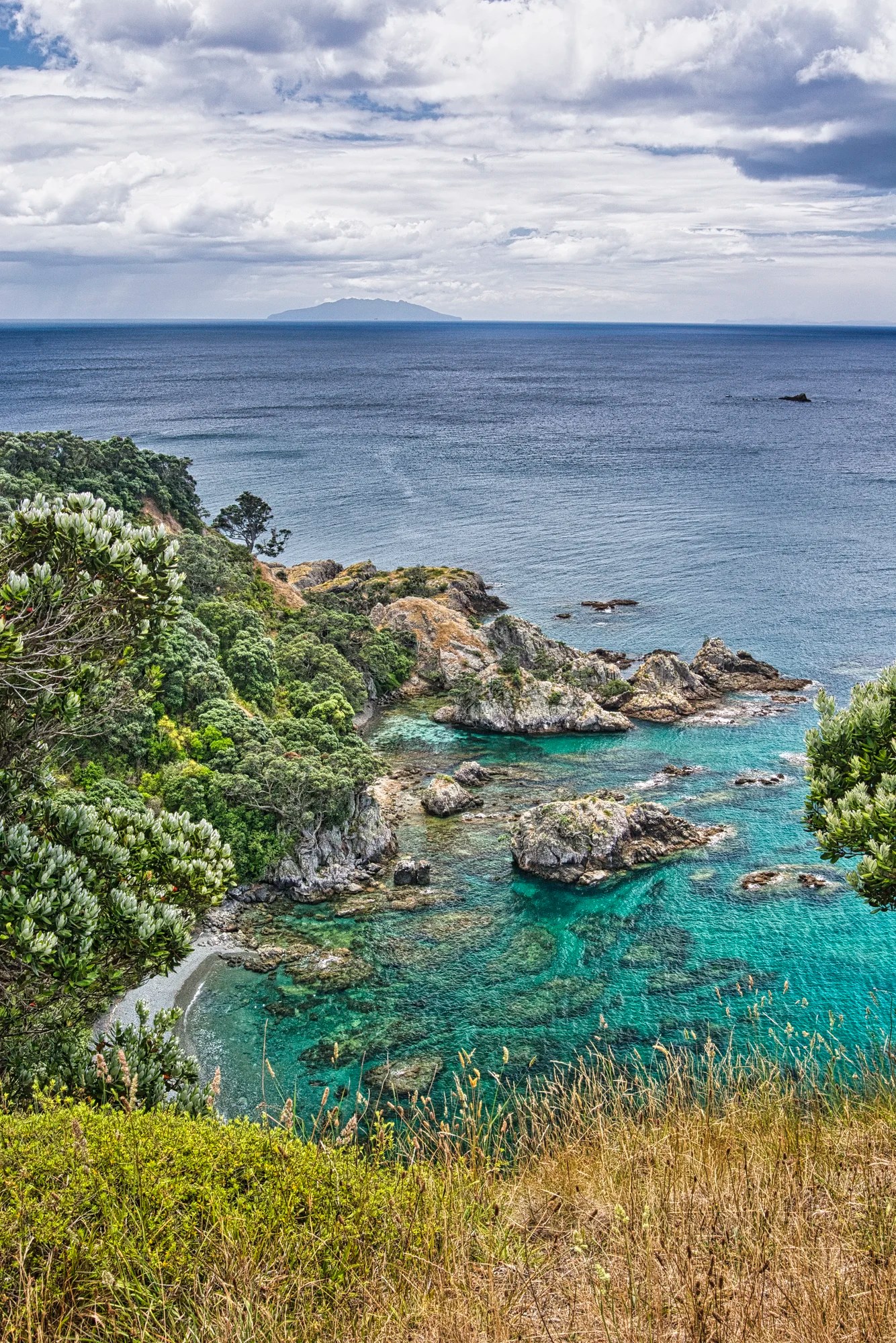
We got a lift to Matapouri. We climbed a hill for ca. 2 km to a lookout with a superb view of trees, rocks and sand, hills and beaches.
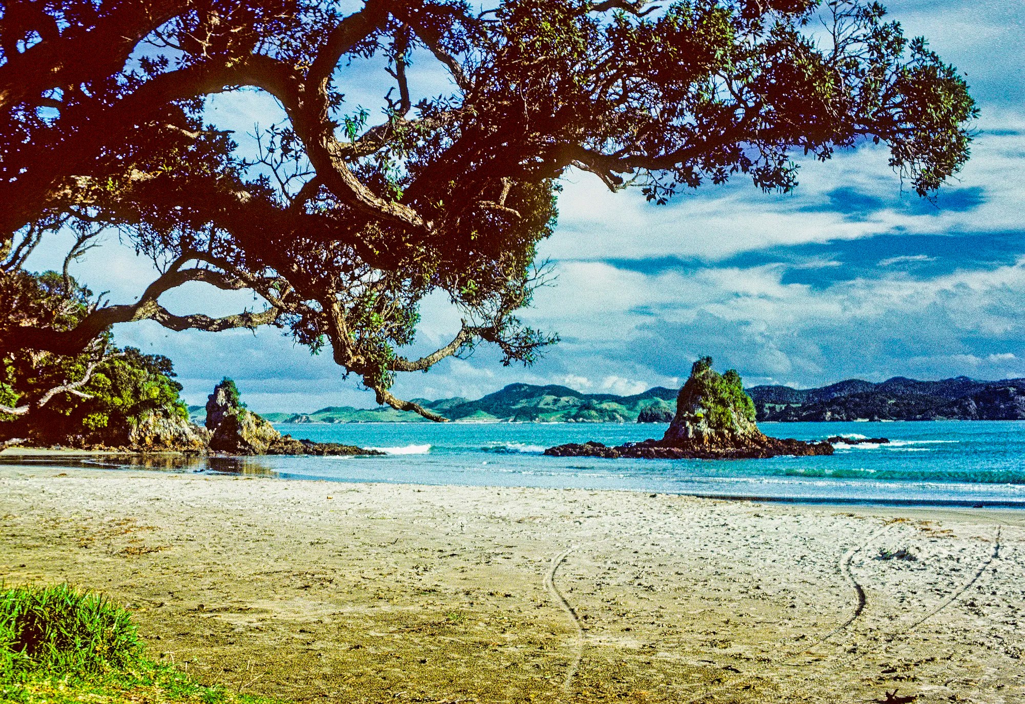
We walked down the trail to sandy Whale Bay where we ate lunch by the frosty green breakers. We walked back to crescent-shaped Manapouri Bay enclosed by rocky points.
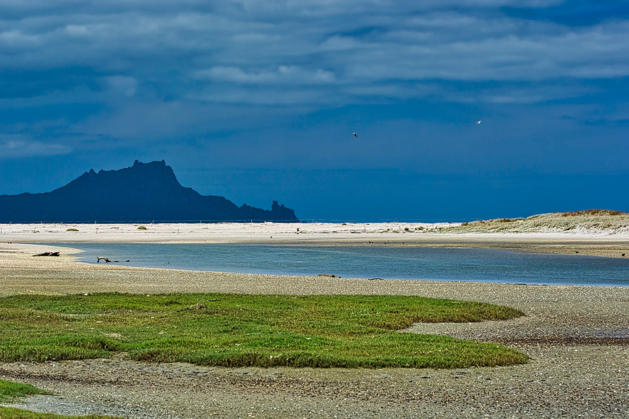
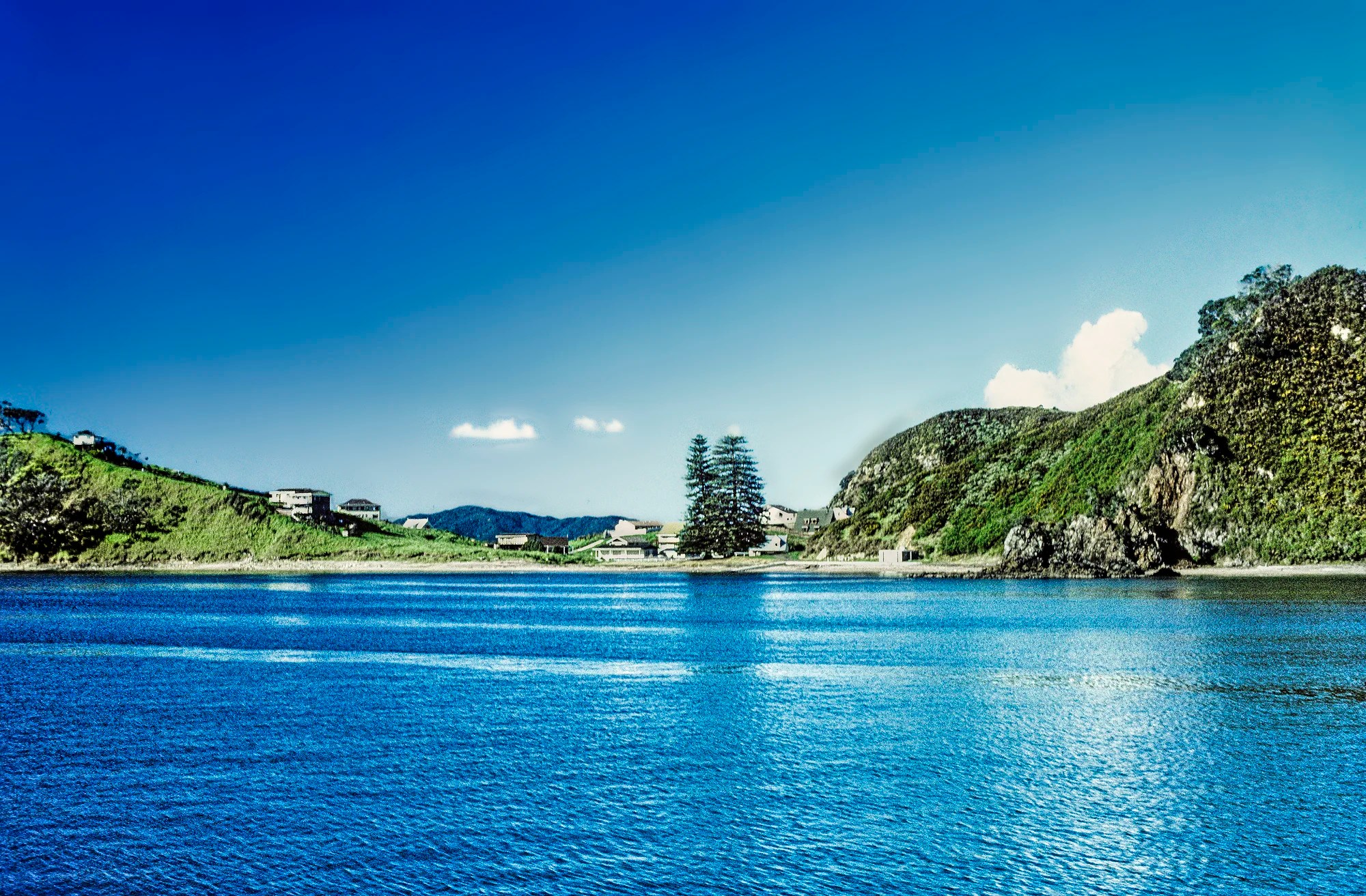
I believe this is Whale Bay (G4.9), a gorgeous beach and headland close to Matapouri. There are so many other bays and beaches to explore in this area — Matapouri Beach (G4.8), Woolleys Bay (G4.8), Sandy Bay (G4.7), and Daisy Bay (G5.0).
Bay of Islands Region
Paihia
Auckland — Paihia 252 km 3:23 hrs
Matapouri — Paihia 81 km 1:17 hrs
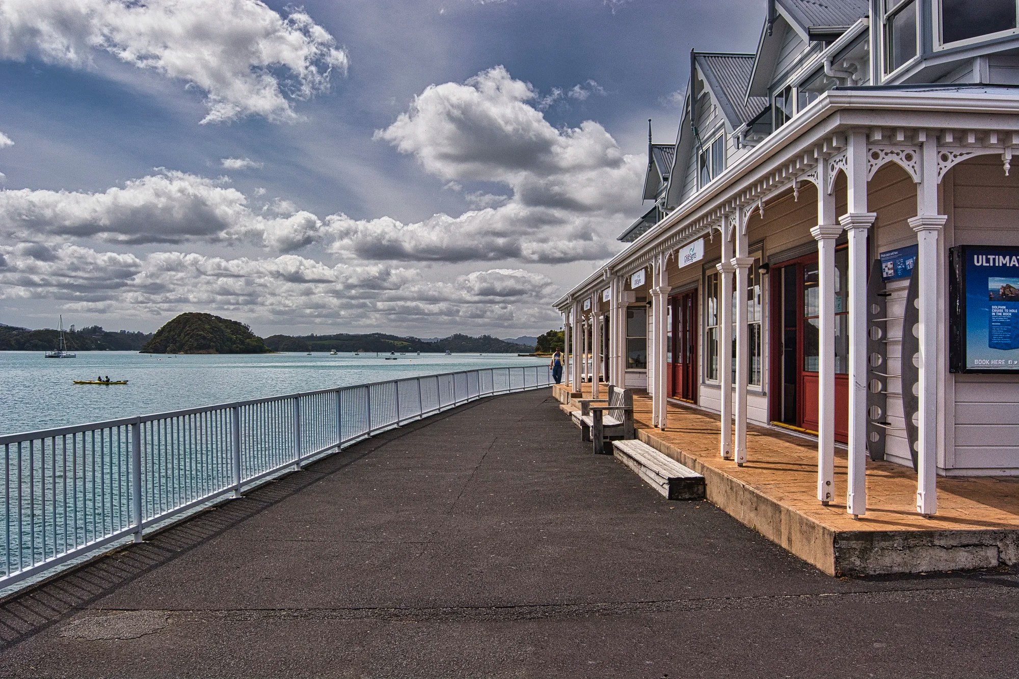
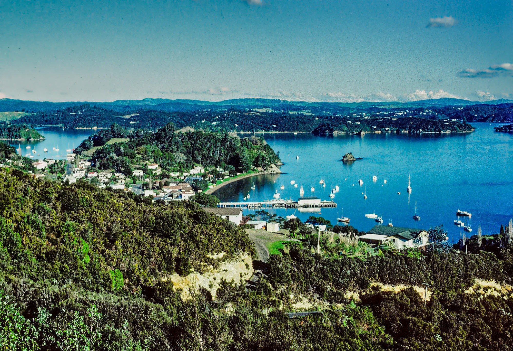
On our third trip, we visited Paihia (G4.6) with our son in search of views of the magnificent Bay of Islands. This was the most touristy town of this itinerary – it was the summer holidays for the Kiwis.
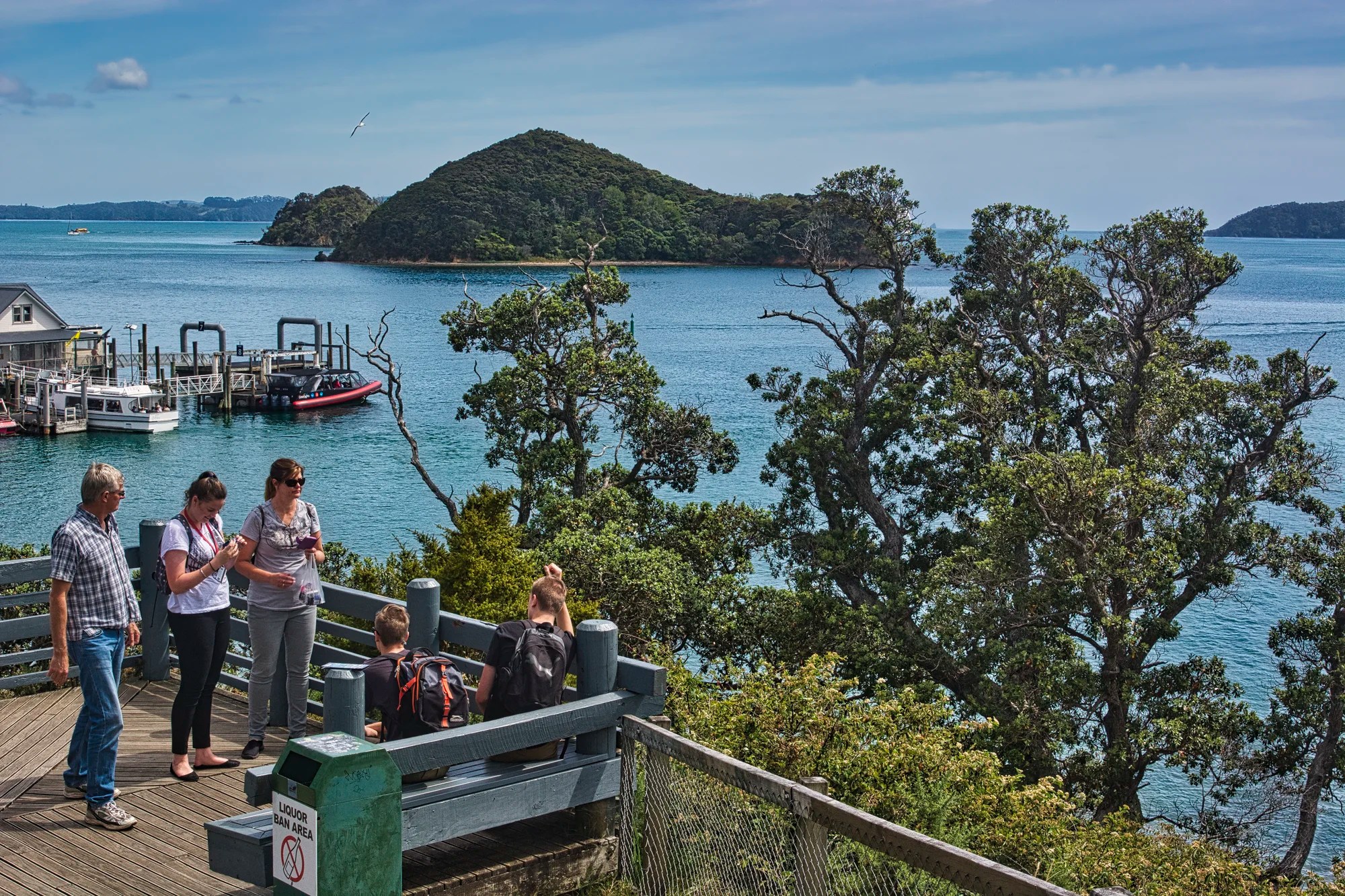
The Bay of Islands Viewpoint (G4.4) was the best vista we could find. One really needs a much higher viewpoint or a boat to see all the islands dotting the bay.
Bay of Islands
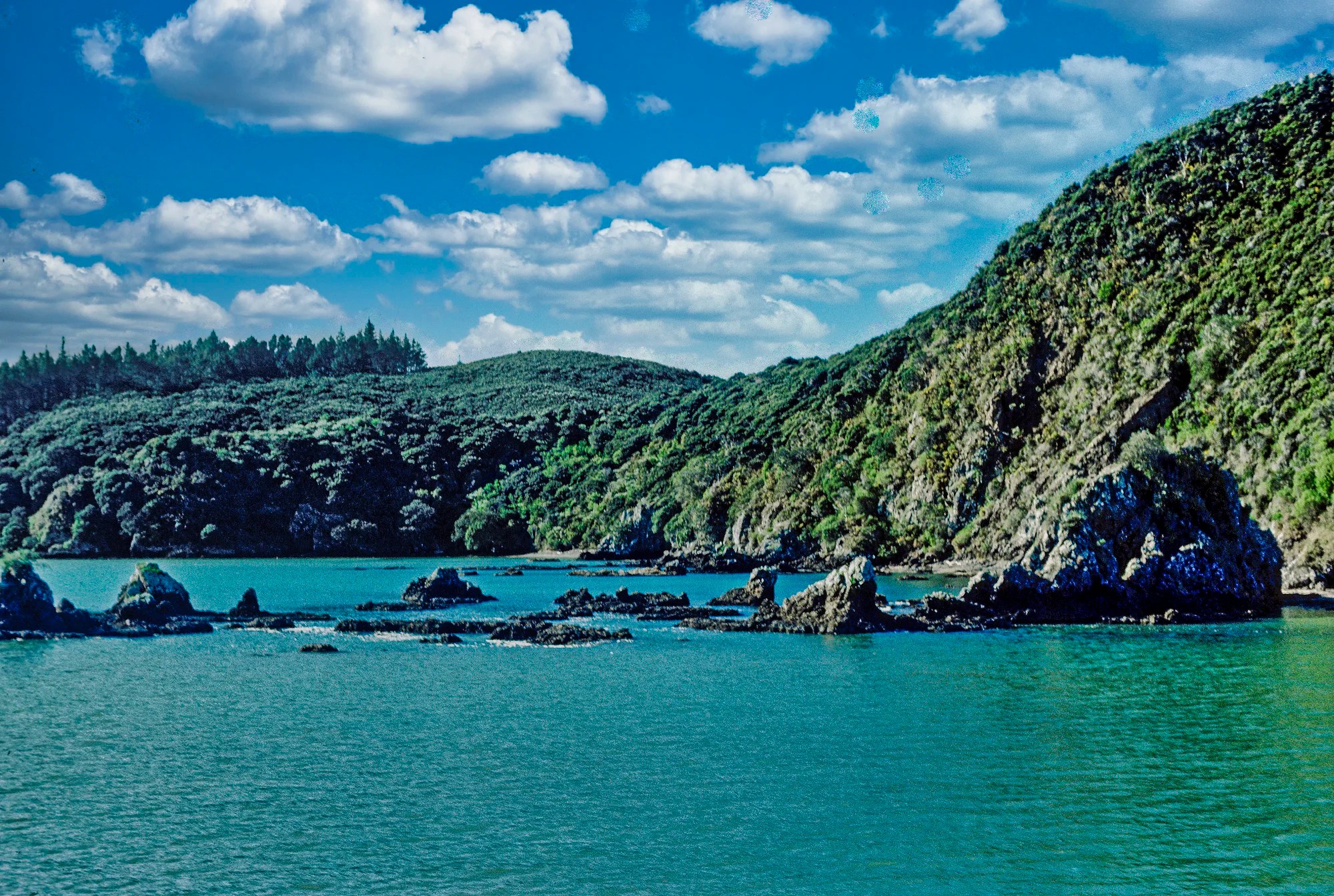
We did the Bay Of Islands Cream Trip (G4.7) when it was not commercialized and actually delivered goods to the islands. The scenery was a contrast of tame grass and rugged rocks. A 52 ft wide hole in the rock looks deceptively small. Large swells moved like a roller coaster. We had to wait for the smoothest time to pass through the rock. It didn’t look like the boat would fit but we went through twice without a problem. There were magnificent schools of blue fish all around.
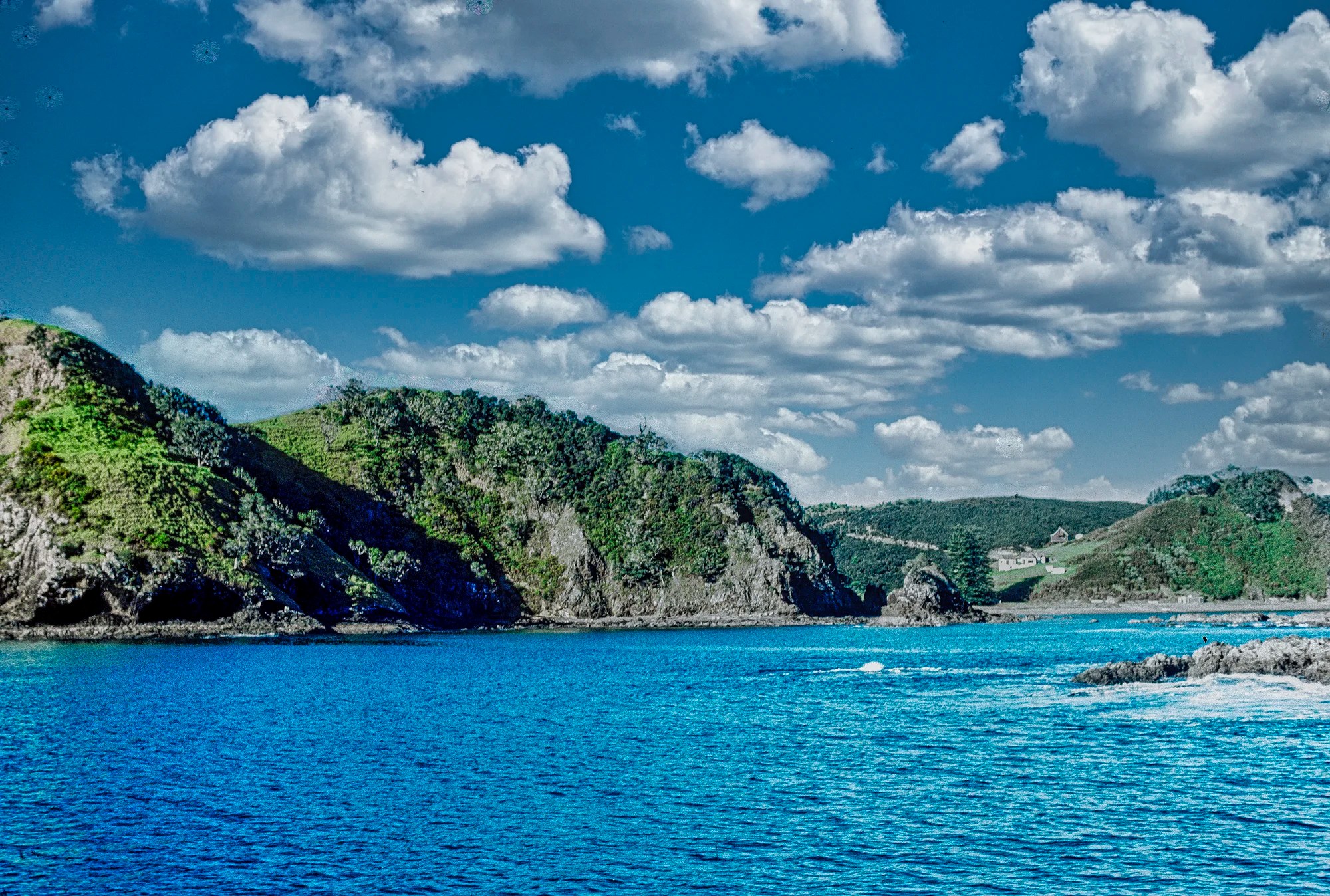
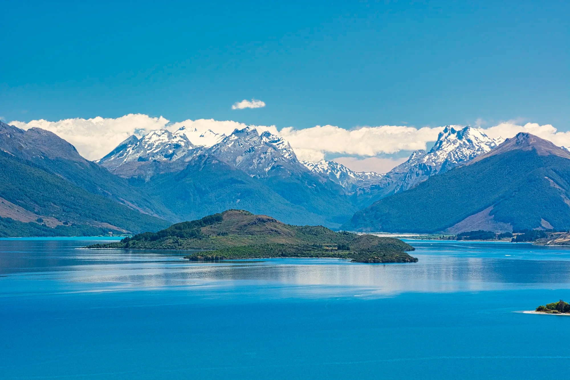
Urupukapaka Island used to be owned by a US millionaire. It is now a maritime park with camping and beaches. Its beauty lies in the contrast between the rock spine piercing the water and the gentle green slopes.
We did a short half-hour track between beaches on Motukiekie Island, a botanical reserve. Caretaker Mr Grey came out in a rowboat to get his mail. He lives in a modern brick house on the sandy beach. Robertson Island is the most photogenic, with a sandy cove and craggy pillars.
Russell
In Russell, we climbed up Flagstaff Hill. It was very steep but only 8 minutes. Here we had an excellent view of Russell in the late afternoon. There is a short ferry between Paihia and Russell.
Taupiri Bay

On our third trip, we did the Russell-Oakura Scenic Drive. Most of the time, you could not see the coast for the trees. The coastal road was not right along the coast. Taupiri Bay Lookout (G5.0) was the most beautiful beach view.
White-faced Heron
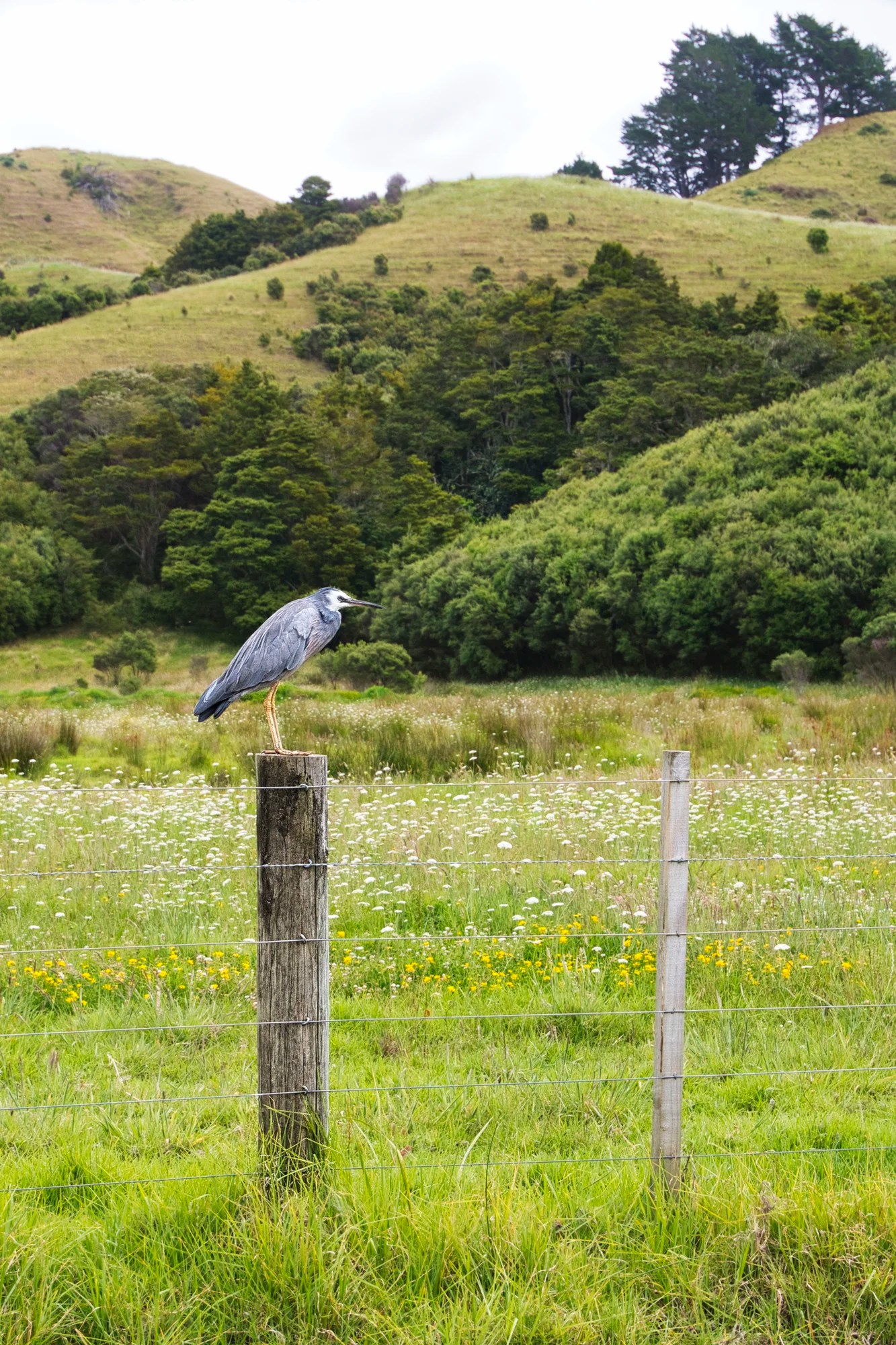
We saw this White-faced heron on a fence post. It is a small gray heron with a white face and yellowish legs. They are native to Australia, New Zealand, Indonesia, and New Guinea. These herons are highly adaptable and can be found in a variety of wetland habitats — or even on a farm field.
Waitangi Treaty Grounds
Auckland — Waitangi 254 km 3:26 hrs
Paihia — Waitangi 2 km 0:05 hrs
The fierce Maori warriors were never defeated by the British. The Waitangi Treaty House (1833) was the home of James Busby, who drafted and successfully negotiated with the Māoris. The Treaty of Waitangi (1840) ceded sovereignty to Great Britain. The house contents are of moderate interest.
The Waitangi Treaty Grounds (G4.7) have a beautiful, lush lawn and rugged coastal scenery. The native pohutakawa or Christmas tree adds a splash of red starting in December. Busby was an expert viticulturalist and during his stay. Even then, the grounds were noted for their appearance. There are several tracks in the area, like the 6 km 1.5 hr. track to Haruru Falls with a boardwalk through mangrove forest. Another walk along the coast to Hobson Beach has a short 300 km detour to a Maori war canoe. Carved from 3 giant kauri trees, it could carry 150 people. It was built in 1940 to celebrate the centennial of the Treaty.
Te Whare Runanga
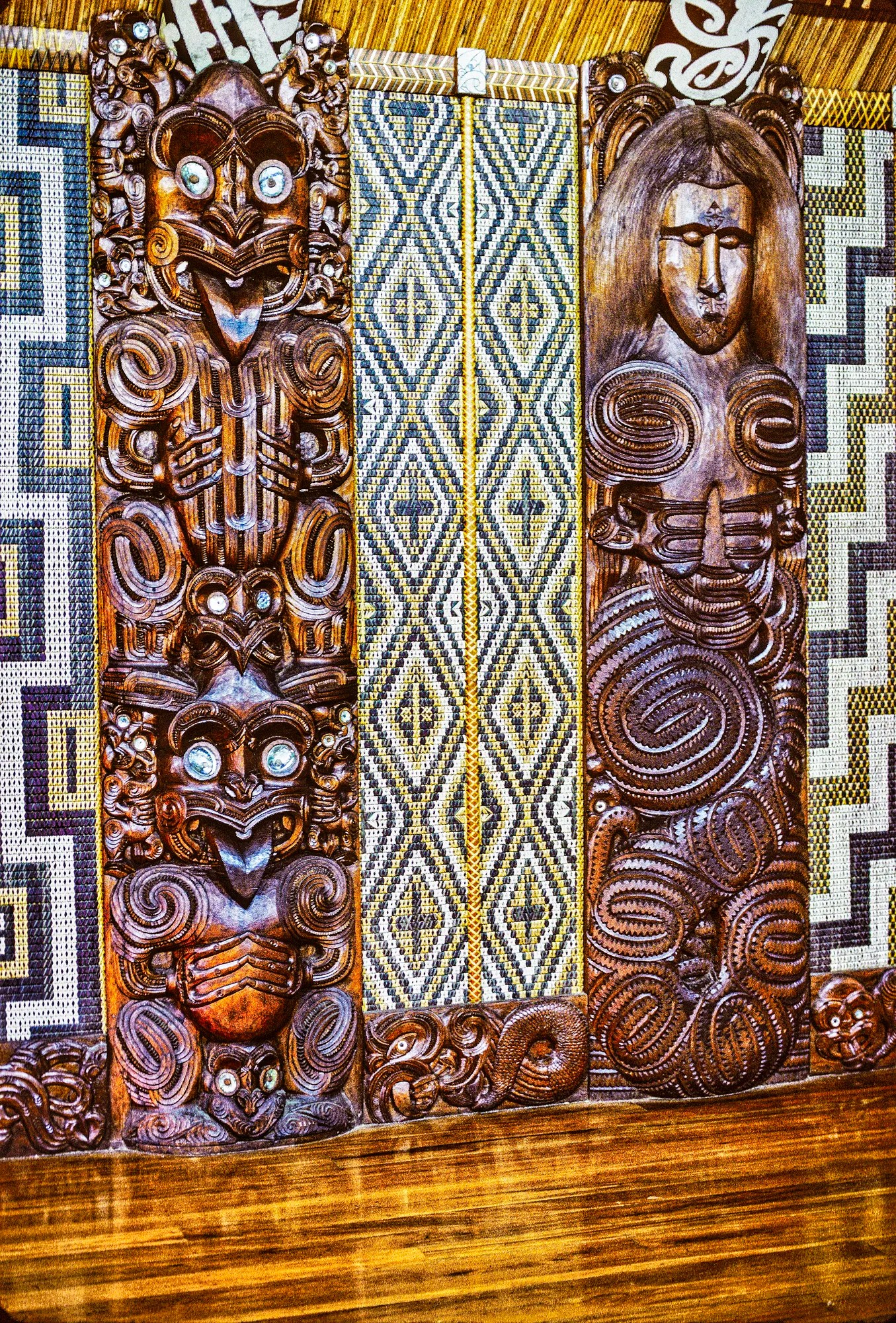
But the must-see was the Te Whare Runanga (G4.4) (1940). Every Maori community has a meeting house for guests, meetings, and historical records. Rather than one tribe, this wharenui (1940) represents all tribes in Aotearoa (NZ). The walls are decorated with alternating poupou (ancestors carved in wood) and tukutuku (geometric weaving) wall panels.
Tukutuku Panels
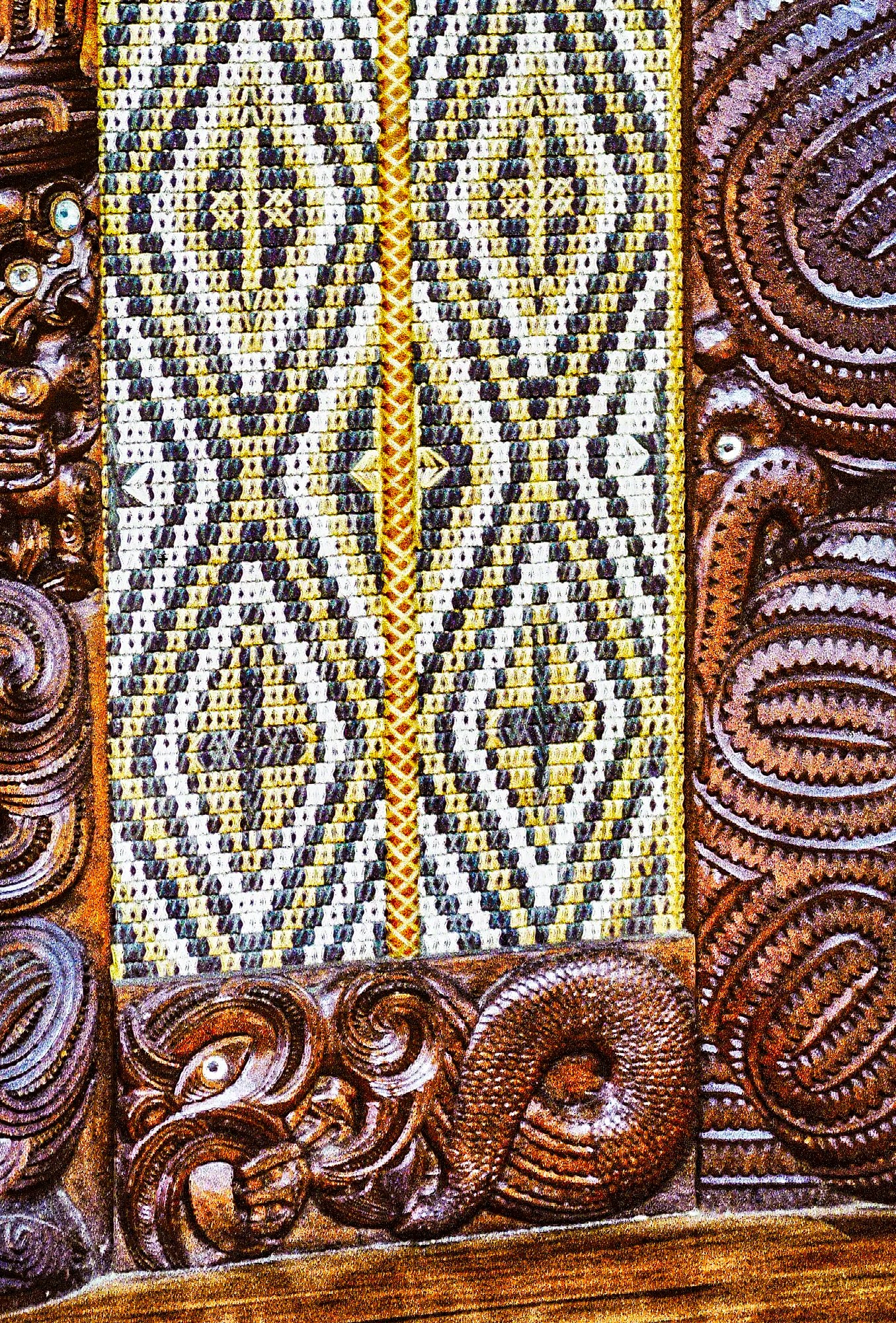
The tukutuku panels are woven by the Māori women. They display symbolic geometric patterns of red, yellow, black and white-dyed fibres made from different plants.
Poupou Panels
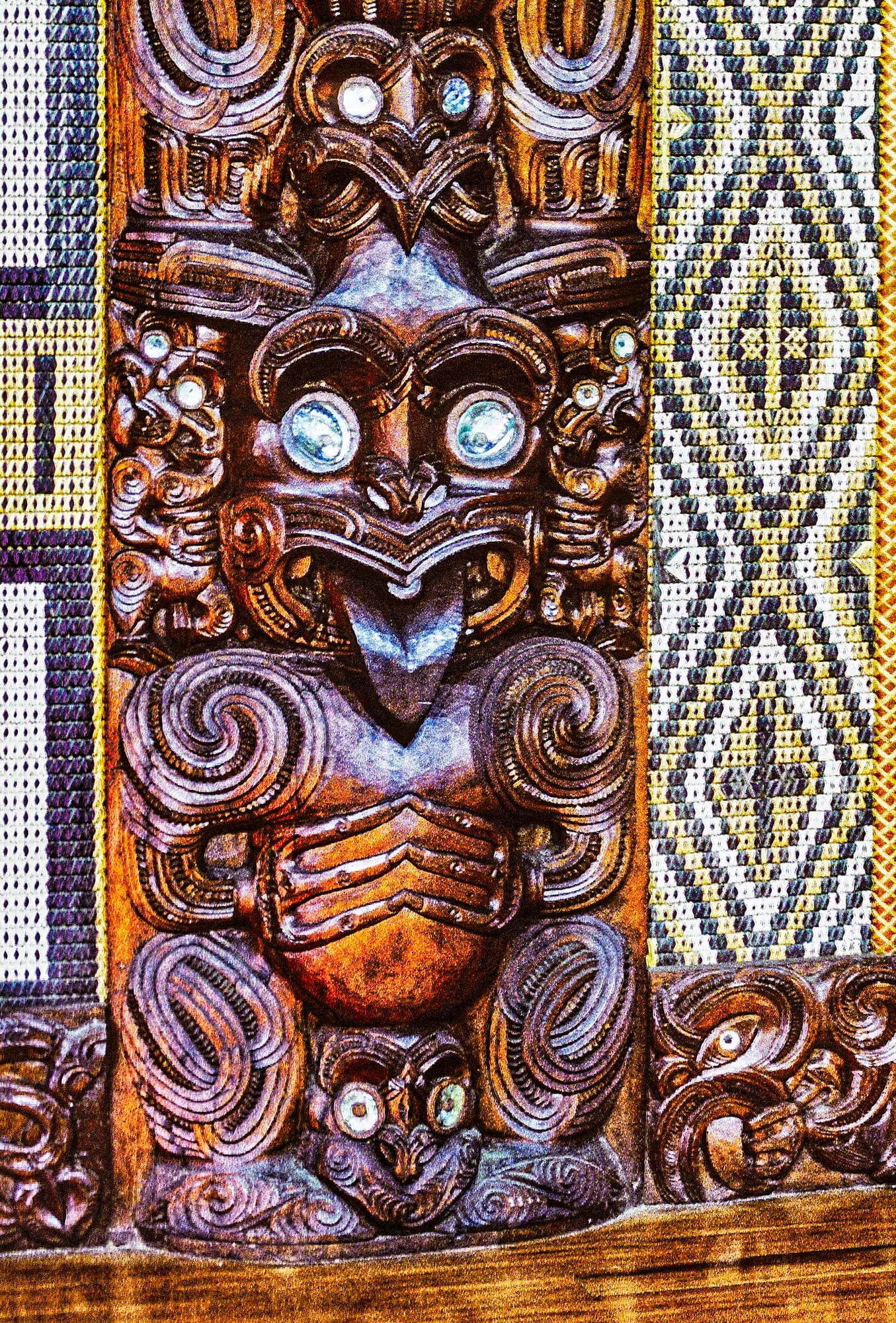
The poupou are carved by the Māori men. Māori carving is superb and represents a notable ancestor from each tribe, made in that tribe’s style.
The eyes are inlaid with paua (abalone mother-of-pearl) shell. In Māori culture, paua are associated with the stars or whetū. They are considered the symbolic eyes of ancestors that gaze down from the night sky. Most of the carvings are grotesque figures in the haka gesture: the tongue protrudes from an overly large head. Haka is a greeting ritual with vigorous movements, facial contortions, and sticking out of the tongue. The latter has several meanings, such as defiance, challenge, or assertiveness.
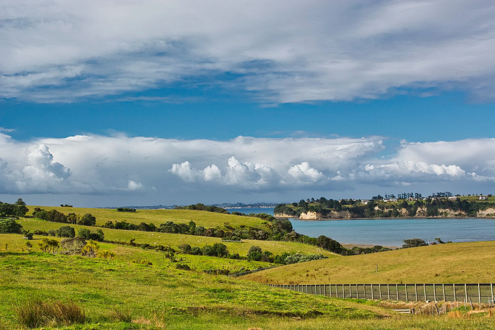
Bedggood Farm
On our first trip to NZ, we had a chance to stay on a farm. Trevor Bedggood was a very quiet, serious person. One day, we stayed on the farm and helped Trevor with his chores.
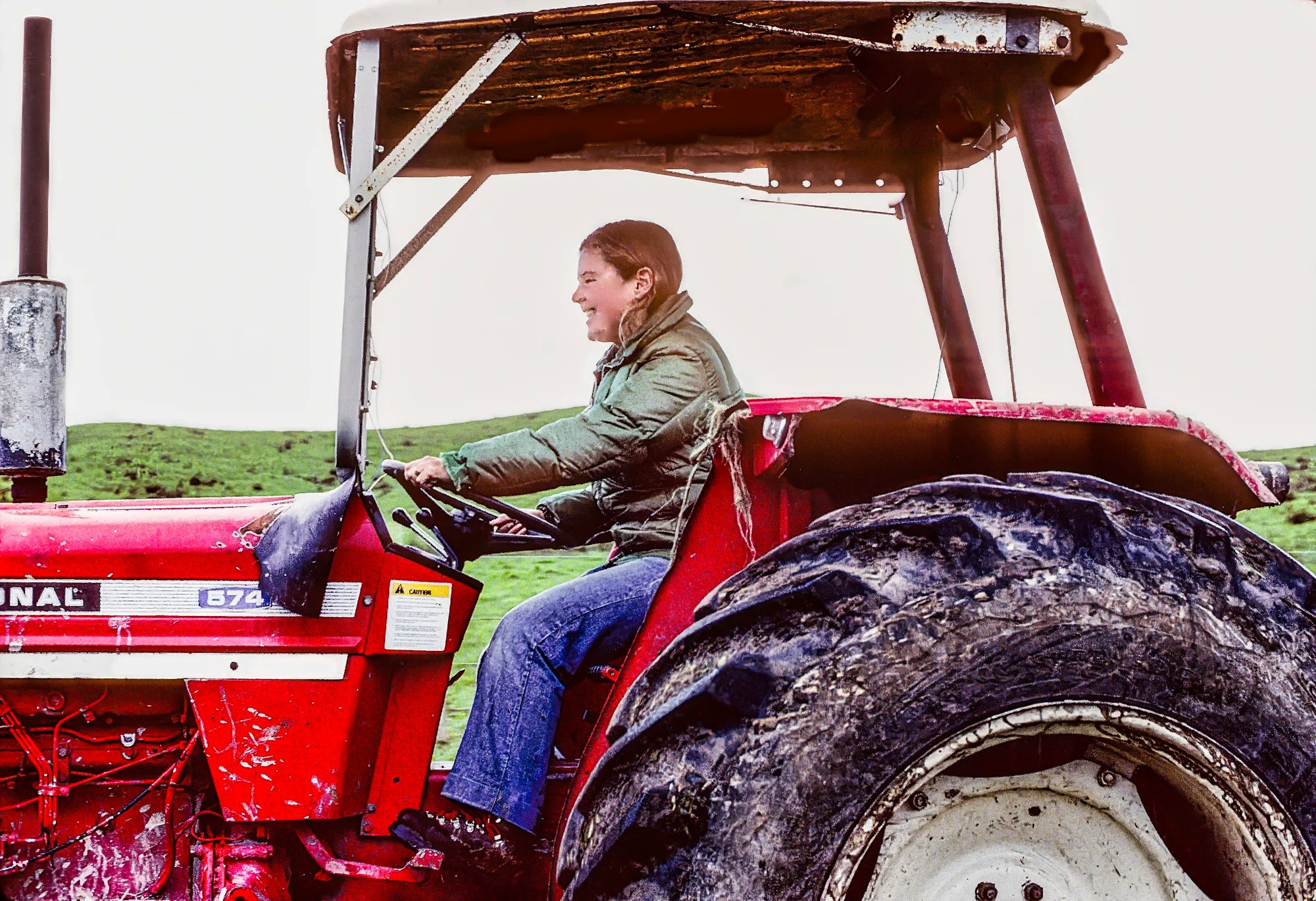
They had 108 acres in separate blocks, so we drove the truck along Anderson Road to a shed, where we loaded eight bales of hay on the tractor. Corinne had a great time driving the tractor.
They had 621 cattle in the winter and over 800 in the summer. We were there in June. In winter, the cattle are fed hay, ca. one bale per 12 head. We had fun cutting the cords and throwing the bales at intervals. The cattle came running to the tractor before we even threw any feed. The hay is a special treat.
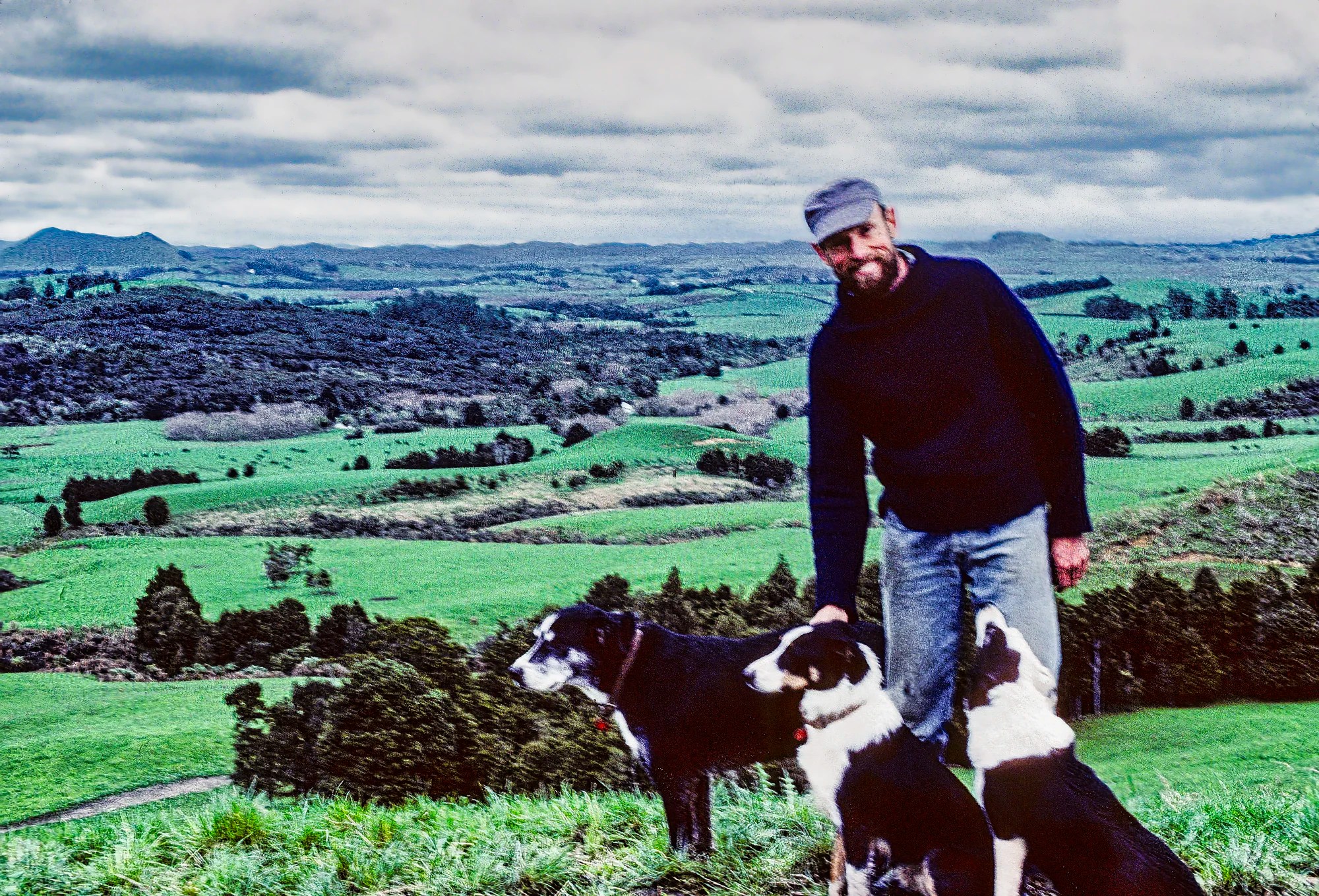
We went to this high point overlooking Puketona Junction with a view of the whole farm. Meanwhile, the three dogs — Chief, Dick and Lisa — were having fun going nose-to-nose with the cows. I believe these are NZ Heading Dogs. This herding dog is derived from the Border Collie. These black and white dogs use their visual prowess, intelligence and quick movement to control flocks.
Hereford Cows
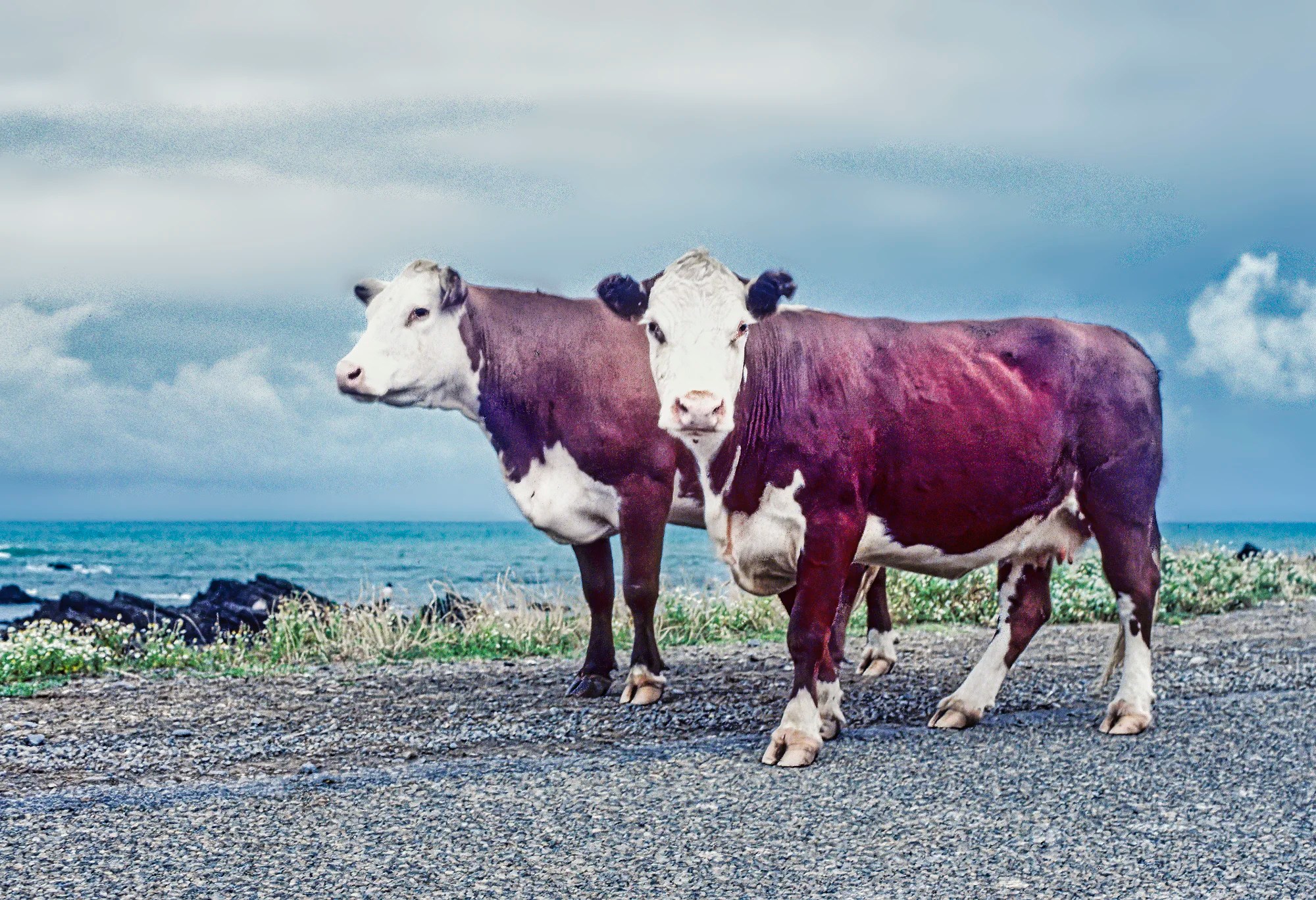
Trevor taught us about the different cattle species. Hereford cattle are known for their distinctive red-brown bodies and white faces. The Hereford breed originated in Herefordshire (England) in the early 19th century. Herefords are prized for their docile temperament, hardiness, and high-quality beef.
The brown and white Jersey cows are noted for their high cream. Jersey cows are a breed of small dairy cattle that originated from the Channel Island of Jersey, near the coast of France. They are renowned for their rich and creamy milk, which has a higher butterfat content. This makes it ideal for producing premium dairy products like butter, cheese, and ice cream.
Possums
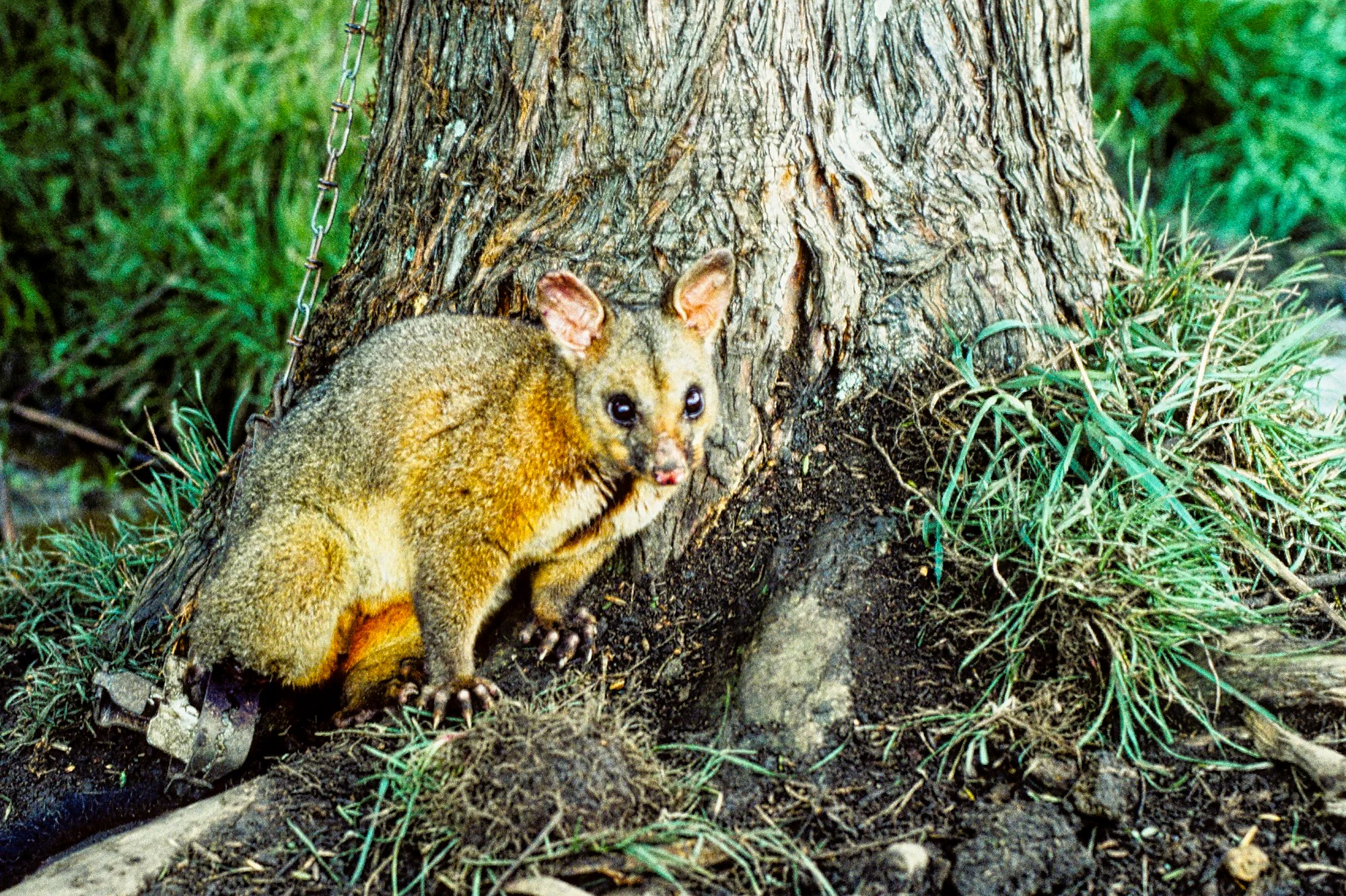
The British had introduced species that had no predators in NZ. They do a lot of damage to the native birds and trees. They are considered pests. The previous day I had mixed curry with flour and Trevor had sprinkled a trail along the ground where he had laid some leg traps near the base of some gum trees. We drove back to that area and sure enough, there was a possum in the trap. I took a picture of the possum while avoiding its sharp claws. Trevor then smashed it with a wrench.
We then shifted some cattle from one section to another. The cattle were already waiting as they saw us approaching. Amazing how the dogs round them up and keep them moving in the right direction — except for the frisky one-year-old Chief, who was too active. Note that the bottom three wires of a fence are not barbed, so the sheep do not get injured. As they say, the grass is always greener on the other side! Even the sheep agree!
Te Waimate Mission
Kerikeri — Te Waimate Mission 15 km 0:15 hrs
Puketona Junction — Te Waimate Mission 9 km 0:08 hrs
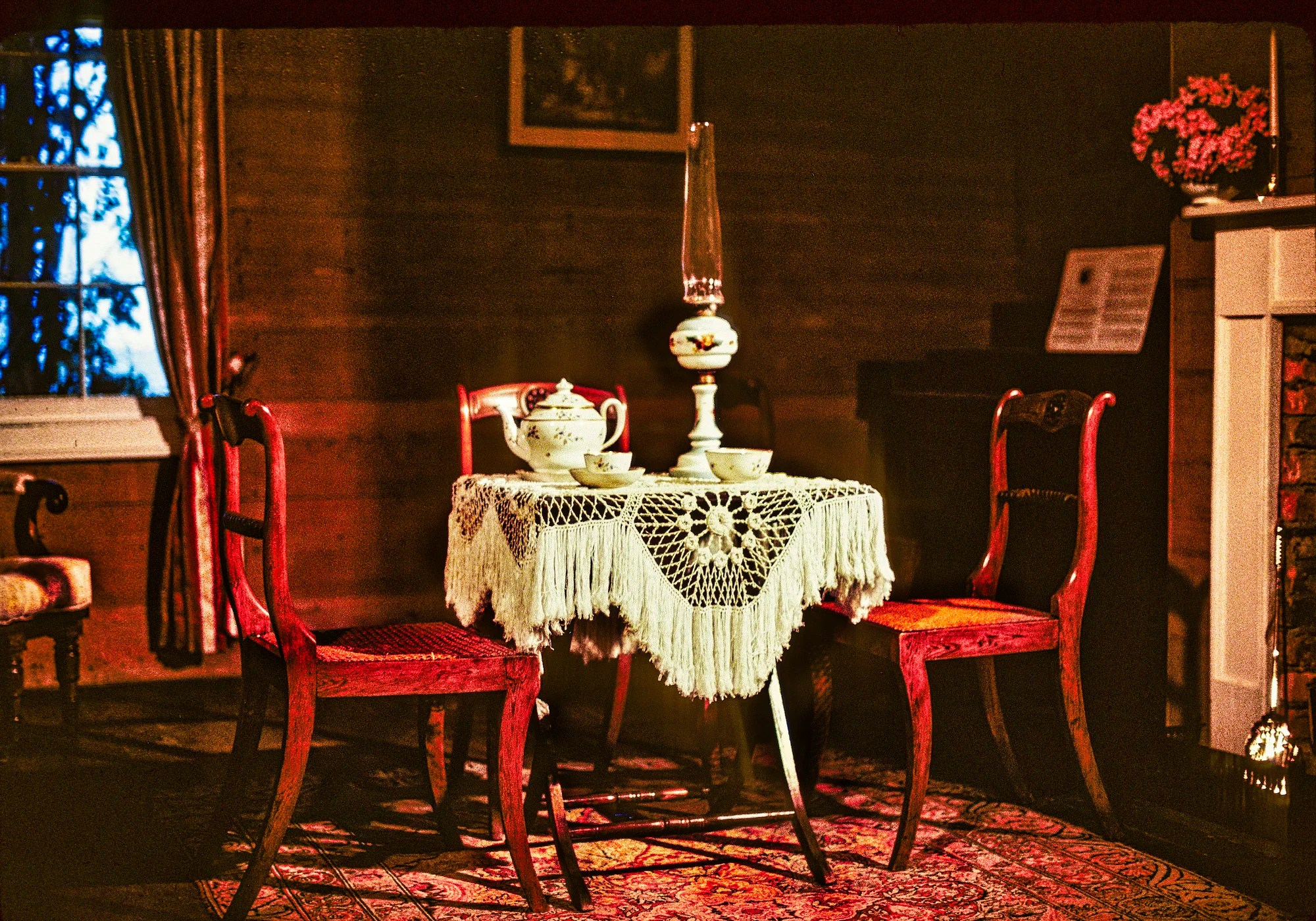
We visited the Te Waimate Mission (G4.6) when it was pouring rain. It’s the second-oldest surviving European building in NZ and offers a glimpse into missionary, farming, and architectural history. The mission was established in 1831 and played a significant role in early European settlement and engagement with Māori.
It was very interesting as each room was restored with actual or typical furnishings of that period. Then we noticed that many of these items came from the Bedggood Family. There were period furniture, blue willow China, blue Wedgwood bowls and jugs, and relics from the Bedggood blacksmith shop. John Bedggood immigrated from Wales in 1836. He worked as a millwright (machinery maintenance) for the Mission. The Bedggoods were craftsmen, wheelwrights, blacksmiths…
Kerikeri
Auckland — Kerikeri 266 km 3:31 hrs
Matapouri — Kerikeri 96 km 1:27 hrs
Paihia — Kerikeri 24 km 0:22 hrs
On our third trip to NZ, we stayed at the beautiful Birders Rest (NZD 170). We came here for the Nighttime Kiwi Tours (NZD 90) that the hosts, Carol and Detlef, led. One of Daniele’s itinerary planning techniques is to go to multiple places for a target species to ensure he will see the bird.
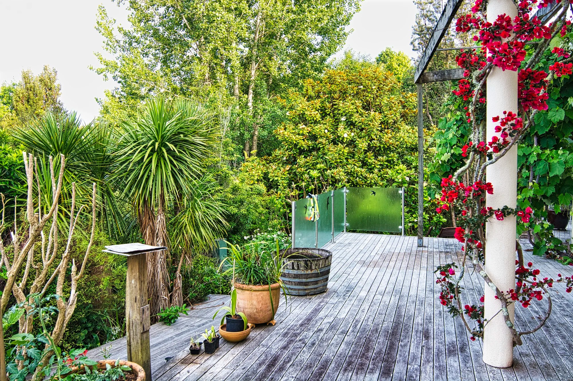
The backyard was like a forest. Cabbage Trees grow up to 20 m (66 ft) high. The Maori people used Cabbage Trees for various purposes, including food, fibre, and medicine. The young leaves and stems were cooked and eaten, while the fibrous leaves were used to weave ropes, baskets, and mats.
Bougainvillea plants are famous for their showy bracts, which come in various colours — magenta, purple, red, orange, pink, and white. These colourful bracts make the small white, true flowers invisible. I always associated Bougainvillea with tropical Polynesia. It is actually native to South America, specifically Brazil, Peru, and Argentina.
Bird of Paradise Flower
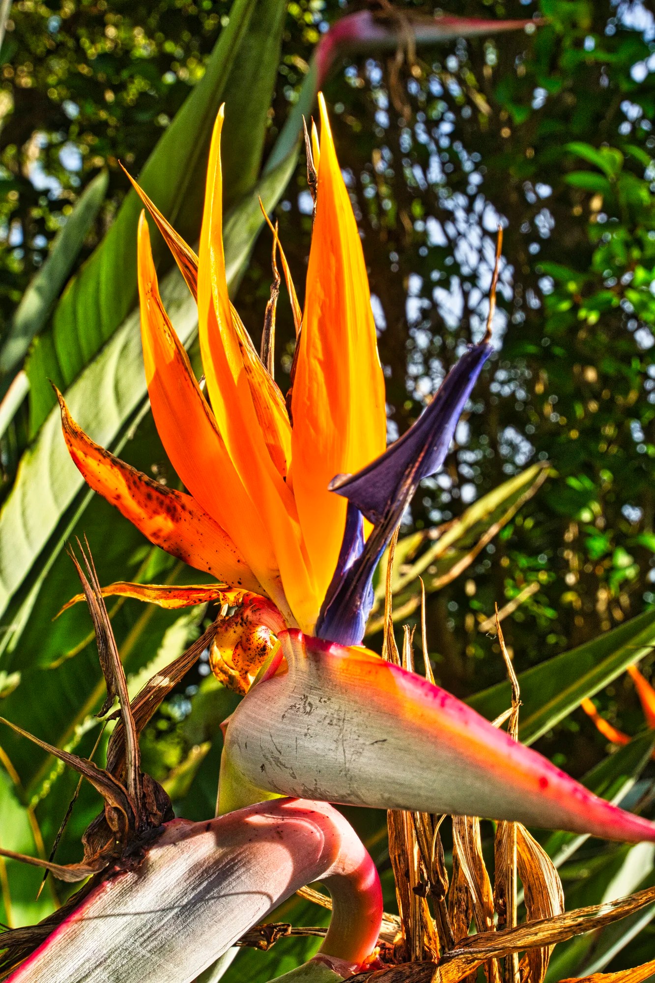
The Bird of Paradise flower (Strelitzia) is a stunning plant native to South Africa. It’s famous for its striking, colourful appearance that resembles the bird for which it’s named. The Bird of Paradise symbolizes joy, freedom, and paradise.
Aroha Island Ecological Center
Kerikeri — Aroha Island 12 km 0:14 hrs
Hours: 9:30 – 17:30 daily
It is gated so guests cannot enter until 09:30
Aroha Island is a 12 ha sanctuary in the Kerikeri Inlet, a short 12 km drive northeast of Kerikeri. A causeway links the island to the mainland, providing permanent and convenient vehicle access. It is a treat to see the rare North Island Brown Kiwi in its natural habitat.
Cape Reinga Region
Kerikeri—Cape Reinga 192 km 2:35 h
Is it worth going all the way to Cape Reinga? Is it worth taking a tour? Our experience tells us that if you are pressed for time, then it is not worthwhile. You really need quality time to experience and enjoy any place, let alone any region. It is not about the number of km or hours to get to the tip of NZ.
Our first trip to NZ was part of our three-year round-the-world backpacking trip. To economize, we did not rent a car. So we took a Cape Reinga tour. The bus wasted half an hour at a coffee stop and then another half hour at the Wagener Museum (Pakenui), which is not even shown on Google Maps today. But the bus did not stop at Coopers Beach (G4.8) and Cable Bay (G4.8) — both very close to Highway 10. These are two of the best beaches in the world with golden sand and red pohutukawas. The rest of the scenery was flat and boring. Finally, we arrived at Cape Reinga (place of leaping). It’s so-called because Maori feel that this is where the spirits leap off.
The tour bus driver told us not to believe in the “hereafter”. He said if we were here after 2 PM (only a half hour from then), then the bus would be gone. This is why we do not like tours. You are rushed, and they waste time stopping at extraneous places of limited value.
Cape Reinga
We hiked the rough uphill path above the Lighthouse (G4.8) to this quintessential view. Cape Reinga (G4.8) lay far below, past a wide crescent-shaped sandy beach. Ahead was a sheer drop and the frothy meeting of the cold Tasman Sea and the warm Pacific Ocean.
Ninety Mile Beach
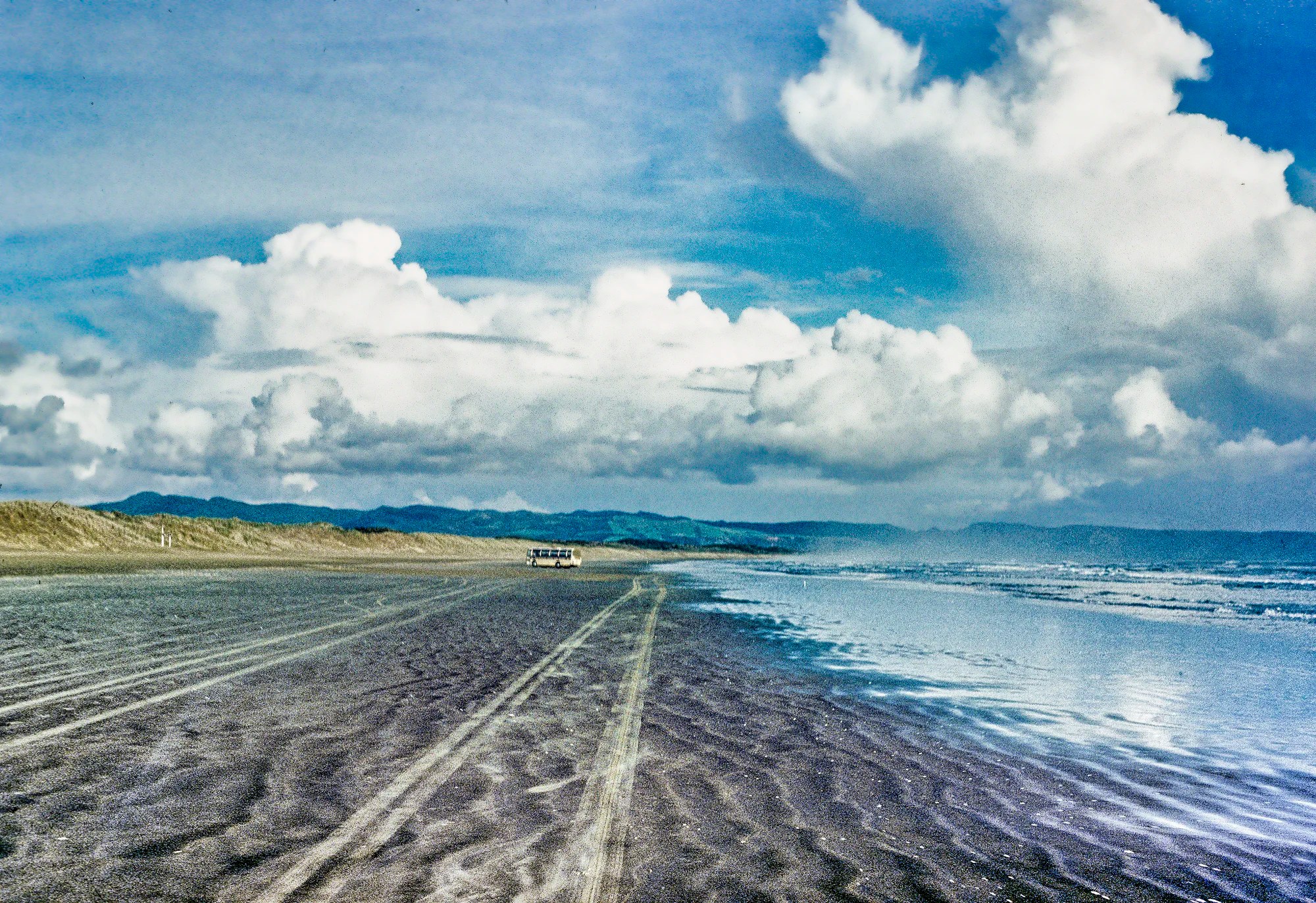
Then we drove southwest to Ninety Mile Beach (G4.5). It was misnamed as it is a 90-km or 64-mile beach. It is the fifth-longest beach in the world. It is also incredibly wide between 500 to 700 ft. The bus drove very fast as the sand below the high water mark was very hard.
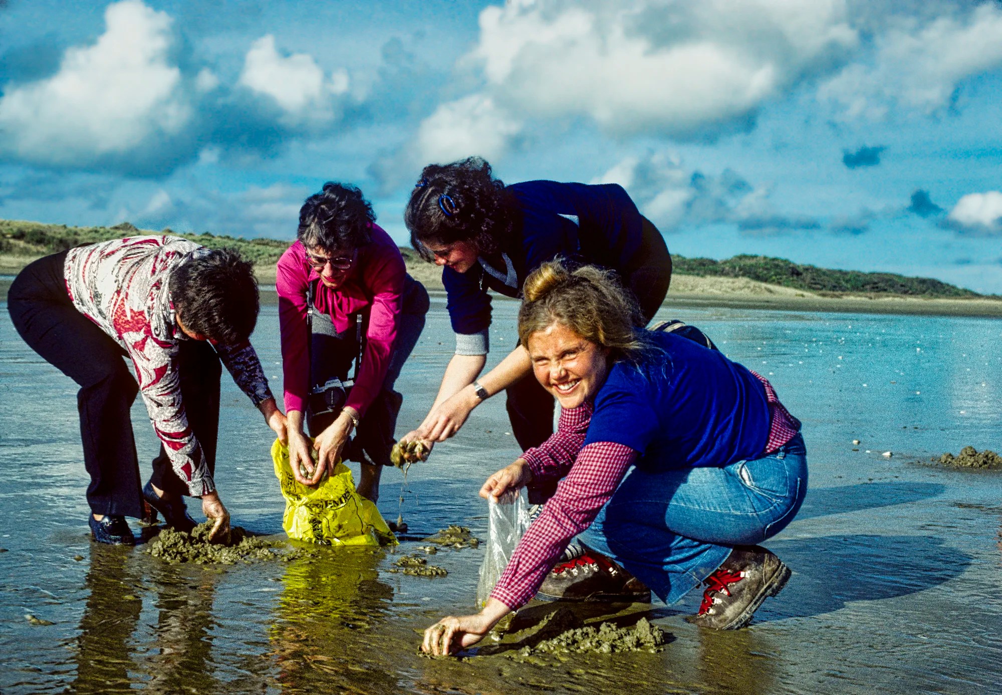
We met some Kiwis and joined them in digging for tuatua, an endemic mollusk living in the sand. We collected two full bags of them. The bus continued south to a Maori shell house in Kaitaia. We got off the bus at Puketona Junction (Bedggood Farm). We had someone make us tuatua fritters, a delicacy. They had a delicious but mild taste.
Waipoua Kauri Forest
Cape Reinga — Kauri Walks 309 km 4:39 hrs
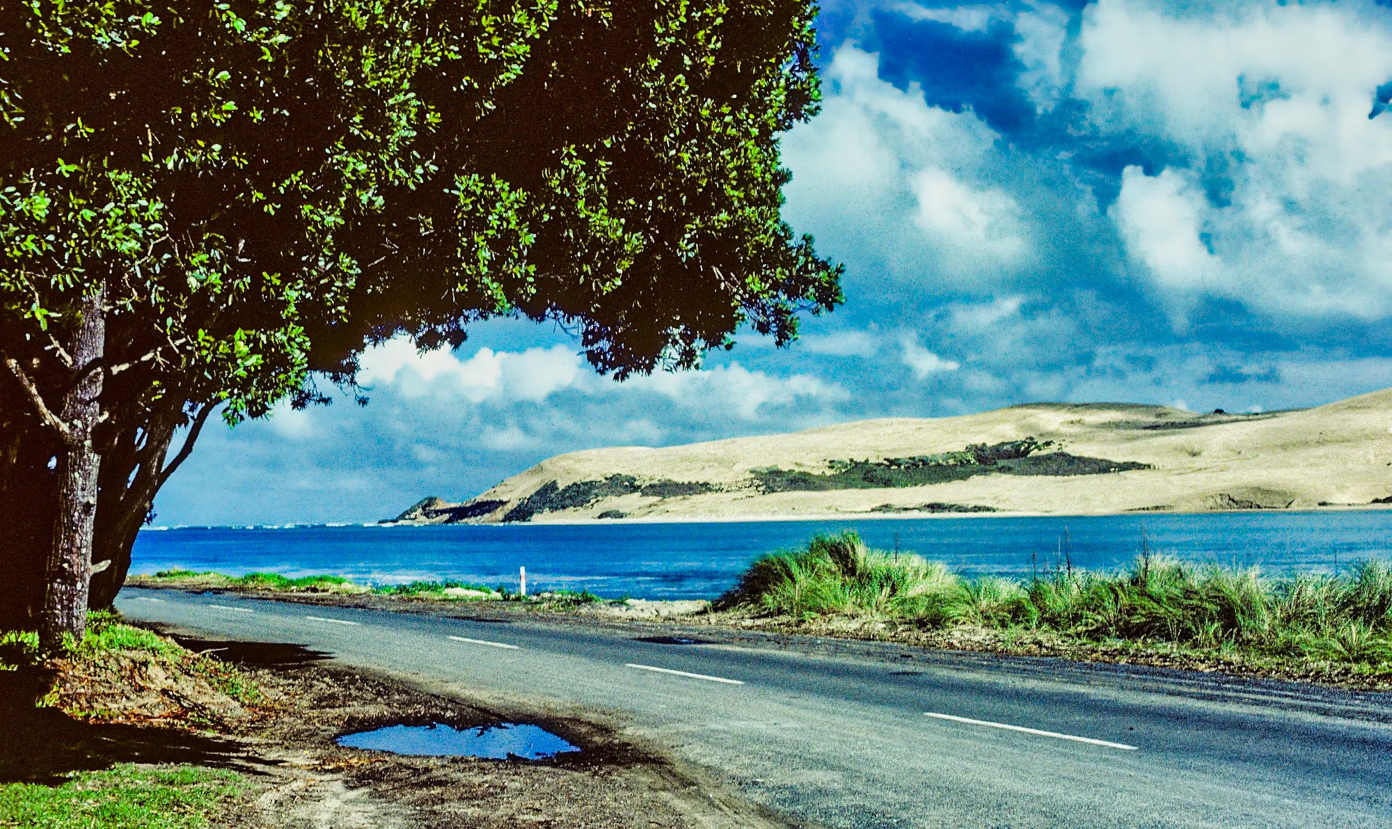
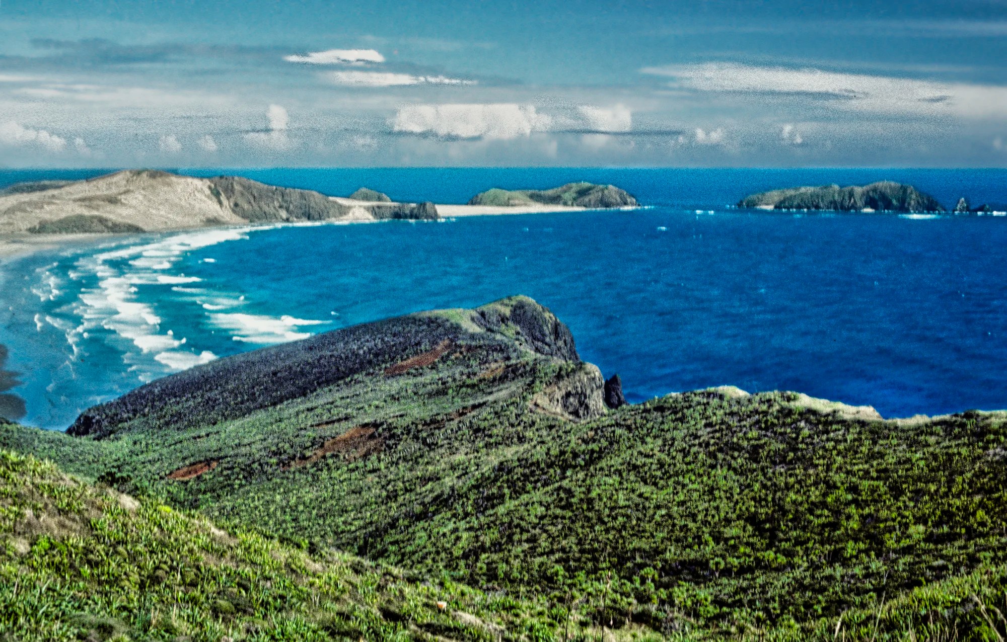
We drove past Opononi on Highway 12. At this point, Hokianga Harbour (the water, not the port) was at its narrowest. Across the blue water were dazzling white sand dunes. To actually visit the dunes, you need to either boat or drive/hike to the north shore of Hokianga Harbour.
From there we went to Waipoua Kauri Forest. Kauri trees are endemic to NZ. The trees are considered taonga (treasures) and play an important role in Māori mythology and traditions.
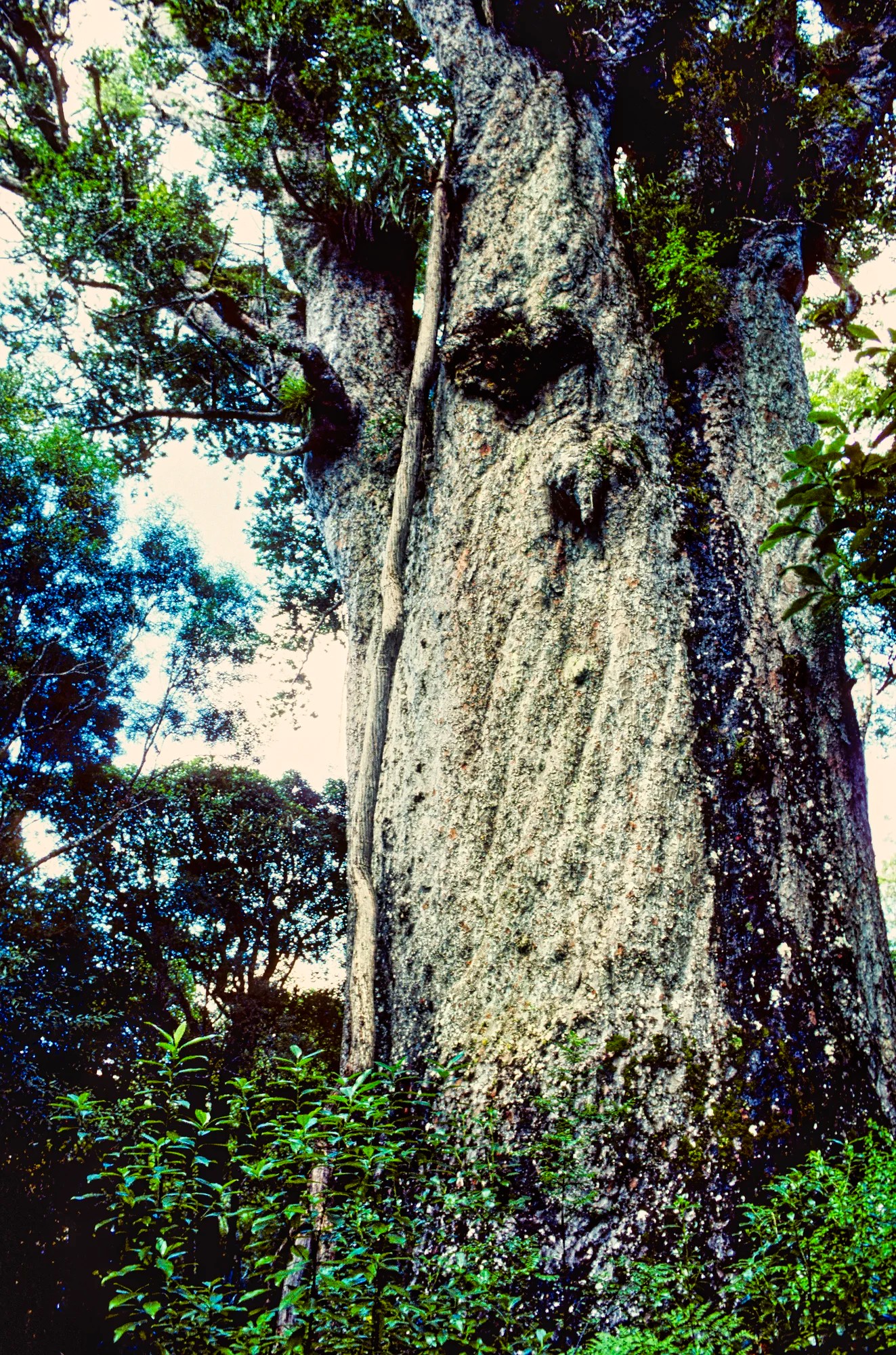
Drive down Highway 12 to the Kauri Walks (G4.8) pin on the map. A 166 m five-minute track led to Tāne Mahuta. Tāne is the Māori god of forests and birds. This 13.7 m (yd) wide and 51.2 m (yd) high kauri tree is estimated to be between 1,250 and 2,500 years old! The next stop was a 20-minute trail to Te Matua Ngahere. or Father of the Forest. This 30 m (yd) high tree was 2000 years old and 16.4 m wide! It suffered severe damage from extreme winter storms in 2007.
The bark flakes off in a ripple pattern, creating a mound of reddish brown humus around the base of the tree. Kauri wood is highly prized for its strength, durability, and beautiful grain. It was historically used for building and carving. The kauri was widely prized for its gum, which was used to make varnish.
NZ Information References
Rome2Rio app – transportation options
Final Comments on this Itinerary
The Northland region is a pleasant, relaxing place to visit. This is also the itinerary to see hidden gems. It is a geographically compact region and can easily be seen in a two-week vacation or less. It has easy and close access to Auckland Airport.
The sights we recommend are very picturesque, though they may not be the top-drawing tourist attractions of NZ. The places included in this route are all highly rated by the people, as shown by their Google Maps Ratings.
Do you want more information? Then subscribe for free.
This was only a taste of some of the scenic wonders of the Northlands. If you have other favourites, share your experiences with us. How long is your trip? What questions do you have?
Itinerary Map & Resources
Lonely Planet New Zealand — their website
New Zealand, Lonely Planet — the book, but nowadays most people use the internet
Google Maps Ratings
Google Maps provides a rating from 0 to 5 for all sights, hotels, and restaurants (but not cities). All of our recommendations are appended with the rating (prefixed with a G) from Google Maps. Google Ratings are based on feedback from locals as well as tourists. They are much more reliable than travel booking websites or tourist anecdotes. We consider a score of 4 to 4.39 to be Very Good and 4.4 to 5 to be Excellent.
Other Places to Add to Your Itinerary
Here are nearby places you might want to explore:

New Zealand FAQ
The New Zealand FAQ post answers Frequently Asked Questions (FAQ) such as:
- Where should I go in NZ?
- What is the best season for travel?
- How much time do I need for NZ?
- How safe is NZ?
How Big is New Zealand?
NZ is a large country compared to Europe. It is the size of the UK or Italy and half the size of the province of Alberta, Canada.
Booking Accommodation
If you are going during the Christmas peak season, most Kiwis are on the summer holidays from December 20th to January 20th. You need to book your places at least 5 months ahead. But we did not find most places in this itinerary over-touristed. Paihia had the most tourists, but it was acceptably busy. Even the beaches were not overcrowded.
The best value places were family-run B&Bs (not Airbnb’s) and fully-equipped cabins and tent sites at campgrounds. Use Agoda or Booking to find places for your price range. But verify the quality by the more reliable Google Maps Rating.
When is the Best Time to Visit the North of Auckland?
Here are the average high temperatures and monthly rainfall in Auckland by season. The month groupings were based on weather similarities, not calendar seasons.
Dec-Apr is the warm season and the best time to go swimming. It is a maritime climate, so it is perpetual spring rather than hot in the summer. However, with global climate change, temperatures can be much hotter than historical averages.
Sep-Nov is the autumn season. The temperatures are fine, especially in October and November.
May-Aug is the cool and rainy season. It is not cold if you are from a Nordic country and are used to sub-zero temperatures.
| Season | Mean High Temp | Avg Rain per Month |
|---|---|---|
| Dec-Apr | 21.6°C 70.9°F | 61.3 mm 2.4″ |
| May-Aug | 15.3°C 59.5°F | 86.9 mm 3.4″ |
| Sep-Nov | 16.7°C 62.0°F | 61.6 mm 2.4″ |
Abbreviations
asl = above sea level
DOC = Department of Conservation = Parks NZ
Max Elev = Maximum Elevation above sea level
Kiwi = New Zealander, or a nocturnal flightless bird
NP = National Park
NZ = New Zealand
NZD = New Zealand Dollar
NI = North Island
OW = One Way
RT = Round Trip
SI = South Island
USD = United States Dollar

Leave a comment