

Why Catlins Must Be on Your Bucket List!
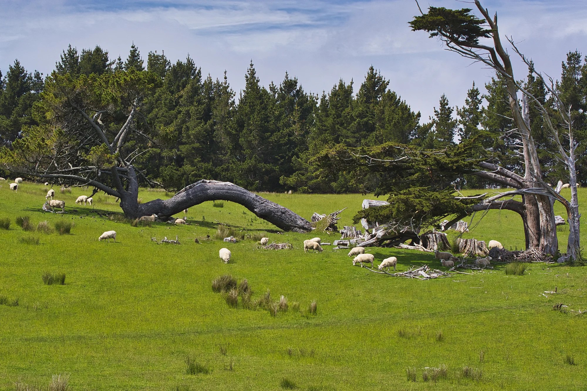
Do you want to see hidden gems? Do you want to enjoy a more relaxed trip with less hassles about finding accommodation? The Catlins Region of NZ is all about turquoise coastlines, rolling green hills and grazing white sheep. This is Quintessential NZ.
The Catlins Region post is part two of an off-the-beaten-track travel route. More hidden gems can be found in part one — Dunedin and Oamaru: Discover NZ’s Best Kept Secrets.
Author & Photographer: George Mitchell
Our recommendations are not influenced by affiliate links – we have none. Our itineraries, photos, and advice are based on travelling six months in New Zealand. We are avid hikers, nature lovers and photographers. NZ is one of our favourite destinations.
All points of interest are shown on our NZ SI Otago-Catlins Map. Their names on this map and in this post are appended with their Google Maps Ratings from G0 to G5. Acronyms can be found in the Abbreviation section.
Nugget Point Route
We drove south on Highway 1 to Balclutha. Since there are no major cities in the Catlins, buy food here if you are self-catering. At Balclutha, we turned south onto the inland Owaka Highway. However, we left the main highway to visit some coastal birding areas.
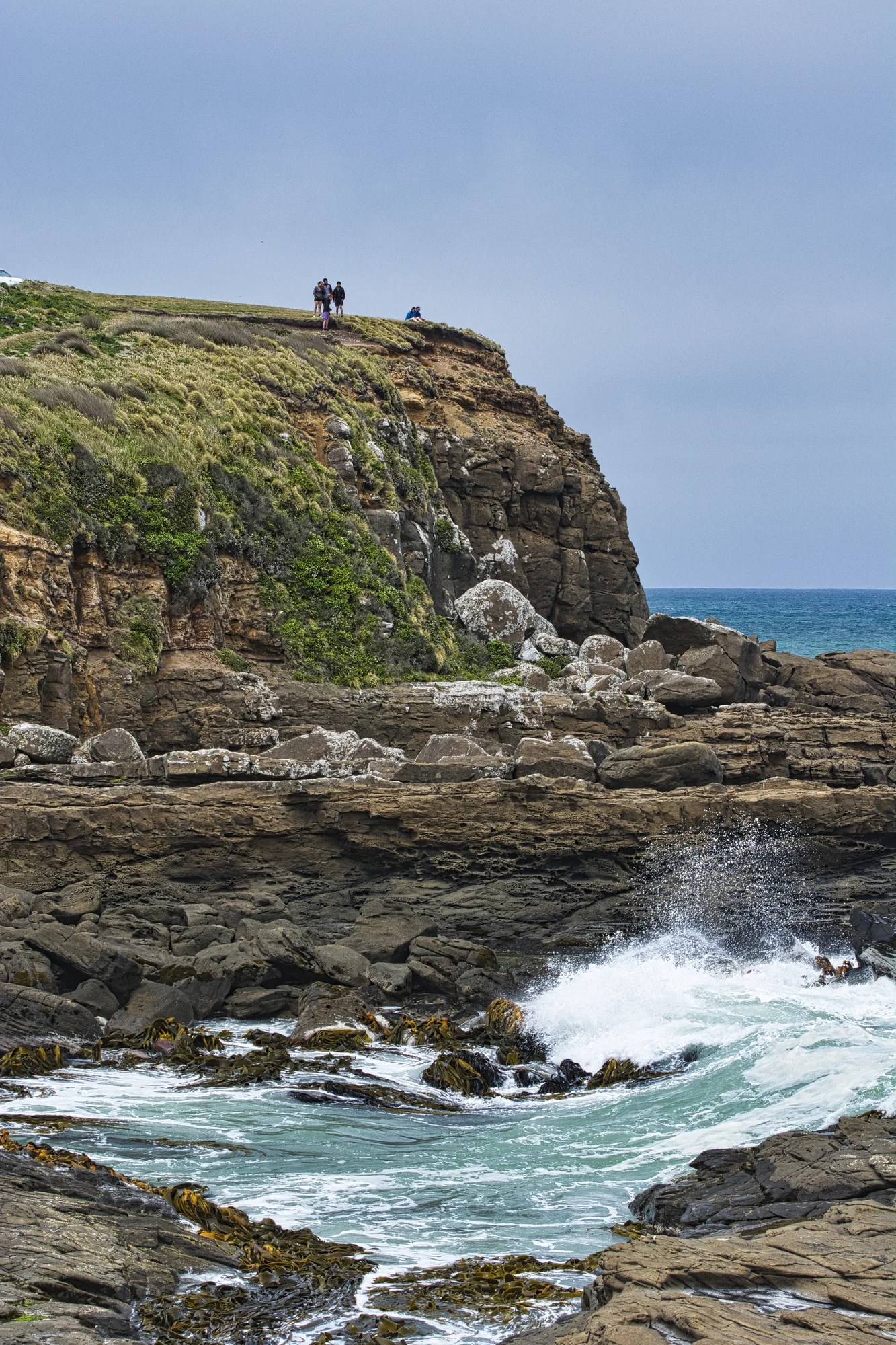
Kākā Point
Kākā Point Lookout (G4.5) is named for the kākā bird, whose signature call is “ka-aa”.
Kākā Point is also home to penguins, seals and sea lions. Only 231 people live here.
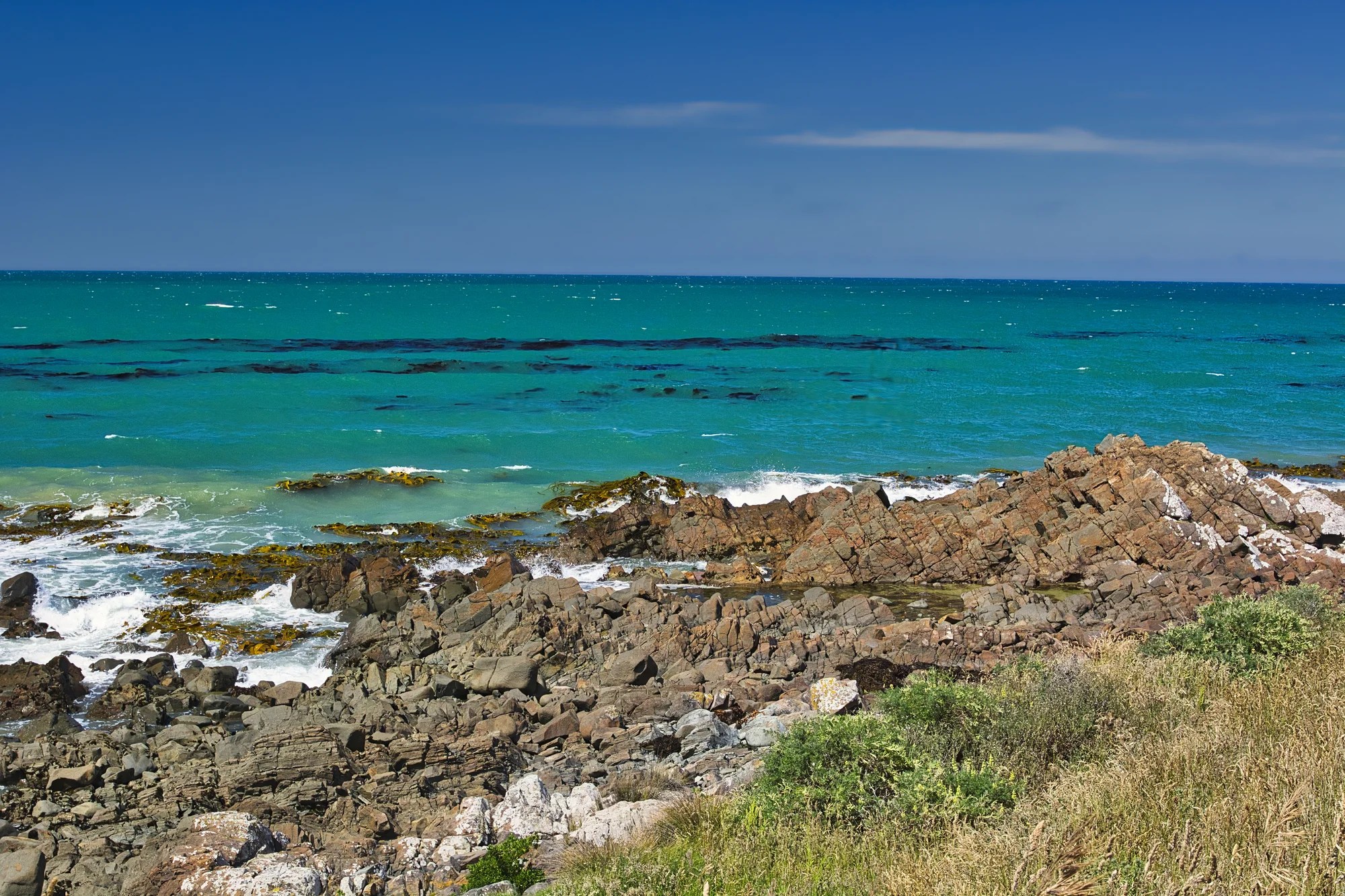
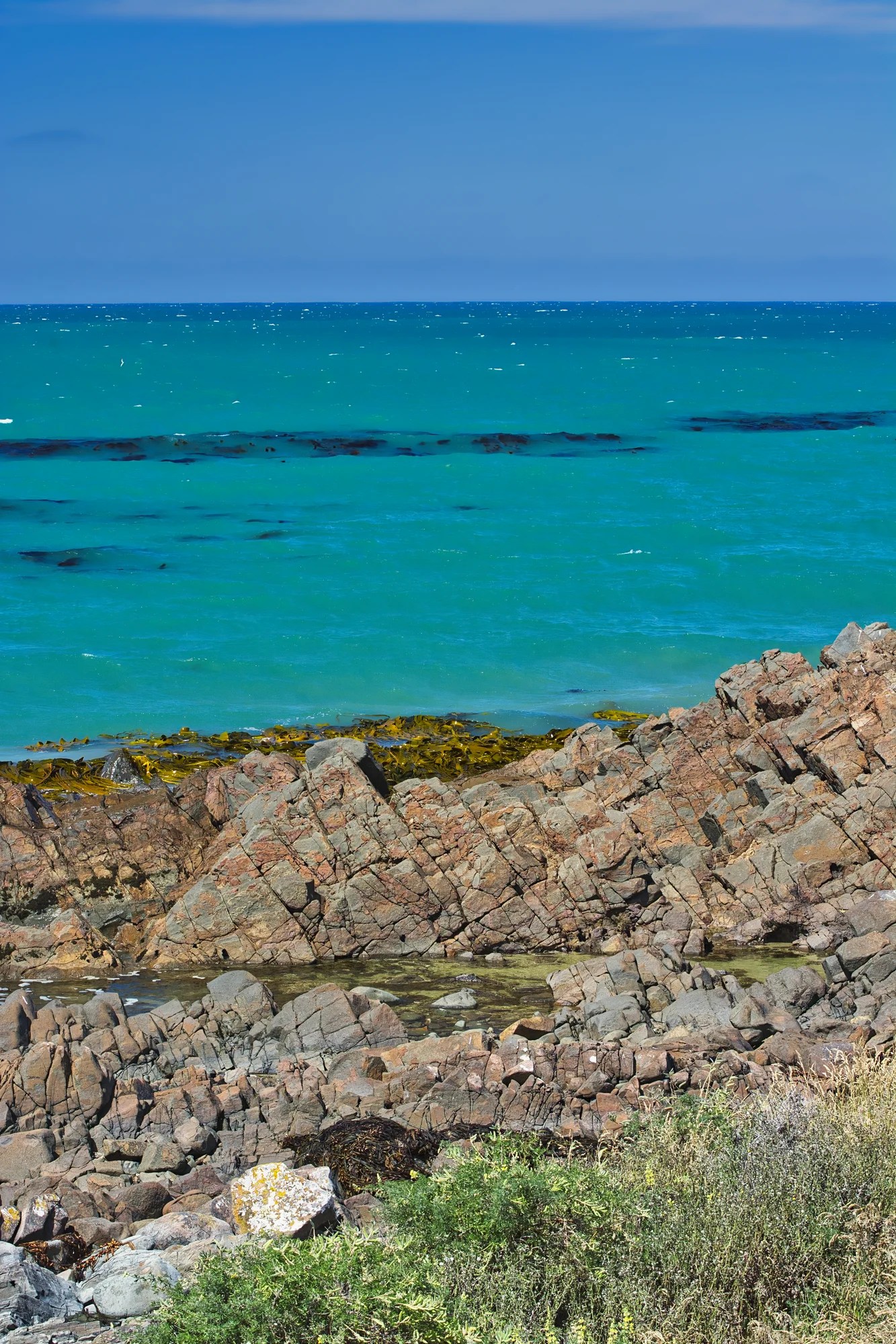
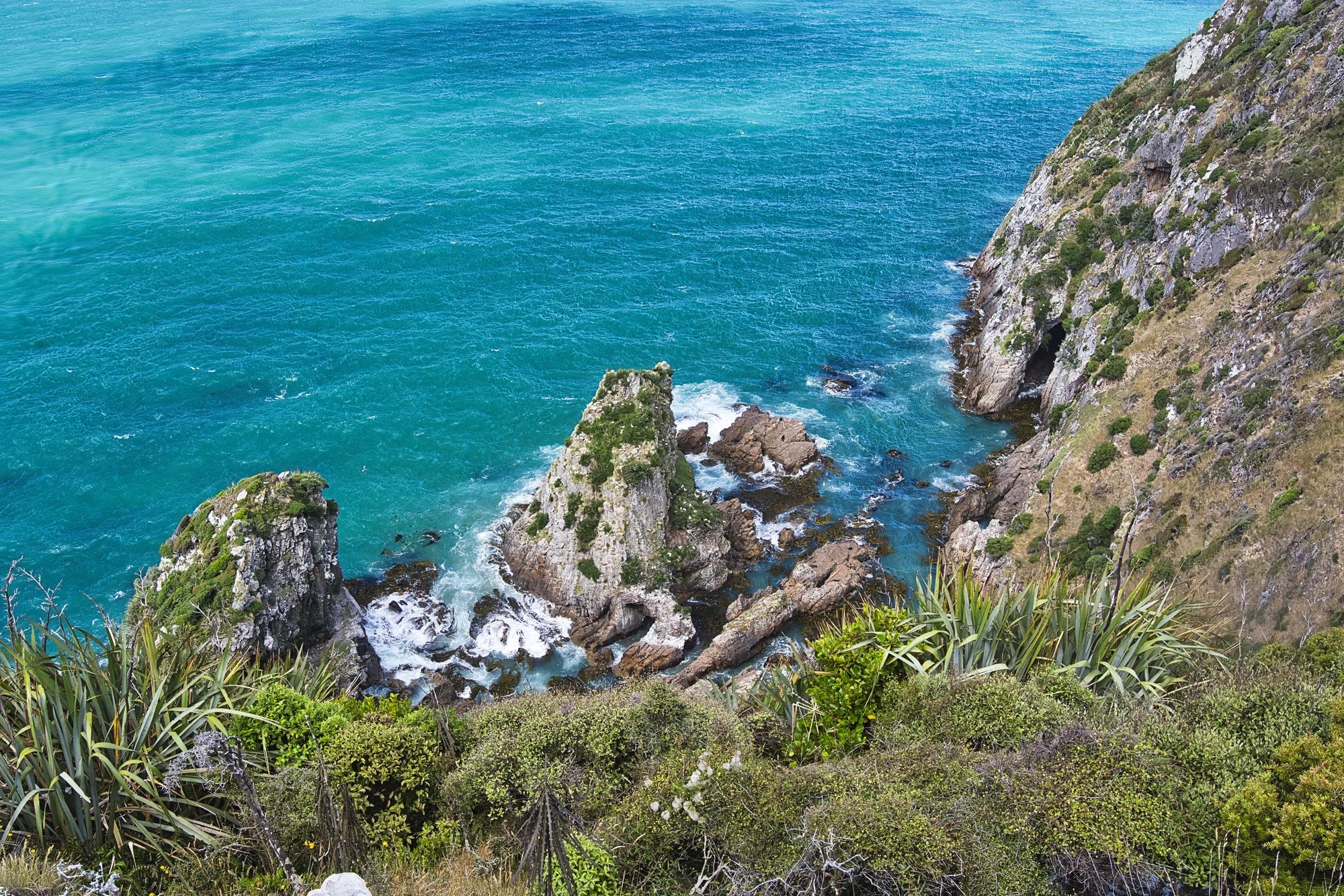
Besides birds, there were stunning coastal views. There was a contrast of black rocks, golden beaches and turquoise seas.
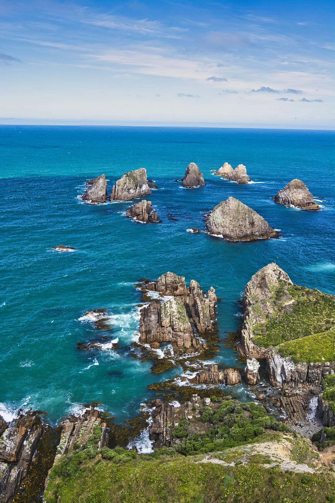
Along the Nuggets Road are viewpoints (G5.0) of the photogenic Nugget Peninsula.
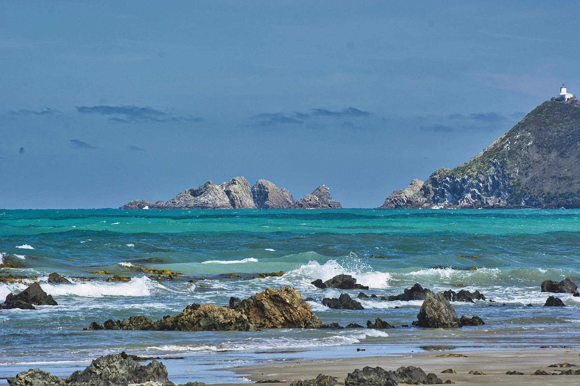
Nugget Point
Dunedin – Nugget Point 112 km 1:33 hrs.
Walk: 1.8 km RT
Time: 20 minutes RT
The Nugget Point Track (G4.8) is an easy, delightful, cliff-side walk.
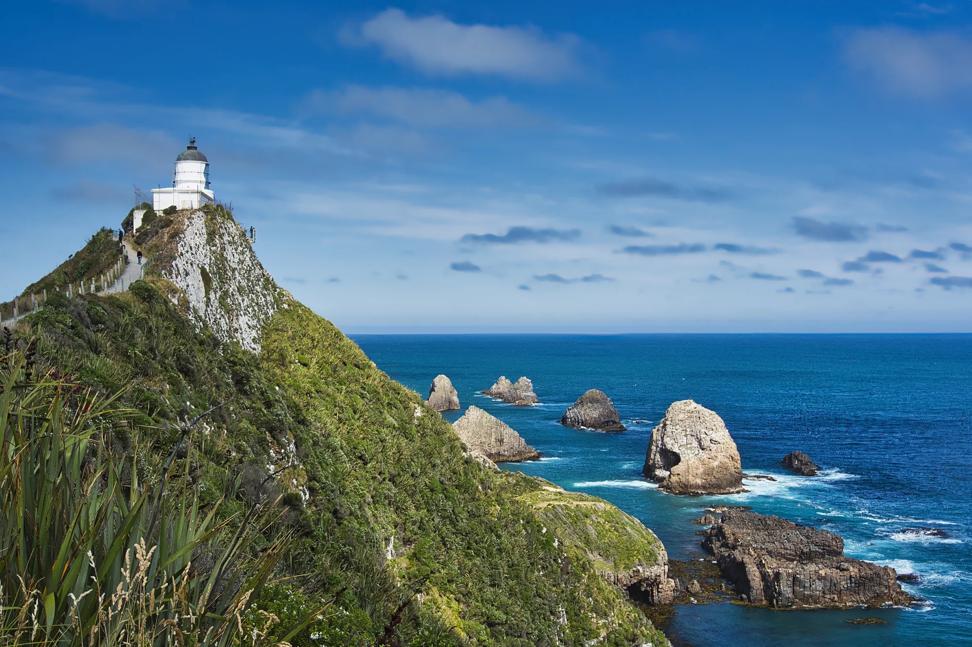
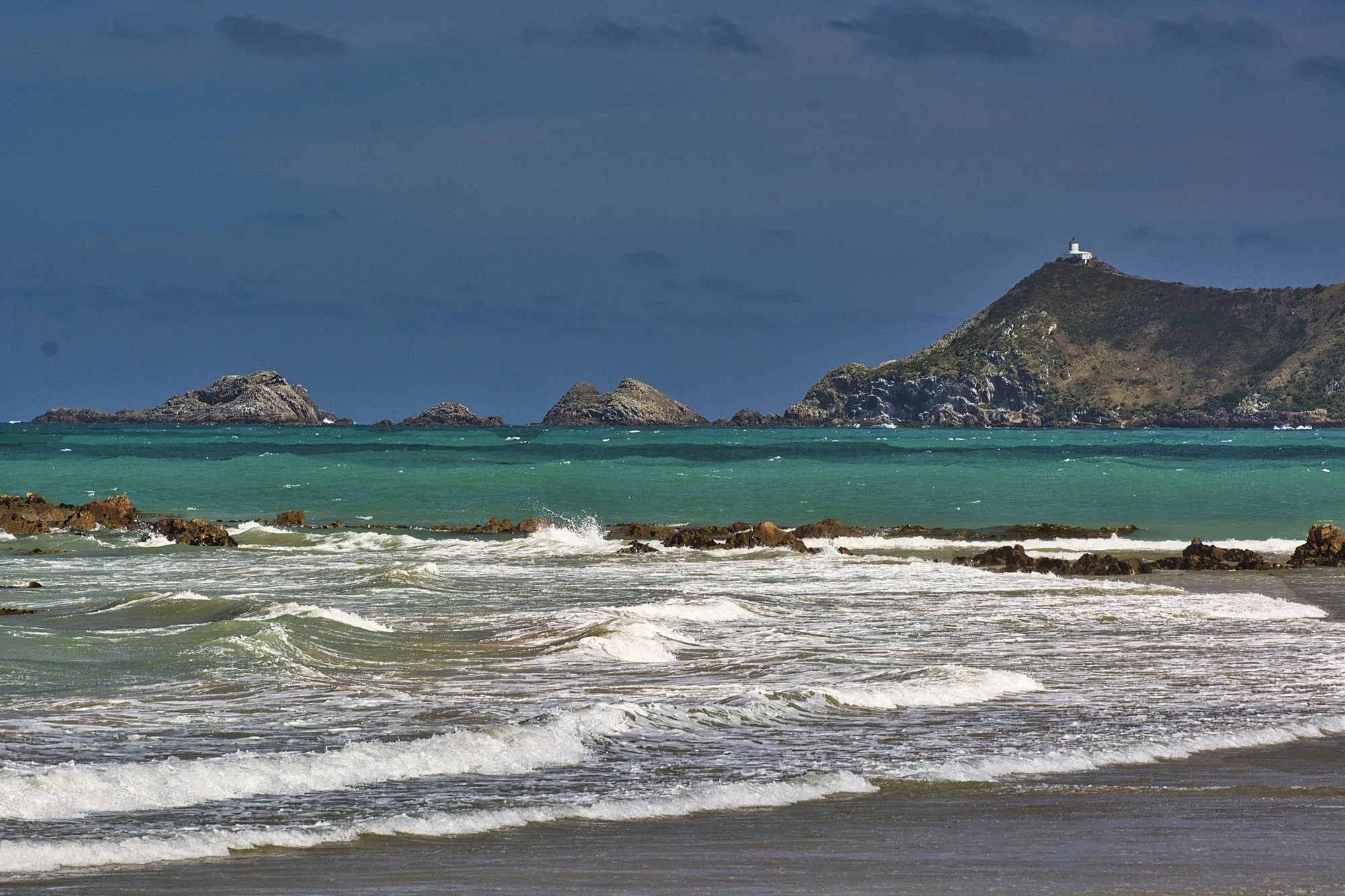
It leads to a viewing platform next to the 76 m (249 ft) tall Nugget Point Lighthouse (G4.8) built in 1869.

Below you see the famous rocks named the Nuggets by Captain Cook because they look like pieces of gold.
The other attraction is the trail to Roaring Bay. This is home to the hoiho – the rare yellow-eyed penguin. You can also see sooty shearwaters, spoonbills, gannets, seals, sea lions and elephant seals.
Catlins
Is it worth visiting the Catlins? It’s not as spectacular as the Southern Alps. But Catlins is one of the best places to experience Quintessential New Zealand. This off-the-beaten-track area is full of rolling hills, green meadows, and white sheep.

There are no big cities with supermarkets in the Catlins. If you are self-catering then get supplies in advance. Try New World or Four Square supermarkets in Balclutha, New World at Invercargill, or Four Square in Bluff.
One excellent reason to go grocery shopping is to find and taste products unique to NZ. One product we tried was pumpkin and kūmara spread with cashews and cumin. It was delicious! Kūmara or yam is a sweet potato brought by the Polynesian ancestors of the Māori who migrated to New Zealand.
New Haven Camping
Nugget Point – Owaka 27 km 0:31 hrs.
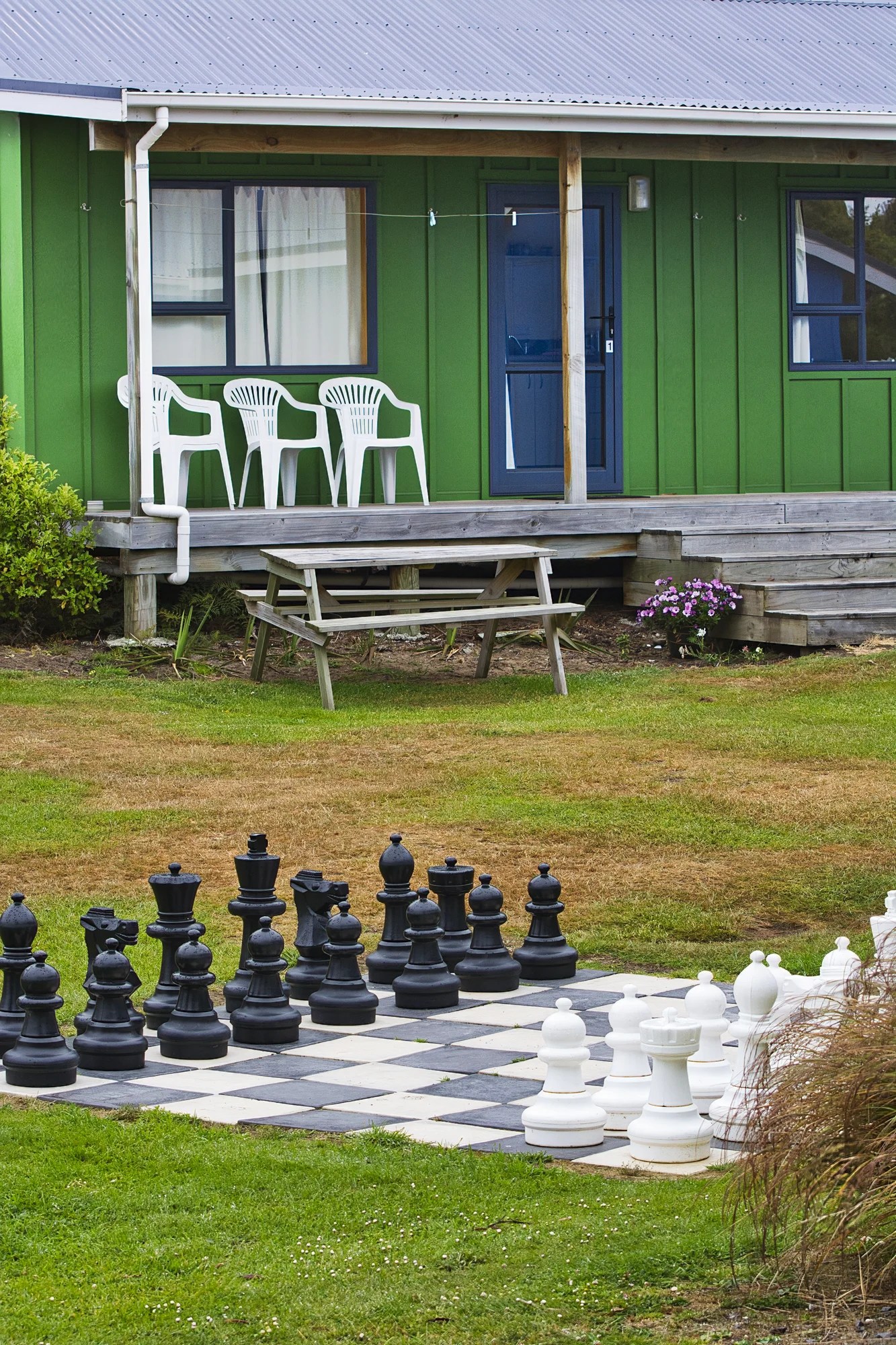
We stayed in a fully equipped cabin at New Haven Holiday Park (G4.5). If you are on a budget, tent sites or cabins are the way to travel. Most Kiwi campgrounds have fully equipped cabins. It was a very relaxing place with activities from beach walking to birdwatching.
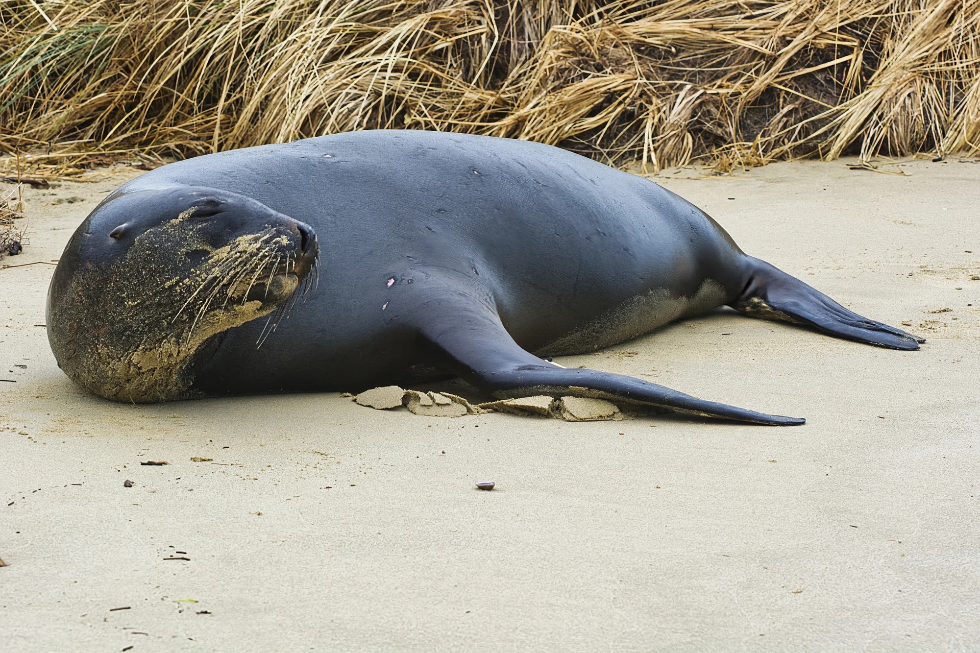
Unfortunately, the beach was being patrolled by a giant bull sea lion. He looked peaceful at first until I stepped onto the sand.
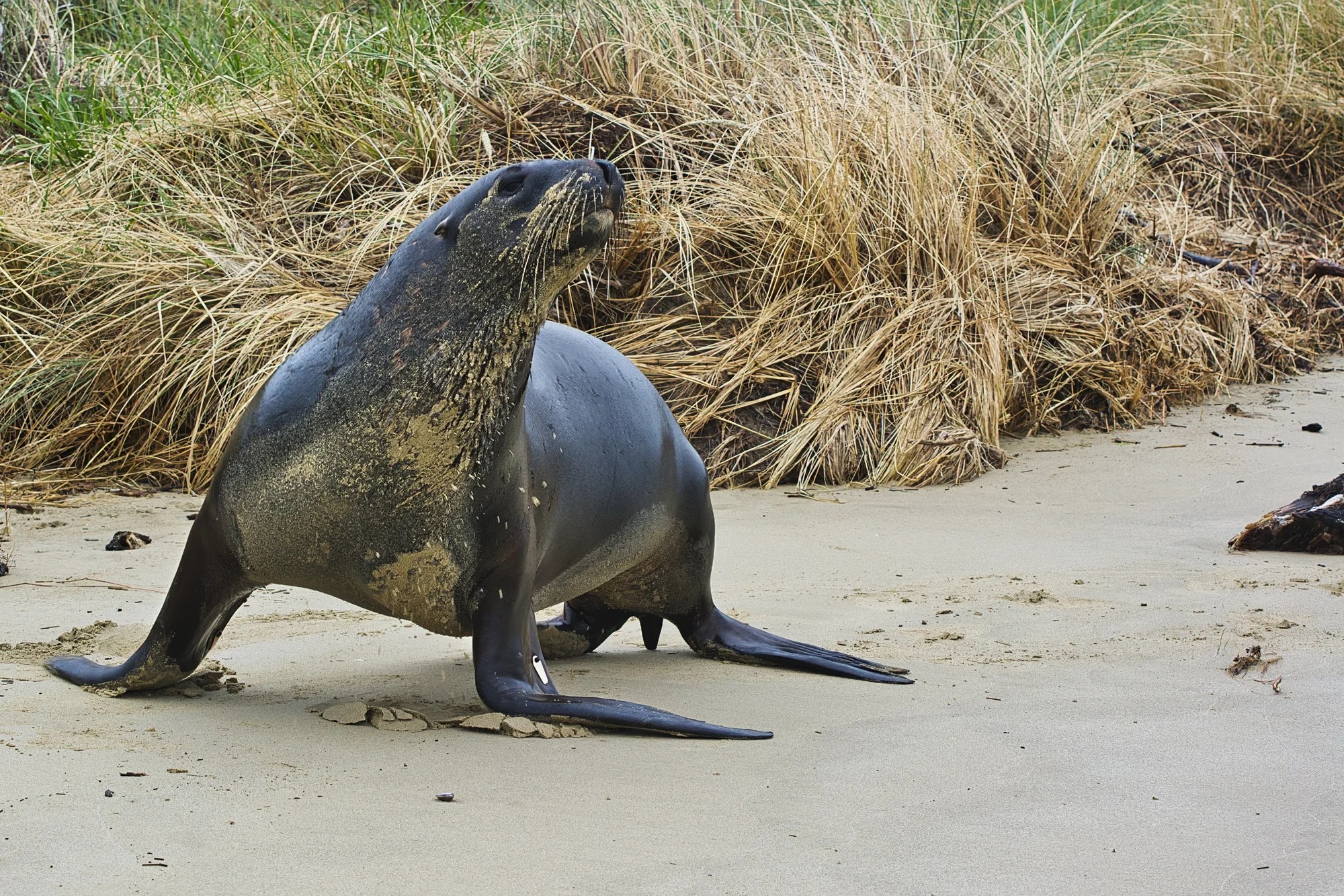
He actually charged me. You would not believe how fast they can move on land on his flippers. I was chased off the beach into the forest. So no swimming today!
Birding
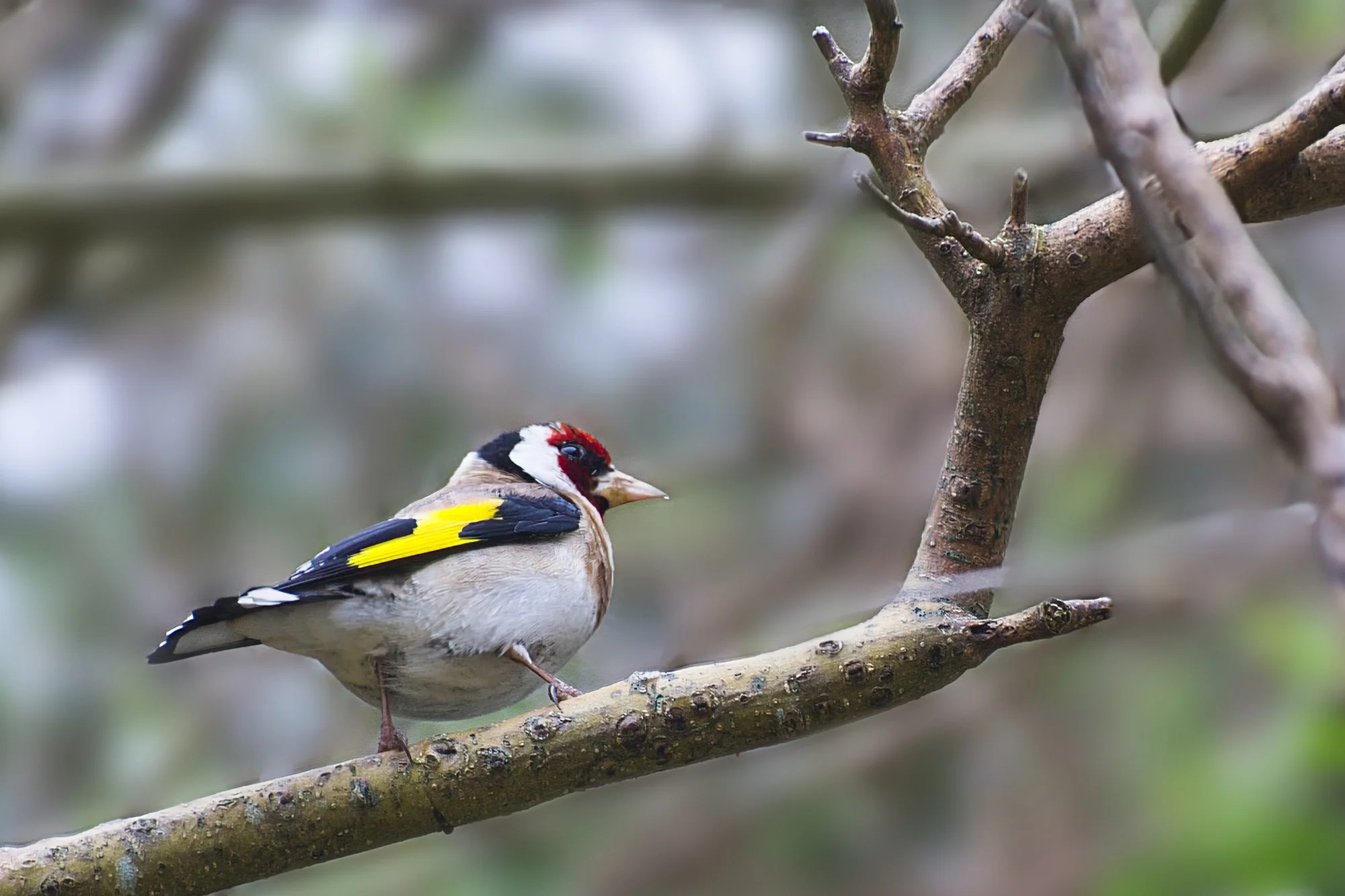
I love the colourful yellow and red European Goldfinch. But how did this Eurasian species get here? About 500 goldfinches were released between 1862 and 1883. Our ancestors had no understanding of ecology.
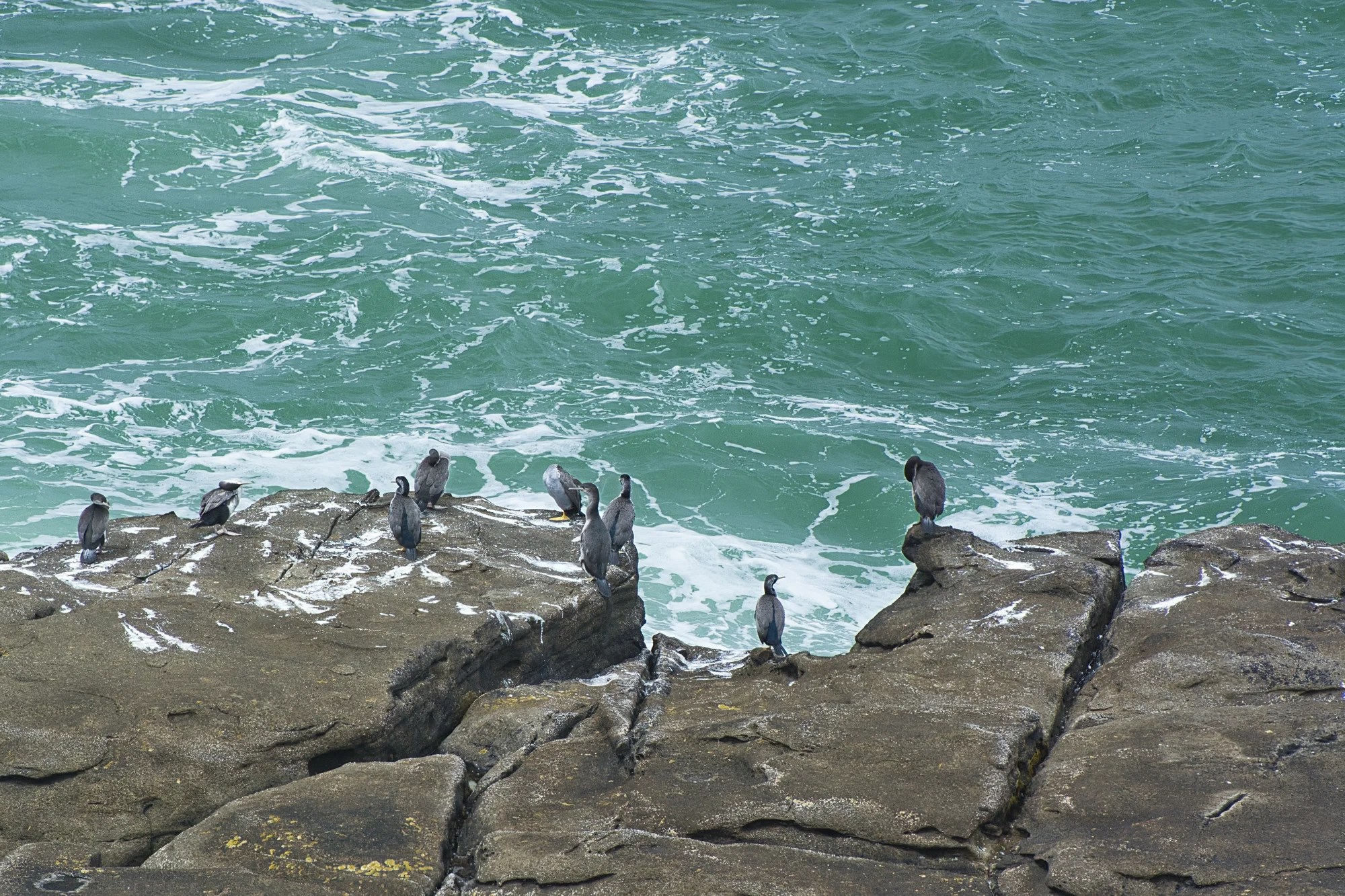
Generally, NZ birds are not as flashy as in Australia. But NZ has many endemics and flightless birds that serious birders like our son search for. Daniele spotted 145 species on his three-week North and South Island holiday. He saw 55 species in the eBird Southland region, which includes Fiordland and Stewart Island.
Owaka
We walked along the Main Road of the town, also known as Owaka Highway or Southern Scenic Route. The Black Sheep Boutique (G4.7) had some amusing signs.
Men are like chocolates. Avoid the nutty ones and
also the ones somebody else tried to put back.

Cinderella is proof that a new pair of shoes
can change your life.
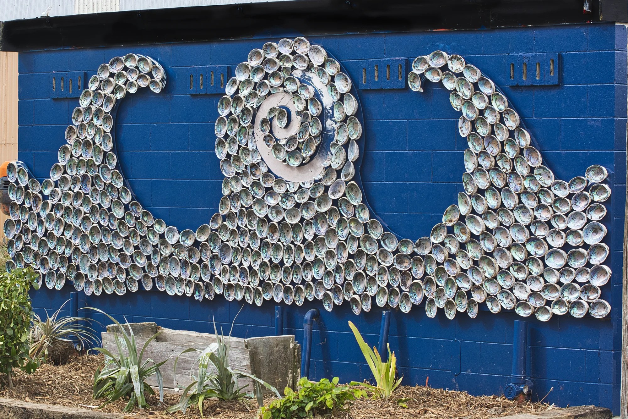
The NZ paua (abalone) shell has an iridescent blue and green nacre (mother of pearl). In Māori culture, paua are associated with the stars or whetū. They are considered the symbolic eyes of ancestors that gaze down from the night sky.
BTW, Paua fritters are a delicious delicacy. These abalone shells decorate the side of the Owaka public toilet! As a result, the toilet has a Google rating of G4.7!
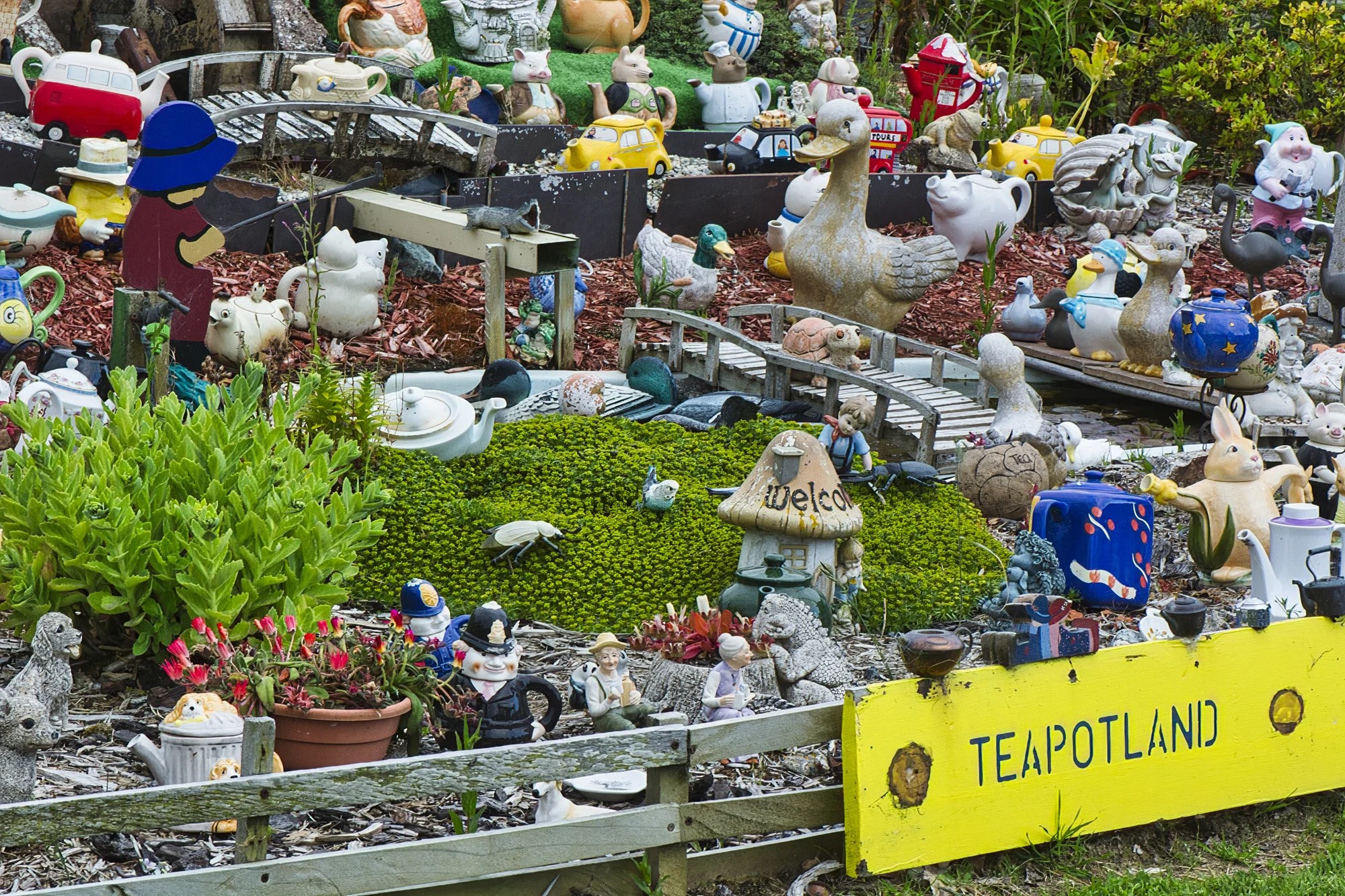
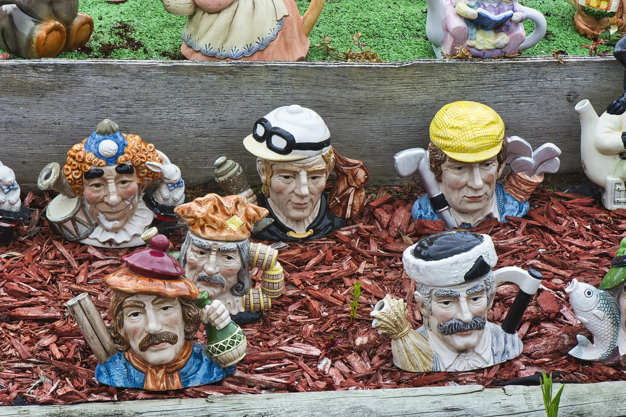
Teapot Land (G3.9) is full of … teapots of the most amazing shapes.
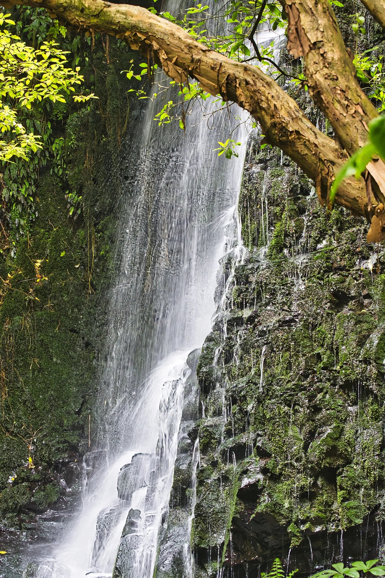
Purakaunui Falls
Owaka – Purakaunui 17 km (11 mi)
Walk: 20 mins.
I don’t usually associate waterfalls with NZ. But, there are several beautiful waterfalls worth visiting in the Catlins. This is a great activity even if it’s rainy or cloudy.
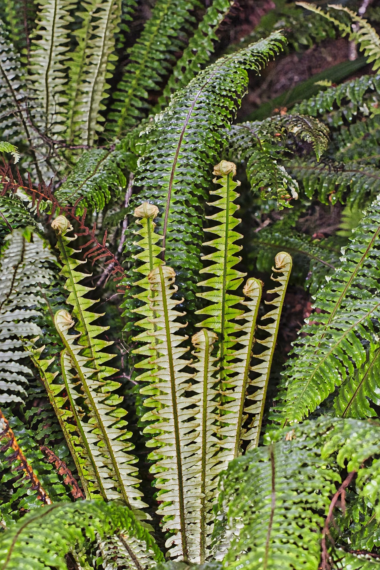
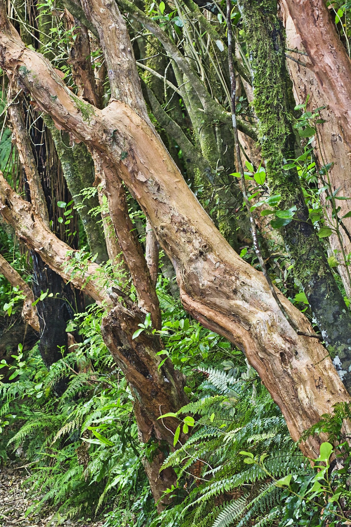
We hiked the flat 0.6 km Purakaunui Falls Track (G4.7). The trail goes through beech and podocarp forest. There was interesting vegetation along the trail to the falls. According to the PictureThis app, these are Sword Ferns.
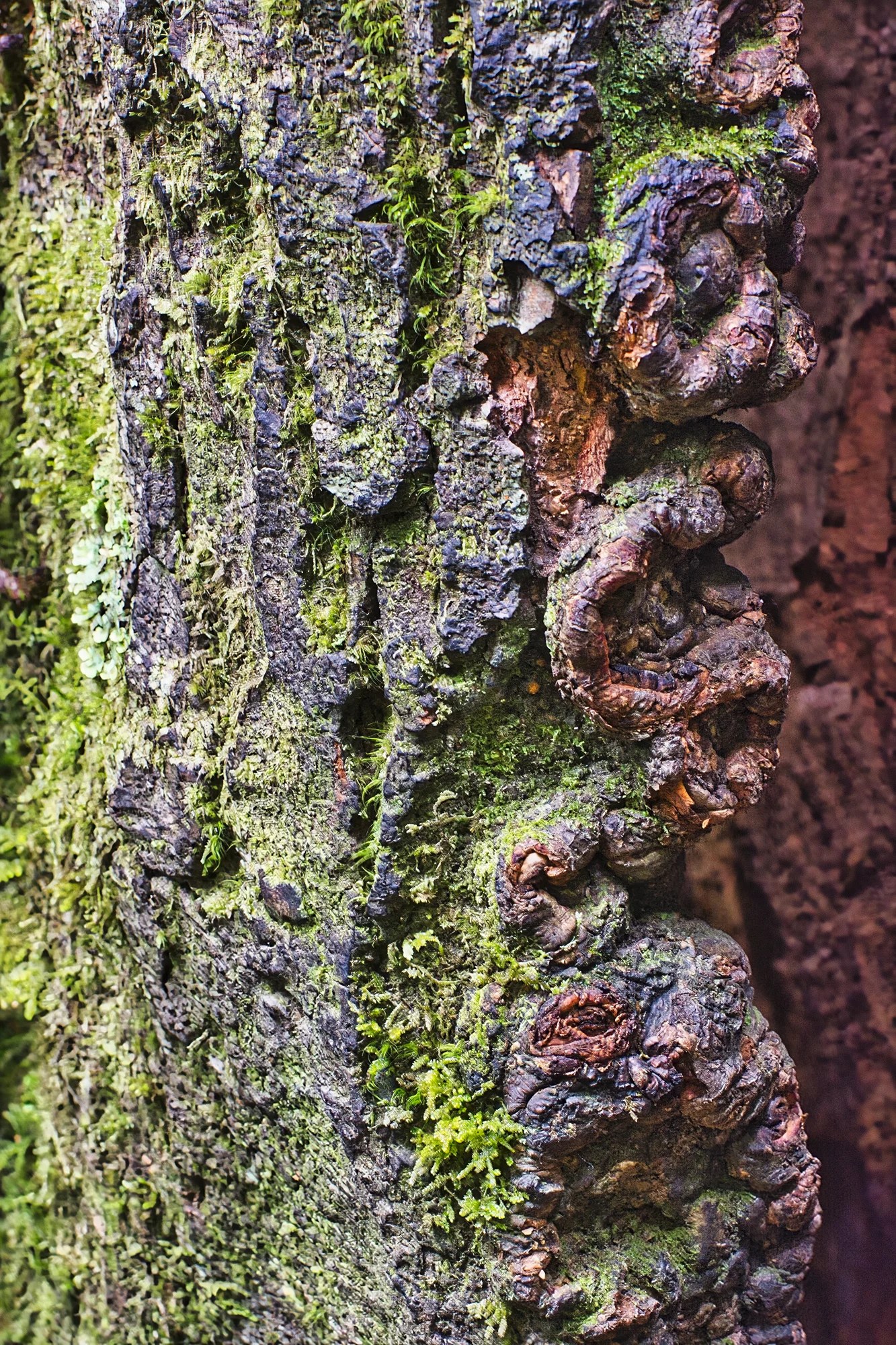
I loved this green and red gnarled tree. Does anyone know what it is? The PictureThis app did not recognize it.
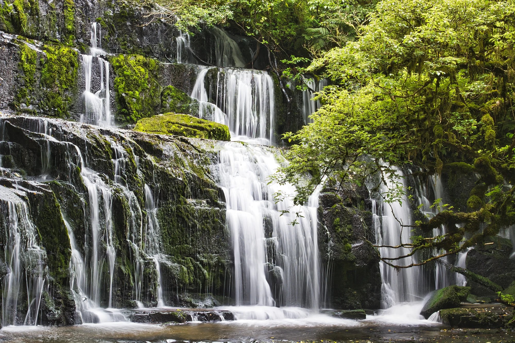
The trail to the top viewing platform is suitable for wheelchair users. From there the track descends to the bottom.
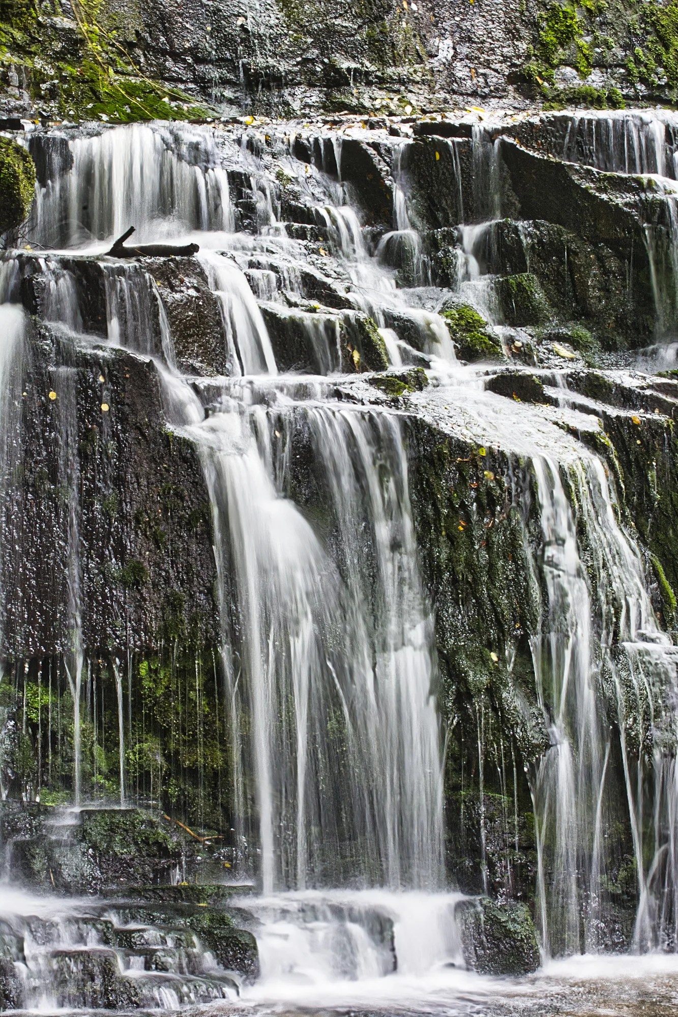
Purakaunui is a very photogenic, three-tiered, cascade falls.
Matai Falls
Owaka – Matai 18 km (11 mi)
Walk: 1.2 km RT easy
Time: 30 mins.
I liked the way the tōtara created a frame for the Matai Falls (G4.6). The tōtara is the most sacred tree within Māori tradition. Tōtara grows throughout the country. Tōtara was used to create taua (Māori war canoes).
Thin-barked tōtara (Podocarpus laetus) is a 20 m tall conifer that is very resistant to rot. Due to its durability, tōtara wood was often used for fence posts and floor pilings. It is also the primary wood used in Māori carving.
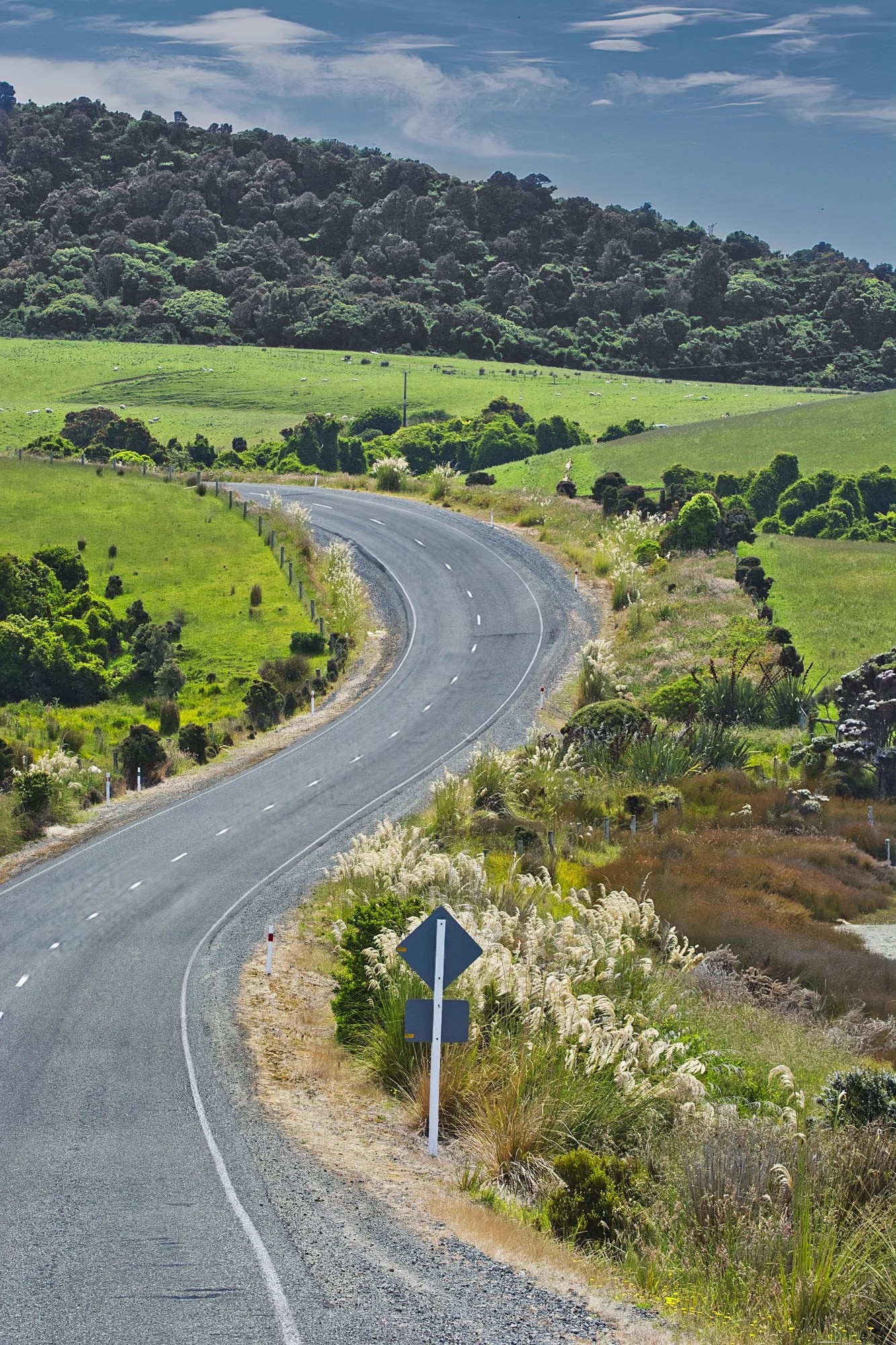
Florence Hill Viewpoint
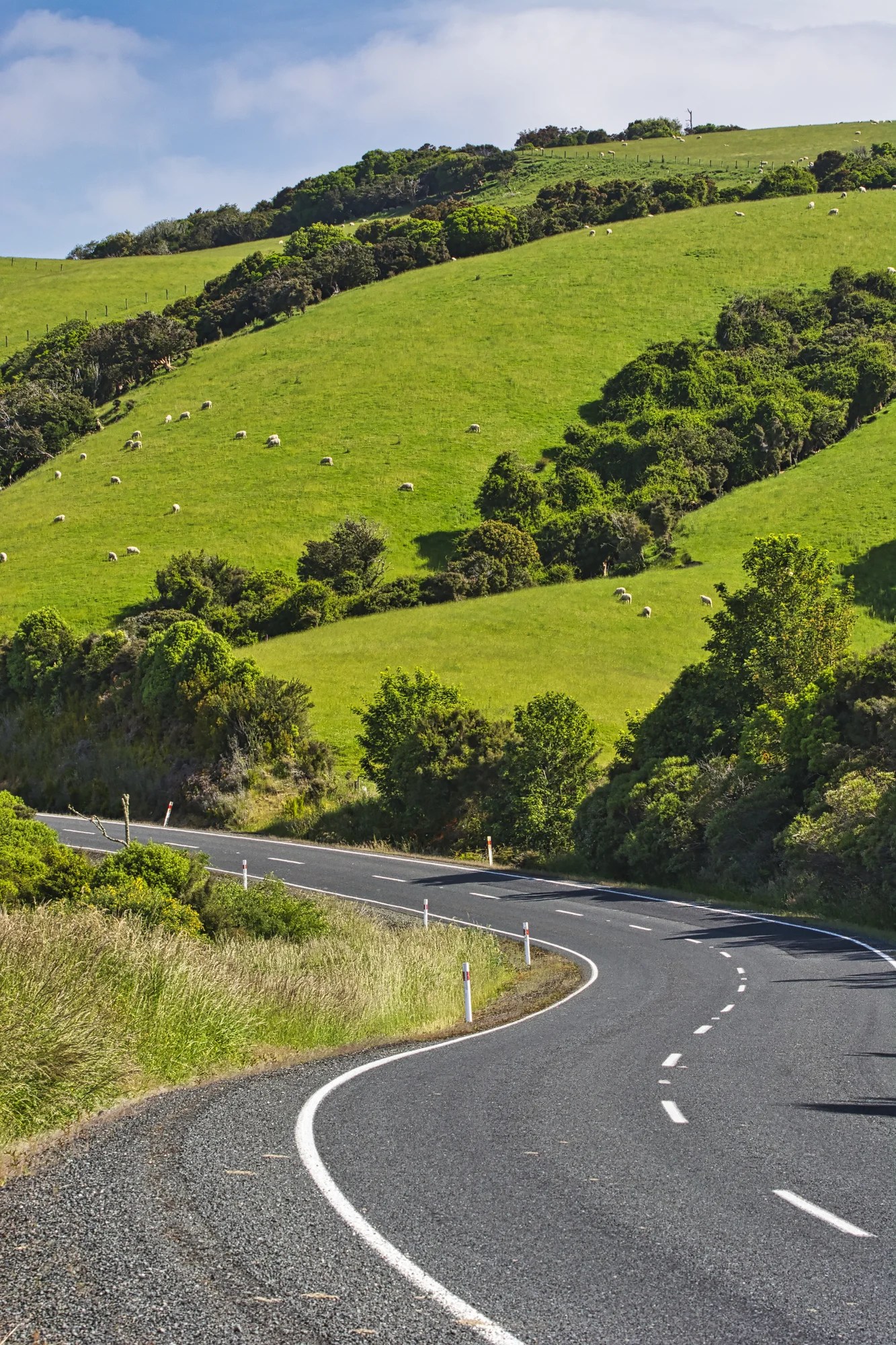
We drove through some switchbacks up to the top of a hill. The view of an S-curved highway with green rolling hills and white sheep is Quintessential NZ.
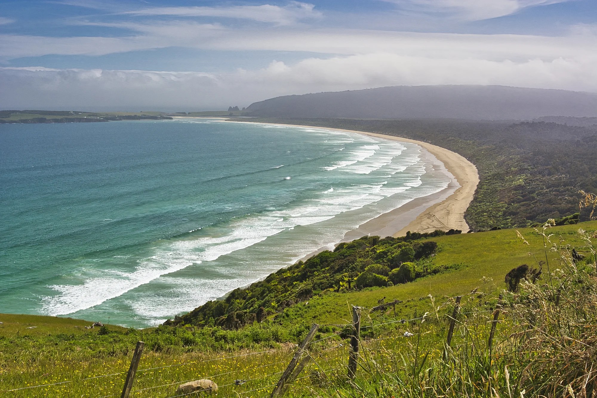
The Florence Hill Viewpoint (G4.7) high up on a hill was spectacular despite the weather. I edited the photos to make them brighter than when we were actually there. We waited quite some time for a bit more sun to come out. We spent the time talking with other tourists from China to Chile.
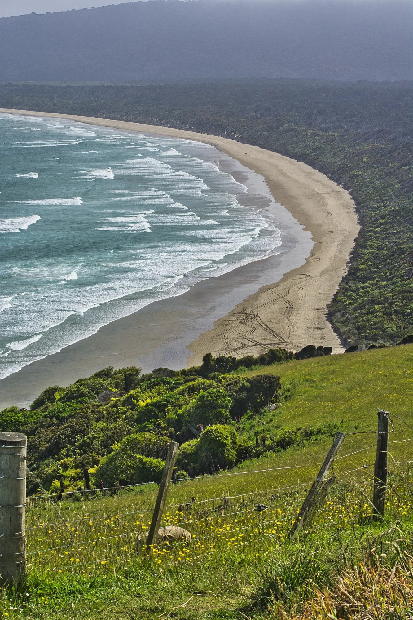
This is the best view along the Chaslands Highway. The perfectly curved Tautuku Beach is what makes this scene so appealing. The dark green trees are an old natural forest. The beach is made of ground quartz.
The flat strata is 180 million-year-old limestone. Limestone is the remains of millions of years of shells crushed and compressed into stone. NZ was part of the original, single continent of Gondwanaland. Tectonic plates split Gondwanaland into several continents during the Triassic Period about 180 million years ago. As a result, island NZ did not have the massive land dinosaurs.
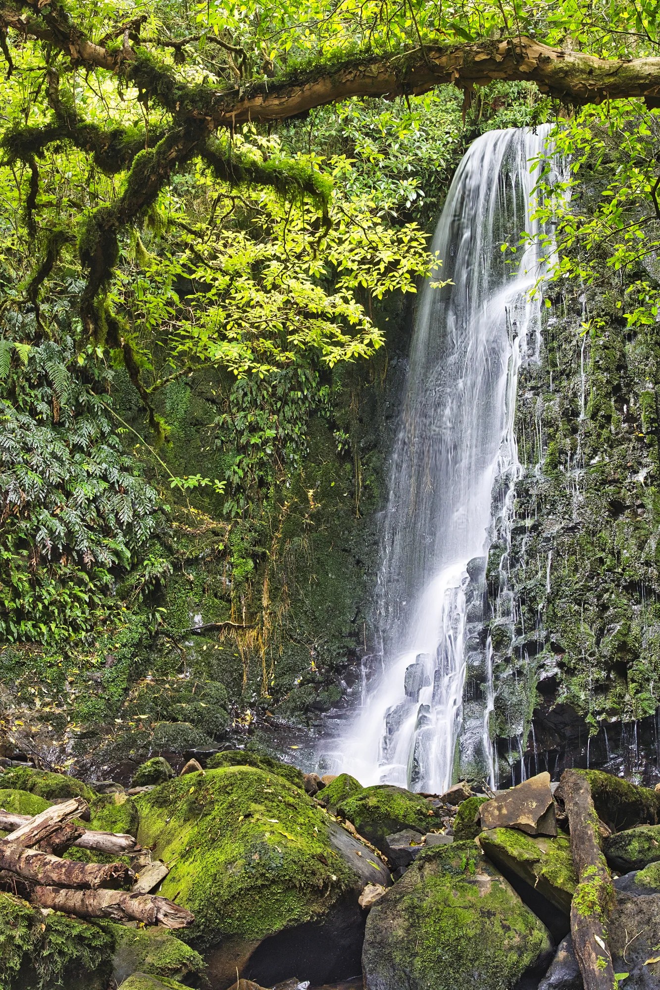
Falls and Views
Hike: 1.6 km RT
Time: 32 – 50 mins.
Turn off Chaslands Highway onto Rewcastle Road 11.6 km south of the town of Papatowai. Drive 3 km to the car park for McLean Falls.
This is another waterfall worth visiting. The spectacular 22-metre high multi-tiered cascade waterfall rushes by dark-green mossy rocks.
Further on the Chaslands Highway is what I call Broken Farm, due to the ruins of a farmhouse. The approximate location is pinned on the map east of Koropuku Falls. This is one of those quintessential NZ views.
We drove through some switchbacks down the hill. The view of an S-curved highway with green rolling meadows is classic Catlins.
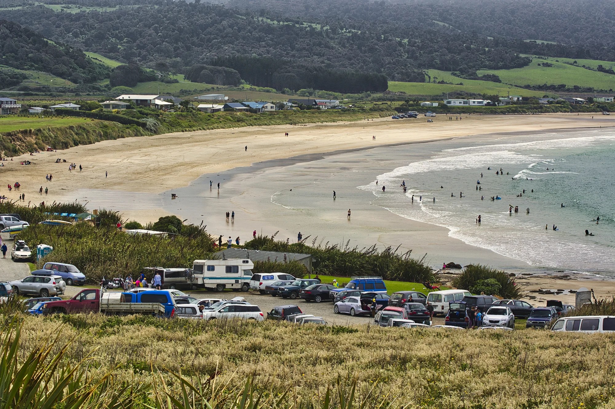
Curio Bay
Owaka – Curio Bay 70 km 1:06 hrs.
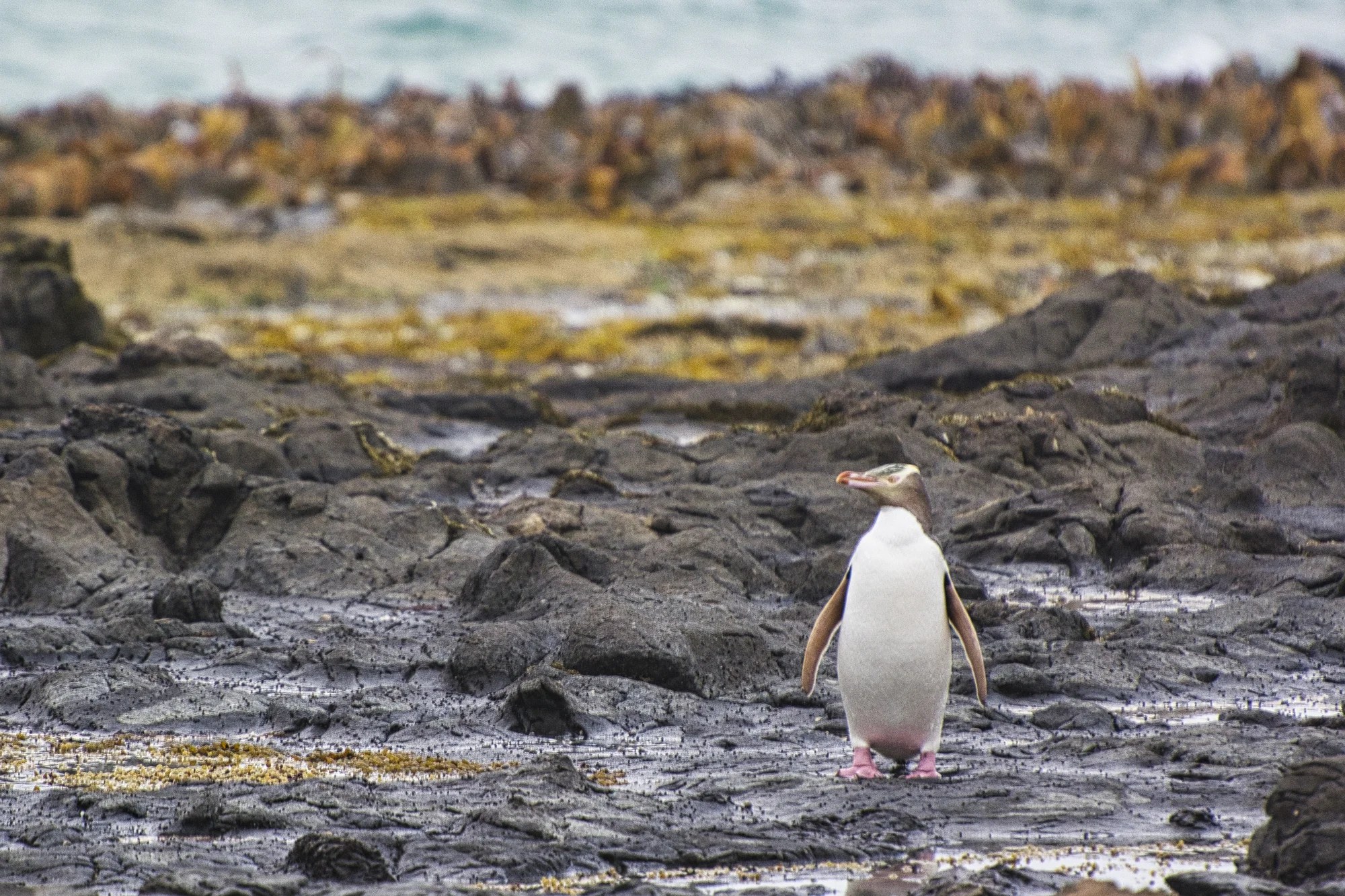
Given that our son is an avid bird watcher, our first stop was actually driving to Curio Bay (G4.6) for dusk. Here we saw the rare yellow-eyed penguins. What a treat! Every night these swimming birds sail in from the sea about one to two hours before sunset.
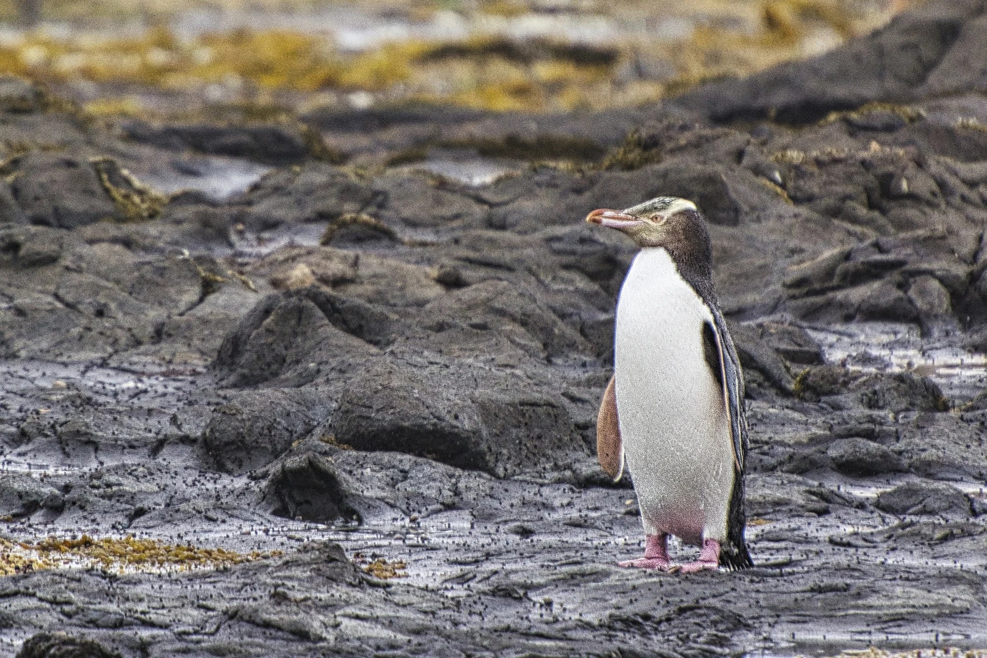
They waddle up the beach towards their nesting area. Please stay behind the barriers. Only one person went forward and the other tourists told him off.
On another day we walked along the Curio Bay Cliffs. We also visited nearby Porpoise Bay with its expansive beach and the most cars in the parking lot.
Waipapa Point Lighthouse
Curio Bay – Waipapa 27 km 0:31 hrs.
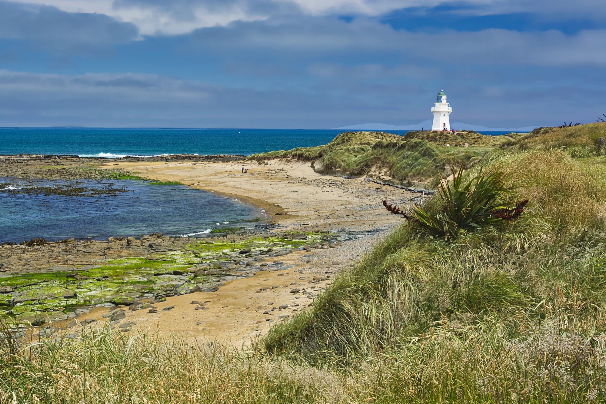
I’m not a big fan of lighthouses. However, Waipapa Point Lighthouse (G4.7) had a very attractive setting. The 13.4 m (44 ft) tower is built with double walls to withstand the brutal coastal storms.
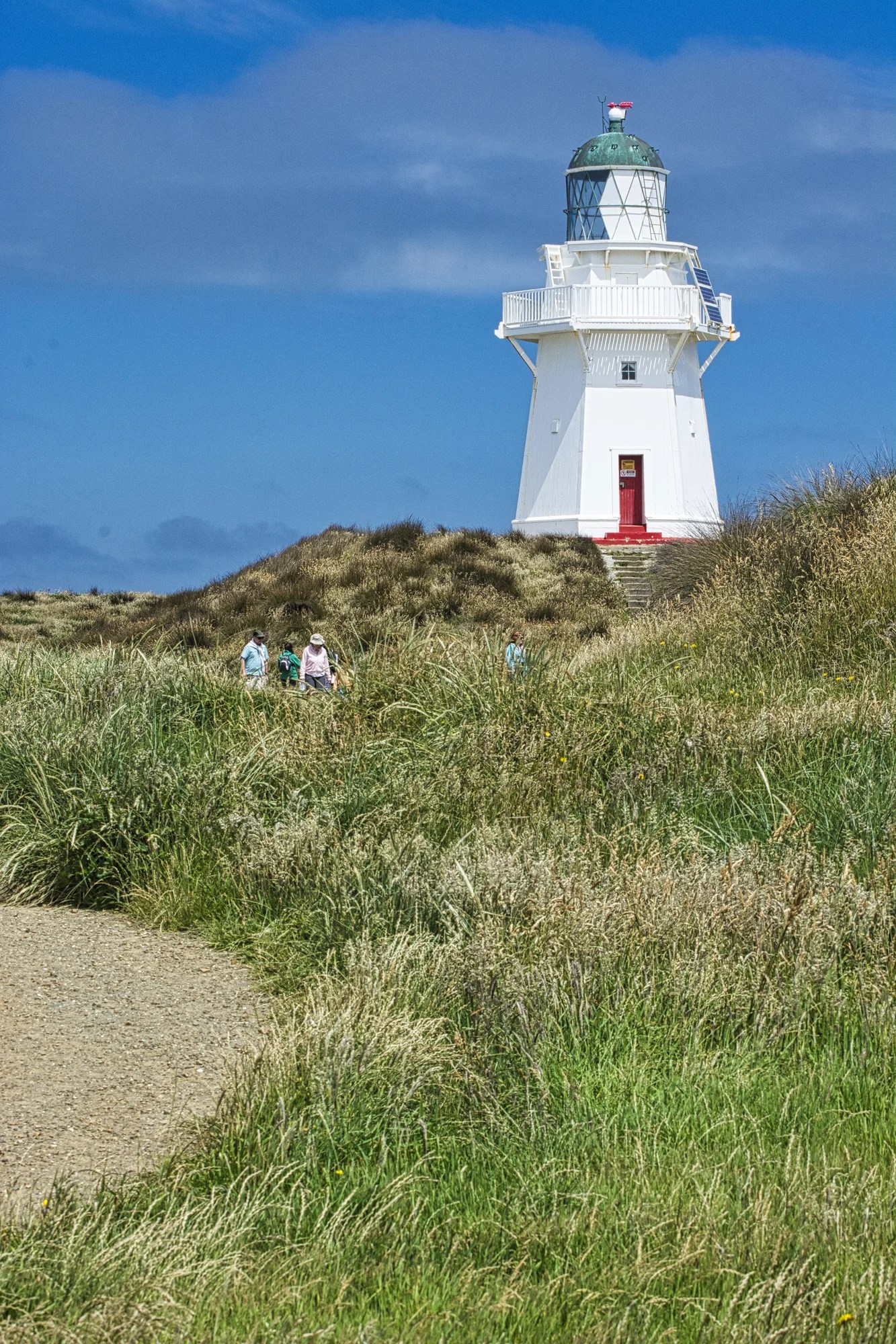
The double walls are made of kauri and tōtara planks. The wall cavity was filled with stone ballast. It may look new to you — it was restored in 2008. But it was built in 1884 for £6,000. That is worth £934,376 today (NZD 1,990,802; CAD 1,664,236; or USD 1,225,712).
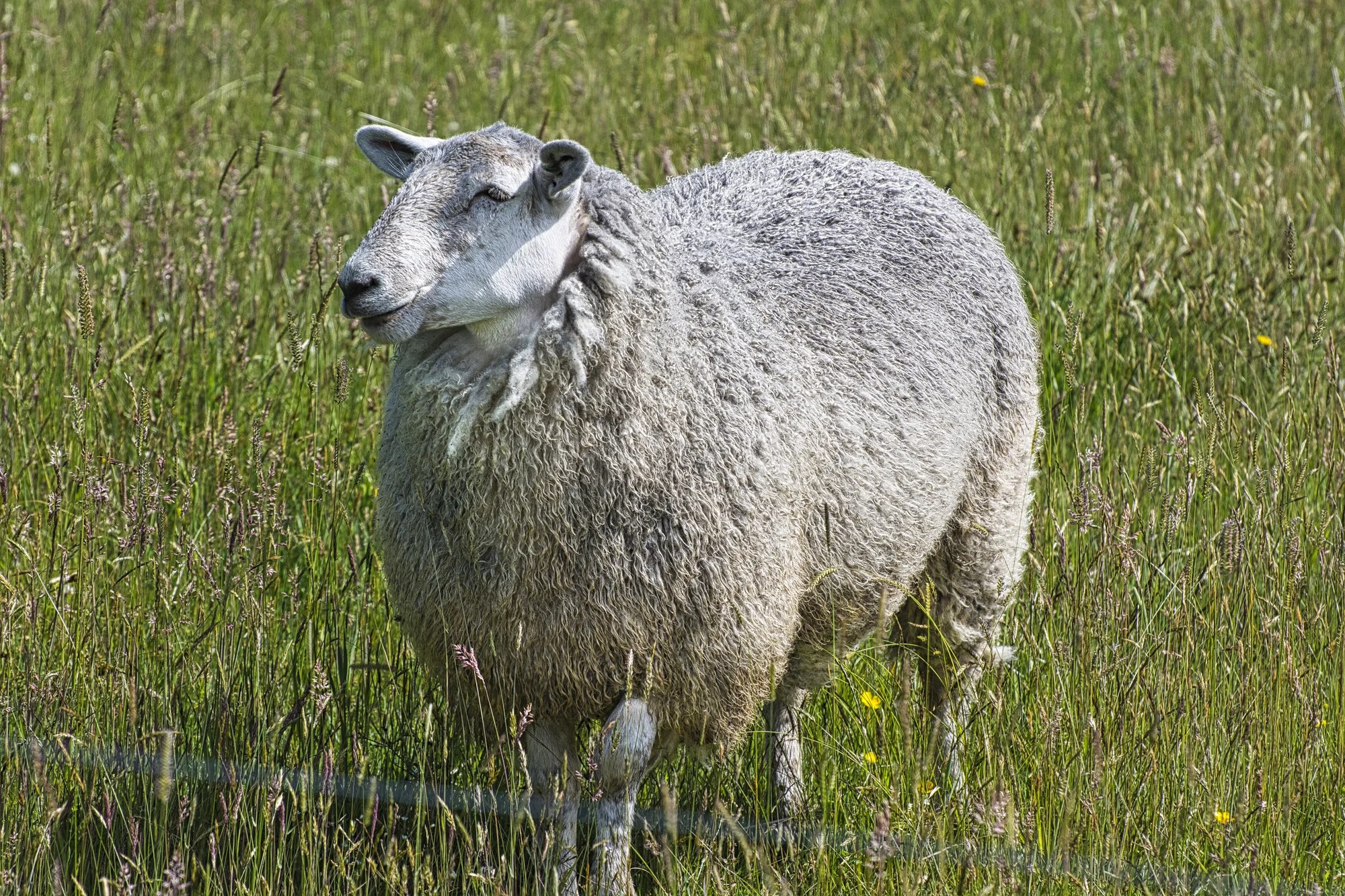
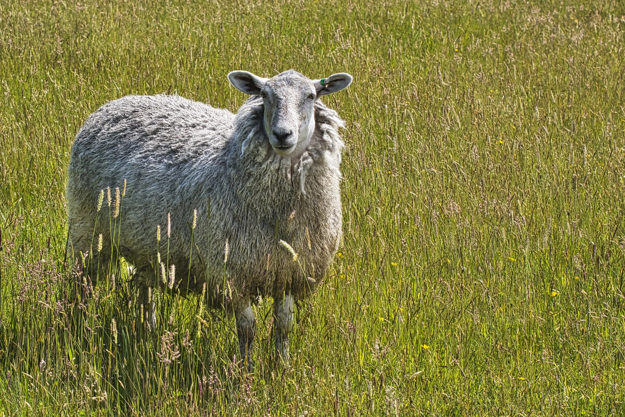
Here is the most common resident of New Zealand. They outnumber humans by 25 million to 5.3 million! There are one of the main reasons why the Catlins are quintessential NZ.
Bluff
Waipapa – Bluff 78 km 1:03 hrs.
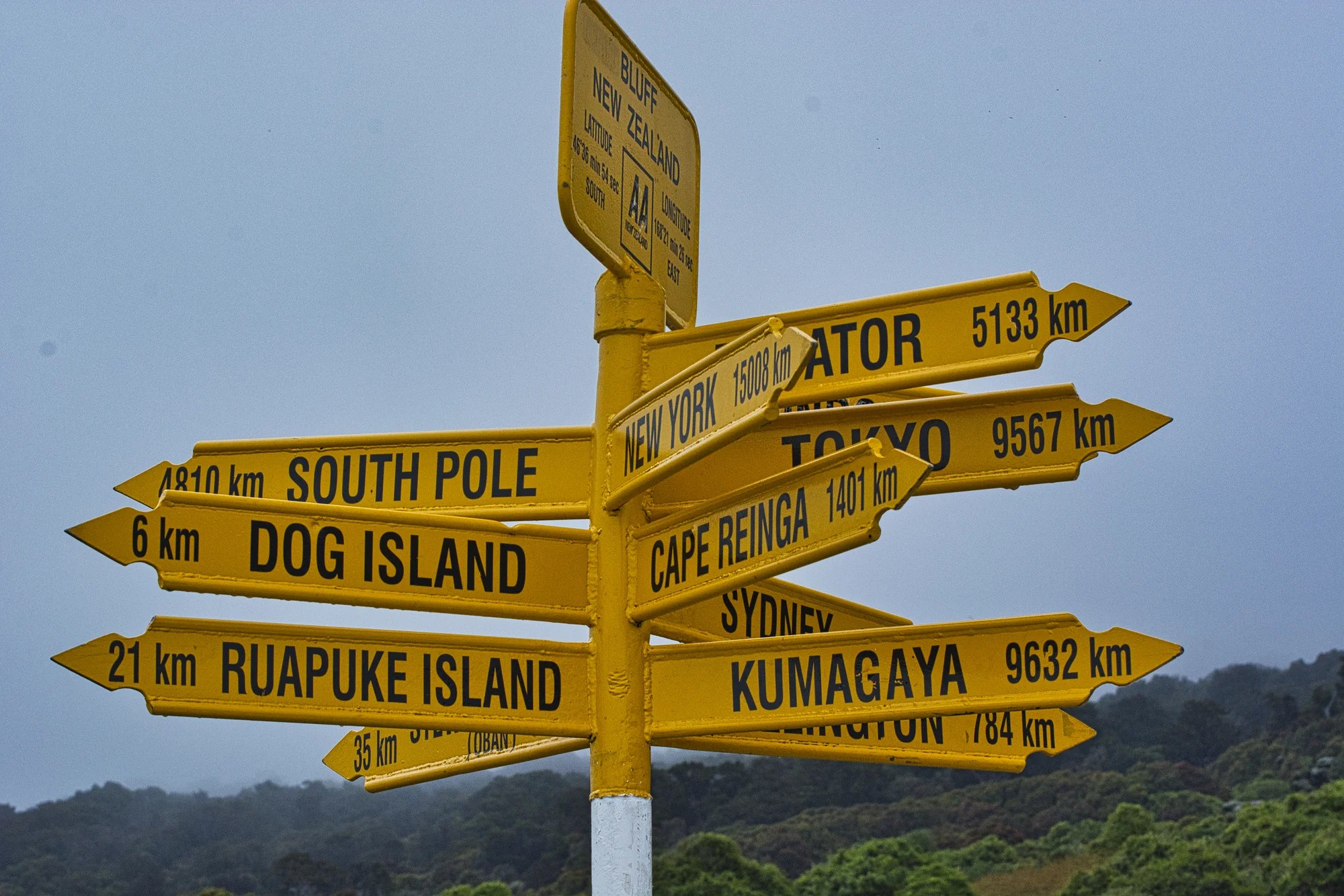
We did a coastal walk (for birding) and found this signpost. Wow, it’s only 4810 km to the South Pole!
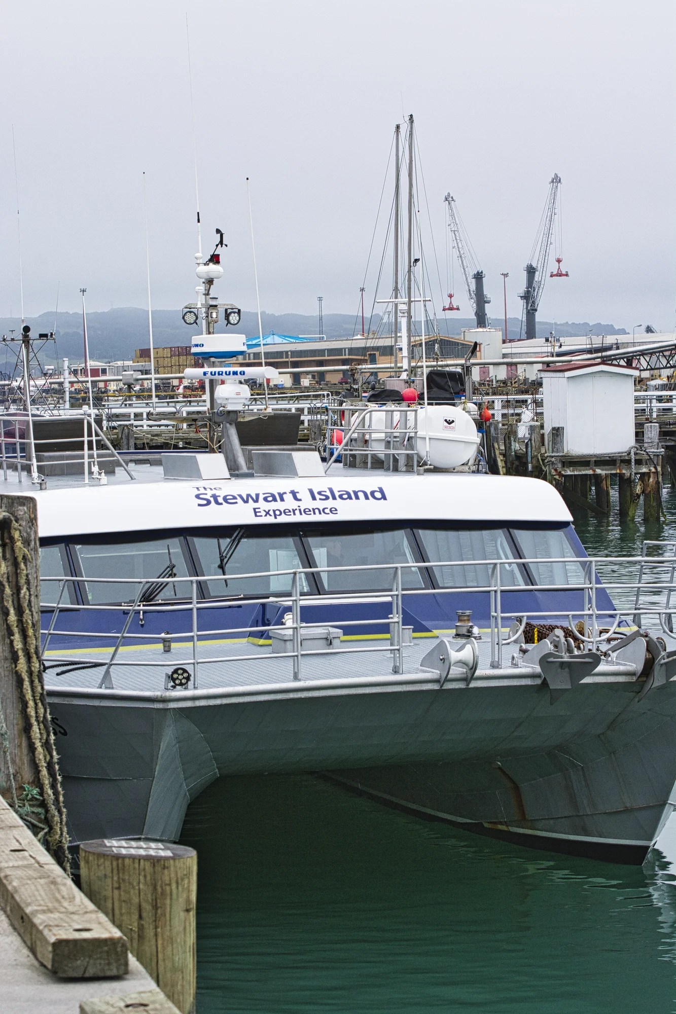
This post is in strict geographic order. In actual fact, we first dropped our son off to do a two-day birding side trip on Stewart Island. He loved it. We drove back and stayed at Owaka to further explore the Catlins.
Final Comments on this Itinerary
The Catlins region is a pleasant, relaxing place to visit far from the main tourist trail. This is the itinerary to see hidden gems. Here you can appreciate the “real” New Zealand. The places included in this route are all highly rated by the people as shown by their Google Maps Ratings.
Do you want more information? Then subscribe for free.
This was only a taste of some of the scenic wonders of the Catlins. If you have other favourites, share your experiences with us. How long is your trip? What questions do you have?
Itinerary Planning
Do you want to learn how to plan an itinerary? Use this ready-made itinerary map to plan your trip.
Our own NZ Planning Maps include all the possible Points of Interest pinned. You can copy or create your own custom maps using the Google My Maps app. Here are some pre-planned itineraries for NZ.
Google Maps Ratings
Google Maps provides a rating from 0 to 5 for all sights, hotels and restaurants (but not cities). All of our recommendations are appended with the rating (prefixed with a G) from Google Maps. Google Ratings are based on feedback from locals as well as tourists. It is much more reliable than travel booking websites or tourist anecdotes. We consider a score of 4 to 4.39 to be Very Good; 4.4 to 5 to be Excellent.
How Big is New Zealand?
NZ is a large country compared to Europe. It is the size of the UK and half the size of the province of Alberta, Canada.
Booking Accommodation
NZ has 25 million sheep but only 5 million people. South Island is even less populated with only 1 million people. So why is South Island so busy during the summer peak season? Too many tourists go to the same famous places — what I call name recognition. There are fewer people available to work in the hospitality industry for a short tourist season. So there is a lack of accommodation.
If you are going during the Christmas peak season, most Kiwis are on their summer holidays from ca. December 20th to January 20th. You need to book your places at least 5 months ahead.
The best value places were family-run B&Bs (not Airbnb’s) and fully-equipped cabins and tent sites at campgrounds. Use Agoda or Booking to find places for your price range. But verify the quality by the more reliable Google Maps Rating.
Other Places to Add to Your Itinerary
Do you want to see more of South Island? Here are some of the best places for you:
When is the Best Time to Visit Otago-Catlins?
Here are the average high temperatures and monthly rainfall at Dunedin by season. The month groupings were based on weather similarities, not calendar seasons.
Nov-Apr is the best time to go. It is a maritime climate, so it is perpetual spring rather than hot in the summer.
May-Aug is cold unless you are from a Nordic country and are used to sub-zero temperatures. Sep-Oct is cool.
| Season | Mean High Temp | Avg Rain per Month |
|---|---|---|
| Nov-Apr | 16.2°C 61.1°F | 46.3 mm 1.8″ |
| May-Aug | 9.5°C 49.1°F | 35.6 mm 1.4″ |
| Sep-Oct | 12.5°C 54.5°F | 34.2 mm 1.3″ |
Purpose of Your Trip
What is the purpose of your trip? What are your interests? This itinerary was based on the features that make New Zealand unique…
New Zealand FAQ
The FAQ post answers questions such as:
- Where should I go in NZ?
- What is the best season for travel?
- How much time do I need for NZ?
- How safe is NZ?
Abbreviations
DOC = Department of Conservation = Parks NZ
Kiwi = New Zealander, or a nocturnal flightless bird
NP = National Park
NZ= New Zealand
NZD = New Zealand Dollar
NI = North Island
SI = South Island
USD = United States Dollar

Leave a comment