
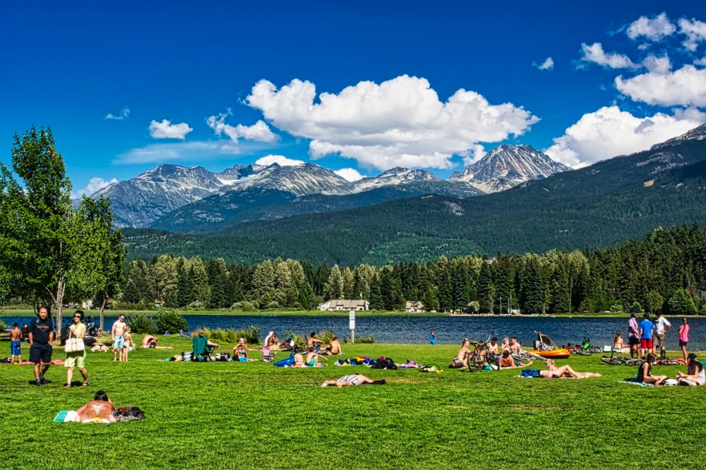
Why You Should Drive the Sea-to-Sky Highway
We have met people who have travelled to Vancouver but do not get to see the surrounding sea and mountains. The Sea-to-Sky Highway (Route 99) is one of the best side trips in this area.
Nonetheless, the goal of driving the Sea-to-Sky Highway should not be just to get to world-famous Whistler. To be a true Vancouver Voyageur (traveller), you must take the time to enjoy the scenic wonders along the way.
Author & Photographer: George Mitchell

Our advice below is not based on a couple of tourist trips. Our recommendations are based on our extensive experience living in Western Canada. We are avid hikers, nature lovers and photographers (all photos are my own).
All of our recommendations are top-rated by Google Maps Ratings, which is based on everyone, not just tourists. Each place in our custom Vancouver Sea to Sky Map is appended with a Google Maps Rating (G0 to G5).
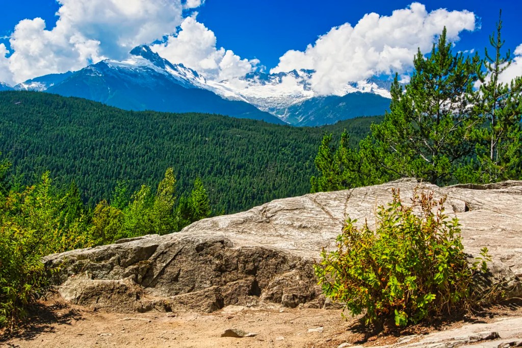
Sea-to-Sky Highway
We did not do all of these activities in one day. The driving distance is short but there are many hiking trails, waterfalls and mountain views. Often, we day-tripped from Vancouver, since we had free accommodation. For the views you want good weather. The Lillooet (northern) portion of the trip we did on our return south from Northern BC.
Highway 99 South
It is unlikely that you can travel all of Highway 99 in one day. Unless all you want to do is drive. The Vancouver Sea-to-Sky Map breaks up the southern portion into two road segments:
- Horseshoe Bay to Squamish is an easy day trip from Vancouver.
- Squamish to Whistler is an easy day trip from Vancouver unless you plan to go hiking, et al.
Horseshoe Bay
Because this is a protected cove, you do not get views of Howe Sound. Nevertheless, it is a pleasant walk along the harbour where you watch departing ferries. Or you can get lunch at the Olive and Anchor Restaurant or the Seaside Village Café. From here, you can get a ferry to Gibsons, Bowen Island or Nanaimo. The ferries offer better island and mountain views.
Whytecliff Park Lookout Point
Whytecliff Park Lookout Point gives a so-so view, which is partially blocked by the trees in the way. It is worth a stop if you are not going past Horseshoe Bay. You are actually viewing Bowen Island, but it’s so large you may not realize that it is an island. On the other hand, the drive to this park passes many upper-class homes and the famous Gleneagles golf course.
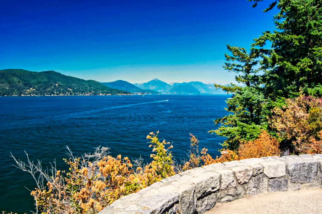
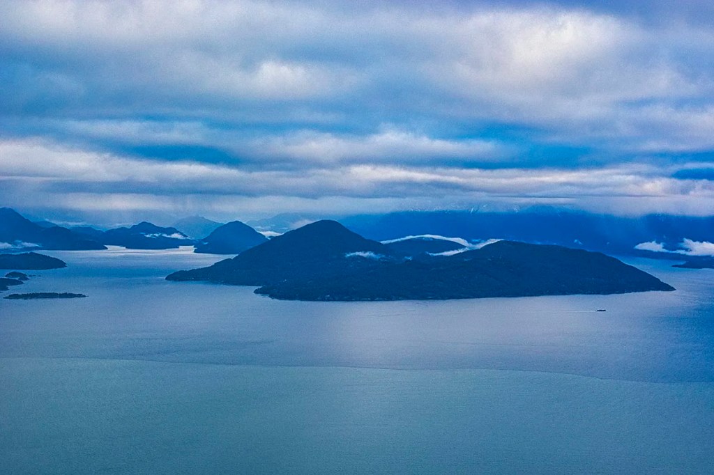
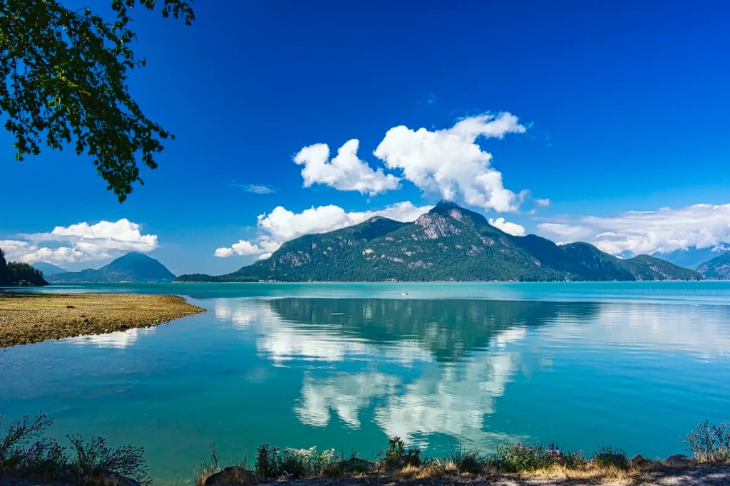
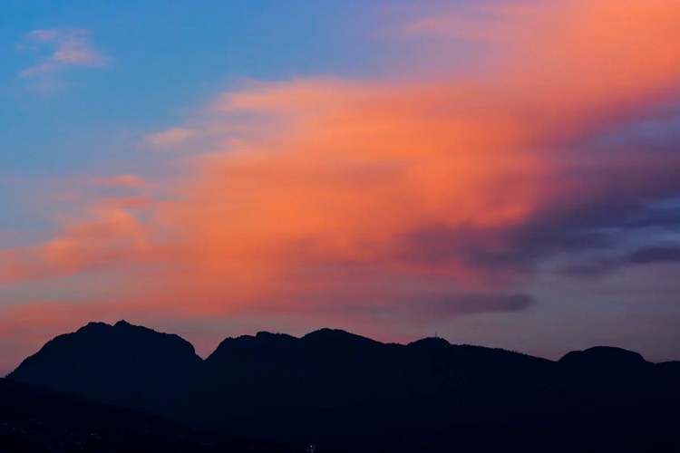
Howe Sound by Sea
Before 2010, the traffic on the two-lane Highway 99 was slower. One could just stop on the shoulder to take in the scenery. There used to be an excellent view high above Horseshoe Bay where I took the above photo of the harbour and Howe Sound. I just read that our viewpoint apparently still exists. The “secret” lookout platform is on Horseshoe Bay Drive at the the third pull-off after the Marine Drive junction. We’ll check it the next time we visit our son.
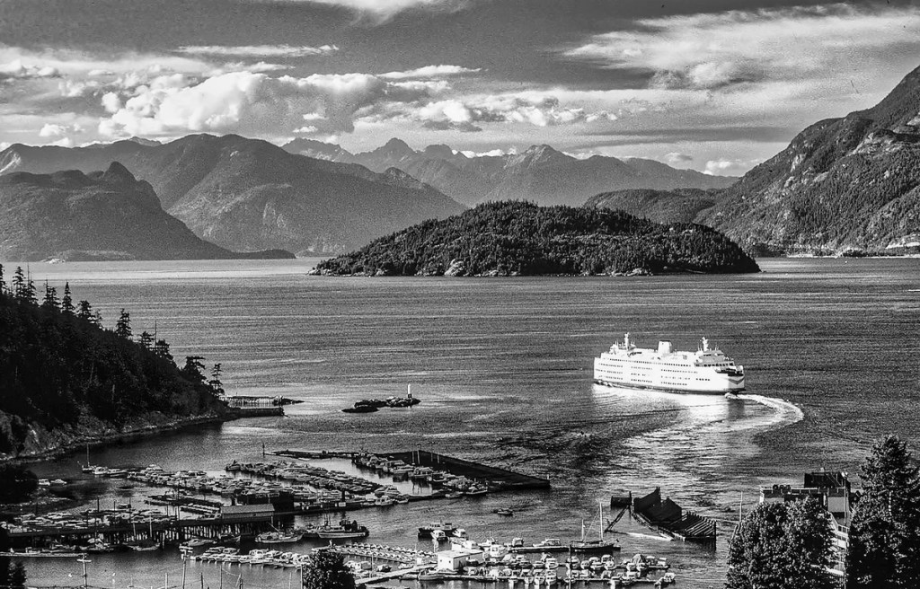
This is such an old slide I could not improve the image quality or the overly blue tint. So I converted it to a grainy black and white image for a vintage feel. Here you can see the ferry leaving for Nanaimo, which gives great views such as the image at the beginning of this post.
Howe Sound by Air & Trail
Views from a road cannot capture the magic of Howe Sound. You need to be at a higher elevation to see its sprinkling of islands. Besides having an airplane, there are two hikes that will offer great panoramas: St. Marks Summit, an 11 km round trip hike starting at Cypress Mountain. The Bowen Trail a 4 km round trip hike starting at Cypress Bowl Road, both trail heads are in Vancouver.
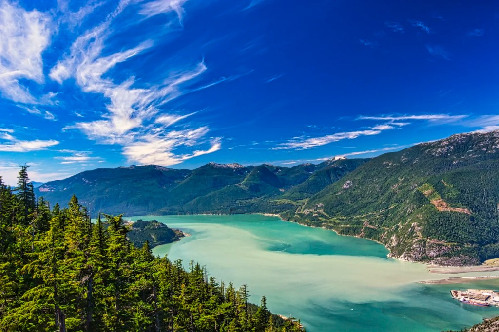
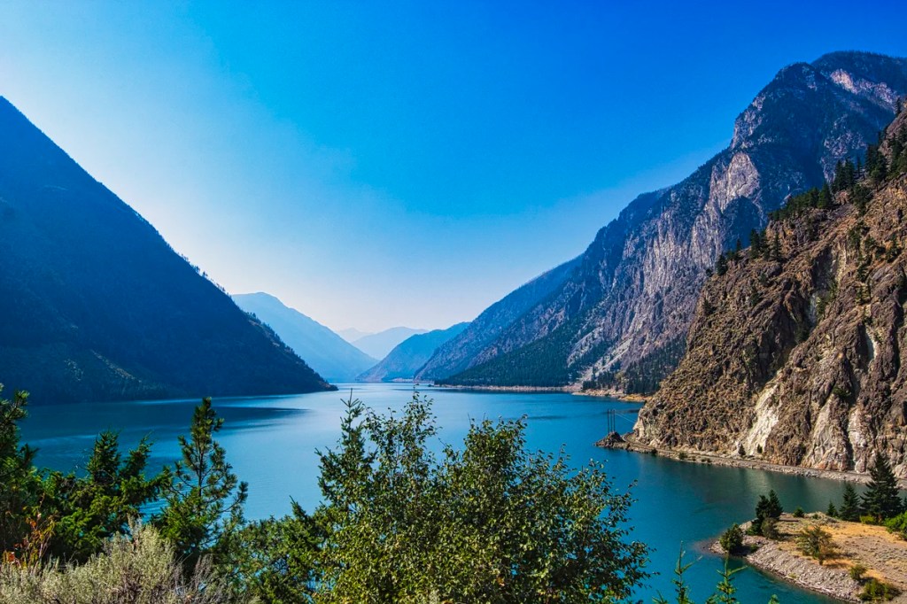
Howe Sound is a Fjord
A sound is formed by the flooding of a shallow V-shaped river valley. Howe Sound is a very deep U-shaped valley carved by glaciers and thus should really be called a fjord. In fact, BC is full of fjords. They are so wide and deep that bridges cannot be built across them. That is why BC Ferries operates the third-largest ferry service in the world, with 36 ships serving 47 ports. BC’s Pacific coastline stretches for 25,725 km (15,985 mi)! That is longer than flying from Vancouver to Bangkok and back!
Sea-to-Sky Highway
Highway 99 was widened for the 2010 Winter Olympics. It is often a divided road, but it is not an expressway. However, the traffic is heavy and too fast for the mountainous sections. Some of the best views are on the top of hills where there are no pull-offs. It is definitely not an improvement for tourism as the road does not offer any viewpoints for voyageurs. BC also needs help in not placing electrical lines directly in the way of the view: i.e. on the water or view side of the road!
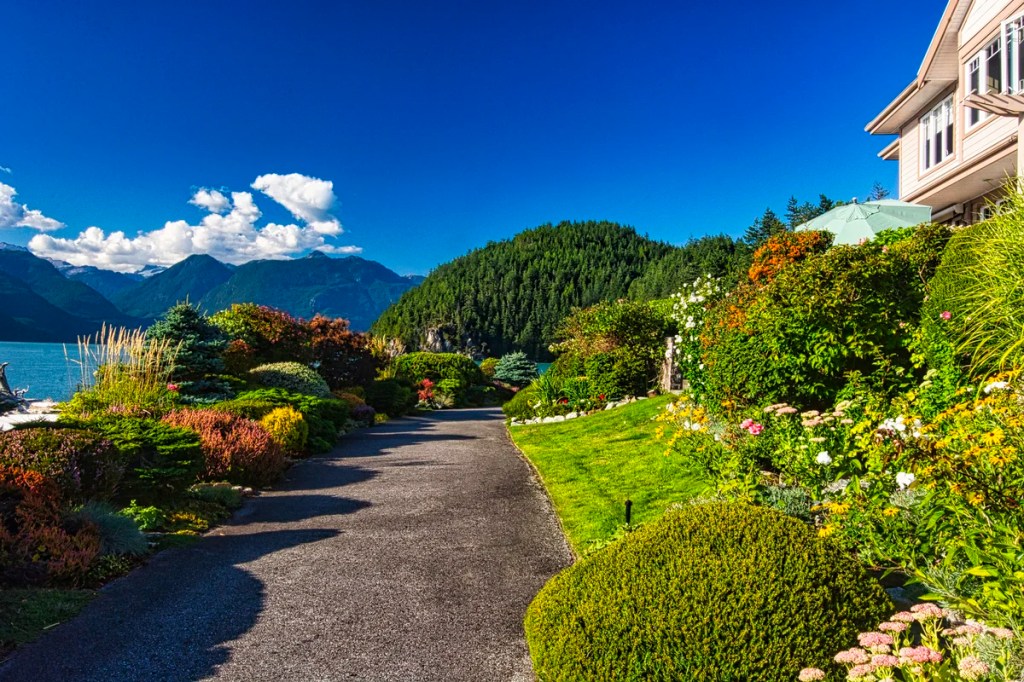
You can get off at exits to the small seaside villages. There are some amazing homes with great views and public gardens.
There are some very pleasant surprises. But, you should probably do this exploring on the way back after seeing the main sights, as well as to catch the sunset lighting.
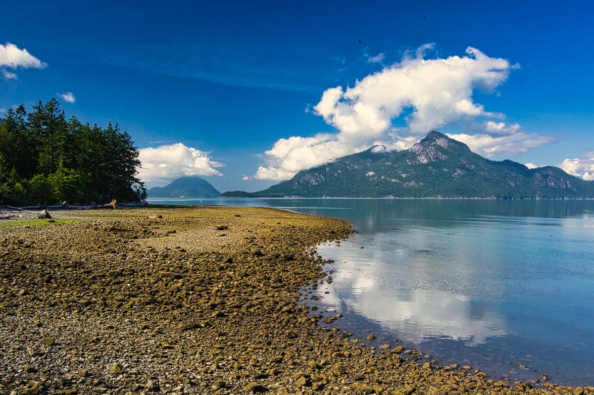
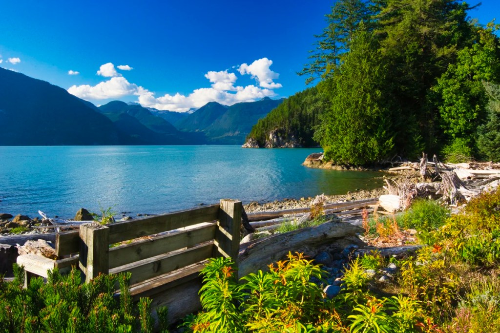
Porteau Cove Provincial Park (PP)
As a result of the lack of roadside viewpoints, Porteau Cove Provincial Park (PP) is one of the few and definitely best viewpoints between Horseshoe Bay and Squamish. After Squamish, the road goes inland, so there are no coastal views.
Looking south of the boat launch parking lot, you see Anvil Island and other islands to its left, with the coastal mountain range on the right.
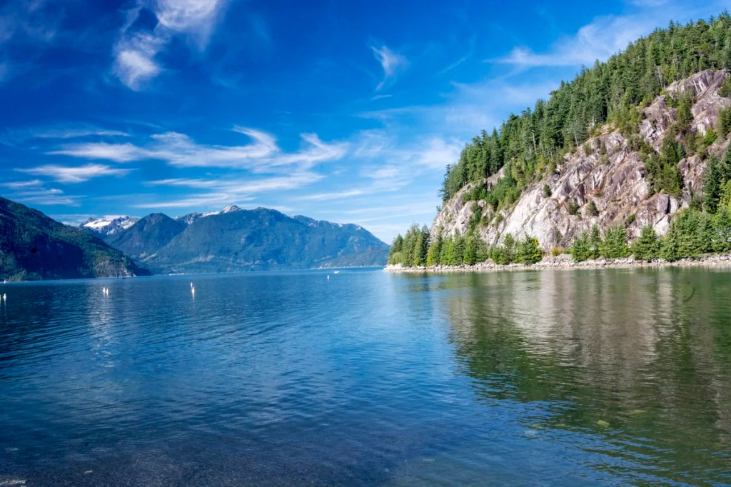
Looking north, you have a view of the distant Tantalus Range, where glaciers came down to carve this fjord. With your eyes, you will see the view above. You need a zoom lens to see the view below.
Sunlight affects the quality of the photography. So it’s worth stopping here twice, once on the way north and once on the return. Haze is a major problem (which affected the photo above). This was compounded by the smoke from forest fires during the last few years.
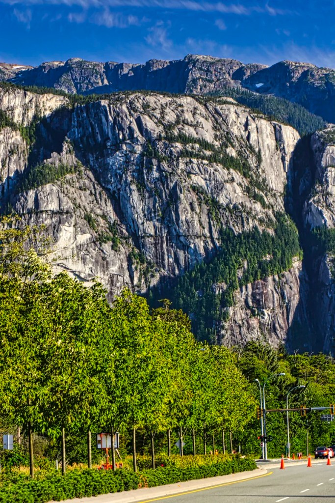
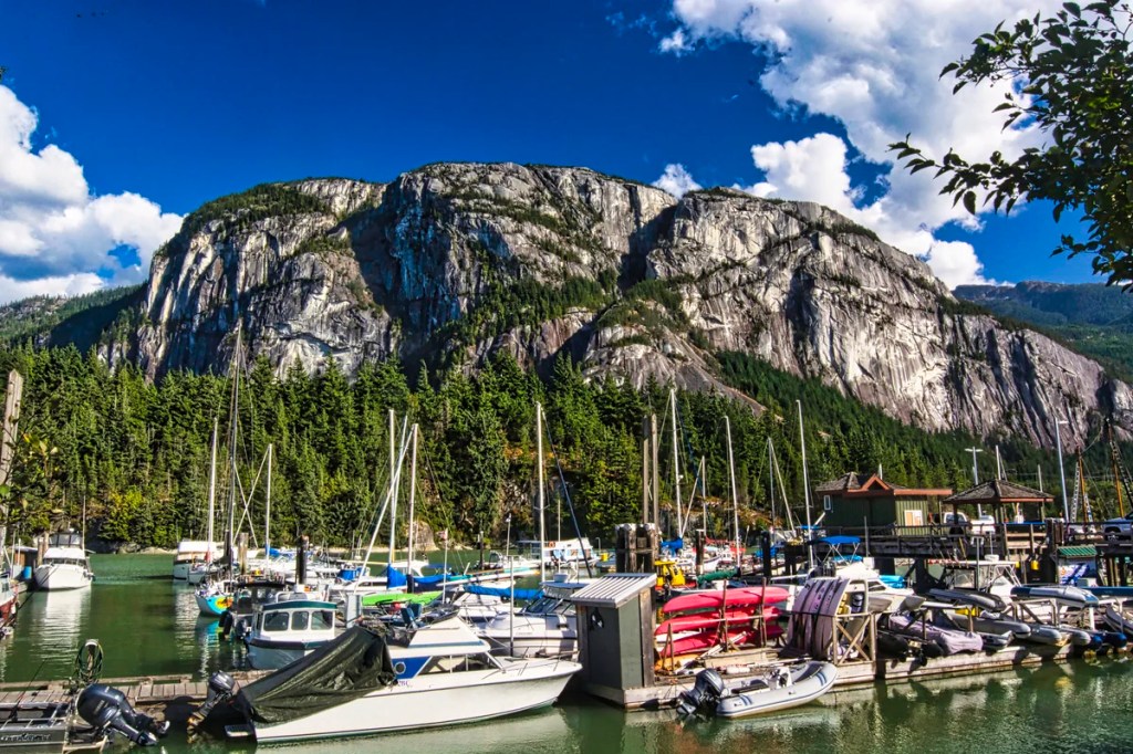
Shannon Falls
This Provincial Park (PP) is right off Highway 99, and the parking lot can be full around midday. The trail is open in the winter, but it may be slippery. This is an easy 350 metre trail to a viewing platform for a worthwhile view of a powerful waterfall.
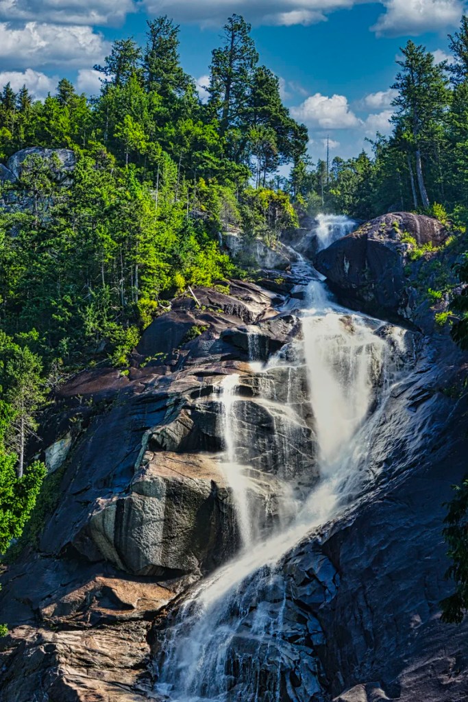
You do not get this close to the falls. This was a 70 mm zoom lens on a crop sensor. This is equivalent to a 140 mm view on a full-frame camera. Along the trail to the falls is photogenic Shannon Creek. The trail is very dark because it is totally enclosed by a tall forest of Western hemlock, Douglas fir and Western red cedar.
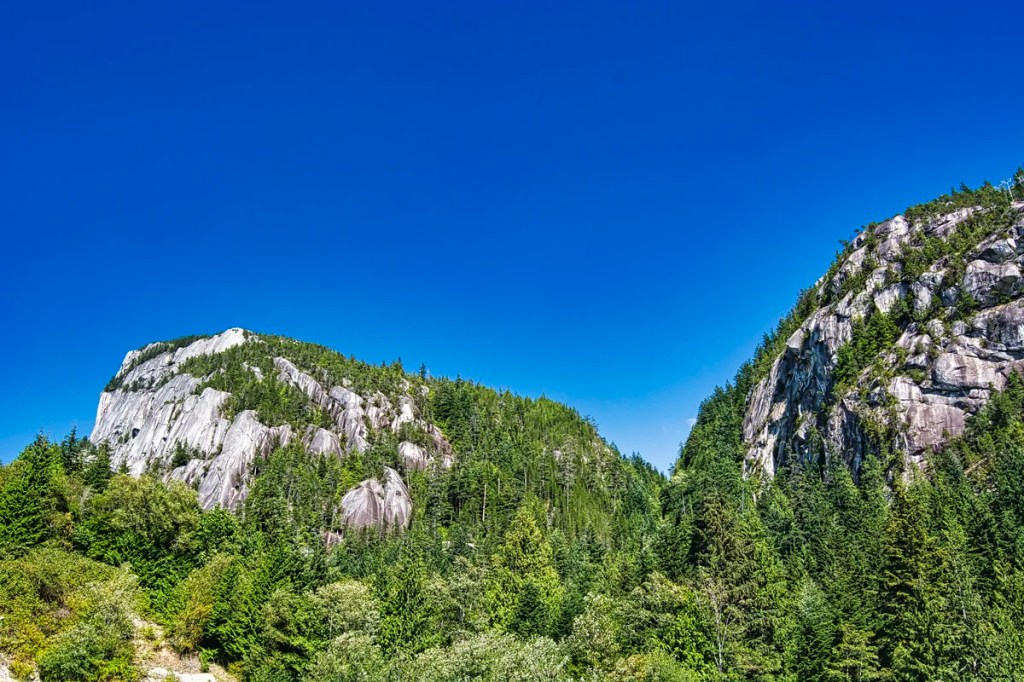
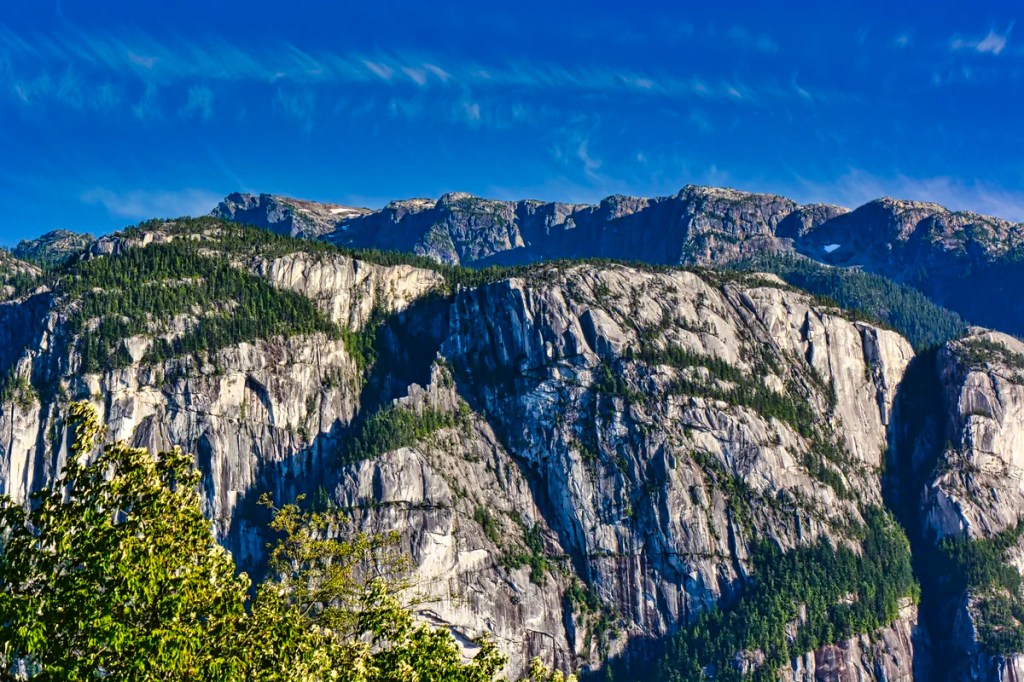
On the way down via the alternate trail, there are views of and trails to Stawamus Chief PP. This is one of the best places for photos of this iconic mountain. However, it is not the famous cliffside. It is the backside of the mountain, which shows the multiple peaks that the difficult 6.2 km Stawamus Chief loop trail climbs 624 m (3:20 hrs return).
Sea to Sky Gondola
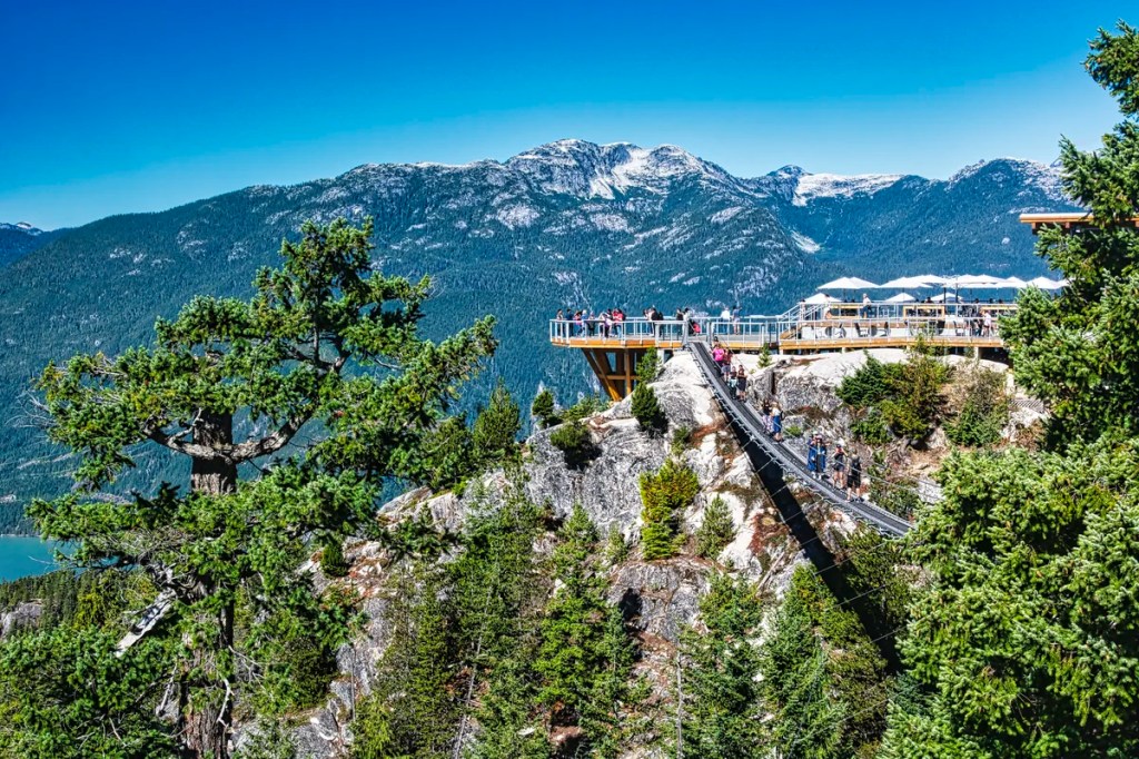
The Sea to Sky Gondola is worth doing. There are nice vistas on the way up but the gondola glass gets in the way of good photography. There are better views from the octagonal deck of the chalet at the top. Here you can enjoy the scenery with a cappuccino or other snack. There are several trails on the Summit Area Trail Map but two are the best.
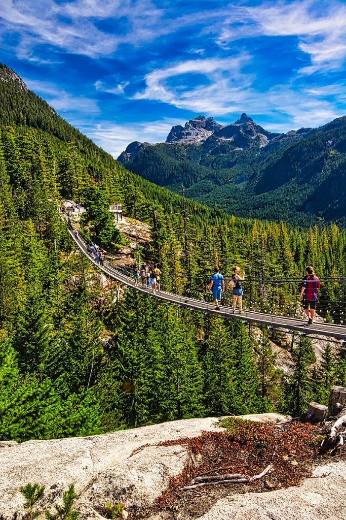
Take the dramatic suspension bridge and walk the 0.4 km Spirit Loop, which has three viewpoints, including superb views of Howe Sound.
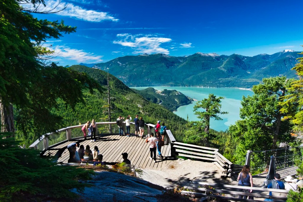
The second viewpoint is essentially the same, but there are less trees in the way. It comes with a wood bench.
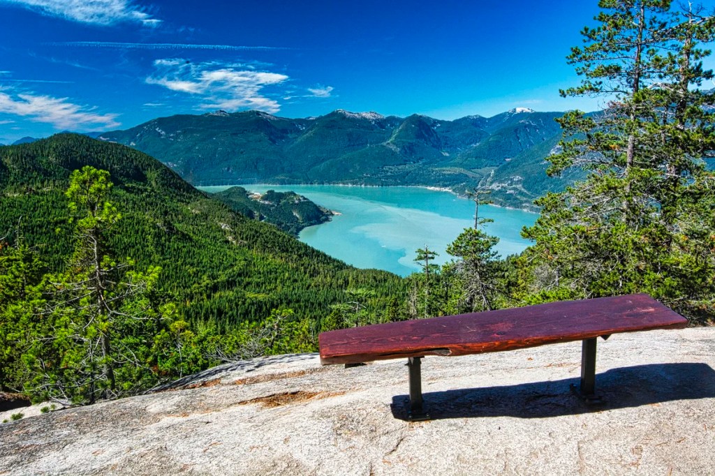
After returning to the lodge, take the 1.3 km Panorama Trail with four viewpoints.
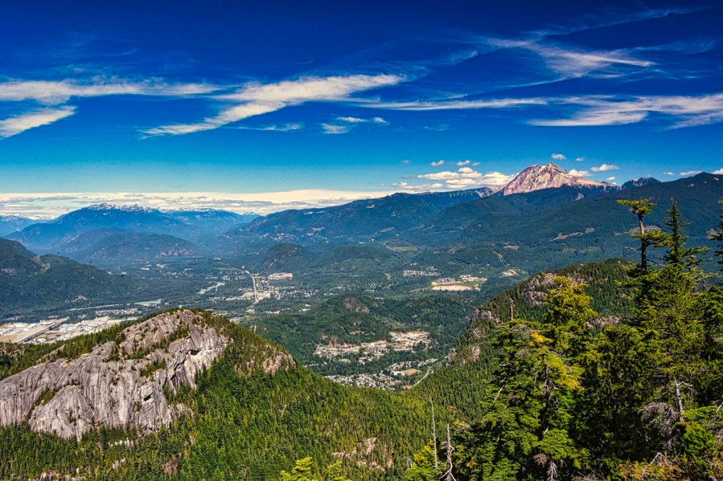
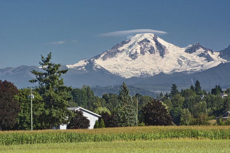
The best one is Chief Overlook. It looks over the top of Chief Stawamus as well as Squamish and the mountains behind it. On the right, the highest peak is Mount Garibaldi, a dormant stratovolcano. Garibaldi actually consists of three peaks with a maximum elevation of 2,678 m (8,786 ft). The non-indigenous name of the mountain was given in 1860 in honour of the Italian General Giuseppe Garibaldi. He led the military efforts that culminated in 1861 with the unification of Italy.
Back at the chalet, we take our final view of the beginning of Howe Sound before heading down on the cable car.
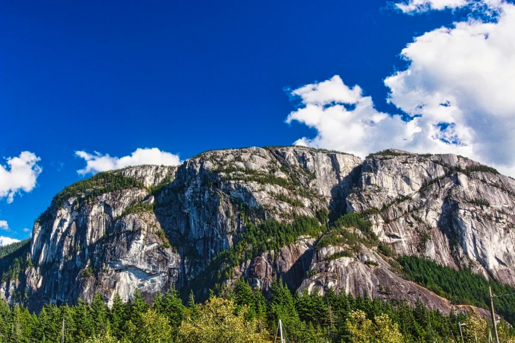
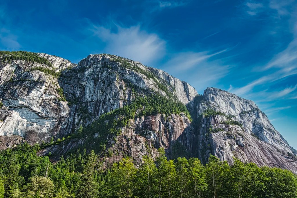
Squamish
Squamish could have been an attractive town. Unfortunately, power lines and ugly modern buildings spoil the potential views. We had to work at finding the best views of Stawamus Chief mountain, which boasts a dramatic and sheer cliff. This cliff is a haven for mountain climbers.
The easiest viewpoint is Highway 99 heading south before the centre of town. But light posts, orange pylons, and cars spoil the views. We waited for a red light to avoid cars.
One way to get around this is to change your position and angle. You can shoot upwards to minimize the foreground or crop out civilization during editing.
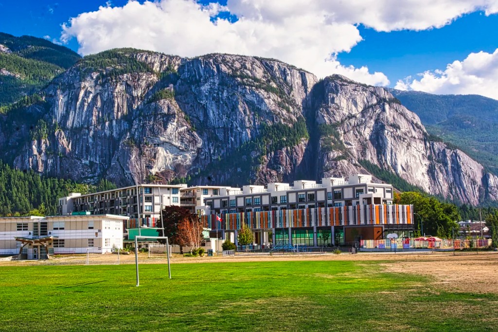
Next, we tried Howe Sound Secondary School. The track and field enables wide open views of Stawamus Chief and the surrounding valley. But there were also two of the ugliest buildings you could imagine. As Italians would say, “ che brutta”. Where are zoning laws and architecture standards when we need them? The alternatives are to use a zoom lens or a photo editor to crop out the ugliness. But this would have been a great place for a wide angle view.
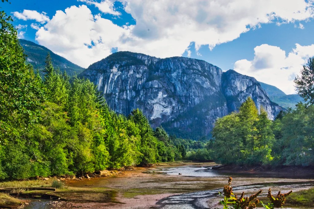
We found a side road, Loggers Lane. We parked the car and walked back to a bridge with a view. It would have been a better picture if there was actually water in the dry river bed. It was also late afternoon (18:00 hrs) so the view was totally in the shade. I relit the image using my photo editor.
Another location is the Squamish Yacht Club. The slips gave some of the best views of Stawamus with many sail boats in the foreground. With a little change in position and zooming, one can get images without the boats. You can see the tallest sail boat mast hidden in the trees in the images below.
Squamish is a good spot for lunch or a coffee. We stopped at Kululu Café (on Discovery Way), which serves Japanese meals as well as a great cappuccino.
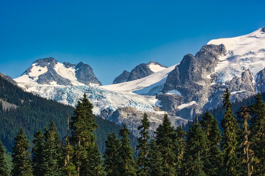
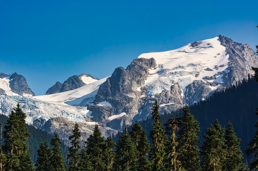
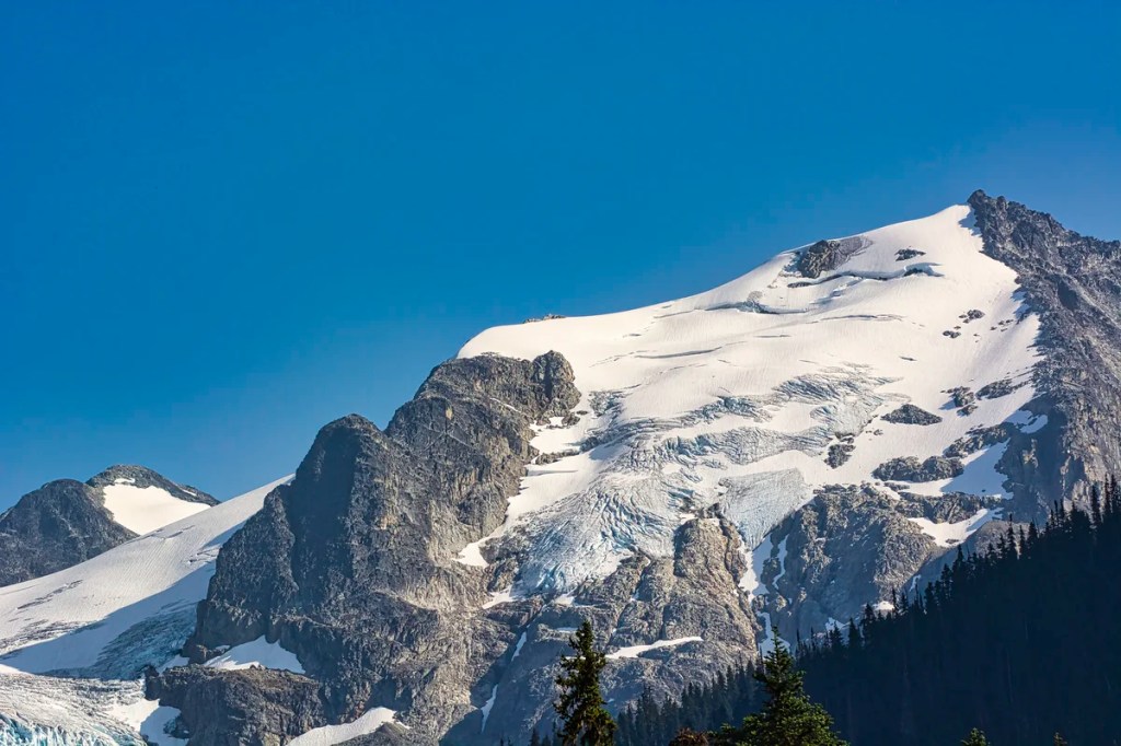
Mamquam Mountain
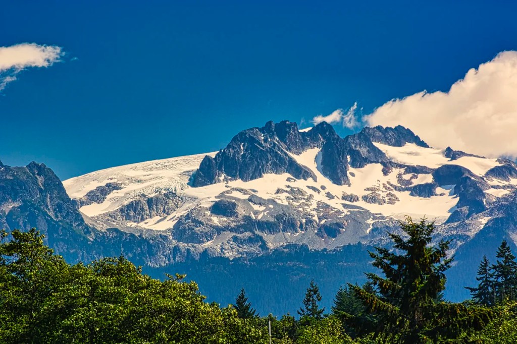
Mamquam Mountain is a spectacular sight of glacier-clad peaks. Icefalls (yes, there are falls made of ice) descend from the Mamquam Icefield. Mamquam is visible from the Squamish River Estuary. It is located in southern Garibaldi Provincial Park, 22 km (14 mi) east of Squamish.
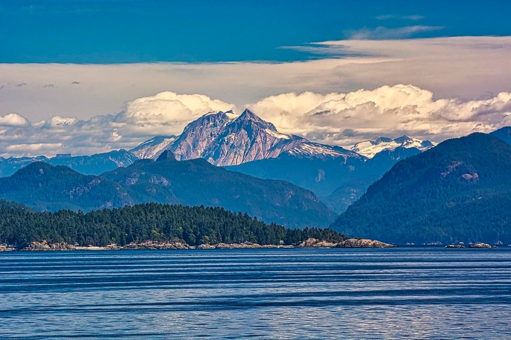
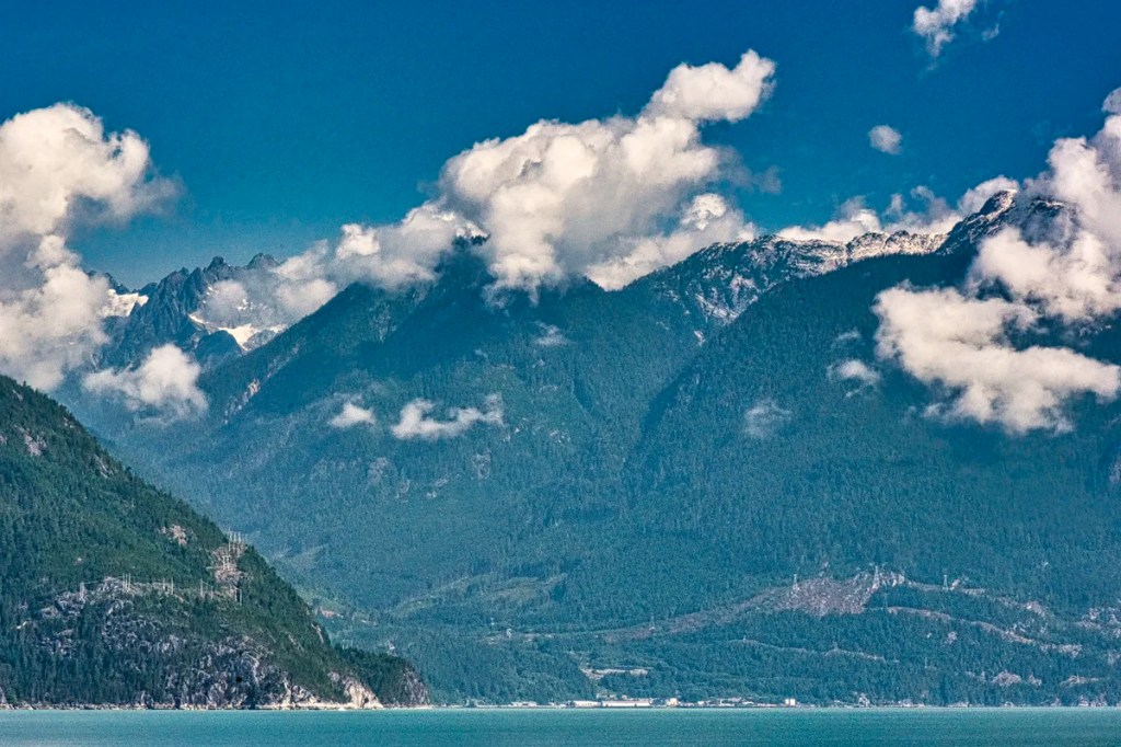
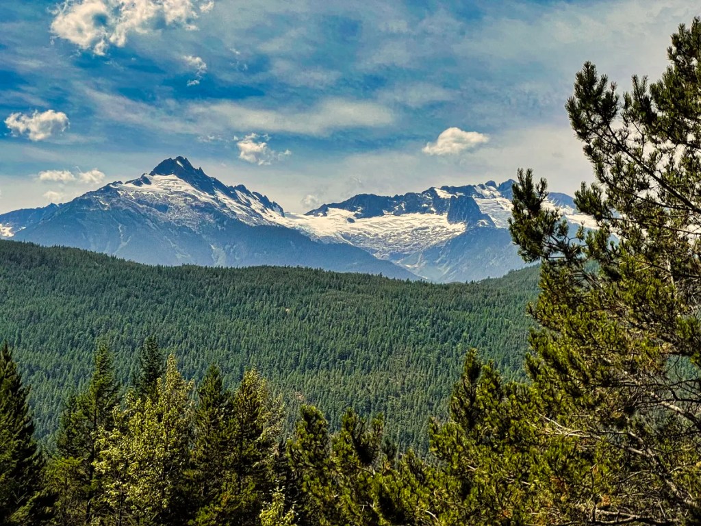
Tantalus Viewpoints
There are a couple of viewpoints, one on each side of the highway. The highway only lets you visit the viewpoint on your side of the road. Both views are worth seeing.
In Greek mythology, Tantalus was a son of Zeus and a mortal mother. In Hades (hell), he was half-submerged in cold water with fruit dangling close but not close enough to eat. This is the origin of our word tantalize! The mountain was named by a local climber. He was “tantalized” by the sight of the range’s impressive spires and icefalls, but was blocked by a major river.
Panorama Ridge Hike
Panorama Ridge is a 28.3-km round trip trail in Garibaldi PP. It is a challenging trail because of its length and the 1610 m elevation gain. It takes about 10:30 hrs. to complete. The trail head is the lake at the end of Daisy Lake Road, which starts in the town of Garibaldi. The best times to visit this trail are June through October. This is a very popular backpacking trail.
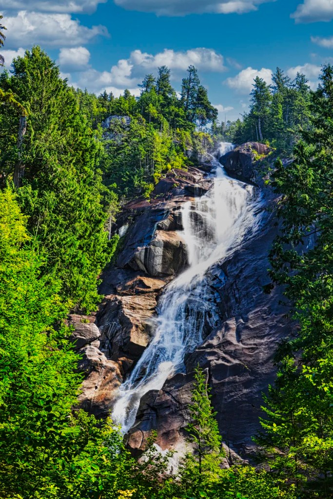
Brandywine Falls
This is an easy one km trail to a powerful waterfall. Unfortunately, BC has not built a proper platform or at least trimmed the tree branches so that you can get an unimpeded view of the waterfall.
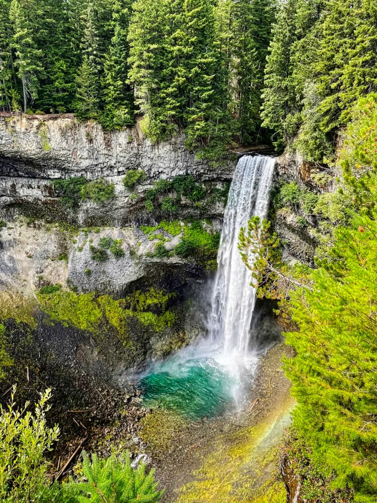
The dramatic vertical walls were basaltic lava flows of the Late Pleistocene age. That is the scientific name for the Ice Age that ended 11,700 years ago. When the ice age ended, the meltwater broke through the basalt layer and eroded the softer layers underneath. What is amazing is that the river flows through a flat channel then suddenly falls 70 metres straight down into a glacial green pool.
A bit further on the trail is a view of the Black Tusk, an ancient volcano from 1.2 million years ago. This is a reminder that BC is part of the Pacific Ring of Fire. BC has many dormant volcanoes, especially along the subduction zone where the Pacific plate goes underneath the North American plate.
Whistler
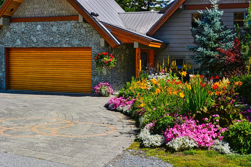
Whistler is an expensive, world-class ski resort. The town has nice architecture, coffee shops, restaurants, the Peak to Peak Gondola, and hiking. We also went around some of the “suburbs” and liked the attractive flowers and houses. We visited the local beach at Rainbow Park on Alta Lake, west of town. There are good views of the Blackcomb Mountains.
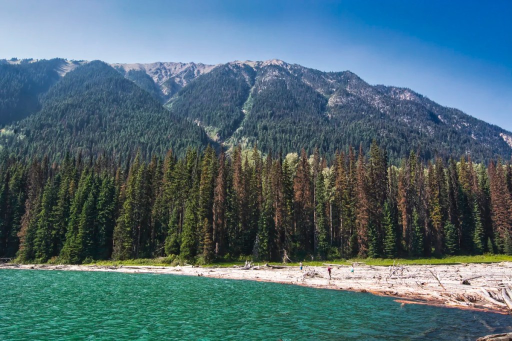
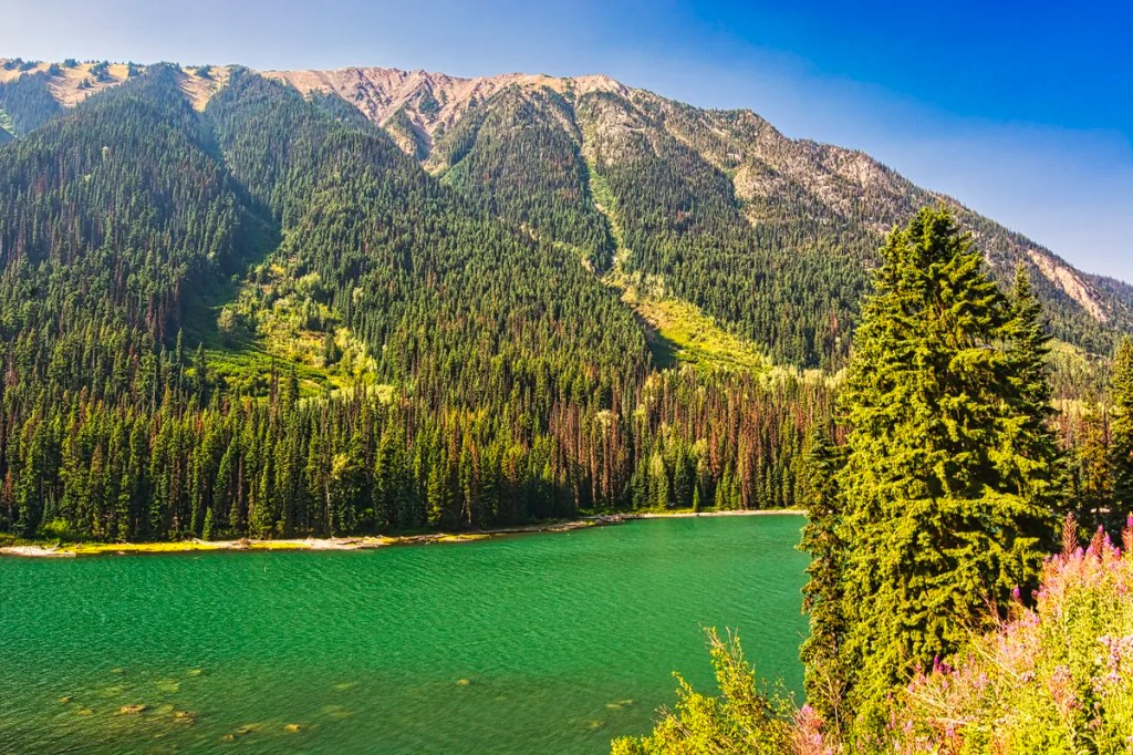
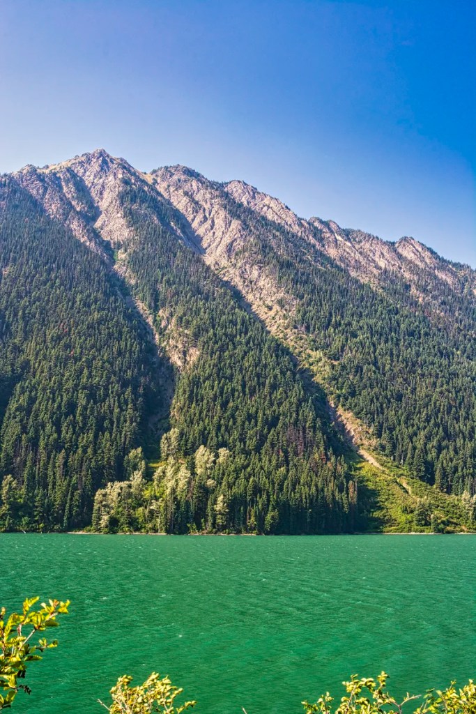
Green Lake
Green Lake is about 1.2 km in length with an area of 2.2 km2. The backdrop is the mountains of the Whistler ski complex.
Glaciers grind bedrock into fine glacial flour. Meltwater carries it to a lake where it is suspended in the water. Because the particles are literally like flour, it results in the typical translucent blue-green colour seen in glacial lakes like Peyto Lake.
Why does this lake have a murky, grey-green colour? This area has high rainfall, higher soil erosion, larger clay sedimentation, and thus much larger particle size. This reflects the light differently.
Highway 99 North
It is unlikely that you can travel all of Highway 99 in one day unless all you are doing is driving. If you want to explore this region in a relaxed manner, book accommodation somewhere in the Whistler-Pemberton-Lillooet area. This is especially true if you plan on hiking. We saw the northern section as we travelled from the superb Barkerville gold rush town back to Vancouver.
This road section from Highway 97 Junction to Whistler is described in the southbound direction. We want to leave the best for last!
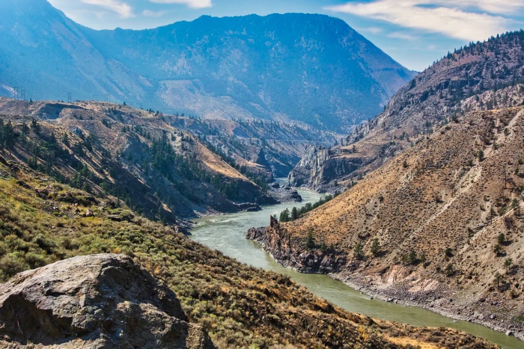
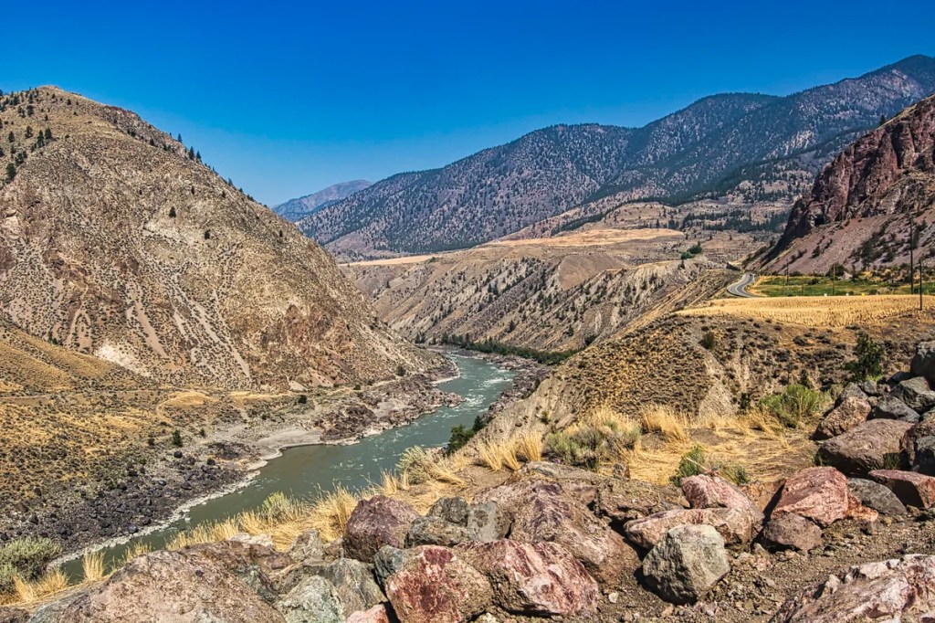
Hat Creek to Lillooet
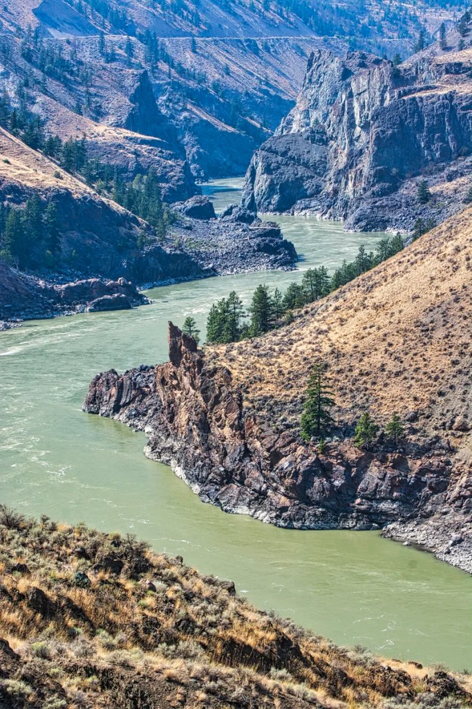
Leaving BC’s main north-south Highway 97, we travelled through an arid Fraser River valley. It was beautiful, but thanks to forest fires, very hazy. All the vegetation and even the rocks were an orange-yellow. The Fraser River was far below, and there were some dramatic canyon views. Now, imagine prospectors exploring the Fraser River one century ago, looking for gold.
Lillooet
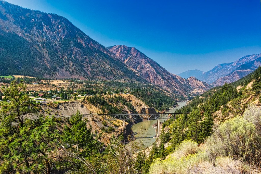
The California Gold Rush ended in 1855. Miners from all over the world took the dangerous Fraser River from Vancouver to Lillooet. They were in search of gold. In 1858, Governor Douglas built the Douglas Road to bypass dangerous sections of the Fraser River.
In 1861, a larger gold strike was made in Barkerville further east. We really enjoyed visiting the Barkerville historic park, especially due to the interpretive re-enactments and preserved buildings. This had a direct impact on speeding up the addition of British Columbia to the Canadian confederation.
The Lillooet area is infamous for four internment camps during World War II. In 1942, Japanese Canadians were forcibly removed from the British Columbia Coast. They also lost all their property, which they did not get back after the war.
Lillooet holds the record for the fourth-hottest temperature in Canada 46.8°C (116.2°F). The 2021 Western North America heat wave brought unprecedented temperatures. The nearby town of Lytton on the Fraser River set a Canadian all-time record of 49.6°C (121.3°F). The next day a wildfire destroyed most of the town and its’ First Nation.
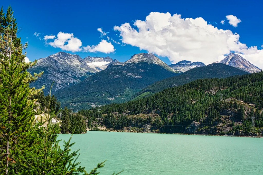
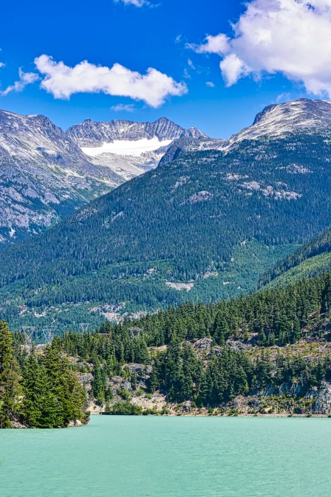
Seton Lake
Seton Lake is a 22 km long freshwater fjord. It drains east via the Seton River into the Fraser River at the town of Lillooet. The glacial green waters are attributed to the diversion of the Bridge River into Seton Lake.
Duffey Lake
Duffey Lake is three hours from Vancouver. I do not remember seeing more than a couple of tourists along this whole route. This is one of the pluses for exploring this region.
This is a taste of how few people live in Northern BC, which starts just north of Lillooet. Northern BC is more than half of the area of the province of British Columbia. Less than 300,000 people live in area 3% bigger than France and 34% bigger than California!!
Joffre Lakes PP
I wanted to finish with the most spectacular views of the Sea-to-Sky Highway. You cannot see anything from the trailhead parking lot. It is lower than the road and the trees. But, you can climb up Highway 99 from the parking lot. From here, you get to see glacier-filled mountains without the effort of hiking. With binoculars or a zoom lens, you can see the spectacular mountains and glaciers close-up.
Joffre Lakes Trail
Joffre Lakes Trail is an intermediate hike with an elevation gain of 491 m. The 7.4 km round-trip hike to see the three glacier-fed lakes and the glaciated mountains takes about 3 hours to complete. The prime hiking season is June-September.

You need a free day pass to access popular hiking trails in Garibaldi, Joffre and Golden Ears parks. The pass is available from 7 AM two days before your visit.
Wedgemount Lakes Trail
Wedgemount Lake is a 12.6-km round trip trail. This is a difficult route with a 1160 m gain that takes about 7 hrs to complete. The access road is about 12 km north of Whistler
Final Comments on this Itinerary

The Sea-to-Sky Highway is the second most scenic road in Canada. This is true only if you know where to stop to admire the scenery. Or even better, you should know where to go for a walk.
This is one of the gems of Canada!
Subscribe
Get travel tips and advice delivered directly to your inbox. The best part is that it is free.
What things fascinate you? How long is your trip? What questions do you have?
Itinerary Maps & Resources
Vancouver Sea-to-Sky Map — our custom itinerary map
Google Maps Ratings
Google Maps provides a rating from 0 to 5 for all sights, hotels and restaurants (but not cities). All of our recommendations are appended with the rating (prefixed with a G) from Google Maps. As it is based on feedback from tourists and locals, it is much more reliable than travel booking websites. We consider a score of 4 to 4.39 to be Very Good; 4.4 to 5 to be Excellent.
Other Places to Add to Your Itinerary
Here are nearby places you might want to explore in or near Vancouver:
Canada FAQ
Fun & Interesting Facts about Vancouver

The Exploring Canada post answers Frequently Asked Questions (FAQ) such as:
- How do you plan a trip to Canada?
- How safe is Canada?
- What is the best season for travel?
- Can I see everything in 3 or 3 weeks?
- What are the best places to see in Canada?

Leave a reply to Terra Encounters Cancel reply